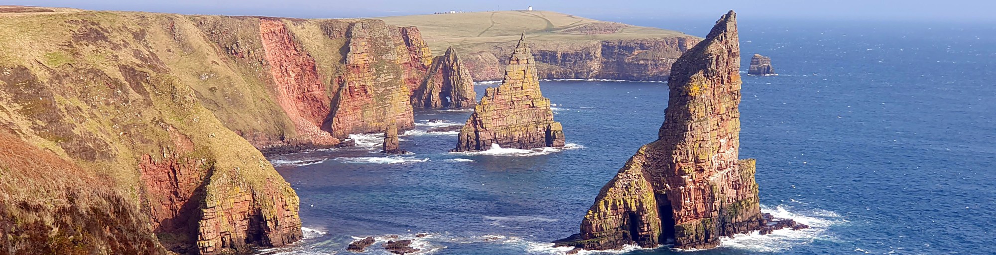
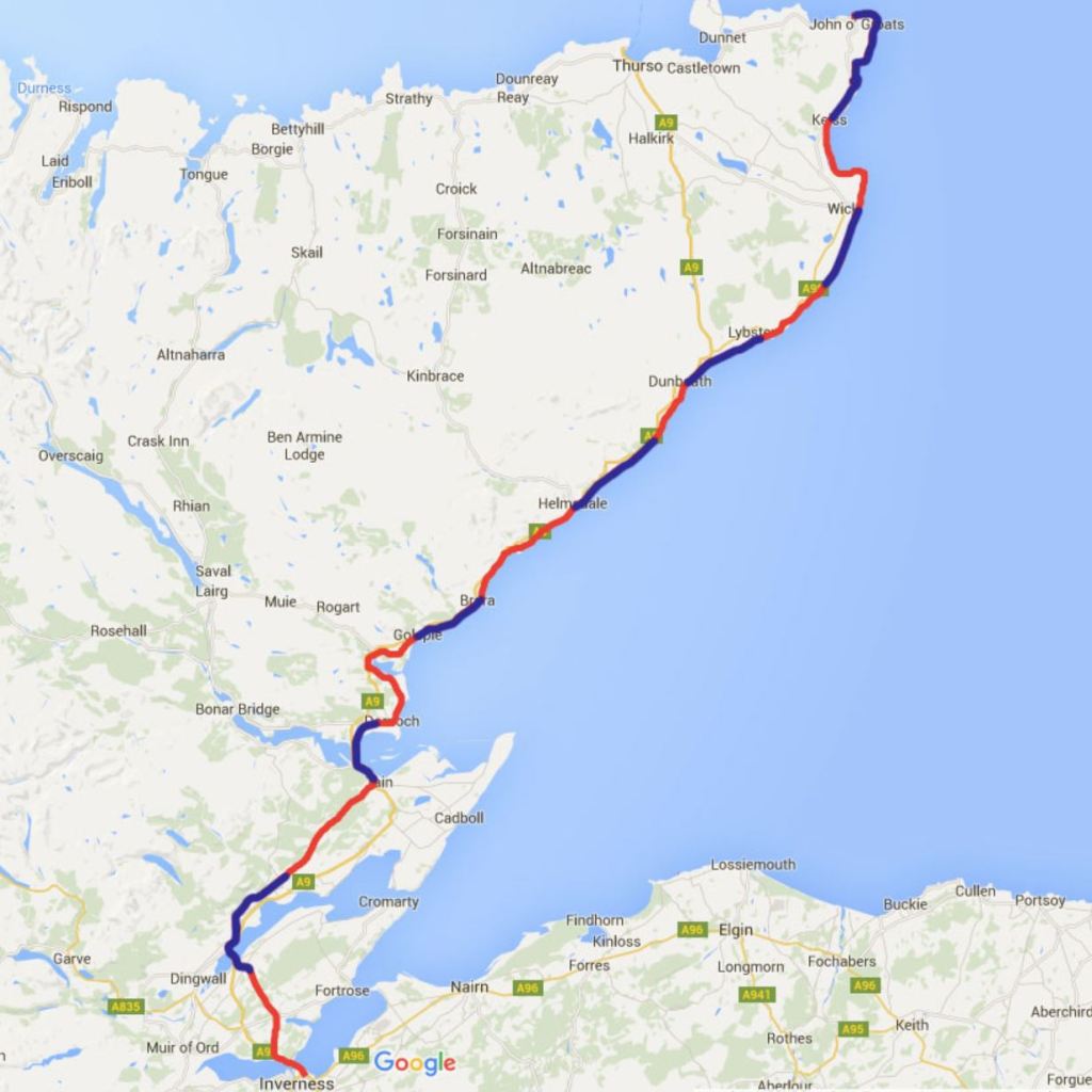
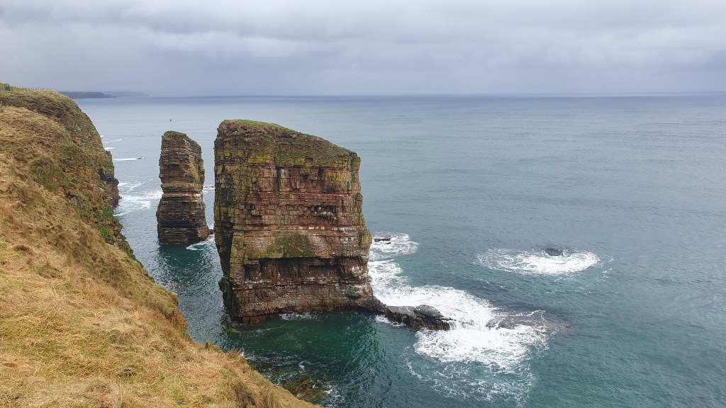
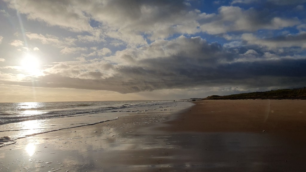
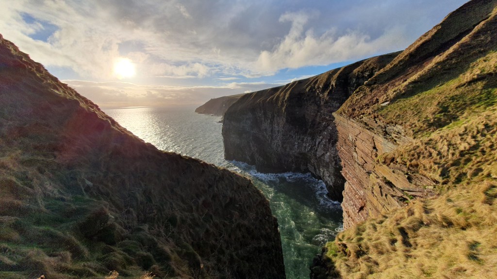
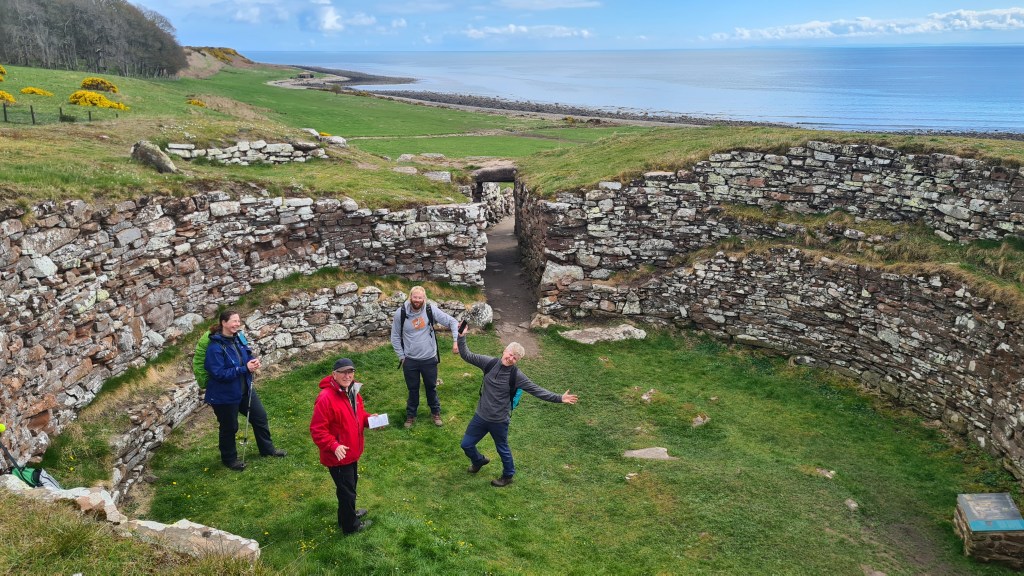
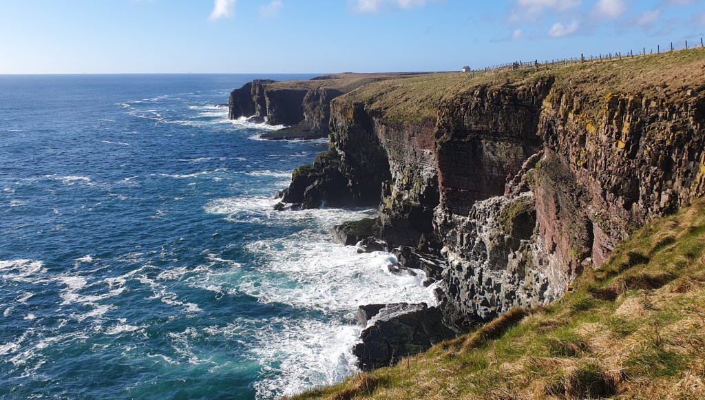
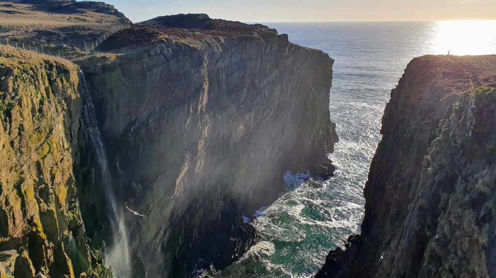
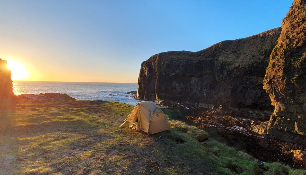
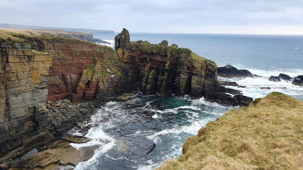
The John O’Groats trail (JoGT) is a 147 mile (236km), mostly coastal route from the city of Inverness to John O’Groats on the north east tip of Scotland. The scenery varies from pleasant inland agricultural areas, to beaches and wildly impressive sea cliffs with arches and sea stacks. The area is home to lots of seabird colonies and you have the chance to spot seals, dolphins and even whales. On top of that there is a tremendous historical interest along the way such as iron age Nybster broch to the Viking Old Wick Castle. And from more recent times there are many picturesque harbours and sights like Whaligoe Steps.
The John O’Groats trail acts as an excellent connector to the 74 mile long Great Glen Way in the south. And south of the GGW, the 94 mile West Highland Way connects to the outskirts of the city of Glasgow.

Going further south the JoGT forms the northern leg of the complete traverse of Great Britain from Lands End to John O’Groats at about 1300 miles (LeJog journey planner).
The JoGT trail is fairly new and is still being improved in places with some rougher, boggy sections and barbed wire fences particularly between Helmsdale to Wick. So it can be a pretty challenging walk overall but constant improvements are being made by the Friends of the John O’ Groats Trail on the trail and signage.
Our hikes
We live near to the southern area, and have walked the trail in sections, including Brian backpacking the northern part from Dunbeath to John O’Groats in 2023. Here are a few pictures from those hikes…


Resources
John O’ Groats website has lots of details including status updates, green/amber/red ratings for each stage, blog posts, plus you can join or donate to the Friends of JoGT
Walkhighlands website also has a trail description, maps, gpx and off-line app
A guide book from Cicerone is excellent
JoGT strip map from Harvey Maps, also very useful
Brian’s description of a 3.5 day possible alternate route in the south from Munlochy to Tain.
