This site has blogs from Brian and Martina’s longer walking trips in the great outdoors. We have done 3 multi-month hikes in the USA over the years and there is a blog of each here; the Pacific Crest Trail, Continental Divide Trail and the Hayduke. Plus lots of other stuff including Canada, the UK, Austria, Spain...There are some se kayaking posts too.
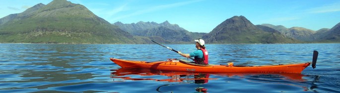
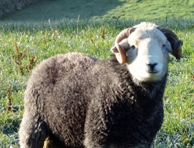
We stay in the village of Fortrose, Scotland- near to the highlands, home of some great mountains, coastal and island scenery. We get out into the mountains most weekends or more but escape from the variable weather to sunnier climates abroad whenever we can! That includes rock and ice climbing, camping, sea-kayaking, hiking and lots of sheep farming as well – in both our home country of Scotland and on trips afar. You can see these activities from our photos link on the menu.
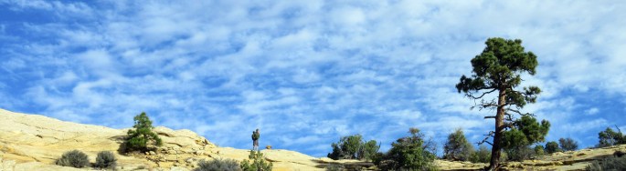
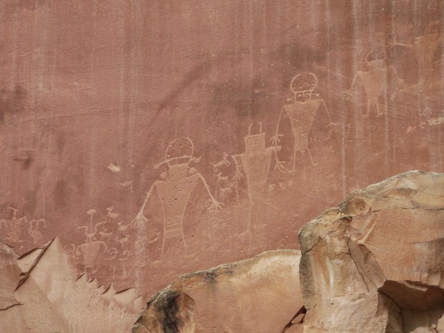
We returned to the desert and canyons of southern Utah and northern Arizona in September/ October 2016. Two years ago we hiked and kayaked our own version of the Hayduke Trail. Having enjoyed it so much we returned this year with a rental car to hike to some other canyons and interesting places. Whilst we wouldn’t get the full immersion of a multi month hike such as the Hayduke, we were aiming to target some of the most spectacular places in the region with some trips ranging from 1 to 5 days.
You can see an overview in the interactive map below and read our blogs listed below too…
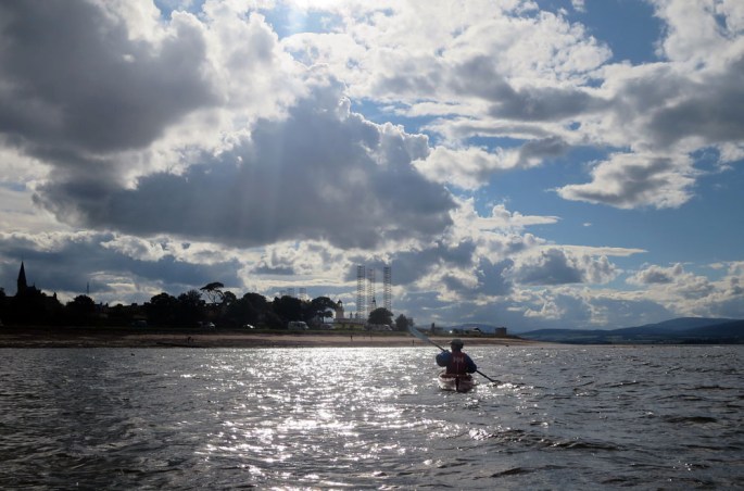
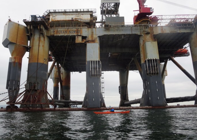
We are lucky enough to have some great coastline near where we stay on the Black Isle of Scotland. There is a mix of coastal cliffs, beaches with some nice towns such as Cromarty and Fortrose. We have some oil rigs parked here as well and cruise liners come into the Cromarty Firth at Invergordon.
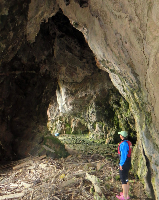
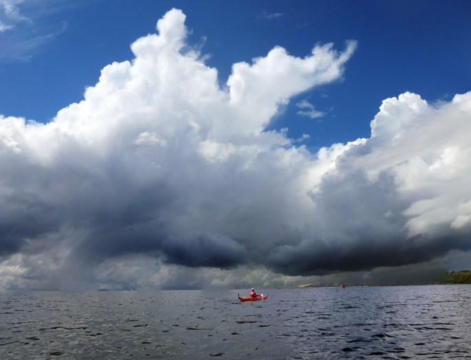
Returning to CromartyCave near north sutorResting at a beach near Eathie bothysurreal kayaking round the oil rigs in Cromarty firthWeather out from Fortrose!
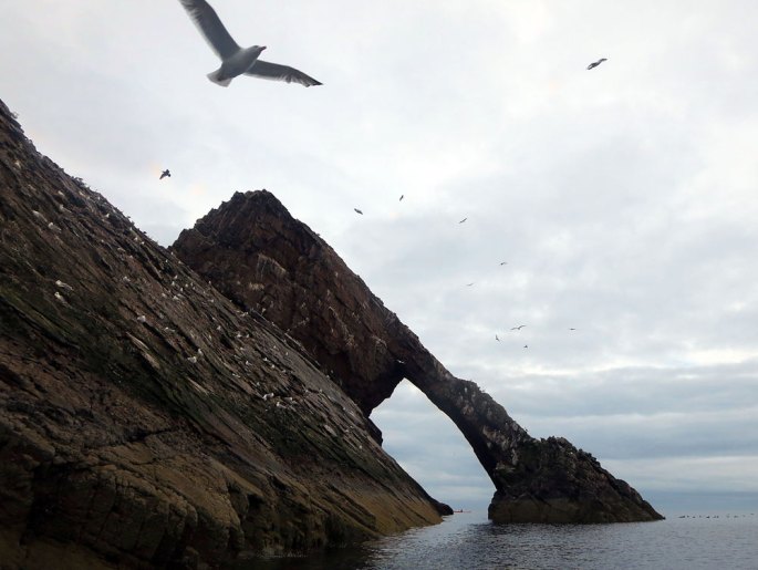
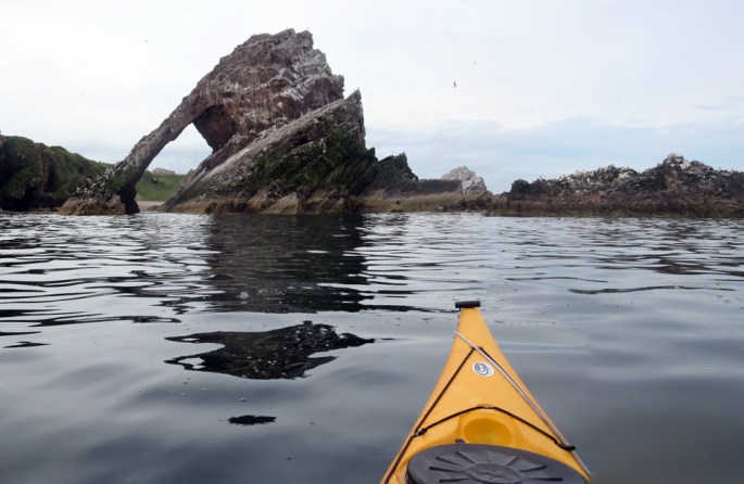
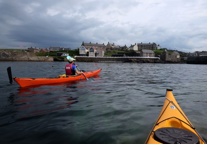
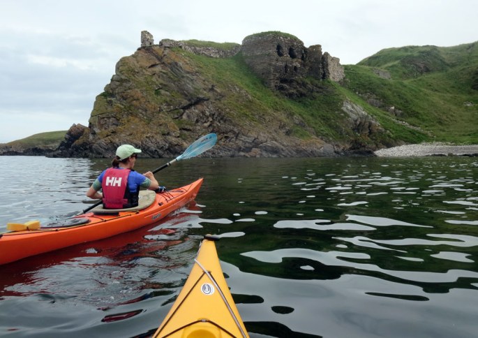
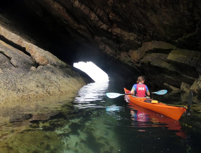
This summer we have had some kayak trips around the Scottish coast. Scotland provides great opportunities for scenery and adventures with kayaks. The photos give an example from the north eastern coastline near Buckie.
Bow Fiddle rock near PortknockieBow Fiddle rock from the seaward sidePaddling into PortsoyThe remains of Findlater castleNatural arch near Cullen beach
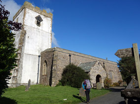
A walking route that crosses northern England passing through the Lake District, Yorkshire Dales and North York Moors national parks The Coast to Coast is about 200 miles long following trails, rough vehicle tracks and minor roads. Devised by Alfred Wainwright in 1972, it has since become the most popular long distance trail in Great Britain. It traverses a great variety of countryside in it’s releatively short length from the uplands of the Lake District to the limestone greenery of the Yorkshire Dales to the wooded valleys of the Eskdale and Littlebeck. The towns are interesting and rich in history too; good examples being Richmond with its Norman castle, Shap Abbey and Grasmere the cute tourist magnet in the Lakes.
We had a fun time on our hike which we split into two week long sections; -Part I October 2015 we hiked west from Kirkby Stephen to St Bees -Part II June 2016 we hiked east from Kirkby Stephen to Robin Hood’s Bay
Our walk
2015 westbound
Day 1 12th Oct 2015 Kirkby Stephen -Orton- Shap 22 miles A gentle start through limestone countryside with dikes and a network of fields. Early drizzle cleared mid morning to give a bright day but with a biting cold westerly wind in our faces! We diverted to the picturesque village of Orton for lunch – which was definately worthwhile. The afternoon’s high moorland made for great hiking but we began to tire for the final few miles over the M6 motorway into Orton. Great day though! Day 2 13th Oct 2015 Shap – Patterdale 17 miles An early start on frosty ground with low lying mist at first. Orton Abbey was an atmospheric and splendid stop. From there we headed out over more undulating fields and woodland to reach Haweswater reaching into the eastern Lake District. Soon we climbed steeply up to the high tops of High Street with clear views back east to where we had come and out west into the central Lake District. A long drop past lovely Angle Tarn and then over some rubbly paths and we made it to camp in Patterdale just as the frost set in. Day 3 14th Oct 2015 Patterdale – Grasmere – Greenup Edge 16 miles We set out on a bitingly cold but clear morning gently up Grisedale to reach its tarn set in a great spot south of Helvellyn. An easy drop down and we were soon lunching in the tourist town of Grasmere with shops and a great bakery. Up Easdale in the late afternoon and we hit the high ridge of Greenup Edge with more great views. We found a camp spot on the descent to Stonethwaite above Eagle Crag. Another excellent day.. Day 4 15th Oct 2015 Greenup Edge – Ennerdale Bridge 16 miles More deep frost this morning as we dropped down to Rosthwaite, picking up some food. A wonder through trees and steep climb by the road gave some more good views before we arrived at Honister Pass. this was a good chance to dry the tent from that covering of overnight frost whilst having coffee and cake from the cafe. Next we climbed over our final high Lake District ridge past Grey Knotts to steeply drop into quiet Ennerdale. This is a big valley stretching westwards and made for easy hiking all the way out to Ennerdale Bridge. We caved in and stayed in a hotel here which was well with the money for its good food and warmth. Day 5 16th Oct 2015 Ennerdale Bridge – St Bees 15 miles Our final day saw us start out on minor roads before following fine trail along a stream and then up Dent hill with its marvellous views out to the coast. The trail continued along minor roads and trail through some old mining villages before hitting the west coast and a grand finale south above the cliffs to St Bees. An excellent 5 day hike!
2016 eastbound
Day 1 28th May 2016 Kirkby Stephen – Nine Standards Rigg camp 6 miles We dropped our car off at Kirkby Stephen around 5pm and decided to set out in the evening on the trail up the hill of Nine Standards Rigg. After a day of travel this was a good way to stretch our legs and we managed a high camp on the south ridge of the hill with nearby water. Day 2 29th May 2016 Nine Standards Rigg – Ellers Beck Swaledale 21 miles A grand long day through the Yorkshire Dales National Park. Dropping down was easy into Swaledale. The countryside here is beautiful with it’s stone built farm buildings and dykes. Ravenseat Farm was our first introduction to the scene, but Keld was also lovely and we had tea and cakes here next to the campsite as a line of vintage tractors started out on a tour of the dales. We met a couple of other C2C hikers hiking down beside the river Swale itself and had a pleasant chat before stopping for lunch at a cafe in Gunnerside. The meadows were green and full of flowers and this was now easy hiking! We pushed on hard though into the evening and both of us were sore by the time we set up camp in the woods. Day 3 30th May 2016 Ellers Beck – Danby Wiske 23 miles Lots of variety to start with walking through forest and fields into the large town of Richmond with its old castle. There was a fair and procession underway as we strode down the streets into the crowded centre of town. After a shopping and cafe stop we hiked out past the castle and over the river eastwards onto flatter countryside. This flat hiking began to hurt a bit for both of us but fortunately the weather brightened a little from the damp start to the day. The final few road miles into anby were sore on the feet so we were relieved to get a room and a shandy at the White Swann Inn in town! Day 4 30th May 2016 Danby Wiske – Osmotherley 10 miles Drab and a gale force westerly wind today. The walking was still flat and we had a fair bit of shelter from hedgerows and some trees. We made it to the A19 just before Inglebury Cross and dashed into the truckers cafe for shelter and mugs of tea. Looking at the forecast of gales continuing for the next few days in the east where we were heading but sunshine in the Lake District to the west, we decided to spend a couple of days out in the Lakes and return. Day 5 4th June 2016 Osmotherley – North York Moors camp 18 miles Refreshed after a wonderful high camp on Pike O Blisco in the Lakes and hill walking round the Langdale peaks, we returned to Osmotherley again in low cloud. But at least the wind had calmed down! We strode onto the high plateau of the North York Moors and into the clouds. The walking was on undulating heather terrain and we could gain distance quite easily on the good trails even though we were wet from the mist. Eventually camped in heather moors somewhere east of Bloworth Crossing near an abandoned railway. Day 6 5th June 2016 North York Moors camp – Grosmont 20 miles The sun eventually poked through in the morning- hoorah!- so we were able to get distant views over the moors. Stopped at the Lion Inn for morning tea, a venerable old travellers inn up on the moorland. From here we skirted the northern edges of the North York Moors over Glaisdale Moor before dropping down into leafy Eskdale. We were now walking down the lush and green river valley in the sun and it made a pleasant contrast to the moors. Stayed at a lovely B&B at Grosmont- the Geall Gallery- really recommended. Day 7 6th June 2016 Grosmont – Robin Hood’s Bay 15.5 miles Final day to the coast! A steep early climb was followed by a drop into another beautiful forested valley – Littlebeck. Then onto lower moors which to be honest were a bit soggy and tedious! We pushed through and made it to the coast by about lunchtime for a splendid finishing walk south to the village of Robin Hood’s Bay nestled by the sea. Overall an great 2 week hike with lots of variety but some tough flat walking on tarmac in the middle!
What’s it like It’s mostly great fun with lots of variety hiking over the hills of the Lake District, Yorkshire Dales and North York Moors. Passing through many quaint villages, historical churches provides lots of interesting things to see. There are many places to resupply so, even if wild camping, you don’t really need to ever carry more than two days of supplies. The start and finish on both coasts are great highlights too. This isn’t that wild a trail so expect to see others and lots of cow and sheep fields. There is also a ‘low point’ of maybe 30 miles of flattish walking on field margins and minor roads between Richmond and Ingleby Cross which we found quite sore on the feet and less scenically interesting! It is mostly good trail underfoot and we had only a few boggy sections (worst was near Robin Hood’s Bay in the moors west of Hawsker) but mostly the trail is excellent. We wore lightweight trail shoes and running shoes.
When to go The trail can be hiked pretty much at any time of the year. We hiked in October and June. Summers (July, August, September) can be busy though which can make accomodation tricky unless you have booked. In October we saw almost no other C2C hikers (but lots of day hikers in the Lake District). In June there were a few groups hiking each day but it didn’t feel busy. September/early October and April/May/June would on balance be our chosen times to visit balancing quiter periods but still potentially decent weather. Winter with the short days and wetter conditions would be for the hardy only.
Where to stay We carried a lightweight tent, mainly because we enjoy (particulary wild) camping but most people stay in B&B’s or hotels each night. The cost can stack up if doing this though. Estimate at about £80-£100 a night for bed and breakfast for two people. We ended up with 4 wild camps, 1 campsite, 5 B&B’s. If wild camping bring along some sort of water purifier such as chlorine dioxide droplets. You will also need to plan ahead as you can’t really camp in the low lying agricultural areas but the Lake District and North York Moors provide plenty of opportunities.
Planning Best to look at the sites below and get a guidebook and off you go. There are companies that can arrange your whole trip for you including accommodation and transport your bags between B&Bs if you like. We carried all our camping gear etc though and didn’t have a problem with that. Our approach also meant we had lots of flexibility in terms of where we stayed each night which suits our approach.
Other trails near to the Coast to Coast Penine Way 270 mile long official trail that crosses the C2C at Keld Cleveland Way North York Moors trail that shares some tread with the eastern part of the C2C Lyke Wake Walk A 40 mile crossing of the North York Moors based on an old coffin route Cumbrian Way A 70 mile footpath through the Lake District Land’s End to John O’Groats The big one..walking the length of Britain
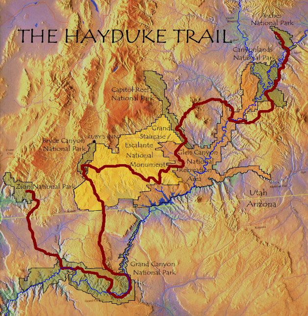
The Hayduke Trail is a 800 mile hike and scramble through the canyons of the Colorado Plateau in southern Utah and northern Arizona USA. The route links six stunning National Parks…. Arches, Canyonlands, Capitol Reef, Bryce Canyon, Grand Canyon and Zion.
The route connecting the parks stays pretty much in public lands including the wonderful Grand Staircase-Escalante National Monument, Glen Canyon National Recreation Area and numerous National Forests, BLM Districts, Primitive Areas, Wilderness Areas and Wilderness Study Areas. According to the Hayduke Trail website
‘the route is not intended to be the easiest or most direct route through this incredibly varied terrain, but is rather meant to showcase the stunning redrock wilderness of the American Southwest‘.
Created by Mike Coronella and Joe Mitchell, who spent years exploring the area and who published a guidebook in 2005, only a handfull of hikers have set out on the Hayduke each year. Roughly following the line of the mighty Colorado river south west, the Hayduke heads down into the Grand Canyon before heading north west to finish in Zion National Park. It goes down to about 1,800 feet at river level up to 11,419 at Mount Ellen in the Henry Mountains.
Mostly the terrain is arid and high desert but the plateau is cut into by a labyrinth of canyons, some with seasonal running water and springs. The prefered time of year to hike is the spring or autumn, between the blisteringly hot summer and the cold, snowy winter. Underfoot, much of the hiking is cross country, sometimes following canyon bottoms, wading rivers, hiking on sand or bushwacking through willow and tamarisk. There are a few good trails though, particulary in the national parks and jeep and dirt roads of various levels of use also provide easier travel across the plateau.
The Hayduke is not signposted or recognised as a national trail so hikers have to be self sufficient if they are to make it through the sometimes harsh, dry conditions. Above all though, the countryside is one of the most beautiful anywhere with the red walled canyons, clear skies, remoteness, lush green riparian corridors and stunning colourful rock strata.
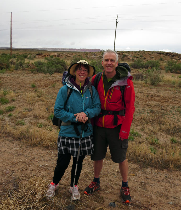
Although there is a guidebook, the nature of the terrain leads itself to a plethora of alternate routes and this appealed to us to research and explore our own variants. We, Brian and Martina, planned to set off hiking on the Hayduke in mid April 2014 and head westwards with lots of variations in mind.
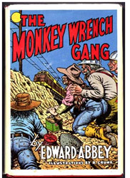
Edward Abbey The name ‘Hayduke’ is from the main character in the novel ‘The Monkey Wrench Gang’ by writer and environmental campaigner Edward Abbey. This has become a classic fictional story of ‘eco-warriers’ fighting back against the spread of industry and urbanisation of the wild areas of the US south west. ‘Hayduke’ set out to blow up railways and dams in the desert and in his run from the law, scrabbled his way through the harsh but beautiful landscape.
“In the first place you can’t see anything from a car; you’ve got to get out of the goddamned contraption and walk, better yet crawl, on hands and knees, over the sandstone and through the thornbush and cactus. When traces of blood begin to mark your trail you’ll see something, maybe.” Edward Abbey
Preparation We stay on the ‘Black Isle’ (but neither black or an island!) in the north of Scotland, a country with a rather wetter climate then the Colorado plateau. Not to be daunted though, during the winter of 2013-14 we did lots of hikes trying to replicate the Hayduke conditions as much as we could, covering around 20 miles a day seeking out rough sandy trails.
A local loop walk between the towns of Fortrose and Cromarty, along a rocky and sandy coastline with some climbing and rough dirt tracks proved to be about perfect- apart of course from the weather! It also happens to include superb geology and a range of coastal wildlife from dolphins, seals and the occasional otter to oystercatchers, fulmars, cormorants, shags and ravens. You can see the Site of Special Scientific Interest document for the coastline here.
In early April 2014 we headed out to Denver Colorado ready to start the Hayduke. Here we are on our first day in the rain at the edge of Arches National Park about to start hiking!
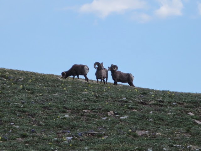
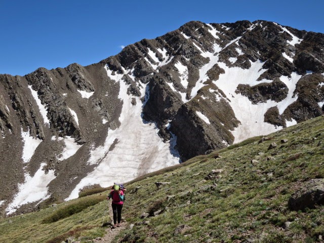
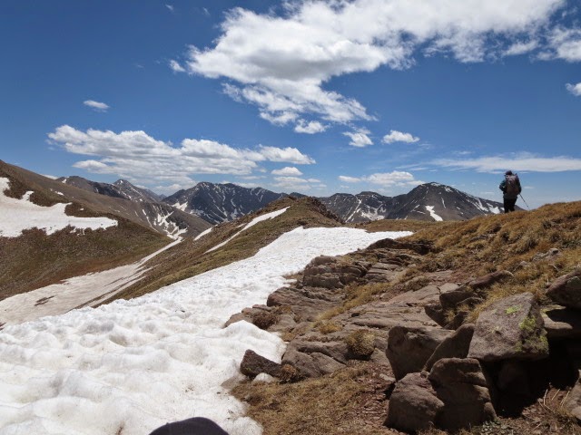
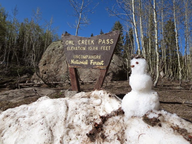
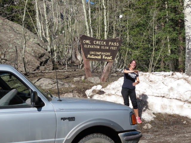
On to the Southern end of the Sangre De Christo range: above Santa Fe loom the Pecos mountains. Best wildlife encounter of the trip so far. We saw herds of elk cows with calves, bighorn ewes and rams, marmots, pika, eagles and of course ravens. 35 miles and 5000 feet ascent, a high camp below a melting snow patch which provided water just under the ridge at 12500 feet. The alpine flora is about to swing into full spring mode. Simply lovely!
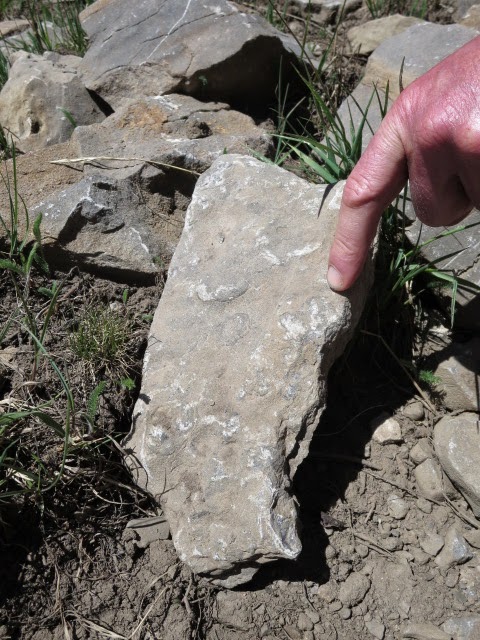
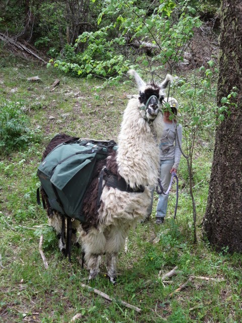
Found marine fossils on the ridge and met a family with pack-lamas…
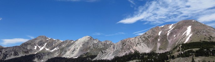
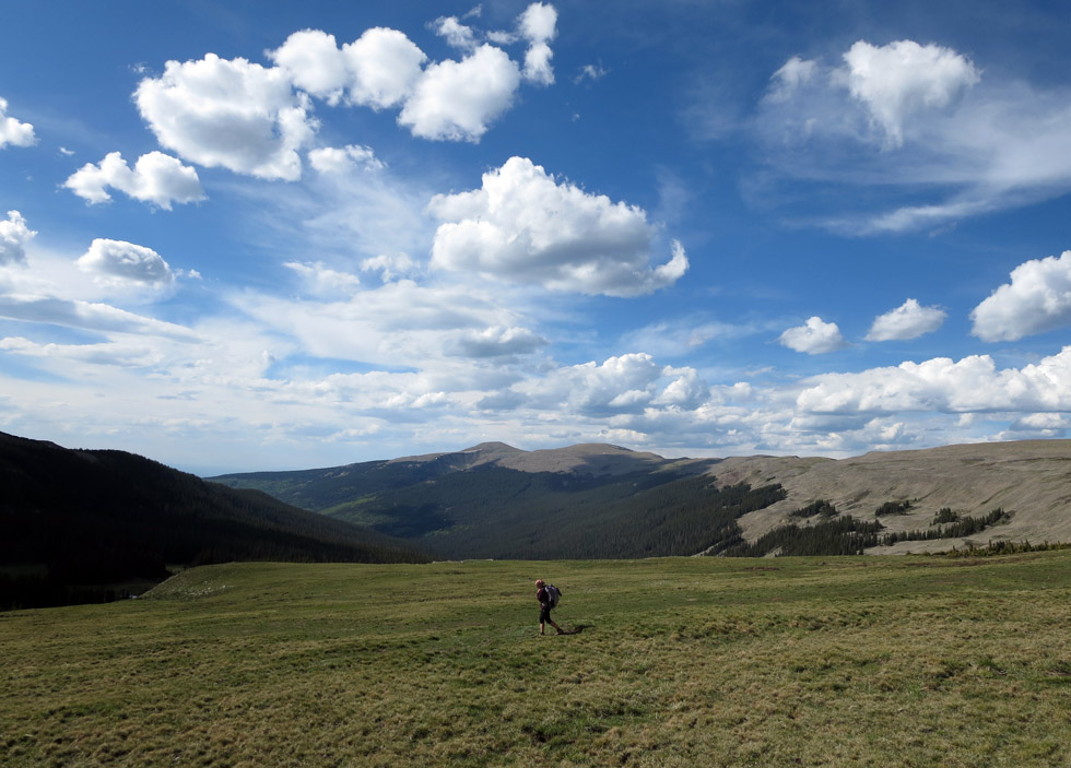
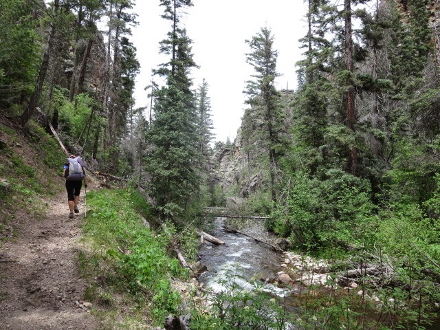
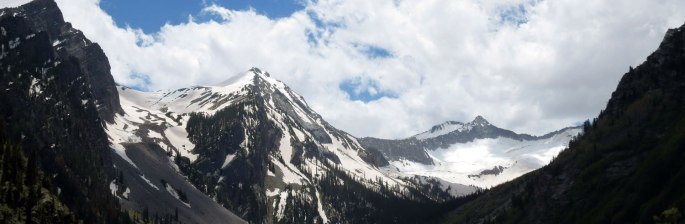
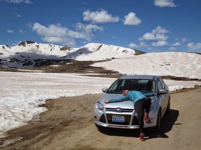
The main Rockies mountains have a LOT of snow this June so we visited another range in the south east of Colorado with a little less snow for a 4 day backpack. It turned out to be a beautiful trip in a wild area where we crossed 5 high passes up to 4000m with some snow and ferocious winds to add some excitement!
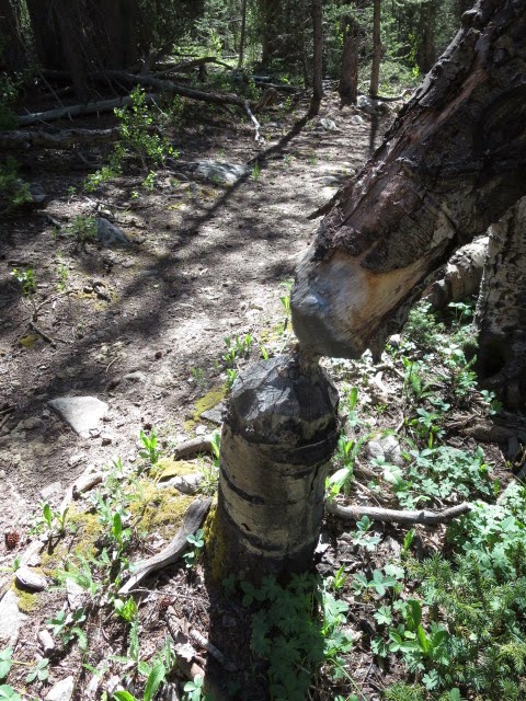
Saw bear tracks, bald eagles, herds of elk with their young, marmots, plenty of beaver signs (see pic of gnawed aspen) and no people once away from the trailhead.
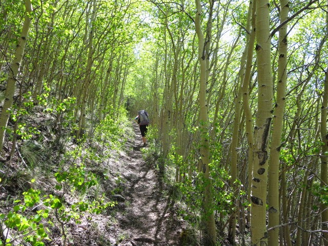
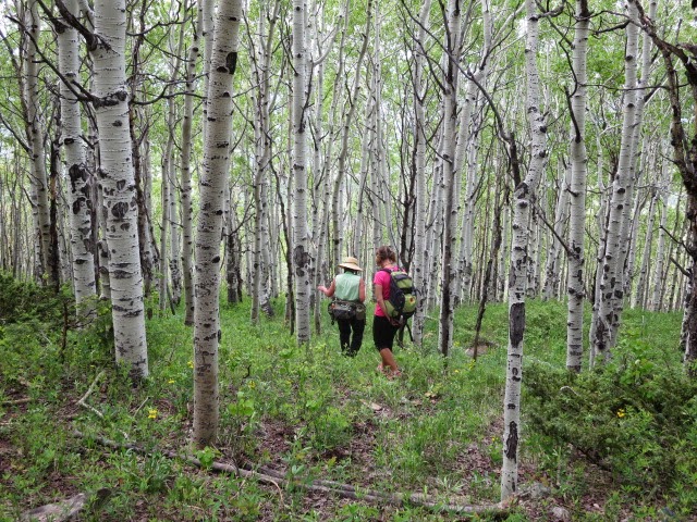
We left the hot desert of southern Utah to return back to the Colorado Rockies visiting the Martin family in Montrose Colorado and doing some hikes into the Rocky mountains. It was nice to hear bubbling streams and to see lush forest and mountains again.
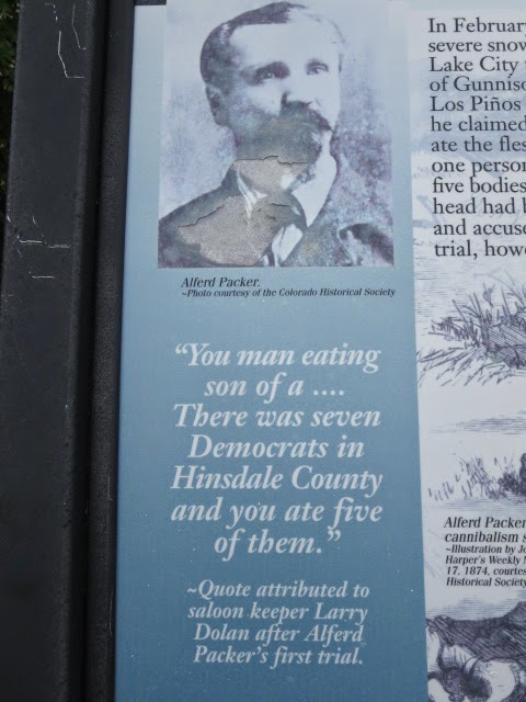
We revisited Lake City where we had resupplied in 2009 on the CDT and where our favourite cannibal in history, Alferd Packer, ate his victims and was later tried.
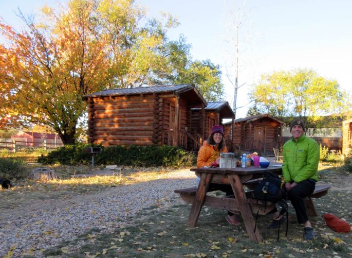
After hiking and kayaking about 700 miles we have come to the end of the Hayduke Trail, our intended route. We have now picked up a rental car and are roaming around heading back to Colorado in general like proper tourists. No longer do we have to explain to incredulous American travelers that “we have no car” – something that seemed v hard for most to grasp if indeed it ever fully sunk in.
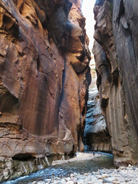
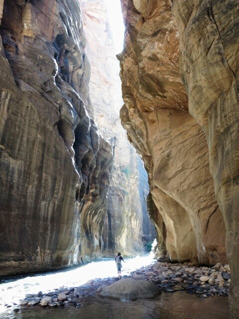
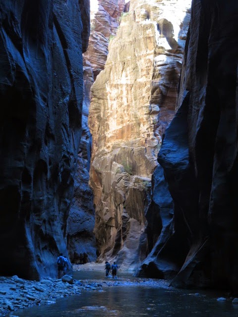
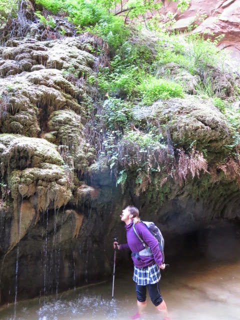
But we are still not done with canyons! We visited ‘Zion narrows’ a famous and super popular canyon hike. We managed to avoid both the heat and crowds by getting up at 4am!
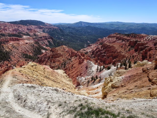
Also pics of Cedar Breaks National Monument, with its cool high elevation temperatures (10,500 feet) it was lovely to visit.
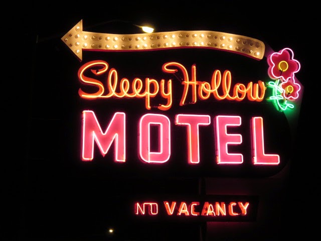
Sent from the Sleepy Hollow motel, Green River Southern Utah.