Hayduke notes-Moab to Hanksville

Moab to Hanksville

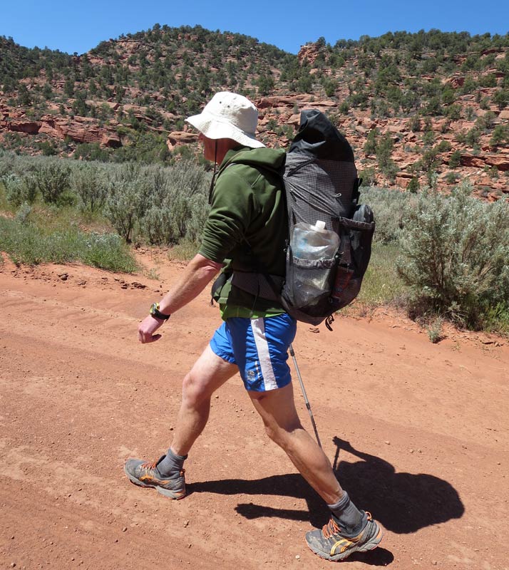
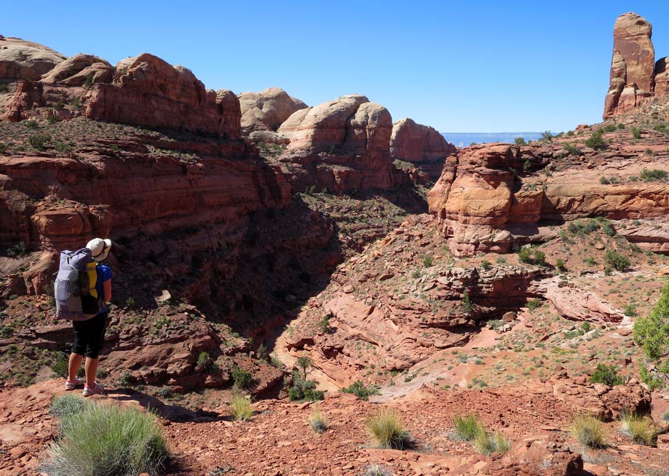
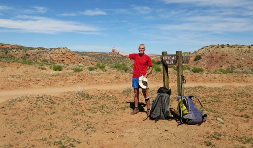
We pretty much diverted from the guide book Hayduke all the way from before the town of Moab (Section 1|23.6) to Poison Spring (Section 4|27.1) just before the crossing of Highway 95 and the hitch into the town of Hanksville, Utah. Our route here was split into two sections; a kayak down the Colorado River, followed by a hike away north of the river following the Happy Canyons.

Colorado River kayak alternate
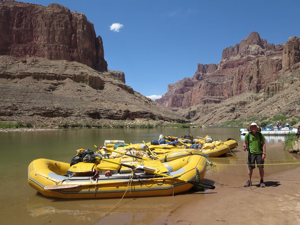
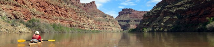
Why Do it?
A few weeks before we started we decided to incorporate some kayaking into our Hayduke trip by paddling down the Colorado River for some 66 miles or so. Overall this was a wonderful little adventure in itself. The kayaking down the Colorado was easily the most relaxing part of our journey as the water carries you downstream at maybe 1 mile an hour without any effort! By arranging to rent sea kayaks (from Tag-a-Long expeditions in Moab) and also coordinating with Tag-a-Long to collect the kayaks from us, it meant that we could continue hiking on without returning to town. However it did cost us money to rent kayaks and pay for their collection, so is definitely more expensive than the standard Hayduke route here.

This image has an empty alt attribute; its file name is kayak.jpg

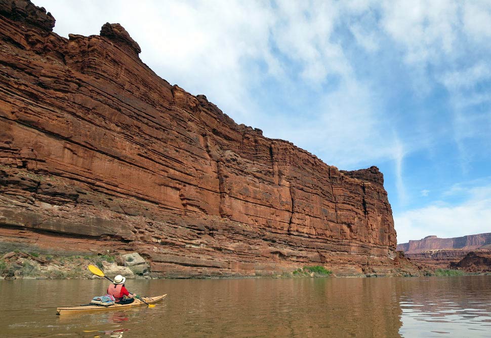
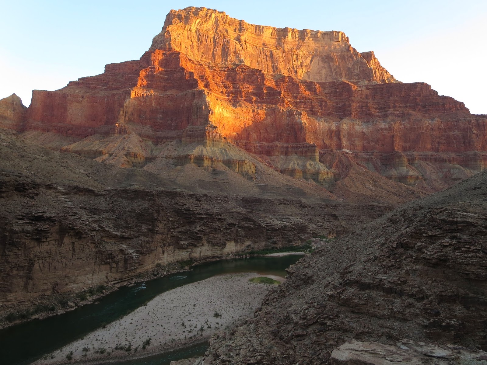
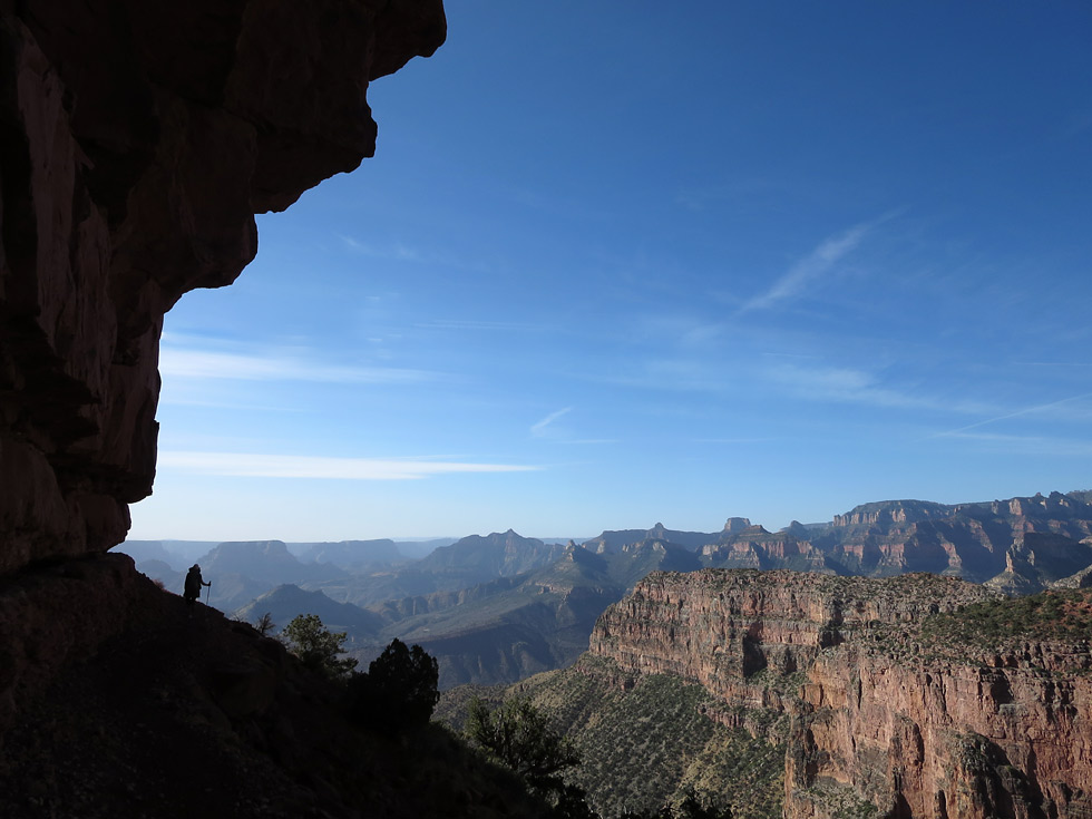
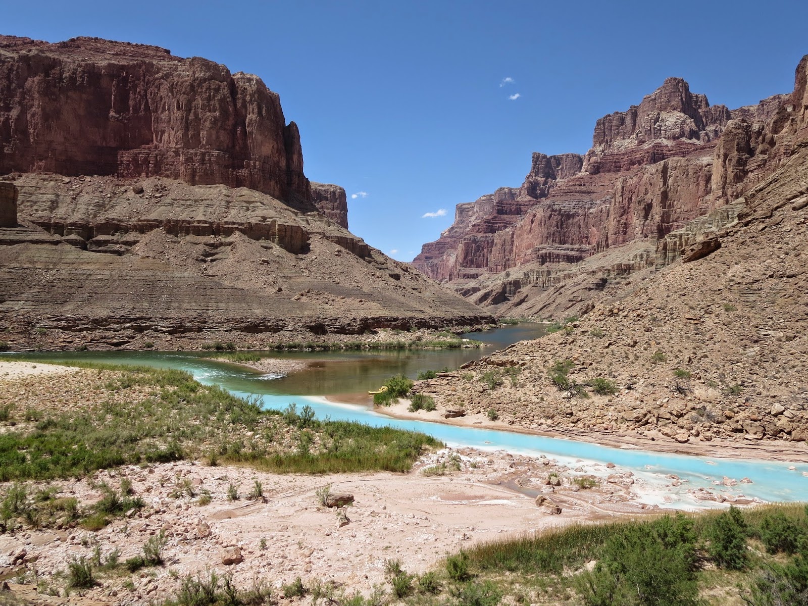
The red canyon walls are an ever changing beautiful sight and the scenery gradually got more dramatic and wilder as we headed downriver away from Moab. Seeing only two other groups in open canoes in four days on the river made for a superbly quiet trip although there was also a daily tourist motor boat travelling the river. It was tranquil journey, contrasting with the hiking, and recommended if you fancy even more variety on the Hayduke!

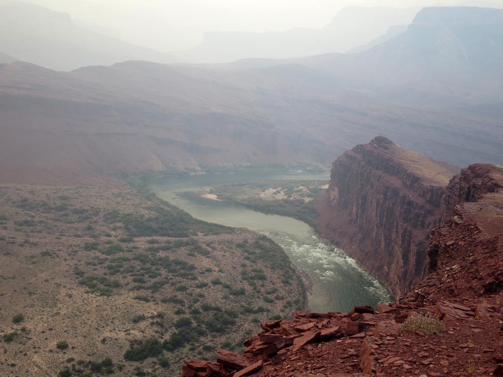
The river is mainly flat but there is one short section of rapids (The Slide) before the Green River confluence. We heard a roar from the rapids from a fair distance upstream which caused a little shiver up our spines but they turned out to be short lived at about 30m and pretty easy to paddle through in sea kayaks. Our main excitement was the swirling eddies after the rapids.

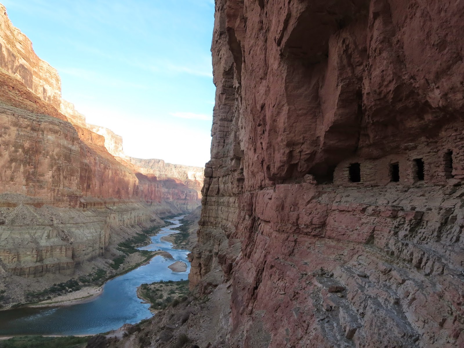
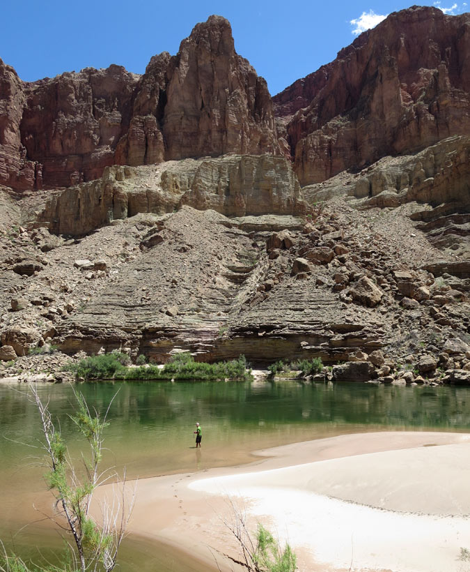
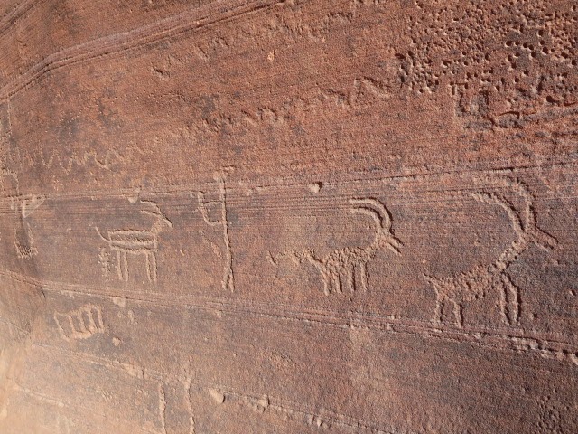
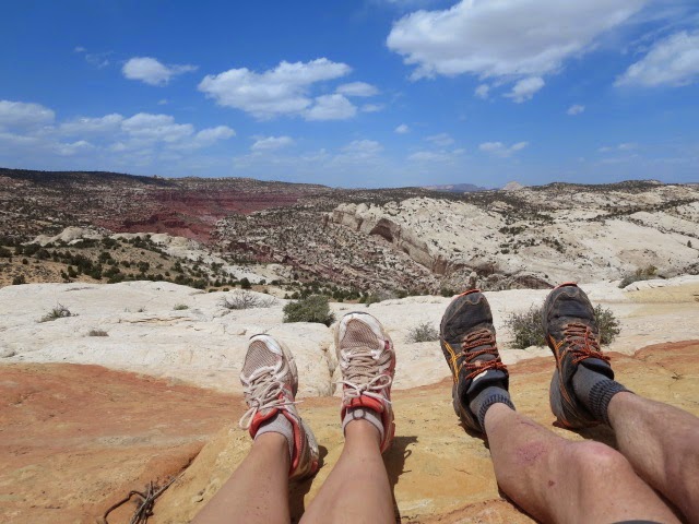
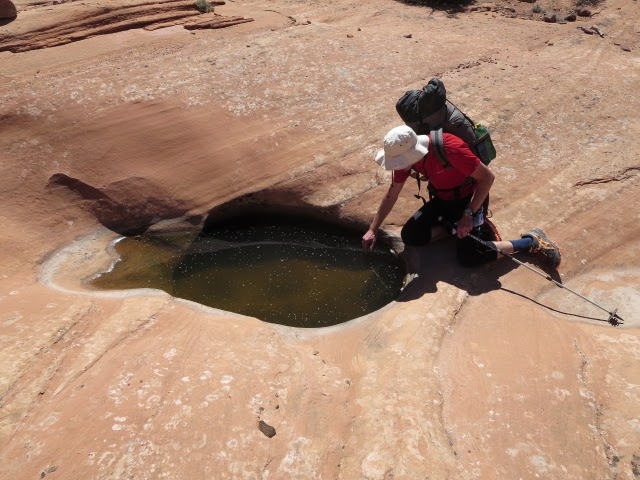
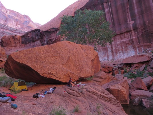
Most days we got out the kayaks for a couple of hours and hiked away from the Colorado River just to explore. We saw a couple of natural arches at Corona Arch from Golden Bar, picked up some fresh drinking water and a dip at Lockhart Canyon near to the normal Hayduke route at mile 58.4 and hiked up to the top of a wonderful gooseneck on the Colorado above the Green River confluence. There are lots of Native American sites to discover and we saw some cool petroglyphs.

How? Our plan was to paddle for four days to a place called Spanish Bottom a few miles downstream from the confluence of the mighty Green and Colorado rivers. This is roughly the same distance as hiking the Hayduke to nearby Needles Outpost.
Setting off paddling from Moab dock just north of the Highway 191 bridge over the Colorado (Section 1|23.6), meant that we had a continuous journey as we had already hiked to that point and then into the town of Moab.

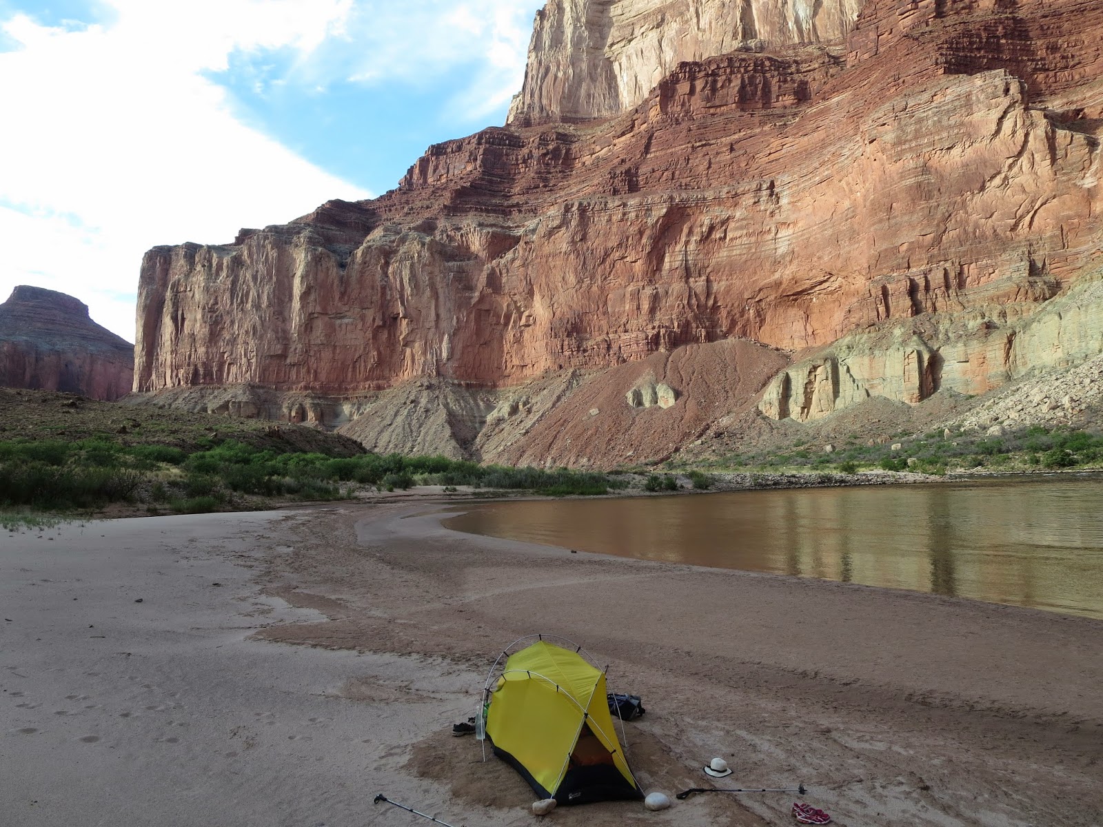
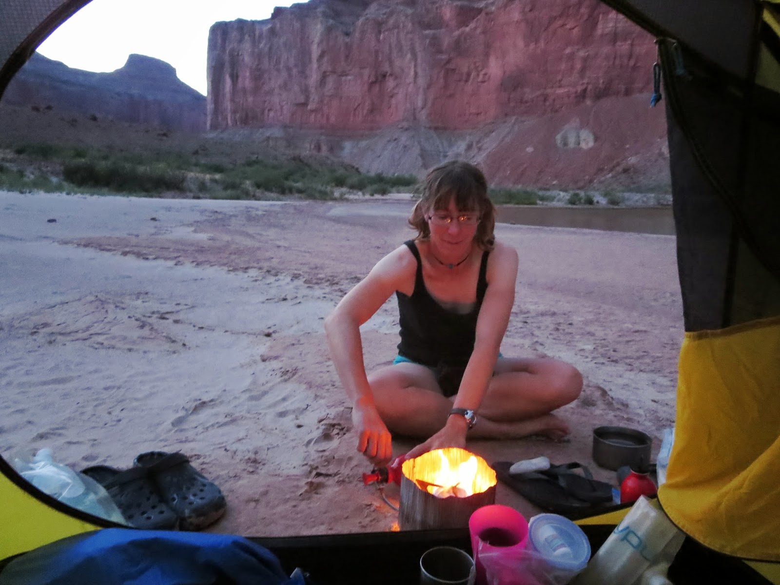
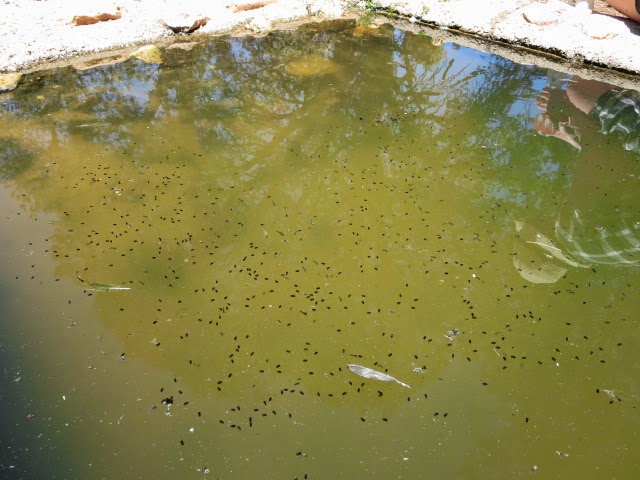
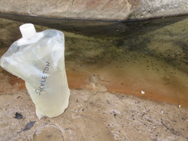
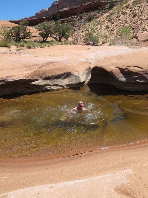
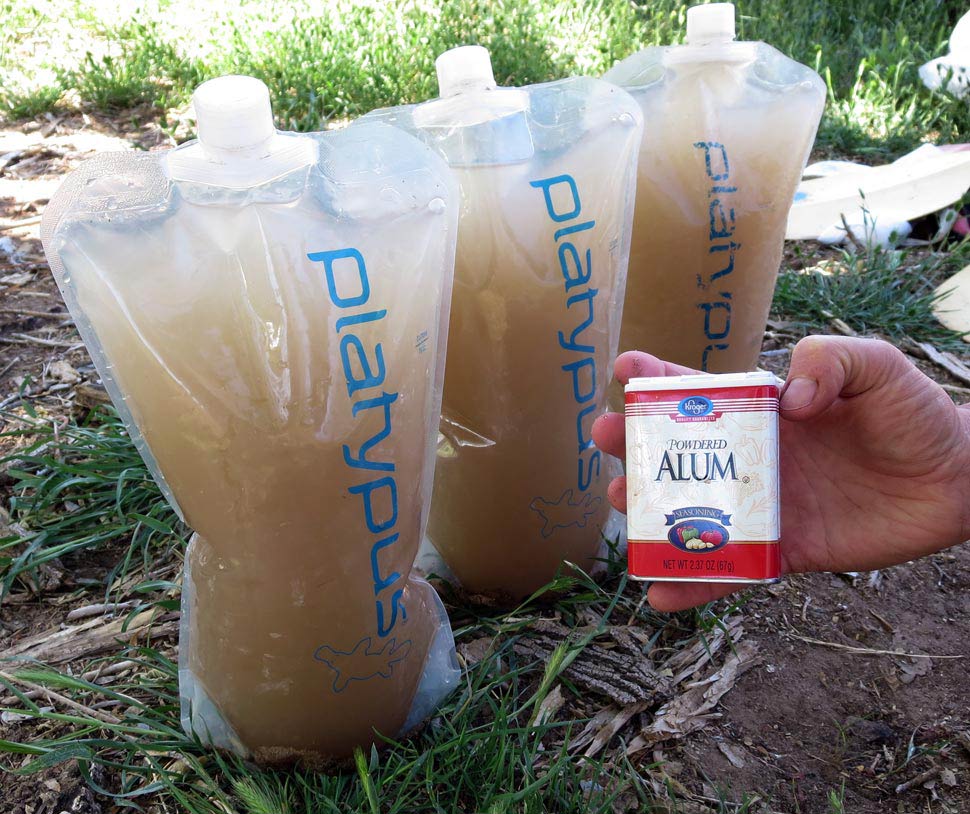
The water in the Colorado is silty, murky and cappuccino in colour as it drains the sandy, desert plateau. We used this water for our drinking supply but by taking care to let the silt in the water to settle to the bottom of our containers overnight, then treating with aquamira chlorine dioxide tablets, we didn’t have any trouble. 

Alum salts are worth considering also, they accelerate the coagulation of the silty water and mean that you can separate the water from the silt after a couple of hours rather than waiting til morning. On the downside we got stomach cramps which we thought was from the Alum though so didn’t make much use of them (cramps possibly caused by using too much Alum and I am sure others could make the salts work without stomach problems!).

This image has an empty alt attribute; its file name is alum.jpg

You need a permit to paddle down the Colorado River in Canyonlands National Park but that is easy to obtain for a fee and I don’t think there is a limit to the numbers of permits. We also had an extra backcountry permit for Canyonlands NP to cover hiking away from the river and camping in the park for a night. A park warden came out before we launched to check that we had enough safety equipment and that we would abide by environmental rules- carry out waste, no naked fires (we had to take a barbecue foil in case we decided to have a fire – we didn’t).

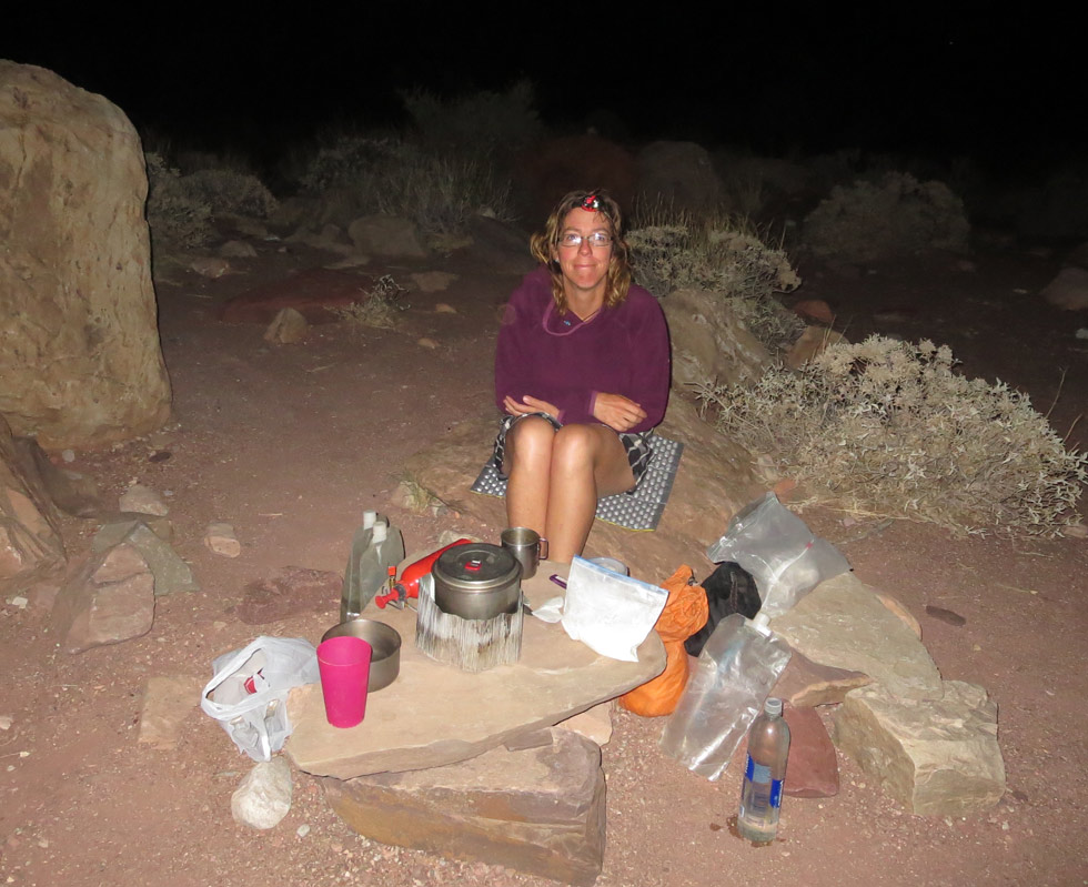
Also you need to carry a portable toilet which the kayak rental company supplied and (thankfully!) carried away when they collected the kayaks. We were given throw bags to aid in the rescue of someone falling in the water- as a bonus these make the most luxurious camp sitting mats and were a real treat to us hikers!

Spanish Bottom was our stopping point on the north shore of the Colorado, but you could easily finish across the river on the south side at lower Red Lake Canyon. There is a trail for 3.3 miles up canyon from here connecting with the Hayduke at Section 3|6.7 in the Needles area of Canyonlands NP. The north side was our choice as we were attracted to the continuation hike from there.

We got by with Canyonlands Trails Illustrated maps and our Hayduke maps but the best map for the river is this one from Belknap which we probably should have invested in….

You can get up to date information of the Colorado river flow levels from USGS river flow.

From Spanish Bottom we had arranged to have the kayaks picked up by the kayak rental company Tag-a-Long expeditions in Moab. That worked out well and I recommend Tag-a-Long – they were very helpful. Although renting kayaks and having them collected down river is more expensive than simply hiking! We carried a total of 9 days food with us in the kayaks to allow us to continue hiking for 4-5 days from Spanish Bottom on the north side of the Colorado River.


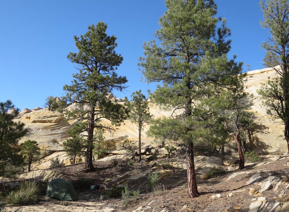
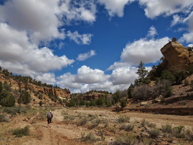
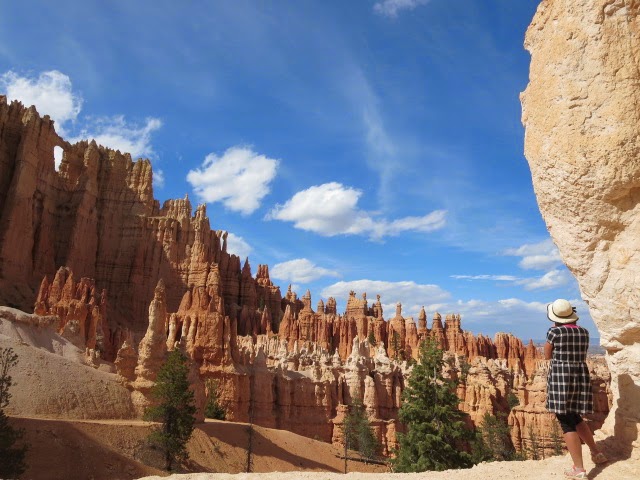
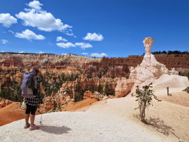
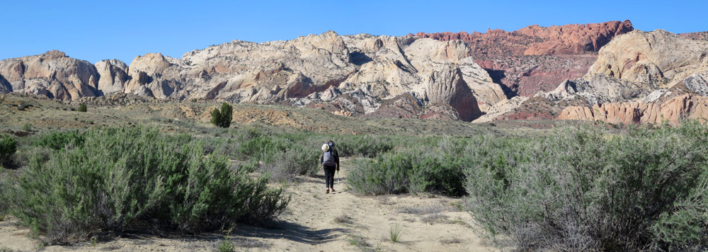
Maze – Happy Canyon alternate
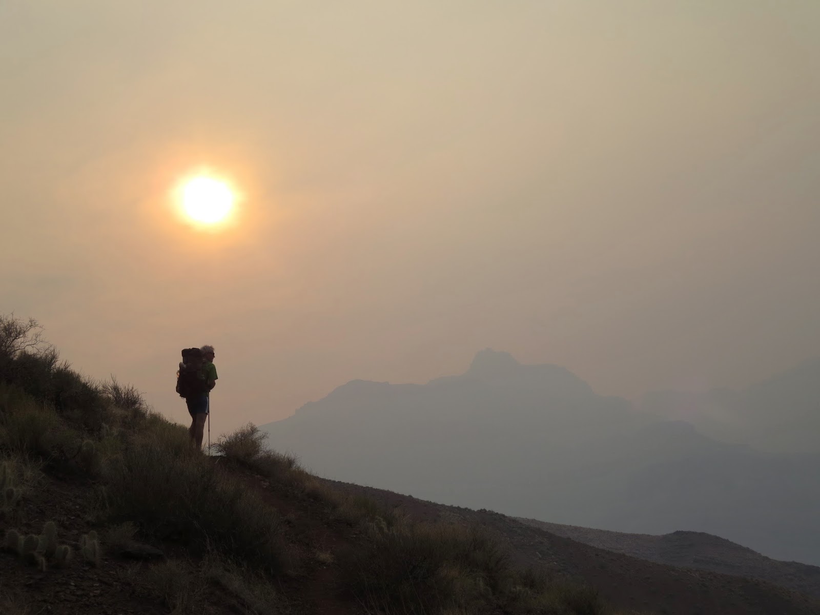
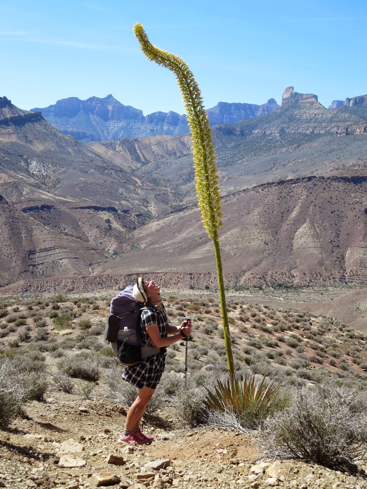
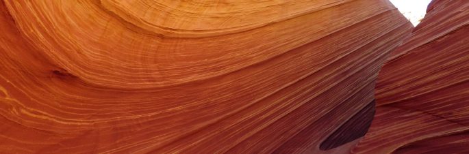
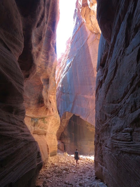
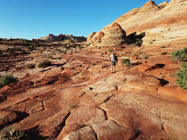
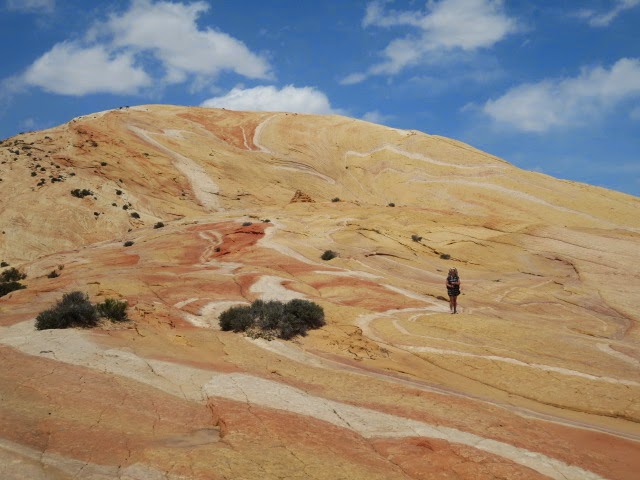
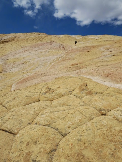
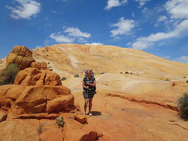
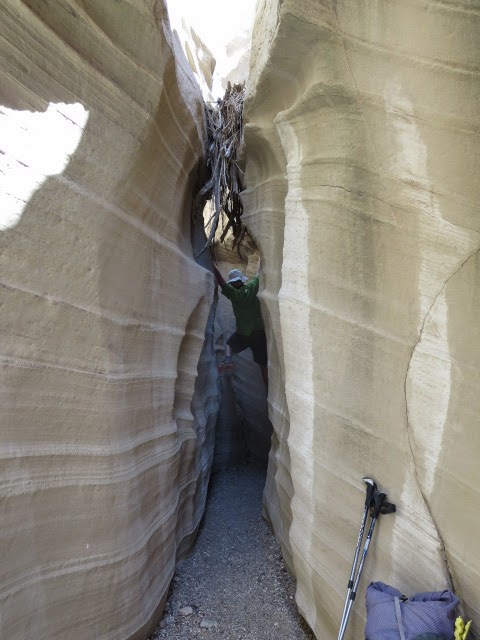
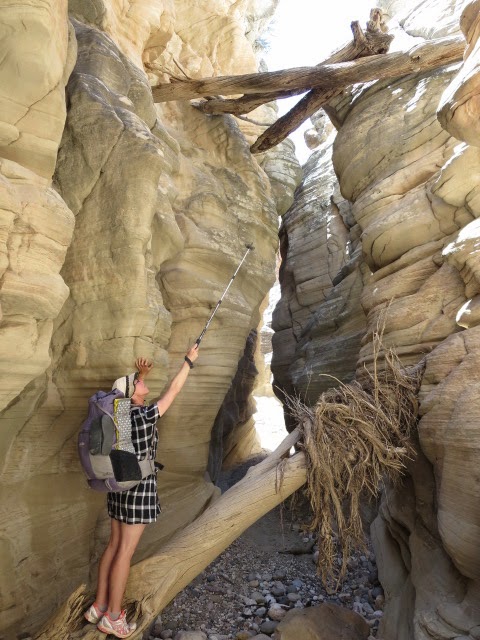
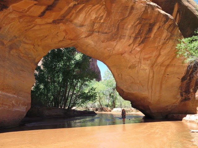
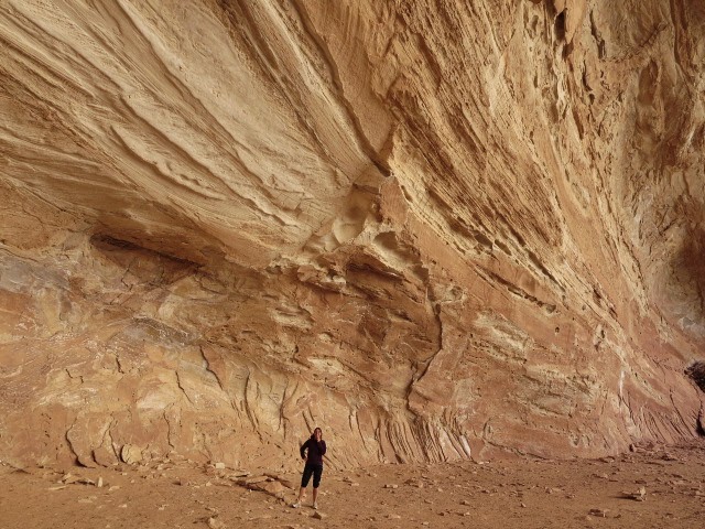
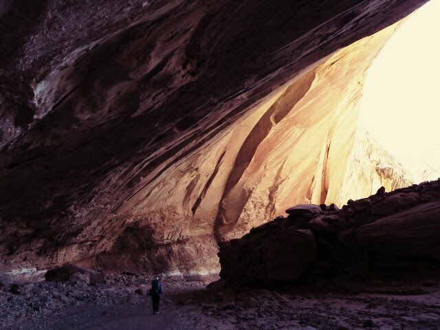
Why Do it?
This route takes a much more direct line from Canyonlands National Park to the Hayduke at Poison Springs just west of the Dirty Devil river crossing (Section 4|27.1) and was convenient for us as we had a much later start to the Hayduke than is ideal (we started 13th April but a month earlier might have been better). It allowed us to catch up some time but is also a splendid expedition in its own right through some spectacular and varied country. Highlights included hiking round the edge of the Maze, the Golden Stairs, the wild subtle beauty of the Happy Canyons, the exceptional slot of Happy Canyon just before it reaches the Dirty Devil River, the petrified logs on the west cliff sides of the Dirty Devil and reasonable water sources….

How? From Spanish Bottom take water to cover about 5-6 hours to Lou’s Spring and climb west steeply away from the river on the well made Spanish Bottom trail.

This link ‘Utah Trails’ gives clear instructions through to Lou’s Spring and the Golden Stairs trailhead along with interesting background- it’s a great hike.

Hike through the Dollhouse on jeep tracks.

At the west end of the Dollhouse camping area, find unsignposted Ernie’s Country east trailhead and then follow the good hiking trail south west down to the meadow, Main Flat.

Clell’s Spring had water when we passed but we waited to camp and take water at Lou’s.

Lou’s Spring is reliable and by following the description in ‘Utah Trails’. It is easy to find but remember it is off the trail so stay alert!

From Lou’s climb north west on trail to the jeep track of the Flint Trail.

Head south west down the Flint Trail for a mile or so then take the ‘Golden Stairs’ trail to the right (north) to climb through the cliff band above you.

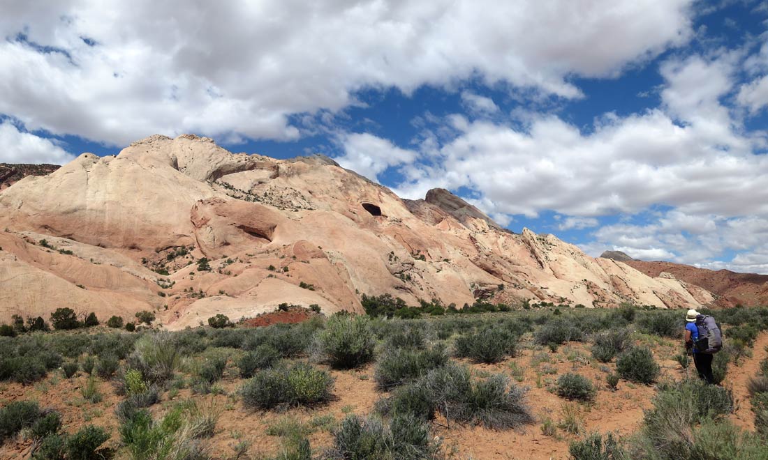
You cross a great narrow rock ridge to arrive at the Golden Stairs Trailhead. From there follow jeep tracks south west on the Flint Trail, firstly over flattish terrain then steeply up to the plateau between Flint Flat and Lands End- we saw plenty of people here- well it was Easter week.

Follow good jeep tracks south through pinyon juniper.

Turn right at the signpost to Happy Canyon and at the campsite sign further on pointing left, go straight on following the track which is blocked off by juniper wood.

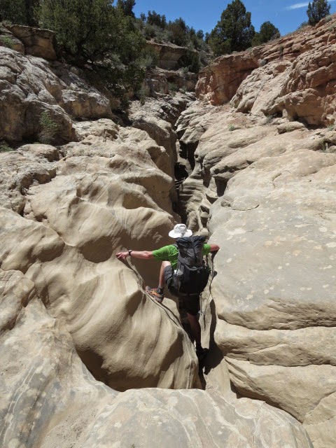
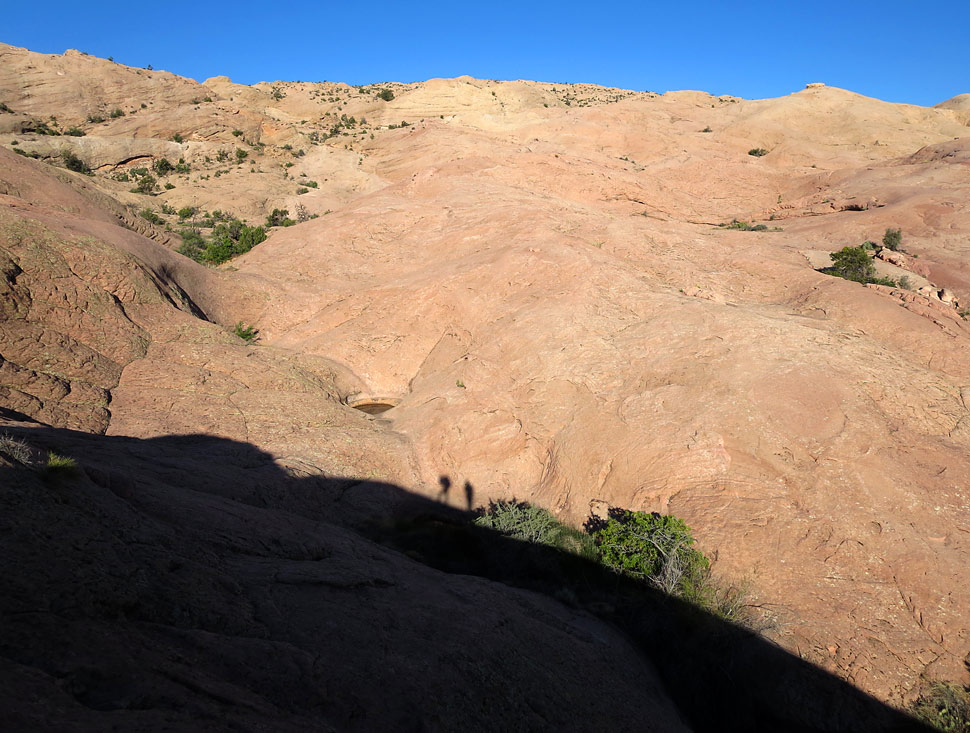
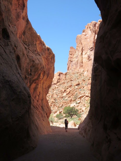
Keep going a short distance down to the road end and the descent route is cairned going down left into Happy Canyon south fork. You will be entering some really remote country here…

This old mining track zig-zags down into the south fork until joining the wash itself. It provides a good descent with great views although it hasn’t been maintained and is a bit bouldery in places.

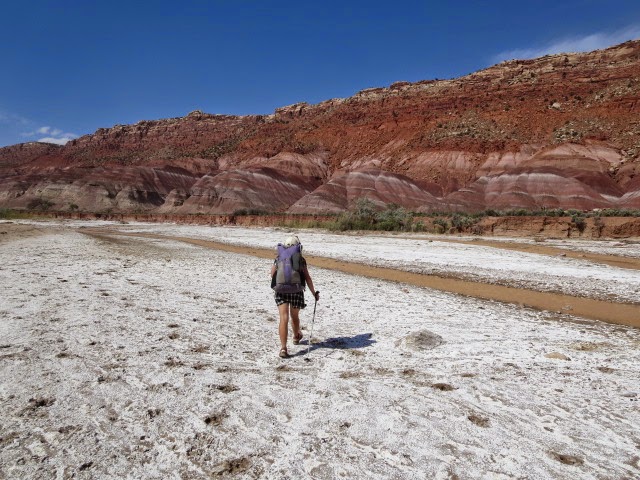
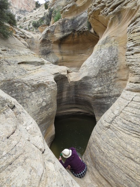
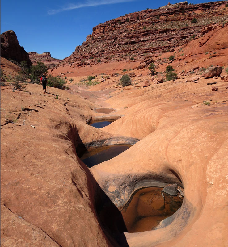
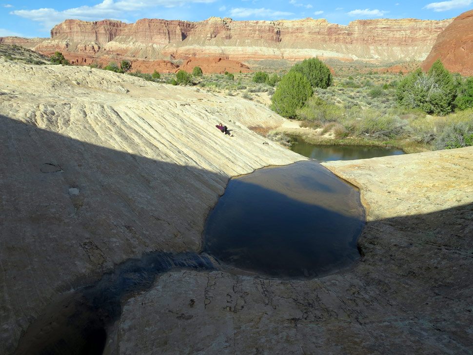
The track follows benches through colourful Chinle rock formations before descending steeply down to Happy Canyon south fork wash. We found good pools of water in the wash here.

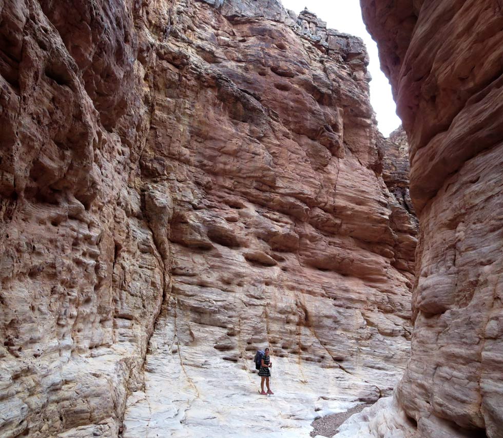
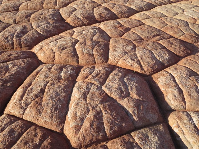
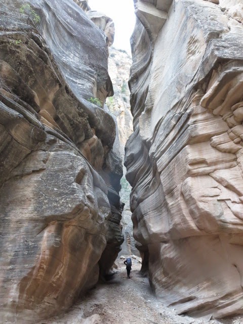
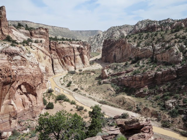
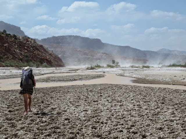
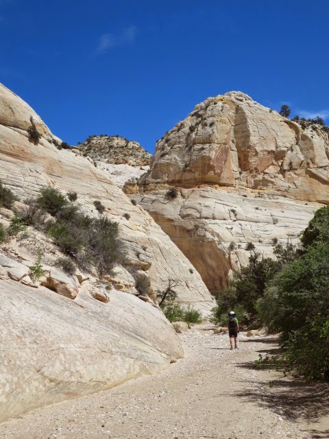
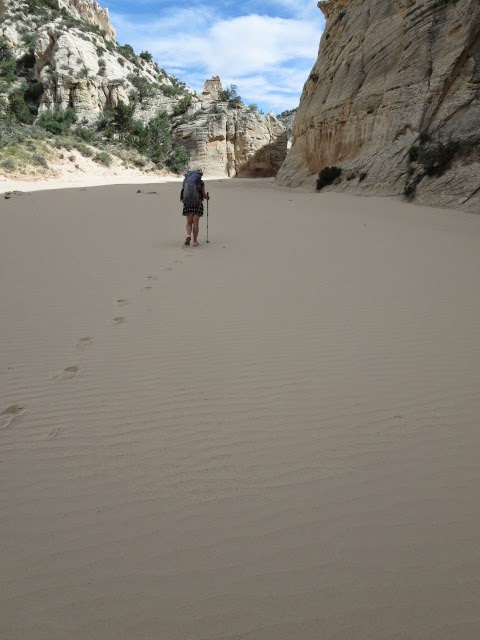
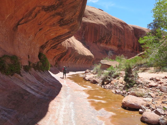
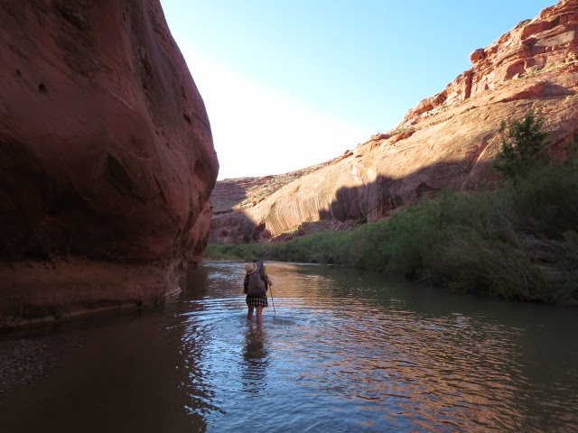
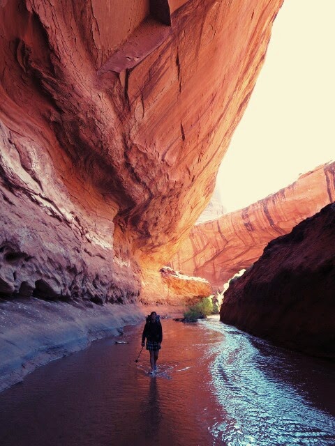
Now follow the wash with easy navigation down for a long way (25 miles?) into Happy Canyon itself, past ‘The Pinnacle’, to the entrance of Happy Canyon slot. The going is pleasant but with deep sand in parts and is exposed to the sun so could prove very tough in the heat I would think. There were more pools of water intermittently along the wash but I reckon they would dry up later in the season.

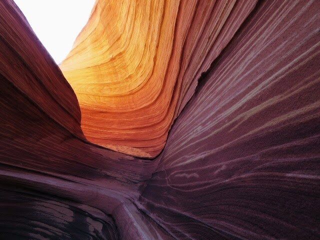
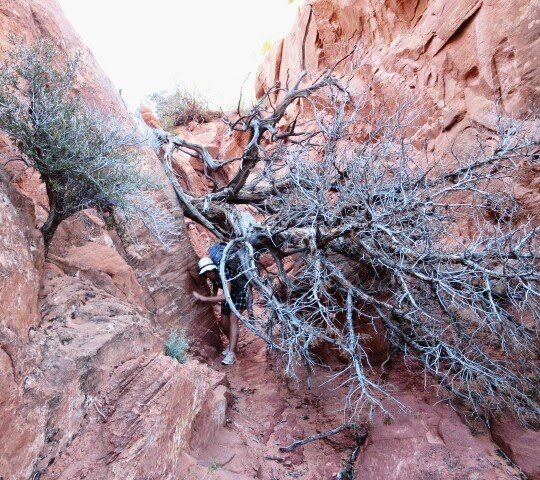
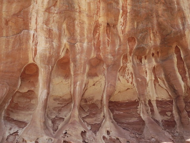
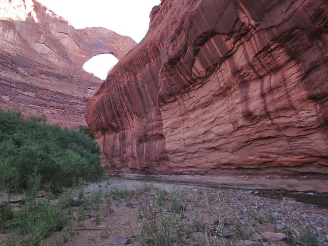
The slot is wonderfully scenic and after a short, maybe 6 foot slickrock descent, had little technical difficulties. We found no water here.

This image has an empty alt attribute; its file name is img_0816.jpg

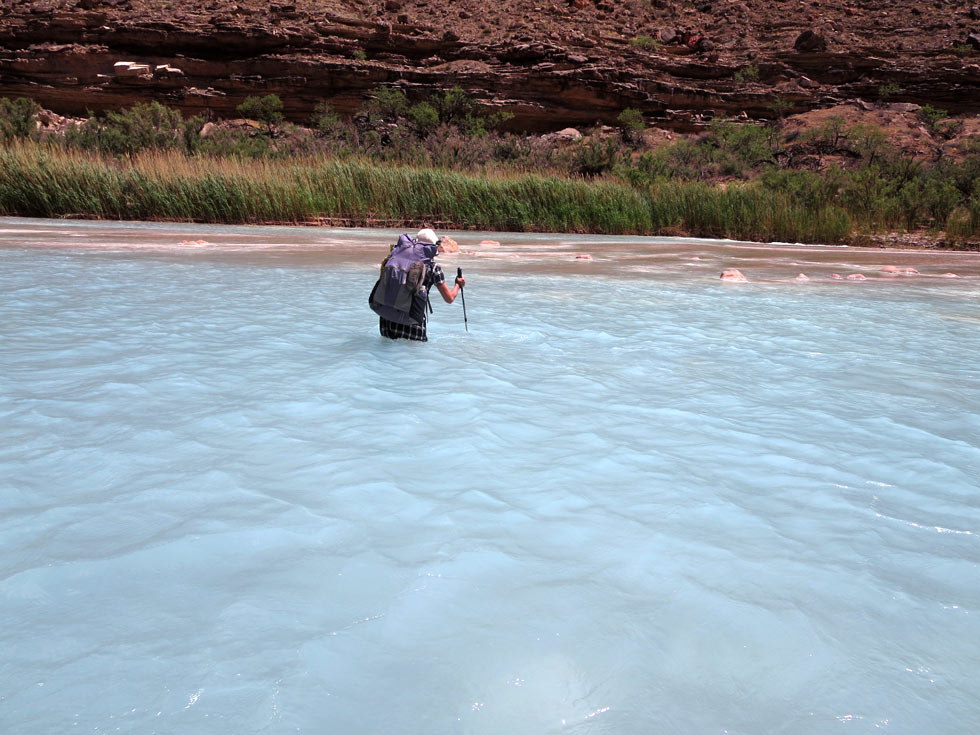
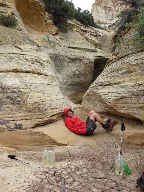
Exit the slot and cross the Dirty Devil River. This was an easy ankle deep splash for us but the Devil can live up to it’s name and rise quickly so watch out! The Dirty Devil water gauge provides data on water levels. We camped and took water from the Devil with no ill effects after treating with aquamira. This is the last until Poison Spring probably 5-6 hours away.

You now have to climb the west slopes above the Dirty Devil. We hiked north a few hundred meters and then picked up a faint trail through the first steep band and followed the odd cairn and trail straight up to an excellent old mining track contouring on a bench southwards in general. There are great views from the mining track to the Dirty Devil and petrified logs abound.

The track eventually swings roughly westward above the Hayduke in Poison Spring canyon and joins it at Black Jump (Section 4|25.4).

Some water in the wash above Black Jump but there is better at Poison Spring.

Section 4|27.1 Poison Spring is about 20m to the right of the jeep track at the foot of the wingate canyon wall with cottonwoods nearby. You need to be careful to keep an eye out for it is hidden from the road by shrubbery- we were alerted to it by hearing a faint dripping.

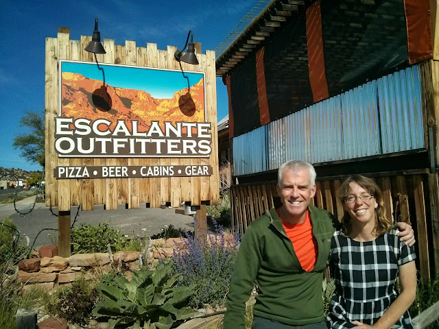
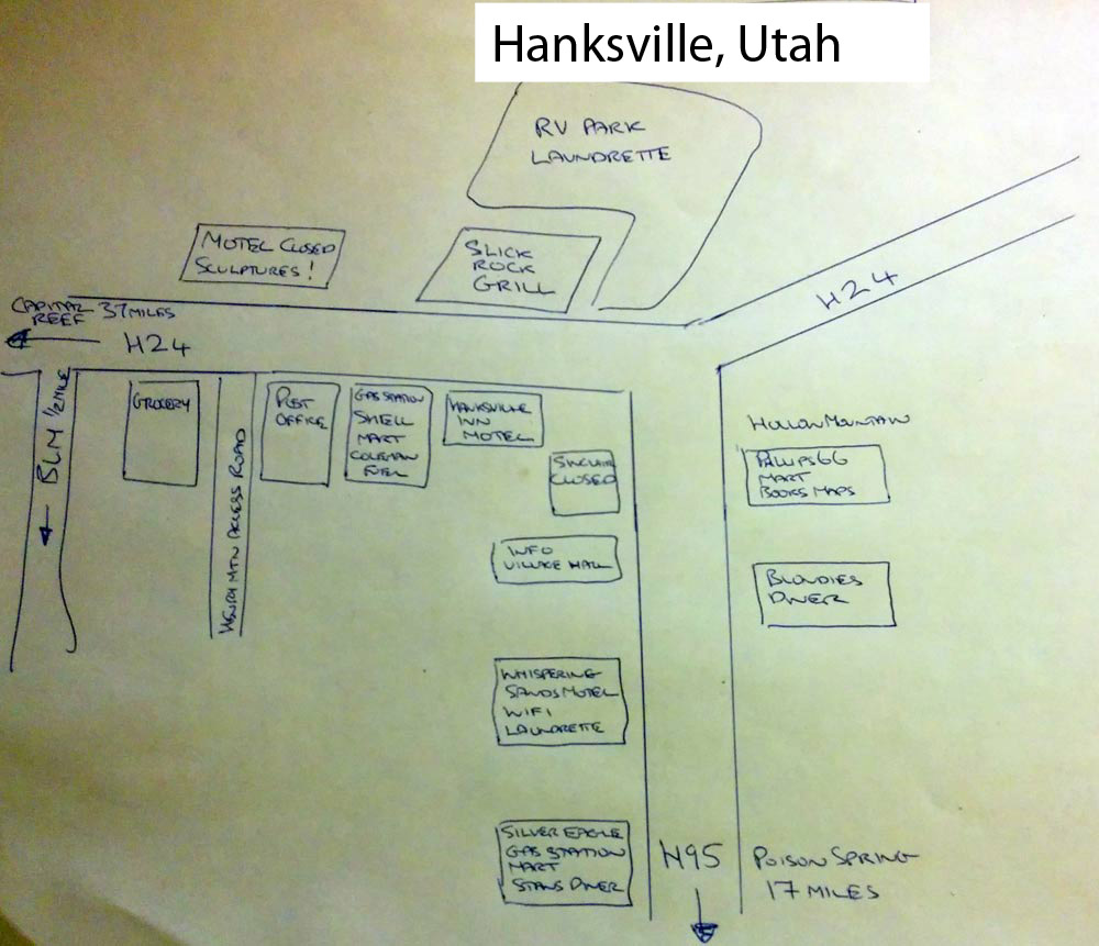
From here we followed the Hayduke and Poison Spring canyon out to Highway 95. The road is quiet but we got a lift quickly into the small town of Hanksville to the north which provided a welcome stopover for us. See the hand drawn street map of the town in the pic. We stayed at the Whispering Sands and would stay there again. The Slick Rock Grill is pretty fine too.

This image has an empty alt attribute; its file name is hanksville-1.jpg

Some links to hiking accounts in the area:

Jamal David Green, Across Utah 2009 A nice journal covering all of the hike
Daniel Wesemann the maze 2009 Both are very good accounts
Daniel Wesemann happy canyon 2009

Back to our Hayduke blog

Next hayduke notes – Hanksville to Escalante

Hiking along the Grand Canyon

22nd May Little Colorado to Escalante Creek 18.5 miles 
We woke at 4.45am to get some distance in before the sizzling sun hit us again. The scenery and hiking was magnificent down here but the heat- was brutal. The trail now though was excellent, contouring up above the river on sandstone terraces (the Tapeats rock layer).

The sun hit us alarmingly early, so we pushed on quickly before the heat built up too much. A stop at Lava Creek, where the trail drops about 1,000 feet to the main Colorado river, was pleasant as we arrived back into the shade.

Morning light on the Beamer Trail, Grand Canyon NP, at 7 am

From there we hiked closer to the river and saw our rafts from yesterday float by. The rafting looks fun but despite the heat, this hiking adventure is the way to go for us. We passed the Tanner Trail campsite and another three miles on to Cardenas Creek. Here the trail climbs up away from the river for a few miles but the heat was too much for us to consider doing that in the afternoon, so we stopped under some mesquite bushes next to the river for some meager shade.

A few hours were spent dipping in the river and lazing in the semi-shade. Haze came in – possibly from a nearby fire- although it didn’t cool the air much.

Riverside stop at the dry Cardenas Creek junction with the Colorado

We had dinner at 5pm and decided to hike on another 7 miles in the evening to the junction of Escalante Creek at the Colorado, which would give us a good camp with the Colorado river as a certain water source.

We set off at 6pm in deep haze with an orange globe of sun just penetrating through, but it remained sweaty and muggy. The terrain had a Mars like feel to it – exaggerated by the red haze. The character of the hiking here is unique as we climbed up the jaggy Escalante ridge with hazy views back down to the river. We walked at a flat out fast pace to make it back down to the river to camp before dark. Descending from the ridge on red soil we reached the black depths of Escalante creek which provided an enjoyable and surprisingly easy route down to the river. That was a great evening hike- we would love to do it again in clearer weather [hey- we did, in 2022…]

Hazy views from the Escalante ridge down to the Colorado
Hazy hiking!

Made it to a descent campsite just as it got dark!
23rd May Escalante Creek to Cottonwood Creek 13 miles 
Awake early again at 4.45 am feeling fatigued after some hard, hot days! It was a rough little trail bordering the rim of 75 mile canyon, which we had to deviate round then drop back down into to reach the Colorado again. The walls of this narrow canyon were a lovely smooth quartzite and there were fantastic large white datura flowers growing here (great looking flowers that give out a scent at night to attract moths).

Wow- we then came across a fresh dead bobcat lying in the base of the canyon. It looked like it might have fallen from the rim down the cliff, poor thing.

75 mile canyon
Bobcat
Datura
[We reported the Bobcat to the National Park when we reached south rim].
75 mile canyon opened out to the Colorado river again and we scrabbled along a great route following the river downstream including a steep climb at Papago canyon before a loose steep gully descent back to the river. A short trail along the river then led to Red Canyon, a lovely spot used as a campsite by rafters, where we took a rest and collected water from the Colorado.
Relaxing at the beach at Red Canyon for ‘mid morning snacks’ at 8am !

We now said farewell to the Colorado river for a while as we followed a good climbing trail (the Tonto trail) as it steadily ascended upwards on baked terraces with boulders, cactus, agave and big views. We made it to Hance creek around lunchtime with it’s small water flow amid cottonwood trees. There were campers here, our first other hikers seen in the Grand Canyon!

Next up we climbed for about 1.5 miles past Page/ Miners spring. Copper and silver were mined in the canyon in the 1890’s and there are some interesting relics around.

Climbing up to the flat area of Horseshoe Mesa was fun and we then dropped steeply back down again into Cottonwood Canyon. On discovering a tiny trickle of water under cottonwood and junipers, we declared an early camp here to rest in the shade and take on more water. It stayed cloudy in the afternoon even threatening thunder which was great for us and we could relax at camp out of the fiercest heat!

Near Page Spring
Typical Tonto trail scenery 1500 feet above the Colorado river but 4000 feet below the rim of the canyon

24th May Cottonwood Creek to Cremation Creek (dry) 18 miles 
A great evening in camp with some distant thunder and rain to cool things down. Both of us were tired- we went to sleep at 7! With an alarm at 4.30 am we were off hiking into the dark at 5.30 am with head torches. It was light enough at 6 am though as we left Cottonwood Creek and headed westwards in a huge arc on a plateau (the Tonto) way above the Colorado river itself.

There was a good trail on flat terrain which made for easy hiking and the most interesting sections were when we could look down from the cliff edges into the black depths of the Colorado.
Six miles in and we reached Grapevine Canyon – a potential water source. We split to look for water; Brian went down canyon on slick rock and Martina up canyon to successfully find some pools of water. Another 4 miles in and we found shade to rest in Boulder Canyon. The weather built up a bit and it didn’t heat up too much – which was a relief as this is frying territory!

From Boulder to Lonetree Canyon (our intended camp) was easy flat hiking with some bighorn sheep along the way. Arriving at  Lonetree we were delighted to find some small pools of water as this was a critical water source which we had heard dries up in early summer each year. We happily lazed around here in late afternoon watching frogs, lizards and chickadee birds at this little oasis.

We decided to walk on around 5 pm stocking up with enough water to do us overnight and tomorrow before reaching the south rim of Grand Canyon along with its shops and plentiful water!

Our trail continued on quite a burnt out, dry, desert landscape along the flattish Tonto plateau still. On reaching the dry Cremation Creek we found a pleasant camp spot and, since we aimed to reach civilization tomorrow, we splashed out by scoffing our spare energy bars with tea after our pasta dinner- luxury! Both of us are looking forward to showers and fresh food!

25th May Cremation Creek to Grand Canyon South Rim 8 miles 
Another early start to beat the heat, hiking out with head torches and adrenaline pre-dawn. This has been a tough, too hot, but fantastic hike and we push on fast along the flat to meet up with the very popular South Kaibab trail. This is the normal way for people to hike down from the Grand Canyon rim to the depths of the Colorado river some 6000 feet below.

There are other people around now as we turn south to ascend up the well worn trail for 4000 feet of climbing to the south rim, roads and town. We have light rucksacks with little food left, are now lean and fit and we charge up the trail at a fast pace, meeting trail runners, mule trains and lines of hikers of all shapes and sizes coming down in the opposite direction.
We reach the summit rim at 8.30 am to relax after a wonderful, but draining hike!

Being watched by ravens….

Descent down to the Grand Canyon

17th 18th 19th May Kanab -Jacob Lake to the top of Nankoweap Trail, Grand Canyon National Park 14 miles
We had a rest in Kanab to let Brian’s insect bites recover aided by cortisone cream, food, coffee and beer! We liked Kanab. Firstly there is the great little outdoor shop ‘Willow Canyon Outdoor’ where you can sit in with a nice coffee and relax. Also we headed out to a pub called ‘The Dog House’ which is a vegan eatery as well. We had vegan cheeseburger pizza and listen to a live bluegrass band playing outside. Sign says ‘WAG MORE, BARK LESS’.

We had two hitches and a bit of waiting to make it out to Jacob Lake where we met another Arizona Trail hiker, Treker4(?)  Being a bit behind our permit dates for the Grand Canyon, we decided to hitch forward about thirty miles to Grand Canyon north rim vehicle entrance and hike for a two to three miles back onto the trail from there. This also gave us the chance to see a fire lookout tower that the writer and inspiration behind the Hayduke Trail,  Edward Abbey, worked at. A wonderful couple from Wisconsin gave us a lift as soon as we wandered out onto the gas station forecourt to stick out our thumbs.

The lookout tower was cool and we were able to scramble up the tower but unfortunately the cabin at the top was locked.

We then hiked along the Arizona Trail at around 9000 feet elevation before rejoining the jeep road of the Hayduke towards Nankoweap Trailhead. Carrying heavy loads with 7 days food and water to do us until the next afternoon made for sore feet. The hiking was easy though through ponderosa and aspen forest and we even glimpsed a couple of squirrels but were unsure if they were the famous Kiabab species.

Our first views of the Grand Canyon itself came when we reached the Nankoweap jeep track trailhead around 5 pm. It was hazy but even so it was impressive as our first ever glimpse into the Grand canyon itself. We hiked onto a ridge protruding into the canyon over a hilltop then down onto a small plateau where we set up camp under some ponderosa at a lovely spot. An evening stroll along the rim of the canyon to catch some late sun catching the cliffs of the canyon walls was a pleasure.

20th May Nankoweap Trail down to the Colorado River Grand Canyon 15.5 miles
This was an exciting day that we had been looking forward to- our descent of 6000 feet + down into the Grand Canyon on ‘the most difficult of the named trails in the Grand Canyon’.

It was very windy overnight with some strong gusts banging against the tent only giving us an intermittent sleep. Despite that we were up at 6 and away hiking by 7 starting with descending a tree covered ridge before we dropped off down into the canyon itself. There wass a clear trail to follow and for a while it traversed and undulated between cliff bands with tremendous views down into the canyon. Both of us were going well this morning with the shaded, rugged trail hiking and the exciting views.

Nankoweap descent

After rounding Marion Point we continued traversing before the trail descended south east more deliberately into Nankoweap Creek valley. The sun was on us now and the heat notched up into the high 20s C. The terrain wass much more arid as well with thorny shrubs and giant agave peppering the dusty ground.

Descending through some lovely colored rock layers of yellow, limestone white, green and black lava rock, the temperatures reached furnace like levels and we were super glad to reach cool shady cottonwood trees and trickling water at Nankoweap Creek for an early lunch break at 11:15.

We had heard that the Nankoweap trail would be difficult but we found it a lovely easy hike, it is the heat that could make it hard (especially if hiking in the other direction, uphill)- it looked like there has also been recent trail maintenance carried out here to ease the way- THANKS!).

We reluctantly left the shade to descend down the rocky wash towards the Colorado river. The temperature reached body melting levels and it started to fry our brains a little as we both got grumpy but stumbled on. Eventually we reached the huge Colorado river in the Grand Canyon and found a lovely beach to pitch the tent in the most amazing of settings. What a fantastic place!

First camp by the Colorado at Nankoweap
Camp cooking!

After dinner and the sun thankfully sinking below the cliffs, we had enough energy again for an evening hike 300 feet up to the wonderful Nankoweap granaries. These are believed to be food storage caves built into the cliff around 1100 AD. The situation is also a candidate for the best viewpoint along the Grand Canyon (IMHO)- tremendous. We descended back to the tent and rested with a late tea and bats swooping overhead.

The Nankoweap granaries built into the cliffs above the Colorado river

21st May Nankoweap granaries to Little Colorado river 12 miles

We were up early for a potentially interesting day on three counts:
-it would likely be in the 30’s Celsius again today,
-there was a reportedly rough trailless section ahead following the west bank of the Colorado river downstream  over boulders and scrub,
-and lastly we would then have to try and get a hitch across the Colorado river from a raft or other boat going downstream (the Colorado is way to big, deep,cold and fast flowing for us to cross without a raft or boat).Since we hadn’t seen any boat traffic on the river yesterday, the hitch might take a while.

We started at 6.15 am in the delicious morning shade with sandy animal trails winding round the deep thorny vegetation. For some of the way we managed to follow the shore, wading in the shallows of the river, but mostly we boulder hopped and bushwhacked for 9 miles through every type of spiky bush and cactus imaginable.

Torn, sweaty and disheveled we made it to a beautiful little sandy beach we thought suitable for hitching a lift from a boat at 12:15. Wonderfully, the beach also came with an overhanging shady rock ledge to sit out from the blazing heat while we waited. We even snuck out from our protective shade for a refreshing swim in the river.

IMG_1819
Our lovely Colorado river hitching location

To be honest, it was so relaxing in our shade next to the beach in this amazing place, we were both quite happy sitting around chilling, but we have next to no spare food so we really needed a lift today at least. And lo – a couple of hours later river rafts appeared round the corner and we leapt out and waved.

Phew – the rafts from ‘Outdoors Unlimited’  outfitters happily agreed to take us a across- and better, a mile or two down river to the junction of the Little Colorado and the Colorado rivers.

The rafts

The river raft guides were interested in our journey, and we in theirs, and we had a nice short chat before we landed at the other side of the river. We were now in a busy little spot after lot’s of time hiking alone. The rafts stopped here to let people out to hike up the Little Colorado river for a while. There were also researchers studying the ‘humpback chub’ – a fish that seems to like the mineral rich, limestone waters.

The Little Colorado is a big river in its own right, draining a large part of Northern Arizona, and it was a deep wade to get across.  A friendly researcher took us up river though to show us the best crossing point of this beautifully turquoise blue river. It was thigh deep but the water is warm, fed from hot springs upstream, making for a relatively easy crossing in the end.

We then picked up a trail again (the Beamer Trail) for some easier hiking we hoped. First though we sat out the oppressively hot sun in a shady spot and decided to camp nearby to hike on in the early morning tomorrow…

Martina crossing the Little Colorado
The confluence of the Little Colorado and Colorado rivers

We cross over to Arizona

12th May Out of Bryce south to Park Wash 20 miles

The next day we woke up to sunny snow cover and frosty conditions. Fortifying ourselves with breakfast at Best Westerns (hash browns, eggs, toast and pancakes) we were ready to take on our hike again.
We negotiated a lift back to our trail and were soon hiking on trails in the crisp post storm air at 9000 feet. Dropping down from Rainbow Point to ‘Riggs Spring’ brought us below the snow line to warmer air and lush green scenery of Ponderosa, White Fir, Douglas Fir, Manzaneta, Juniper and Pinyon.
Heading on south out of the national park we hiked on jeep tracks through more open but still pleasant country. We headed away from the jeep tracks into Bullrush Gorge which started as a dirt banked dry river but turned nicely into a steep sided gorge, but this time with broken sides and trees growing from the walls. Deciduous trees here included oak and mahogany. It’s amazing how every canyon has it’s own character.
It’s always cheering to find water and Adam’s Spring didn’t disappoint- water flowed clear and healthily into an old bathtub just off the trail.
Our campsite was a mile or so south from here amidst some great sandstone tepees and we scrambled up the rock to have a splendid dinner amidst rock and ponderosa. Excellent day.
Heading south from Rainbow Point
Park Wash camp
13th May Park Wash to Highway 89 and hitch to Kanab 19 miles
Another cold clear frosty morning and we headed off at 7.40 with the aim of reaching the highway early enough to hitch a ride into the town of Kanab.
Hiking here was down a sandy bottomed wash to No Man’s Mesa. The wash had maybe 10 feet high dirt banks topped with sagebrush and there were lots of cows around. The views to the surrounding white vertical cliffs were great though. After a couple of hours we hit a windmill (not working) and better jeep tracks following a terrace above a wash. The valley was filled with a carpet of green grass and sage. BLM have signs marking restoration work done here which looked like it is having a positive effect.
Making good time on the jeep tracks, we meet two guys looking at artifacts from Indian settlements for BLM. They agreed to give us a lift into Kanab which we welcomed as we thought it might be a difficult and lonely hitch out here!
Kanab is a cool town but with a slightly pre-season feel to it. We checked in at the small Travelers Motel on the east side of town and it was a great place for us -sitting outside the motel munching bagels happily into the evening!
Brian striding towards town…
14th May Buckskin Gulch 16 miles
We get a ride back out along Highway 89 in the morning and are soon hiking down Buckskin Gulch in much warmer temperatures now.  The upper gulch is all beige limestone with marine fossils a-plenty.
We popped out to the dirt road of Buckskin Gulch trailhead. It was broad to start from there but with lovely red walls and swirly layers of sedimentary rock. We were back in the familiar (and favorite) red gold and orange sandstone layers of Navajo, Kayenta and Wingate. The heat was intense now in the afternoon and we lunch in the shade under a juniper. Soon we are hiking down the narrow canyon of Buckskin itself  and reach a junction where the Hayduke heads off to ‘Wire Pass’.
There are interesting sheep petroglyphs here. We drop our backpacks and head further down Buckskin Gulch ( a canyon famous for its continuous 12 mile slot and it’s beauty) for an explore. Returning back after a couple of hours of amazing canyon shifting light and reflected light on steep red walls, we vowed to return someday to do the full Buckskin and lower Paria Canyon traverse down to the Colorado river or as a long alternate loop of the Hayduke.
We set up a camp nearby after carrying water from town for today and most of tomorrow.
Sheep petroglyphs
Buckskin Gulch
15th May Buckskin Gulch to Arizona Trail meadow 21 miles
An alarm at 5.30 am went off this morning ready for a visit to a beautiful sandstone area called ‘The Wave’ in the early morning. We walked amongst glorious sculpted sandstone slabs and spend a relaxing hour or so wandering around the scenery. Fantastic and it was nice to enjoy it with no-one else around.
Coyote Buttes near the Arizona / Utah border

Coyote Buttes
Near The Wave
IMG_1678
From ‘The Wave’ we continued up valley on sand, slabs and rocks to reach a notch on a rocky ridge. The descent westwards down from there was a bit difficult and we had to retrace our steps on one occasion to get round a dry water pour off cliff. Lower down we find a trail and relaxed as we dropped down to a dirt road.
Descending back down from  ‘The Wave’ -Coyote Buttes
A guy in a pickup stopped to ask us if we needed water, which was very kind of him, but as it happened, we were carrying about the right amount now to get us to our next mapped water source 2-3 miles away on good trail. We didn’t want to carry any extra weight so reluctantly said no to the water.
One mile of the dirt road in hot, dusty conditions and we reached the Arizona/Utah border at the end point of another more famous walking route- the Arizona Trail. There is a campsite here with shade, tables, benches and a privy(!) but no water and we had a late morning rest here in the shade.
Around 11.30 we set off south on the Arizona Trail and marvelled at the well constructed easy path we were now hiking on as a contrast to the rougher normal way on the Hayduke. An actual trail to hike on with sign posts and no bushwhacking -walking was easy now for a while. The trail climbed and the heat picked up even more though with little shelter from the low lying desert scrub.
It was a relief to locate our next water source – a big open tank in the pic below- the black dots are mosquito larvae – mostly – which Martina deftly filtered out through her neckerchief.
Taking water to do us the rest of today and tomorrow morning to get us to the small resort of Jacob’s Lake, we gradually climbed into high desert forest of the Kaibab plateau on this good trail but with limited views. We were both going well and are hiking fast into the evening although it hurt a bit in the hot conditions on hard packed trail. Interesting to see two raven nests with chicks fairly low down near to the ground in juniper trees and to meet two new types of lizard we hadn’t seen before.
16th May Arizona Trail meadow to Jacob Lake 14 miles
Brian’s legs were covered in big welts from insect bites in the morning which were super itchy- he must have got them from being bitten in the evening at Coyote Buttes. We were up early again though and hiking by 7.15 am to catch some cool morning air.
A rare thing happened- we met another hiker at 7.30 am- he was doing the Arizona Trail but unfortunately wasn’t chatty so we pass on. Given that we have hardly met any other hikers on this trip it would have been great to exchange hiking experiences with someone else, but – oh well.
We soon enter into tall ponderosa pine forest at about 7,000 feet which provided some shade and morning air is cooler then yesterday’s hot miles so we made good time. Brian’s itching bites got worse and it seemed a bit of an allergic reaction so we resolved to put our head’s down to make it quickly to Jacob Lake.  We can then tried and hitch back into Kanab to get to a pharmacy – we also hopefully have new shoes arriving at the post office there.
We hit Highway 89A at about 11.15 and hiked the road up to Jacob Lake. Picked up a lift from a Texan couple heading to a Mormon wedding in St George, Utah who drop us off in the small town of Fredonia where we got another lift the final 7 miles to Kanab by a Mormon WiFi engineer. Thanks everyone for the lifts and we enjoyed chatting and finding out about Arizona/Utah.

Into Bryce Canyon National Park

8th May Skutumpah Road to Cannonville 11.5 miles

 The temperature plummeted overnight and in the morning there was ice all over the tent. Temperature differences in the desert are mind boggling. We had a slow start before shuffling off in the cold sun on a dirt road through pinyon-juniper to Willis Creek trailhead. Although only a dirt road the panoramic views in the clear air to horizons lined with crisp new snow were superb.
At Willis Creek we headed down the mellow canyon eastward back to the main Hayduke route in Sheep Creek. The sun started warming us and we stopped to dry out the tent and sleeping gear soaking up the warm rays.
Hiking up Sheep Creek the canyon opened up but the clear post rainstorm air made everything look lovely this morning.
Willis Creek
Crisp air in Upper Sheep Creek

We soon hit jeep trails and roads and headed north to the town of Cannonville. We had left a food package for ourselves here a few days ago and were happy to collect that and book into the motel here for a night. There was a grocery at the motel and the nearby KOA campground had a great selection of Uinta brewery beers – enough for us to have a veggie Mexican meal outside the motel!

9th May Cannonville-Tropic-Bryce Canyon National Park campsite 18 miles
The official Hayduke route bypasses Bryce Canyon National Park (or at least the most famous part of it) so we decided to continue north and west into the park on a longer alternate.

A jeep track led from the town of Tropic to the National Park and then we were on trails from there. Bryce looked like NOTHING else on this planet. We followed the Queens Garden trail up through the magical ‘hoodoos’ (pinnacles of rock) onto the rim of the escarpment to where there is road access and lots and lots of people. After meandering around a national park campsite that is designed for cars and not hikers we eventually were able to book into the campsite and have some food outside the little grocery store cafe nearby.

Later on in the day we followed some more scenic park trails – the Navajo and Peek-a-boo. The crowds died down into the evening but the light was lower and the hoodoos looked even more vivid. Back to the tent and the luxury of a picnic table for a late dinner plus beers, biscuits, peanuts and crisps- great.

Bryce Canyon
Bryce Canyon
Ground squirrel in Bryce
Bryce Canyon

10th May Bryce Under the Rim Trail 21 miles
A mild complication of being in the national park was that there is a rule that we need to have bear canisters to protect our food when backcountry camping. Unfortunately we don’t have a means of getting a canister or if we did, returning it back, as we will be hiking south from here. We could have arranged to camp outside the park boundary – where the rules don’t apply – but we were not sure if the bears will conform to the rules though! But instead we decide to hike south from the park center where we are camped with daypacks and hitch back at the end of the day to the same campsite. Then hitch out the next day to carry on hiking where we will be able to camp the next night outside the park.

First though we had a luxury breakfast at our picnic table with real milk, yogurt and grapefruits. A nice couple from Michigan parked next to us gave us the grapefruits. They are ‘snow birds’ who have spent 6 winter months in Arizona’s ‘Sun City’ before travelling back to spend the summer in Michigan.

We set off with light backpacks along the Bryce canyon rim to Bryce point which has a wonderful panoramic view of the hoodoos. We then descended a wonderful trail through colorful clay and gravel beds onto the ‘Under the rim’ trail, soon reaching an area called the ‘Hat Shop’ -lots of pinnacles at the cliff edge with limestone boulders perched on top.

The trail was excellent, reminiscent of the Pacific Crest Trail in southern California. Lots of ups and downs, zig-zagging over ridges extending out from the pink cliffs of the rim edge. And then looking up to the escarpment it was like a better version of the Continental Divide Trail’s ‘Bob Marshall Wilderness’ section. Anyway – it was great.

Eventually we pulled off the trail to climb up the escarpment to the park road. We hoped to catch a shuttle bus here back to the campsite but none appeared so hitching was required. We lucked out and got a great ride back from another Michigan couple in the back of their pickup truck.

Around 10pm a storm came through. We were at 9,000 feet here and we got dumped on by a huge amount of snow through the night along with gale force winds.  Our tent was sheltered to an extent in the tall ponderosa pines- but Martina spent most of the night shaking the tent to free it of snow- Brian slept through…

11th May Bryce 0 miles

We beat a retreat in the morning back to the park visitor centre then caught a bus 3 or 4 miles down to the town of Ruby’s Inn where we dried out in a motel.
Hit by a snowstorm in Bryce

Paria river

6th May Hackberry Canyon to Paria River – Kitchen Canyon 21 miles
We had a nice campsite under a steep striped wall in Hackberry Canyon and we were off hiking at 8am down canyon. We followed the now running river, sometimes down the water itself with some trails on either side and willow bashing. It was pretty easy going though amidst lovely green lush riparian scenery and varied colorful walls of deep red along with yellow/grey/blue bands (probably Chinle?).

As the canyon narrowed further down we met some day hikers coming up from the Cottonwood Wash trailhead we were nearing. Seeing people is a good sure sign that there is road access nearby.

We popped out of the canyon at the trailhead and wandered down about 300m into a small ‘box canyon’ for some lunch. This is where we wanted to head away from the Hayduke route again for a 2-3 hour longer alternate up above the canyons past some colorful rock features (described in our Notes for Hikers website as the ‘Yellow Rock’ alternate).

‘Yellow Rock’ really does not do it justice! It should be called “orange and pink and yellow swirly rock” and is a splendid surreal landscape of stunning vibrant colors. The wind was wild up there though- maybe 40 mph- so it was difficult to linger to long.

Yellow Rock
Looking back up Hackberry Canyon from Yellow Rock
Yellow Rock
At the natural cairn below Yellow Rock

After Yellow Rock itself we crossed a rugged plateau full of white sandstone lumps and pumps with some cross country and faint trails before finding a better trail that took us to an overlook above the wide valley of the Paria river. The Paria is a Paiute word for ” muddy river ” and it really was – like orange milk – the early European settlers said it was….

“too thin to plough and too thick to drink”

By the time we had descended to the Paria, the regular afternoon wind had started up kicking up dust storms mixed with alkaline white salts that coat the ground. Not a welcoming place!

It had its charms though as it was bordered by bright red banded rock and narrowed to a more amenable canyon as we headed upstream.
Overlooking the Paria from the Yellow Rock route
Paria dust storms
Paria colors
We found a place to camp in a vegetated silty side canyon, Kitchen Creek. The trickle of stream was heavily polluted by cattle but Martina found a little fresh spring bubbling into the side of the creek and we took our water from that.
7th May Paria River – Kitchen Canyon to Skutumpah Road camp 20 miles
After a good sleep we headed back along the Paria at around 7.40 am. Our route upstream involved many river crossings and the water was frigid at that early time in the morning so we kept a fast pace up to keep warm.
The canyon scenery gradually improved as we headed up, the walls closed in and the rock turned redder and redder. We took a a nice stop in a big rocky alcove with hummingbirds darting by and Martina was delighted to find a small well preserved skull – possibly a ground squirrel.
By mid-morning we headed out of the Paria and into lovely Sheep Creek which had it’s own character- white rock, tall ponderosa pine and a clear stream at last.
Footprints- Raccoon?
Melted rock shapes in the upper Paria
We split from the Hayduke route again here for another longer alternate up Bull Valley Gorge to the west of Sheep Creek. For the first 3-4 miles or so this is a grand hike up a dry wash of a twisting wide canyon – somehow with a big mountain feel – we even saw bigger trees lining the rocky walls Douglas Firs perhaps.
Three people we had met in Sheep Creek had told us about a pothole water source up here. We were delighted to find it and tanked up with water to do us through to tomorrow afternoon where we hoped to hit the town of Cannonville again.
Water pocket heading up Bull Valley Gorge

Continuing up valley rain started to fall. It was still raining and the skies were foreboding when we arrived at the start of the two mile slot canyon section of Bull Valley Gorge. Wary of the risk of flash floods and the lack of escape routes once in the slot canyon, we were a bit nervous but decided to go for it anyway- we were committed.

The gorge narrowed impressively, but the rain poured down more heavily and water started running off the walls and puddled in the floor of the slot. We took shelter a few meters up on a ledge in case a flood came through and waited for half an hour or so. But with no change in weather we decided just to keep going as fast as we could through the remainder of the slot. A few sections of scrabbling up boulders and tree branches that blocked the canyon and slowed us down, but eventually we escaped out and were grateful to climb up onto the canyon rim rather soaked and bedraggled.

We set up camp next to a jeep road in cold, still wet conditions. We saw Bryce Canyon, our next destination ahead, but covered in fresh snow.

Round Valley Draw to Hackberry Canyon

5th May Round Valley Draw to Hackberry Canyon 14 miles
Escalante is a small town but has all the facilities we needed; post office, grocery store, thrift shop, gear shops and some nice eateries. We had a good rest up here and after much deliberation, decide to hitch forward around the next section of the Hayduke to start hiking again from near Grosvenor Arch. This allowed us to have a shorter hike next where we could carry less food (four days) whilst allowing us to add in some interesting side trips including Yellow Rock and Bull Valley Gorge.
On the 5th we headed out of town. Breakfast first, sitting outside our motel room, then we packed up and posted our ‘float box’ of extras to the town of Kanab, a couple of weeks of hiking away.

We waited for about 30 minutes at the edge of town before we got a hitch from Mario who worked in the building trade in Escalante and gave us some of his wife’s delicious cactus salad! He dropped us of in the tiny town of Cannonville. As we aimed to hike back through here, we arranged to leave a food package for the next 4 days so that we can save weight whilst hiking.

Cactus salad!


 Cannonville was still around 20 miles by dirt road from our re-connection with the Hayduke but we just headed off hiking south on ‘Cottonwood Canyon Road’. We soon got another lift from a very friendly and chatty German couple in an RV along a dirt road for a few miles (there is some traffic here heading to Kodachrome Basin State Park and the Arch). Eventually at midday we reached Round Valley Draw trailhead near Grosvenor Arch. It was pretty around here in an open sagebrush landscape but with sweeping Ponderosa pine trees and white and pink Navajo sandstone cliff faces.

After our cactus salad lunch we headed down south towards the slot canyon of Round Valley Draw. This was an amazing place, the land just opens up into a slot which we could squeeze down for about 20 feet to the floor of the canyon. We loved it! We needed to hand down our backpacks in a few places to squeeze through and jammed logs showed the power of flash floods.

Dropping down into Round Valley Draw slot canyon


Down!


Flood debris in Round Valley Draw slot canyon


From there we traveled down the wider and sandy Hackberry Canyon where eventually we found water (shared with lots of tadpoles which you can see in the pic) and lush cottonwood trees.

(Explanation of “Shackleton”: our 4 two liter water bags are named for polar explorers so we can distinguish them when we carry treated and untreated water – we also have Nansen, Franklin and Tillman with us).

Hackberry Canyon


Hot sandy floor of the canyon


Our tadpole water source


Camp in Hackberry Canyon


Escalante!

Wow that was a wild, tough but beautiful hike!
Have reached the small western town of Escalante last night after 7 days out there.
We climbed into the Henry mountains and got snowed on then descended in wonderful Capitol Reef national park before weaving through the canyons of Escalante national monument through world class scenery. Now recovering in town after demolishing a 16″ pizza and pitcher of excellent Wasatch brewery beer. Oh met one other hayduke hiker in town..  Micheal Geiss from Munich! Details to follow in the next post………

Into the Escalante canyons

 May 1st Halls Creek to lower Steven’s Canyon 15.5 miles

Our first aid flowchart!


From our camp we crossed the river through thick riparian vegetation to the west side and scrambled our way onto Navajo slickrock slabs. A cairn was found-excellent, we hoped this was the historic Baker Trail and would lead us upwards out of Halls Creek and into the Stevens Canyon watershed.

Hiking up the slabs was superb with views opening out back to the Henry mountains again- already showing signs of snow melt since we crossed them a few days ago. Dammed Lake Powell (or Lake Foul as Li Brannfors had named it on his maps) appeared now to the south east, its low water levels revealing expanses of unnatural scrub plains.

IMG_1091

We soon lost the cairns and headed up south west. The terrain was complex though- domes of slickrock sometimes dropping steeply requiring some backtracking to weave a reasonable line up to the top. Occasionally we found another cairn but couldn’t see any continuation of the route so we just navigated our own way.

At the summit we had a short rest then descended south west looking for a way into Stevens Canyon. The top of Stevens has many steep ‘fingers’ and there was no sign of a route so we just picked a ‘finger’ and scrabbled down slabs using junipers for holds until we popped out into what looked like the main canyon.

Eventually we made it onto an easier beautiful wash bottom with lots of pink towers and steep canyon walls. Awwhhh, this was brilliant hiking down slabs with sensually sculpted potholes of water like a ‘string of pearls’.

IMG_1108

The upper canyon had a real wild feel so we were surprised to meet 3 hikers coming up canyon. We exchanged navigation and water notes and this gave us encouragement that there was a way through down Stevens to the Escalante river (we did have doubts!).

Looking west down upper Stevens Canyon
 Sometimes we would be hiking the canyon bottom but we alternated to following the canyon sides on amazing slick rock shelves. On one of these we had to scramble over a boulder field sitting on the slab. Brian hopped off a freezer sized boulder onto the ground below between other rocks. The boulder rolled towards him just about pinning him against another rock but luckily jammed itself in. He was left with various gashes to thighs and arm. Martina emptied our somewhat frugal first aid kit and, along with duct tape and some spare clothing managed to patch Brian up. Even more luckily for him his injuries were just scrapes and bleeding rather than muscular or any bones and he could still hike, albeit a bit wobbly for the first hour or so!

Lower down in Stevens the hiking was through more densely vegetated canyon bottom with some wading through deep water pockets. Poison ivy made an appearance as well and was quite hard to avoid. About a mile short of the junction with the main Escalante river we found a marvelous camp next to a garage sized boulder serenaded by croaking frogs through the evening!

Despite the boulder incident it was a fantastic day through the best of scenery with varied challenging hiking. Some more images below…..

Lots of potholes with water in Stevens Canyon
Stevens Canyon
Cold water dip in Stevens!
Our wonderful camp in lower Stevens Canyon

2nd May Stevens to Hurricane Wash 16 miles (plus hitch into Escalante)

We aimed to make it to town today and were off at 7 am (early for us) in lovely early morning canyon light. Our canyon emptied into the larger Escalante and we follow this downstream for 1.5 miles or so. The water seemed to be running quite high with much thigh deep wading and the water temperature was COLD! Stunning hiking though in this world class area. The reflected light on the striped uniform sandstone cliffs was a sight to behold.

 We passed 3 hikers sleeping in bivvy bags under Stevens Arch indicating to us that we were entering the popular Coyote Gulch area. Turning into Coyote Gulch itself we found it had quite a strong water flow and we had a rest to warm our feet up and change into dry socks.
Coyote is popular for a reason, as it has splendid scenery- mixing flowing water, lush green vegetation, awesome canyon walls and many natural rock arches. We kept to a fairly fast pace though, winding our way up the canyon hoping to make it to the Hurricane Wash trailhead dirt road by early afternoon to give us a chance to find a lift back the 30 miles or so to the town of Escalante.
The day heated up but the mix of shade and sun was ideal for us. Passing by campers at Jacob Hamblin Arch we looked up to see the scrambling route up the arches rib we had taken when last here in 2004.
Stopped to watch a raven returning to feed chattering chicks on a high rock ledge. Swirling fluff from the cottonwoods added a surreal edge to the day.
We exited out into Hurricane Wash which was smaller and pleasant but soon opened out into a dry, sandy, exposed hike to the trailhead.  Reaching the dirt road where we hoped to hitch, it was hot and windy and most disappointingly there were very few cars there! We hung around for an hour or so but lucked out as a hiker returned to his car and agreed to give us a ride to Escalante- hoorah!
In town, all the motel rooms were booked out for the night, so we camped at Escalante Outfitters and booked a motel room for the next night. Both of us were a bit tired, dirty and sore, so a rest was in order. After a shower we had a huge pizza and beer at the outfitters and met Micheal Geiss, the other Hayduke hiker we had heard of- the first we have met. It was nice to relax and exchange tales of our hikes from the last few weeks!
Wading the Escalante
Looking up to Stevens Arch
Starting up Coyote Gulch
Coyote Arch
Hot, dry and dusty hitching next to the dirt track

Capitol Reef National Park

April 29th Swap Canyon to Muley Tanks 20 miles

An epic and great day…
We had a pleasant start down Swap Canyon on a meandering gravel wash surface. It was cold and windy but warm when the sun hit us. After an hour or so we emerged out of the canyon into colourful views of the waterpocket fold and its multiple pinnacles of rock.

What happens here is that all the colourful layers of sandstone that are usually horizontally stacked on top of one another have tilted upwards. The plateau we were moving over is sloping up. Erosion creates deep canyons full of colour and reflected light- like ‘sleeping rainbows’. After the snow and rain from the past days the desert was blooming. Temperatures were still mild and a fresh wind blew us gently along.

IMG_0945-6-pano
Approaching the waterpocket fold

Our route took us onto the dirt road of the Burr trail which zig zagged upwards under huge sandstone walls. Expansive views opened up eastwards back the way we had come to the Henry Mountains.

At the top we hit Capital Reef National Park, the Lower Muley Twist Trailhead and signed the trail register. Surprisingly we saw that another Hayduke hiker had been here two days ago- Micheal Geiss.
Since we hadn’t met any other long distance hikers yet (and hardly any other hikers at all) we looked forward to seeing if we could meet him – perhaps in our next intended town stop of Escalante.
IMG_0968
We did meet an English couple staying in Calgary a few minutes into the canyon though and enjoyed a chat with them, before we headed between the amazing sculpted sheer rock walls of Lower Muley Twist.
Further on the twisting canyon had some fantastic deep alcoves (or alcaves as we called them) -bigger than we had ever seen. The 8 miles down the canyon were tremendous with lots of variety overall.
We stopped at ‘Cowboy Alcove’ – complete with some old food tins and graffiti- for a break before the canyon dropped east through lovely narrows and exited out into the wide expanse of Halls Creek.
Cowboy Alcove
Here the canyon was less dramatic but still scenic with maroon wingate sandstone domes. Our destination was some huge pools of water called Muley Tanks lying a few hundred meters west of the canyon bottom. We struggled to find them though, and had to double back and search around for them. It was worth it though as the pools sit in an idyllic spot on sandstone slickrock. Our feet were sore but it was a great end to the day and we set up camp a few hundred meters away under a juniper tree.

IMG_1022
Muley tanks

Deep alcoves in Lower Muley Twist
April 30th Muley Tanks to south end of Halls Creek 20 miles

After studying our maps we decided to divert from the Hayduke route again and take an alternate down Halls Creek and Stevens Canyon over the next 2-3 days. It looked scenically fantastic in Stevens (we had visited the lower part of the canyon in 2004) and the alternate would avoid the normal Hayduke route’s.long 25 mile wade down the Escalante river.

Halls Creek was initially dry and sandy and was wide open in complete contrast to yesterday’s narrow canyon. The going was fairly good – a gravelly sandy base- and the views were ever changing. We found a single track trail on the east side of the wash that took a more direct line than the meandering river for much of the way.

IMG_1045-6-pano-halls-creek
Halls Creek

It also took us through some of the loveliest desert flowers we have seen! Pink cactus, yellow lillies, purple lupins, white primrose, some orange flowers, sages- contrasting with a deep red soil.

IMG_1053
Quicksand shoes

Further south, water surfaced and into the afternoon we hit thicker scrub and bushwhacked through bamboo like willow and other tangled vegetation. We resorted to just hiking down the river for a while and some spots of quicksand kept us alert! The quicksand we came across wasn’t particularly dangerous especially with a partner to help pull the victim out! Once you emerge from the quicksand you end up with thick clinging goo over your shoes and socks though which can be hard to clean off.

Our campsite was beside the river in halls Creek nestled against a red sandstone dome, about 2 miles short of where we aim to climb out of the valley over into Stevens Canyon via a disused route called the Baker Trail. One of the tent zippers  at the front failed probably due to the excessive sandy, dry conditions- bummer (we have a otherwise wonderful Terra Nova Voyager)!