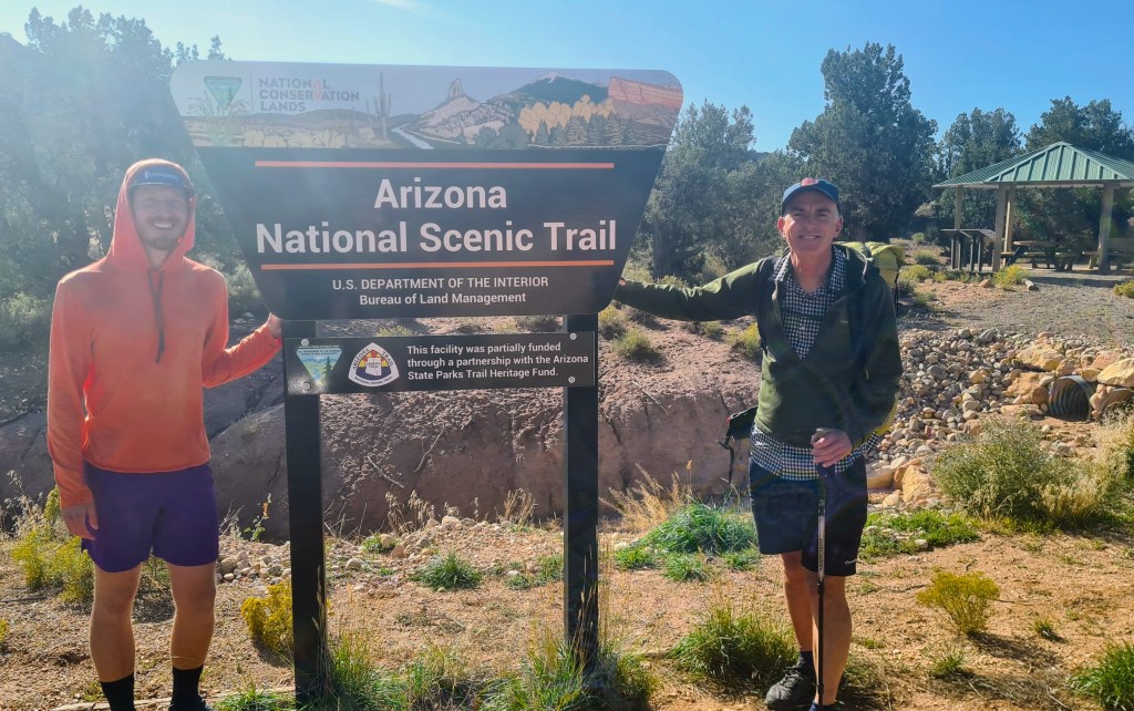
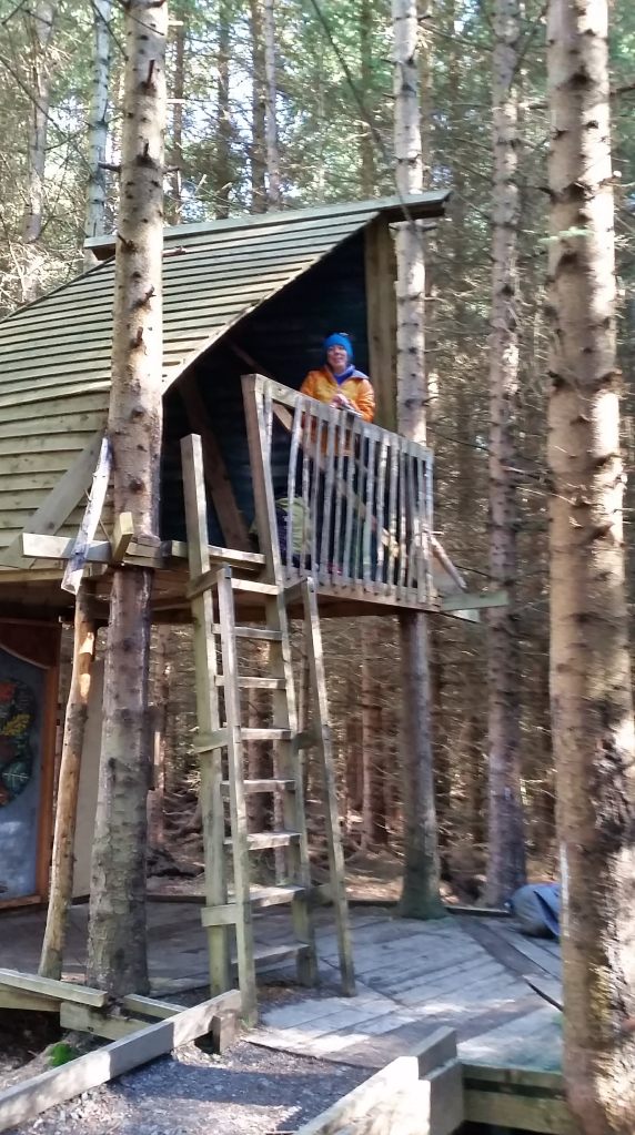
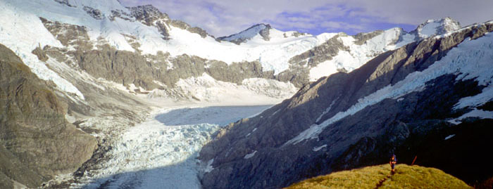
Here are some of my notes on the Arizona Trail for other hikers…
Hiker references Being quite a popular walk, there is a lot of planning information already out there….
Arizona Trail Association A great first stop and worthwhile joining the Association to support the trail.
Average Hiker, Ellie Thomas has a good website setting out the logistics.
The Trek has a guide to trail towns for resupply and resting. A web search will find many more…
Facebook There is lots of info and a place for hikers each year to ask questions on Facebook- really helpful- just search with this text for your planned year ie Arizona Trail Class of 2023
Maps and guides I love maps, I love imagining what it represents on the ground and then actually travelling through the territory displayed. For hiking, call me ‘old skool’, but paper topographic maps are my first choice. Easy to use, great for navigation, but also showing the surrounding countryside and a reasonably large area of land to provide context on distant features. I fold the current pages in the pocket of my shorts so I can easily refer to them whilst walking.
I do also download maps to my phone as a backup and to utilise the GPS.
It adds a lot to my enjoyment to have something on say the local geology, flora, fauna and history. I often take extracts from paper books or electronic documents on my phone for this- really nice to read overnight in the tent.
On this trail I cut out map pages from the Arizona Trail guidebook, which to be honest in this case didn’t offer much useful information except a rough overview and were limited value for either navigation or wider context.
In addition I had the FarOut app on my phone which has the trail marked against a low definition background map. The best use for me though was the ability to view comments from others against features (and add my own). This was superb for getting up to date info on water sources in particular and was worth paying for the app just for that alone. On the downside, I found FarOut rather reduced the trail to a line ahead with a series of waypoints of gates, fences and water tanks! Its a pity it doesn’t offer any other interesting information such as on the flora/fauna.
If hiking the trail again I would prepare my own topo maps using online mapping software such as Caltopo, add a GPS track and my comments, then print out colour map sheets in advance. I would also still take FarOut app on my phone, mostly for water and trail updates and find some more flora/fauna background reading for along the way.
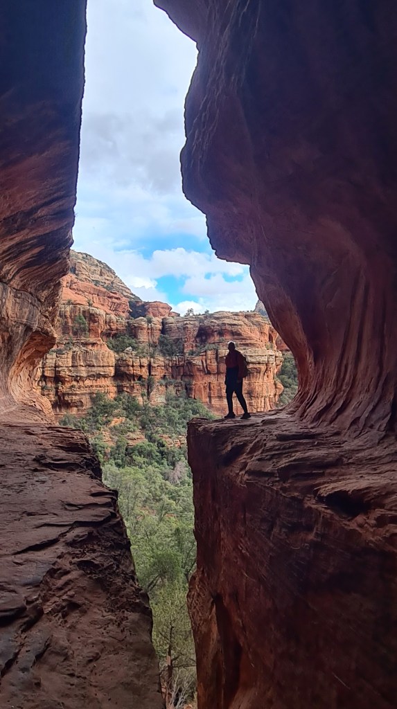
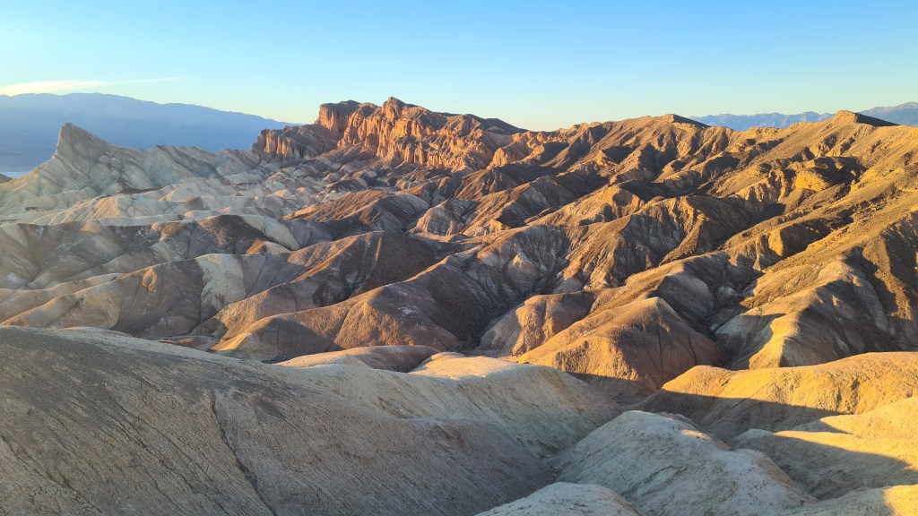
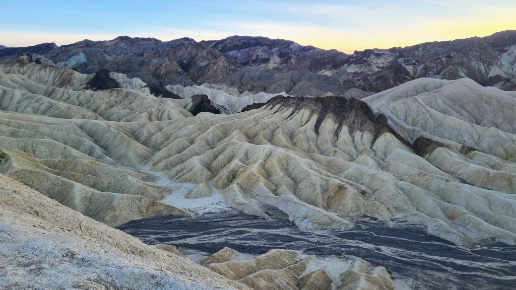
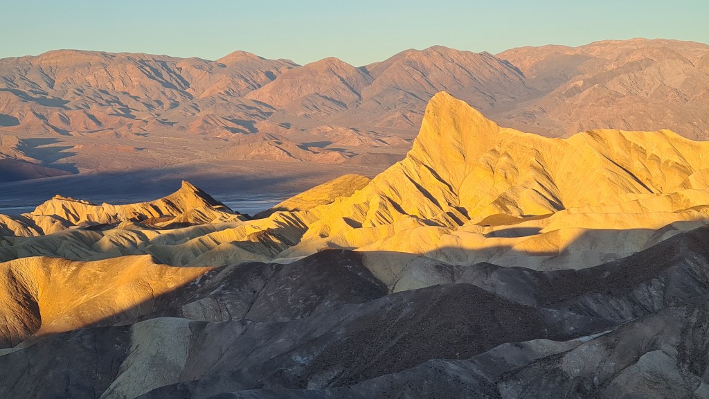
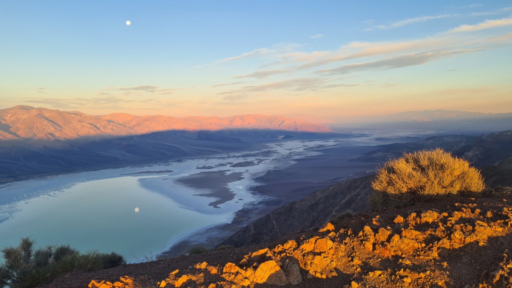
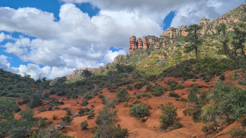
After the Arizona Trail… I had a few days spare before flying out of Las Vegas back to Scotland and made good use of these for some shorter hikes near Sedona then Red Rocks Canyon, Nevada and Death Valley National Park, California.
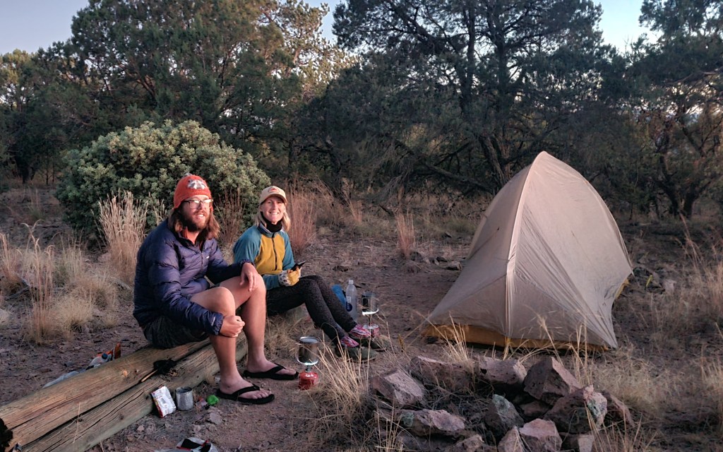
Section 7 Molino Basin Trailhead to Gabe Zimmerman Trailhead 12th November 48 miles Oh that was a great stop in Tucson, and feeling refreshed I got an Uber back out to Molino Basin via Safeway for a food restock, bagels and coffee. I sat outside the supermarket at the trolley bay charging my phone at a mains socket, sifting food and munching bagels. It was wonderful and I had 3 people come up to me and chat asking about the Arizona Trail, maybe they felt sorry for me looking a bit trashy!
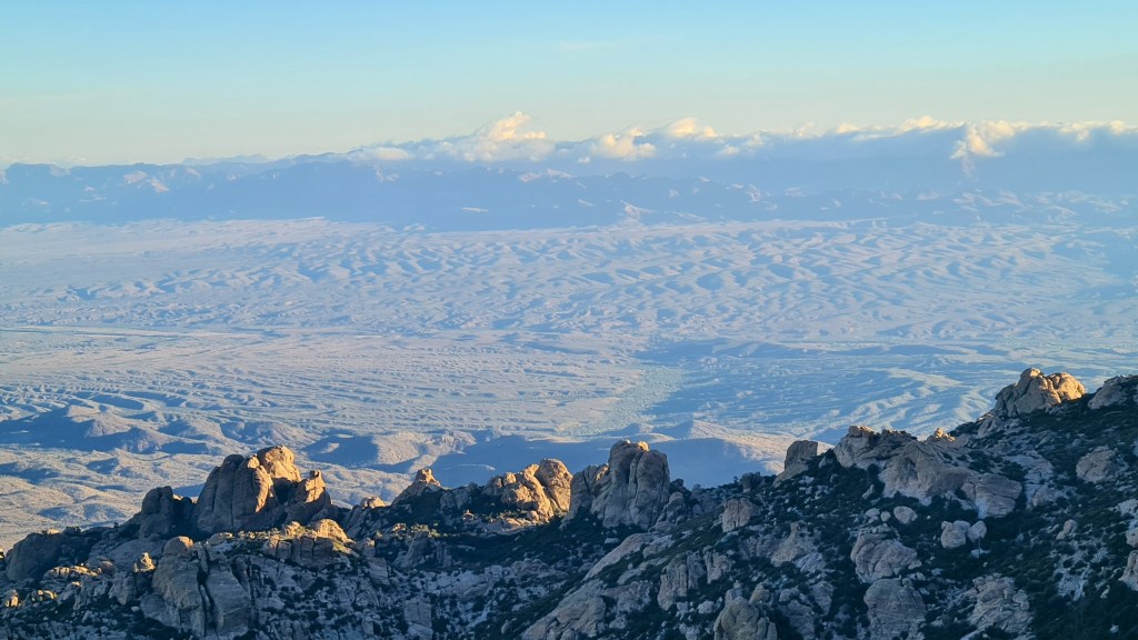
At the trailhead I was restarting where I left off following a well made undulating path southward with ever closer views of the next ‘sky island’, Mica Mountain. It was pleasant coolish hiking at between 18-22C and I made quick time to camp in the dark at the edge of Rincon Wilderness Boundary a little of the way up the climb. Away by 6am next morning in the dark I enjoyed the steady climb into Saguaro National Park and up to the top at about 8,600 feet. I had seen a torch light a few miles below me to the north and it was nice to know another hiker was out there too.
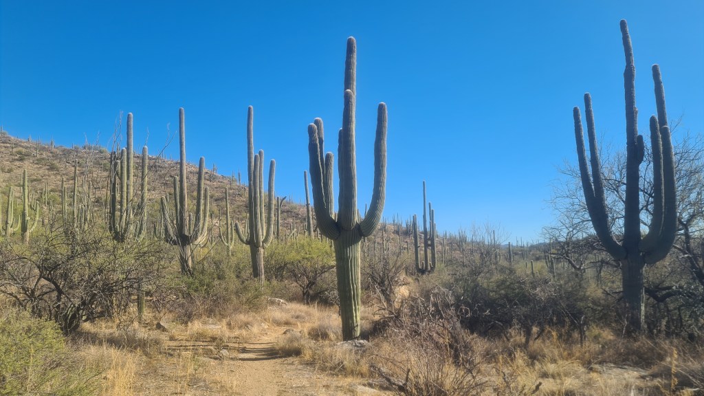
Boy but it was cold up there, it felt well below freezing and I happily headed downhill through the trees and out below into open saguaro cactus country.
Section 8 Gabe Zimmerman Trailhead to Patagonia 15th November 67 miles After a stopover with Josh and Suzanne, two kind people who let me stay with them near Colossal Cave, I kept going across I10, the last of the east-west highways, and onto lower flatter terrain again. I made good miles from here to Patagonia, assisted by some weather including clouds overhead and even the odd thunderstorm to cool things down.
Highlights included spotting a bobcat, 2 bikepackers and some pretty good water sources along the way. Hitching into Patagonia turned out to be easy and rather inevitably I headed straight to a diner for an extended brunch!
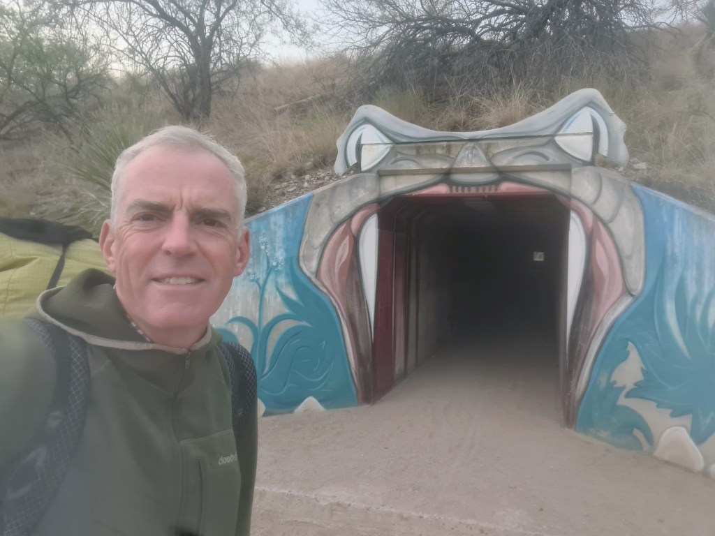
PatagoniaHiking pre-dawnI10 tunnel
Section 9 Patagonia to Mexican Border 19th November 53 miles Well refreshed again after another welcoming town of Patagonia, I left for the final push to Mexico with Swig and Firecracker, hitching a lift back to the road crossing.
Swig, Brian, Firecracker
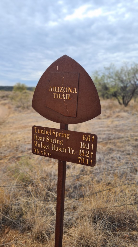
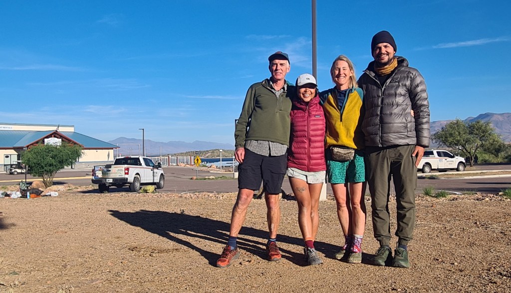
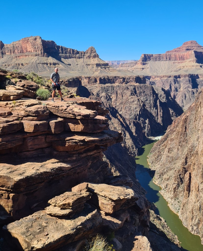
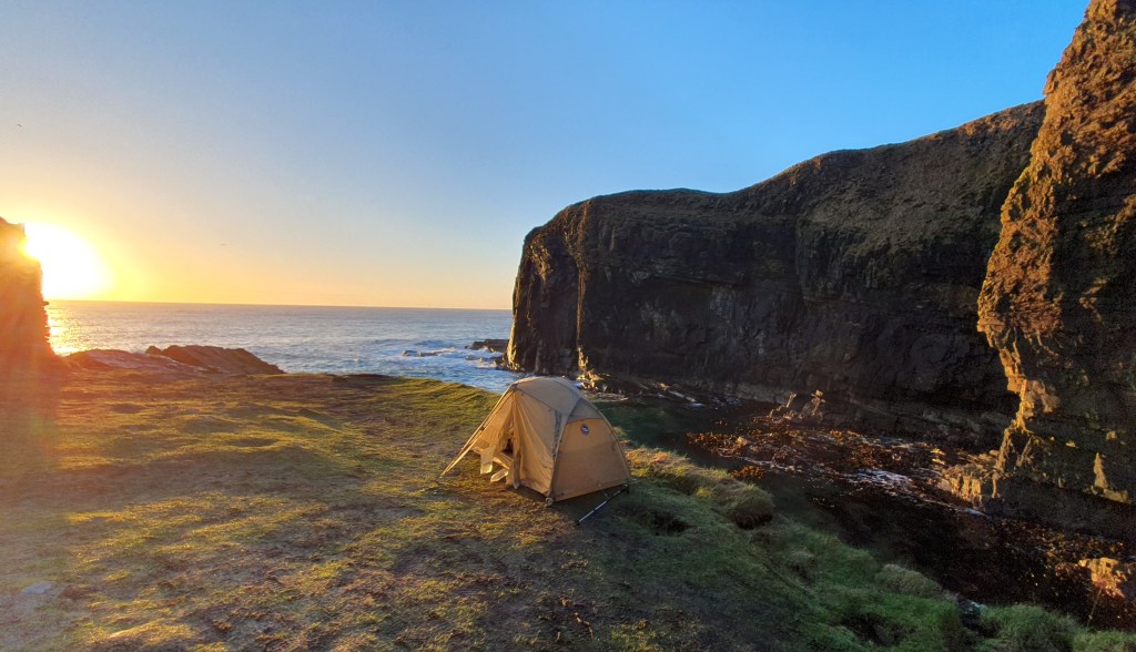
Conditions got cold and windy once we climbed up to about 8,000 feet on the flanks of Miller Peak for one bitterly cold last camp. On the last day 20th November, I nipped up to the top of Miller Peak which was covered in frost before the steady descent to the border. Finishing there with other hikers Swig, Firecracker and Cheese Curd was fun, but it felt a little anti climatic with the weird section of high metal fencing and the super high winds…… But 800 miles of Arizona was a really great experience overall and it was superb to share it off and on with so many cool people!
Survivorman’s last night cowboy camping to the endSwig and Firecracker at camp
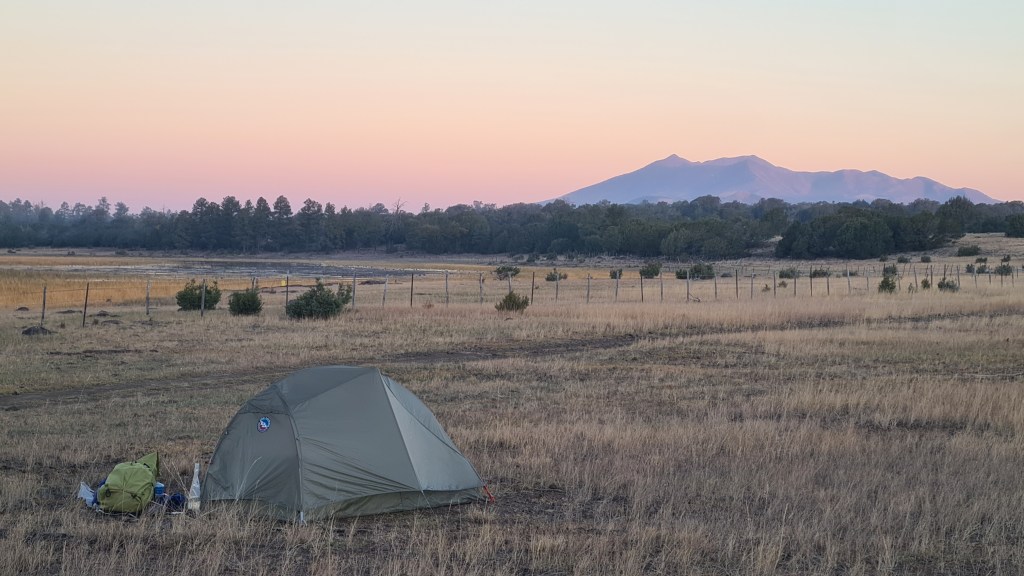
Section 3 Flagstaff to Pine 20th October Another long fairly flat walk of 115 miles on the next stretch to the tiny town of Pine was again going to be tough on my feet!
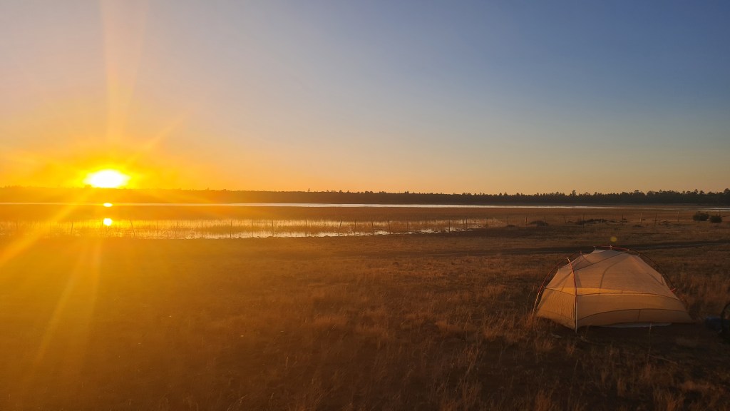
Leaving Flagstaff after crossing Route 66 on the ‘Urban Route’ variation of the AZT, I was back into the countryside surprisingly quickly. Ponderosa pines again dominated but then gave way to more sparse pinyon juniper. I chatted with ‘Fliss(?)’, ‘Mo’ and ‘Firecracker’ heading out of town but ended up camping solo at Horse Lake that night. Sunset here was stunning across the flat grasslands and lake, with noisy geese, elk and coyote adding to the ambience.
Arriving at Mormon Lake!Golden cottonwoodSmoldering firesSmoke hazeBack north to Humphreys PeakHorse Lake sunset
On the 2nd day out from Flagstaff I hiked round a prescribed fire set off by the Forestry Service which filled the air with thick smoke for an hour or two, before cutting off trail to the small settlement of Mormon Lake for lunch at the bar and a food top up. I came across a few of these 8 legged wonders along the way….
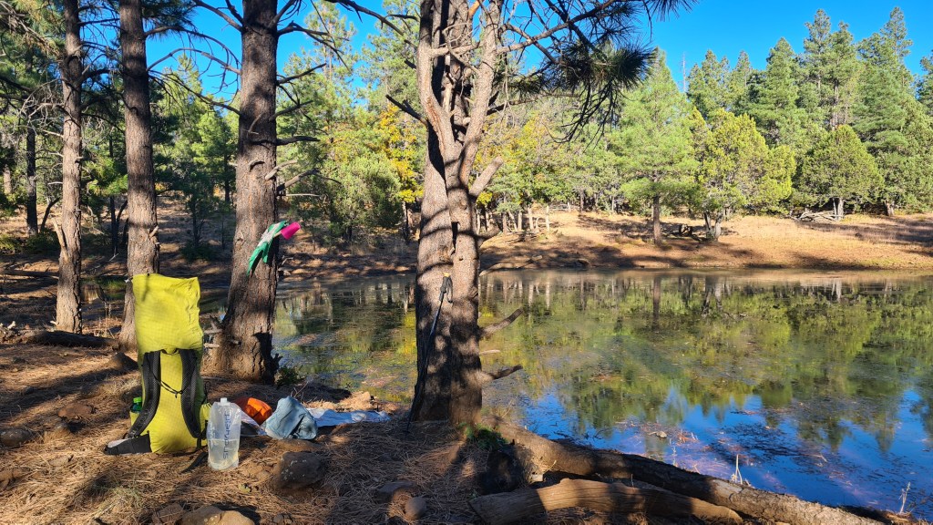
After another 3 days I eventually hit the pleasant Highline Trail and dropped off the ‘Mogollon Rim’, an escarpment descending from the Colorado Plateau with some welcome streams, red rock and (a rarity so far) clouds! The trail took me into the tiny town of Pine- arriving at 8.30am and diving into the Early Bird Cafe to meet a few other hikers for second breakfast. 330 miles or so hiked- hoorah
Camp above PineWater filtering break at ‘Foot in Tree’ TankBelow the Mogollon Rim
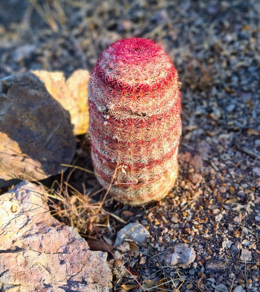
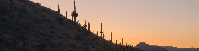
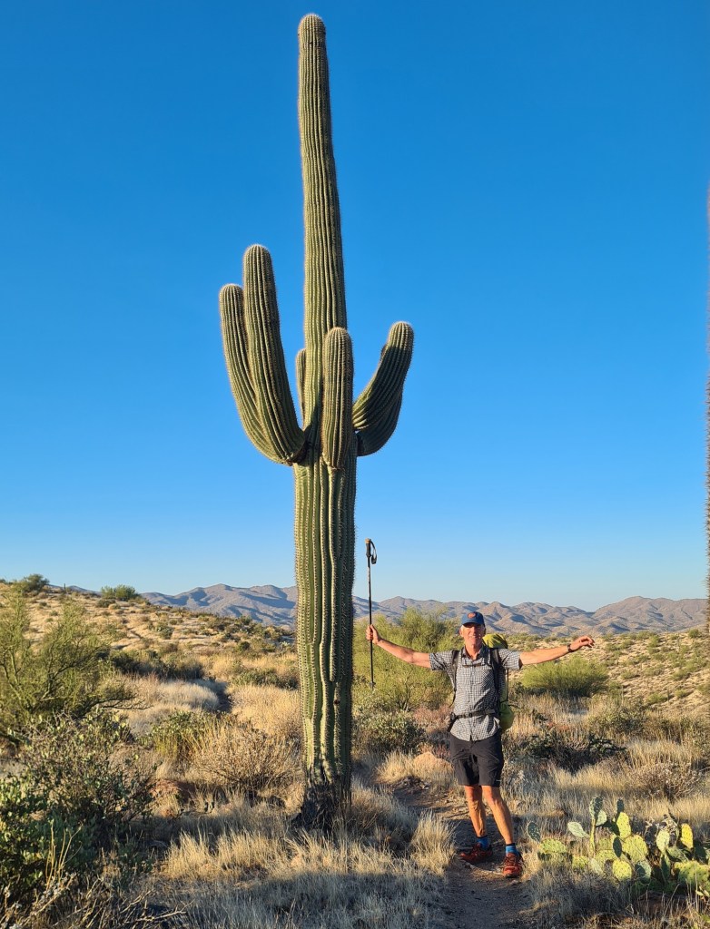
Section 4 Pine to Roosevelt Lake Marina 26th October 115 miles again to my next food resupply at Roosevelt Lake Marina. This one involved some more rugged up and down over the Mazatzal and Four Peaks Wilderness’s. A bit of rocky trail and scratchy shuffling through spikey bushes kept me on my toes. I think this was my favourite stage so far however as the variety was interesting and I saw my first javelinas (small boar that live in groups called squadrons!) ……and stunning saguaro cactus…yipee.
Saguaro cactus at dawn
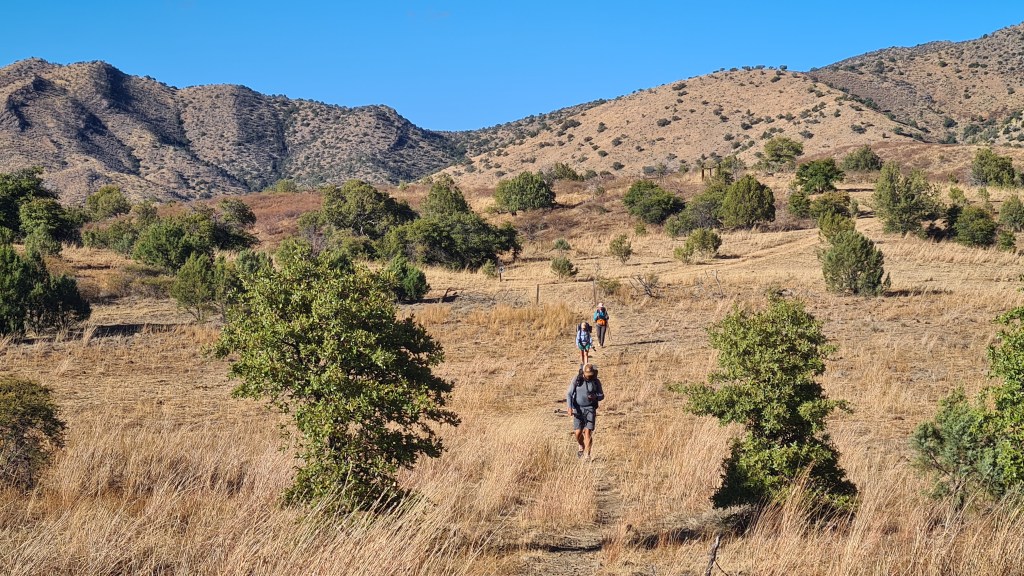
Section 5 Roosevelt Lake Marina to Kearny 1st November80 miles Hikers seemed to coalesce at the lake marina with about 10 of us at one point- resting weary legs, eating, sifting gear and sharing tales from the trail.
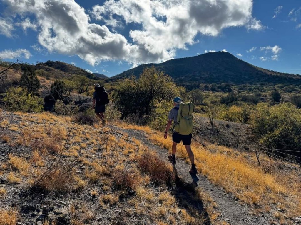
South from the marina I entered the Superstitions Wilderness, crisscrossing and chatting with fellow hikers Grandpa, Firecracker and Survivorman. It was another fine rocky area but one that dropped in elevation meaning that, despite now in November, the temperature really ramped up in the middle of the day. I took the opportunity for a cooling dip as we traversed alongside the Gila River, the trail’s lowest point at about 1,600 feet, before reaching the mining town of Kearny the next day.
L-R Brian, Grandpa, Firecracker, Survivorman
Section 6 Kearny to Molino Basin Trailhead and Tucson 6th November 100 miles Kearny was a super friendly small town; from the offer of a place to stay by ‘Q’, easy hitching in and out, diner, pizza place, supermarket with free coffee for hikers, helpful post office staff etc…. it was just great.
With fellow hikers and ‘Q’, middle right, at her house in Kearny
Setting out from Kearny, the terrain continued as low desert scrub and the temperatures were hot- maybe 30C in the afternoon. I got into a pattern of waking about 5am and hiking by 6 in the dark for a bit to enjoy sunrise and the cool early temperatures. These were my favourite times of the day with hiking into dusk at about 17.30 to 18.00 being a close second. The disadvantage was that I spent most, if not all, of my camping time in the dark!
I met up with Carrie/Firecracker along the way and we hiked together after applying some plasters to patch Carrie up as a result of an argument with a barbed wire fence!
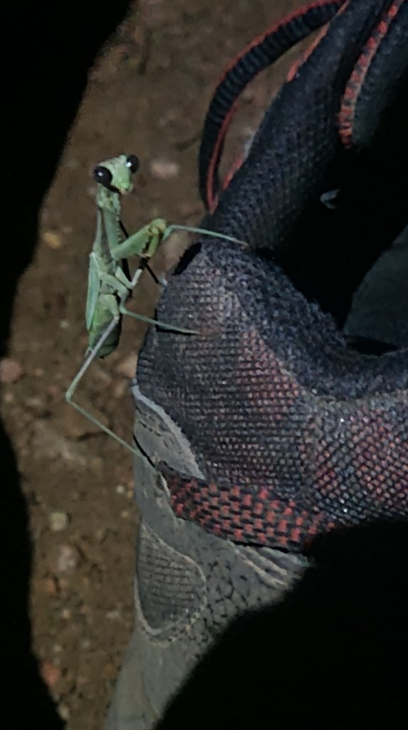
Preying mantis Rare shade at a water tankMount Lemmon, granite country
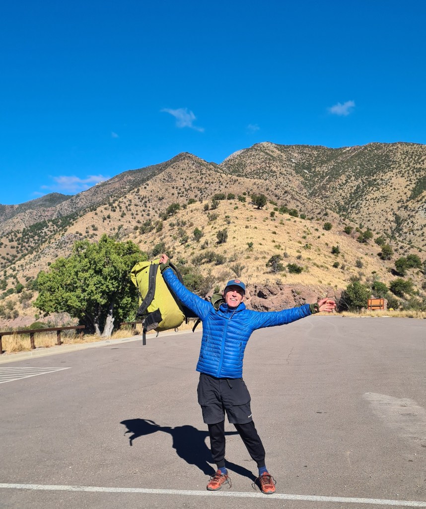
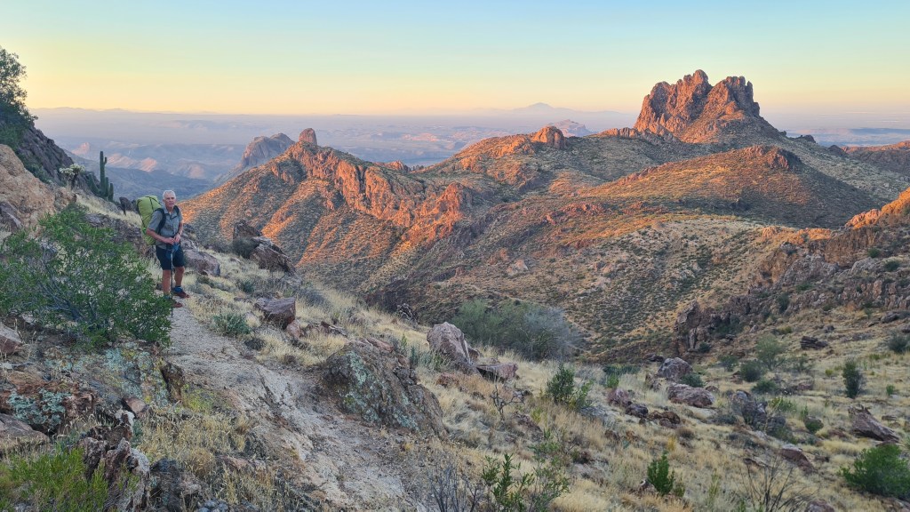
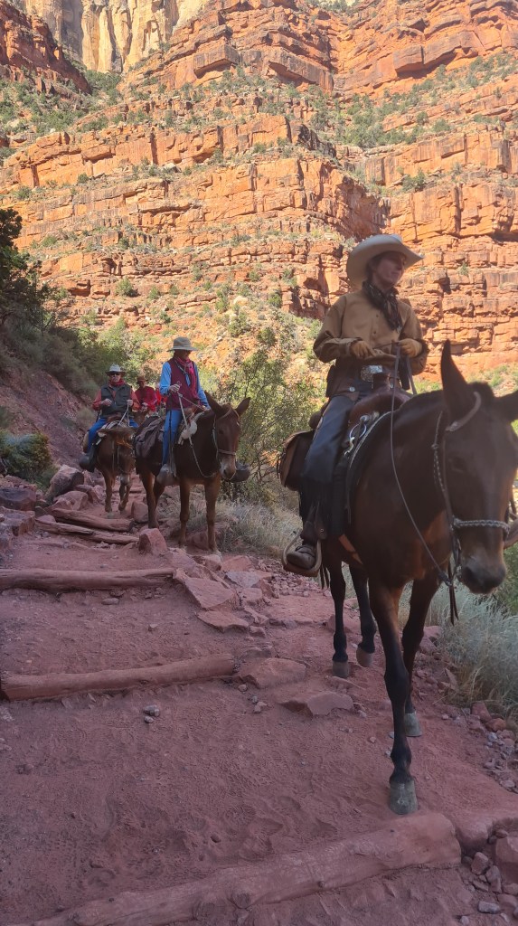
I was glad when the trail climbed up high to about 7.800 feet at Summerhaven (amazingly this far south, a winter ski resort) and Mount Lemmon. A veggie burger with Survivorman was a rare treat here and the granite hills and pine clad slopes were really nice. Leaving early morning was a bit harder with the sub-zero overnight temperatures but the trail remained interesting all the way down to Molino Basin trailhead road crossing. I decided to hitch from here into the city of Tucson for a full day off of luxury; real food, showers, a swim in the motel outside pool(!) and some gear fixing.
In October-November 2023 Brian walked the 800 mile Arizona Trail southwards from the Utah stateline down to the Mexican border. I wild camped most of the way, but also stayed at designated campsites, with ‘trail angels’ and some motels in town. Overall it was an excellent experience! Here is a short (ish) description of my hike, some pictures, my impressions and links to more info.
‘Lentil’ atRibbon Falls, Grand Canyon
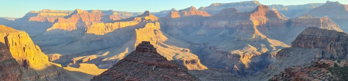
Background The Arizona Trail (AZT) is a well defined and maintained trail heading north-south across the state of Arizona. It traverses a mix of desert, high plateau and mountain ranges up to about 9,000 feet (called Sky Islands), crossing two National Parks; the iconic Grand Canyon and less well known Saguaro outside the city of Tucson.
With blazingly hot summer temperatures at low levels and deep snow in winter on the higher sections, the best seasons to walk the whole way (‘thruhike’) are spring and autumn.
Reasons for hiking Martina and I have hiked many times in southern Utah which borders onto the north of Arizona. We have also been in the Grand Canyon in northern Arizona a few times before as part of our two Hayduke Trail adventures in 2014 and 2022, and as another wonderful 2018 loop hike in Kanab Creek area. From these we were aware of the Arizona Trail and have even hiked the northern 100 miles or so as it overlaps the Hayduke.
With Martina starting a new job, Brian chose the AZT as a less risky solo adventure than the cross country, scrambling Hayduke routes whilst providing the opportunity to hike in new areas to the south of our previous travels.
Hayduke in orange and Arizona Trail in blue below…
Section by section
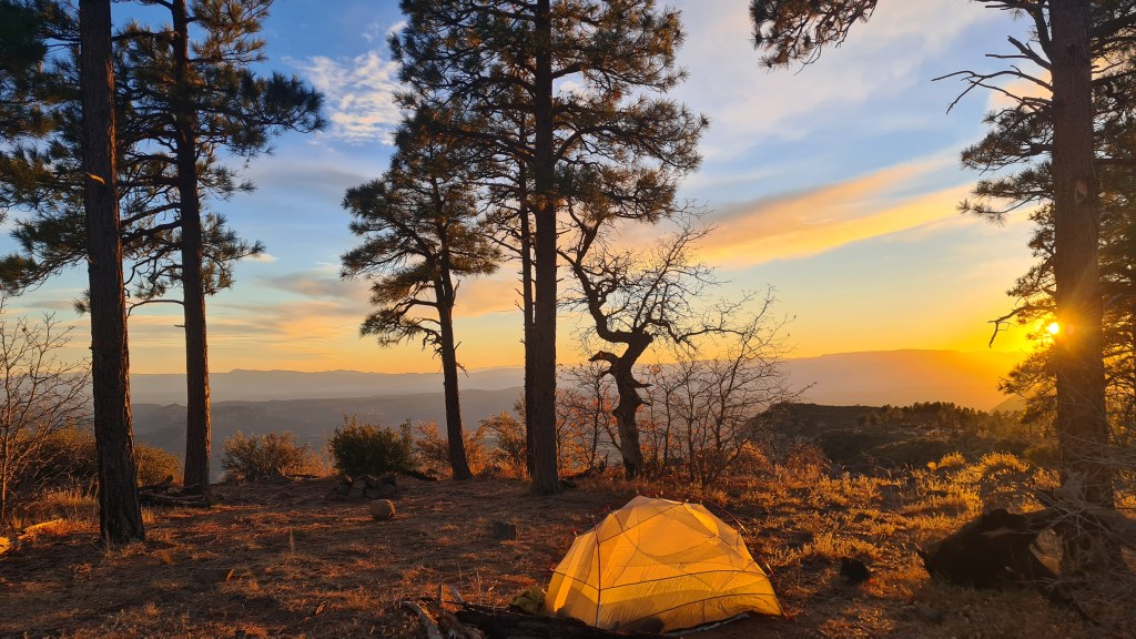
Section 1 to South Rim Grand Canyon 3rd October 2023 I set off from the Utah -Arizona stateline with a heavy feeling backpack and slight trepidation in pleasant cool sunshine and an initial stretch of about 90 miles hiking to reach the north rim of the grand canyon. The trail was well made and I soon climbed up from scrub desert through pinyon-juniper trees to the higher Kiabab plateau dotted with tall ponderosa pines. Trying to take it easy for the first few days to look after my feet and avoid injury, I kept to a moderate pace and under 20 miles per day. Camping was pretty straightforward making use of plenty of clear flat ground under the shelter of trees.
I chatted with 3 other hikers starting that same day; ‘Lentil’, ‘Good News’ and ‘Kidnapper’ – their ‘trail names’ – I decided just to be ‘Brian from Scotland’! That number of hikers was quite typical throughout the trail where I would be aware of other hikers each day, sometimes meeting them but often hiking on my own occasionally seeing signs of others such as their footprints.
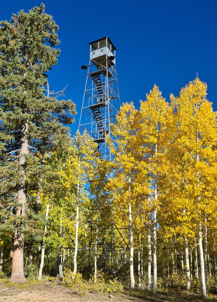
The highest plateau elevations (up to 9,000 feet) were really fun with grassy meadows and gorgeous golden aspen trees amidst fir and pines. Temperatures were cool during the day and a chilly sub-zero (Celsius) at night, coating the tent with a layer of ice in the morning. Wildlife was surprisingly good; horned toad, lynx, woodpeckers, elk, deer and the ubiquitous ravens with their croaking and gurgling vocals.
Starting offwith LentilLynx!
Reaching the north rim of the Grand Canyon felt like a minor but significant success as the first completed section of the trail and the chance to stock up on food at the small store, pick up a camping permit for the crossing of the canyon and meet a few other hikers congregating there.
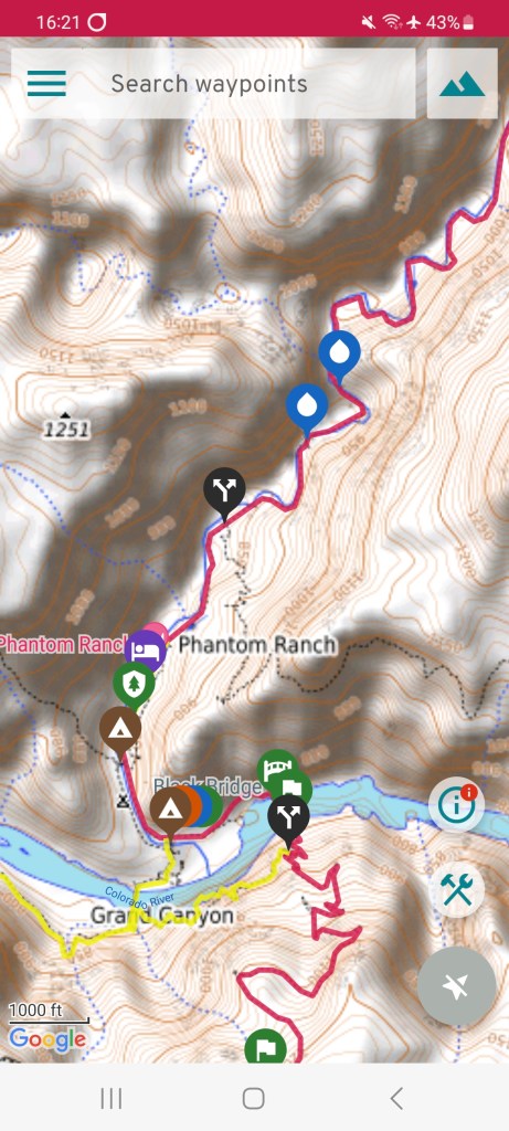
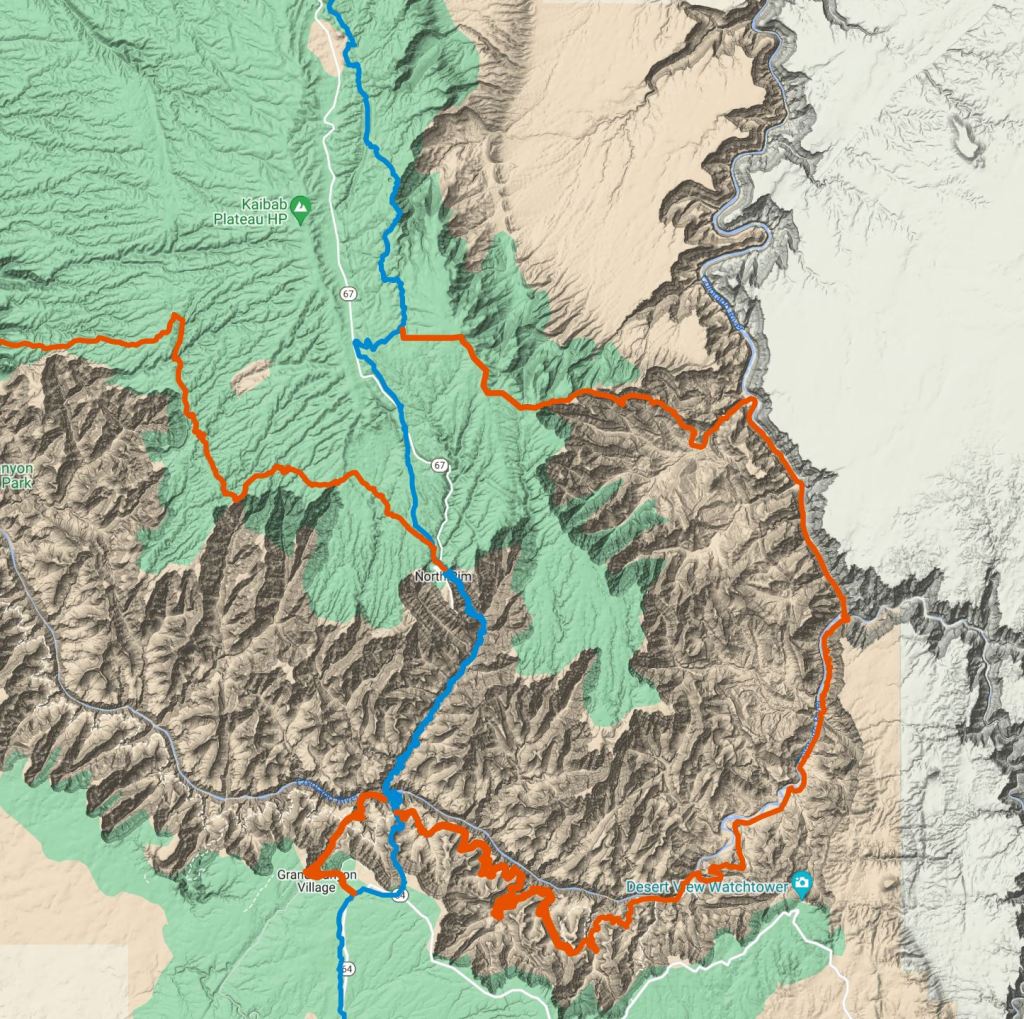
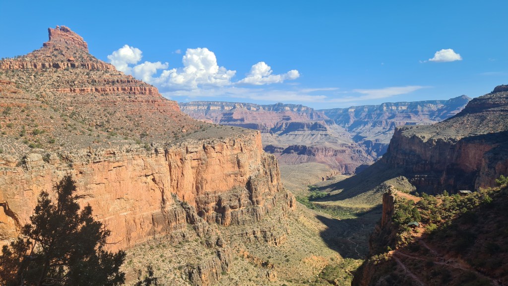
The map below shows the AZT in blue taking a scenic 26 mile direct crossing of the grand canyon via the ‘corridor trail’ ….. as opposed to the orange line of the Hayduke, a 5-6 day rollercoaster of excitement from North to South Rim. The Hayduke then also has another 7-8 day adventurous and stunning section in the canyon heading west to Kanab creek and beyond.
Crossing the Grand Canyon
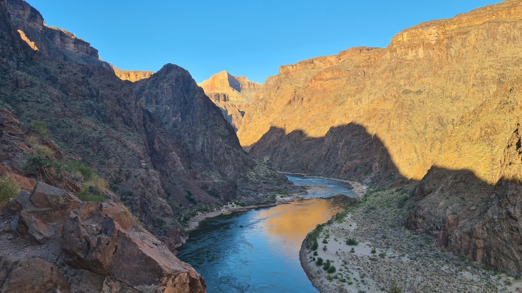
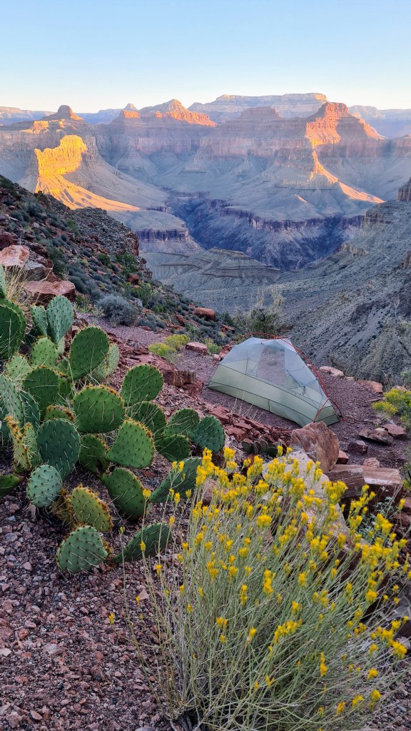
‘Bonus’ Grand Canyon loop 11th October I made an ‘on the spot’ decision to do an extra loop before leaving the Grand Canyon southwards on the AZT. My reasons were that it seemed a pity to depart the canyon after such a brief visit, I heard of a cool area around the Hermit Trail that I hadn’t been to before, and it gave me the chance to do some bigger climbs but shorter miles than the next couple of weeks of long, flat plateau hiking on the AZT. Fortunately I was able to pick up up a last minute permit easily at the backcountry park office and I set off…..
I had 3 1/2 days down the canyon (Bright Angel, Tonto West, Granite Falls and a bit of Boucher Trail) and in summary it was lovely, beautiful views, cool temperatures and away from the crowds.
Section 2 Grand Canyon South Rim to Flagstaff 14th October This section was always going to be tough for me as it was a long 115 miles of flattish high plateau to the next resupply in the town of Flagstaff – it wasn’t playing to my strengths as I like hills! That said the initial hiking through ponderosa pines was mellow, the water sources were sufficient and I was able to hike longer, up to 23.5 miles each day. The undulating terrain gave huge wide vistas, especially to Humphreys peak (the highest in Arizona that we walked up in 2017) and great sunsets and sunrises at camp. I was however relieved to arrive in Flagstaff to take a day off from hiking, sort out gear and food logistics, clean up and rest my battered feet.
One thing to consider when planning backpacking trails is the amount of up and down that is involved. This chart shows a comparison between some famous trails as well as some we have had experience with….
Some of the figures are estimates, such as the Hayduke where a number of alternates are possible meaning varying length and ascents depending on the route chosen. Also measuring ascent accurately seems to be a difficult task. For the West Highland Way (a well documented trail) for example, estimates I have seen vary from 3,155m to 4,700m.
So it gives a rough idea of relative climbing for different trails. But you can see the steepest trails listed are in the European Alps and Dolomites- you will have strong leg muscles after hiking these!
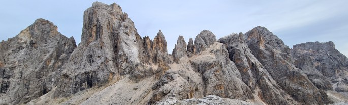
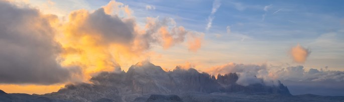
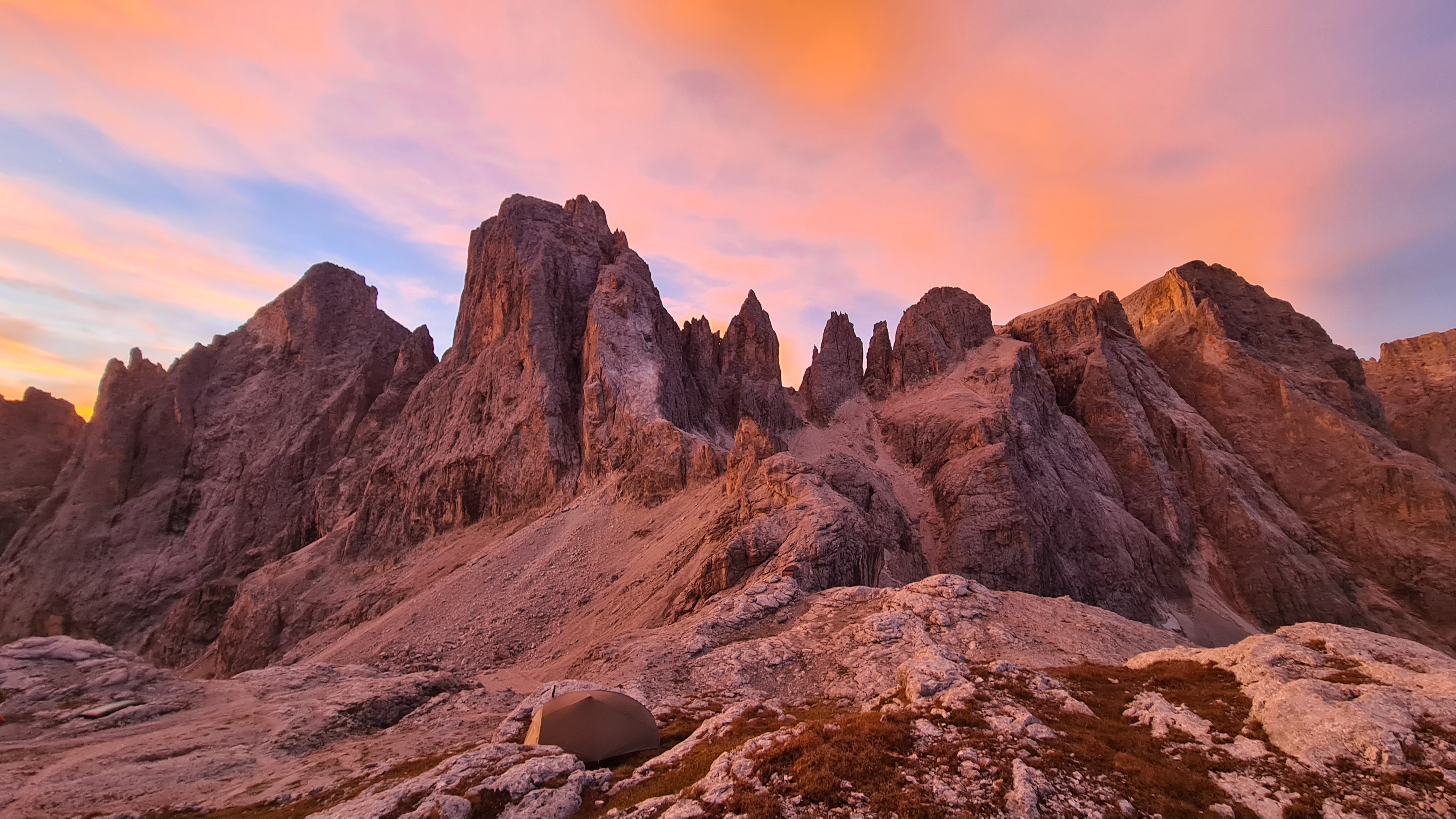
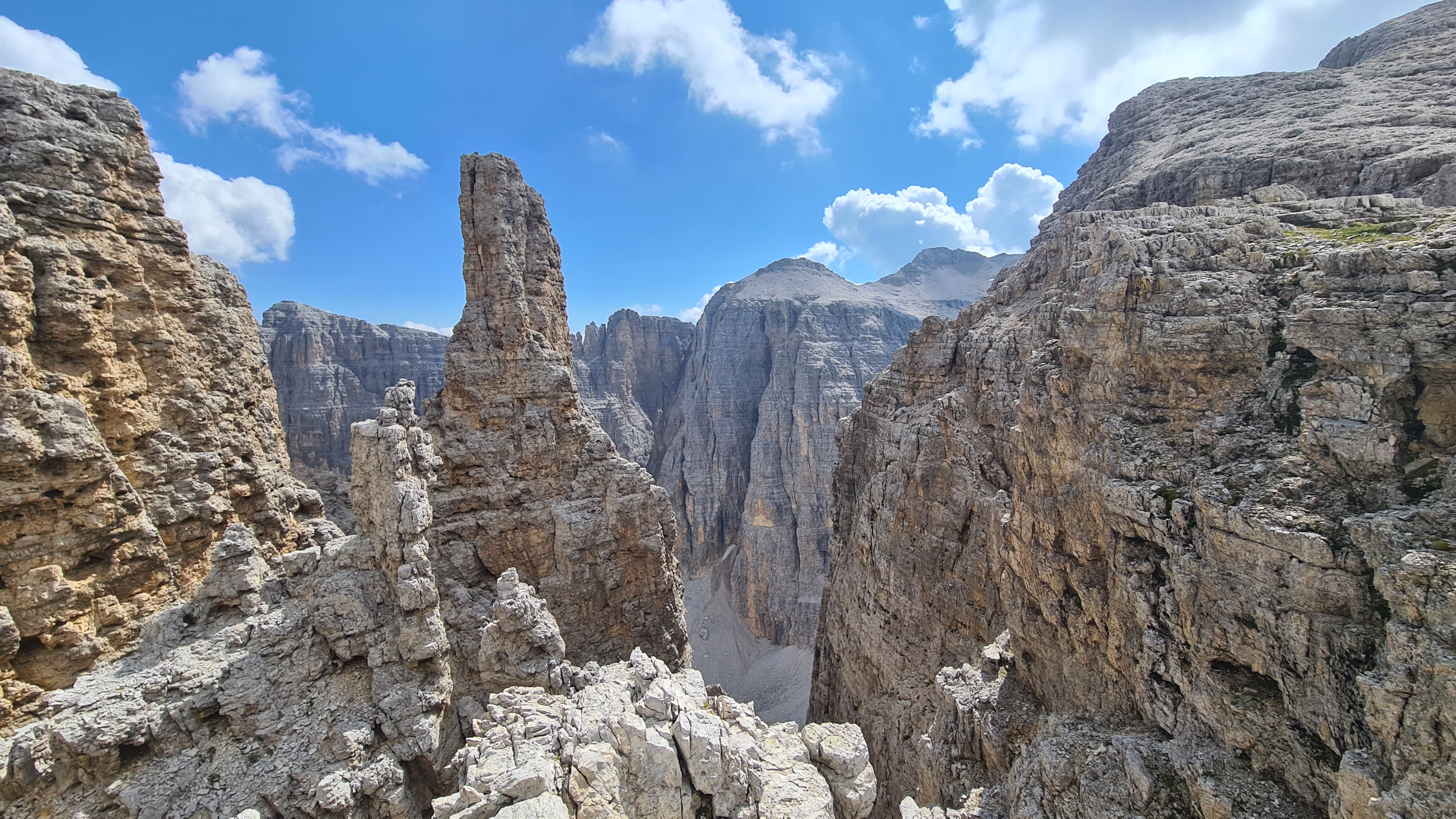
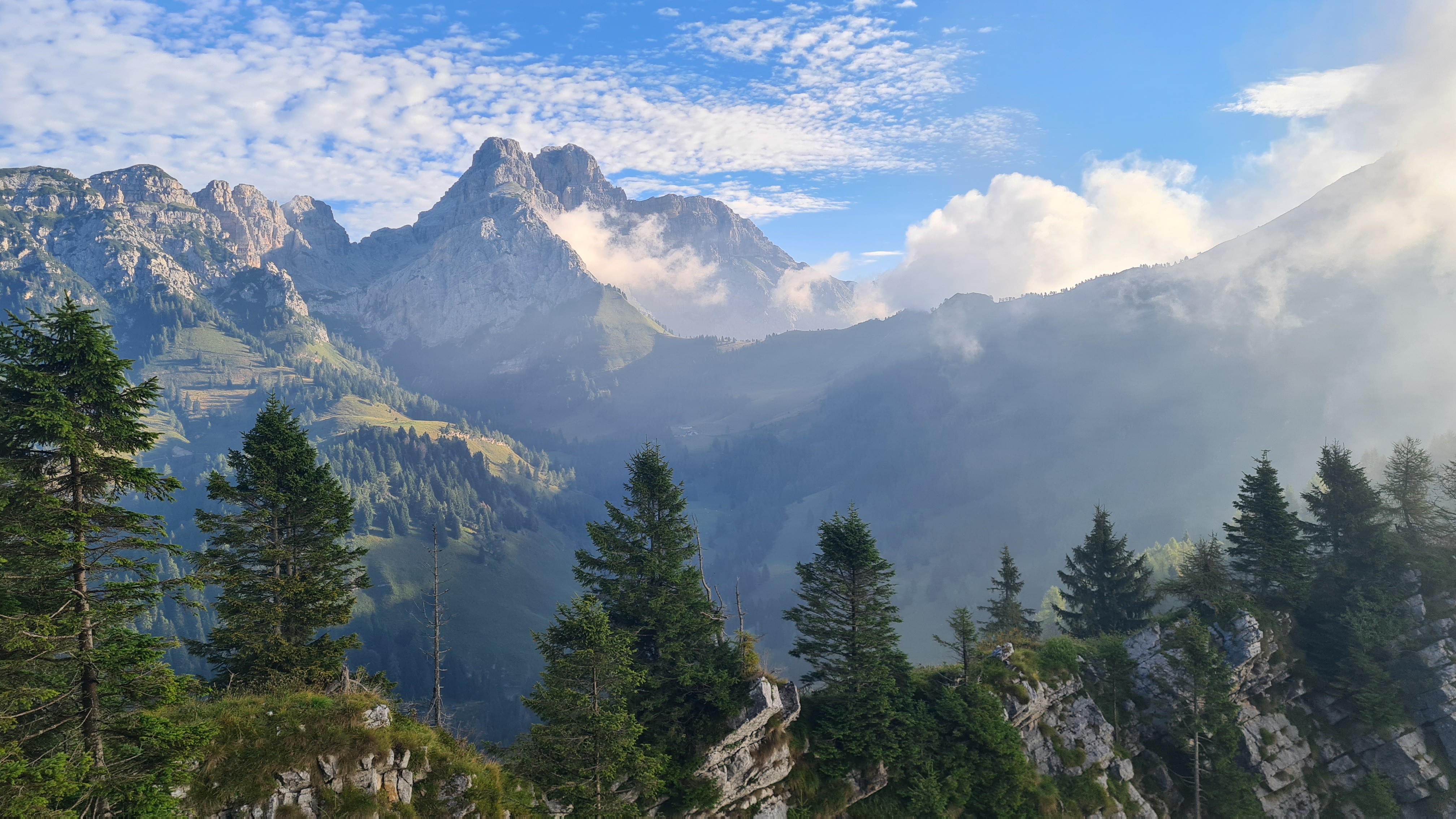
The Alta Via 2 is a very cool high level hike that traverses the Italian Dolomites mountain range north to south. Brian had hiked the nearby Alta Via 1 way back in 1994 and that was excellent. With lots of ascent and descent and some scrambling and ‘via ferrata‘ sections the AV2 provides a really fun 1-2 week hike. There are Refugio’s along the way that can be used but I mostly wild camped starting 23rd August into the first week September 2023.
Alta Via2 Purple, AV9 Blue(my 2024 variations Rust), AV1 Green (my 2024 route Orange)
My Itinerary
Day 1 Brixen train station to camp north of Rif Genova (I used the Plose chairlift to assist the ascent for 500m- in my defence it was about 35C in Brixen!)
Day 2 To Passo Gardena camp
Day 3 To camp north of Malga Ciapela (there is also a proper campsite here in town with showers which in retrospect would have been better)
Day 4 To camp north of Passo di Velles
Day 5 To Rif Mulaz then I descended for 2-3 hours west to Passo Rolle and bus to San Martino (stormy day)
Day 6 Bus back to Passo Rolle and followed trails to Rif Rosetta on west of Pale di San Martino mtns. Then to Rif Pradidali (stayed here due to more rain)
Day 7 To Rif Treviso then to camp near Passo Cereda
Day 8 To Rif Boz
Day 9 To road end at Croce d’Aune and transport to Feltre
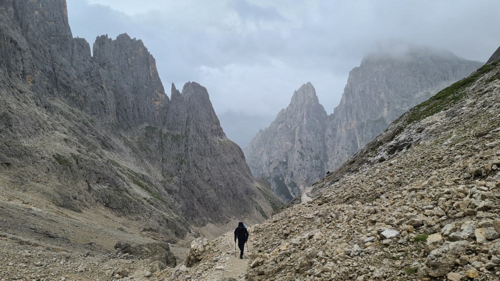
I thought that the southbound direction I took was slightly easier than northbound, as many of the trickier scrambles or loose sections are taken in ascent. It also seemed like the trail got wilder with less people as I hiked south, with the last few days (say from Passo Velles south) being both the wildest and for me the best. But to be honest, it was all pretty great!
I had a few days left before my flight home so I took a bus back to San Martino and did a 2 night camping hike here taking in the AV2 main route I missed from Rif Mulaz to Rif Rosetta. I think this AV2 section, though short, was probably the toughest scramble/VF on the AV2.
Eidelweiss!Rif PradidaliCooking dinner along the way
Notes for hikers
Difficulty The trail is mostly very easy to follow, but does cross some high mountain terrain with moderate exposure, scrambling and via ferrata. As a rough guide the equivalent would be short scrambling sections at US Class 4.
Some people carry special via ferrata equipment to assist (harness, slings, karabiners, maybe a helmet also). I didn’t feel the need, and that worked out correct for me being able to hike without that extra weight, but I guess each individual needs to make their own decision.
An advantage of having the VF gear is that you can also then tackle some tougher via ferrata side trips to summits along the way for even more spectacular views!
The trail seemed to have a lot of ascent and descent, and since returning I produced an ascent comparison with other trails which confirms this. Its right up there with some other European alpine trails with the most steep up and down!
Transport I used public transport from Venice airport to both north and south terminus’s. The transport network is superb and good value. Just remember when using trains that once you buy a ticket you also need to get it stamped in the station before boarding- or you risk a fine like I did on the first train!
Guides and maps I really liked the Cicerone guide to the AV2-6 and recommend it (even though I had an old edition). I also bought a paper map – Dolomiten Hohenweg 2 by Geomarketing – at the first Refugio in the north, Plosehutte and also found this strip map style very useful and it saved me time looking at my phone which I appreciated.
As a back up I had topo maps downloaded to my phone using the OutdoorActive app. I didn’t download a gpx as the route was mostly marked on the topo maps.
In general the signposting for the route on the ground was superb though. Often the way was marked on posts as a ‘2’ in a red triangle. It helped to know the number of the local trail that the AV2 followed as well, as at times only that number was on signposts.
Food supplies Both Brixen at the north of the trail and Feltre at the southern end have excellent supermarkets for food supplies.
The Refugio’s all sell meals and most had a (fairly expensive) small supply of chocolate bars such as Ritter Sport or Snickers.
The trail crosses road passes such as Passo Gardena – Guidebook Stage 4 – and Pordoi – Guidebook Stage 5 – where a regular bus service can be used to travel down to valley towns if required.
Malga Ciapela – Guidebook Stage 6 -on the trail on the east side of Marmolada has a good small grocery store next to the cafe as well as a outdoors gear store.
I used trails to descend west from Ref Mulaz – Guidebook Stage 7-down to Passo Rolle, then local bus to San Martino which is a good supply town with plenty of accommodation. I was able then to take the bus back to Passo Rolle to restart from where I left off.
East of Passo Cereda – Guidebook Stage 10 – the village of Mis has a grocery store which you could hike as a loop to and from the trail (I didn’t go there though).
In general there was no need to carry more than 2-3 days food at any one time and you could carry less if you made more use of the Refugio’s for food than I did.
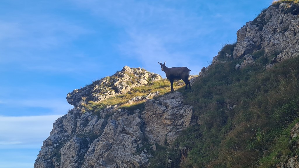
Near Passo BallBivouac MinazioSan MartinoGams – Chamouis
Water I took Chlorine Dioxide ClO₂ tablets to treat water where I thought it was needed along the way. There were quite a few water fountains or fonts, often outside Refugio’s, so I didn’t use the tablets too often. But for me, they were definitely worth carrying to be safe. Other options are to carry ClO₂ droplets ora water filter to treat water. The Refugios also sell bottled drinking water if you need that (at about 3 Euro per 1.5 litre bottle in 2023).
Gas canister supplies I used screw in gas canisters and found these for sale at nearby town of Bozen/Bolzano (Sportler), on trail at Malga Ciapela (De Grandi Sport Marmolada, next to the grocery) and San Martino sport shop (100g canisters only). I had the availability of canisters confirmed from Pantano Gas (about 3km south of Brixen centre). I also suspect that Decathlon in Venice Mestre will sell them too.
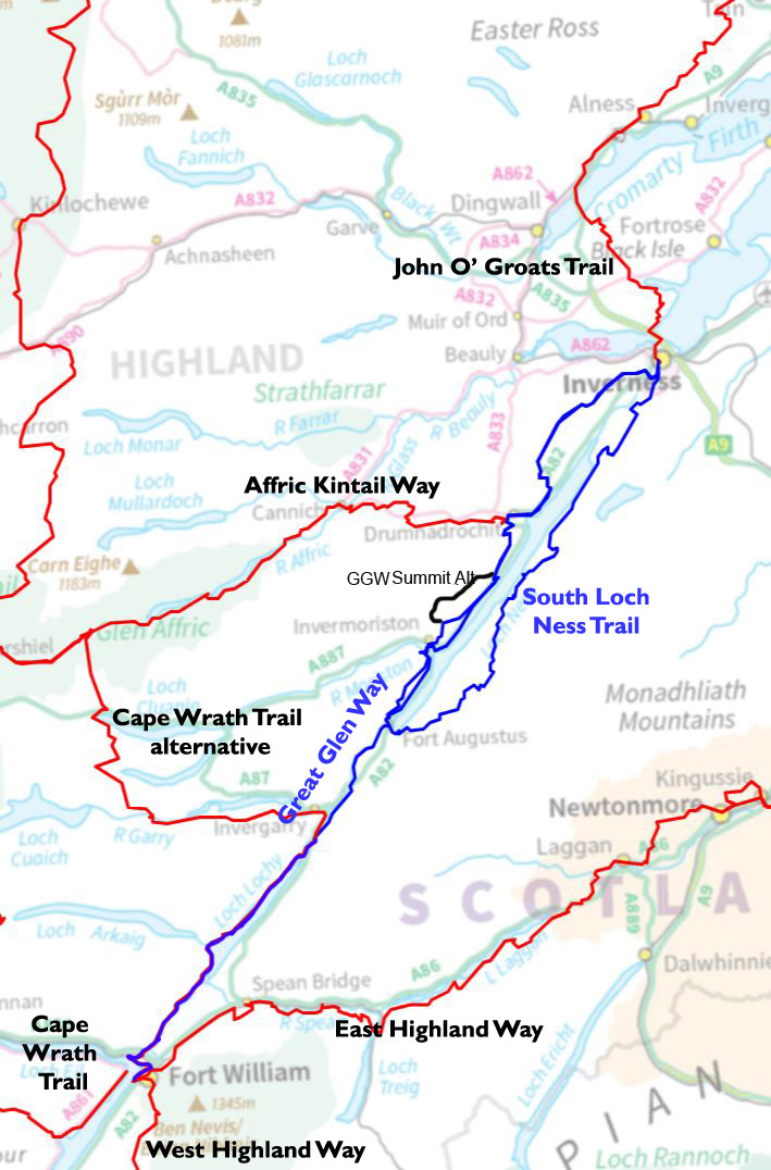
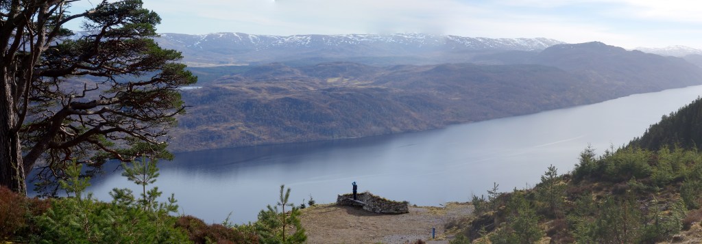
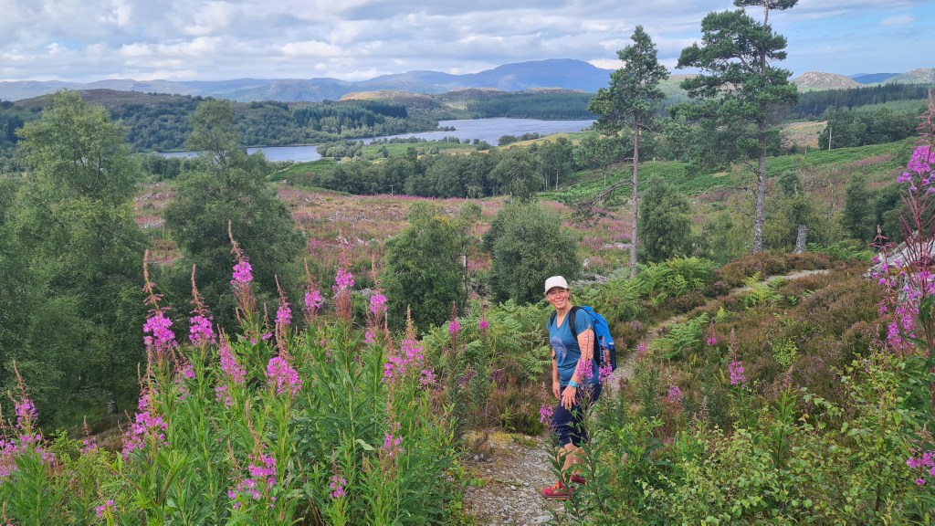
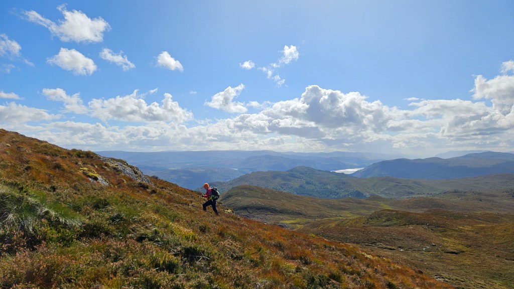
These are two linked trails in Scotland that form part of a connected network. They are local to us, and we have hiked them as a series of day hikes throughout the years and seasons.
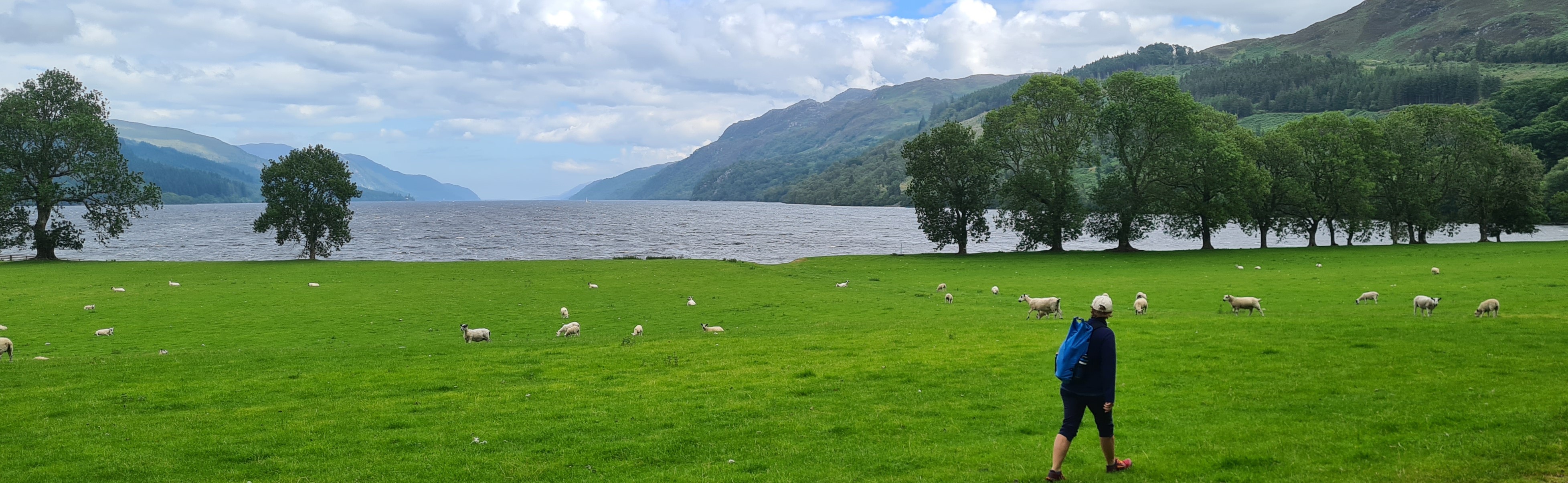
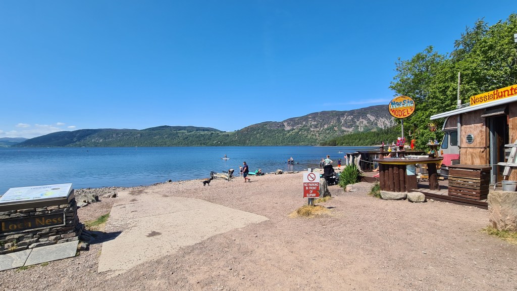
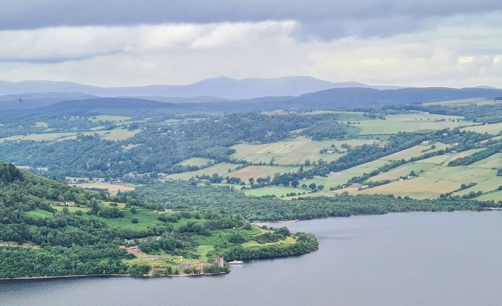
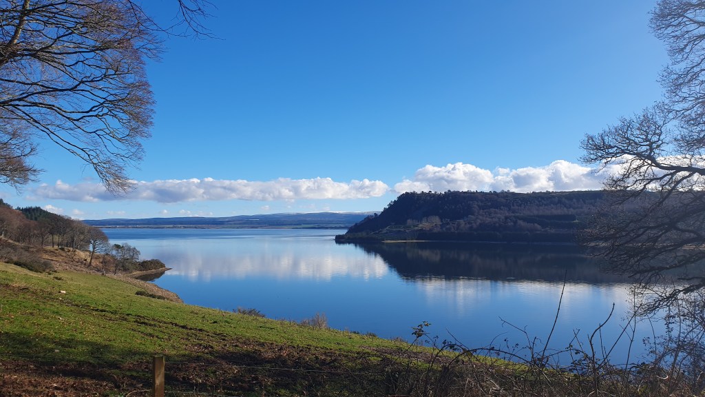
The Great Glen Way provides a fairly straightforward and popular 118km (74 mile) hike between Fort William and Inverness. It travels along an iconic glen that slices north east through Scotland with a series of waterways including Loch Ness.
The South Loch Ness Trail is a 55km (34 miles) hike linked to the GGW, in effect acting as a variant on the northern half from Fort Augustus to Inverness. It is less busy but is also easily navigated on good trails.
The northern part of the GGW could be hiked together with the SLNT as a loop around Loch Ness -the Loch Ness 360 at 129km (80 miles).
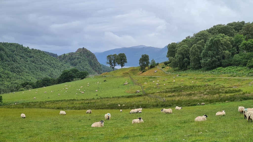
The scenery traveled through is a mix of forestry (managed and natural), fields grazed by sheep/cattle and lochsides. As the trails stay relatively low (maximum of 450m on the SLNT) and are well made and dry in the most part, they can be hiked enjoyably for most of the year, even in winter – if you can handle the short days!
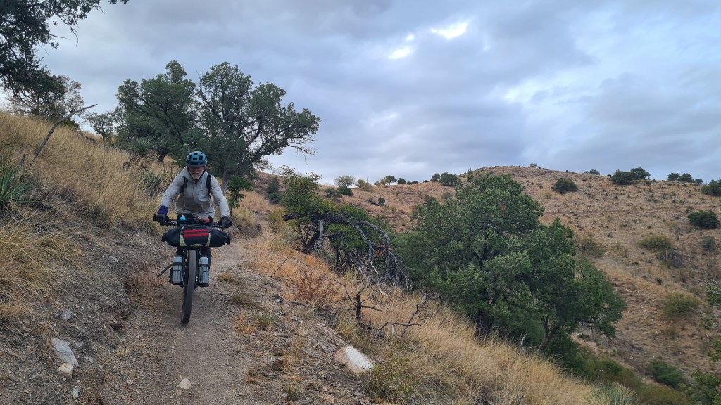
It should be said that both are also possible by mountain bike or gravel bike, with some short pushes needed on the SLNT.
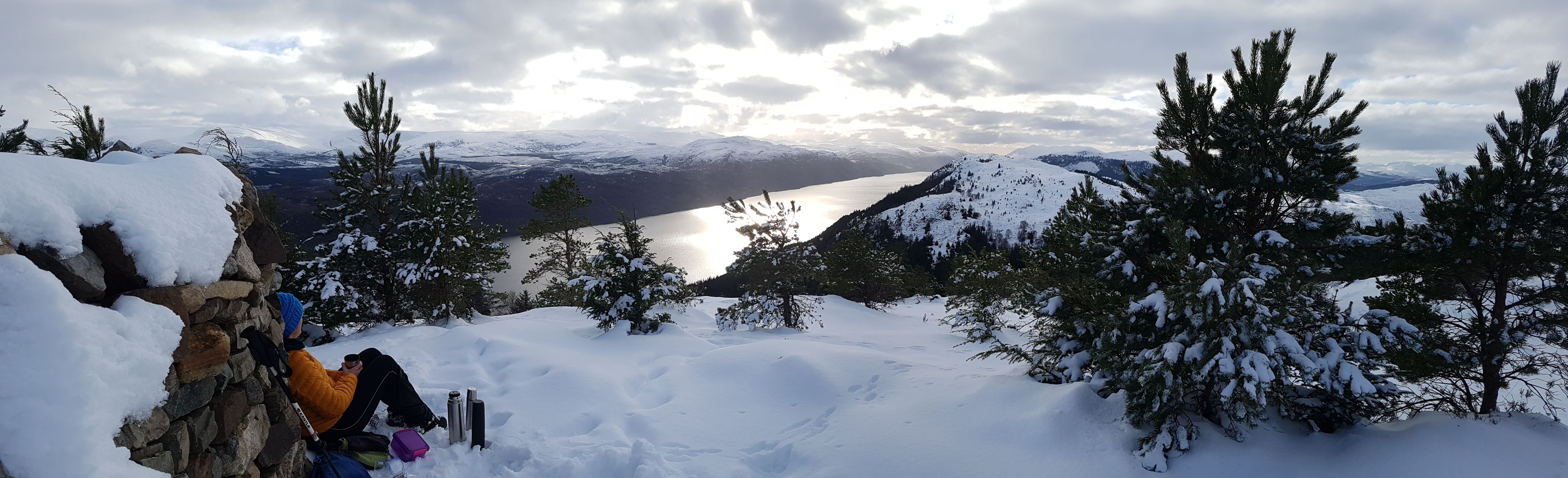
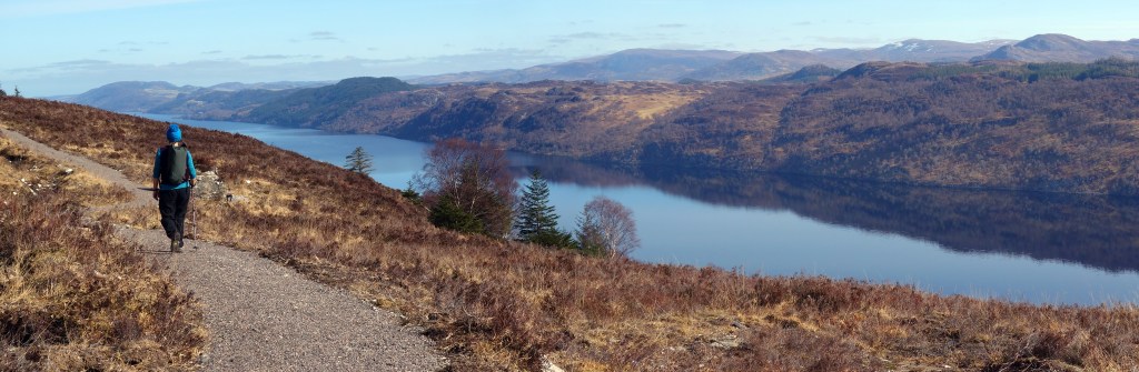
Great Glen Way Good resources are the Great Glen Way Walkhighlands website, Cicerone guidebook and Harvey Map. You can either stay in accommodation along the way as described in the guides above or can wild camp. I recommend the two high route options (well I would of course!) between Fort Augustus and Drumnadrochit which provide some nice views of Loch Ness from above and spend more time above the forestry.
We also hiked a Great Glen Way summit alternative that provided better views with a bit more adventure. This splits off from the high trail on the section between Invermoriston and Drumnodrochit.
Winter snow on the high route north of Invermoriston
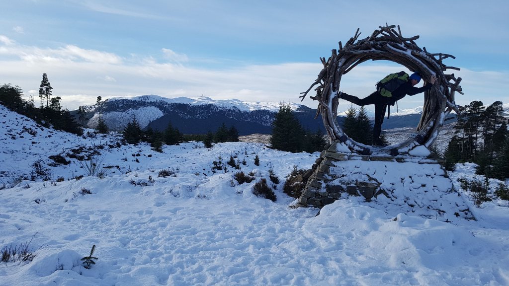
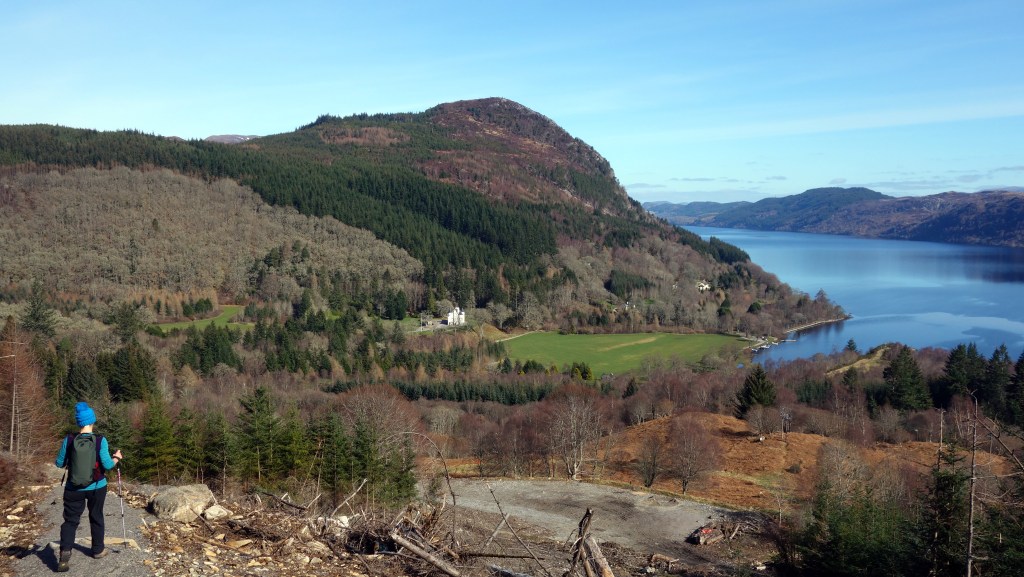
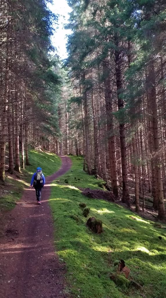
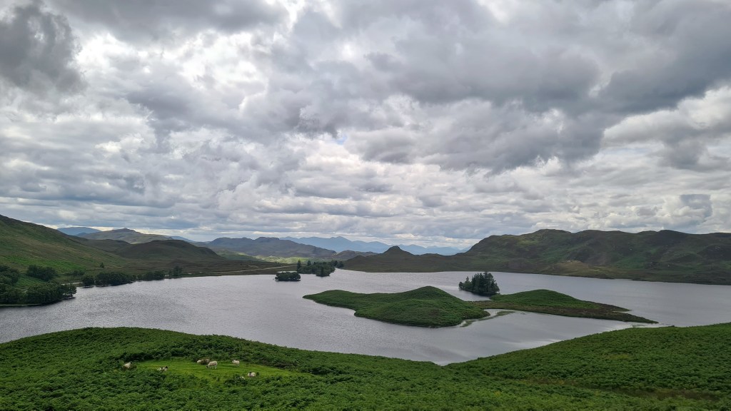
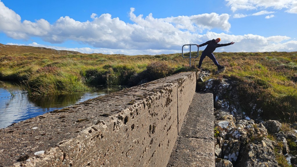
Here are some pictures from our hikes on the Great Glen Way…
I don’t recall seeing any long distance hikers on the trail and very few other hikers away from the small towns. The SLNT has fewer towns along the way than the equivalent GGW section north of Fort Augustus. There is a shop and café at Foyers and cafes and pub at Dores before reaching Inverness. I thought there was a bit more variety than on the GGW with more views to Loch Ness, but both trails provide a similar experience through relatively low level scenery. Again wild camping is possible along the way, and some accommodation at Whitebridge, Foyers and Dores.
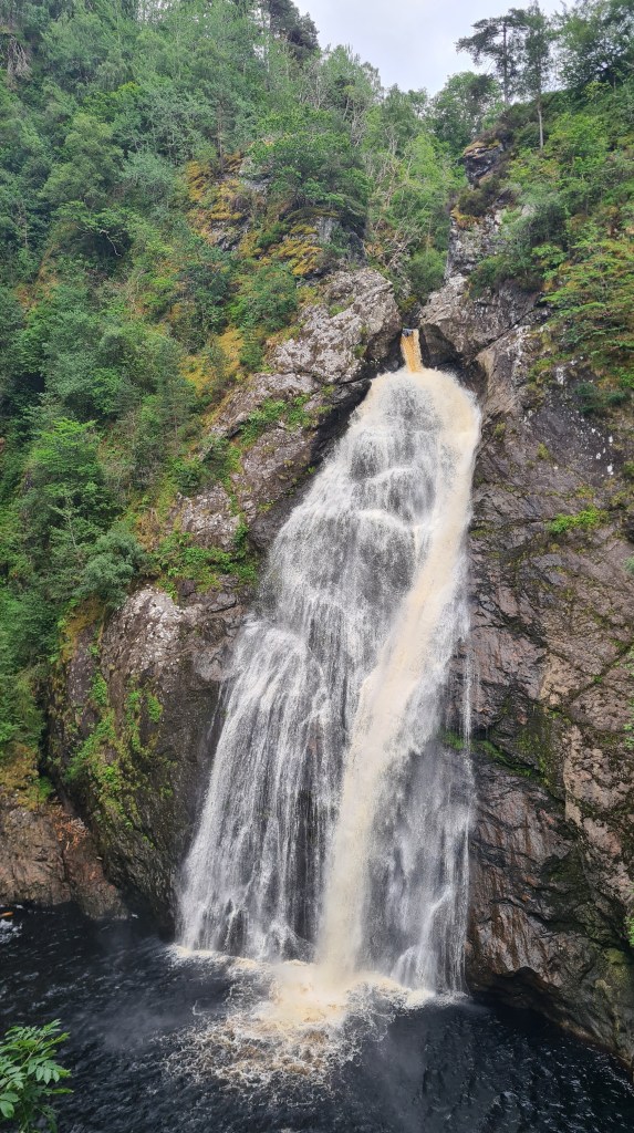
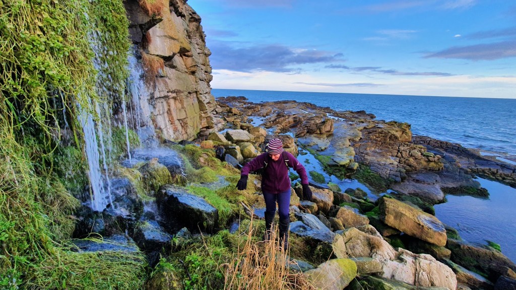
Foyers waterfall
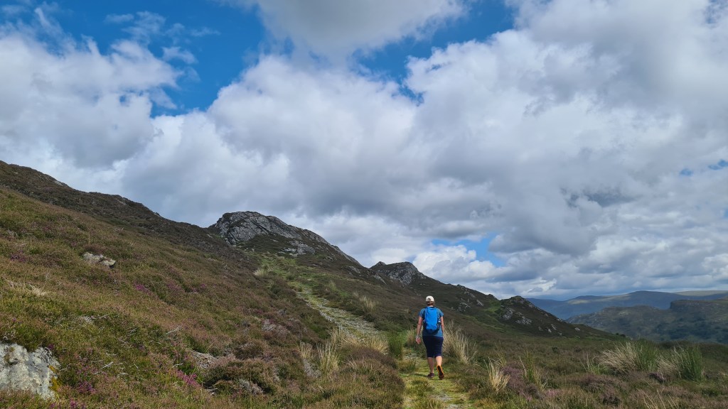
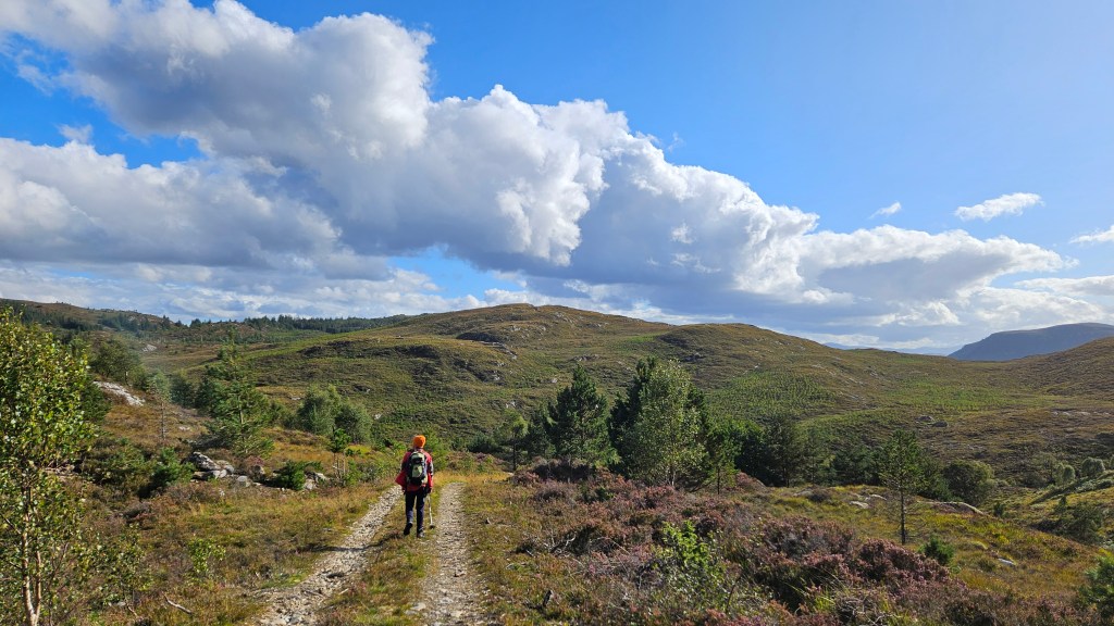
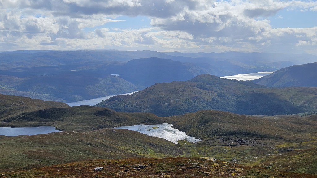
Great Glen Way- summit alternative
This was a chance to climb up above the Great Glen Way high trail for better panoramic views of Loch Ness and the mountains to the west.
An overview of the route is marked in purple in the map below.
From the south, the route consists of; jeep track, cross country to a summit, then a hill trail (that can be boggy) back north east to the Great Glen Way. So it does require more navigation skills than either of the standard trails.
Whilst hiking the route we found an old running race marker and now realise that it’s Day 1 of an ultrarunning event. The link here has details of Ultra X with a GPX for interest. Walkhighlands also has a route description for the northern section as a ‘there and back’ hillwalk.
We enjoyed it, but its definately muddier than the standard routes!
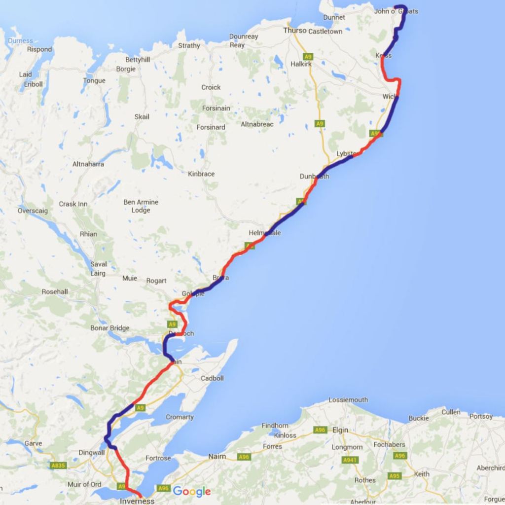
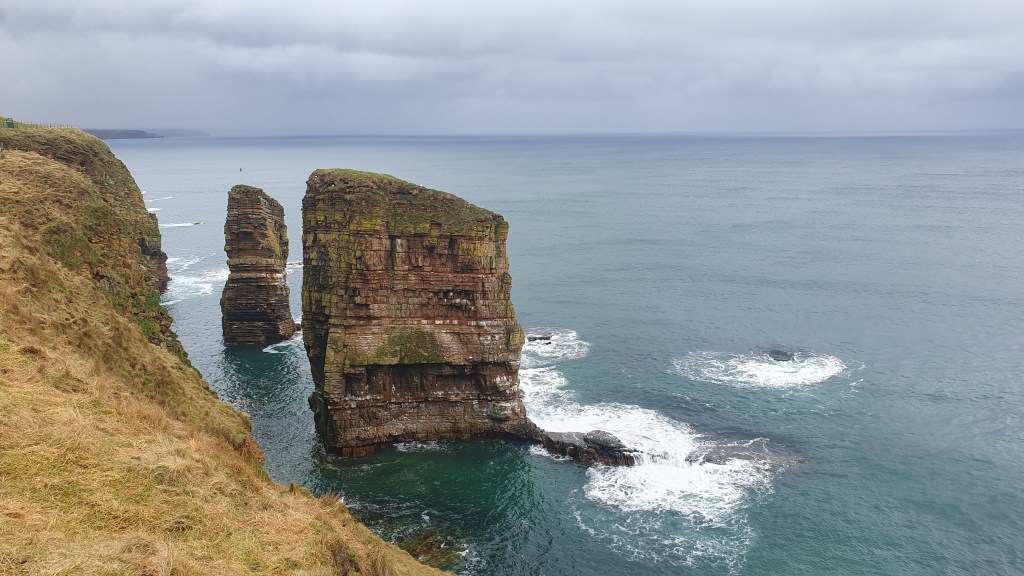
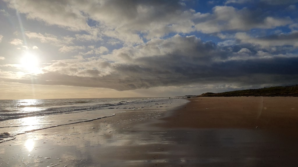
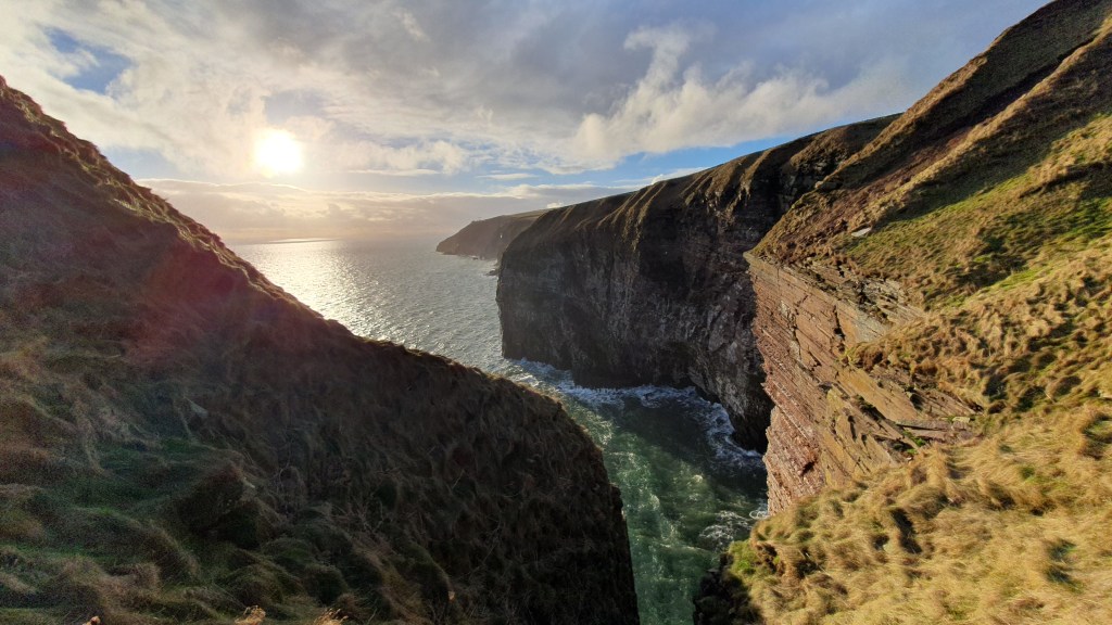
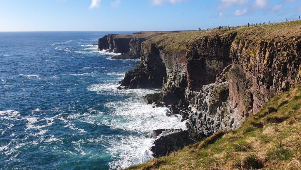
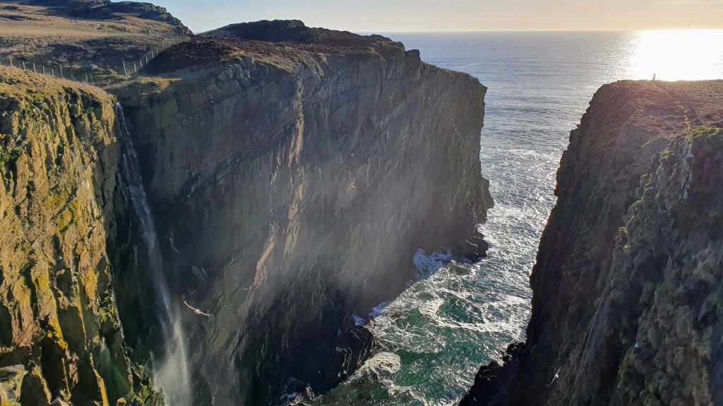
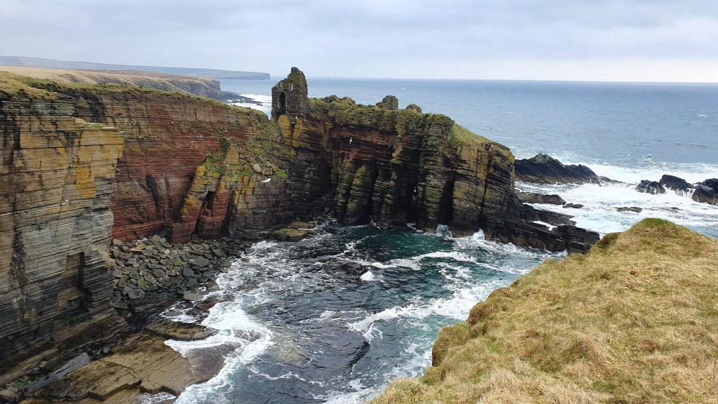
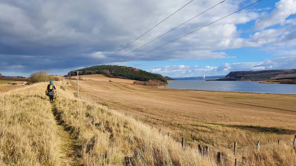
The John O’Groats trail (JoGT) is a 147 mile (236km), mostly coastal route from the city of Inverness to John O’Groats on the north east tip of Scotland. The scenery varies from pleasant inland agricultural areas, to beaches and wildly impressive sea cliffs with arches and sea stacks. The area is home to lots of seabird colonies and you have the chance to spot seals, dolphins and even whales. On top of that there is a tremendous historical interest along the way such as iron age Nybster broch to the Viking Old Wick Castle. And from more recent times there are many picturesque harbours and sights like Whaligoe Steps.
The John O’Groats trail acts as an excellent connector to the 74 mile long Great Glen Way in the south. And south of the GGW, the 94 mile West Highland Way connects to the outskirts of the city of Glasgow.
The JoGT trail is fairly new and is still being improved in places with some rougher, boggy sections and barbed wire fences particularly between Helmsdale to Wick. So it can be a pretty challenging walk overall but constant improvements are being made by the Friends of the John O’ Groats Trail on the trail and signage.
Our hikes
We live near to the southern area, and have walked the trail in sections, including Brian backpacking the northern part from Dunbeath to John O’Groats in 2023. Here are a few pictures from those hikes…
Resources
John O’ Groats website has lots of details including status updates, green/amber/red ratings for each stage, blog posts, plus you can join or donate to the Friends of JoGT
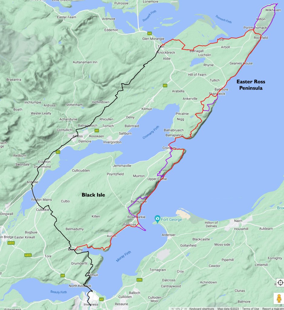
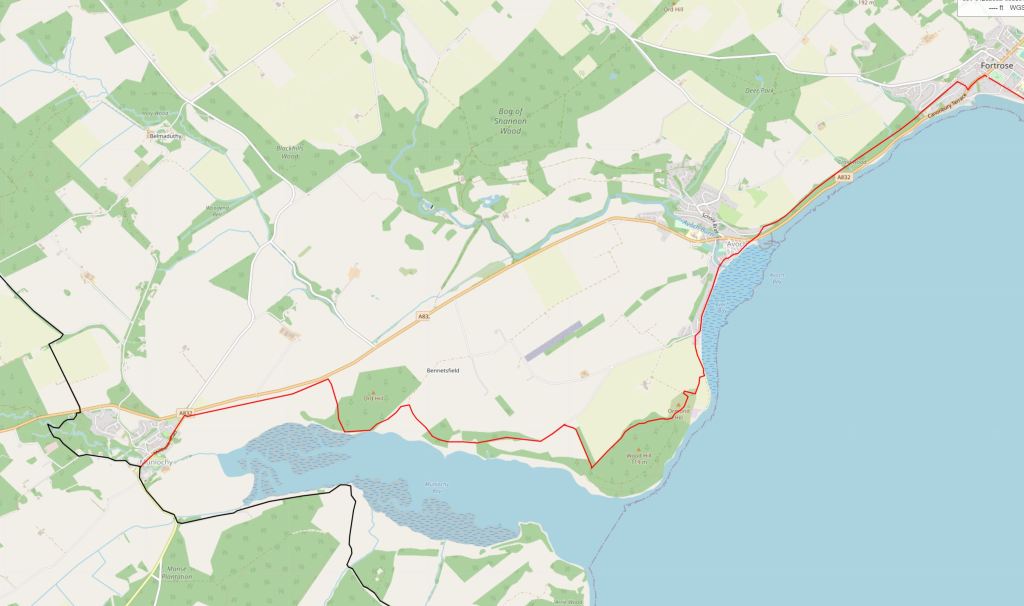
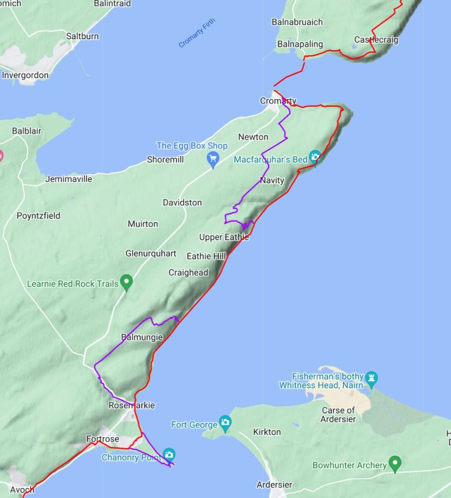
About 14km north of Inverness at Munlochy, the John O’ Groats Trail heads inland for about 2 1/2 days to the town of Tain. The hike is through a pleasant rural landscape but this is a description of a possible alternate route between Munlochy and Tain over the ‘Black Isle’ and the ‘Easter Ross Peninsula’ that stays closer to the coast, with (arguably) better scenery that is more in tune with the rest of the JoGT.
Map 1 – Black: JoGT, Red: Alternate, Purple: Further Alternates!
From Munlochy, the alternate will take about a day longer to get to Tain. 3 1/2 days on the alternate as opposed to 2 1/2 days on the main JoGT – see distance breakdown below. Here’s a bit more on pros and cons of the alternate:
Cons
A day longer
This is not the JoGT and just a suggested route and as such is not signposted with no trail in places. Requires a map, the ability to navigate, with perhaps at times the need to work out your own route on the ground
There is a short ferry crossing between Cromarty and Nigg which usually only runs between June 1st and September 30th. Without the ferry you could possibly use public transport routes from Cromarty->Inverness, then Inverness->Tain, then Tain->Nigg, but it could take a while!
Tidal 1 mile north of Rosemarkie on Day 2 (but easily managed or bypassed, see the Fortrose to Cromarty section below)
Pros
Great variety of scenery and mix of trails, beaches and tracks
Less tarmac
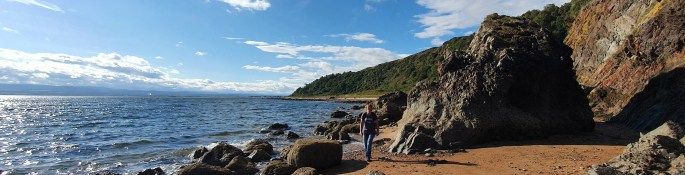
Rosemarkie to Cromarty in particular has excellent beach and coastal walking as well as fossil beds
Morrich More beach walking – coastal and marine nature site near Inver
Good town stops
Options for interesting side trails, particularly to Chanonry Point and Tarbet Ness
John O’Groats Trail distances
Section
Distance (km)
Of which tarmac
Munlochy to Culbokie
10.3
5.2
Culbokie to Alness
14.8
14
Alness to Tain
21
12.2
Total
46.1
31.4
Black Isle Alternate red route distances
Section
Distance (km)
Of which tarmac
a. Munlochy to Fortrose
11.3
2.2
b. Fortrose to Cromarty
18
1.3
c. Cromarty to Portmahomack
28
7
d. Portmahomack to Tain
17
3
Total
74.3
13.5
Alt a. Munlochy to Fortrose11.3km
Summary A varied walk on the Black Isle which is about half a day and meaning that you could walk from Inverness to Munlochy on the JoGT then this route to Fortrose making for a 25.5 km day.
It follows along field edges to the northern shore of Munlochy Bay, then nice woodland tracks to the ruins of Ormond Castle dating back to the 12th Century. Passes through Avoch, a scenic little harbour town with shops and a café. An old railway line through woods provides an easy hike from there into another scenic town of Fortrose with its cathedral, shops, post office, chemist, accommodation, 2 campsites and harbour.
Map 2
From Munlochy leave the main JoGT by following the high street northeast up to just before the A832
Follow the signposted route on the right to walk east along the field margin parallel to the A832
At the far end of the field, turn right for 20m to access the path along an old railway track still parallel to the A832
Go past a car parking area and continue to a 2nd parking area
Turn right down towards Munlochy Bay by field margins and past ruins
Go along the edge of the bay to a wooden structure (nice rest stop). Continue on 30 meters or so until you are able to follow a field margin left uphill go to find a good vehicle track. [Note, you can continue around the coast to Avoch along pebbly beaches, sometimes slippy. Low tides needed]
Turn right on this better track through Bay Wood (with excellent bluebells in spring) onto tarmac
Reach a small parking area and go through the gate on the right to a dirt trail
At the edge of the wooded hill (Wood Hill(!) on Map 2) turn left on the track (carrying straight on will take you to 10. as well)
At the north edge of Wood Hill turn left at the junction and past the mound of the site of Ormond Castle. A quick diversion to the top gives nice views across to Chanonry Point and Fortrose
Continue on the trail to a gate, turn sharp right towards the sea on a short trail and over another gate to cross a field diagonally downhill to reach a track along the shore
Follow the track and turn right on the road north along the shore into Avoch (pronounced Och!)
Avoch has a shop, accommodation and a small harbour. Take a route up onto the railway line path above Avoch (there are 2 trails with steps or a road up to the church and railway line). The church contains the grave with plaque of Alexander MacKenzie, explorer of the MacKenzie River in Canada
Follow the old railway path into Fortrose and take a right at its end into Fortrose centre
Old railway near MunlochyEast of MunlochyMunlochy Bay wooden structureSite of Ormond CastleAvochFortrose
Alt b. Fortrose to Cromarty18km
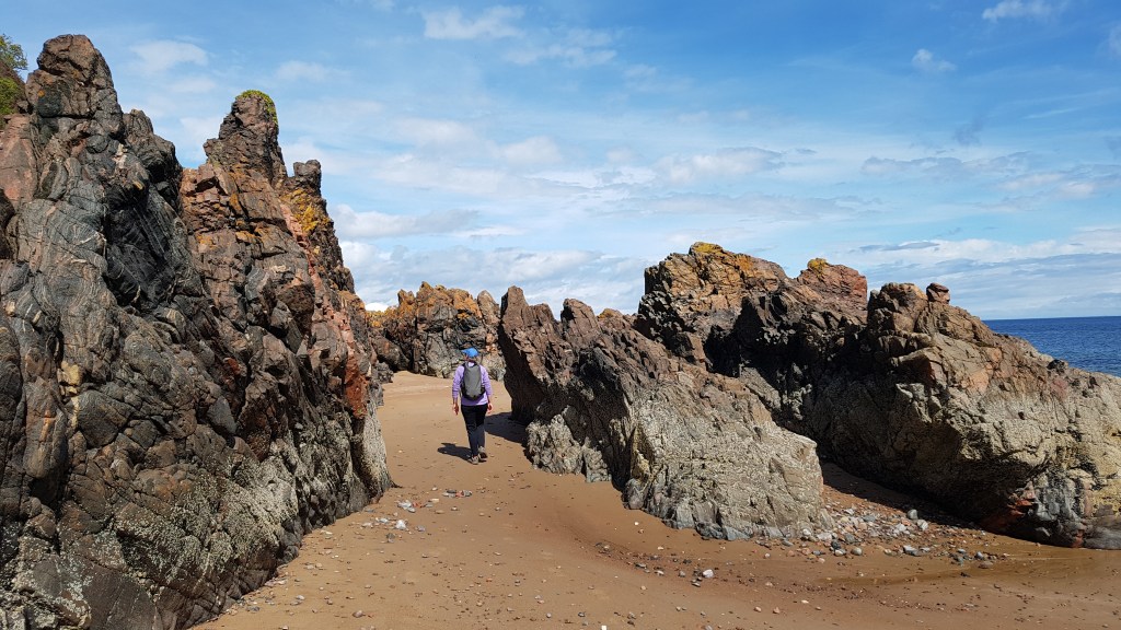
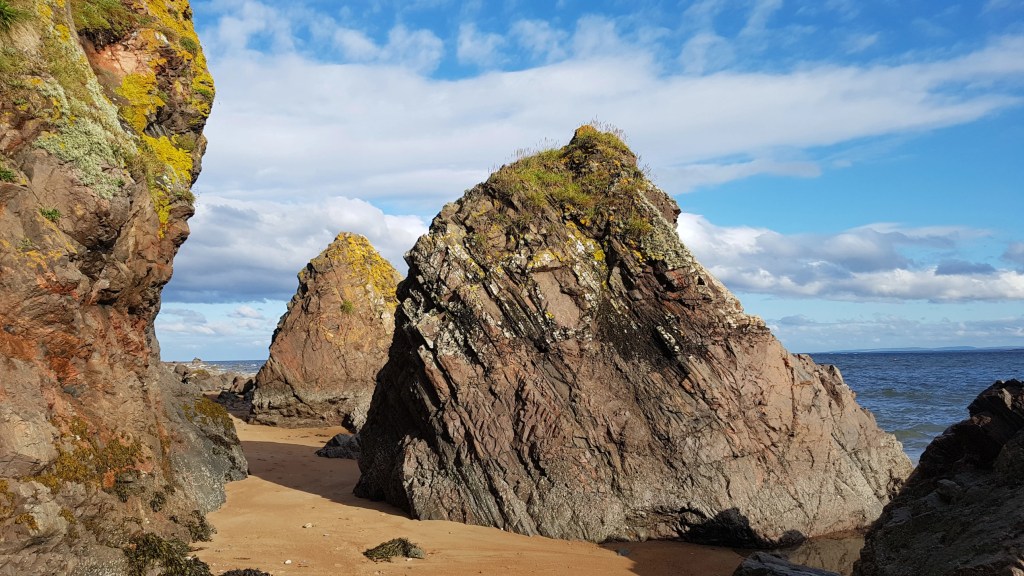
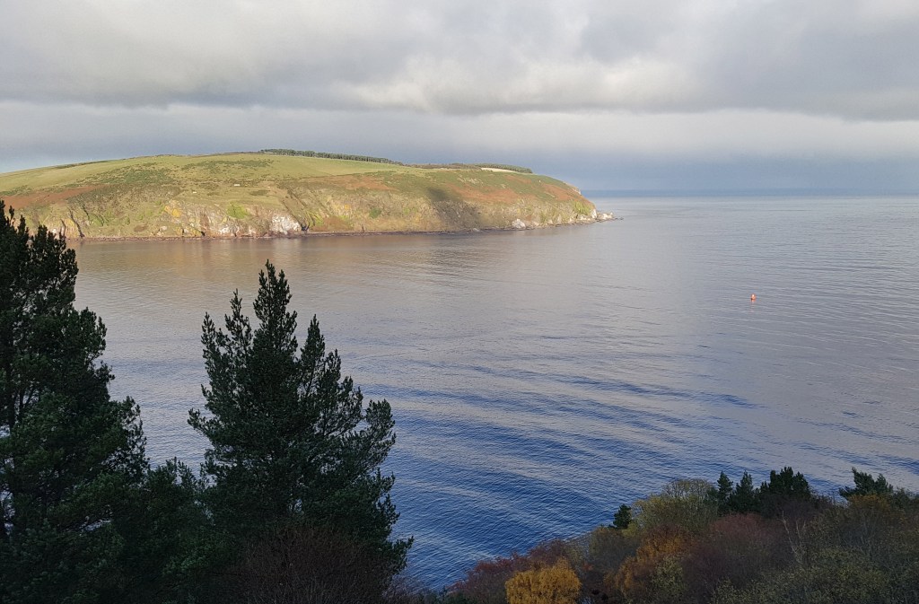
Summary This is a great walk on the Black Isle, with beach and some boulders along the coast, then field margins with views to the sea along to the South Sutor and a final good trail down to Cromarty.
Highlights include the colourful and varied geology along the coast, caves, chance of spotting fossils, a bothy at Eathie, birdlife, world war coastal defenses and grand views across down to the sea nearing Cromarty. Three alternates are also described below.
The coastal southern section is best hiked at low tide as this exposes more of the sandy beach with easier walking. In addition about 1 hour beyond Fortrose and just over a mile north of Rosemarkie (Caird’s Cave on maps) there is a tidal section about 20 metrs long where the water can wash onto the cliff making passage difficult to impossible. As a rough guide, if the tide level at nearby Cromarty is at 2.4m or below it should be fine to cross.
Tidal section
Map 3
Red Route on Map 3 and Map 4
From Fortrose centre Coop grocery store you can take a number of ways to Rosemarkie. Here is one;
Go down Castle Street opposite the Coop and continue down the grassy avenue past the school. Take a left turn just after the grass signposted ‘Path to Ness Road’ (straight on takes you to Fortrose caravan/campsite) on the short road then onto a path past houses
Turn right at the next road junction, Ness Road, then left on the road signposted for Fortrose & Rosemarkie golf course and caravan campsite.
Go along the road to the golf course club house. From there you can walk along the road, the grass trail above the beach or on the beach to Rosemarkie (Crofters cafe and then Beach cafe further along)
From Rosemarkie you can then just follow the coast for a couple of hours to Eathie bothy. As mentioned above you will pass the tidal section after a mile and you will need to cross pebbles and boulders on occasion with the easiest hiking generally on harder sand near the water edge
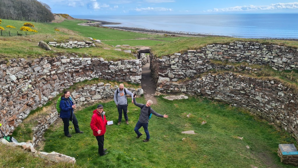
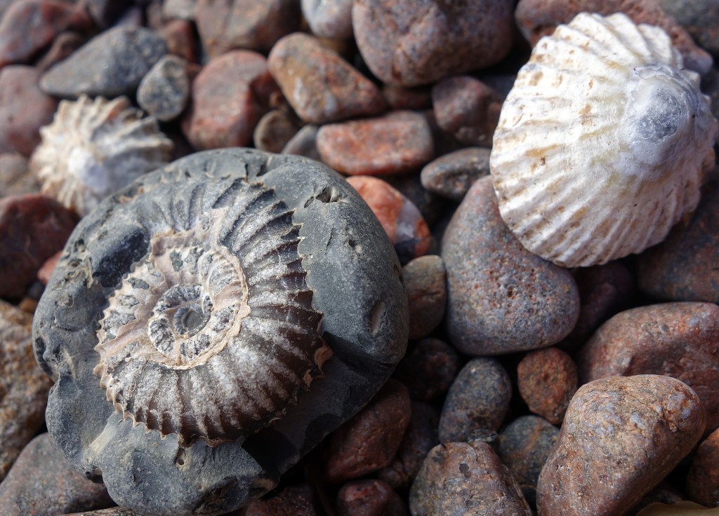
Watch out for sea and woodland birds, and maybe even otters, seals or dolphins. There are a number of caves to explore along the way, in one of which was found ‘Rosemarkie Man‘, a Pictish skeleton from about 500AD with severe head injuries. The changing geology is interesting… This coast is part of the Great Glen Fault and as such very old rocks are exposed at the surface such as gneiss and granites. Fossils can be found too and the 19th century geologist Hugh Miller made a number of discoveries here. If you are looking for fossils, note that hammering the bedrock is not permitted and follow the Scottish Fossil Code
Eathie bothy provides shelter and some information panels. At the bothy you have a choice. My main red route is to continue along the coast then follow the escarpment above the cliffs. This is more scenic but in mid summer has a 200 meter long walk through deep bracken after climbing up above St Bennet’s Well. There is also an easier alternate heading inland, but with some tarmac walking (purple line Map 4)
For the main route (red line Map 4) keep walking along the coast over sand, pebbles and boulders. Watch out for the slippy green rock slabs! After about an hour you will get to a small sandy bay NH793650 marked St Bennet’s Well on the map. The cliffs reach the sea beyond here and it is best to head up above onto the escarpment
Follow a faint trail going steeply straight up the slope past a dead pine tree to the plateau above the cliffs
The aim from here is to follow field margins and then trails above the cliffs to the parking area at South Sutor. The first 200m can have deep bracken in summer until you reach woodland. Cross this then follow the field margin to the next narrow band of woodland (worthwhile short side trail down to sea arches at McFarquhar’s Cave)
Follow field margins and trails to the South Sutor carpark
At South Sutor parking area take a fine trail down to the right, initially through woods, then contouring and descending gradually westward towards the sea and Cromarty, Map 4
Further Alternates exist if required (purple on Map 3 and 4);
a. An extra loop round Chanonry Point (beach, lighthouse, vistas and chance of seeing dolphins). From Fortrose Coop head down to the Fortrose caravan site then follow a trail on the south side of the peninsula beside the golf course to Chanonry Point. Continue via the north side to Rosemarkie either along the beach or on trails beside the golf course. [Dolphins can often be seen jumping very close to the point. Best chances to spot them are between April and September and on a rising tide]. This Walkhighlands route describes the walk in more detail as part of a loop.
b. High tide option from Rosemarkie, up Fairy Glen on good trail with its waterfalls, along a minor road then descent on good trail from Hillockhead to the coast. This Walkhighlands route describes a loop including both this high tide route as well as part of the normal route.
c. Leaving the coast at Eathie bothy(Map 4) to climb a good trail to join a minor road then track and trail through woods to Cromarty. Described again in Walkhighlands– but a more interesting route towards the end is to follow the route drawn on Map 4 rather than Walkhighlands. At section 8 Walkhighlands, leave the track 300m before Mains Farm where a path goes down left through woods. About 300m on, turn right on a good path going along a field margin and at the far side various trails allow access into Cromarty town.
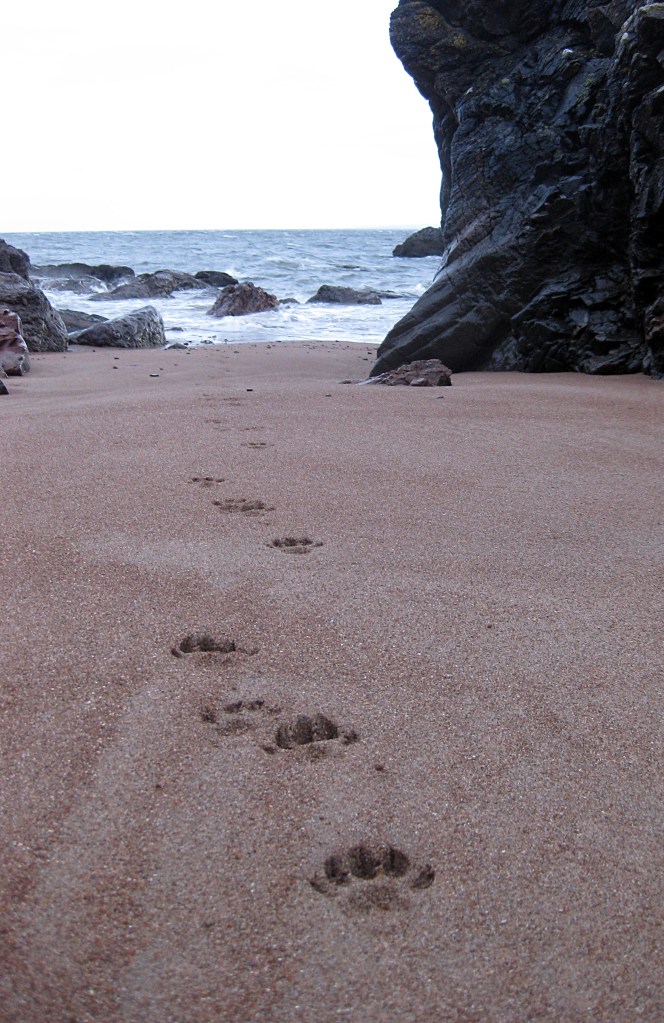
Otter tracks!Eathie coast from aboveEathie bothyField margins in springFrom South to North SutorAmmonite on beach
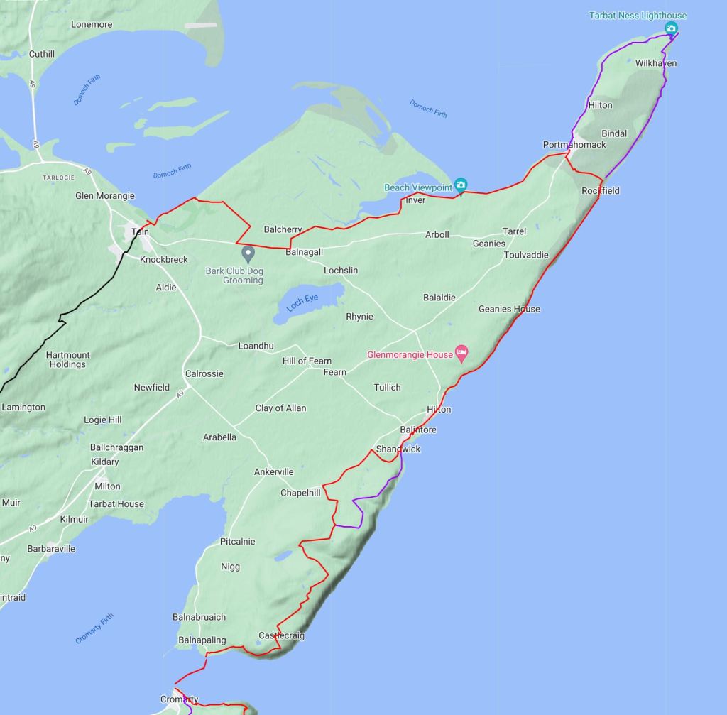
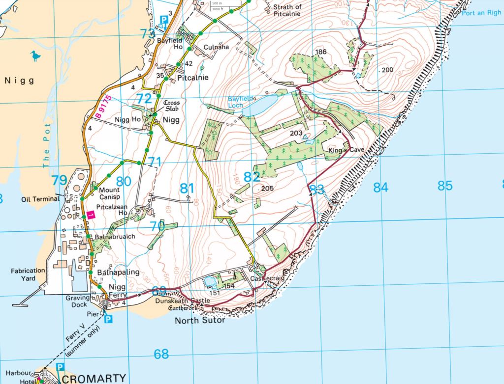
Alt c. Cromarty to Portmahomack27km
Summary This longer section starts with the small ferry across from Cromarty to Nigg and the ‘Easter Ross Peninsula’, then a mix of walking above the sea to Shandwick and to Balintore with a shop. A fine walk along the shore to Rockfield follows before a short road walk across to Portmahomack. A further scenic alternate could be to hike out round to the tip of the peninsula and lighthouse at Tarbet Ness.
Map 5
Red route on Map 5 and Map 6
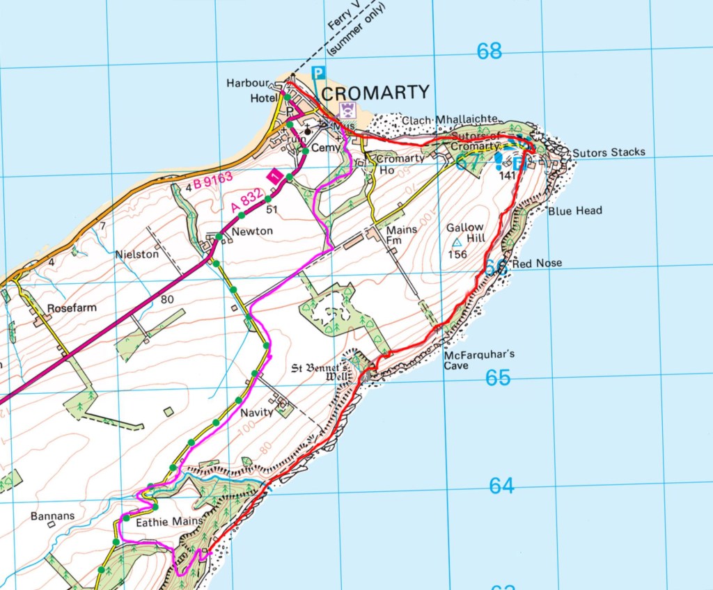
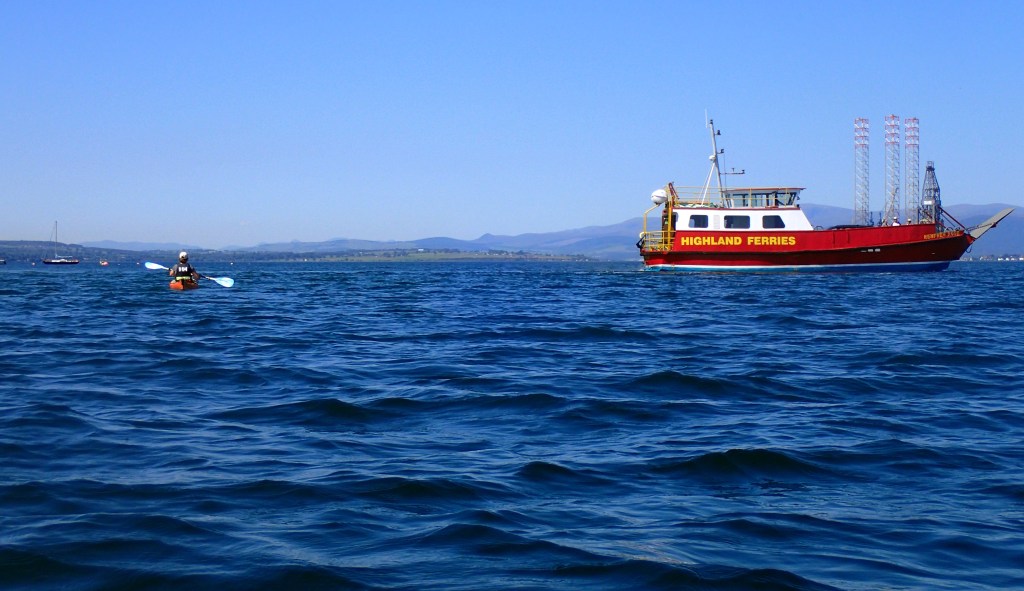
From Cromarty take the tiny ferry across to Nigg (Balnapaling on Map 5)- the ferry runs between June 1st and September 30th
Walk north past houses for a short way then take the road right marked Castlecraig (you can also walk the beach eastward to before the cliffs then head back left to a carpark and road) uphill to another Castlecraig trail marker and style on the right
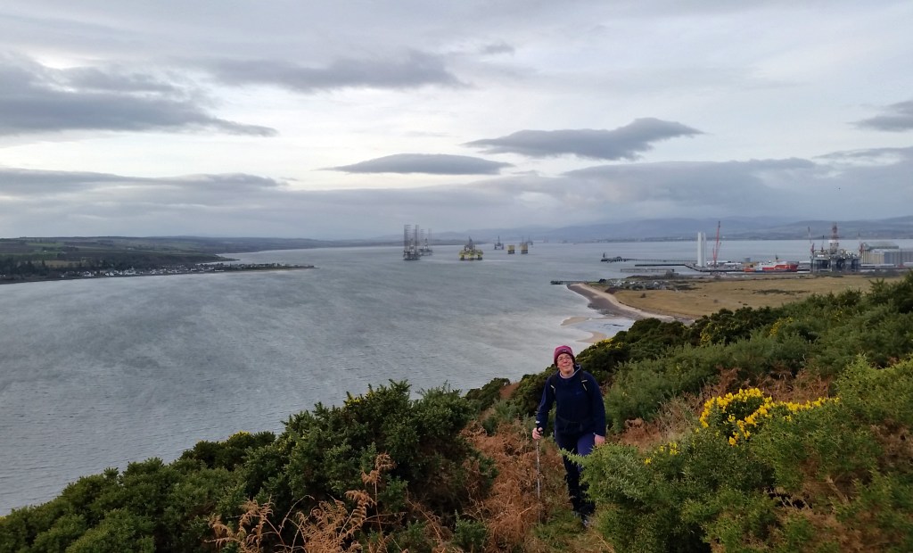
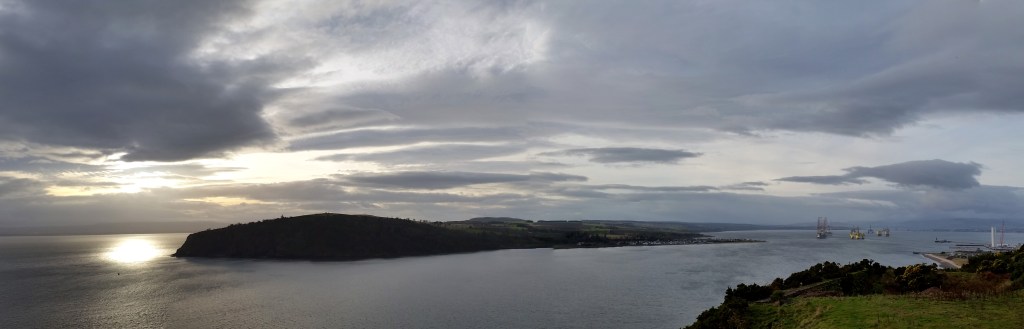
Walk a trail, faint in places, across the field and through gorse with great views back to Cromarty Firth
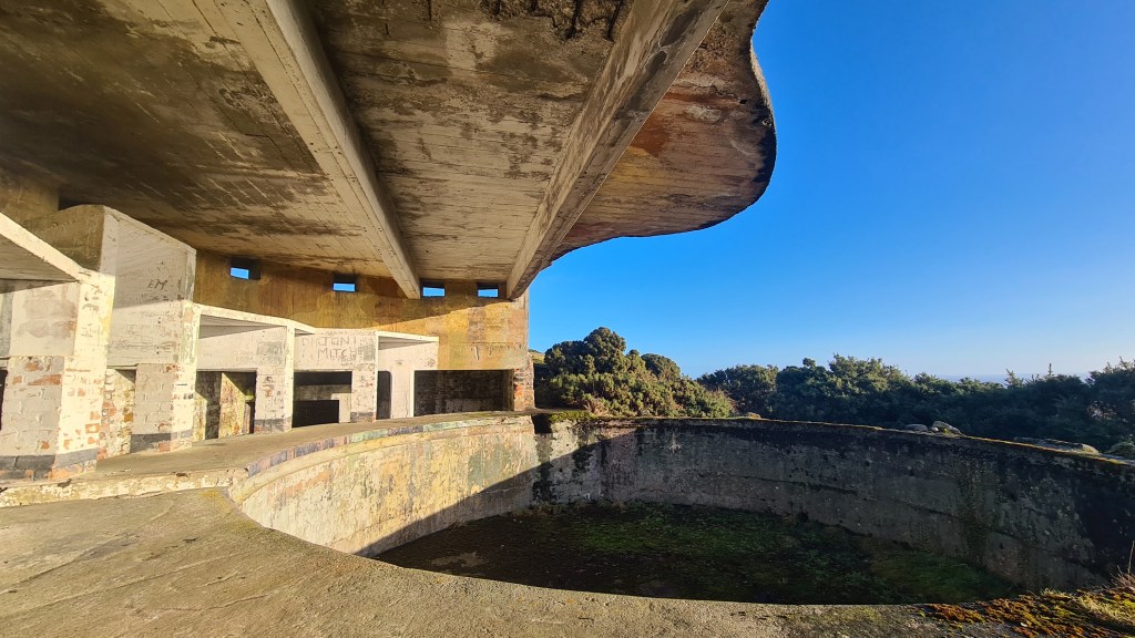
The first cool World War gun emplacement is at North Sutor below the trail on the right after about 300m. From there follow the track round onto a more open field to ruined buildings. Skirt these on the right with a better gun emplacement area, again to the right. If you are brave you can descend down a ramp underground (torch handy!)
From the gun emplacement head north about 200 meters to a birdwatchers signpost before a track uphill to houses. Follow the signpost to the right alongside, then through a fence to a river
Go up the riverside upstream for 100 meters or so then cross to the right at a ford, through the gate then left uphill 100 meters on the track to another gate on right
Go through the gate to hike on grass near the edge of the escarpment above the sea until reaching another river
Cross the river to a stile. From here go diagonally uphill across the field, through a gate to pick up another track
Now head for the seaward (right) side of the forest plantation on the skyline, reaching a good vehicle track on the far side heading inland just north of Kings Cave on Map 6
Follow this track north west to a dip over the Allt nan Damh river and then a junction
Map 6
Now on Map 7, turn north east on a track then soon follow the edge of the trees uphill to a gate
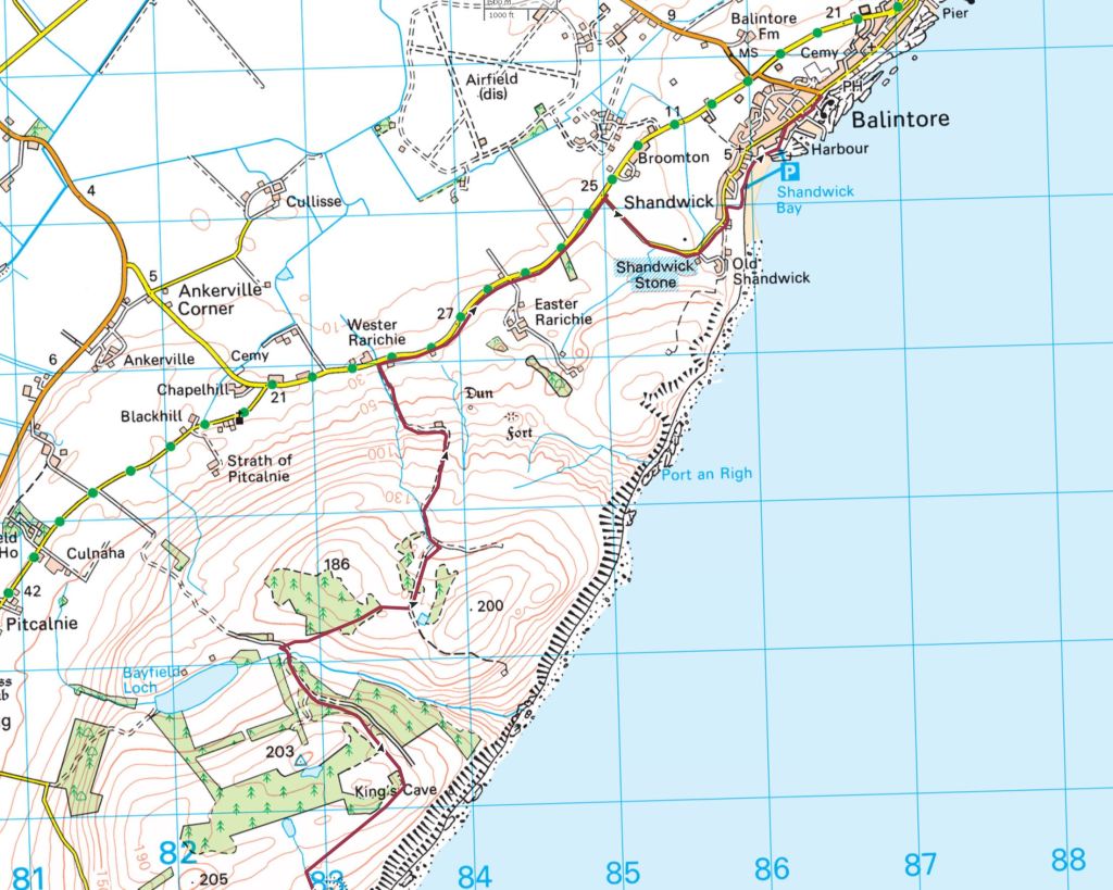
Through the gate and cross the sparse forest to a good track with wide open views north to Balintore, Portmahomack and the JoGT coastline and hills way to the northwest [The forest growth may make future access here more difficult, you may need to explore options here]
Take this track down to the road at Wester Rarichie [I have also walked a more direct off road line to Shandwick from here but found it tough bushwhacking through gorse in places. There might be a better way though…]
Walk the road taking a right turn after 2km to the Pictish Shandwick Stone. Impressive, even though its now preserved inside a glass box
Follow the road into Balintore, shop, cafe, and watch out for the Mermaid of the North statue!
Next is a fine coast walk for 10.25km to Rockfield as described in Walkhighlands
From Rockfield, walk the road for 3km, uphill at first, to Portmahomack which has a shop-post office, café and accommodation.
a.Tarbet Ness14km A coastal loop from Rockfield to Portmahomack round a peninsula jutting out into the sea with a lighthouse and panoramic views. Described in this Walkhighlands route.
Alt d. Portmahomack to Tain17km
Summary Good walking from Portmahomack to Inver along coastal edges and beaches with spacious views out east to the Dornoch Firth and the next legs of the actual JoGT. A section past motorbike tracks, an old airfield and a road is less pleasant, but the going improves to finish through woods and the coast into Tain. See Map 5 for an overview.
Leave Portmahomack to the south west along the coast past the caravan site (or by the road)
After about 1km you can follow a trail above the shore
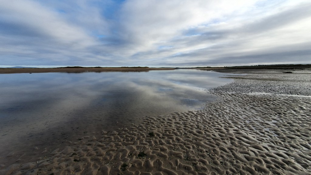
If the tide allows, it is great to hike along the wide sandy beach, part of Morrich More nature reserve
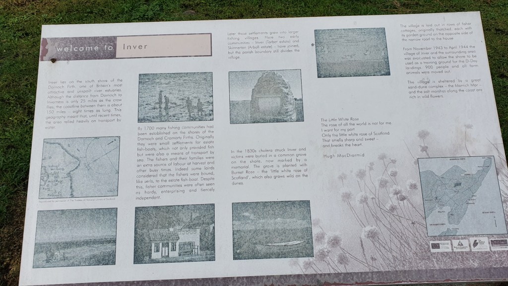
You can pick up a trail approaching the small town of Inver and walk into its centre with the Inver Inn bar and kitchen
From Inver I walked on generally south eastwards on grassy saltmarsh skirting the south shore of Inver Bay. The area to the north here is a RAF shooting range so I was forced to deviate from the coast at the head of Inver Bay
You could just head onto the road from there and walk 3.5 km west to a turn off on the right signposted ‘Junipers Holiday House’
I kept on the saltmarsh past a motorcycle track to an abandoned airstrip and walked that south west to the road – leaving 1.5km road walking to the Junipers turn off
At the road junction for ‘Junipers Holiday House’ turn right and follow the road north east for about 700m passing houses to a 4 way junction. Take a left on a gravel track for a km to a woodland – Cnocan Mealbhain
Turn left on trails to the coastal edge of the woodland
Now follow the coast on trails south west, crossing a bridge over the River Tain to the centre of the town where you meet up with the John O’Groats Trail again!
PortmahomackMorrich MorInverOld airfieldBridge into Tain
Further Alternates
Chanonry PointLighthouseFairy Glen near RosemarkieTarbet Ness lighthouseTarbet Ness coast