The South West Coast Path is a 630 mile long trail in England. The path itself takes a huge loop round the south west tip of England from Minehead to Poole through Devon, Cornwall and Dorset.
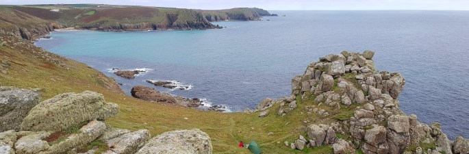
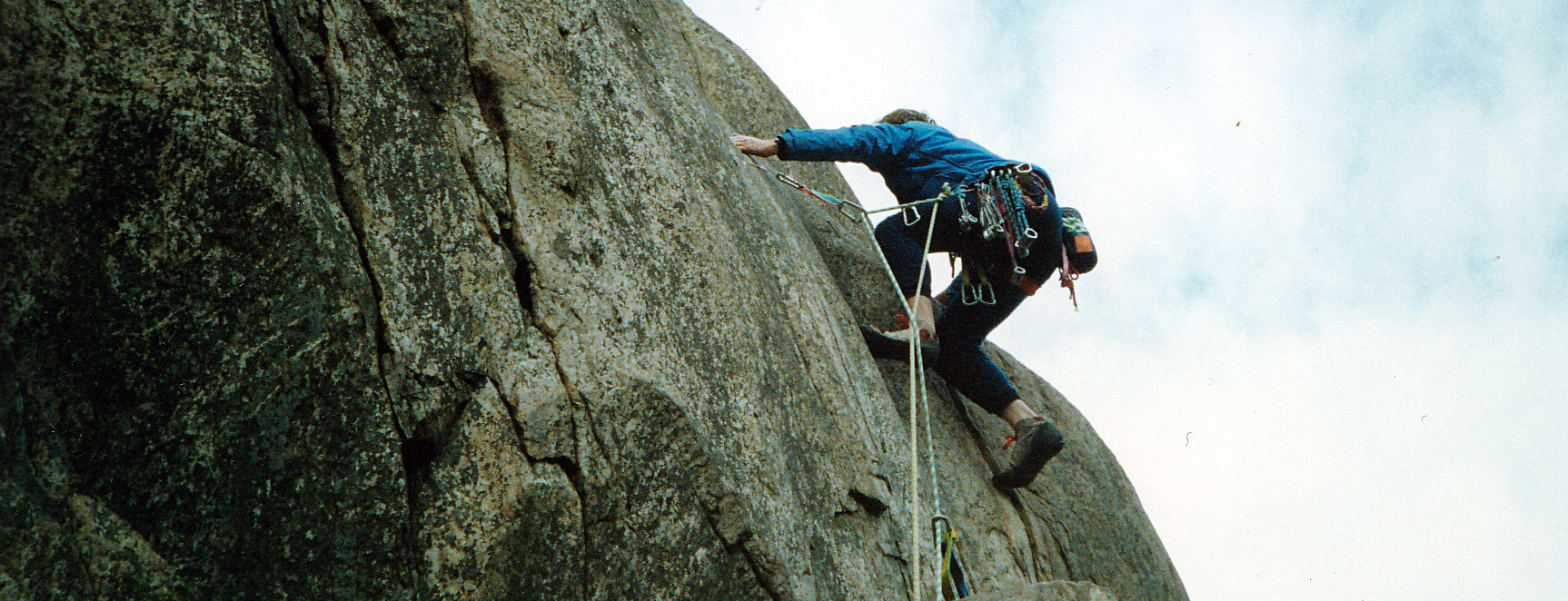
We have visited Cornwall a number of times on rock climbing trips. Sea cliffs like Bosigran and Chair Ladder near Lands End have provided us with some of the best climbing anywhere on golden granite with Atlantic rollers crashing into the shore for atmosphere. In between the climbing days we have also walked along the coast path and thoroughly enjoyed these too.
I was also encouraged to see that the incredibly well travelled hikers, Amy and James from California, had included the coastal path in their top 10.
We have hiked 3 sections of the coast path so far, going in an anti clockwise direction from Bude near the Cornwall-Devon border round to Plymouth on the south coast.
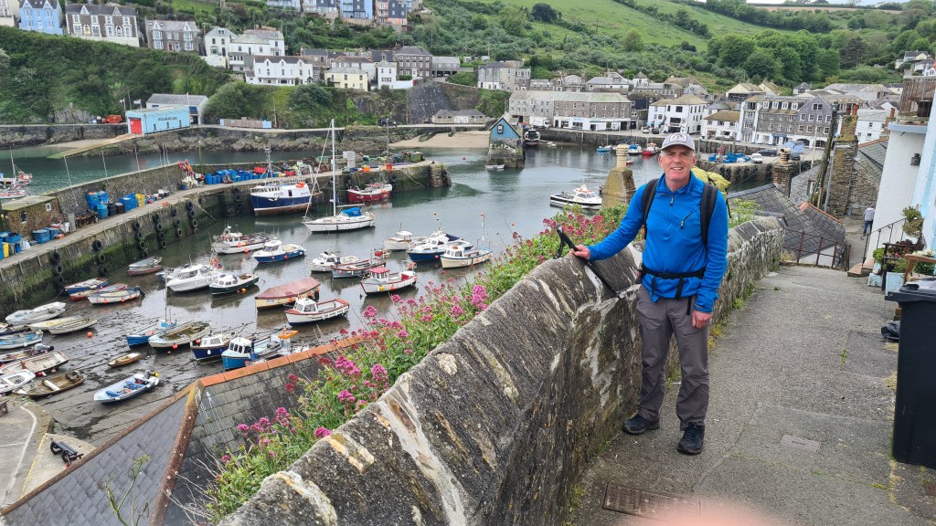
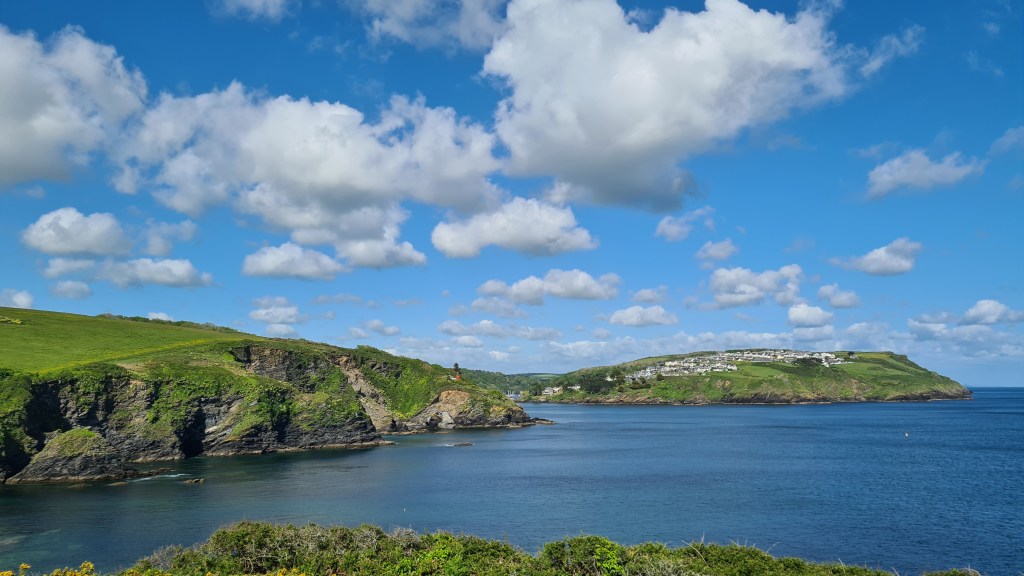
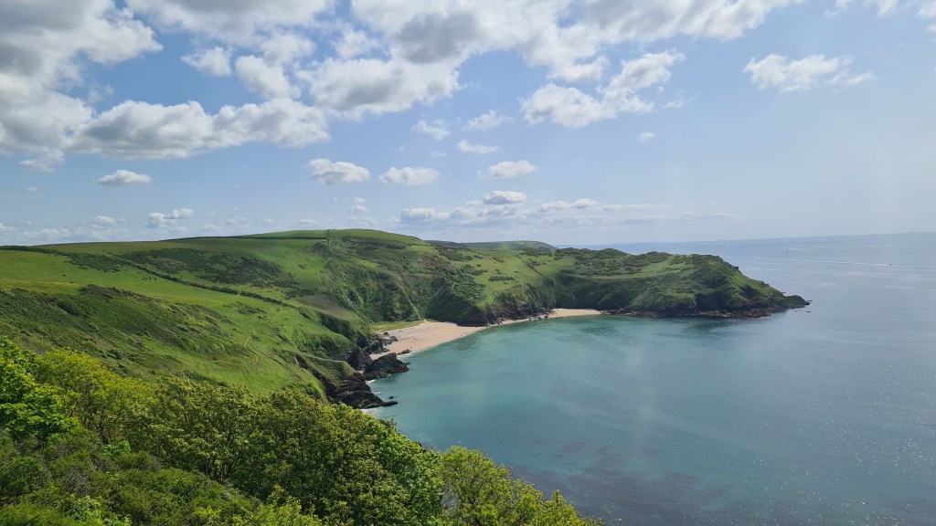
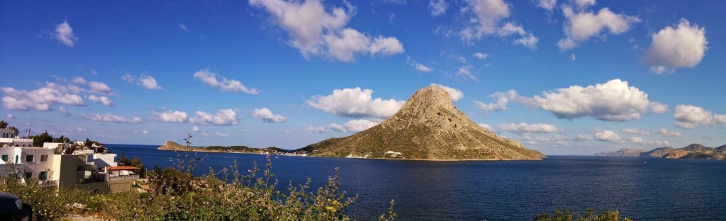
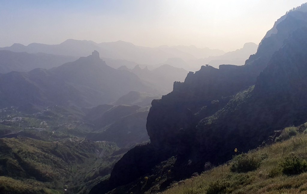
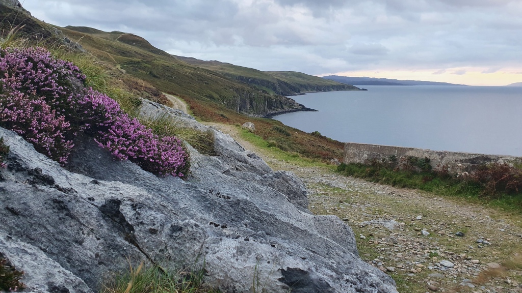
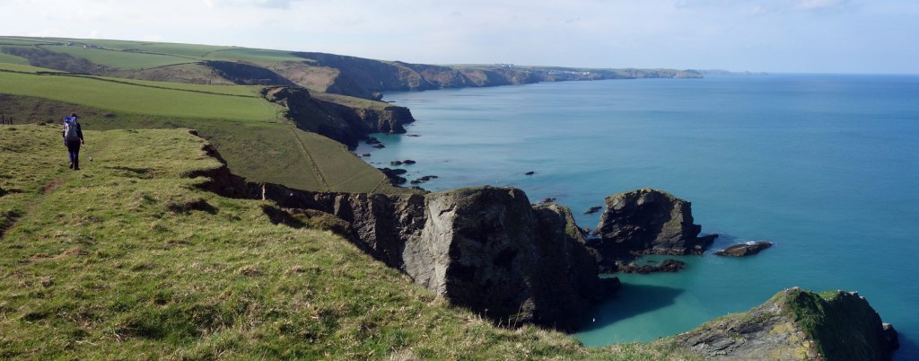
We returned to Cornwall in May 2023 for a third section of the South West Coast Path, this time walking from Falmouth to Plymouth in about 5 days.
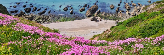
In summary the weather in May was kind to us with mostly bright sunny conditions. The trail in this section of Cornwall continued to be really scenic passing through some superb small villages and harbours.
Day 1 Falmouth to Nare Head 13th May 2023 After 6 days sailing from Falmouth and living on board the boat as part of a ‘Competent Crew’ sailing course we both thought that a land based camping trip would be a pleasant contrast and ‘next step’.
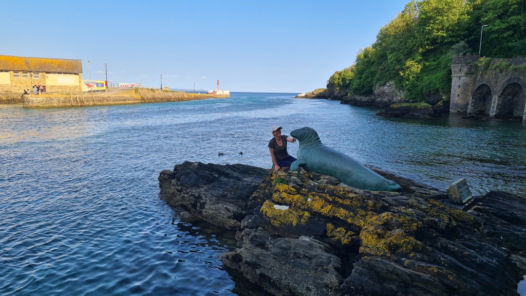
Happily we were able to pick up our South West Coast Path progress to date from 2020 by starting the directly from Falmouth harbour with two ferries over to St Anthony on the east side of Falmouth Bay.
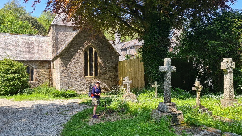
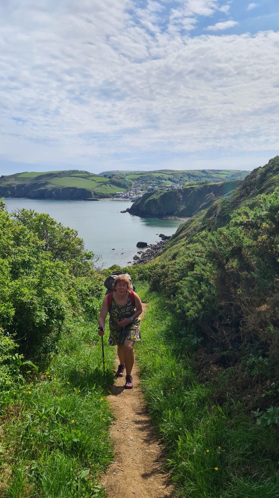
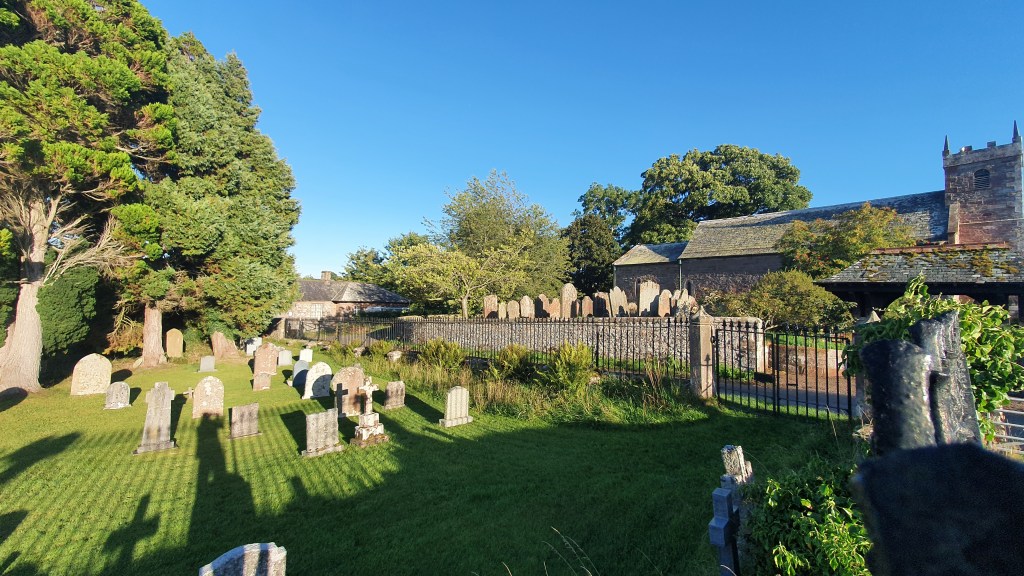
The bright sunny weather helped the transfer from ‘sea legs’ to ‘landlubbers’ and we enjoyed the boat trip over to St Mawes and connecting 2nd short ferry to St Anthony to the start of our hike. There was a rustic old church in St Anthony set amongst lush green vegetation. The hiking beyond took us up above the coastal cliffs on good trail past the cluster of houses at Portscatho. We were happy with a shortish day after a late start and found a decent wild camp above Nare Head with a steady breeze on the promontory.
Day 2 Nare Head to Portgiskey 14th May 2023 The outer of the tent was soaked with condensation overnight and we were glad to stop at Pebbles Cafe mid morning for 2 cups of tea in the garden and a well needed tent drying session.
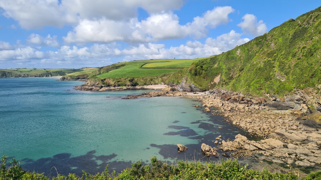
The heat picked up during the day, but a slight breeze helped at Hemmick Beach to accompany our pastie lunch. Next up, Dodman Point is a peninsula with significant coastal tidal currents where we had applied a dose of healthy respect during our recent sailing trip. It was a less exciting walk but the views were open back to St Mawes and over to the china clay ‘mountains’ above the town of St Austell.
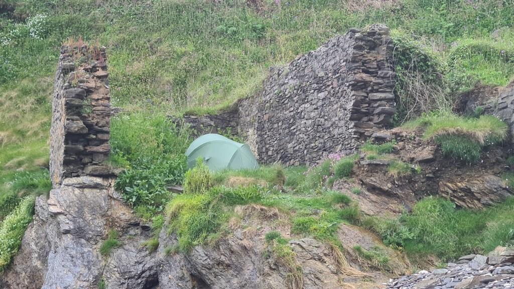
After dinner in Mevagissey we walked on in the evening looking for potential camping spots. They were thin on the ground though, but where there is a need something usually pops up and this time it was old ruin at the tiny rocky bay of Portgiskey.
Day 3 Portgiskey to Fowey 15th May 2023 Another sunny day, but with a welcome chilly breeze, where we started with a grand beach walk to Pentewan then some mellow cliff top walking round Black Head to a beach side stop at Lower Porthpean. Picturesque Charlestown was our next stop with coffee and date cake. Cool memories for us as we had stayed at the inn here in 2001 on a rock climbing trip during a spell of heavy rain.
From Charlestown we had a bit of a ‘suburban’ romp, passing a line of holiday homes then a golf course. We managed to get a bit lost in the golf course tracks, but did correct our course before hiking through the edge of urban streets of Par.
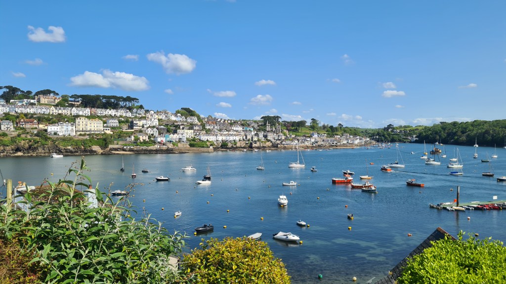
The heat returned again in the afternoon as we passed the impressive bright red and white ‘daymarker’ tower at Gribbin Head. From there we turned north into the small town of Fowey for a bit of a luxury stay under cover at the Ship Inn.
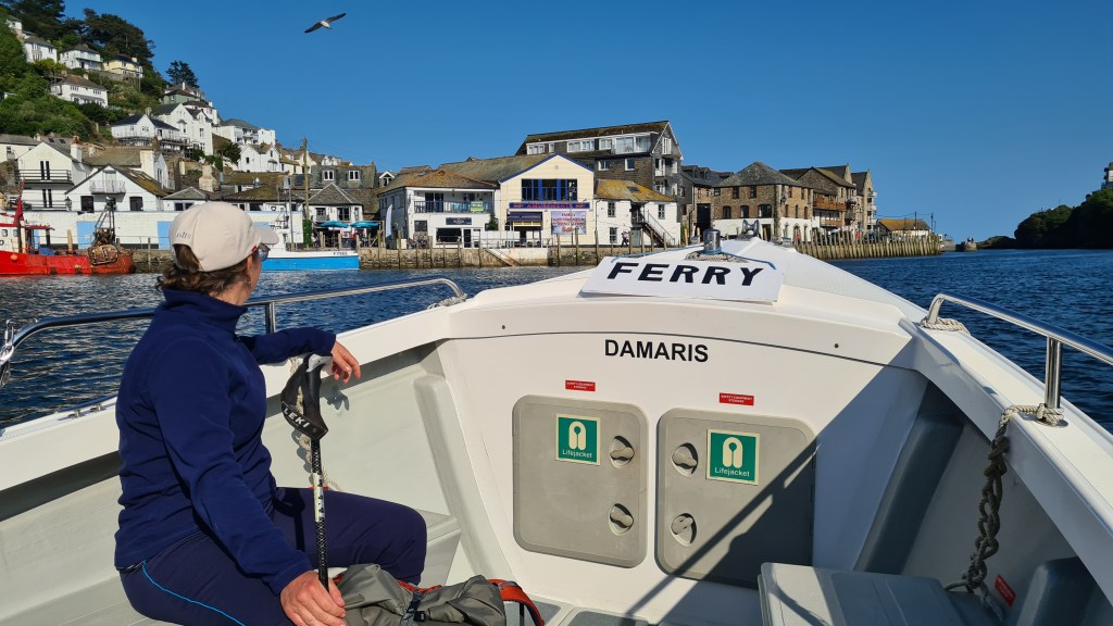
Day 4 Fowey to Looe (Bay View Campsite) 16th May 2023 A slightly later start with breakfast at the Ship Inn then a lovely ferry across to pretty Polruan. From there we had a wonderful rollercoaster hike along the clifftops with blue sea and sandy beaches below. Along the way an eerie sound from the sea turned out to be a buoy with a bell that dongs with wave action – there to warn boaters of the offshore rocks.
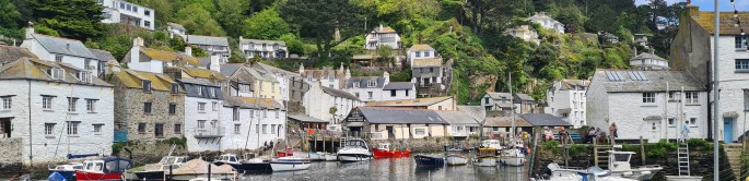
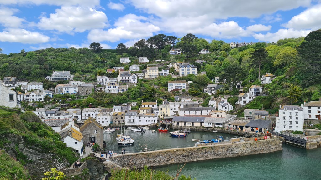
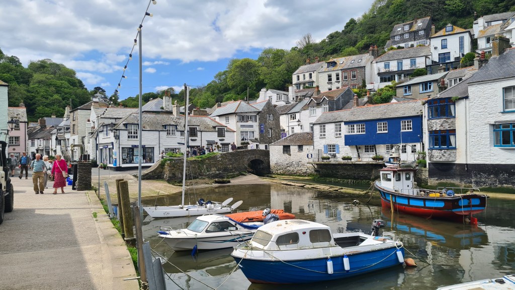
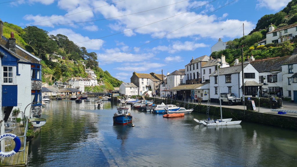
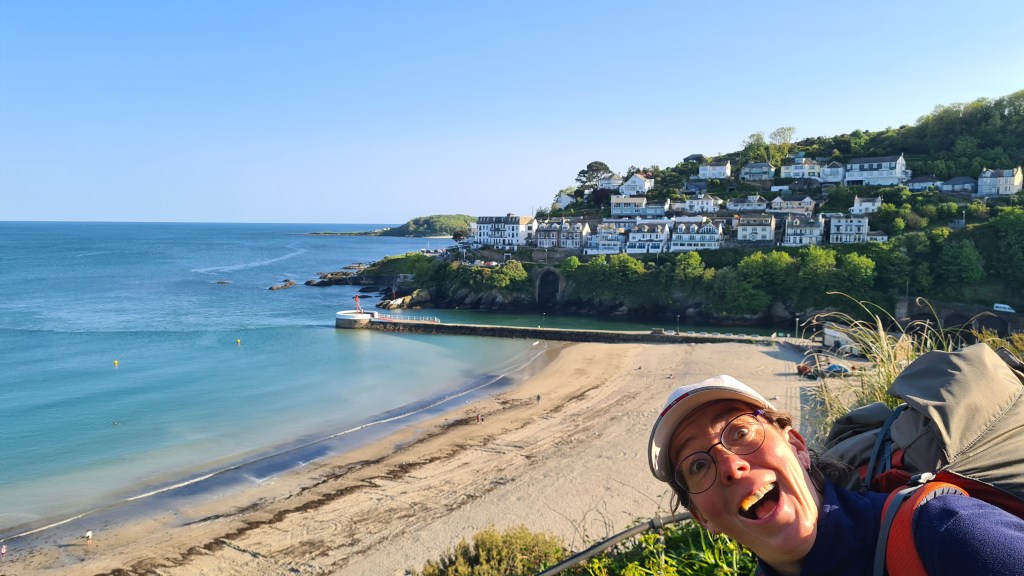
The town of Polperro was a great lunch spot- about as cute as Cornish towns can get, quite rightly attracting a few tourists.
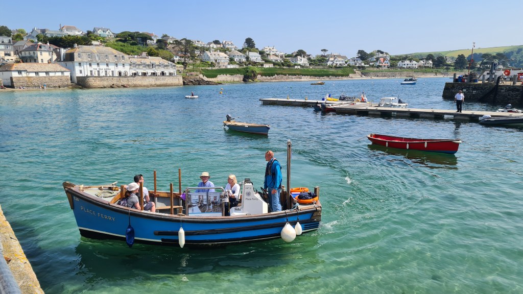
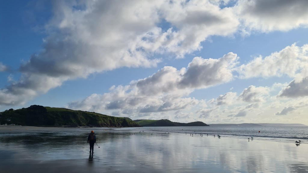
We dragged ourselves on though to the town of Looe, catching another tiny ferryboat from West to East Looe – ferrys are a great highlight of the Coastal Path, and as a bonus provide a luxury enforced rest from walking! That night’s camp was at a ‘proper’ campsite – Bay View Farm- living up to its name with extensive views back down to the sea and Looe.
Day 5 Bay View Campsite to Picklecombe Point 17th May 2023 Nice weather again. We were able to hike along the shore for a while at Seaton, before climbing steeply back up to the official path after Downderry. After the wonderfully named Portwrinkle we crossed a military firing range (not in use!) before some road walking past some cool wooden holiday homes around Freathy.
Across from Rame Head we reached the seaside houses of Cawsand and Kingsand where we stopped for some dinner sandwiches looking out into The Sound of Plymouth now with some busy boat traffic.
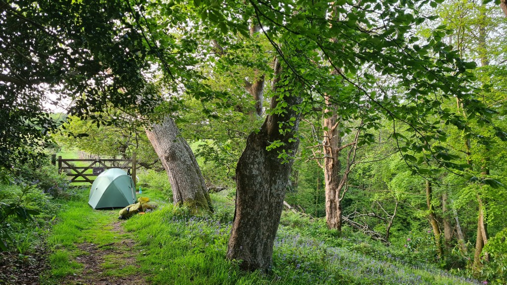
Day 6 Short day and ferry into Plymouth 18th May 2023 After camping in woodland across the Sound from Plymouth, we had a short walk down to the ferry, the Devon/Cornwall border, then into central Plymouth.
A rather lovely hike with good weather meaning that we had now hiked the whole Cornish coast part of the coastal path…hoorah!
2016 2015 Coast to Coast Trail (blog) of 190 miles across northern England through the Lake District, Yorkshire Dales and North York Moors National Parks.
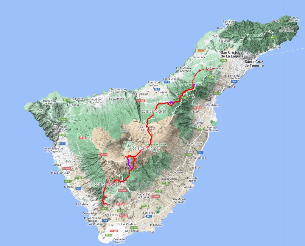
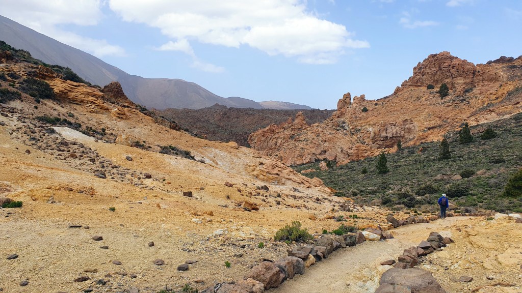
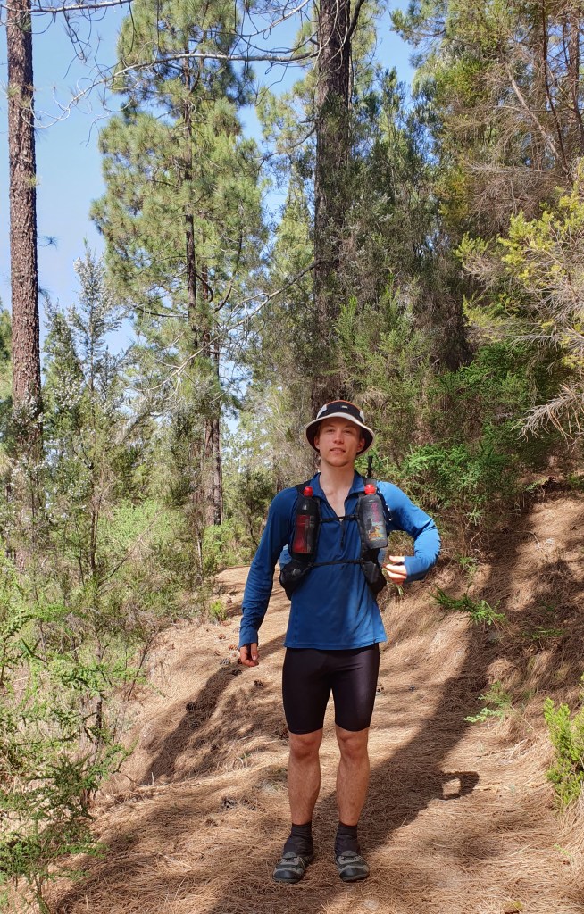
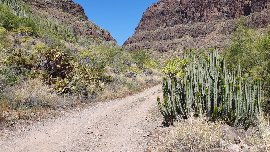
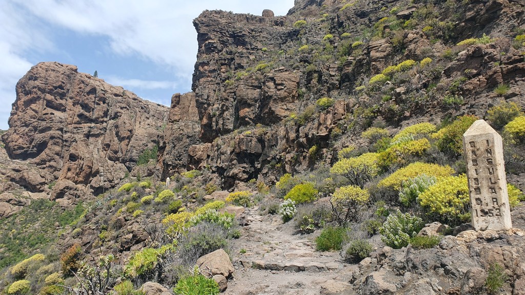
At the end of March 2023 Brian hiked the Gran Canaria GR131 then took a ferry to continue with the Tenerife section of the same trail.
Tenerife GR131 I hiked about 67 miles in 5 days (guidebook route is 58 miles). I again was armed with a guidebook, Cicerone’s Trekking in the Canary Islands as a kindle app.
The GR131 crosses from coast to coast on most of the Canary islands but in Tenerife it terminates inland at both ends. Possibly this is due to Tenerife being heavily populated around the tourist coastal fringe and creating a scenic trail in these parts is more difficult.
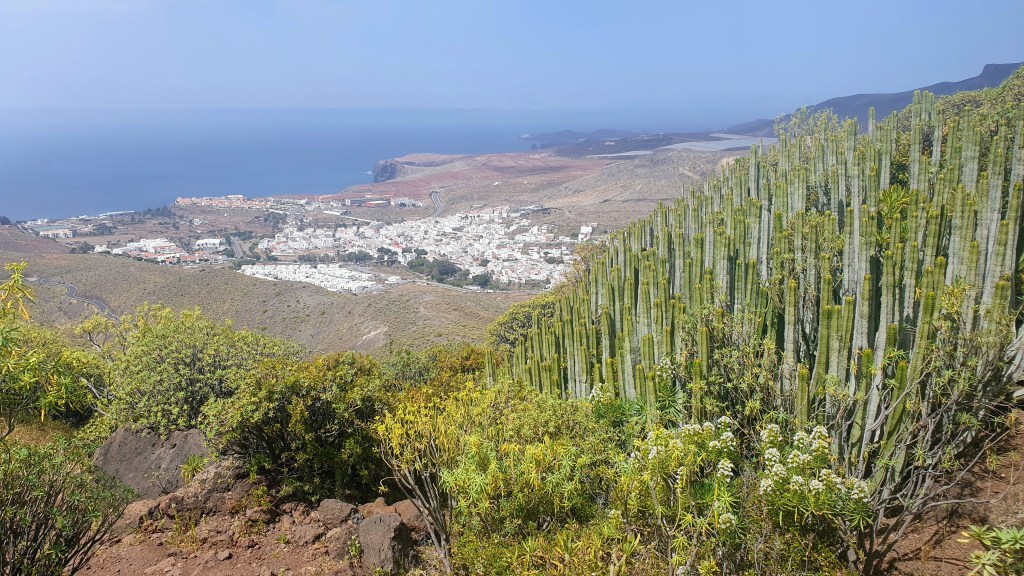
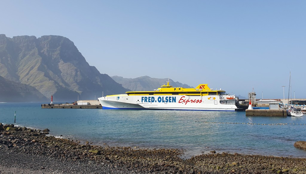
Anyway the boat landed at the biggest town on the island, Santa Cruz de Tenerife in the north east, and I then hopped on a bus down to the southern tip at Los Cristianos before getting a connection to the trail’s southern start at Arona.
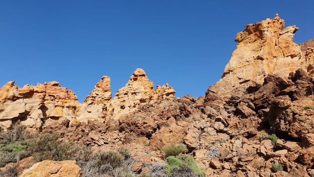
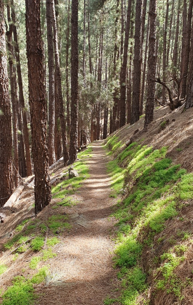
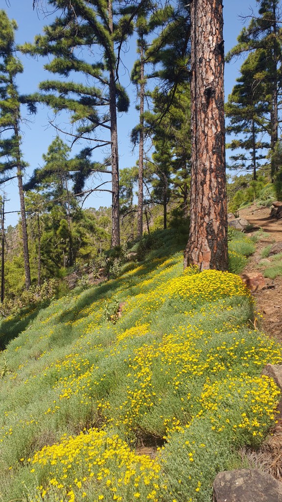
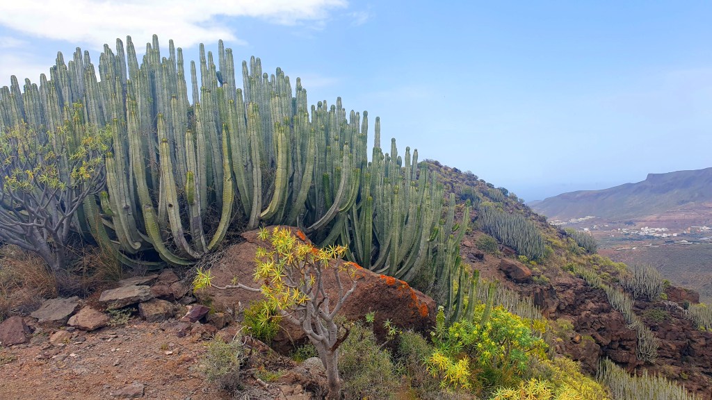
It was pretty hot again – maybe 28 to 30C – here at 4pm in the small town of Arona 600m above sea level. But it was going to get cooler as I set out up the arid, cactus landscape to the north. After collecting water to do me til tomorrow morning I set off and crossed a couple of dry barrancas which looked like old lava flows before climbing up to an attractive craggy hillscape around Roque Imoque. The air was really hazy again as in Gran Canaria so I lost sight of the coast but the hiking was on great trails and I soon entered shady pleasant pine forest causing the temperature to dip nicely.
I found a campsite on a rocky ridge in trees overlooking Barranco del Rey pleased with today’s travel progress and well established on the hike.
To Roque ImoqueFirst camp
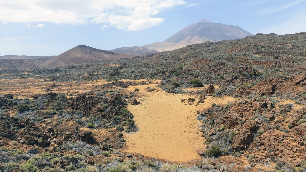
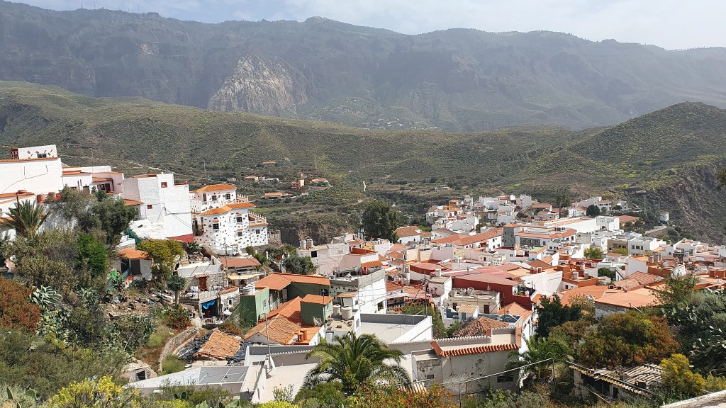
I continued the next day with pleasant undulating walking across pine clad hillsides on the southern slopes of El Teide, the island’s volcano high point at 3715m. I passed a concrete water tank where it would have been possible to collect water using buckets lying around and then remarkably some water potholes under a cool stone bridge. There was a running race about to start in the town of Vilaflor as I arrived at 10am and it was pretty vibrant and noisy as I bought some food and water for a few days then sat down for a coffee in the shade. I even managed to bathe my feet in town waterfall feature!
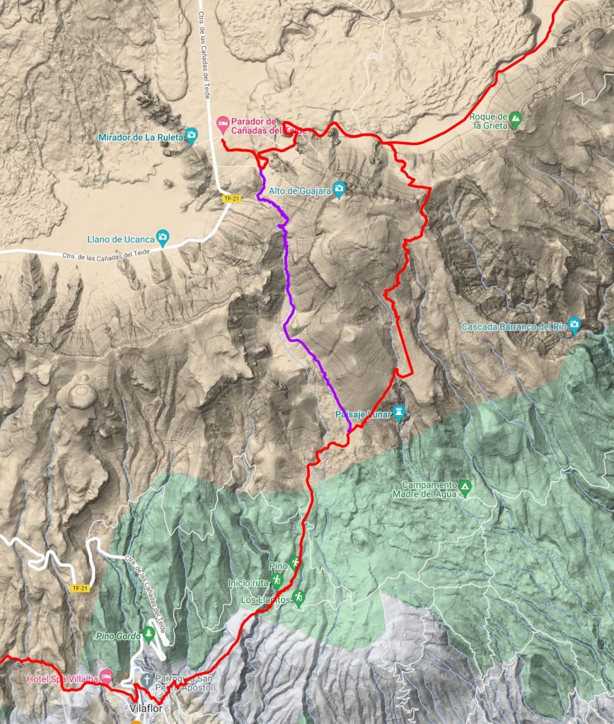
From there, the good trail climbed a bit more steadily to the edge of the treeline with views to raw lava hillsides above. I took a minor trail away from the GR131 rounding the west side of the hill of Guajara to get to the National Park centre at Parador. This looked an interesting route in itself and meant I avoided doing a part of the GR131 twice to get to Parador (purple line on map below).
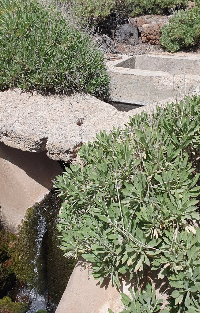
I was now climbing steeply up a valley on open lava slopes with feint trail and cairns. I followed a tiny (now broken) aqueduct line before coming upon a strong water flow emerging from a pipe into a concrete tank. Probably the best water source I saw on either of the islands!
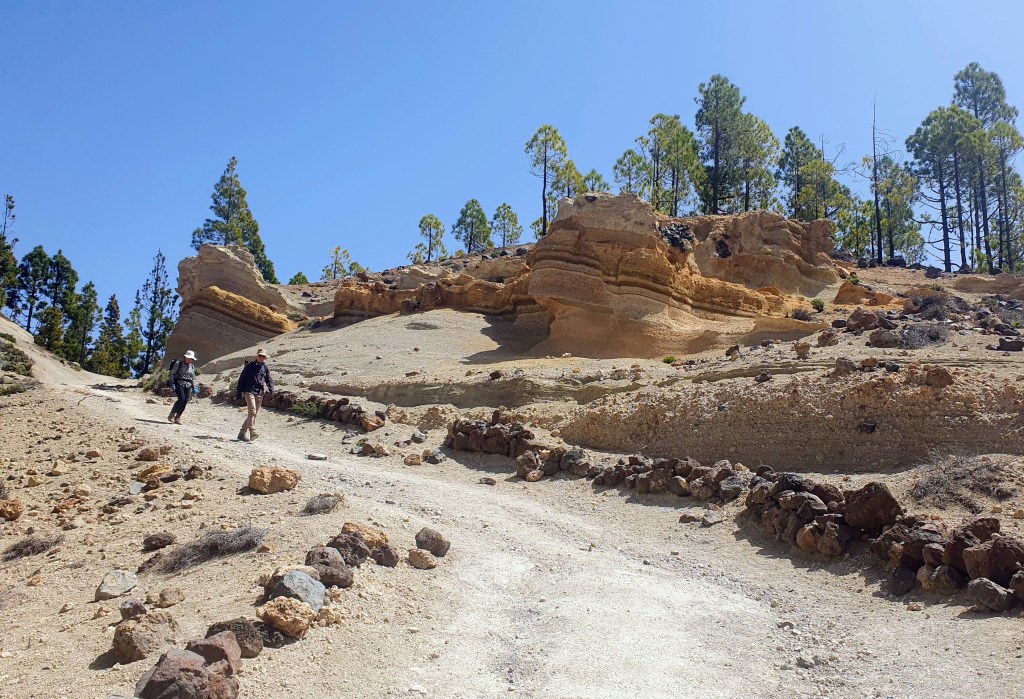
Pothole west of VilaflorVilaflor race startWater!Descent to Parador
After a lunch stop in the shade of a pine tree I pushed up to the col at 2,450m to views of El Teide at last! From the col there was a better trail zig zagging down to the valley below and Parador car park and visitor centre where I collected some more water for the night.
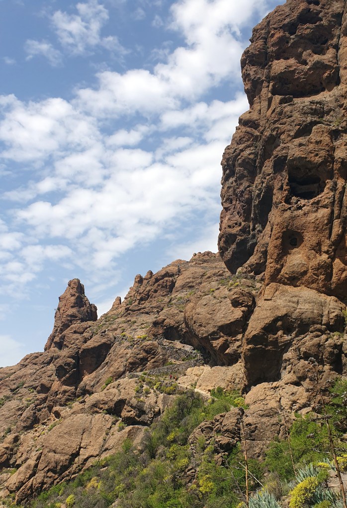
Leaving the crowds of tourists, I headed back east to the GR131 on jeep tracks past a cool looking climbing area of surreal volcanic pinnacles. The air temperature was now more pleasant higher up and the walking was scenic. I decided to climb up to another col to the south on the GR131 to camp to the east of Guajara and found some flat spots to pitch the tent. This was Degollada de Guajara, at 2,390m, the highest point on the GR131 in the Canaries I think.
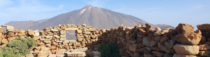
First thing in the morning I hiked up Guajara the hill beside camp with views across to El Teide and thankfully a bit less haze than on previous days. The ruins of an old observatory adorn the summit (see banner picture above), seemingly the first high altitude observatory. Returning back to the trail there was a long flat section on jeep track skirting the south of El Teide around the lava fields and I saw a few other hikers and runners here. I headed to the road at El Portillo Alto which had a couple of busy cafes so I hiked on down the road for a mile or so to El Portillo Visitor Centre. I wanted to pick up water but the taps at the toilet had ‘Non Potable’ signs up. Since this was likely my last chance for water before tonight I hiked back to the first café and sat down for a sandwich and chips and filled up on water there. Probably a 5km round trip….but worth it!
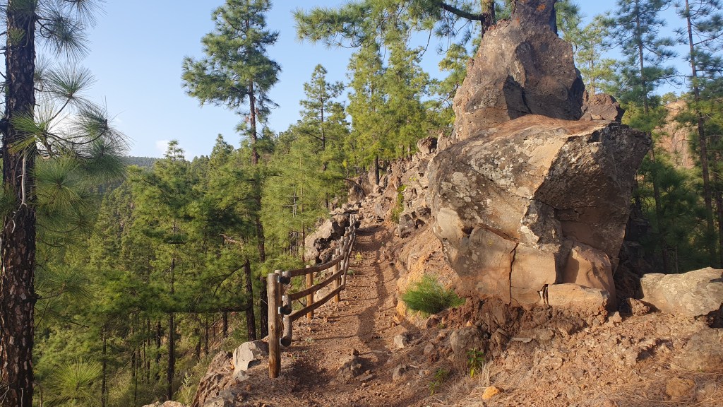
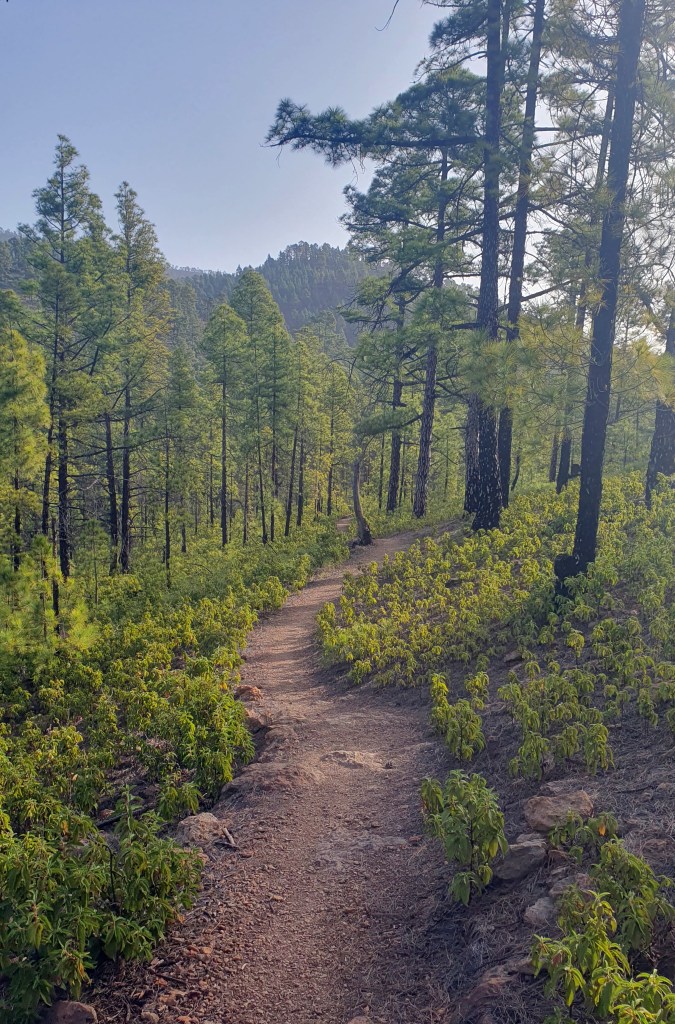
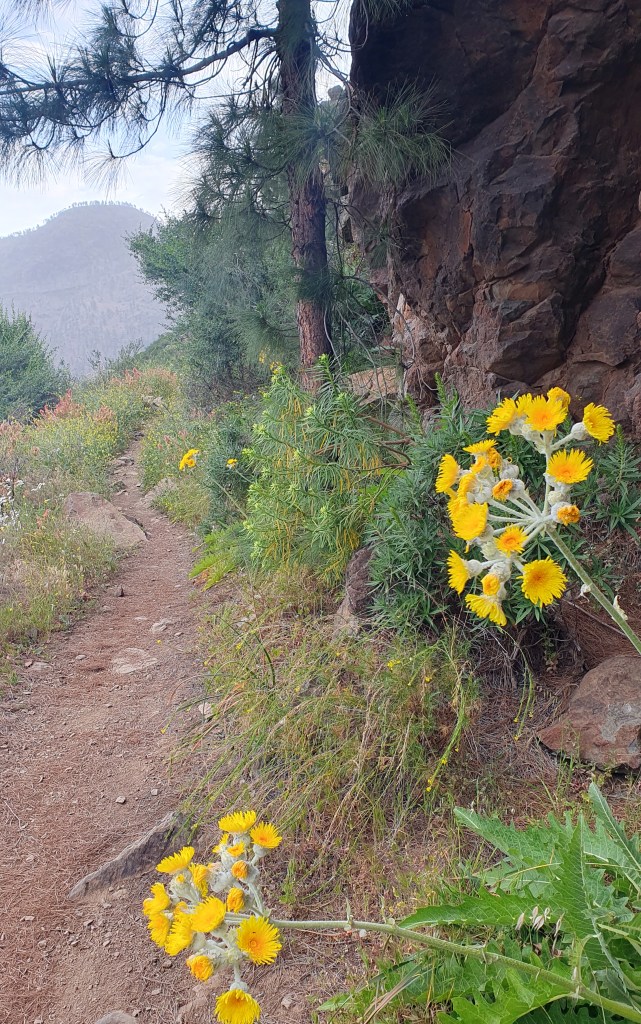
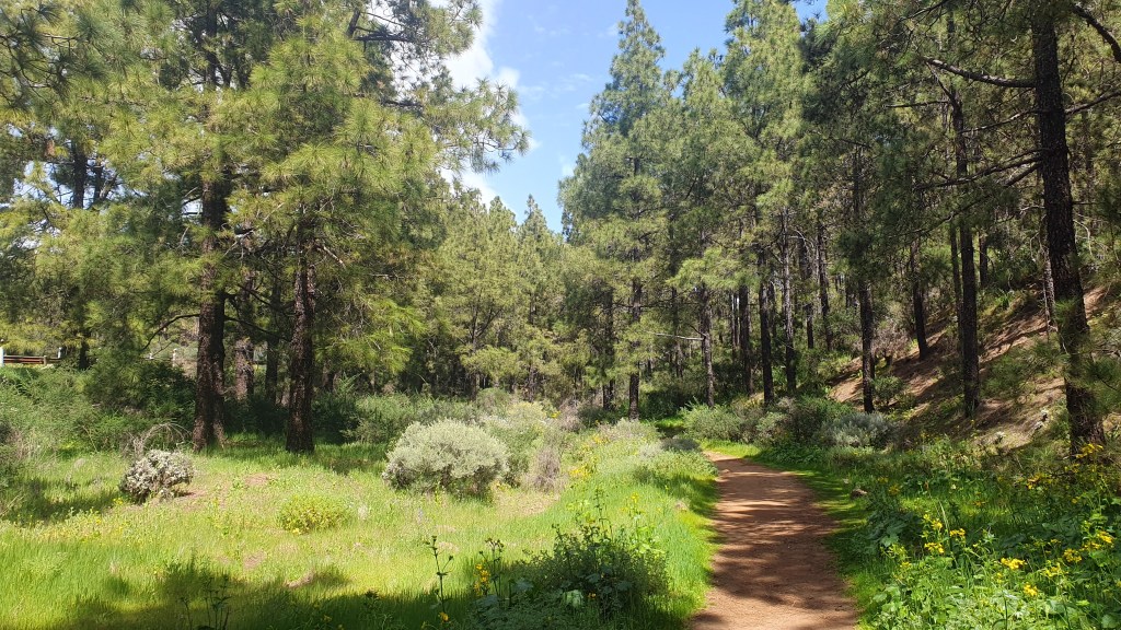
Next I descended north away from El Teide, down into pine woodlands on a track covered with ‘No Cycling’ signs but obviously ignored as there were deep rutted berms from mountain bikes all the way. At about 5.30pm I found a rocky river bed to cook up pasta and tea as a nice relaxing stop. The forest changed from pine to ‘laurisilva’ which is a mix of scrub and pine with some flowering giant heather trees. Unfortunately for me it didn’t provide camping spots but I lucked out by coming across an open wooden shelter with a table and a micro spot for the tent. Phew!
The dawn chorus in this forest was tremendous and I was away early in the cool air traversing across forested slopes to the recreational camp area of La Caldera. With high hopes of a shower, charging my phone, washing and a pleasant café I was a little disappointed. The café was closed, the power sockets were dead and about 6 buses of screaming school children arrived just before me! I did get a good wash though and treated the water ready for another dry camp that night.
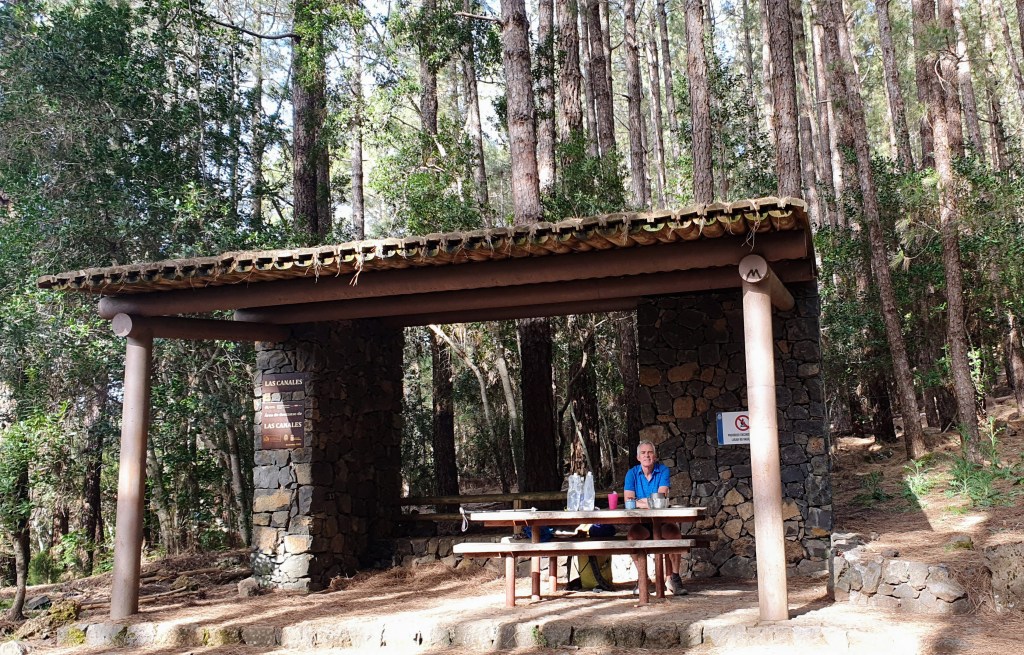
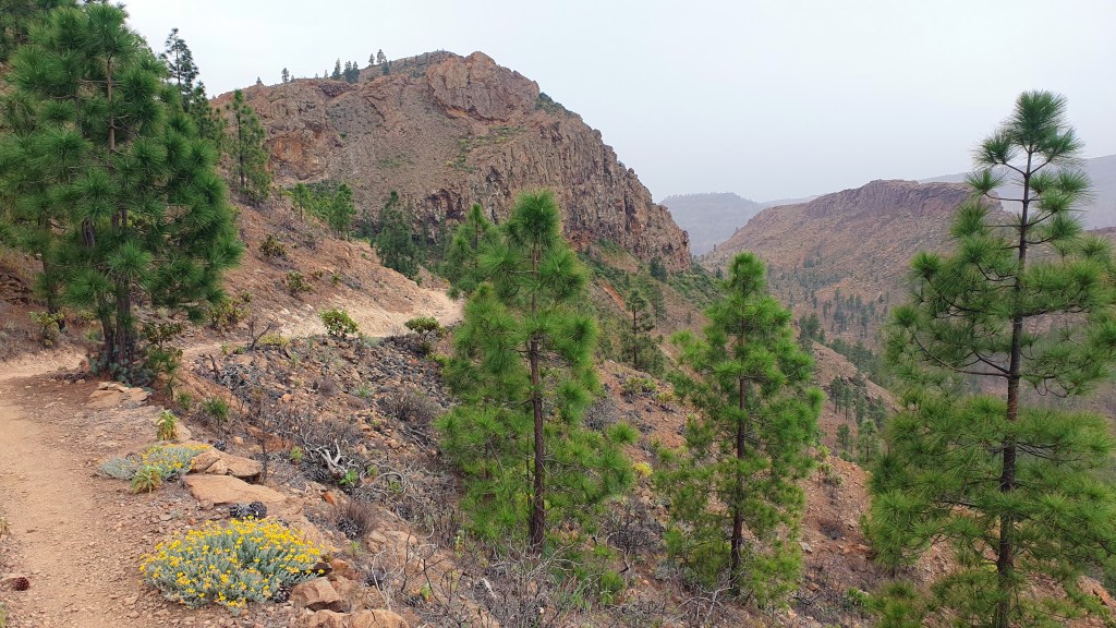
From El Caldera I climbed about 2,000 feet up in pine forest to reach a well crafted trail undulating round very steep sided hills – reminiscent of the Pacific Crest Trail in southern California. It was here that I met Toby coming the other way. He was hiking all the islands on the GR131 and had the tiniest backpack I think I have ever seen, using a poncho to double up as a tent. After an interesting chat about trails covering everything from Arizona to Sweden we departed on our ways with the temperature cooling nicely in the late afternoon. I stopped at the wooden shelter of Las Canales to cook up dinner with the luxury of a table and benches.
From here I left the pine forest and trail to hike along a less interesting managed forest on a dirt road. Camping options looked less attractive as well, but I was saved just before dusk when I saw a sign to a recreational camping area at Las Calderetas about 1/2 mile north of the GR131. It turned out to have good camping platforms at the edge of the forest and I happily plonked down in the dark after a good 20 mile day.
TobyLas Canales
All that remained was a short 4 1/2 mile potter to the northern terminus of the trail at La Esperanza the next morning. I got a bus straight away down to the larger university town of La Laguna and form there a second bus to Santa Cruz de Tenerife for a much needed hotel shower and good food before flying back to Scotland!
Thoughts on Tenerife GR131
Another really nice short backpack taking 3 full days and two half days at either end. The southern part is more arid with lava flows whilst the north mainly consists of good, well crafted trail contouring round mountain sides in sparse pine woodland akin to the Pacific Crest Trail in southern California. As per Gran Canaria, there was almost no running water so I had to plan out picking up water at recreational campsites, cafes and towns.
Again, a downside was the amount of toilet paper alongside the trail- carry it out please folks!!
The Canaries are a series of volcanic islands west of Morocco in the Atlantic- and a popular tourist destination for Europeans due partly to the consistent warm climate throughout the year. They also provide surprisingly good hiking including the long distance trail the GR131 which crosses the 7 main islands.
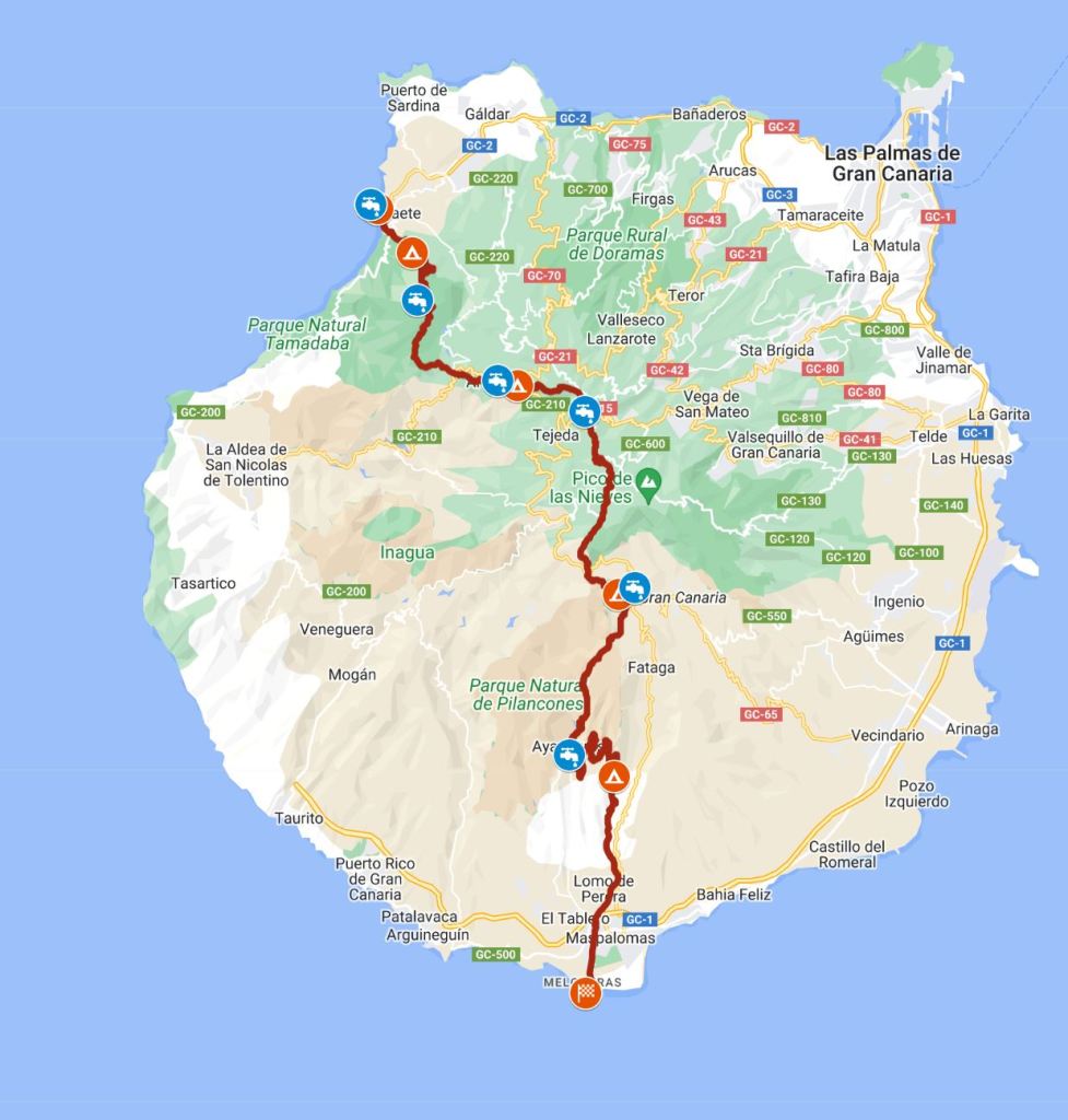
Brian visited Gran Canaria and Tenerife in late March 2023 for a 8 day backpack including a ferry between islands in the middle. I was armed with a guidebook, Cicerone’s Trekking in the Canary Islands as a kindle app.
Gran Canaria GR131 I hiked about 52 miles in 3 days (guidebook route is 46 miles)
Tenerife GR131 I hiked about 67 miles in 5 days (guidebook route is 58 miles)
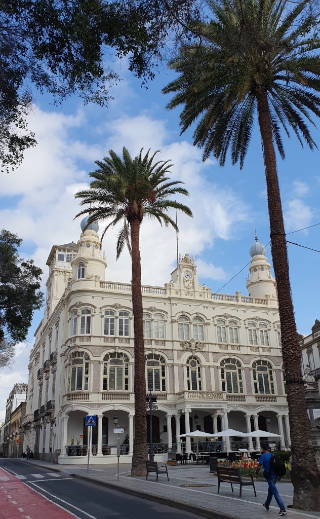
I arrived at Gran Canaria’s main town of Las Palmas and went on a search for a gas cannister for my stove. I got the screw on cannister for my gas stove at one of the two Decathlon stores outside town and a small scale map from a bookshop and was set to go.
Las Palmas colonial looking centre
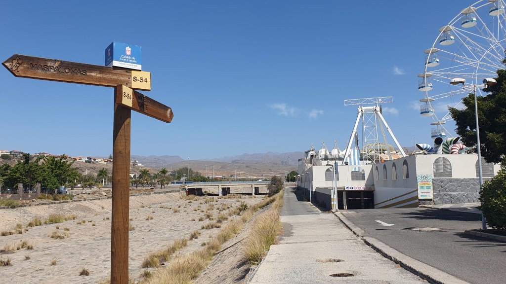
On March 21st – equinox!- I took a bus down to the southern tip of the island and the tourist beach resort of Maspalomes with its distinctive area of sand dunes.
It was hot as I headed off hiking north – maybe 28 to 30C. The start is alongside a messy dry riverbed, with litter and graffiti but I soon left this tourist coastal strip to climb slowly into the hills and more natural scenery.
The Cicerone guide’s follows a road for its first day to the small town of Ayagaures. Being keen to avoid the road I saw a line to the east on the map which followed jeep tracks up Barranco de Los Vicentes. This worked well for me providing a quiet wander up through an arid valley with cactus and palm trees lining the hillsides. I climbed up at the head of the barranco on a good trail to a viewful dirt road that zig zagged down to Ayagaures to rejoin the guide book route.
The attractive looking café/bar in town was closed unfortunately but I was able to collect some water from a nearby house and climb out past two reservoirs into pleasant sweet smelling pine. These looked a little like the ponderosa pine that grows in the US in high desert areas and provided some welcome shade in the still hot late afternoon. I found a good viewful campsite at a col at 950m after 15 sweaty miles!
I should say that camping is technically not allowed but I didn’t have any problem ‘bivouacking’ – that is setting the tent up discreetly at dusk and heading off in the morning soon after dawn. Of course you need to keep a clean camp if doing this and follow leave no trace principles. One thing to be particularly mindful of is not to light any fires and be very careful if using a stove as the ground was extremely dry and packed with pine needles that looked very combustible.
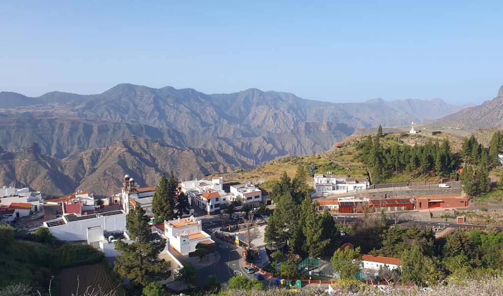
Next day I followed a really good trail into the mountain village of Nunte (full name -San Bartolome de Tirajana) by mid morning and stopped off for coffee and cake at one of the cafes and stocked up on some more food at the shop. I met some other hikers here, a lovely spot to hang out or I guess you could overnight too.
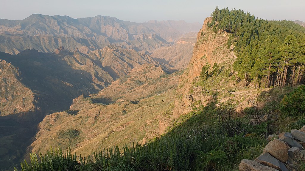
The trail I had hiked to here looked like it is used a lot by mountain bikers – although I didn’t see any – and wound its way through some rugged hillsides. Unfortunately, although the weather was hot and stable, there was a constant dusty haze which reduced the visibility a bit. Someone said to me that it was a wind bringing sand over from West Africa but I wasn’t sure if that was the reason!
More really nice trail followed for the rest of the day, staying high and weaving round the sides of mountains and then through upland plateau. The distinctive pinnacle of Roque Nublo stuck out like a thumb from the surrounding hills.
Later I reached a road at the col of Cruz de Tejeda which also had a café and a toilet block where I could collect water. It was 4pm and the café had stopped selling food so I cooked an early dinner and washed myself and my clothes as best I could. I didn’t see any running water on the trail in Gran Canaria so I relied on cafés, toilet blocks and buying bottled water at grocery stores along the way.
I hiked out beyond the pass in the evening with slightly cooler air and found a good camp in the woods perched above a cliffside. 18 miles today with lots of up and down.
In the morning I met another hiker, Nikoli from Belarus and we had a chat at Artenara, a picturesque village overlooking the steep sided valley to the south. The way ahead was mellow, wandering through pine clad hills with views out west down to the sea. I stopped off at the recreational area of Tamadaba for lunch in the trees then headed north to plunge downwards towards the sea at Agaete.
Jeez it was hot down there, maybe 35+C I would guess but the trail was superb finding a way down a steep band of cliffs and finishing right in town. About 20 miles today and I booked a room in a hostel ready for a ferry trip the next day over to Tenerife!
Thoughts on Gran Canaria GR131
I enjoyed the hike, it was scenic with great trails and enough town or café stops to make it easy to resupply. It was hot though and perhaps November – early March might be the best time to hike.
The island also looks good for road cycling and mountain biking if you are into that.
One downside was the amount of toilet paper along the trail. This is the most I remember seeing on any hiking trip and is a bit disgusting to be honest- carry it out with you folks!!
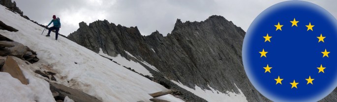
This page provides links to a few visits to Africa and the Middle East, mostly based around climbing or hiking…
Morocco 2008 (Photos) from a backpacking trip round Toubkal, northern Africa’s highest point, plus visits to Marrakesh and Essaouira
Jordan 2000 (Blog) of a rock climbing trip to Wadi Rum by Brian Dickson and Gavin Rees. We also visited the ancient city and UNESCA site of Petra for 3 days
Kenya 1995 Climbs on Mt Kenya and safari in Tanzania
Kenya 1992 Climbs on Mt Kenya and a visit to Mombasa on the east coast
Introduction For all Martina and I’s backpacking over the years, we have actually done very little long distance walks in our home country of Scotland. I guess one of the reasons is that we have explored Scotland extensively as part of hillwalking, climbing, kayaking and other trips such that there is less of a sense of discovery for us here. Not to say that Scotland isn’t fantastic with its beautiful mix of hills, sea and islands, ever changing light and accessibility throughout the year. And there is still plenty new for us to see, particularly around the coasts. But Scotland also does have challenges for backpacking over many days, with principle adversaries being wet weather with boggy underfoot conditions and, in summer- the midge!
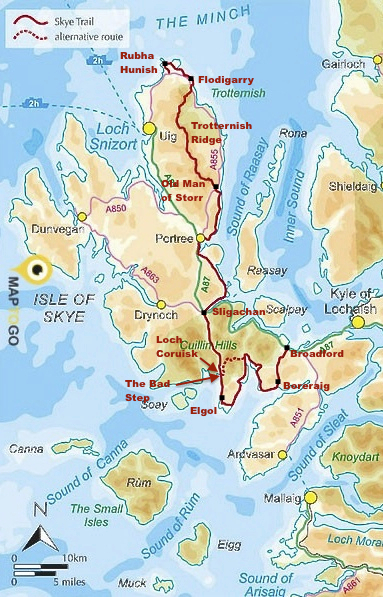
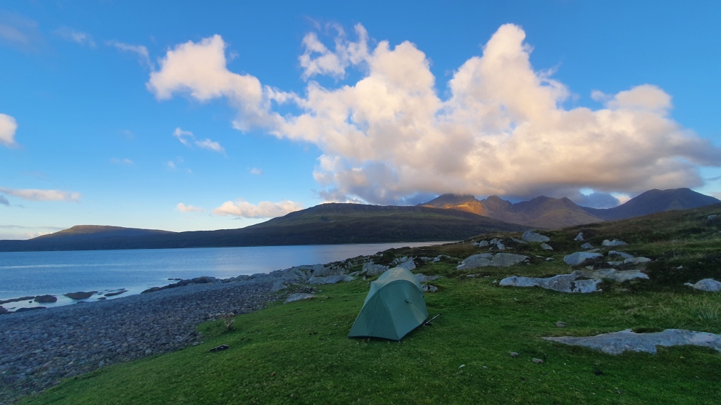
The Isle of Skye though has a potentially wonderful backpack of about 7 days duration and 80 miles (130km) called the Skye Trail. Brian thought he would give it a go in the autumn of 2022. You can see maps of the route at Walkhighlands along with an excellent web guide and app.
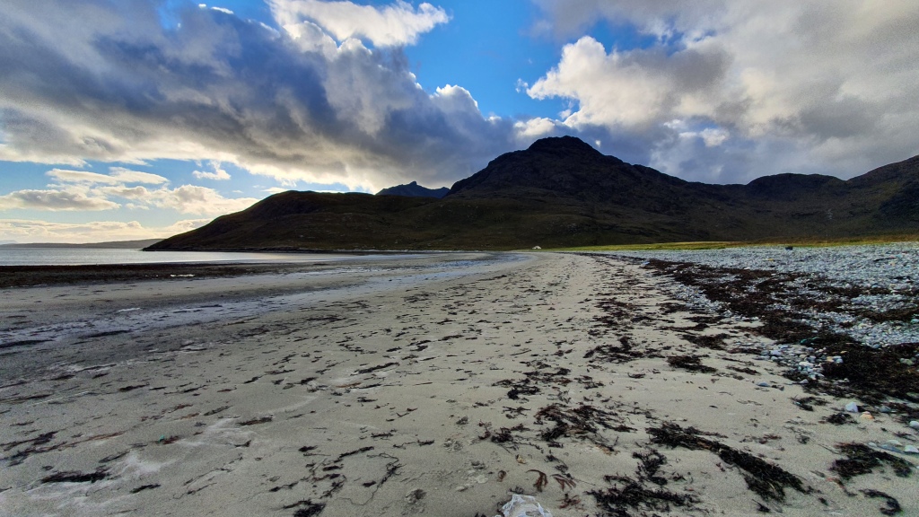
Day 1 Broadford to Torrin This was a short easy day. I started late from Broadford around 4pm but still made it just short of Torrin to camp at the bay of Camus Malag before joining road. The trails are dry making for relaxed walking over to the coast at Boreraig, with its town ruins evidence of Highland Clearances described in Walkhighlands. There is a lovely coastal path round to Loch Slapin and the views of the mountain Blabheinn (pronounced Blaven) in particular are spectacular. A really enjoyable mellow start.
Day 2 Torrinto Elgolto Camasunary This is another short guidebook day and I hiked on from Elgol for an extra few hours to camp to the north at Camasunary Bay. I started with a road walk through the small settlement of Torrin (the cafe was closed unfortunately!) and round the head of Loch Slapin. Good views to the mountains here and there is roadside camping opportunities next to the sea but you may need to share with campervans. The route leaves the road at the Blaven trailhead following a trail south for about 4km to return to the tarmac.
[Note that you could do a wild alternate here by hiking to the summit of Blaven, then down its south ridge to Camasunary. The panoramic views are great, but its a 3000 feet climb with rough ground on the descent and some scrambling. One for good weather. Maybe on balance I would recommend the Coruisk – Sgurr na Stri alternative below instead.]
I had showers and rainbows as I hiked through Kirkibost [a shortcut alternate takes you direct to Camasunary from south of here on a landrover track but its not as good as the normal route]. then a series of again viewful tracks south above the coast to near Spar Cave. I didn’t visit the cave but I think it would be a superb diversion-note you need a low tide to access it.
Another quiet road headed east over to Elgol. More great views out to sea and across to the Isle of Rum.
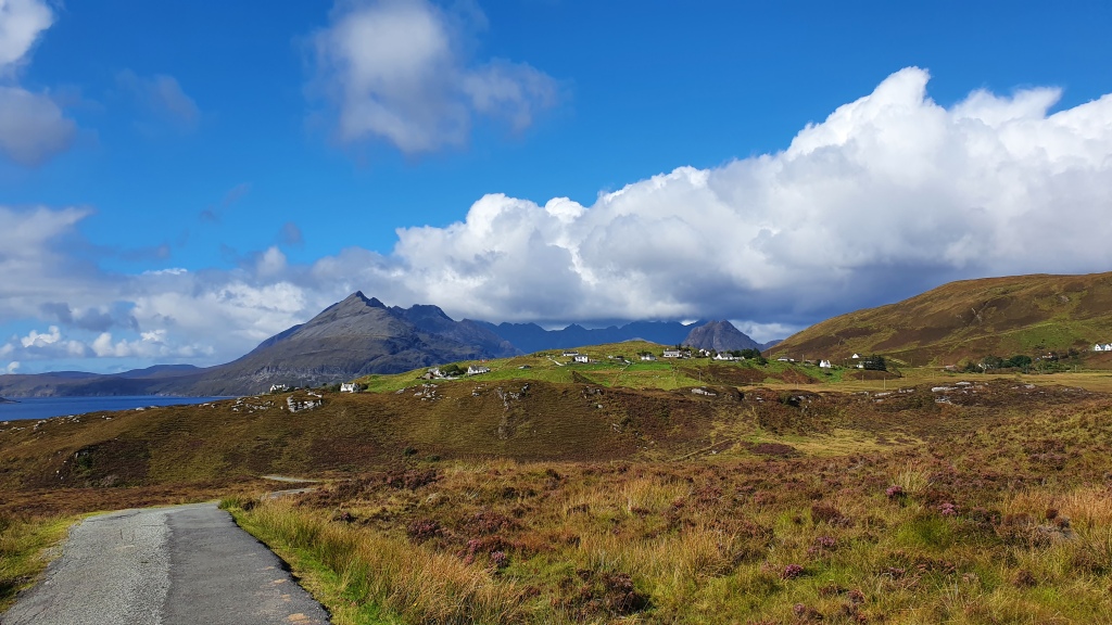
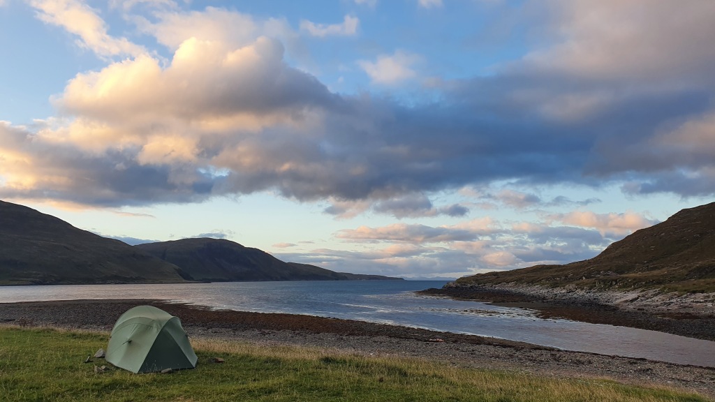
I stopped at Elgol for a late lunch before turning north on a excellent trail on a coastal escarpment to Camasunary. This was the best section so far as I headed along the, at times exposed, trail looking to the Cuillin mountains. You could camp at Glen Scaladal, there is some beach plastic ‘flotsom and jetsom’ but its still a good spot. I stopped beyond at Camasunary Bay to camp (there is also a popular bothy here you could stay at). Superb day.
Day 3 Camasunary to Sligachan The normal route here is straightforward following Glen Sligachan north on a good trail. This provides everchanging views to the Cuillin peaks above but stays low in a valley and misses the Cuillin mountains themselves which is a pity.
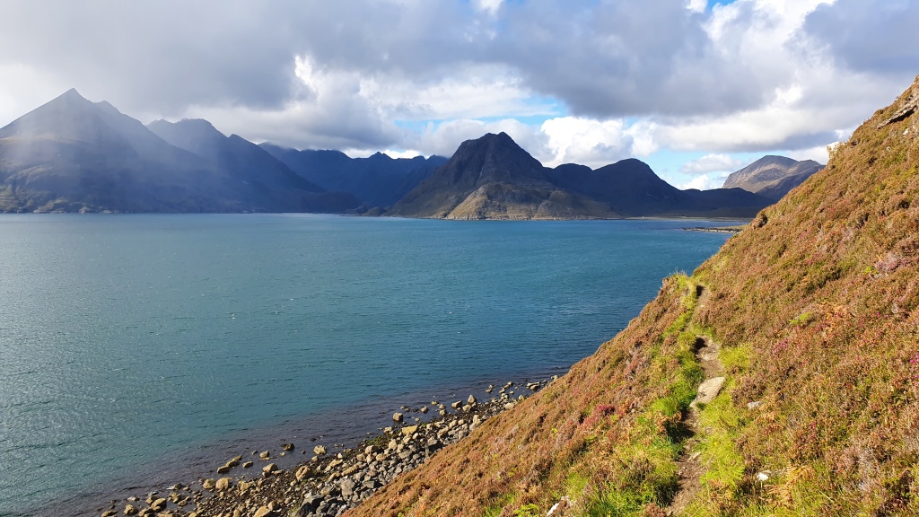
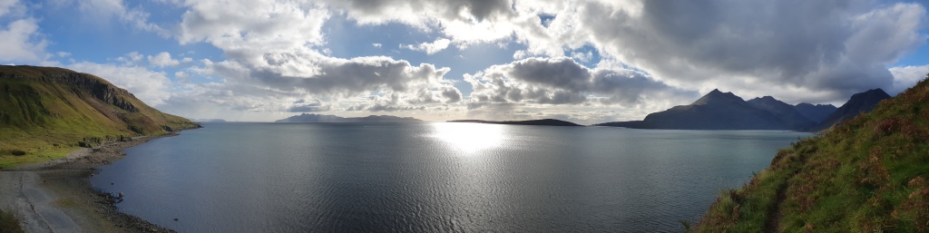
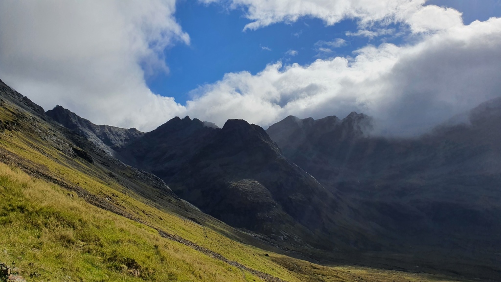
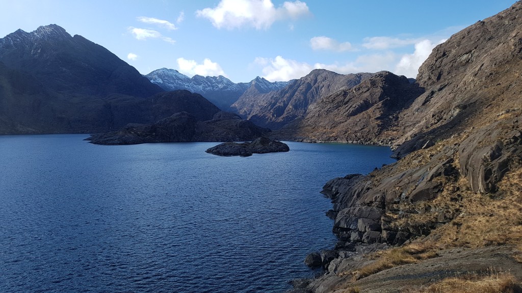
I took a somewhat more interesting route round the coast to Loch Coruisk via the ‘Bad Step’, then along the south of Loch Coruisk, up over the Cuillin ridge at the pass Bealach na Glaic Moire then after some scrabbling scree descents I connected with trails on the west of the mountains to Sligachan.
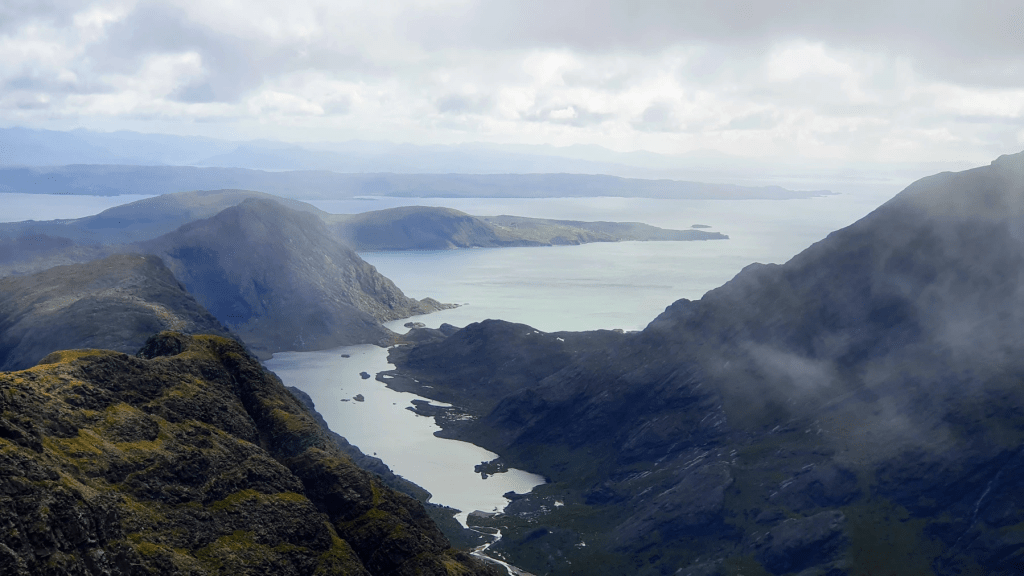
My day started with a crossing of the river west of Camasunary over some stepping stones about 300m inland from the sea. I managed to stay dry which was a bonus – I have been soaked here before as it’s tidal and the river rises a lot during wet spells. Next up was a grand rough trail round the coast to the outlet of Loch Coruisk. This is atmospheric territory and reaches a crescendo at the ‘Bad Step’ – a sloping slab of rock perched above the sea. It is short and requires a Grade 2 (US Class 4 maybe) scramble using a crack line as a hand rail. Once past that I followed a faint trail through a short section of boulders and deep vegetation before exiting out over a shallow pass to Loch Coruisk. This was a fantastic spot with the loch walled in by imposing mountains.
There was a strong wind funneling down the loch and it was tough going along the lochside with lots of bog then a steep haul up to the high pass, Bealach na Glaic Moire, on the Cuillin ridge itself. I stopped for lunch hunched down behind a boulder from the gale force winds but the views were superb. The descent involved some (to be honest unpleasant) steep scree before I picked up a good trail above the crowded ‘Instagram spot’ of the Fairy Pools. I sped on over the pass, Bealach a’ Mhaim, with heavy rain showers preventing me stopping for a brew of tea to relax. There are beautiful waterfalls on the way to Sligachan which are quiet- unlike the Fairy Pools -and would be great for a dip if it was a bit warmer! Another superb day.
Along Loch CoruiskThe ‘Bad Step’Showers on the west side of the CuillinsHeading to the ‘Bad Step’ (April 2021)
Back down to Loch Coruisk and Elgol from the pass
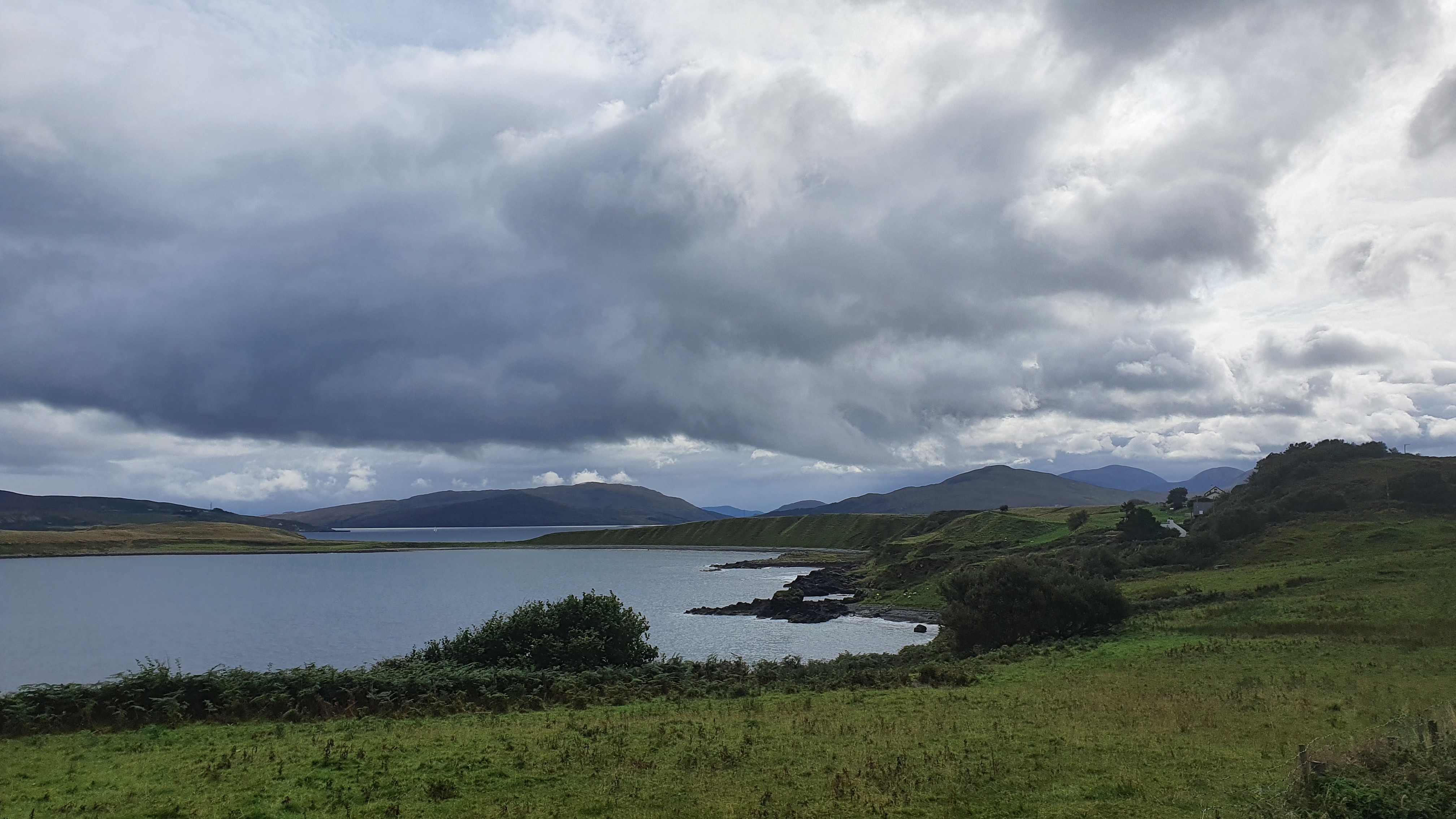
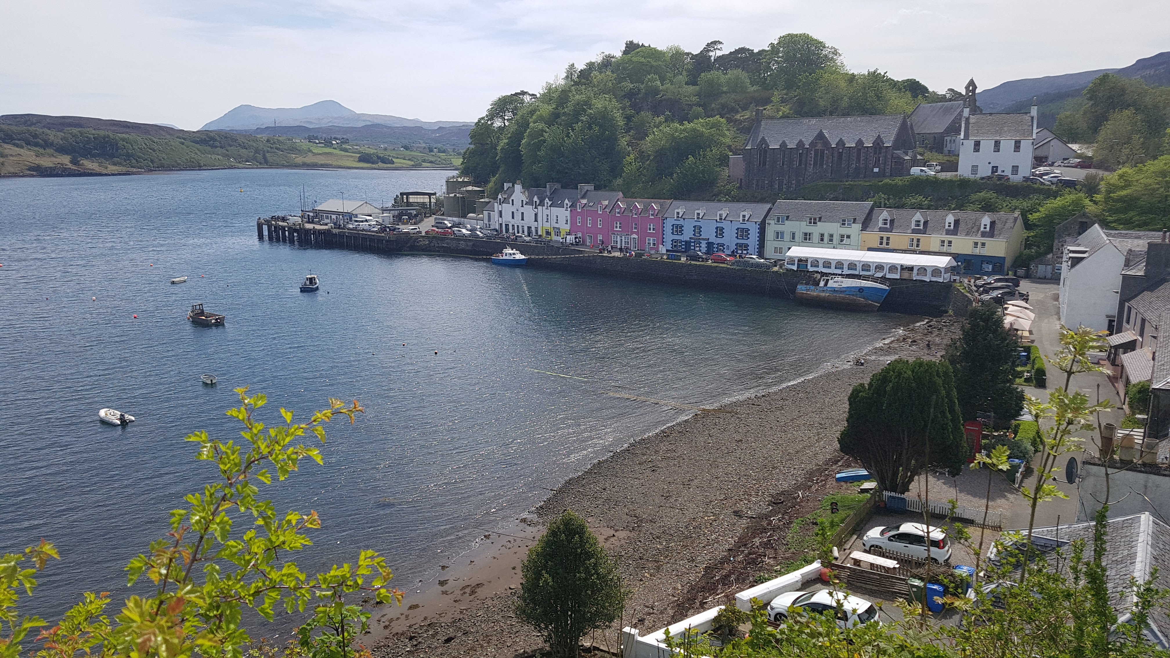
Day 4 Sligachanto Portree This is the least interesting day of the hike, more of a connector between the Cuillin mountains and the Trotternish ridge north of Portree. On the plus side the views can be good reducing the slightly dull 10.5km of road walking. I set off from Sligachan campsite in dark cloudy weather and followed the pleasant path along the north shore of Loch Sligachan. Views are good (again) and you see the Raasay ferry setting off on its short voyage. Unfortunately the sky’s opened once I hit the minor road so it was ‘heads down’ fast walk from there into Portree for me.
Back south to Raasay and Scalpay
Day 5 Portree to The Storr trailhead It was raining hard in Portree and checking the forecast showed more rain for the next three days so I reluctantly stopped at this point and intend to return to backpack the remaining 3 days in better weather.
I did do this section in May 2021 though. A good trail leads round Portree harbour and bay- I saw both sea eagles and golden eagles on the climb out onto the ridge to the north. Views back to the Cuillin mountains and over to Raasay are splendid. It gets a bit boggier descending north but there is a short road you meet above Bearreraig Bay. I took the steep path down to the bay past the hydro station to its cool beach and fossils. A short but excellent day with Portree bay and a ridge walk.
Portree
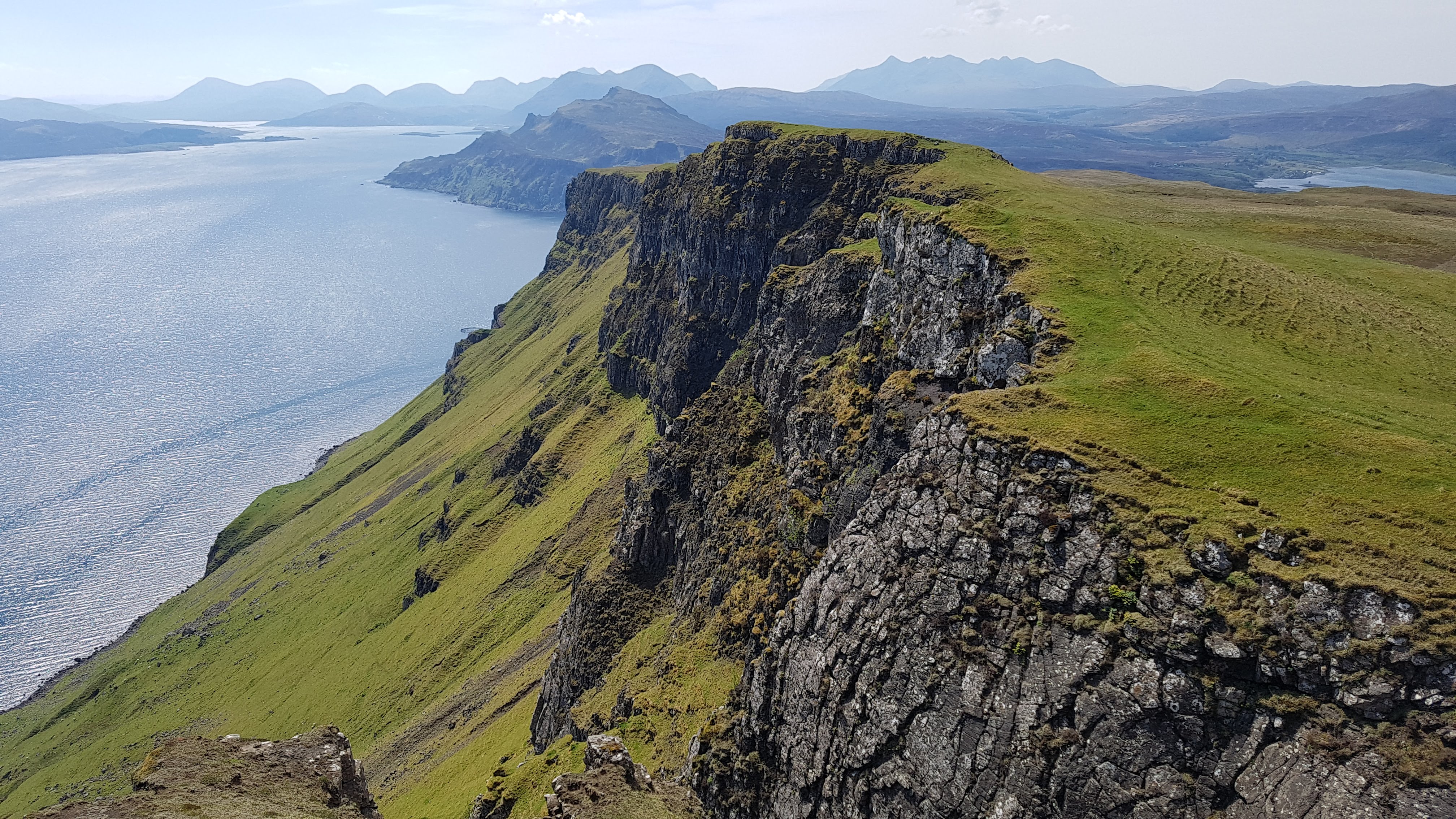
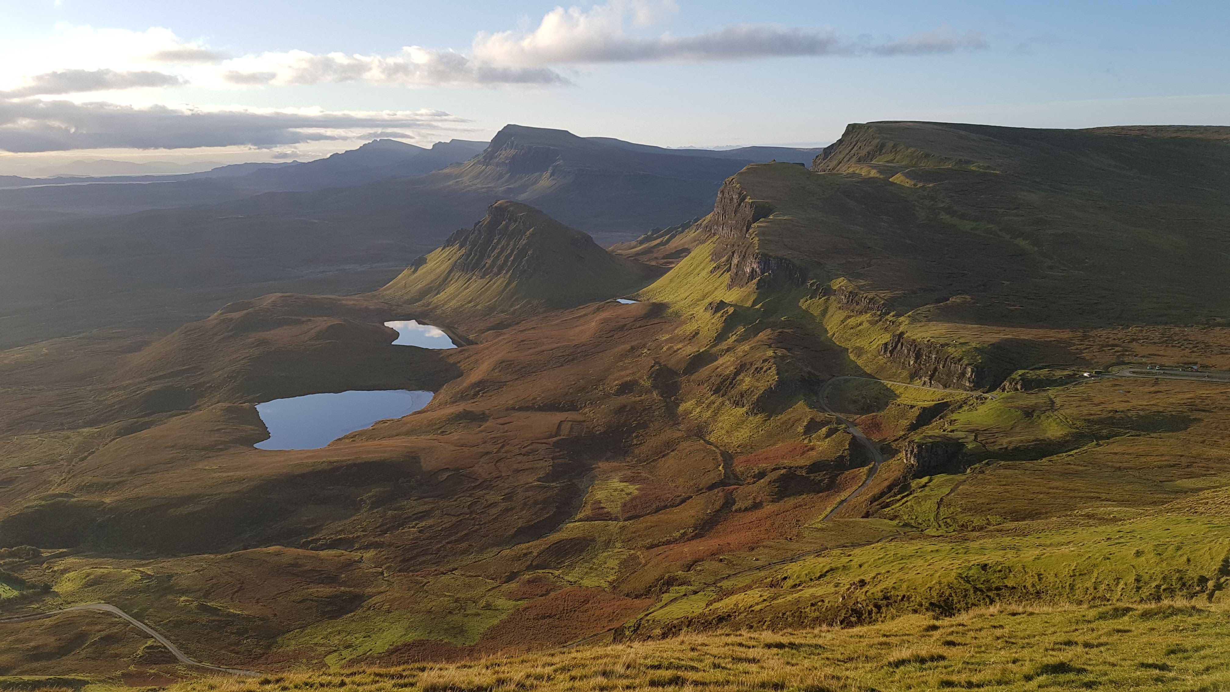
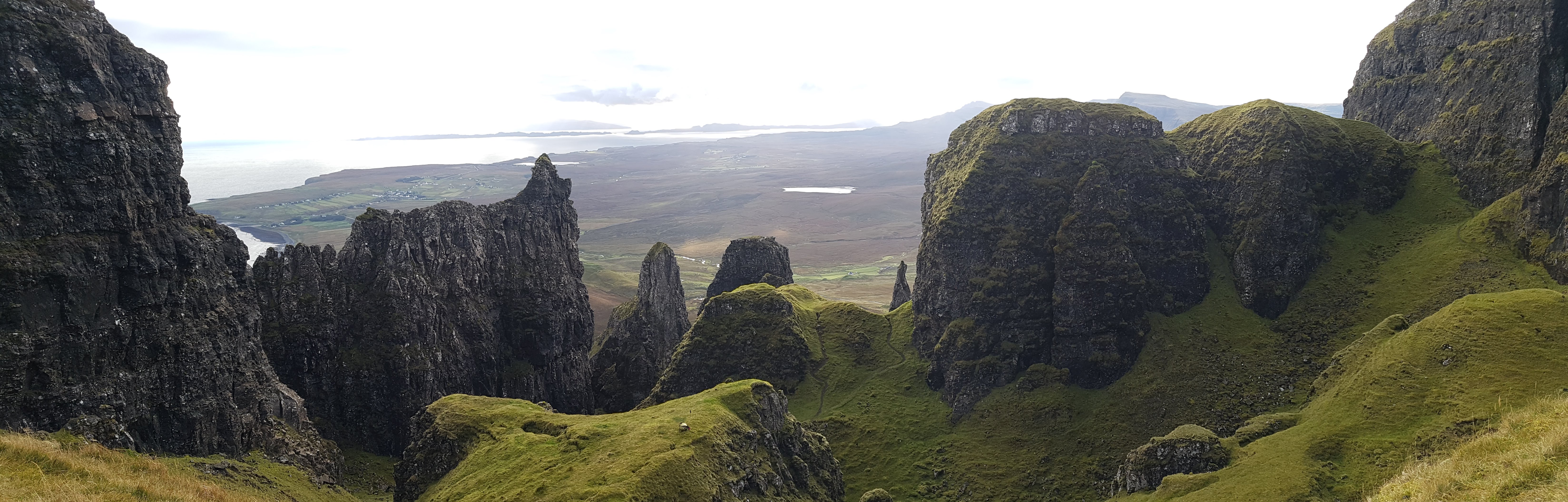
Day 6 The Storr to Flodigarry – Trotternish ridge Again I have hiked this ridge in the past and it is a brilliant undulating grassy ridge walk with expansive views. To the east are the hills of the mainland and the isles of Raasay and Rona. To the west are the island chain of the Outer Hebrides. At both ends are the weird rock formations of The Storr in the south and The Quirang in the north. Try and savor all of this on a good weather day.
Looking south down the Trotternish Ridge from the Quirang
The Quirang
Day 7 Flodigarry to Rubha Hunish and Duntulm A mostly cross country coastal walk to Sky’s most northerly point Rubha Hunish which has a wild spacious feel looking out across the sea to Harris.
There are a number of long distance hiking trails to the south of us in England. We have done some bits and bobs of these over a period of about 6 weeks and overall had a great time.
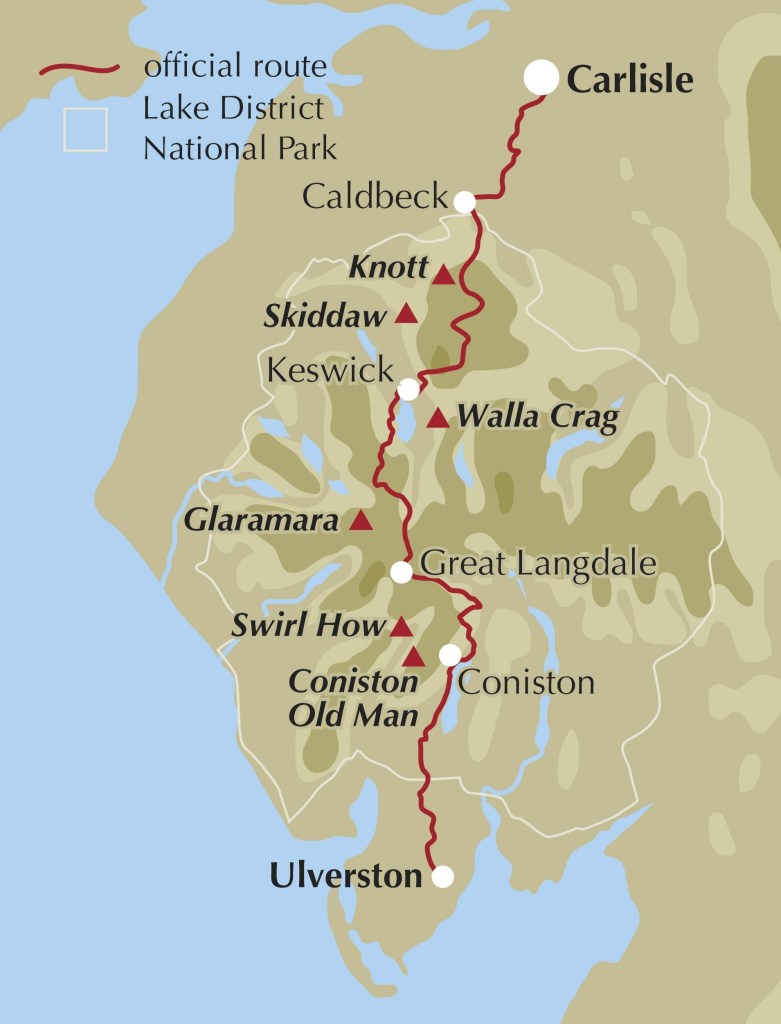
The Cumbria Way is a 70ish mile long route north-south through the Lake District National Park in northern England. Brian hiked this over 4 days and 80 miles in August 2022 with some variations to ‘bag’ and camp on hill summits.
Overall I found it a nice, mellow hiking route with plenty of lush bucolic Lakeland scenery. It provides great opportunities to hike variations as I pleased with an almost unlimited labyrinth of trails criss crossing the lakes which could be connected up.
The trail has two distinct characters; the first and last 15 miles or so are outside the Lakes and are at low level, crossing farmland, often along field edges with views to the distant hills. The central section from Caldbeck in the north down to about Coniston Water goes through the heart of the Lakes and offers classic beautiful scenery.
The going is on trail the whole way, but it isn’t that well waymarked and I found that I needed to keep a map at hand at each of the many trail/road/field intersections. The trail can be hiked in either direction and I hiked south from Carlisle but the guidebooks and most other hikers go from Ulverston north.
Most people do the trail in 5 days and stay in towns along the way; either B&Bs or campsites. It is possible to wild camp – as I did for 2 of the 3 nights – as long as you ‘stealth camp’ responsibly i.e. pitch in the evening and break camp early in the morning and follow leave no trace principles.
I used the Cicerone guide which had pretty good background but would be more useful for a northbound hike as that is how it is written. I love the Cicerone guides in general but this one is quite text based and was tricky to read going in the other direction. In retrospect maybe the Harvey strip map of the route would have been more useful. I also downloaded Ordnance Survey topo maps to my phone (I used the OutdoorActive Android App) which was very handy.
Getting to the start and finish is straightforward as both are well served by railway. Trains run a number of times every day between Carlisle and Ulverston and take between 2 to 3 hours (you can choose to pay £40 for the 2 hour fast route or £18 for the slower 3 hour route- you make your choice!). Here also are a couple of good web sites on the trail:
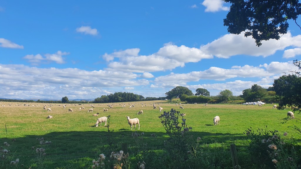
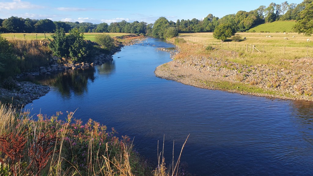
I parked my car at a Council site near Carlisle train station (a bargain at £3 per day) and set off south at about 3pm. Camping spots are a bit tricky in this first section leaving Carlisle so I decided to push on to Caldbeck 15.5 miles away which has a great wee friendly site including a ‘hiker biker’ area. This day pretty much follows the Caldbeck River all the way to Caldbeck itself. It starts in the city of Carlisle but soon is out in at least suburban and then semi rural territory on a mix of paved cycle ways, trails, fields and dirt roads. A trail closure (temporary hopefully) north of the town of Dalston was a bit of a surprise and I ended up doing a longer route round finishing with 2 miles along the grass verges of a busy B road. Not great hiking but I got past the closure quickly at least.
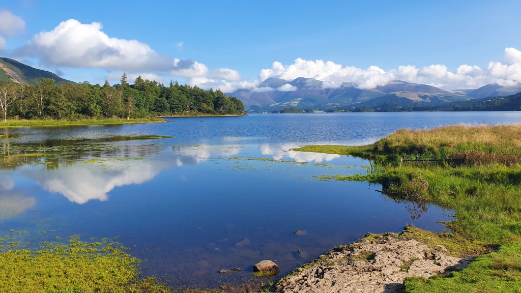
Day 2 Caldbeck – Keswick- Walla Crag
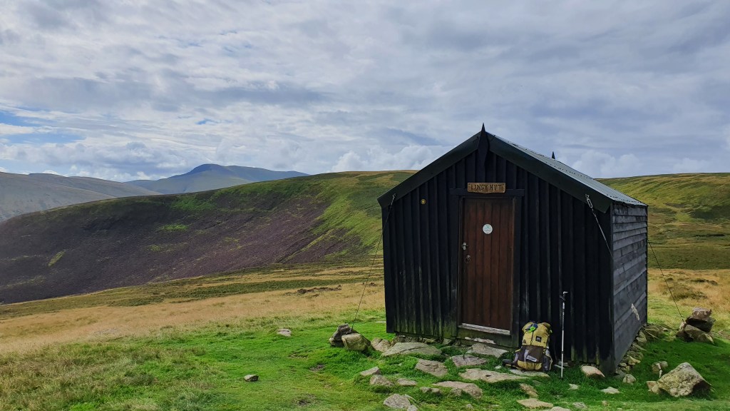
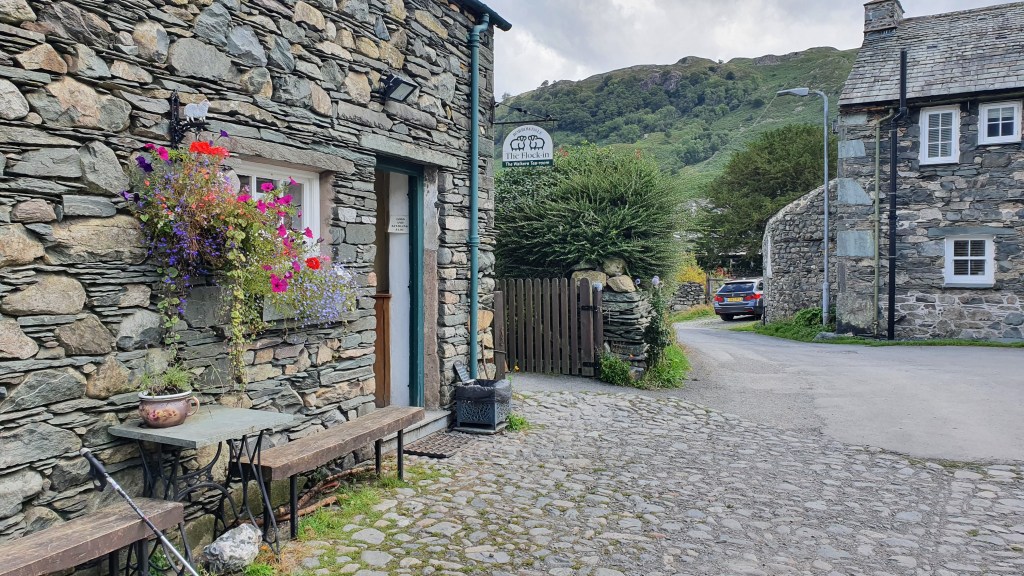
Caldbeck is a lovely village with a campsite, 2 cafes, pub/hotel and friendly village store. From here the route climbs into the ‘fells’ of the Lake District to High Pike with panoramic views south to the hills to come, out east to the Penines and back north to Scotland. There’s a cool small wooden hut on the way – ‘Lingy’ – maintained by the Mountain Bothies Association which would be a good overnight stop.
Caldbeck store with comfy cushion seats- perfect!Lingy BothyInside Lingy BothyHigh Pike
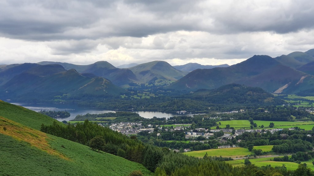
I deviated off to ‘bag’ Knott, another hill nearby that I hadn’t climbed before. It was well defended though with boggy, tussocky ground so was hard going! Back on the Cumbria Way I passed Skiddaw House then followed a viewful balcony trail around Lonscale Fell into the ‘bustling’ town of Keswick.
Approaching Keswick
I just realised that it was the Friday of a Bank Holiday weekend- and it was mobbed! I had some dinner and shopped for a couple of days food to make it easy to wild camp, then happily left town at about 6pm.
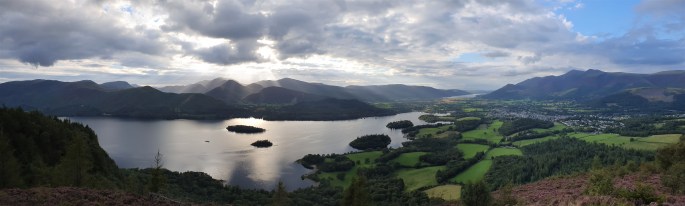
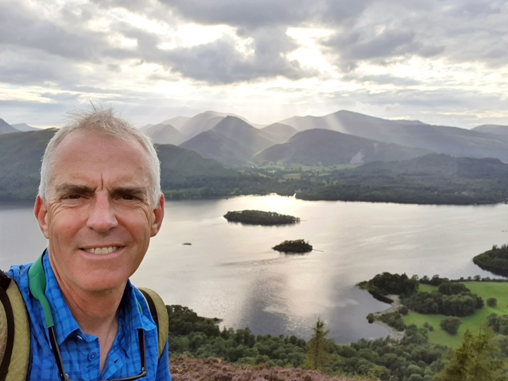
I took an alternate to the main Cumbria way by heading along some hill tops on the east of Derwent Water, rather than the official route which goes down the west side at low level. This also provided a great camp spot near Walla Crag….
Walla Crag camp
Day 3 Walla Crag to Lingmoor Fell
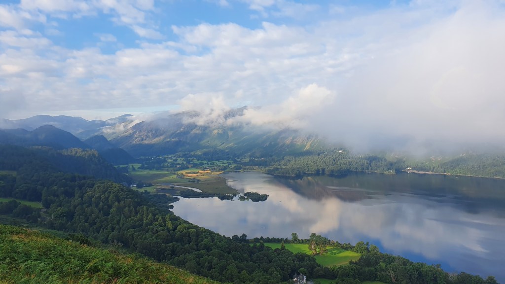
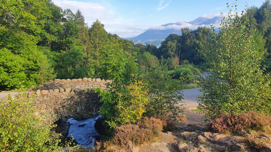
After a very still night with some mist down below, I had some midges around at breakfast but set off south with great views around and to Derwent water below. I soon made it down to Ashness Bridge with a short quiet road walk through forest then steeply down to the Borrowdale Hotel at the south end of Derwent Water. Above was a climbing cliff, Shepherds crag I have been to in the past with some classic routes.
Looking down to Derwent Water
There were good trails round the foot of Derwent Water and I soon rejoined the Cumbria Way again on mellow low level walking into the small cluster of rustic houses at Rossthwaite for a fine snack/ lunch stop at the café.
Ashness BridgeBack to SkiddawRossthwaite
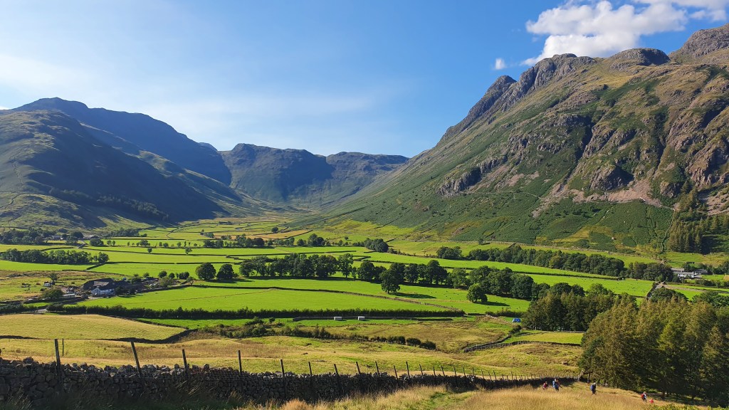
From there I headed out into more open hill country up Langstrath (the well named long valley). I sped past a couple of waterfalls that were thronging with people, but I did have a quick cooling dip in the river a bit higher up. The going got hot as I went over Stake Pass with it’s glacial drumlins and down to Langdale with more excellent climbing crags above.
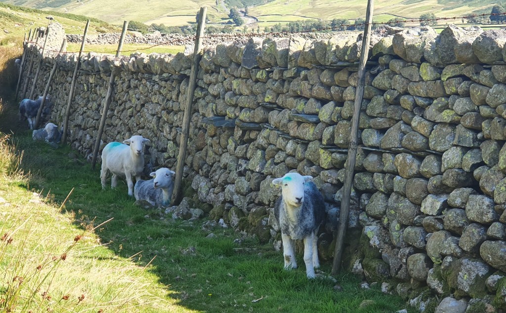
Herdwick sheep shelter from the sunLangdale
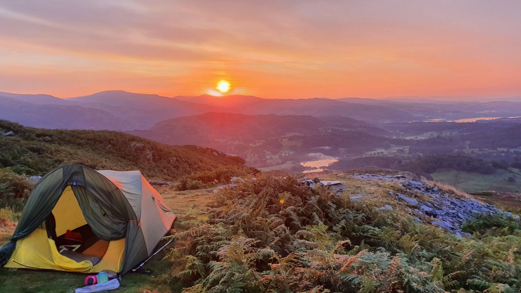
The hills again beckoned for tonight’s camp and I traversed Lingmoor Fell to the south of Langdale. Here I experienced a first for camping on hill tops- I needed to put in my ear plugs to dampen the sound of music floating up from a party in the valley below!
Lingmoor Fell
Day 4 Lingmoor Fell to Ulverston
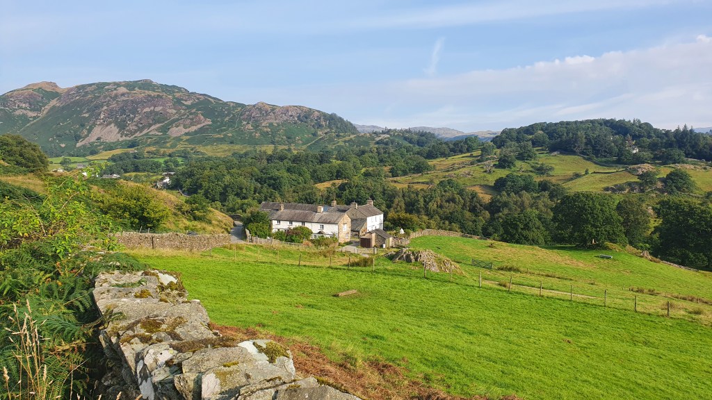
Another still, warm night and I quickly descended to Little Langdale then along lanes and trails to pick up the Cumbria Way again at High Park.
Back to Lingmoor Fell
I noticed my first Cumbria Way trail sign here- hoorah! Rolling lower level fields and woodland made for quick walking into the town of Coniston for early lunch. Hiking south of the town alongside Coniston water I took a well needed dip to cool down – superb! From there the Way headed over moorland covered in thick bracken and heather but thankfully with a clear path through the vegetation. I now had the ‘bit between my teeth’ and decided to push on to the end of the trail that day. The air was hot and muggy but the ground was dry and the walking was easy into the pretty town of Ulverston.