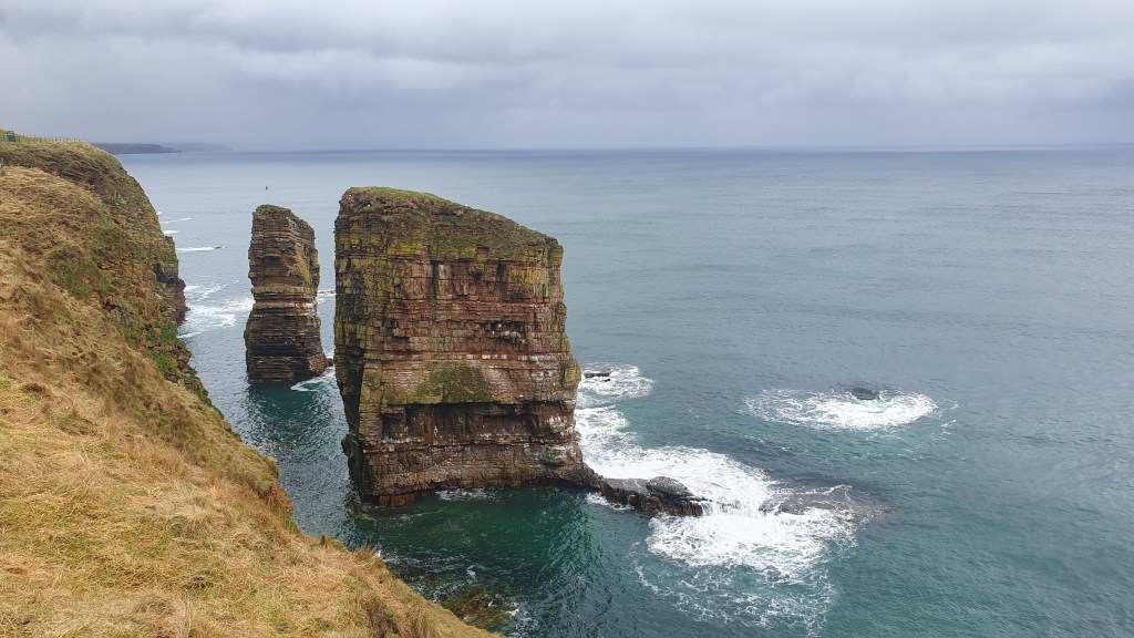
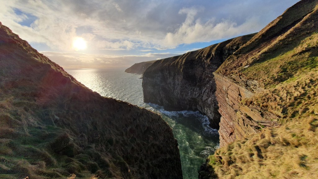
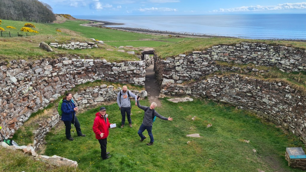
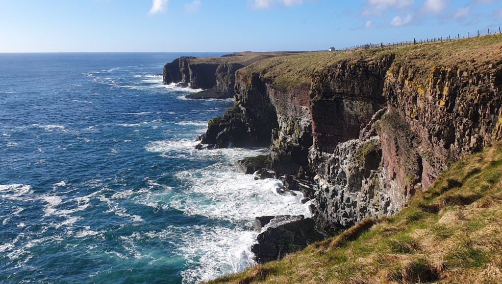
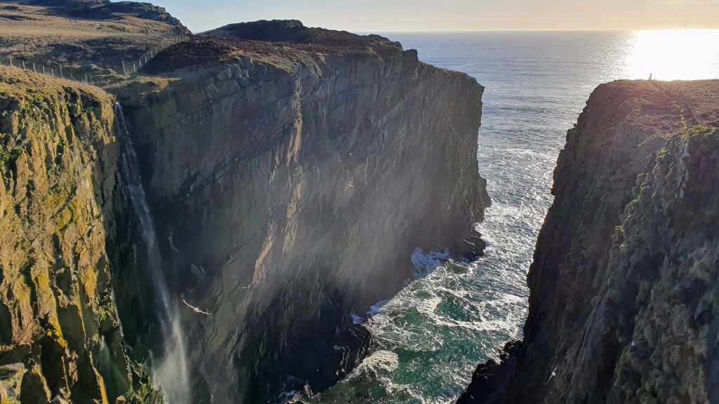
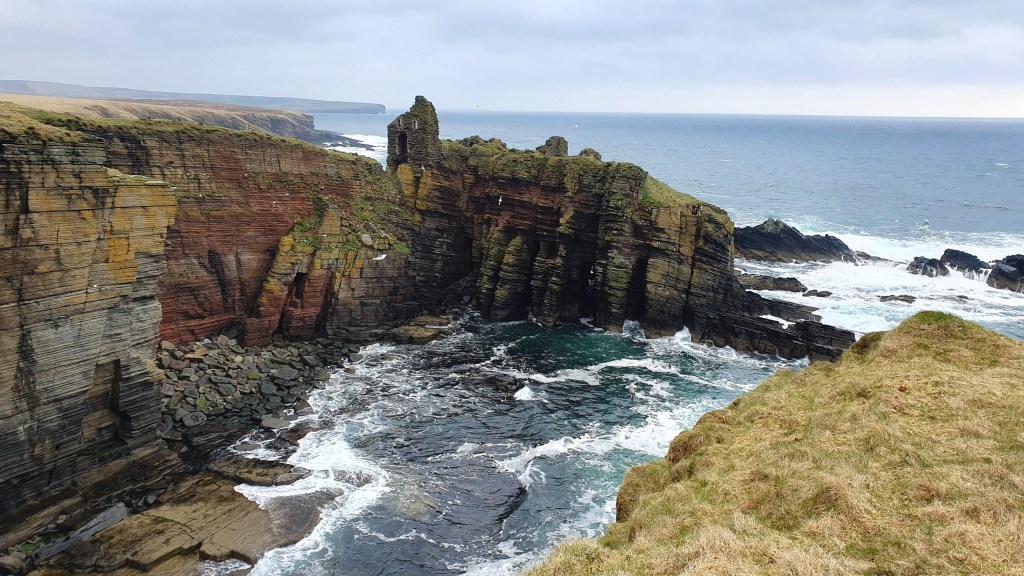
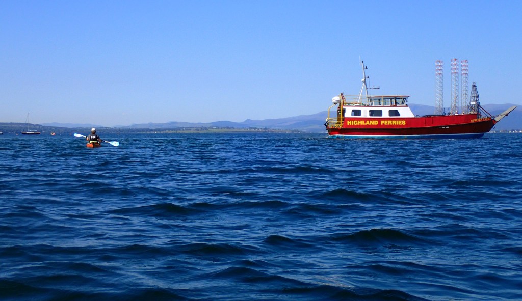
The John O’Groats trail (JoGT) is a 147 mile (236km), mostly coastal route from the city of Inverness to John O’Groats on the north east tip of Scotland. The scenery varies from pleasant inland agricultural areas, to beaches and wildly impressive sea cliffs with arches and sea stacks. The area is home to lots of seabird colonies and you have the chance to spot seals, dolphins and even whales. On top of that there is a tremendous historical interest along the way such as iron age Nybster broch to the Viking Old Wick Castle. And from more recent times there are many picturesque harbours and sights like Whaligoe Steps.
The John O’Groats trail acts as an excellent connector to the 74 mile long Great Glen Way in the south. And south of the GGW, the 94 mile West Highland Way connects to the outskirts of the city of Glasgow.
The JoGT trail is fairly new and is still being improved in places with some rougher, boggy sections and barbed wire fences particularly between Helmsdale to Wick. So it can be a pretty challenging walk overall but constant improvements are being made by the Friends of the John O’ Groats Trail on the trail and signage.
Our hikes
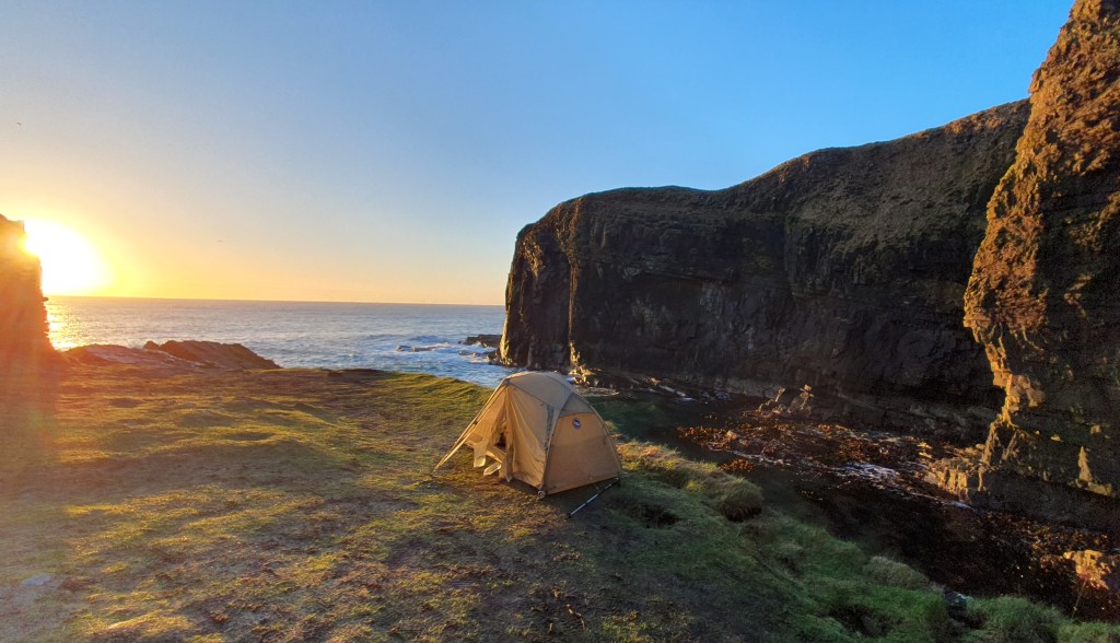
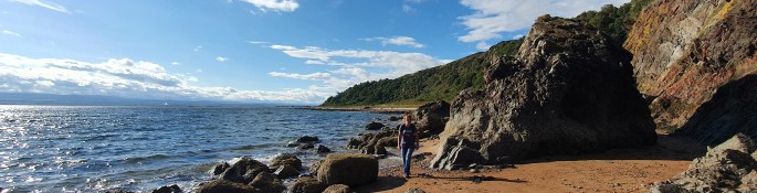
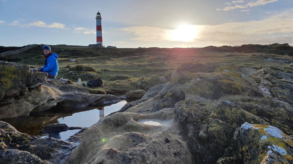
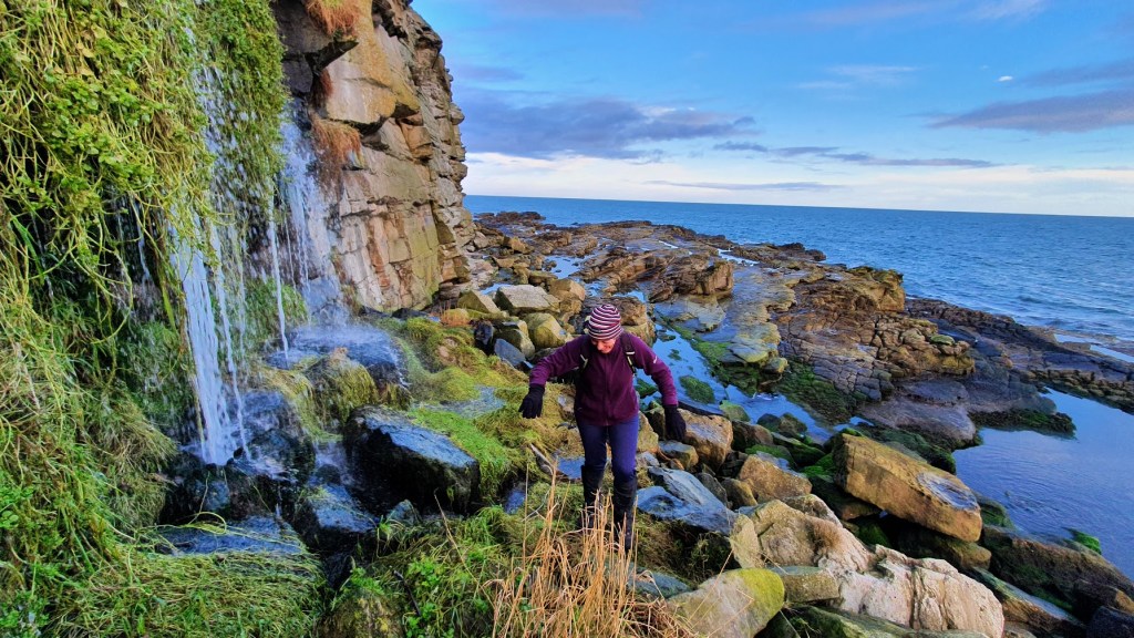
We live near to the southern area, and have walked the trail in sections, including Brian backpacking the northern part from Dunbeath to John O’Groats in 2023. Here are a few pictures from those hikes…
Resources
John O’ Groats website has lots of details including status updates, green/amber/red ratings for each stage, blog posts, plus you can join or donate to the Friends of JoGT
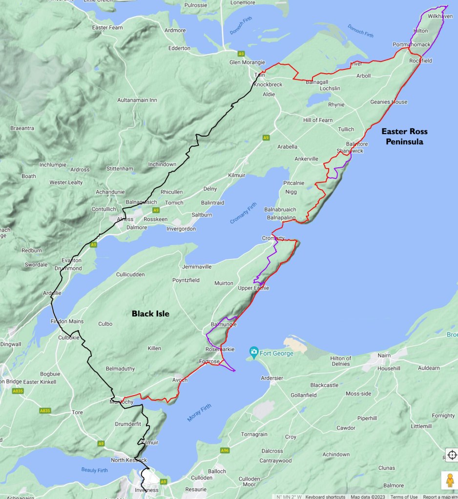
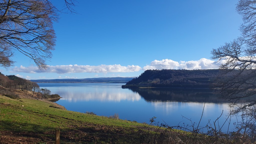
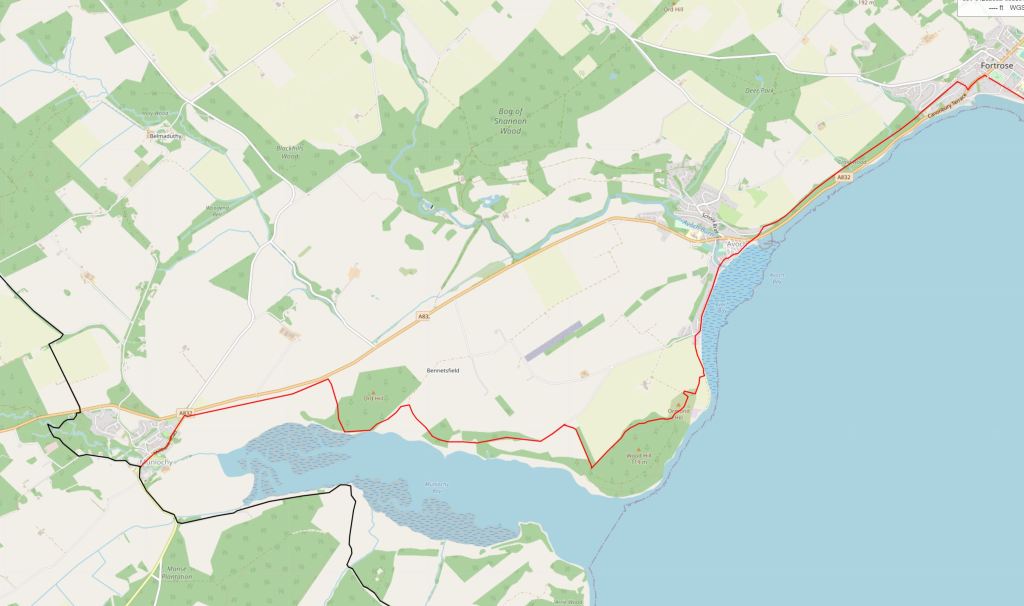
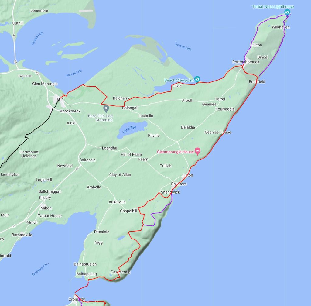
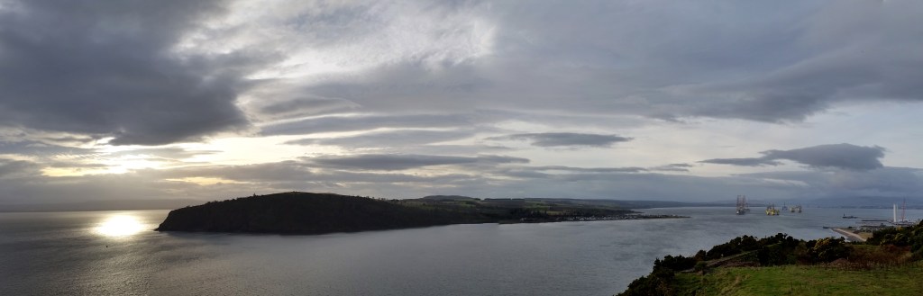
About 14km north of Inverness at Munlochy, the John O’ Groats Trail heads inland for about 2 1/2 days to the town of Tain. The hike is through a pleasant rural landscape but this is a description of a possible alternate route between Munlochy and Tain over the ‘Black Isle’ and the ‘Easter Ross Peninsula’ that stays closer to the coast, with (arguably) better scenery that is more in tune with the rest of the JoGT.
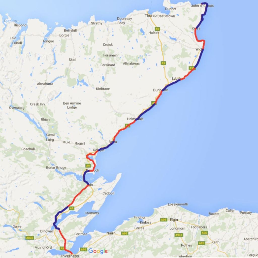
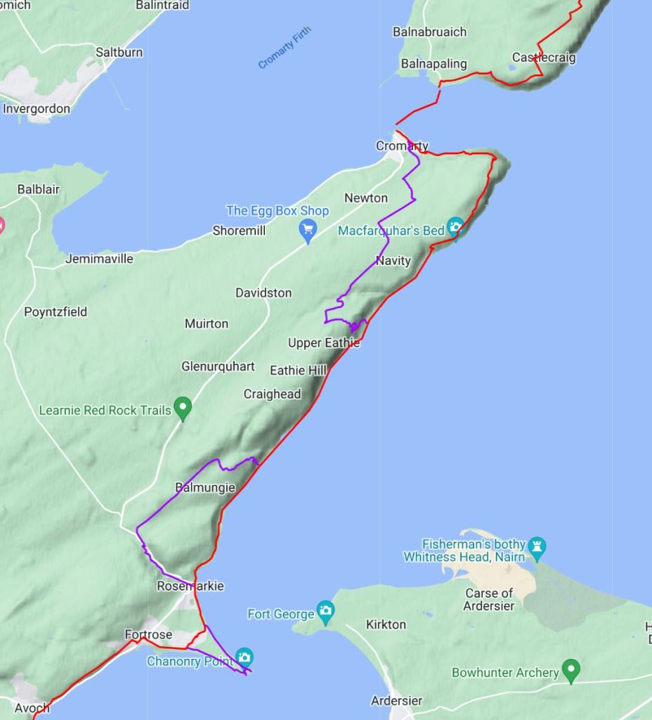
Map 1 – Black: JoGT, Red: Alternate, Purple: Further Alternates!
From Munlochy, the alternate will take about a day longer to get to Tain. 3 1/2 days on the alternate as opposed to 2 1/2 days on the main JoGT – see distance breakdown below. Here’s a bit more on pros and cons of the alternate:
Cons
A day longer
This is not the JoGT and just a suggested route and as such is not signposted with no trail in places. Requires a map, the ability to navigate, with perhaps at times the need to work out your own route on the ground
There is a short ferry crossing between Cromarty and Nigg which usually only runs between June 1st and September 30th. Without the ferry you could possibly use public transport routes from Cromarty->Inverness, then Inverness->Tain, then Tain->Nigg, but it could take a while!
Tidal 1 mile north of Rosemarkie on Day 2 (but easily managed or bypassed, see the Fortrose to Cromarty section below)
Pros
Great variety of scenery and mix of trails, beaches and tracks
Less tarmac
Rosemarkie to Cromarty in particular has excellent beach and coastal walking as well as fossil beds
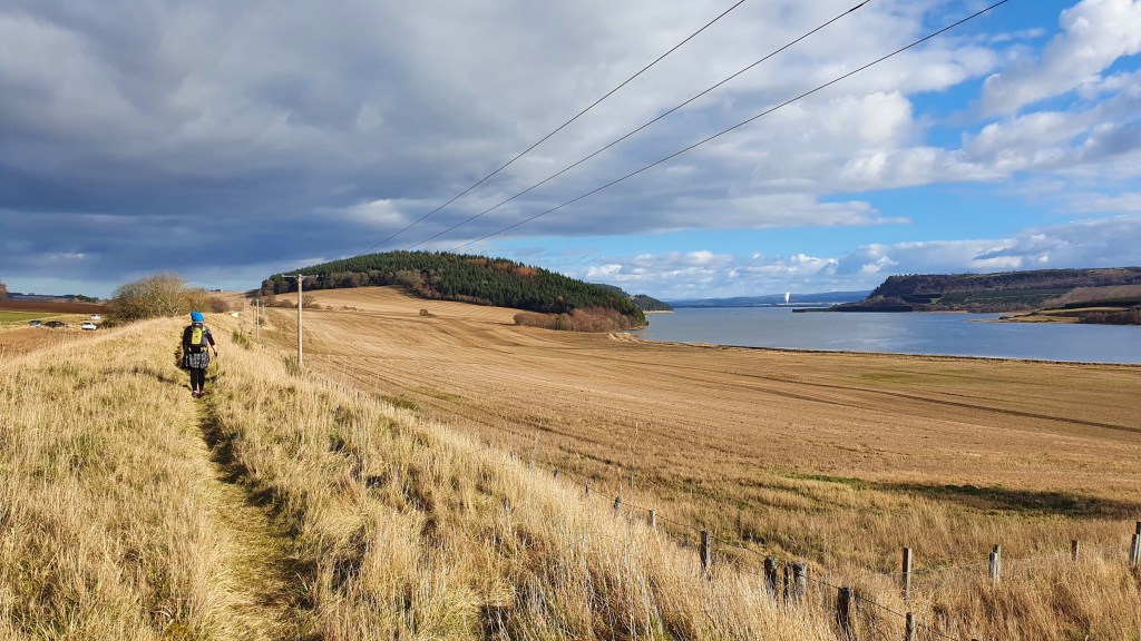
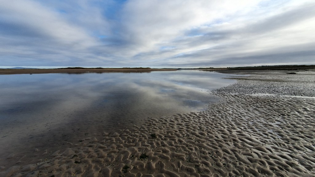
Morrich More beach walking – coastal and marine nature site near Inver
Good town stops
Options for interesting side trails, particularly to Chanonry Point and Tarbet Ness
John O’Groats Trail distances
Section
Distance (km)
Of which tarmac
Munlochy to Culbokie
10.3
5.2
Culbokie to Alness
14.8
14
Alness to Tain
21
12.2
Total
46.1
31.4
Black Isle Alternate red route distances
Section
Distance (km)
Of which tarmac
a. Munlochy to Fortrose
11.3
2.2
b. Fortrose to Cromarty
18
1.3
c. Cromarty to Portmahomack
28
7
d. Portmahomack to Tain
17
3
Total
74.3
13.5
Alt a. Munlochy to Fortrose11.3km
Summary A varied walk on the Black Isle which is about half a day and meaning that you could walk from Inverness to Munlochy on the JoGT then this route to Fortrose making for a 25.5 km day.
It follows along field edges to the northern shore of Munlochy Bay, then nice woodland tracks to the ruins of Ormond Castle dating back to the 12th Century. Passes through Avoch, a scenic little harbour town with shops and a café. An old railway line through woods provides an easy hike from there into another scenic town of Fortrose with its cathedral, shops, post office, chemist, accommodation, 2 campsites and harbour.
Map 2
From Munlochy leave the main JoGT by following the high street northeast up to just before the A832
Follow the signposted route on the right to walk east along the field margin parallel to the A832
At the far end of the field, turn right for 20m to access the path along an old railway track still parallel to the A832
Go past a car parking area and continue to a 2nd parking area
Turn right down towards Munlochy Bay by field margins and past ruins
Go along the edge of the bay to a wooden structure (nice rest stop). Continue on 30 meters or so until you are able to follow a field margin left uphill go to find a good vehicle track. [Note, you can continue around the coast to Avoch along pebbly beaches, sometimes slippy. Low tides needed]
Turn right on this better track through Bay Wood (with excellent bluebells in spring) onto tarmac
Reach a small parking area and go through the gate on the right to a dirt trail
At the edge of the wooded hill (Wood Hill(!) on Map 2) turn left on the track (carrying straight on will take you to 10. as well)
At the north edge of Wood Hill turn left at the junction and past the mound of the site of Ormond Castle. A quick diversion to the top gives nice views across to Chanonry Point and Fortrose
Continue on the trail to a gate, turn sharp right towards the sea on a short trail and over another gate to cross a field diagonally downhill to reach a track along the shore
Follow the track and turn right on the road north along the shore into Avoch (pronounced Och!)
Avoch has a shop, accommodation and a small harbour. Take a route up onto the railway line path above Avoch (there are 2 trails with steps or a road up to the church and railway line). The church contains the grave with plaque of Alexander MacKenzie, explorer of the MacKenzie River in Canada
Follow the old railway path into Fortrose and take a right at its end into Fortrose centre
Old railway near MunlochyEast of MunlochyMunlochy Bay wooden structureSite of Ormond CastleAvochFortrose
Alt b. Fortrose to Cromarty18km
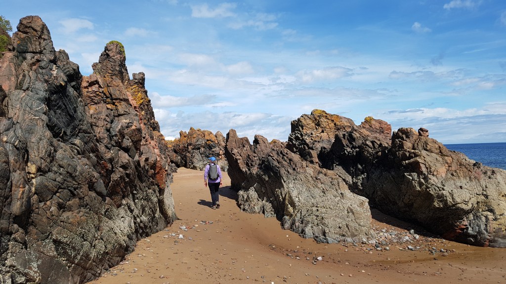
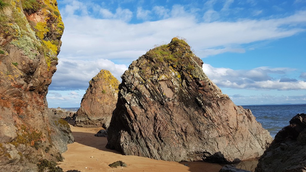
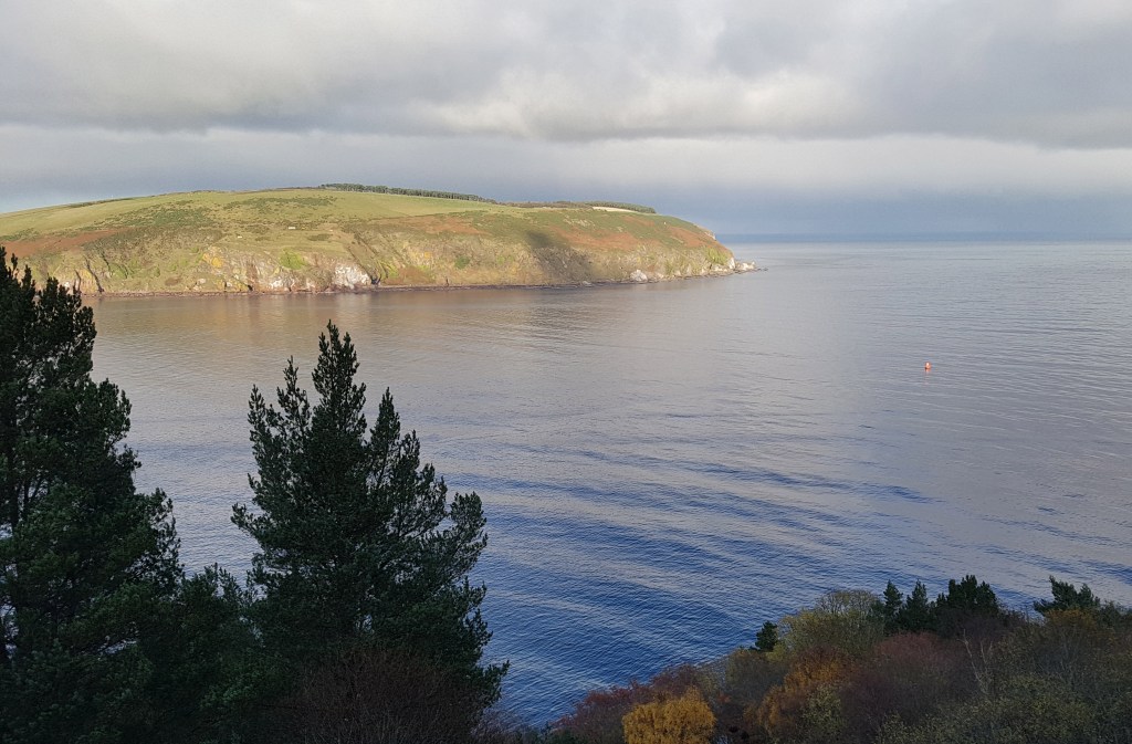
Summary This is a great walk on the Black Isle, with beach and some boulders along the coast, then field margins with views to the sea along to the South Sutor and a final good trail down to Cromarty.
Highlights include the colourful and varied geology along the coast, caves, chance of spotting fossils, a bothy at Eathie, birdlife, world war coastal defenses and grand views across down to the sea nearing Cromarty. Three alternates are also described below.
The coastal southern section is best hiked at low tide as this exposes more of the sandy beach with easier walking. In addition about 1 hour beyond Fortrose and just over a mile north of Rosemarkie (Caird’s Cave on maps) there is a tidal section about 20 metrs long where the water can wash onto the cliff making passage difficult to impossible. As a rough guide, if the tide level at nearby Cromarty is at 2.4m or below it should be fine to cross.
Tidal section
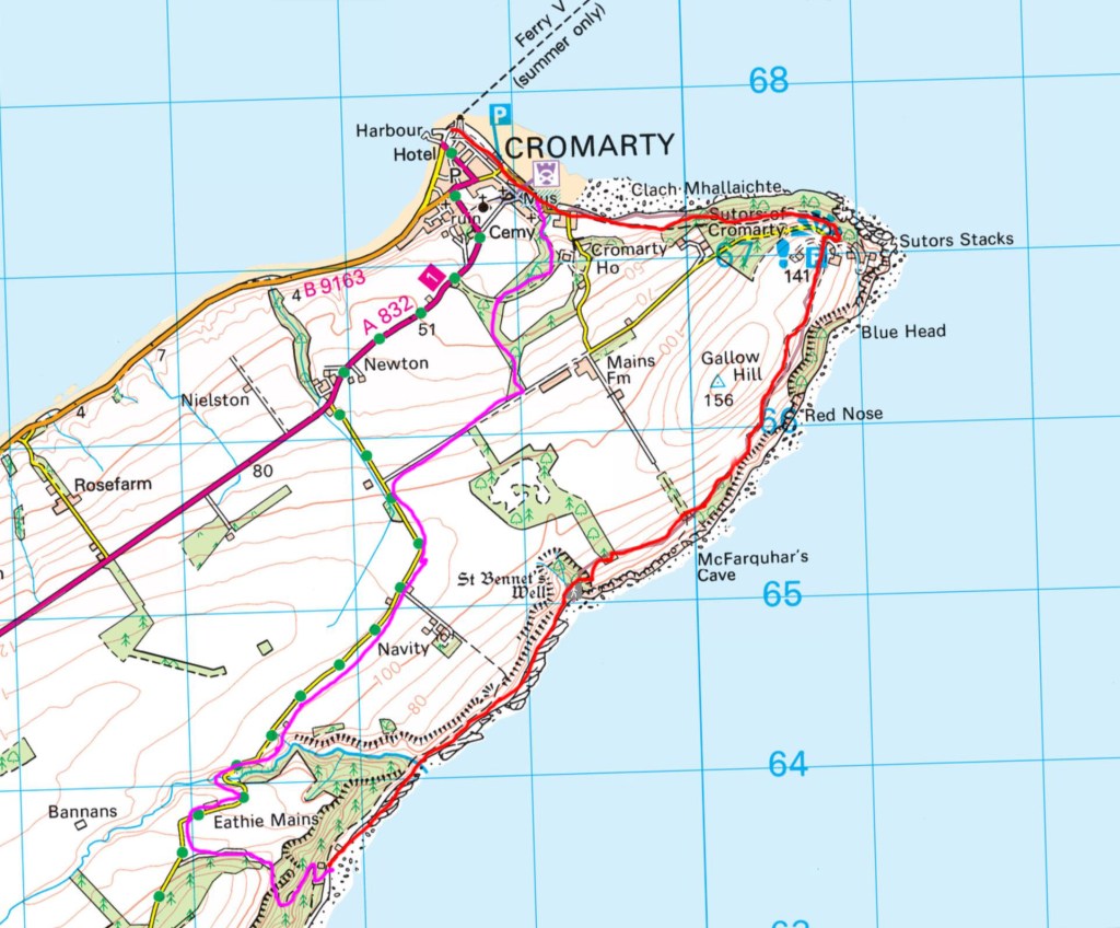
Map 3
Red Route on Map 3 and Map 4
From Fortrose centre Coop grocery store you can take a number of ways to Rosemarkie. Here is one;
Go down Castle Street opposite the Coop and continue down the grassy avenue past the school. Take a left turn just after the grass signposted ‘Path to Ness Road’ (straight on takes you to Fortrose caravan/campsite) on the short road then onto a path past houses
Turn right at the next road junction, Ness Road, then left on the road signposted for Fortrose & Rosemarkie golf course and caravan campsite.
Go along the road to the golf course club house. From there you can walk along the road, the grass trail above the beach or on the beach to Rosemarkie (Crofters cafe and then Beach cafe further along)
From Rosemarkie you can then just follow the coast for a couple of hours to Eathie bothy. As mentioned above you will pass the tidal section after a mile and you will need to cross pebbles and boulders on occasion with the easiest hiking generally on harder sand near the water edge
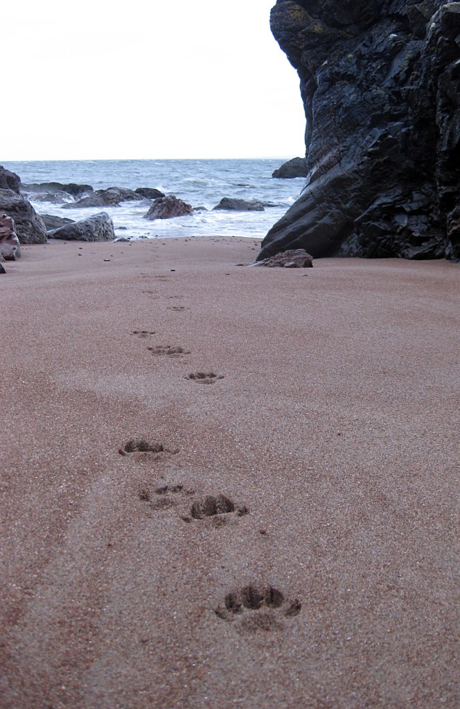
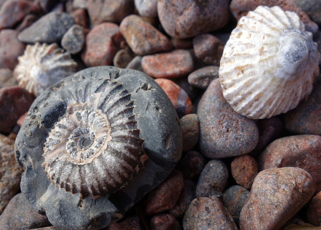
Watch out for sea and woodland birds, and maybe even otters, seals or dolphins. There are a number of caves to explore along the way, in one of which was found ‘Rosemarkie Man‘, a Pictish skeleton from about 500AD with severe head injuries. The changing geology is interesting… This coast is part of the Great Glen Fault and as such very old rocks are exposed at the surface such as gneiss and granites. Fossils can be found too and the 19th century geologist Hugh Miller made a number of discoveries here. If you are looking for fossils, note that hammering the bedrock is not permitted and follow the Scottish Fossil Code
Eathie bothy provides shelter and some information panels. At the bothy you have a choice. My main red route is to continue along the coast then follow the escarpment above the cliffs. This is more scenic but in mid summer has a 200 meter long walk through deep bracken after climbing up above St Bennet’s Well. There is also an easier alternate heading inland, but with some tarmac walking (purple line Map 4)
For the main route (red line Map 4) keep walking along the coast over sand, pebbles and boulders. Watch out for the slippy green rock slabs! After about an hour you will get to a small sandy bay NH793650 marked St Bennet’s Well on the map. The cliffs reach the sea beyond here and it is best to head up above onto the escarpment
Follow a faint trail going steeply straight up the slope past a dead pine tree to the plateau above the cliffs
The aim from here is to follow field margins and then trails above the cliffs to the parking area at South Sutor. The first 200m can have deep bracken in summer until you reach woodland. Cross this then follow the field margin to the next narrow band of woodland (worthwhile short side trail down to sea arches at McFarquhar’s Cave)
Follow field margins and trails to the South Sutor carpark
At South Sutor parking area take a fine trail down to the right, initially through woods, then contouring and descending gradually westward towards the sea and Cromarty, Map 4
Further Alternates exist if required (purple on Map 3 and 4);
a. An extra loop round Chanonry Point (beach, lighthouse, vistas and chance of seeing dolphins). From Fortrose Coop head down to the Fortrose caravan site then follow a trail on the south side of the peninsula beside the golf course to Chanonry Point. Continue via the north side to Rosemarkie either along the beach or on trails beside the golf course. [Dolphins can often be seen jumping very close to the point. Best chances to spot them are between April and September and on a rising tide]. This Walkhighlands route describes the walk in more detail as part of a loop.
b. High tide option from Rosemarkie, up Fairy Glen on good trail with its waterfalls, along a minor road then descent on good trail from Hillockhead to the coast. This Walkhighlands route describes a loop including both this high tide route as well as part of the normal route.
c. Leaving the coast at Eathie bothy(Map 4) to climb a good trail to join a minor road then track and trail through woods to Cromarty. Described again in Walkhighlands– but a more interesting route towards the end is to follow the route drawn on Map 4 rather than Walkhighlands. At section 8 Walkhighlands, leave the track 300m before Mains Farm where a path goes down left through woods. About 300m on, turn right on a good path going along a field margin and at the far side various trails allow access into Cromarty town.
Otter tracks!Eathie coast from aboveEathie bothyField margins in springFrom South to North SutorAmmonite on beach
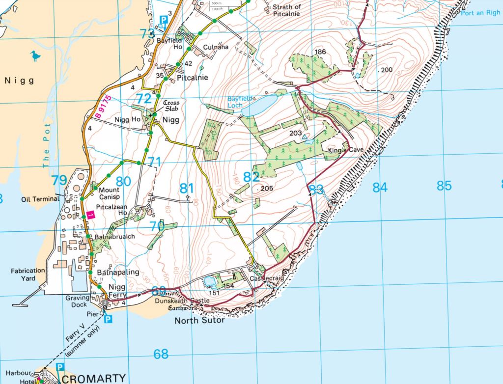
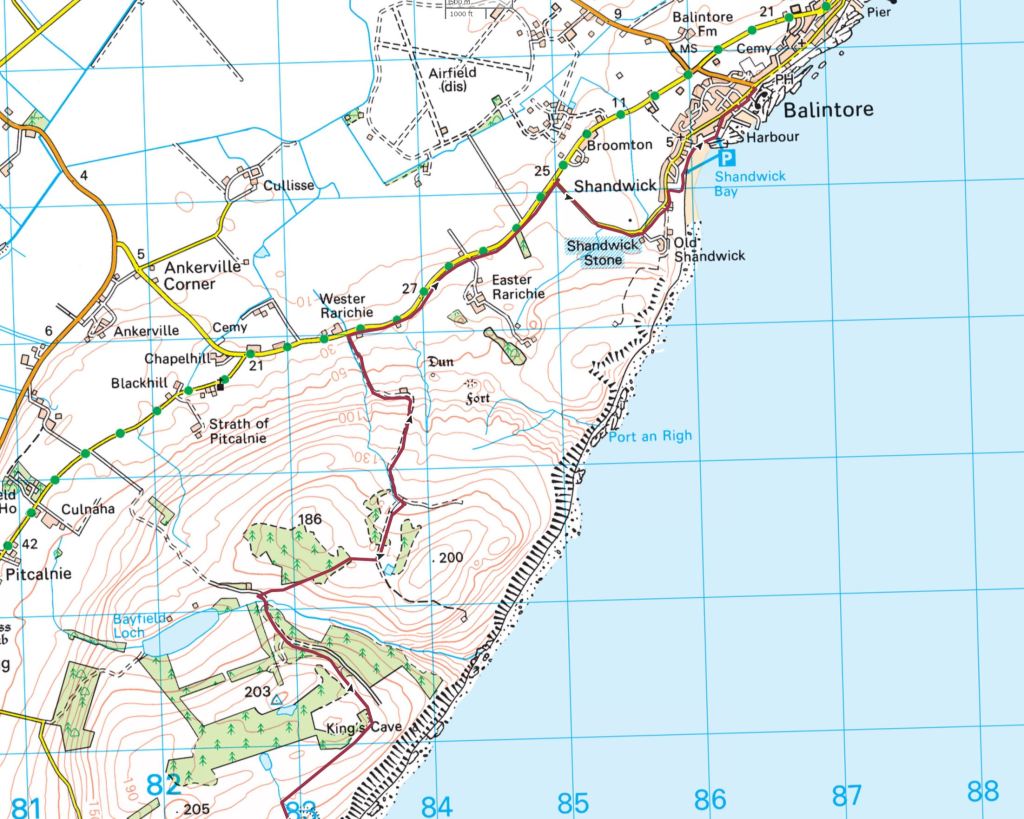
Alt c. Cromarty to Portmahomack27km
Summary This longer section starts with the small ferry across from Cromarty to Nigg and the ‘Easter Ross Peninsula’, then a mix of walking above the sea to Shandwick and to Balintore with a shop. A fine walk along the shore to Rockfield follows before a short road walk across to Portmahomack. A further scenic alternate could be to hike out round to the tip of the peninsula and lighthouse at Tarbet Ness.
Map 5
Red route on Map 5 and Map 6
From Cromarty take the tiny ferry across to Nigg (Balnapaling on Map 5)- the ferry runs between June 1st and September 30th
Walk north past houses for a short way then take the road right marked Castlecraig (you can also walk the beach eastward to before the cliffs then head back left to a carpark and road) uphill to another Castlecraig trail marker and style on the right
Walk a trail, faint in places, across the field and through gorse with great views back to Cromarty Firth
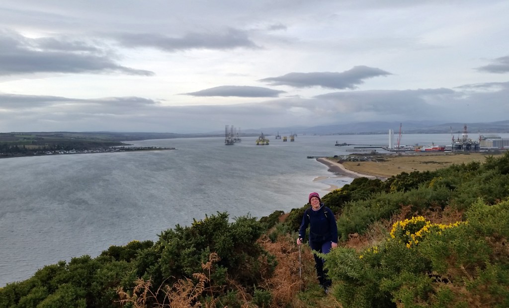
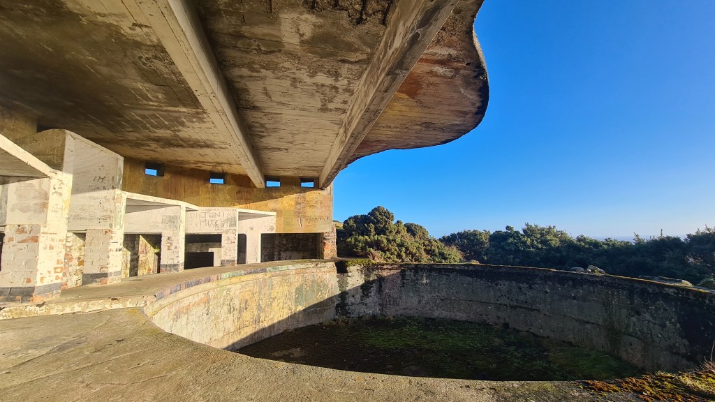
The first cool World War gun emplacement is at North Sutor below the trail on the right after about 300m. From there follow the track round onto a more open field to ruined buildings. Skirt these on the right with a better gun emplacement area, again to the right. If you are brave you can descend down a ramp underground (torch handy!)
From the gun emplacement head north about 200 meters to a birdwatchers signpost before a track uphill to houses. Follow the signpost to the right alongside, then through a fence to a river
Go up the riverside upstream for 100 meters or so then cross to the right at a ford, through the gate then left uphill 100 meters on the track to another gate on right
Go through the gate to hike on grass near the edge of the escarpment above the sea until reaching another river
Cross the river to a stile. From here go diagonally uphill across the field, through a gate to pick up another track
Now head for the seaward (right) side of the forest plantation on the skyline, reaching a good vehicle track on the far side heading inland just north of Kings Cave on Map 6
Follow this track north west to a dip over the Allt nan Damh river and then a junction
Map 6
Now on Map 7, turn north east on a track then soon follow the edge of the trees uphill to a gate
Through the gate and cross the sparse forest to a good track with wide open views north to Balintore, Portmahomack and the JoGT coastline and hills way to the northwest [The forest growth may make future access here more difficult, you may need to explore options here]
Take this track down to the road at Wester Rarichie [I have also walked a more direct off road line to Shandwick from here but found it tough bushwhacking through gorse in places. There might be a better way though…]
Walk the road taking a right turn after 2km to the Pictish Shandwick Stone. Impressive, even though its now preserved inside a glass box
Follow the road into Balintore, shop, cafe, and watch out for the Mermaid of the North statue!
Next is a fine coast walk for 10.25km to Rockfield as described in Walkhighlands
From Rockfield, walk the road for 3km, uphill at first, to Portmahomack which has a shop-post office, café and accommodation.
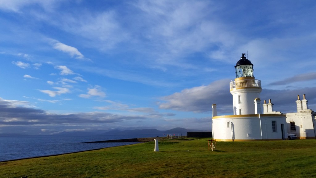
a.Tarbet Ness14km A coastal loop from Rockfield to Portmahomack round a peninsula jutting out into the sea with a lighthouse and panoramic views. Described in this Walkhighlands route.
Alt d. Portmahomack to Tain17km
Summary Good walking from Portmahomack to Inver along coastal edges and beaches with spacious views out east to the Dornoch Firth and the next legs of the actual JoGT. A section past motorbike tracks, an old airfield and a road is less pleasant, but the going improves to finish through woods and the coast into Tain. See Map 5 for an overview.
Leave Portmahomack to the south west along the coast past the caravan site (or by the road)
After about 1km you can follow a trail above the shore
If the tide allows, it is great to hike along the wide sandy beach, part of Morrich More nature reserve
You can pick up a trail approaching the small town of Inver and walk into its centre with the Inver Inn bar and kitchen
From Inver I walked on generally south eastwards on grassy saltmarsh skirting the south shore of Inver Bay. The area to the north here is a RAF shooting range so I was forced to deviate from the coast at the head of Inver Bay
You could just head onto the road from there and walk 3.5 km west to a turn off on the right signposted ‘Junipers Holiday House’
I kept on the saltmarsh past a motorcycle track to an abandoned airstrip and walked that south west to the road – leaving 1.5km road walking to the Junipers turn off
At the road junction for ‘Junipers Holiday House’ turn right and follow the road north east for about 700m passing houses to a 4 way junction. Take a left on a gravel track for a km to a woodland – Cnocan Mealbhain
Turn left on trails to the coastal edge of the woodland
Now follow the coast on trails south west, crossing a bridge over the River Tain to the centre of the town where you meet up with the John O’Groats Trail again!
PortmahomackMorrich MorInverOld airfieldBridge into Tain
Further Alternates
Chanonry PointLighthouseFairy Glen near RosemarkieTarbet Ness lighthouseTarbet Ness coast