Skye Trail Alternatives

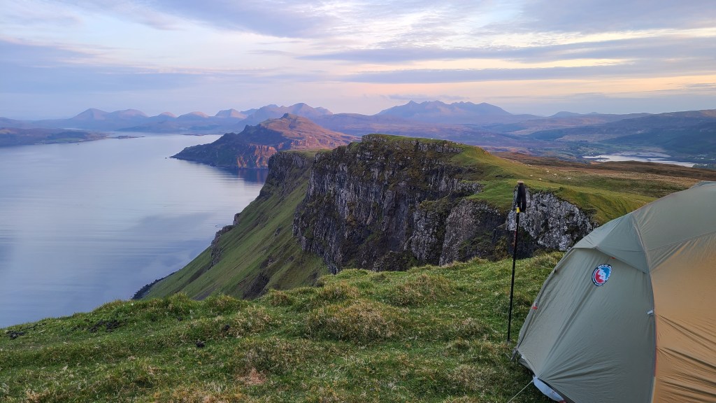
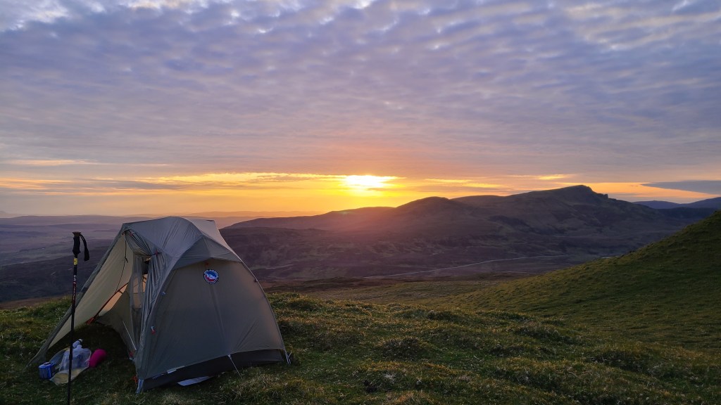
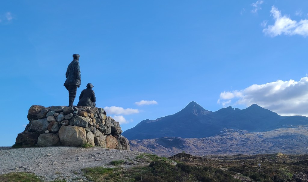
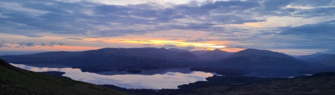
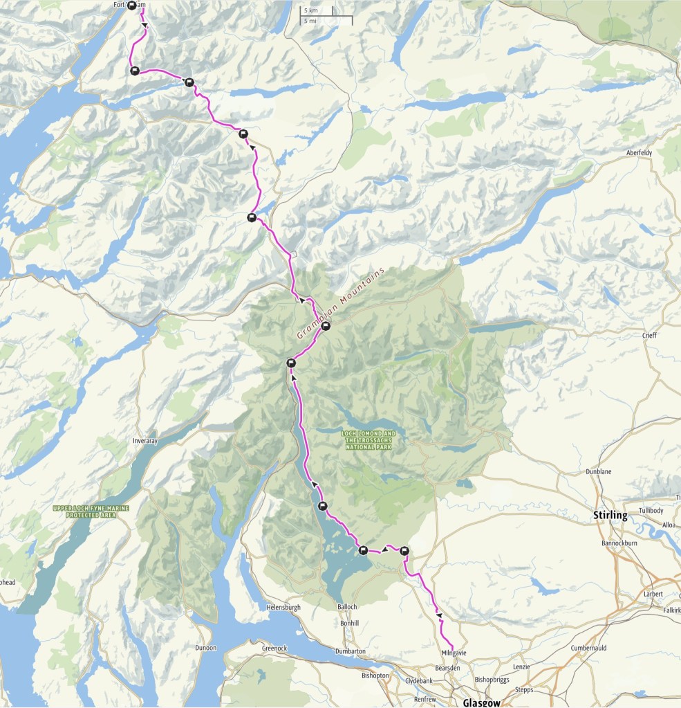
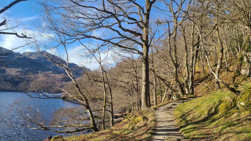
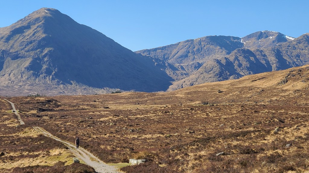
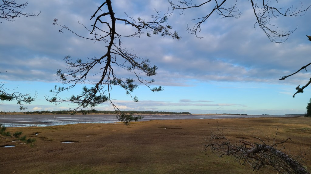
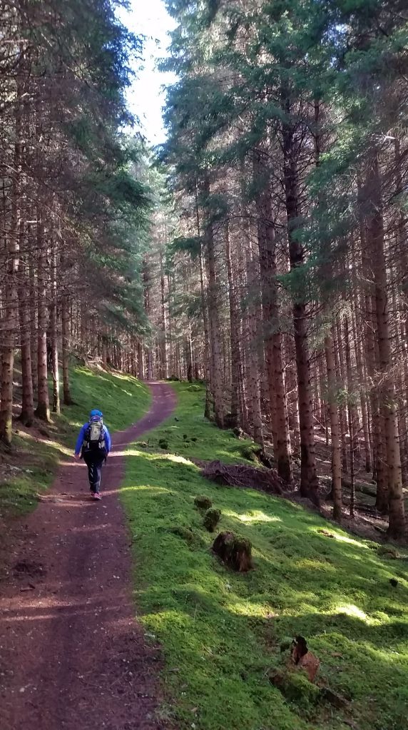
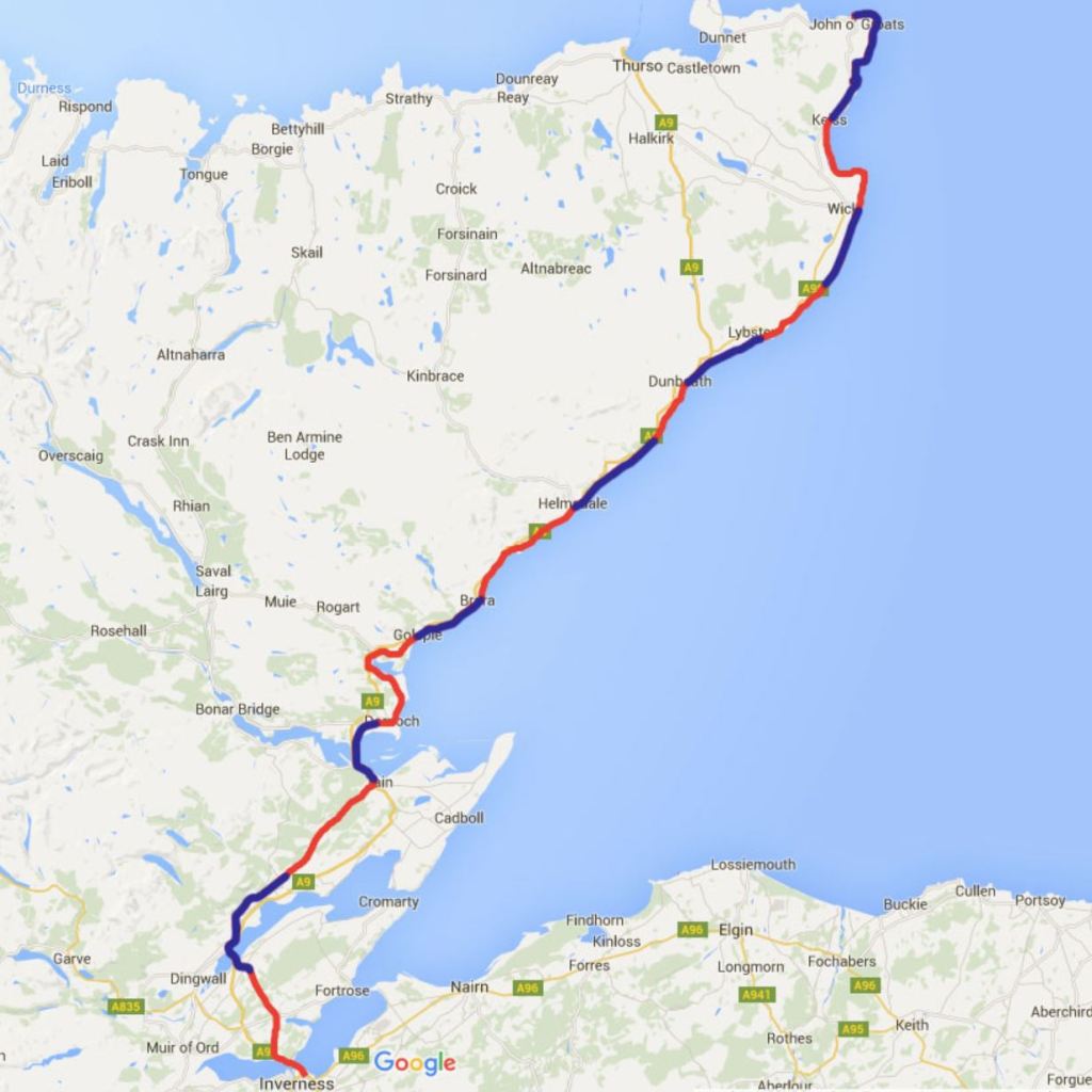
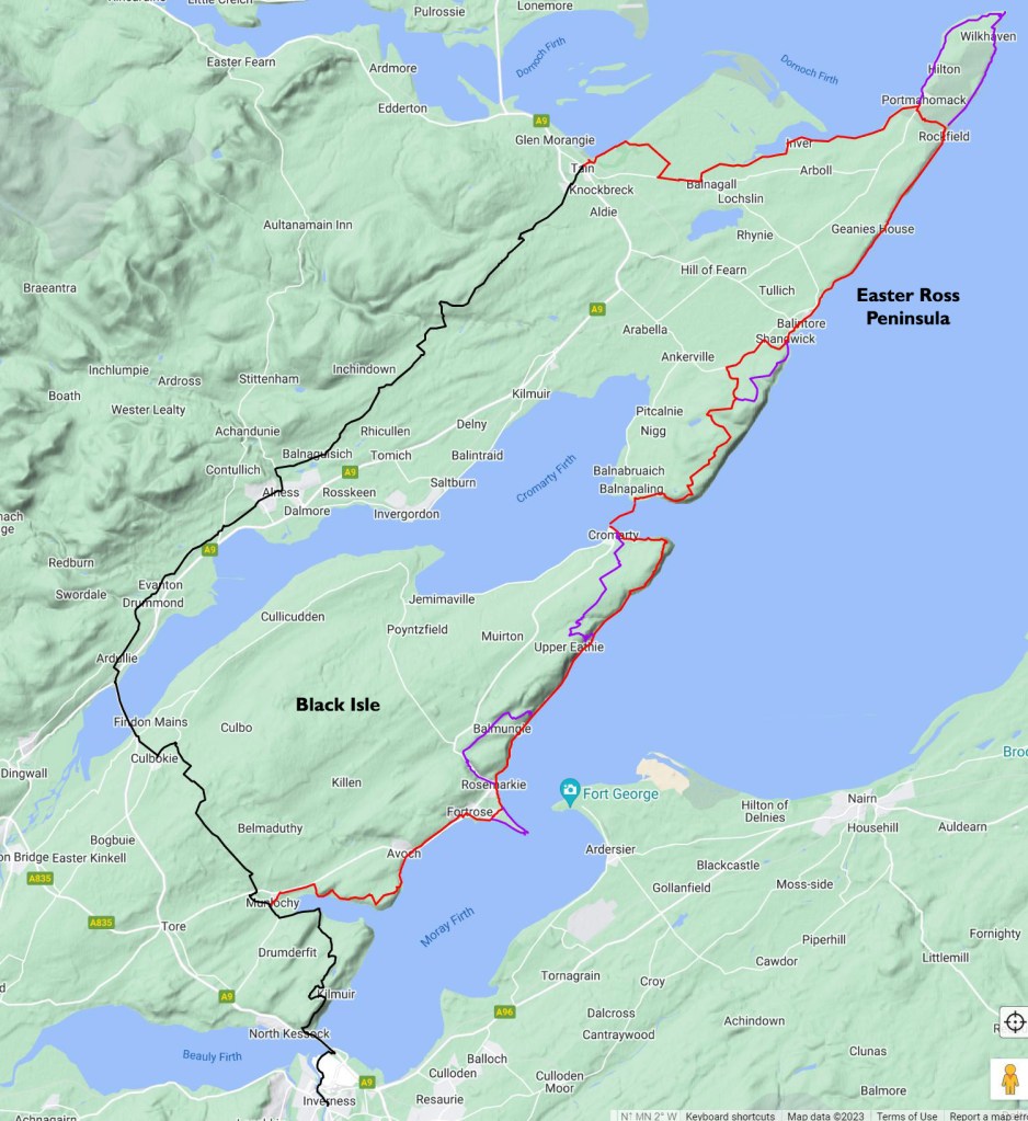
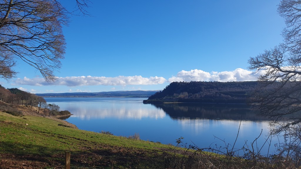
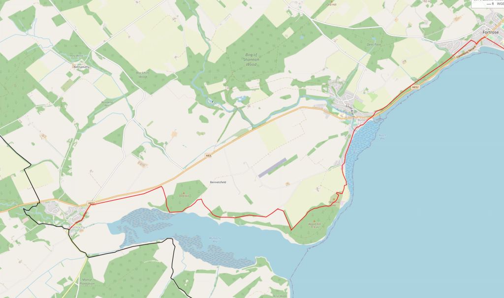
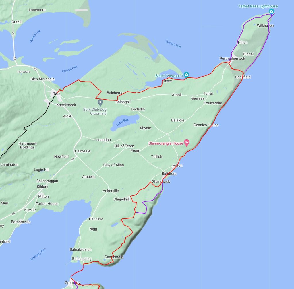
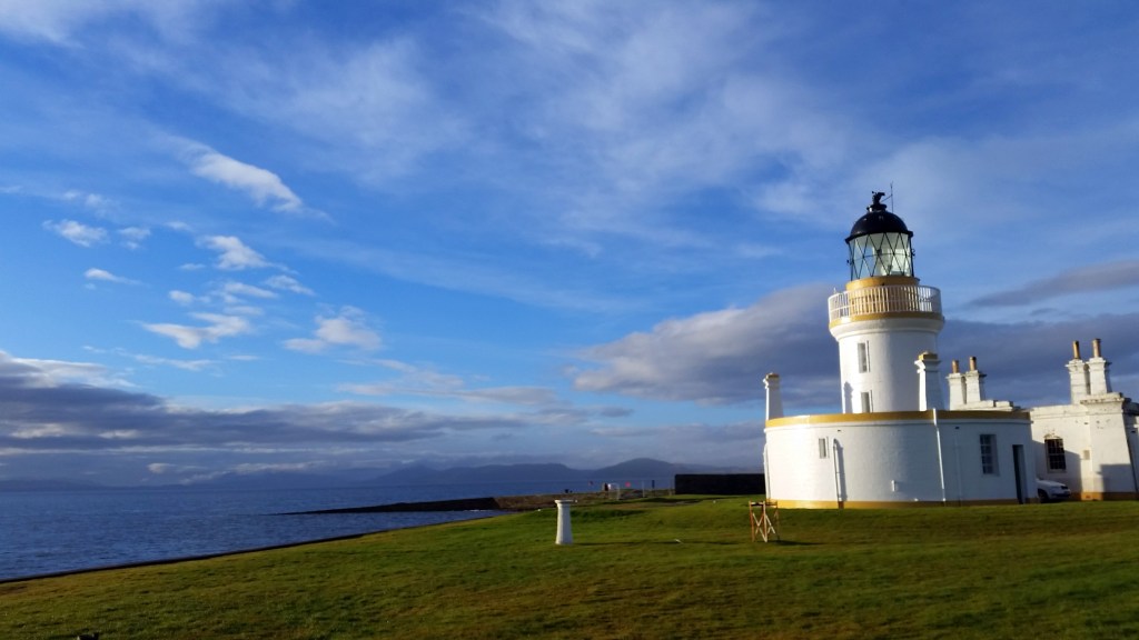
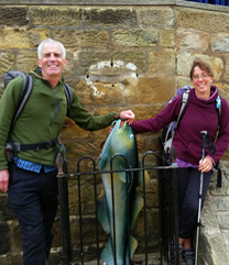
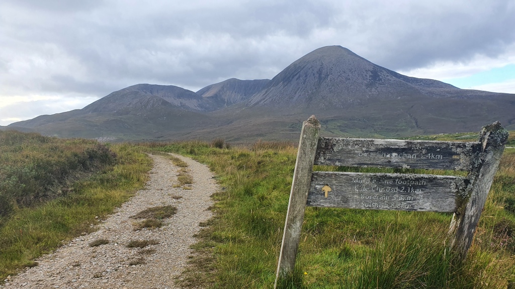
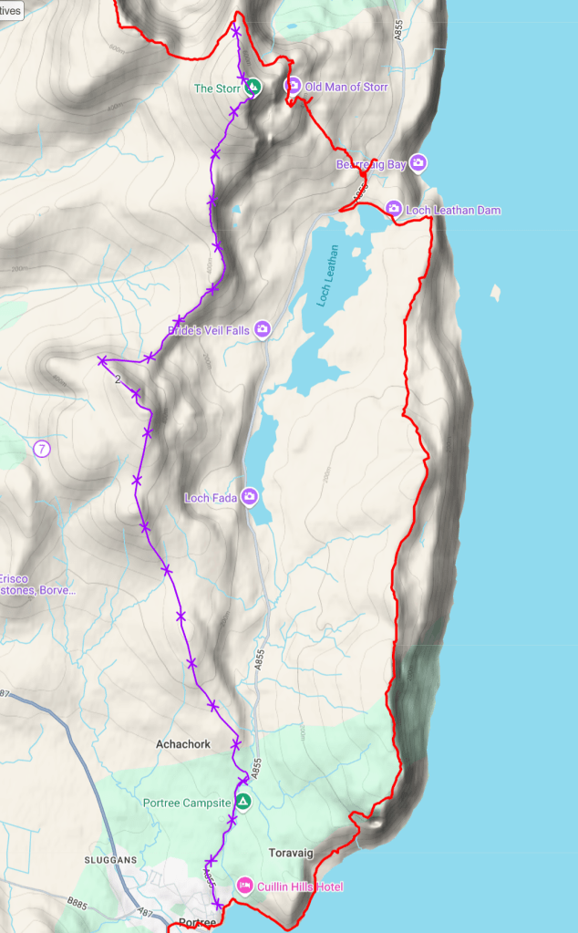
I have hiked and scrambled many alternatives to the standard Skye Trail over the years and describe them here. To be honest the standard route is great as well, but particulary the first alternative, Coruisk-Sgurr na Stri is fantastic if you are up for it. You can click the map below for an interactive version.

All require solid navigation skills – and some scrambling for 1,2,3 and 4. If you are considering any of these you should do your own planning with maps and further resources such as Ralph Storer’s ’50 Best Routes on Skye and Raasay’ book (lots in there for a lifetime of great adventures on Skye). ‘Skye Scrambles’ by the Scottish Mountaineering Club is also good…..
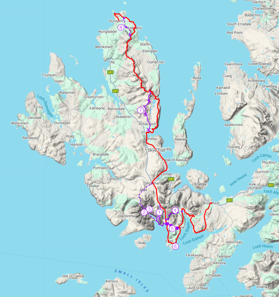
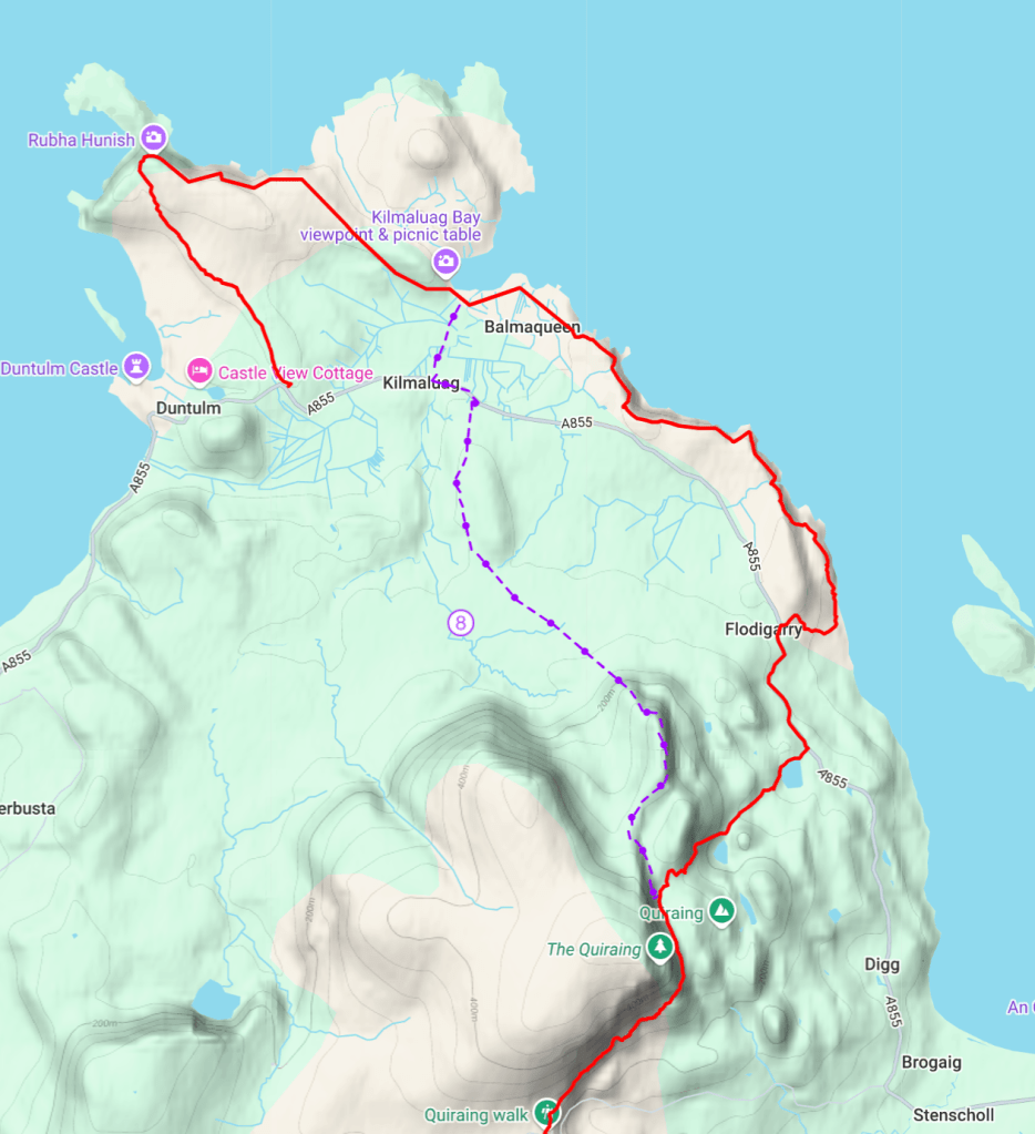
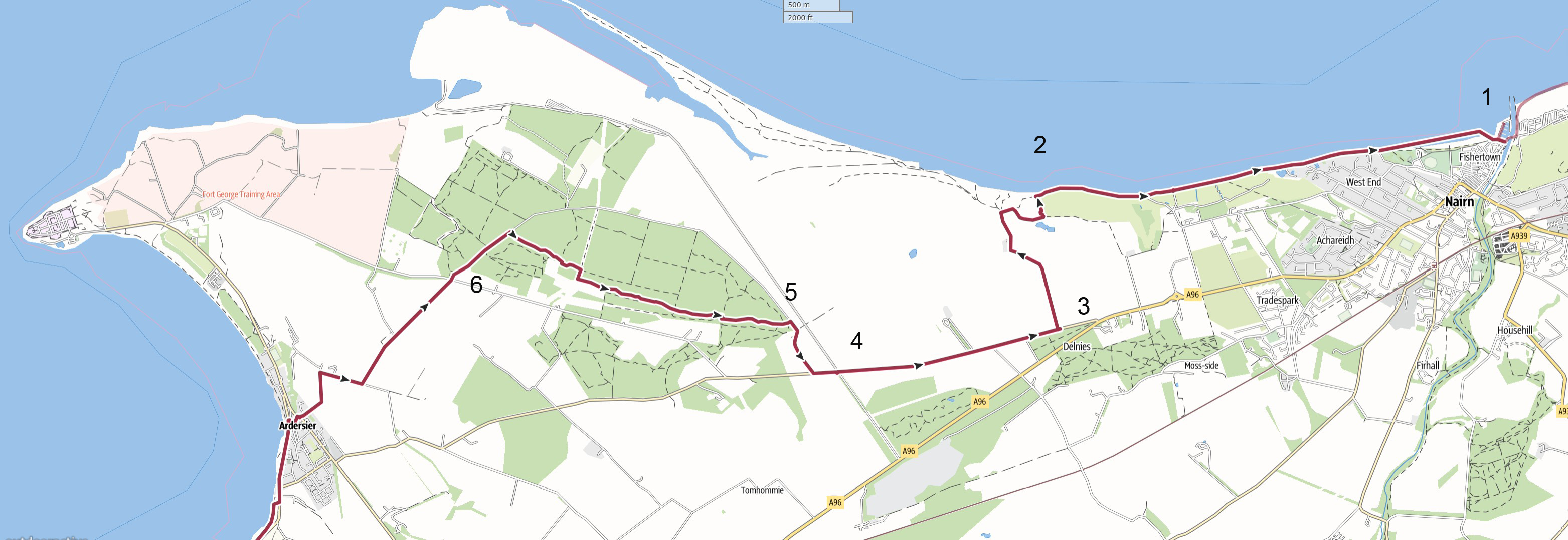
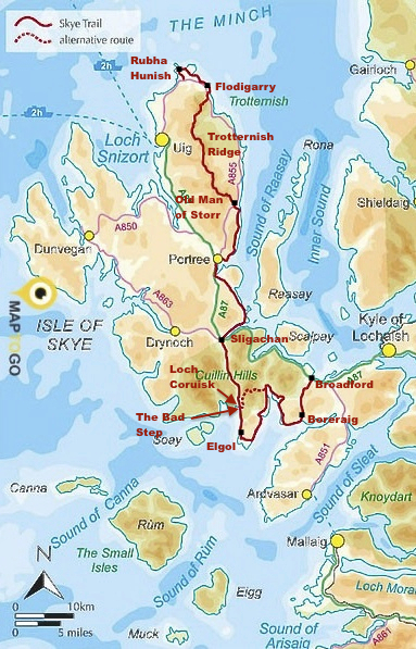
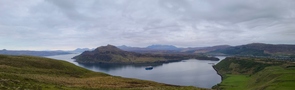
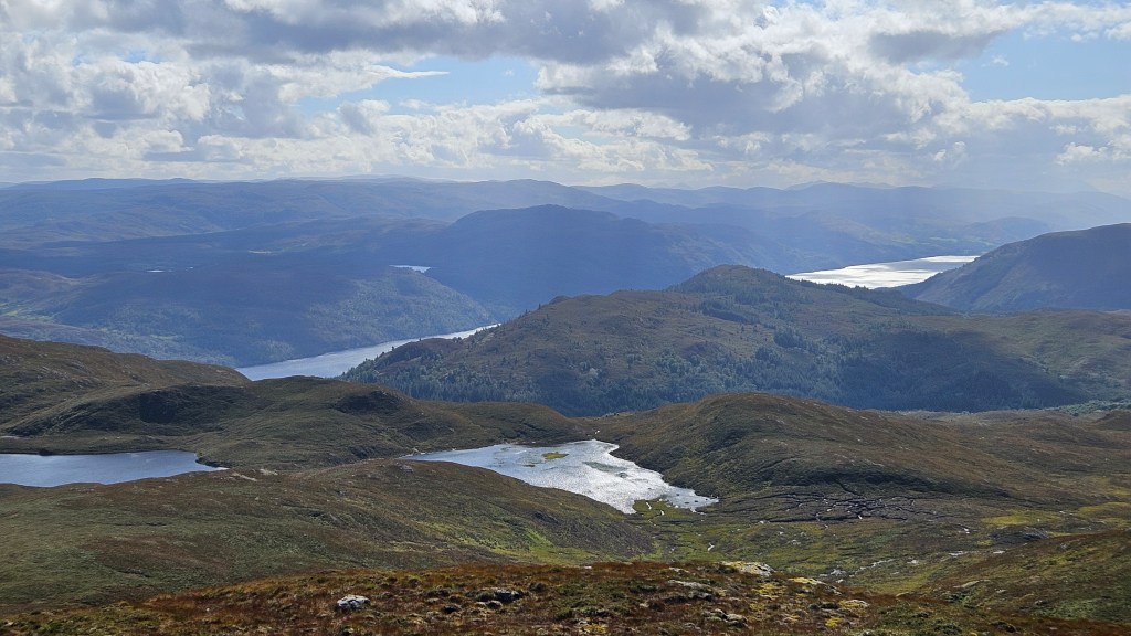
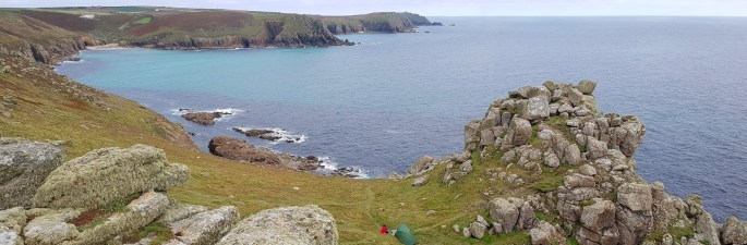
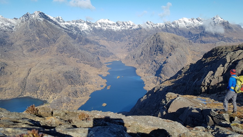
1. Coruisk – Sgurr na Stri

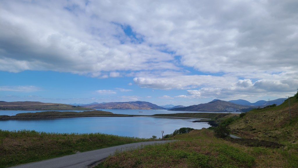
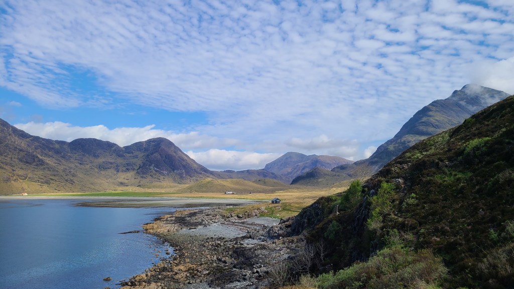
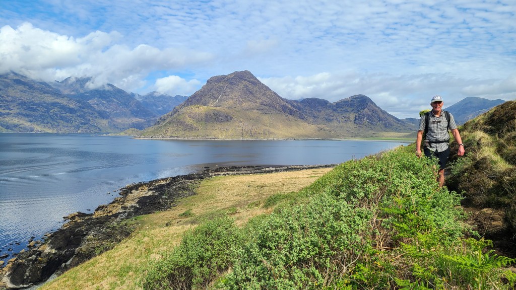
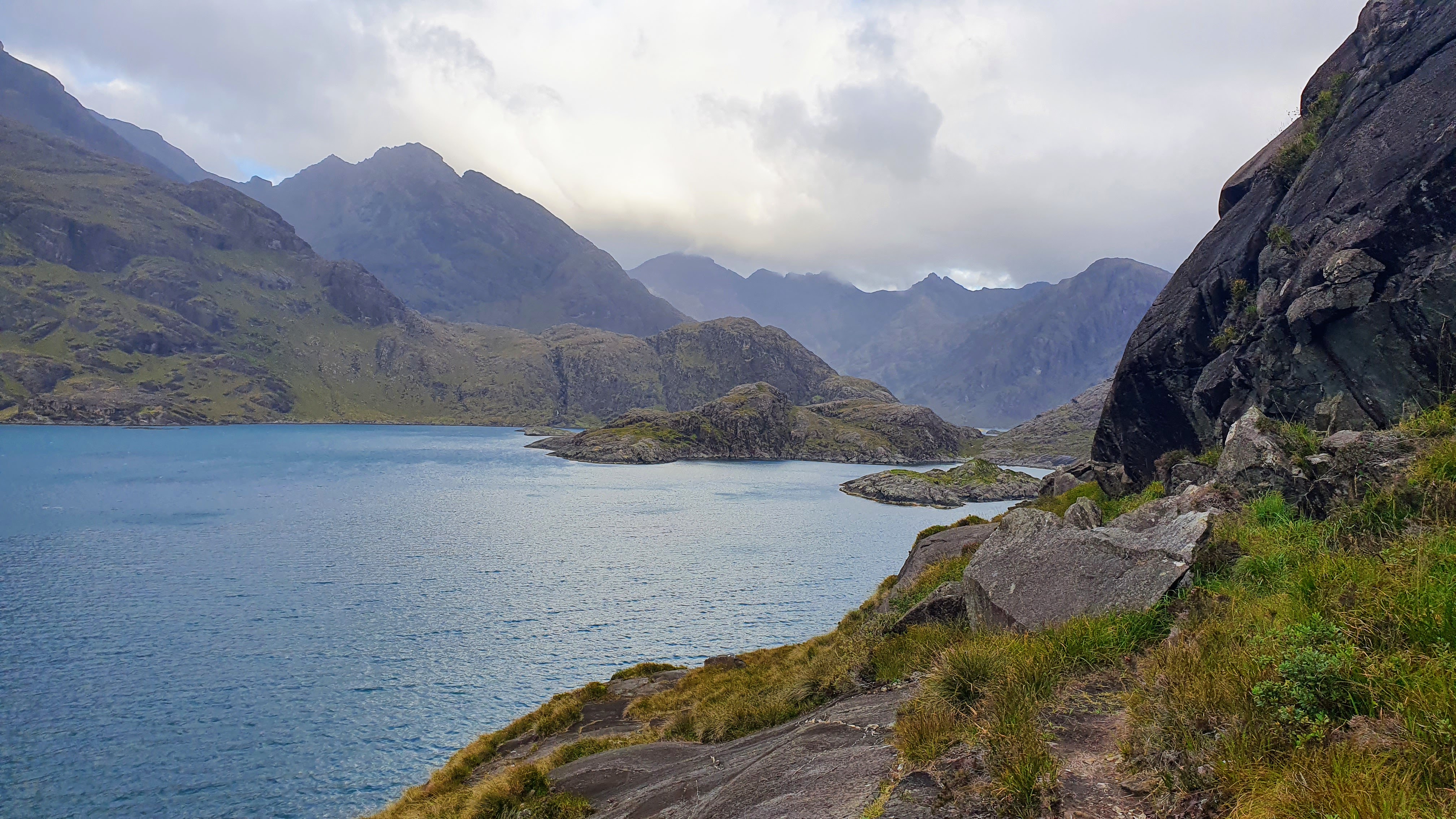
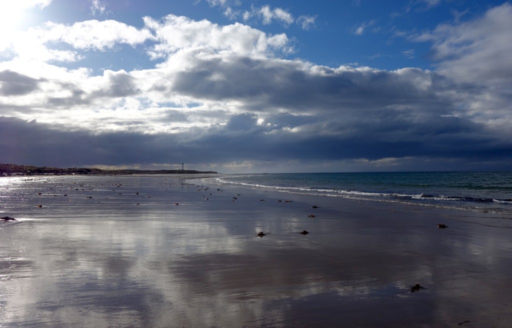
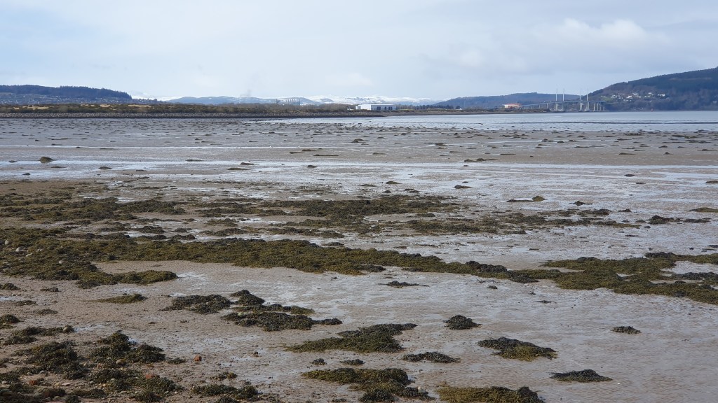
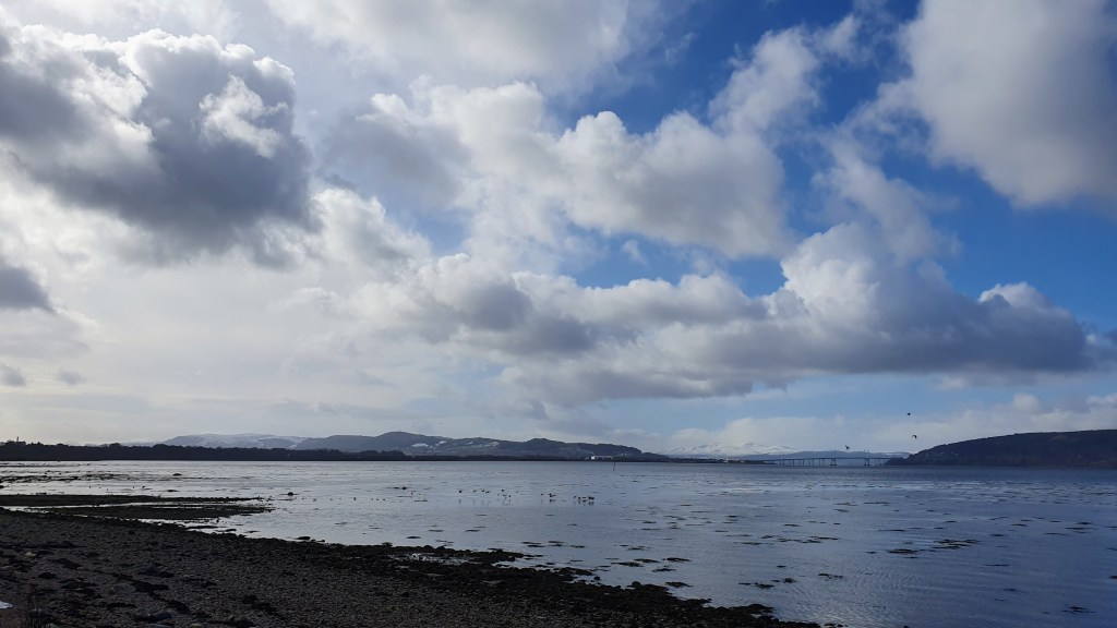
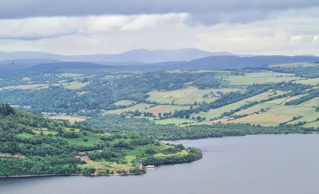
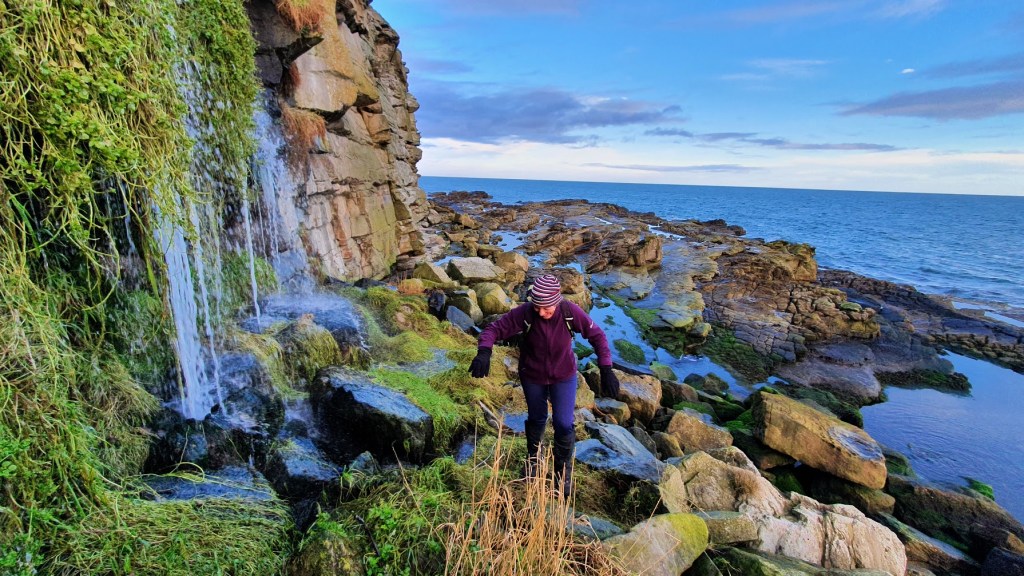
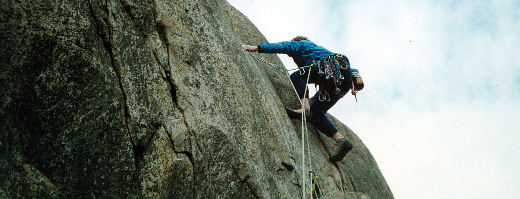
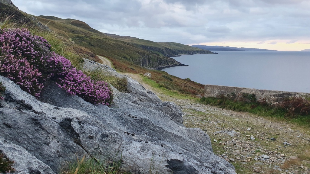
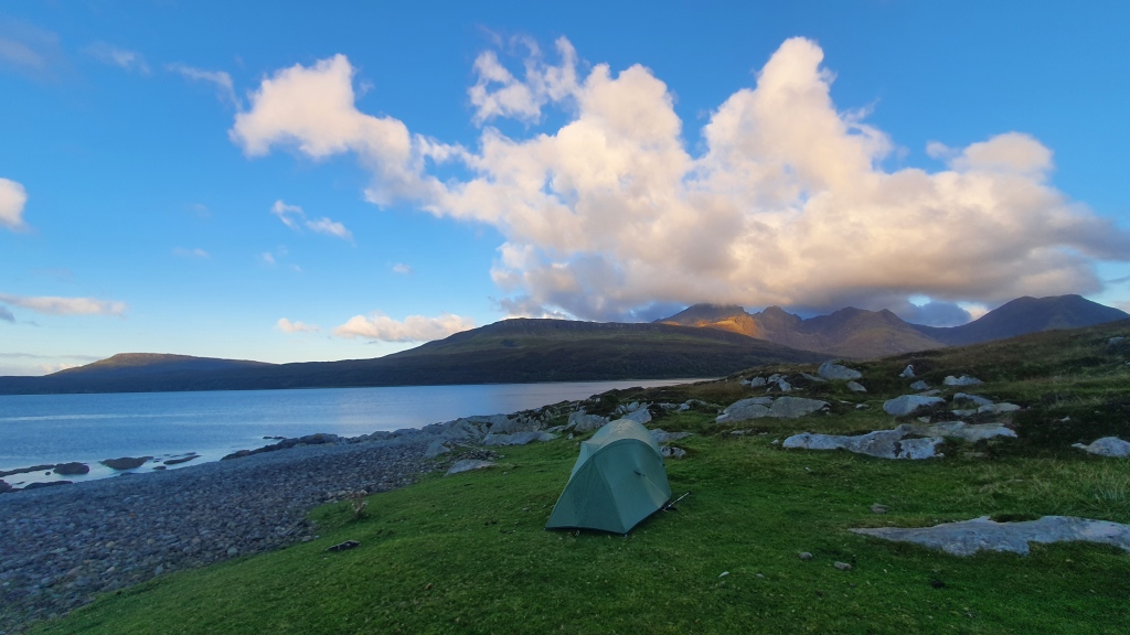
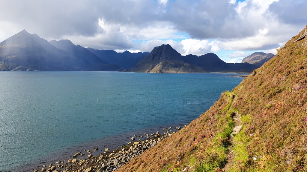
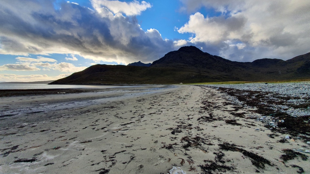
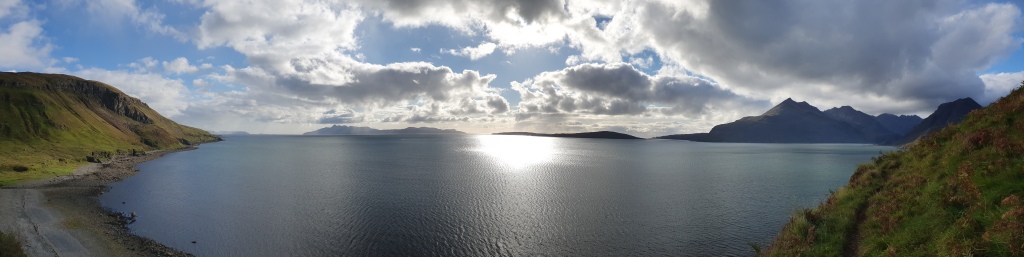
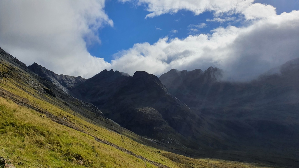
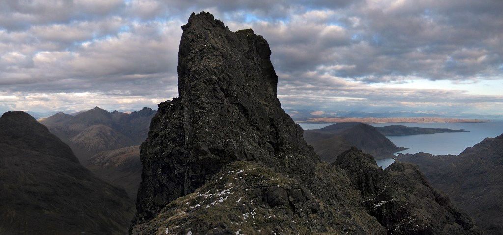
Leaving the Skye Trail at Camasunary I headed west along the lovely beach then crossed the river in September 2022 (tidal and I had to wade) and followed the rough coastal trail to the west past the ‘Bad Step’ (Grade 2 scramble) to Loch Coruisk. I have been here many times over the years and the scramble looks a little intimidating being perched above the sea but has good solid handholds and is a very short crossing of a steep slab (maybe 10 meters?)

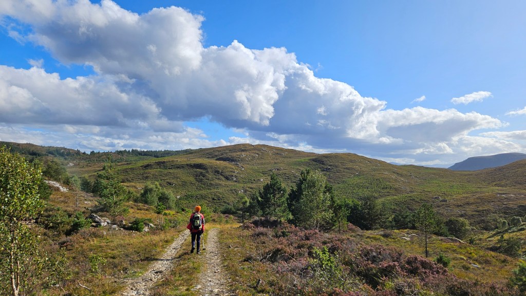
I took the trail north over a pass before descending down into Glen Sligachan to connect again with the main Skye Trail.

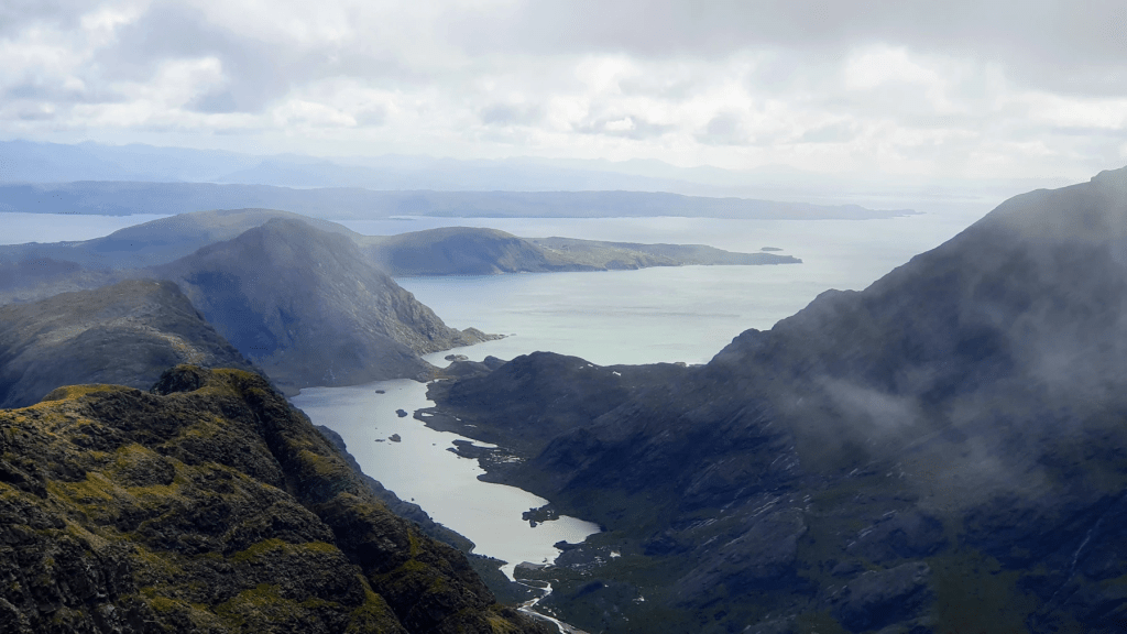
Better still is to also cut back south near the pass on a trail to the summit of Sgurr na Stri for some brilliant views. Return back to the trail to Glen Sligachan.

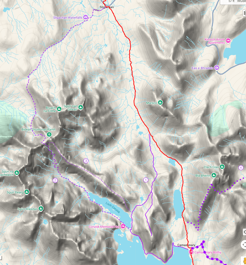
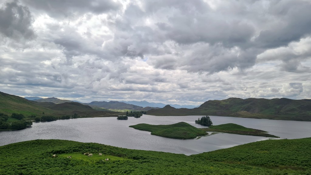
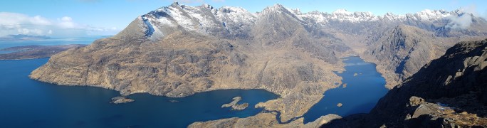
2 Loch Coruisk and Bealach na Glaic Moire

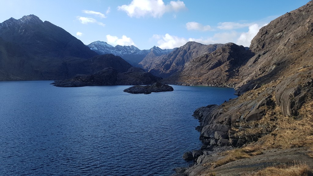
This is an interesting and atmospheric mountain route round the coast to Loch Coruisk via the ‘Bad Step’ (Grade 2 scramble) as per route 1, then along the south of Loch Coruisk, up over the Cuillin ridge at Bealach na Glaic Moire (pass of the big glade) then a scrabbling scree descent to connect with trails on the west of the mountains to Sligachan.

I followed route 1 in September 2022 to Loch Coruisk then left it by crossing the loch outlet using stepping stones (very tricky if the river is high) and picked up a rough trail along the south side of Loch Coruisk.

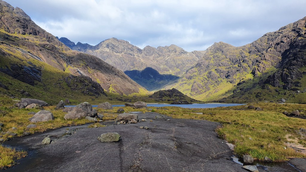
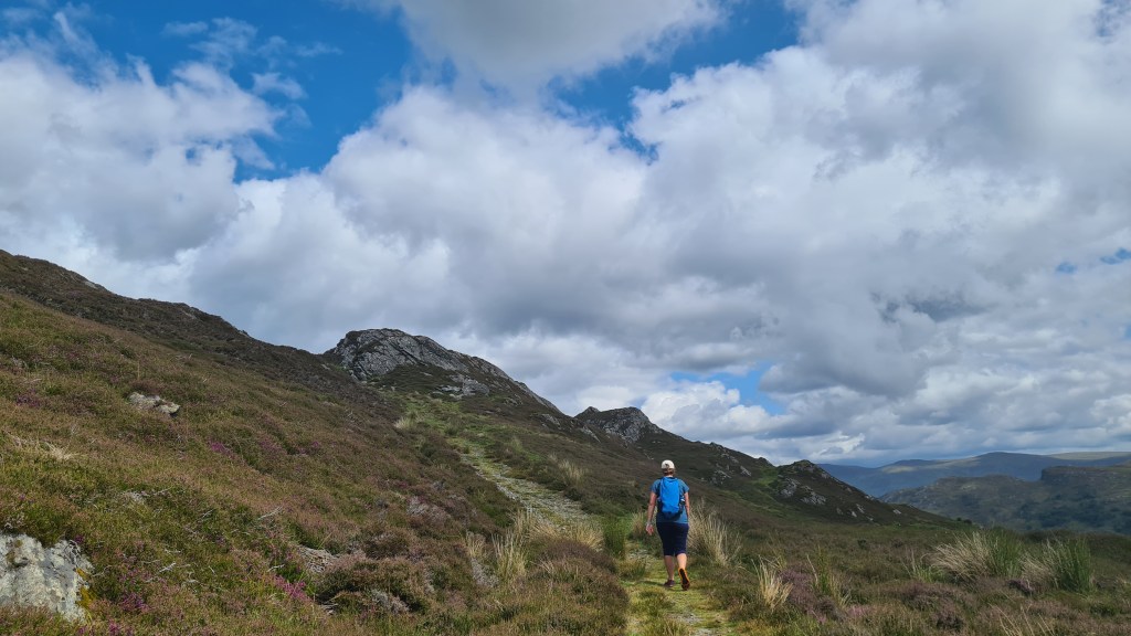
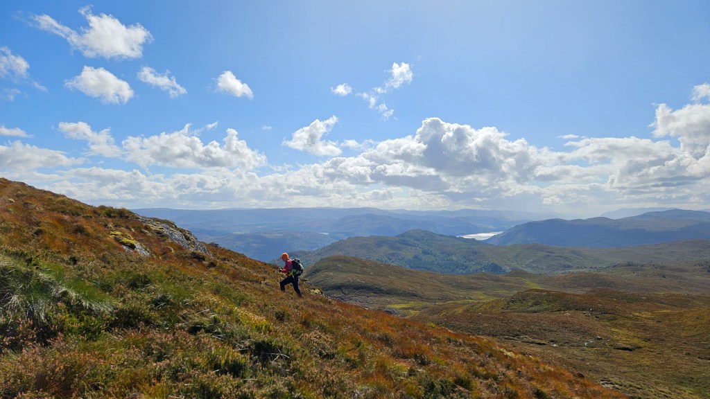
The going was very rough, steep and slow all the way up to the Bealach but the views are superb and this route takes you into the heart of the Cuillin mountains and over the crest to the north side.

Nearing the top of the Bealach

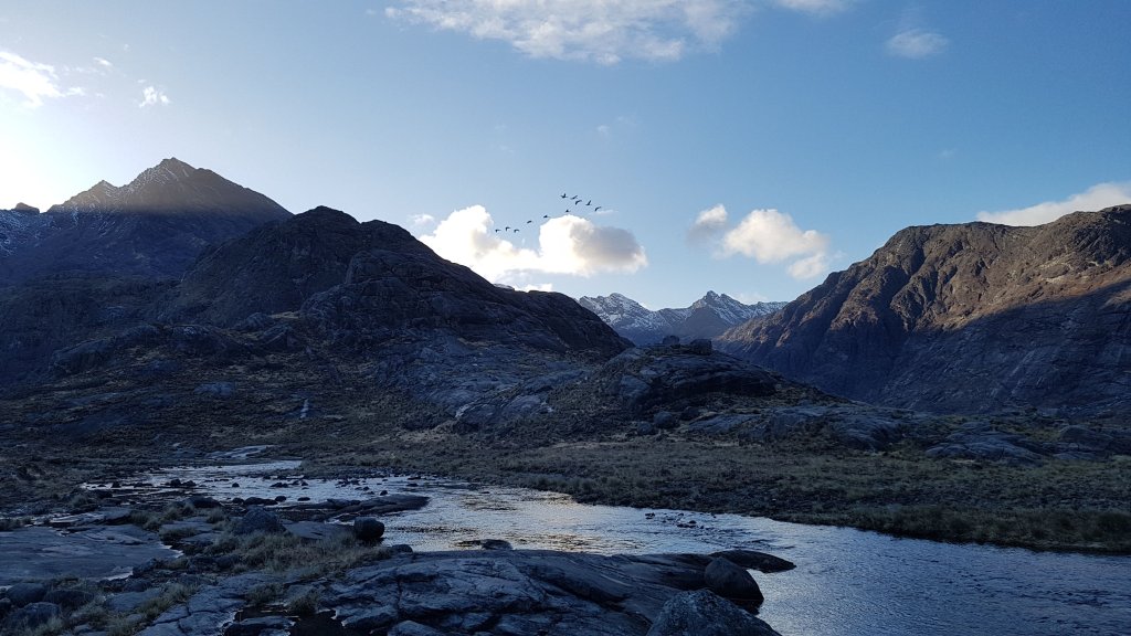
On the descent I carefully traversed right along a grassy shelf to find the top of the steep scree descent to easier grassy ground and alpine meadows.

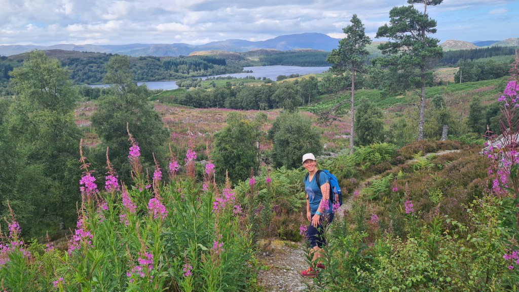
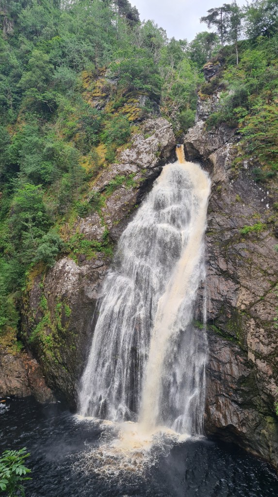
From the grassy ground and river, I trended right away from the river gorge on a faint trail down to pick up a better trail heading northward skirting the edge of the hills to the gentle Bealach a’Mhaim. A good path now follows the river with lovely waterfalls to Sligachan.

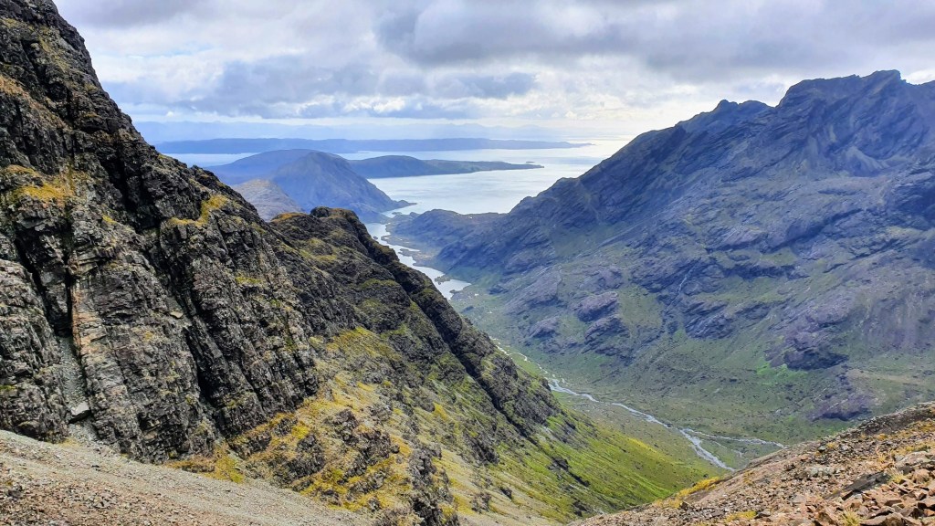
3 Druim nan Ramh ridge

Purple dotted line above. This is a varient on the above two routes and involved following the long ridge on the north side of Loch Curuisk. I took the Bad Step route as per 1 (Grade 2 scramble), then the trail north over to the pass, then split north west along the Druim nan Ramh ridge. This offered great views and was easy until near the top before the junction with the main Skye ridge. The least difficult route involved some Grade 2 scrambling avoiding the ridge on the left looking up for the final stretch. The book ‘Skye Scrambles’ by the Scottish Mountaineering Club was helpful. I arrived at Bealach na Glaic Moire as per route 2, bivouaced for the night then I followed that route to Sligachan.

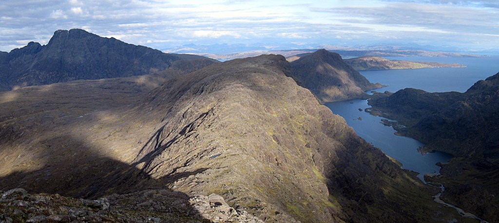
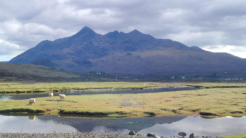
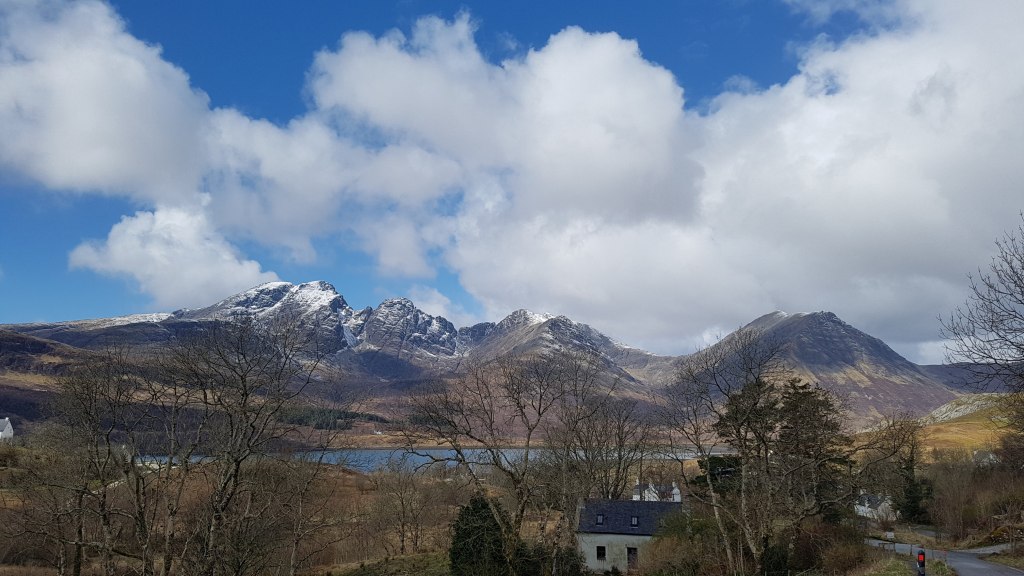
4 Blaven south ridge

We have only done this route as part of a day trip, and it would be tougher carrying backpacking equipment if on the Skye Trail as it involves a steep 3,000 foot ascent from sea level. That said, Blaven is a great mountain, visible and distinctive from afar, that calls out to be climbed with fab views.

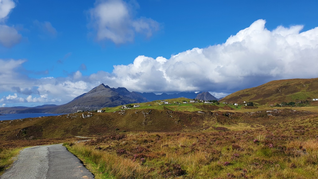
5 Camasunary short cut

A good quality trail. We have hiked this a few times. It’s included here as it offers a shortcut between Camasunary and Kilmarie if required. Although by doing so you miss the fine coastal walk between Elgol and Camasunary on the main Skye Trail.

6 Spar Cave

This is the one alternative, more of a side trip, that we haven’t done…although we would love to as the cave looks fantastic. Note that access to the cave is tidal but Walkhighlands provides all the details.
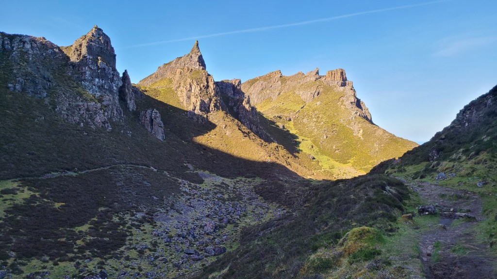
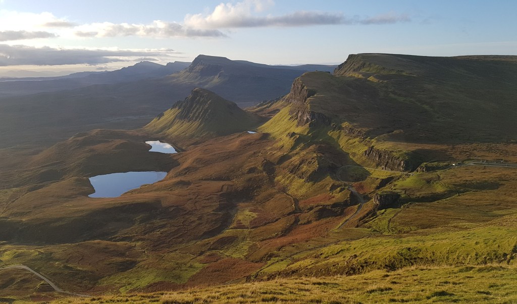
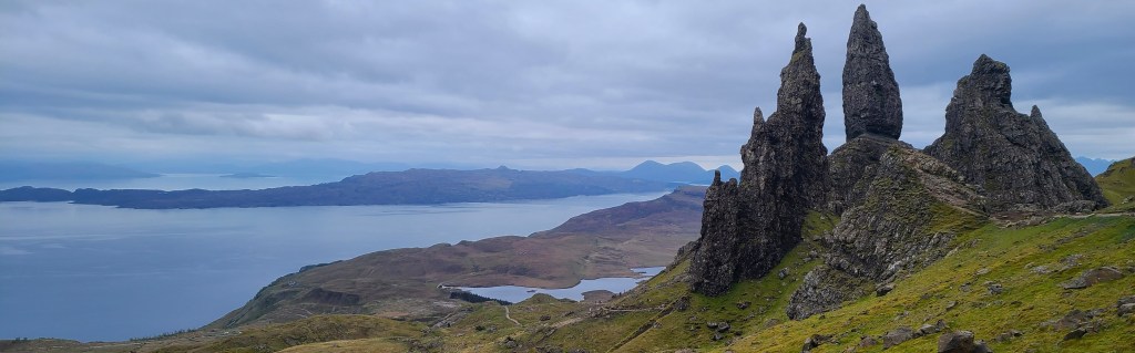
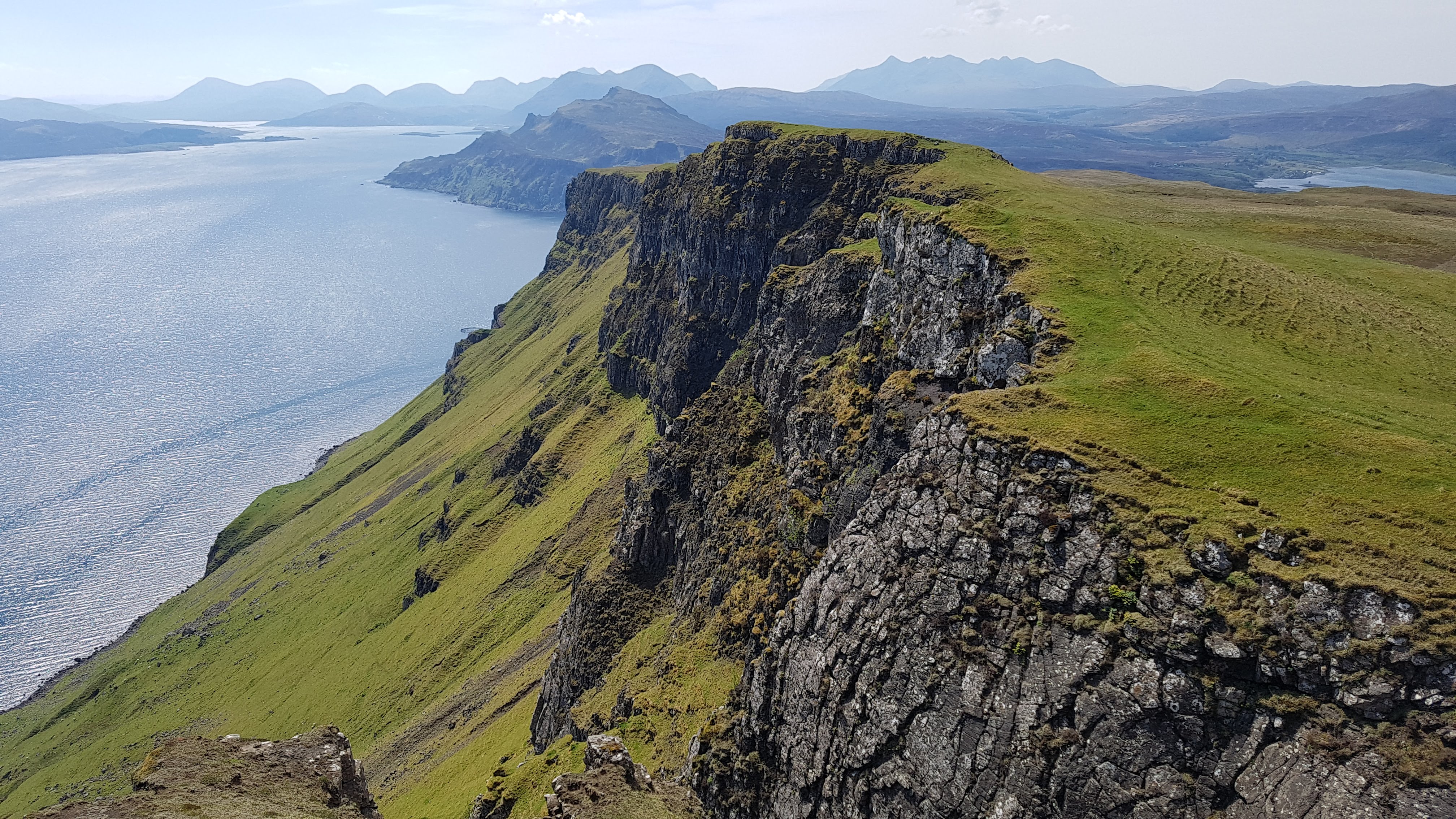
7 Storr ridge

This is the southern continuation of the Trotternish ridge on the Skye Trail. It’s less frequented though and involves some similar trackless and occasionally boggy ridge walking.

From Portree you need to walk up the A855 main road for about 1.5 miles before heading out cross country up the hills.

This is worthwhile and there are some really nice views including hiking to the top of the hill, The Storr above the Old Man of Storr, but to be honest I think the main Skye Trail route is better.

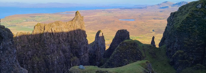
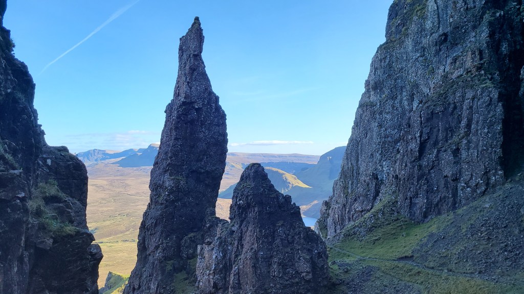
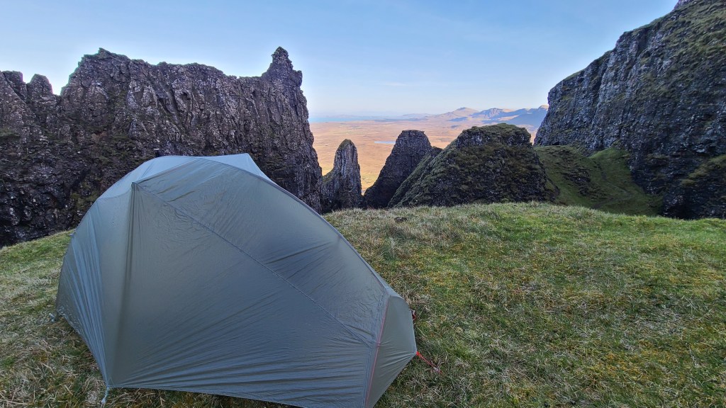
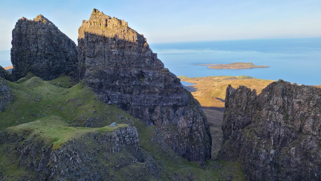
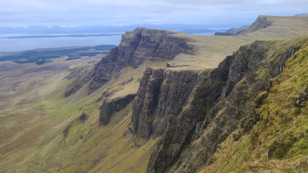
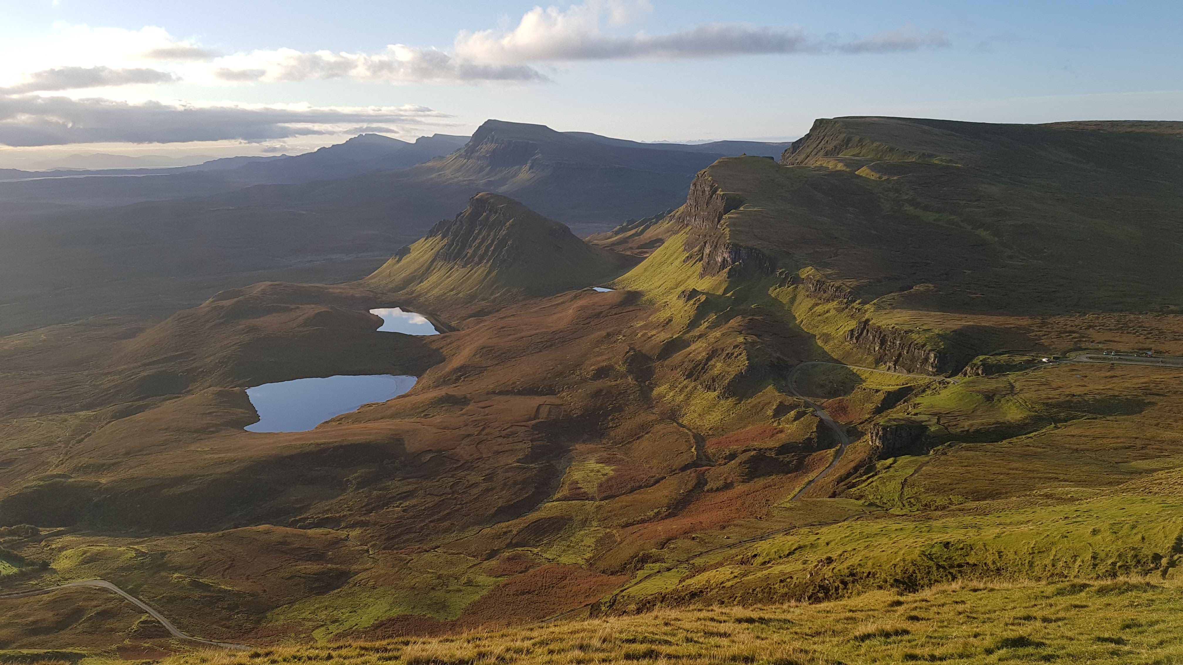
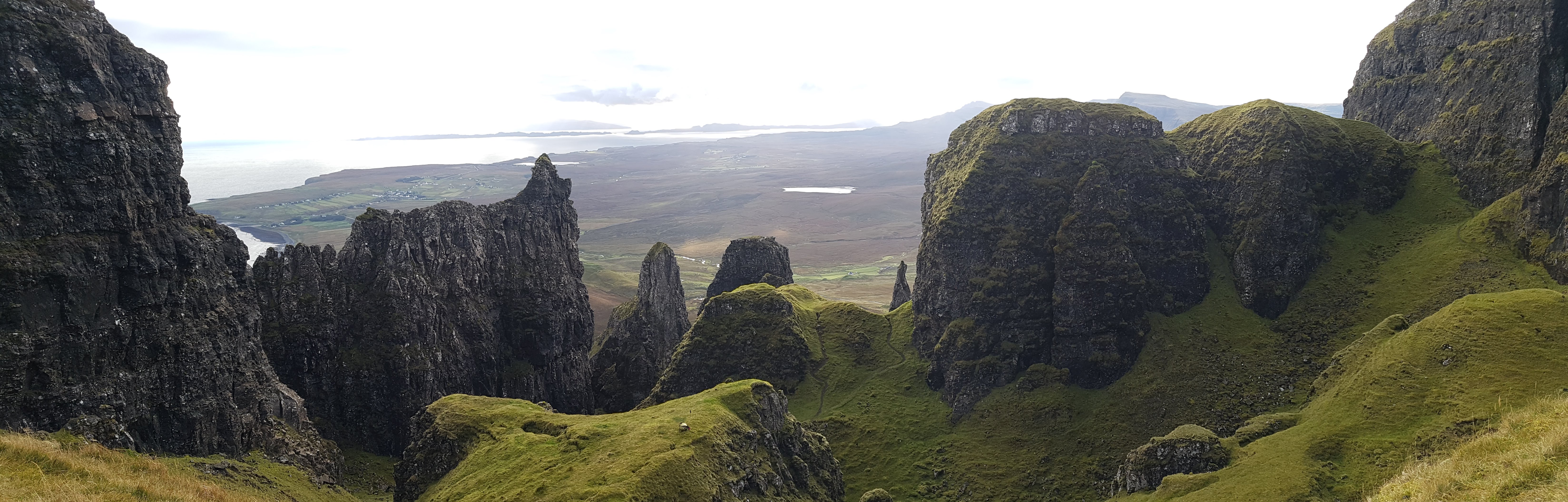
8 Quiraing north ridge

This is a route I did about 20 years ago northbound by splitting from the Quiraing trail before it descends to Flodigarry and following a trail to climb onto the north end of the Quiraing ridge.

I traversed some really scenic tops before descending boggy ground north west to the road at Kilmaluag. A short local road north took me to Kilmaluag bay and connecting with the main Skye Trail for its final flourish along the coast to Rubha Hunish.

Given the choice though I think the main Skye Trail has more merit with greater variety and drier ground for walking!

Skye Trail

Introduction The Isle of Skye has a fantastic backpack (if you get reasonable weather, see planning below) of about 82 miles (132km) and 4-7 days duration called the Skye Trail.

Skye Trail (map from Cicerone)

The Isle of Skye sits off the north west coast of Scotland and has wonderfuly diverse geology and scenery. The trail traverses both mountains and coastline with some tremendous everchanging landscapes and, maybe I am biased, but the scenery is world class.

In the south are the Cuillin mountains which are the most rugged in the British Isles. In the north is the Trotternish Ridge, where the trail traverses the long undulating ridge with splendid views and other worldly rock formations at either end. The coastal sections are equally good, particularly around Elgol in the south and Flodigarry to Rubha Hunnish in the north. That’s a lot of excitement to pack into around 80 miles! 

My hike May 2025 Southbound

Day 1 5th May 2025 Rubha Hunish to Flodigarry and the Quiraing

Skye’s bus service is helpful for accessing the Skye Trail at various points along the way, and I was able to leave my car at Sligachan and take buses north to Portree, then to the start at Shulista.

It had been very sunny here for the last few weeks which meant that the ground was pretty dry as I walked north at 1pm on an improved trail. The lookout and bothy at Rubha Hunish stands at a panoramic headland, with particularly good views north west to the Outer Hebrides over the small, wild looking island group of Fladda-chuain.

Next I headed east along the top of the cliffs on a surprisingly good line of faint dry trails with lovely views down to sea stacks and the hills of the mainland on the horizon.

Back down to sea level I passed the picturesque bay of Gobhlaig / Balmaqueen with its old church and then more gentle scenic cliff top walking along to the posh looking Flodigarry nestled in a rare woodland for these parts.

About 10 minutes walking along the main road gave access to the wide trail climbing up to the Quiraing, a wonderful series of peaks and pinnacles, and amazing to think its caused by landslips which are still active. This is a justifiably popular walking area but by the time I stopped for dinner about 5pm it was deserted. I took water and headed steeply up away from the trail to find a campsite in an incredible spot in amongst the towers. A really scenic first day.

Day 2 Quiraing, Trotternish, Old Man of Storr

Ravens were vocal in the early morning with their croaking echoing between the rock walls. I carried on southwards to cross a road and car park to start the hike along the long undulating Trotternish ridge. This provides superb walking with panoramic and subtely changing views all round to cliffs, islands and hills. I was glad I had saved this for a good weather day to appreciate this 14 mile high level stretch to the next road at The Storr.

Following the route was straightforward (in the clear weather I had anyway, it would be much trickier in mist), with a use trail along the cliff edge of the steep east facing slopes. It was also mostly dry underfoot, but my trail running shoes still got soaked on intermittent boggy seeps. Carrying a couple of spare pairs of socks and switching over to try and dry off the feet helped a bit though.

Trotternish ridge

I saw a few hikers out today, maybe about 15 others mostly heading northwards but it still felt like a fairly wild experience. This changed as I neared The Old Man of Storr- another crazy, stunning set of pinnacles and popular tourist spot. I descended down past The Storr on a good maintained trail to the road and carpark packed with people. Well, it is justified, as it’s another incredible place that has been used in a few movies….

I left the hubub and crossed the road to follow another lower, more mellow ridgeline south over the hill ‘Sithean Bhealaich Chumhaing’ -a Scottish Gaelic name that is a bit of a mouthful but I think it means ‘fairy hill of the narrow pass’. This is a relatively unfrequented area of Skye but is incredibly scenic as well as providing a good chance to spot eagles.

With little wind, I was able to set up a splendid camp right on the ridge with grand views all round, especially south to the Red and Black Cuillen mountains where I was heading.

Day 3 Portree and Glen Sligachan

I had a couple of hours walking in the morning into the largest town in Skye, Portree. Descending down from the camp the views of Portree bay opened up with a small cruise ship arriving. There is a lovely walk along the north shore of the bay into Portree itself and I got some food, along with a visit to the Inside Out outdoors shop for some glue to repair (hopefully succesfully!) my inflatable sleeping pad.

I walked out of town along the road and then cut down back to the edge of the bay for about a mile giving enjoyable hiking with plenty of waders and geese around. From there, it was time to hike the road for a couple of hours- albeit a minor single track road with few cars and more views, which I didn’t mind at all.

Eventually the road ran out and I joined a cool trail on the north shore of Loch Sligachan to arrive at Sligachan campsite for about 5pm. I had intended camping here but first I had a veggie burger at the nearby hotel. The sun had just come out and this is a lovely spot to sit outside. But…. I decided to head out along Glen Sligachan in the nice evening light to find a wild camp.

All the tourist buses stop here quite rightly for the views into the Cuillin mountains, and I do like the newish statue of early mountaineers Mackenzie and Collie looking up to the hills. Anyway I soon was hiking a quiet trail along Glen Sligachan between the jaggy Black Cuillen on the right and more rounded Red Cuillen on left.

I have previously done some alternatives to this glen walk in the past, described in Skye Trail Alternatives. These are fab, but to be honest this walk down the glen looking up to the hills is also pretty good, as well as being dry underfoot and easy to navigate. Camping spots were few and far between but I found a good spot down by two lochs, Lochan Dubha (the Black Lochs).

Day 4 To Elgol, Torrin and Boreraig

A sunny morning and I hiked easily out of the glen to the shore at Camasunary, stopping to have a look at the luxury MBA Bothy here. A great spot, but I wouldn’t have exchanged it for my wild camp last night!

The next stretch is a favourite of mine, a couple hours to Elgol on a sometimes rather exposed trail above the sea- it’s worth stopping a lot to look back at the grand views to the Cuillins and Loch Coruisk… After a lunch break at the recommended Cafe Elgol (the grocery shop seemed closed) I now headed back east then north around the peninsula, first on quiet road then trail. This is a mellow stretch that affords lots of distant views to islands and sea.

After rounding Loch Slappin, I made it back down south to camp on the coast between the Highland Clearance villages of Suisnish and Boreraig. Another great day and with easier dry, walking.

Day 5 To Broadford

All that was left was an easy six or so miles back north over to Broadford- it was still pretty scenic though. What a trail, and I would do it again!

Planning 

Walkhighlands has an excellent web guide and app.

Cicerone also a has a detailed guidebook available in paper or eBook.

Harvey Maps Skye Trail paper map is also very useful.

No permits are required, you can wild camp easily outside the towns and access to drinking water mostly isn’t a problem.

There are good bus services down the length of the island connecting the start and finish, as well as Portree and Sligachan. Check the guides or use an app such as Google Maps.

Approaching Loch Coruisk on an alternative

Best time to hike But when is best? Here are some factors to consider…. April to July is the driest time in Skye. For me from November to February is too dark, wet and boggy at least for wild camping. The biting insect called the midge makes itself felt from some time in May to September. Tourists flock to Skye in summer and they won’t impact your hiking but they do make it more difficult and expensive to get accommodation if you need it.

So I would say April, May, early June along with late September and early October are the best times to plan in advance – with May perhaps being optimal. That said Skye has very variable weather and can be good or bad any month of the year.

Best direction I don’t think it matters too much. However if you are flexible then checking the forecast wind for the week (see links below) and hiking with the wind at your back might prove a good idea.

If you are not wild camping then you have a long, exposed day along the Trotternish ridge between The Storr carpark and Flodigarry in the north. It might be best to do this near the end of the trip and thus hike northwards so you have time to ‘warm up’ before tackling this stage. If you are wild camping, you have more flexibility if the weather is reasonable as you could pitch your tent along the ridge.

Hiking terrain There is a huge mix. From trails, cross country along ridges and coast – and some stretches of tarmac. Expect lots of soft wet ground and some bog, especially in wetter periods between Portree and Flodigarry.

I reckon there is about 28km of the 130km total length on tarmac, with the longest stretch being 6.5 miles (10.5km) between Sligachan and Portree in the middle. On the plus side the roads are quiet and the views are mostly extensive, but its a bit more than I would like on a trail.

Weather I will be honest, Skye has a pretty wet climate with the prevailing south westerly winds bringing damp air from the Atlantic. I had a quick look at the web, and for example the town of Portree on the Skye Trail has about double the precipitation (1815mm average annual) compared to Tuolumne Meadows in the USA on the Pacific Crest Trail. I suspect Portree is one of the driest parts of the Skye Trail as well! But there are dry spells – and mixed cloudy, showery weather can provide clear air and beautiful, atmospheric views.

Ideally to me it would be best to plan your hike in advance but have some flexibility to look at forecasts before you set off such as: 

West Highland Way

This is Scotland’s most popular and oldest trail, going between Milngavie, on the outskirts of Glasgow, and Fort William for 96 miles. The scenery is grand but fairly familiar to us having hiked and climbed in the area most of our lives, and so up til now we hadn’t thought of doing it. But Brian decided to walk the route in April 2025 backed by an inviting stable weather forecast and the prospect of pre midge season!

We have also walked the 10 mile Kelvin Walkway which extends the trail south to near the centre of Glasgow.

Day 1 31st March 2025 North from Milngavie

After a train to Glasgow and then Milngavie (pronounced Mil-guy) I set off just after 1pm in coolish (12C), still, cloudy conditions – great for hiking. Most of this first day was on pleasant, packed trails leaving the suburbs northwards and soon passing the Campsie hills.

I stopped at the purple ‘Turnip the Beet’ cafe for late lunch of a terrific veggie toasted bagel and saw a handful of hikers in the afternoon, people from the UK and across the world out enjoying themselves. Making it to the first climb in the late evening, I camped after 18 miles at 8pm and dusk on the top of Conic Hill with sunset views over Loch Lomond.

Great camp, with a bonus of no midges ending a nice first day.

Day 2 Loch Lomond

Today was spent hiking up the east side of Loch Lomond, the latter part of which was new to me, and it turned out to be a scenic and varied route.

Firstly I dropped down to the settlement of Balmaha, picked up some food at the small shop and had a sit in the early morning sun at the cafe next door.

The trail then heads along near the shore of the loch through woodland with cool ever changing views of the loch and the Luss hills across on the west side. I chatted with hikers along the way, eventually reaching Inversnaid Hotel mid afternoon.

There were loads of hikers resting or finishing for the day here (there is a bunkhouse in addition to the hotel) but I headed onwards on a bumbly, rougher trail for maybe 6 miles to the north end of Loch Lomond. This trail has a reputation for being tough but to be honest I enjoyed the route, weaving up and down around boulders and tree roots.

I finished up just at dusk again and lucked out with a tiny spot for the tent on a rise looking back down southwards to Loch Lomond.

Day 3 Past Crainlarich, Tyndrum and Bridge of Orchy

Both nights so far had dipped to freezing with a light frost on the tent, but I awoke to another shiny blue sky day and it soon warmed up. I walked for less than an hour to Inverarnan with Beinglas campsite and a hotel at the nearby A82 road. Another 2nd breakfast- I could get used to this!

This is a common overnight stop and today I counted 50+ people hiking northward from here. I was finding that by wild camping I was a bit ‘out of sync’ with other hikers as most people either stayed in pre booked accomodation at set points along the trail or camped in commercial campsites usually near the accomodation. We definitely prefer wild camping if we can, with the excitement of not knowing where you will find a spot that evening, the chance of camping at the most scenic points, along with the flexibility of not sticking to a fixed itinery.

The trail followed the River Falloch north for a while with lots of rocky waterfalls which would be tempting for a swim in the warmer summer months. Although the A82 main road and railway line took the same glen, it didn’t detract from the pleasant leafy hiking.

I should mention that the WHW is a very clear trail to follow, usually wide and often on hardpacked ground- making for easy walking for most people but I found the hard, flattish terrain a bit sore on the soles of my feet!

I pushed on further than intended today, past the ‘resupply’ spot at Tyndrum and the hotel at Bridge of Orchy to camp again at dusk at a lovely high point overlooking Loch Tulla and north to the Black Mount hills.

Day 4 Rannoch Moor and Devil’s Staircase to Kinlochleven

Another sunny day – I was being spoilt! Dropping down to the Inveroran Hotel and some nice riverside campsites at Victoria Bridge, I set off onto an old Military Road across the edge of Rannoch Moor, built in the early 1800’s by Telford. The Moor is a tremendous place of high undulating plateau, with peat bog and lochans, fringed with rugged hills particularly to the west. Today I had clear skies and a cold wind sweeping across which was lovely, but I guess it could get a bit exposed out here in poorer weather.

Rannoch Moor

I deviated a short distance at the northern edge of the moor to Glencoe ski area near Blackrock cottage for a nice lunch and a hot shower- wonderful!

A short climb over the ‘Devil’s Staircase’ gave great views back over the Moor and across to Buachille Etive Mor (scene of many of our scrambling and climbing trips and a favourite hill ) guarding the top of Glen Coe. From there, the trail high point at a modest 548m (the WHW isn’t a mountainous trail!), but it was a long weaving descent down to the village of Kinlochleven for a night at the Blackwater Hostel -recommended.

Day 5 Final day to Fort William

There was a scenic climb first thing from Kinlochleven through woods with views across to Loch Leven and the hills on either side. From there the trail follows a more remote set of glens and with a strong cold wind, it was a time for keeping the head down and just hiking on.

There were some grand views to Ben Nevis (UK’s highest peak) before the descent to Glen Nevis and a rather long 4 miles or so of pavement to the end in the town of Fort William.

I stopped here, but from Fort William there is a network of trails heading north on the Cape Wrath Trail or Great Glen Way-John O’Groats Trail….

Overall I really enjoyed the hike, it was obvious that lots of work goes into maintaing the trail and that is really appreciated. But I imagine it could get really busy from Easter through to October and this would put me off walking at these times a bit. That said, it’s a pleasant introduction to Scottish walking and, with not being very remote and lots of services at hand I can see why it is popular.

References

There is lots of info out there on the WHW:

I loved the Harvey strip map– lightweight, small and pretty much all I needed

Walkhighlands has detailed descriptions, maps, gpx and an app

And the official West Highland Way website

The Kelvin Walkway is a pretty cool short 10 mile extension of the West Highland Way in the south from the River Clyde near the centre of Glasgow.

It follows the Kelvin River north from the River Clyde and goes through Glasgow’s west end as it gradually makes its way into the countryside. The walkway ends at Milngavie conveniantly connecting with the southern start of the West Highland Way.

The trail is much less used than the WHW and the riverside path can get a little overgrown in places, but we enjoyed following the river and seeing Glasgow from a different perspective. A nice addition to the West Highland Way.

Moray Coast, Speyside Way and Dava Way Trails

These are three well marked trails in the north east of Scotland providing easy walking at low levels and that are mostly doable all year round. Combining the trails creates a loop called the Moray Way. This page has an overview of each with some pictures from our hikes.

MCT -Moray Coast Trail, DW Dava Way, SW Speyside Way, Moray Link

In addition there are also short sections on sea kayaking along the Moray Coast and the ‘Moray Link’, an unmarked route that links the town of Forres to Inverness and thus connecting these trails up with the John O’ Groats Trail and Great Glen Way/South Loch Ness Trail.

Moray Coast Trail 74km

Speyside Way 138km

Dava Way 38km

Moray Link about 60km

Moray Coast sea kayaking

This is a pleasant flat hike along a coastline with plenty of beaches and towns and some beautiful cliff scenery. I have an ascent comparison of trails and this one comes out the flattest by some margin!

Walkhighlands has good descriptions, maps, gpx -splitting the trail into 4 days.

The weather on this coast tends to be drier than say the mountains in the west and it could be a good choice as a first or early backpack, given; the weather, quite a few towns along the way, it’s at sea level and on mostly well signposted trail. It could be possible to hike this through the winter too (if the short days don’t bother you).

Forres to Burghead 20.5km

Burghead to Lossiemouth 14.5km

Arch near Cummingston (the trail itself is above on the field margins here, we dropped down at low tide onto the shore to walk past this and the coast cliffs)
Covesea lighthouse

Lossiemouth to Buckie 25.25km

Buckie to Cullen 12km

Bowfiddle rock
Portknockie harbour

This trail takes you from the Moray Coast in the north roughly following the River Spey to Kingussie. Its very well sign posted and again is a fairly gentle walk with a good well made path. There are loads of whisky distilleries along the way too!

Walkhighlands has good descriptions, maps, gpx -splitting the trail into 8 days.

Uath Lochans between Kincraig and Kingussie

Dava Way 38km

This is a particularly gentle hike as it mostly follows an old railway line connecting the Speyside Way at Granton to the Moray Coast Trail at Forres. We have only done a short part of this route as part of a longer loop hike in the area.

Walkhighlands has good descriptions, maps, gpx -splitting the trail into 3 (short) days.

This is an unmarked route following the Moray coast that links the town of Forres to Inverness and thus connecting the Moray Coast Trail and Dava Way up with the John O’ Groats Trail and Great Glen Way/South Loch Ness Trail. I have split the walk into 2 stages below but it could also be done in 3 stages with a break at the village of Ardesier.

Forres to Nairn (about 22.5km)

I think this is currently the better of the two stages where you can follow existing trails and forest tracks with some short minor roads. The map above shows the rough route we have taken but other options are available. Of note are the lookout tower in Culbin Forest providing good views above the forest canopy, and the hike along the edge of the saltmarsh in Culbin. Oh also take note that its pretty flat!

There are bus connections between Forres and Nairn.

Nairn to Inverness (about 34km)

This is a longer stage that could easily be split at the coastal town of Ardersier or at Inverness Airport (roughly halfway). There is accomodation and good transport links at both to Inverness, Nairn and beyond.

The route is mostly along the shore or on minor roads but also with occasional pleasant trail. The shore sections mean that it is best done at lowish tides.

The Google Map above shows a possible route Brian hiked and below is more detail for the eastern section between Nairn and Ardersier.

Nairn-Ardersier
  • 1 Nairn You can just walk the pavement west from the harbour. Brian walked the scenic beach along the golf course at the ouskirts of Nairn (but you can probably walk the edge of the golf course on grass at high tides).
  • 2 Hilton of Delnies Head inland southwards after the golf course to pick up a narrow vehicle lane to the B9092. Brian’s track here followed a signposted trail around the edge of the course but there may be a more direct way.
  • 3 B9092 Brian walked the road for about 2.5km. The traffic was light but fast moving and overall it’s not that great. However a direct hike may be possible between points 2 and 4 on the map through the Carse of Delnies – but I didn’t explore.
  • 4 Haventus Port entrance The road going north west from here is fenced off with security so acts as a bit of a barrier to the possible direct hike above- or to going around Fort George. At least I was able to take the next minor road on the right and past the cottage (with Kebbuck standing stone in the garden!).
  • 5 Carse Wood Turn left (west) onto nice trails through Carse Wood. I hiked below (north of) the escarpment but it may be possible to hike along the top for a while then drop down.
  • 6 Minor lanes into Ardersier

This part of the coast has spacious views across the Moray Firth to the Black Isle in the north and there should be plenty of bird life around.

Moray Coast sea kayaking

In some ways kayaking along the Moray Coast provides better scenery than the walking trails. The coast has plenty of birdlife, cliffs, cave, arches with a chance of seeing dolphins and whales. Add in some old castles, lighthouses, lovely harbour towns… and its a great kayak destination. The coast is exposed to a north or north east swell so we find it’s best when the swell is down (forecasts at Surfline) and avoiding a north easterly on shore wind allowing us to weave in and out of caves and tunnels.

A great guidebook is North & East Coasts of Scotland Sea Kayaking.

At Bowfiddle rock

Affric Kintail Way

This is a short backpacking trail (AKW below in map) running east west, connecting the west coast of Scotland at Morvich in Kintail with Drumnadrochit and Loch Ness in the east. It also acts as a link between the Great Glen Way (GGW) and the Cape Wrath Trail (CWT) at Morvich.

Walkhighlands Affric Kintail Way provides a good description of the 76km (47 mile) trail including a gpx track and off line map.

Approaching Glen Lichd with the Kintail mountains behind

The character of the trail is one of scenic low lying glens with the iconic and beautiful Glen Affric in the middle and a route through wilder mountain scenery in the west. Almost all of the walk is on good trail or vehicle tracks with only the odd bit of bog at the head of Glen Affric- I wore running shoes throughout and stayed fairly dry. Given its short length, signposts and quintessential Scottish highland scenery it would make a good introduction to backpacking in Scotland.

Cannich store with an unusual forest fire in summer 2023

Here are some pictures from Brian’s hike in May 2024…

The final miles in Glen Lichd (the river valley) from above on the hill of Sailaig

Great Glen Way, South Loch Ness Trail

These are two linked trails in Scotland that form part of a connected network. They are local to us, and we have hiked them as a series of day hikes throughout the years and seasons.

The Great Glen Way provides a fairly straightforward and popular 118km (74 mile) hike between Fort William and Inverness. It travels along an iconic glen that slices north east through Scotland with a series of waterways including Loch Ness.

The South Loch Ness Trail is a 55km (34 miles) hike linked to the GGW, in effect acting as a variant on the northern half from Fort Augustus to Inverness. It is less busy but is also easily navigated on good trails.

The northern part of the GGW could be hiked together with the SLNT as a loop around Loch Ness -the Loch Ness 360 at 129km (80 miles).

The scenery traveled through is a mix of forestry (managed and natural), fields grazed by sheep/cattle and lochsides. As the trails stay relatively low (maximum of 450m on the SLNT) and are well made and dry in the most part, they can be hiked enjoyably for most of the year, even in winter – if you can handle the short days!

It should be said that both are also possible by mountain bike or gravel bike, with some short pushes needed on the SLNT.

Great Glen Way Good resources are the Great Glen Way Walkhighlands website, Cicerone guidebook and Harvey Map. You can either stay in accommodation along the way as described in the guides above or can wild camp. I recommend the two high route options (well I would of course!) between Fort Augustus and Drumnadrochit which provide some nice views of Loch Ness from above and spend more time above the forestry.

We also hiked a Great Glen Way summit alternative that provided better views with a bit more adventure. This splits off from the high trail on the section between Invermoriston and Drumnodrochit.

Winter snow on the high route north of Invermoriston

Here are some pictures from our hikes on the Great Glen Way…

South Loch Ness Trail Again Walkhighlands website and Harvey Maps have lots of details to help hike the trail.

Leaving Fort Augustus looking north up Loch Ness

I don’t recall seeing any long distance hikers on the trail and very few other hikers away from the small towns. The SLNT has fewer towns along the way than the equivalent GGW section north of Fort Augustus. There is a shop and café at Foyers and cafes and pub at Dores before reaching Inverness. I thought there was a bit more variety than on the GGW with more views to Loch Ness, but both trails provide a similar experience through relatively low level scenery. Again wild camping is possible along the way, and some accommodation at Whitebridge, Foyers and Dores.

Great Glen Way- summit alternative

This was a chance to climb up above the Great Glen Way high trail for better panoramic views of Loch Ness and the mountains to the west.

From the south, the route consists of; jeep track, cross country to a summit, then a hill trail (that can be boggy) back north east to the Great Glen Way. So it does require more navigation skills than either of the standard trails.

Whilst hiking the route we found an old running race marker and now realise that it’s Day 1 of an ultrarunning event. The link here has details of Ultra X with a GPX for interest. Walkhighlands also has a route description for the northern section as a ‘there and back’ hillwalk.

We enjoyed it, but its definately muddier than the standard routes!

John O’ Groats Trail

The John O’Groats trail (JoGT) is a 147 mile (236km), mostly coastal route from the city of Inverness to John O’Groats on the north east tip of Scotland. The scenery varies from pleasant inland agricultural areas, to beaches and wildly impressive sea cliffs with arches and sea stacks. The area is home to lots of seabird colonies and you have the chance to spot seals, dolphins and even whales. On top of that there is a tremendous historical interest along the way such as iron age Nybster broch to the Viking Old Wick Castle. And from more recent times there are many picturesque harbours and sights like Whaligoe Steps.

The John O’Groats trail acts as an excellent connector to the 74 mile long Great Glen Way in the south. And south of the GGW, the 94 mile West Highland Way connects to the outskirts of the city of Glasgow.

Going further south the JoGT forms the northern leg of the complete traverse of Great Britain from Lands End to John O’Groats at about 1300 miles (LeJog journey planner).

The JoGT trail is fairly new and is still being improved in places with some rougher, boggy sections and barbed wire fences particularly between Helmsdale to Wick. So it can be a pretty challenging walk overall but constant improvements are being made by the Friends of the John O’ Groats Trail on the trail and signage.

Our hikes

We live near to the southern area, and have walked the trail in sections, including Brian backpacking the northern part from Dunbeath to John O’Groats in 2023. Here are a few pictures from those hikes…

Resources

John O’ Groats website has lots of details including status updates, green/amber/red ratings for each stage, blog posts, plus you can join or donate to the Friends of JoGT

Walkhighlands website also has a trail description, maps, gpx and off-line app

A guide book from Cicerone is excellent

JoGT strip map from Harvey Maps, also very useful

Brian’s description of a 3.5 day possible alternate route in the south from Munlochy to Tain.

JoGT Alternate ‘Black Isle’ route

About 14km north of Inverness at Munlochy, the John O’ Groats Trail heads inland for about 2 1/2 days to the town of Tain. The hike is through a pleasant rural landscape but this is a description of a possible alternate route between Munlochy and Tain over the ‘Black Isle’ and the ‘Easter Ross Peninsula’ that stays closer to the coast, with (arguably) better scenery that is more in tune with the rest of the JoGT.

From Munlochy, the alternate will take about a day longer to get to Tain. 3 1/2 days on the alternate as opposed to 2 1/2 days on the main JoGT – see distance breakdown below. Here’s a bit more on pros and cons of the alternate:

Cons

  • A day longer
  • This is not the JoGT and just a suggested route and as such is not signposted with no trail in places. Requires a map, the ability to navigate, with perhaps at times the need to work out your own route on the ground
  • There is a short ferry crossing between Cromarty and Nigg which usually only runs between June 1st and September 30th. Without the ferry you could possibly use public transport routes from Cromarty->Inverness, then Inverness->Tain, then Tain->Nigg, but it could take a while!
  • Tidal 1 mile north of Rosemarkie on Day 2 (but easily managed or bypassed, see the Fortrose to Cromarty section below)

Pros

  • Great variety of scenery and mix of trails, beaches and tracks
  • Less tarmac
  • Rosemarkie to Cromarty in particular has excellent beach and coastal walking as well as fossil beds
  • Morrich More beach walking – coastal and marine nature site near Inver
  • Good town stops
  • Options for interesting side trails, particularly to Chanonry Point and Tarbet Ness

John O’Groats Trail distances

SectionDistance (km)Of which tarmac
Munlochy to Culbokie10.35.2
Culbokie to Alness14.814
Alness to Tain2112.2
Total46.131.4

Black Isle Alternate red route distances

SectionDistance (km)Of which tarmac
a. Munlochy to Fortrose11.32.2
b. Fortrose to Cromarty181.3
c. Cromarty to Portmahomack287
d. Portmahomack to Tain173
Total74.313.5

Alt a. Munlochy to Fortrose 11.3km

Summary A varied walk on the Black Isle which is about half a day and meaning that you could walk from Inverness to Munlochy on the JoGT then this route to Fortrose making for a 25.5 km day.

It follows along field edges to the northern shore of Munlochy Bay, then nice woodland tracks to the ruins of Ormond Castle dating back to the 12th Century. Passes through Avoch, a scenic little harbour town with shops and a café. An old railway line through woods provides an easy hike from there into another scenic town of Fortrose with its cathedral, shops, post office, chemist, accommodation, 2 campsites and harbour.

  1. From Munlochy leave the main JoGT by following the high street northeast up to just before the A832
  2. Follow the signposted route on the right to walk east along the field margin parallel to the A832
  3. At the far end of the field, turn right for 20m to access the path along an old railway track still parallel to the A832
  4. Go past a car parking area and continue to a 2nd parking area
  5. Turn right down towards Munlochy Bay by field margins and past ruins
  6. Go along the edge of the bay to a wooden structure (nice rest stop). Continue on 30 meters or so until you are able to follow a field margin left uphill go to find a good vehicle track. [Note, you can continue around the coast to Avoch along pebbly beaches, sometimes slippy. Low tides needed]
  7. Turn right on this better track through Bay Wood (with excellent bluebells in spring) onto tarmac
  8. Reach a small parking area and go through the gate on the right to a dirt trail
  9. At the edge of the wooded hill (Wood Hill(!) on Map 2) turn left on the track (carrying straight on will take you to 10. as well)
  10. At the north edge of Wood Hill turn left at the junction and past the mound of the site of Ormond Castle. A quick diversion to the top gives nice views across to Chanonry Point and Fortrose
  11. Continue on the trail to a gate, turn sharp right towards the sea on a short trail and over another gate to cross a field diagonally downhill to reach a track along the shore
  12. Follow the track and turn right on the road north along the shore into Avoch (pronounced Och!)
  13. Avoch has a shop, accommodation and a small harbour. Take a route up onto the railway line path above Avoch (there are 2 trails with steps or a road up to the church and railway line). The church contains the grave with plaque of Alexander MacKenzie, explorer of the MacKenzie River in Canada
  14. Follow the old railway path into Fortrose and take a right at its end into Fortrose centre

Alt b. Fortrose to Cromarty 18km

Summary This is a great walk on the Black Isle, with beach and some boulders along the coast, then field margins with views to the sea along to the South Sutor and a final good trail down to Cromarty.

Highlights include the colourful and varied geology along the coast, caves, chance of spotting fossils, a bothy at Eathie, birdlife, world war coastal defenses and grand views across down to the sea nearing Cromarty. Three alternates are also described below.

The coastal southern section is best hiked at low tide as this exposes more of the sandy beach with easier walking. In addition about 1 hour beyond Fortrose and just over a mile north of Rosemarkie (Caird’s Cave on maps) there is a tidal section about 20 metrs long where the water can wash onto the cliff making passage difficult to impossible. As a rough guide, if the tide level at nearby Cromarty is at 2.4m or below it should be fine to cross.

Tidal section

Red Route on Map 3 and Map 4

  1. From Fortrose centre Coop grocery store you can take a number of ways to Rosemarkie. Here is one;
  2. Go down Castle Street opposite the Coop and continue down the grassy avenue past the school. Take a left turn just after the grass signposted ‘Path to Ness Road’ (straight on takes you to Fortrose caravan/campsite) on the short road then onto a path past houses
  3. Turn right at the next road junction, Ness Road, then left on the road signposted for Fortrose & Rosemarkie golf course and caravan campsite.
  4. Go along the road to the golf course club house. From there you can walk along the road, the grass trail above the beach or on the beach to Rosemarkie (Crofters cafe and then Beach cafe further along)
  5. From Rosemarkie you can then just follow the coast for a couple of hours to Eathie bothy. As mentioned above you will pass the tidal section after a mile and you will need to cross pebbles and boulders on occasion with the easiest hiking generally on harder sand near the water edge
  6. Watch out for sea and woodland birds, and maybe even otters, seals or dolphins. There are a number of caves to explore along the way, in one of which was found ‘Rosemarkie Man‘, a Pictish skeleton from about 500AD with severe head injuries. The changing geology is interesting… This coast is part of the Great Glen Fault and as such very old rocks are exposed at the surface such as gneiss and granites. Fossils can be found too and the 19th century geologist Hugh Miller made a number of discoveries here. If you are looking for fossils, note that hammering the bedrock is not permitted and follow the Scottish Fossil Code
  7. Eathie bothy provides shelter and some information panels. At the bothy you have a choice. My main red route is to continue along the coast then follow the escarpment above the cliffs. This is more scenic but in mid summer has a 200 meter long walk through deep bracken after climbing up above St Bennet’s Well. There is also an easier alternate heading inland, but with some tarmac walking (purple line Map 4)
  8. For the main route (red line Map 4) keep walking along the coast over sand, pebbles and boulders. Watch out for the slippy green rock slabs! After about an hour you will get to a small sandy bay NH793650 marked St Bennet’s Well on the map. The cliffs reach the sea beyond here and it is best to head up above onto the escarpment
  9. Follow a faint trail going steeply straight up the slope past a dead pine tree to the plateau above the cliffs
  10. The aim from here is to follow field margins and then trails above the cliffs to the parking area at South Sutor. The first 200m can have deep bracken in summer until you reach woodland. Cross this then follow the field margin to the next narrow band of woodland (worthwhile short side trail down to sea arches at McFarquhar’s Cave)
  11. Follow field margins and trails to the South Sutor carpark
  12. At South Sutor parking area take a fine trail down to the right, initially through woods, then contouring and descending gradually westward towards the sea and Cromarty, Map 4
  13. Cromarty has plenty of sights, excellent pizza, pub, hotel, shops and often oil rigs offshore as a surreal backdrop

Further Alternates exist if required (purple on Map 3 and 4);

a. An extra loop round Chanonry Point (beach, lighthouse, vistas and chance of seeing dolphins). From Fortrose Coop head down to the Fortrose caravan site then follow a trail on the south side of the peninsula beside the golf course to Chanonry Point. Continue via the north side to Rosemarkie either along the beach or on trails beside the golf course. [Dolphins can often be seen jumping very close to the point. Best chances to spot them are between April and September and on a rising tide]. This Walkhighlands route describes the walk in more detail as part of a loop.

b. High tide option from Rosemarkie, up Fairy Glen on good trail with its waterfalls, along a minor road then descent on good trail from Hillockhead to the coast. This Walkhighlands route describes a loop including both this high tide route as well as part of the normal route.

c. Leaving the coast at Eathie bothy (Map 4) to climb a good trail to join a minor road then track and trail through woods to Cromarty. Described again in Walkhighlands– but a more interesting route towards the end is to follow the route drawn on Map 4 rather than Walkhighlands. At section 8 Walkhighlands, leave the track 300m before Mains Farm where a path goes down left through woods. About 300m on, turn right on a good path going along a field margin and at the far side various trails allow access into Cromarty town.

Alt c. Cromarty to Portmahomack 27km

Summary This longer section starts with the small ferry across from Cromarty to Nigg and the ‘Easter Ross Peninsula’, then a mix of walking above the sea to Shandwick and to Balintore with a shop. A fine walk along the shore to Rockfield follows before a short road walk across to Portmahomack. A further scenic alternate could be to hike out round to the tip of the peninsula and lighthouse at Tarbet Ness.

Red route on Map 5 and Map 6

  1. From Cromarty take the tiny ferry across to Nigg (Balnapaling on Map 5)- the ferry runs between June 1st and September 30th
  2. Walk north past houses for a short way then take the road right marked Castlecraig (you can also walk the beach eastward to before the cliffs then head back left to a carpark and road) uphill to another Castlecraig trail marker and style on the right
  3. Walk a trail, faint in places, across the field and through gorse with great views back to Cromarty Firth
  4. The first cool World War gun emplacement is at North Sutor below the trail on the right after about 300m. From there follow the track round onto a more open field to ruined buildings. Skirt these on the right with a better gun emplacement area, again to the right. If you are brave you can descend down a ramp underground (torch handy!)
  5. From the gun emplacement head north about 200 meters to a birdwatchers signpost before a track uphill to houses. Follow the signpost to the right alongside, then through a fence to a river
  6. Go up the riverside upstream for 100 meters or so then cross to the right at a ford, through the gate then left uphill 100 meters on the track to another gate on right
  7. Go through the gate to hike on grass near the edge of the escarpment above the sea until reaching another river
  8. Cross the river to a stile. From here go diagonally uphill across the field, through a gate to pick up another track
  9. Now head for the seaward (right) side of the forest plantation on the skyline, reaching a good vehicle track on the far side heading inland just north of Kings Cave on Map 6
  10. Follow this track north west to a dip over the Allt nan Damh river and then a junction

  1. Now on Map 7, turn north east on a track then soon follow the edge of the trees uphill to a gate
  2. Through the gate and cross the sparse forest to a good track with wide open views north to Balintore, Portmahomack and the JoGT coastline and hills way to the northwest [The forest growth may make future access here more difficult, you may need to explore options here]
  3. Take this track down to the road at Wester Rarichie [I have also walked a more direct off road line to Shandwick from here but found it tough bushwhacking through gorse in places. There might be a better way though…]
  4. Walk the road taking a right turn after 2km to the Pictish Shandwick Stone. Impressive, even though its now preserved inside a glass box
  5. Follow the road into Balintore, shop, cafe, and watch out for the Mermaid of the North statue!
  6. Next is a fine coast walk for 10.25km to Rockfield as described in Walkhighlands
  7. From Rockfield, walk the road for 3km, uphill at first, to Portmahomack which has a shop-post office, café and accommodation.

Further Alternate

a.Tarbet Ness 14km A coastal loop from Rockfield to Portmahomack round a peninsula jutting out into the sea with a lighthouse and panoramic views. Described in this Walkhighlands route.

Alt d. Portmahomack to Tain 17km

Summary Good walking from Portmahomack to Inver along coastal edges and beaches with spacious views out east to the Dornoch Firth and the next legs of the actual JoGT. A section past motorbike tracks, an old airfield and a road is less pleasant, but the going improves to finish through woods and the coast into Tain. See Map 5 for an overview.

  1. Leave Portmahomack to the south west along the coast past the caravan site (or by the road)
  2. After about 1km you can follow a trail above the shore
  3. If the tide allows, it is great to hike along the wide sandy beach, part of Morrich More nature reserve
  4. You can pick up a trail approaching the small town of Inver and walk into its centre with the Inver Inn bar and kitchen
  5. From Inver I walked on generally south eastwards on grassy saltmarsh skirting the south shore of Inver Bay. The area to the north here is a RAF shooting range so I was forced to deviate from the coast at the head of Inver Bay
  6. You could just head onto the road from there and walk 3.5 km west to a turn off on the right signposted ‘Junipers Holiday House’
  7. I kept on the saltmarsh past a motorcycle track to an abandoned airstrip and walked that south west to the road – leaving 1.5km road walking to the Junipers turn off
  8. At the road junction for ‘Junipers Holiday House’ turn right and follow the road north east for about 700m passing houses to a 4 way junction. Take a left on a gravel track for a km to a woodland – Cnocan Mealbhain
  9. Turn left on trails to the coastal edge of the woodland
  10. Now follow the coast on trails south west, crossing a bridge over the River Tain to the centre of the town where you meet up with the John O’Groats Trail again!

Further Alternates

Rest of Britain

Some of our British backpacking trips but also other hikes, climbs, sea kayaking and cycling.

Scotland

Some sample Scottish trips from a lifetime in the outdoors!

England

2023 2020 2019 South West Coast Path section hikes (blogs)

2022 Cumbria Way (blog) 70-80 miles across Lake District National Park

2016 2015 Coast to Coast Trail (blog) of 190 miles across northern England through the Lake District, Yorkshire Dales and North York Moors National Parks.

Lake District climbing and fell walking

Cornwall and the south west climbing

Wales

2021 Pembrokeshire coastal path (4 days)

1999 1996 1995 1991 1990 1989 Llanberis and Anglesey climbs and hill walking

Ireland

1999 Donegal sea cliff climbing

1999 Connemara hill walking

1999 Dublin Dalkey quarry rock climbing

Skye Trail September 2022

Introduction For all Martina and I’s backpacking over the years, we have actually done very little long distance walks in our home country of Scotland. I guess one of the reasons is that we have explored Scotland extensively as part of hillwalking, climbing, kayaking and other trips such that there is less of a sense of discovery for us here. Not to say that Scotland isn’t fantastic with its beautiful mix of hills, sea and islands, ever changing light and accessibility throughout the year. And there is still plenty new for us to see, particularly around the coasts. But Scotland also does have challenges for backpacking over many days, with principle adversaries being wet weather with boggy underfoot conditions and, in summer- the midge!

The Isle of Skye though has a potentially wonderful backpack of about 7 days duration and 80 miles (130km) called the Skye Trail. Brian thought he would give it a go in the autumn of 2022. You can see maps of the route at Walkhighlands along with an excellent web guide and app.

See also Skye Trail 2025 blog

Skye Trail (map from Cicerone)

My hike Northbound

Day 1 Broadford to Torrin This was a short easy day. I started late from Broadford around 4pm but still made it just short of Torrin to camp at the bay of Camus Malag before joining road. The trails are dry making for relaxed walking over to the coast at Boreraig, with its town ruins evidence of Highland Clearances described in Walkhighlands. There is a lovely coastal path round to Loch Slapin and the views of the mountain Blabheinn (pronounced Blaven) in particular are spectacular. A really enjoyable mellow start.

Day 2 Torrin to Elgol to Camasunary This is another short guidebook day and I hiked on from Elgol for an extra few hours to camp to the north at Camasunary Bay. I started with a road walk through the small settlement of Torrin (the cafe was closed unfortunately!) and round the head of Loch Slapin. Good views to the mountains here and there is roadside camping opportunities next to the sea but you may need to share with campervans. The route leaves the road at the Blaven trailhead following a trail south for about 4km to return to the tarmac.

[Note that you could do a wild alternate here by hiking to the summit of Blaven, then down its south ridge to Camasunary. The panoramic views are great, but its a 3000 feet climb with rough ground on the descent and some scrambling. One for good weather. Maybe on balance I would recommend the Coruisk – Sgurr na Stri alternative below instead.]

I had showers and rainbows as I hiked through Kirkibost [a shortcut alternate takes you direct to Camasunary from south of here on a landrover track but its not as good as the normal route]. then a series of again viewful tracks south above the coast to near Spar Cave. I didn’t visit the cave but I think it would be a superb diversion-note you need a low tide to access it.

Another quiet road headed east over to Elgol. More great views out to sea and across to the Isle of Rum.

I stopped at Elgol for a late lunch before turning north on a excellent trail on a coastal escarpment to Camasunary. This was the best section so far as I headed along the, at times exposed, trail looking to the Cuillin mountains. You could camp at Glen Scaladal, there is some beach plastic ‘flotsom and jetsom’ but its still a good spot. I stopped beyond at Camasunary Bay to camp (there is also a popular bothy here you could stay at). Superb day.

Day 3 Camasunary to Sligachan The normal route here is straightforward following Glen Sligachan north on a good trail. This provides everchanging views to the Cuillin peaks above but stays low in a valley and misses the Cuillin mountains themselves which is a pity.

I took a somewhat more interesting route round the coast to Loch Coruisk via the ‘Bad Step’, then along the south of Loch Coruisk, up over the Cuillin ridge at the pass Bealach na Glaic Moire then after some scrabbling scree descents I connected with trails on the west of the mountains to Sligachan.

My post on Skye Trail Alternatives has more

My day started with a crossing of the river west of Camasunary over some stepping stones about 300m inland from the sea. I managed to stay dry which was a bonus – I have been soaked here before as it’s tidal and the river rises a lot during wet spells. Next up was a grand rough trail round the coast to the outlet of Loch Coruisk. This is atmospheric territory and reaches a crescendo at the ‘Bad Step’ – a sloping slab of rock perched above the sea. It is short and requires a Grade 2 (US Class 4 maybe) scramble using a crack line as a hand rail. Once past that I followed a faint trail through a short section of boulders and deep vegetation before exiting out over a shallow pass to Loch Coruisk. This was a fantastic spot with the loch walled in by imposing mountains.

There was a strong wind funneling down the loch and it was tough going along the lochside with lots of bog then a steep haul up to the high pass, Bealach na Glaic Moire, on the Cuillin ridge itself. I stopped for lunch hunched down behind a boulder from the gale force winds but the views were superb. The descent involved some (to be honest unpleasant) steep scree before I picked up a good trail above the crowded ‘Instagram spot’ of the Fairy Pools. I sped on over the pass, Bealach a’ Mhaim, with heavy rain showers preventing me stopping for a brew of tea to relax. There are beautiful waterfalls on the way to Sligachan which are quiet- unlike the Fairy Pools -and would be great for a dip if it was a bit warmer! Another superb day.

Back down to Loch Coruisk and Elgol from the pass

Day 4 Sligachan to Portree This is the least interesting day of the hike, more of a connector between the Cuillin mountains and the Trotternish ridge north of Portree. On the plus side the views can be good reducing the slightly dull 10.5km of road walking. I set off from Sligachan campsite in dark cloudy weather and followed the pleasant path along the north shore of Loch Sligachan. Views are good (again) and you see the Raasay ferry setting off on its short voyage. Unfortunately the sky’s opened once I hit the minor road so it was ‘heads down’ fast walk from there into Portree for me.

Back south to Raasay and Scalpay

Day 5 Portree to The Storr trailhead It was raining hard in Portree and checking the forecast showed more rain for the next three days so I reluctantly stopped at this point and intend to return to backpack the remaining 3 days in better weather.

I did do this section in May 2021 though. A good trail leads round Portree harbour and bay- I saw both sea eagles and golden eagles on the climb out onto the ridge to the north. Views back to the Cuillin mountains and over to Raasay are splendid. It gets a bit boggier descending north but there is a short road you meet above Bearreraig Bay. I took the steep path down to the bay past the hydro station to its cool beach and fossils. A short but excellent day with Portree bay and a ridge walk.

Portree

Day 6 The Storr to Flodigarry – Trotternish ridge Again I have hiked this ridge in the past and it is a brilliant undulating grassy ridge walk with expansive views. To the east are the hills of the mainland and the isles of Raasay and Rona. To the west are the island chain of the Outer Hebrides. At both ends are the weird rock formations of The Storr in the south and The Quirang in the north. Try and savor all of this on a good weather day.

Looking south down the Trotternish Ridge from the Quirang
The Quirang

Day 7 Flodigarry to Rubha Hunish and Duntulm A mostly cross country coastal walk to Sky’s most northerly point Rubha Hunish which has a wild spacious feel looking out across the sea to Harris.

Coast east of Rubha Hunish
Lookout and bothy above Rubha Hunish