The Lycian Way is a long distance hiking route along or near the south coast of Turkey with a mix of mountainous and coastal terrain.
Length There are various estimates of the length of the trail, but I think it is about 280 miles by the main route and takes up to about 30 days to hike. With quite a few alternatives being recorded, route lengths can vary depending on options chosen.
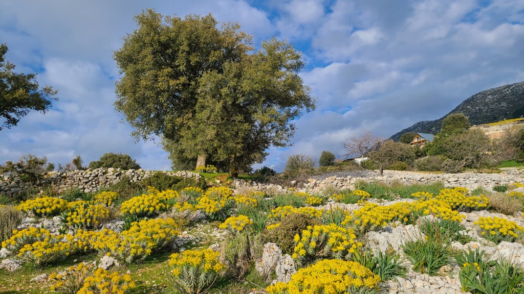
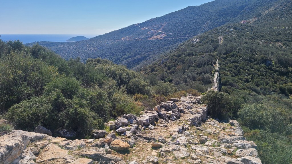
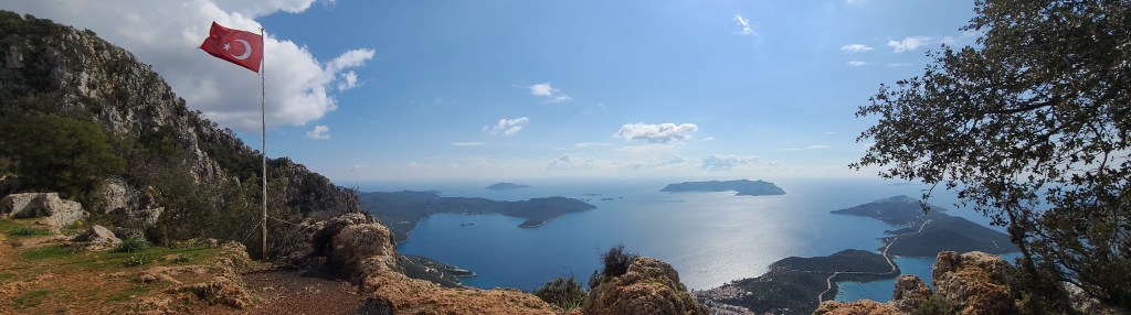
Terrain The trail is generally well marked and signposted, but can be rugged underfoot at times due to the underlying karst limestone geology on this Mediterranean region. My trail ascent comparison with other routes shows it to be a ‘hilly’ trail with fair bit of ascent and descent -overall varying in altitude between sea level to a maximum of about 1,815m (with options to ascend higher).
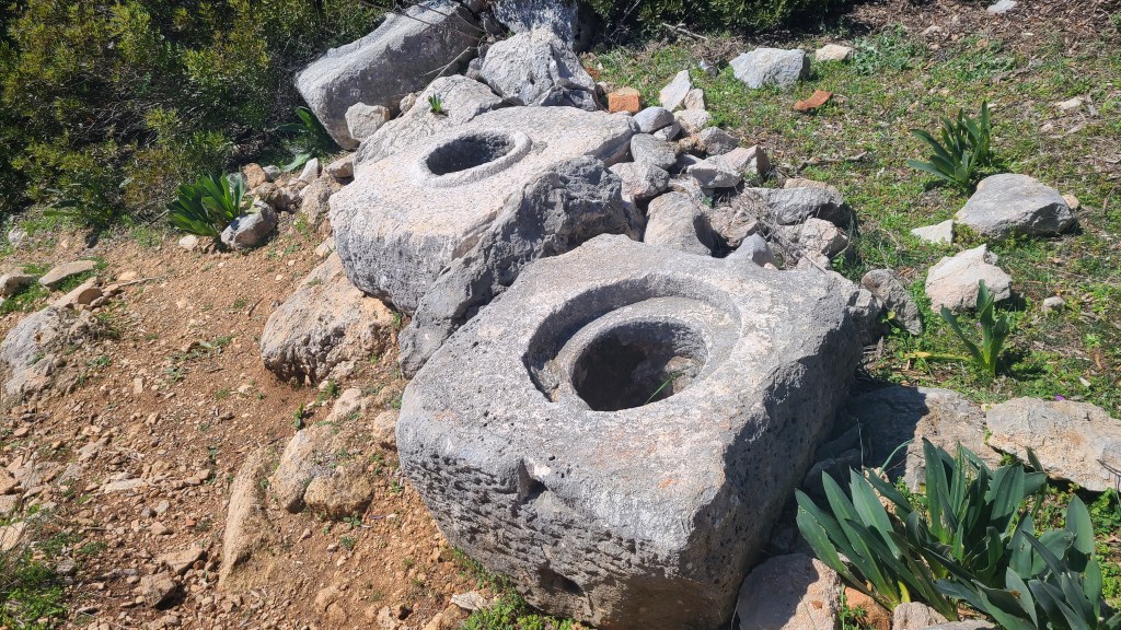
History The trail has a variety of scenery and one particular outstanding feature is the incredible archeology and historic sites to be seen along the way. This region has been populated by Lycian, Greek, Roman and other civilisations and there is still heaps of evidence of these to be seen. Come to think of it, it would be difficult to imagine a better long distance trail to see ancient history!
Seasons I would say the normal seasons to walk here are mid-March to May and October-November. The summer would be too hot (at least for me!) although the area is a popular summer tourist destination. Winter could be good for hiking but the days would be short and the higher elevations could be snow covered and cold.
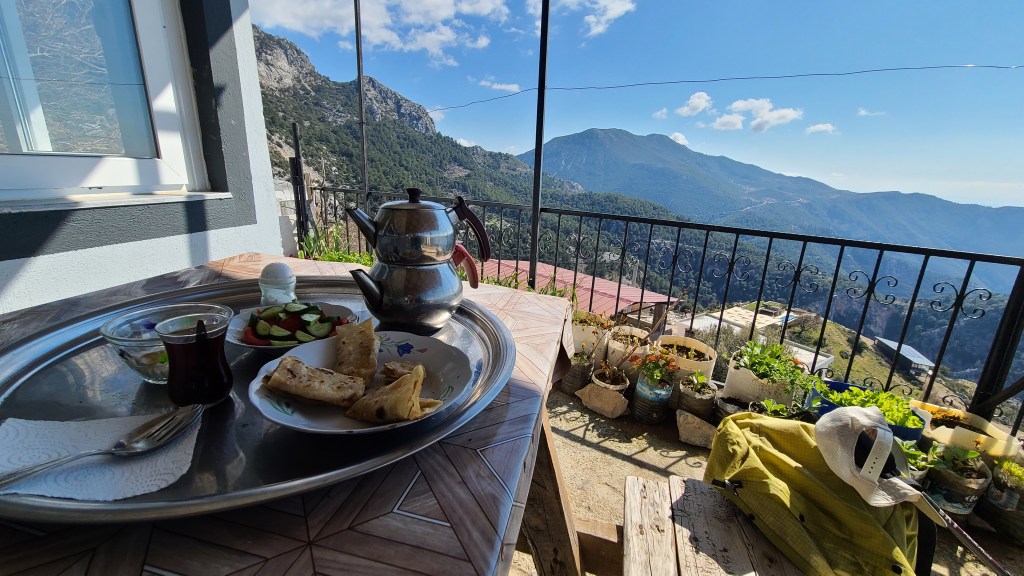
Overnights Another appealing feature is that wild camping is permitted. Along with the options of commercial camp sites I found the tenting options to be superb. Many people do the hike without a tent as well, and there are good accomodation options along the way.
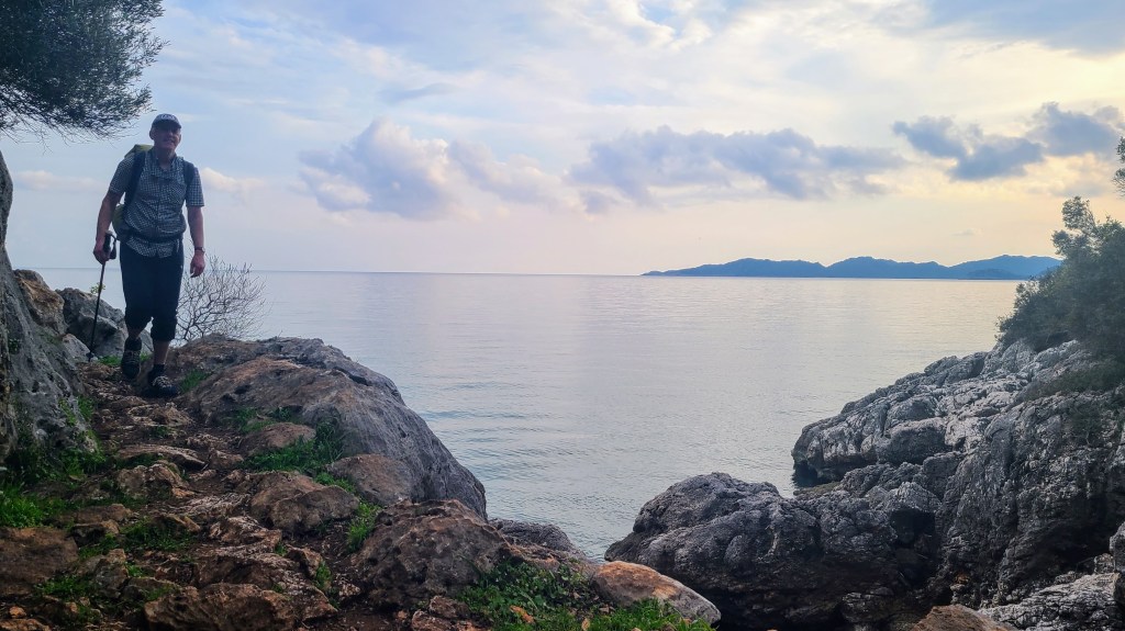
My hike Brian decided to hike for a week from the western terminal at Ovicek near the city of Fethiye as a sort of sampler, and I ended up walking around 105 miles.
I hiked at the end of February to the start of March in 2025 and this is pre season in Lycia. As it turned out, the weather was great, warm during the day and cool at night. I had a day and a half of rain but otherwise it was pleasant with sun and clouds.
After a 3 1/2 hour bus journey from the city of Antalya to Fethiye, I set off late in the afternoon at the trail’s western terminal in low cloud and drizzle on Tuesday 25th February, but keen to get going.
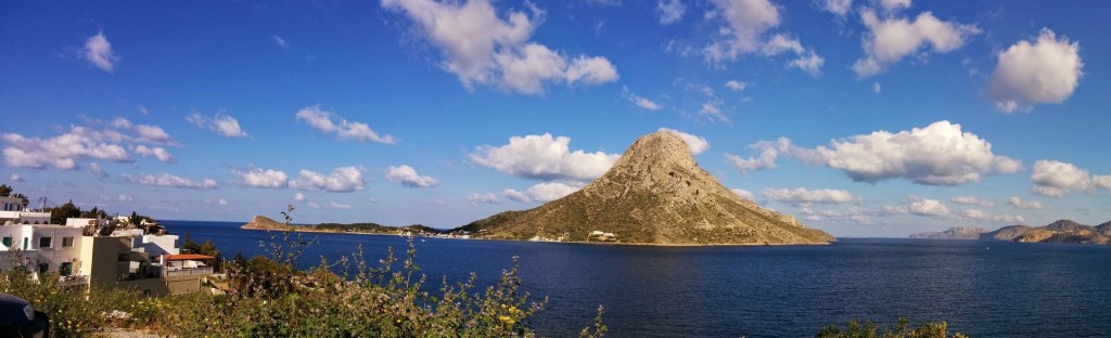
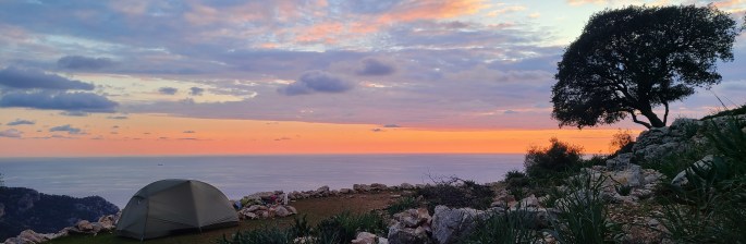
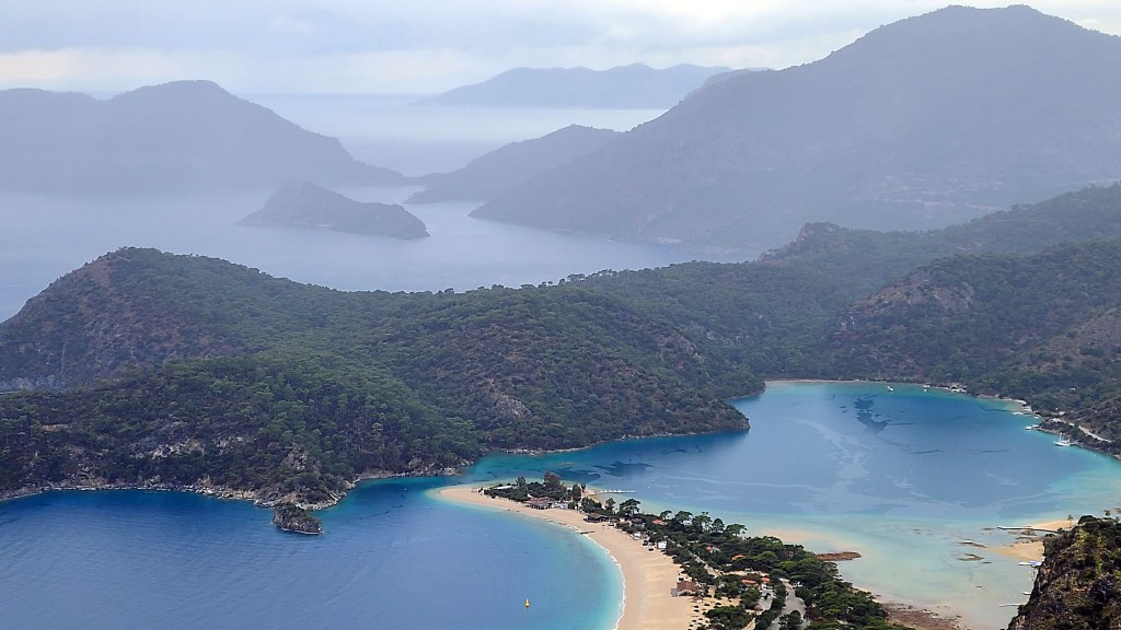
The Way started on jeep tracks but soon I was hiking rough mountainous trails with grand, if hazy views down to the rugged coast indented with sandy bays. I pushed on until dusk at about 19.15pm after passing the cluster of houses at Faralya and fortunately found a lovely flat grassy terrace to camp. In the evening I could hear a nearby owl and the distant call to prayer from villages down the valley.


Next day I continued on rough trail in pinewoods about 400m above the sea before dropping steeply (and bushwacking after getting lost) to the somewhat grotty beach of Kabak – it was a bit too strewn with rubbish and building detriatus for me to linger, maybe it gets tidied up later in spring ready for the tourist season.
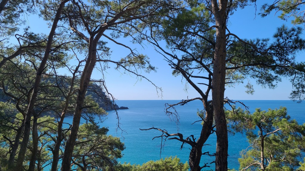
I climbed steeply up a well made path back to lovely woodland with views down to the coast and continued along high ground through forest and around rocky cliffs.
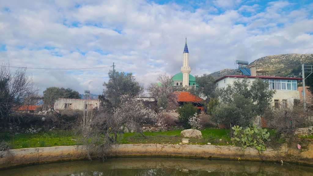
A stop for lunch at Alinca was fun (they opened the cafe for me!) and I hiked into the evening past the cluster of houses at Gey. I was working out that mosques can be seen (and heard!) from afar and provide beautiful fresh water fountains for the thirsty hiker. I stopped for the night at a irresistable small terrace overlooking a steep sided sea cove.

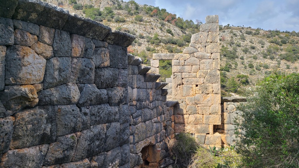
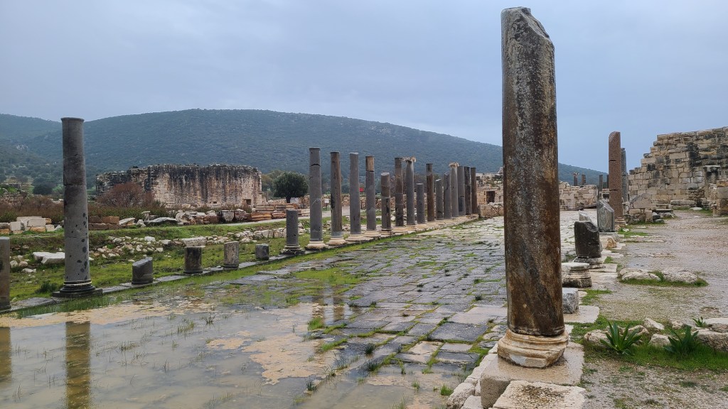
The trail passed right through a doorway of the ruined Lycian fortress at Pydnai next day. The huge polygon limestone building blocks were impressive along with the view north across the alluvial plain, now covered in polytunnels growing cucumber and tomatoes.

Later in the day I sheltered from rain for the night at an apartment in the nearby town of Gelemis and spent the next day visiting the ancient port city of Patara dodging downpours.
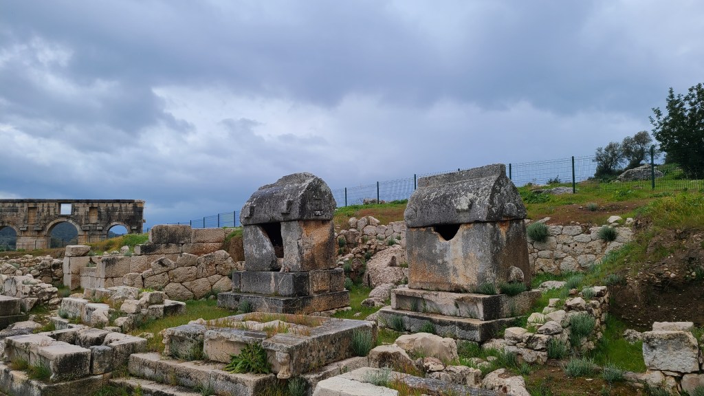
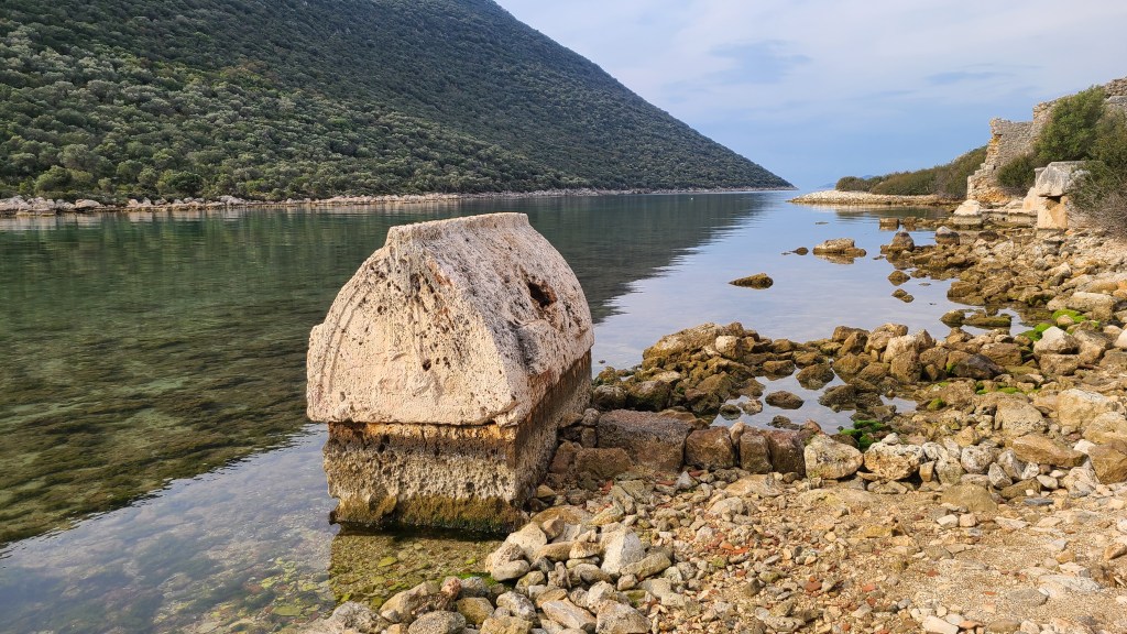
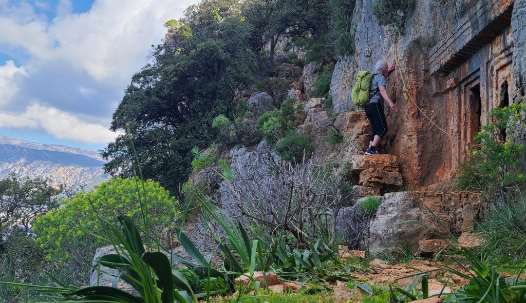
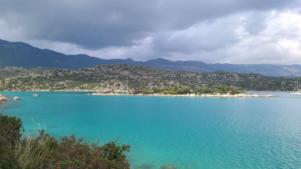
I had a few more days at lower elevations, at times along the seashore, even getting a swim (well, short dip) at one point. Interestingly the trail seemed rougher nearer the sea, with jaggy rocks and wiry bushes to weave around. Of note was the Roman aqueduct of Delikkemer, a rocky traverse past cliff tombs and some beautiful turquiose blue sea. Grand hiking.

I met a lot of dogs along the way, stray dogs (and cats) are common here. Most were friendly but some belonging to farms were pretty aggresive- maybe they could smell the fear eminating from me! Anyway I didn’t have any real problems and pretending to throw a stone at them seemed to work.
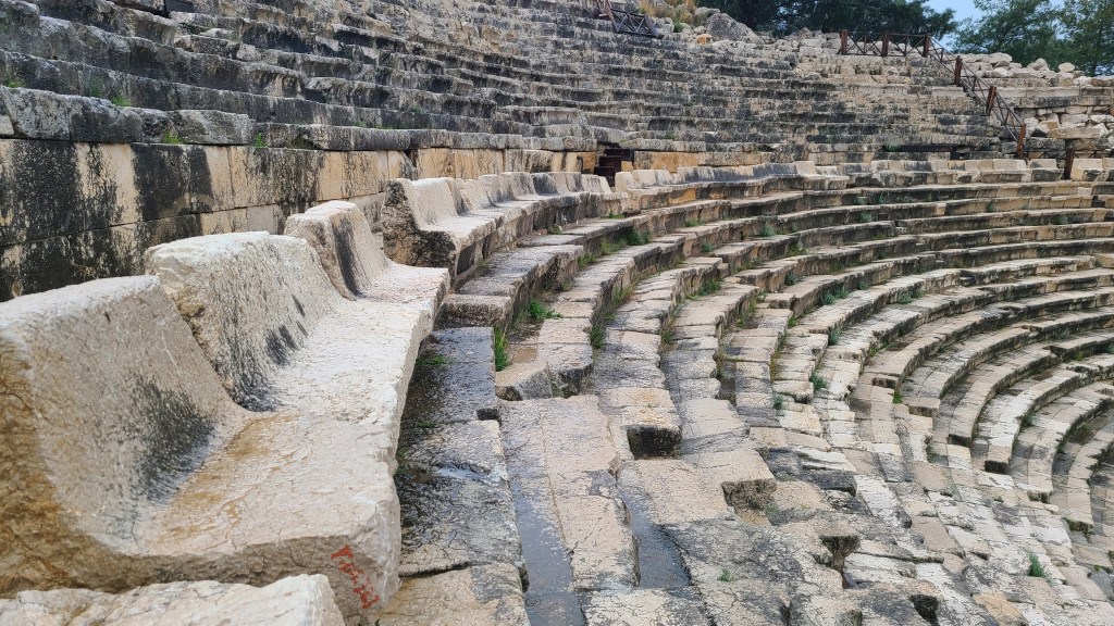
I wound up my hike at the town of Demre, home to the incredible ancient city of Myra.
Overall this was an interesting and superbly varied hike and I would love to return to complete the whole route….


Maps and Guides
I downloaded a trail gpx and with a map layer to my Android phone on the Caltopo app allowing me to navigate offline. I added in extra details that I found online to the gpx, particularly on water sources and shops. Trekopedia below was great for this.
I do like to have a paper map or guide as well though, as I dislike looking at my phone all the time. So I created and printed a Word document – with maps from Caltopo and helpful descriptions I had collated.
I also took along relevant sections of the Kate Clow Lycian Way 2014 guidebook (updated 2022 version now available). The guidebook is definately worth buying but I didn’t find it that useful for navigation unfortunately and deferred to my notes and the Caltopo app.
The Step by Step Lycian Way guidebook looks excellent as well, although I don’t yet have a copy I would buy that before going back to the trail.
Links to information
Trekopedia Very detailed and excellent guide to the trail, alternatives, accomodation, historic sights. I used this for planning but unfortunately the app wouldn’t work on my Android phone. It would have been great if it had!
Culture Routes Society From Kate Clow who conceived the trail (a fantastic job, thank you!), lots of info including recent trail updates.
Doing Miles hike in 2011 Reliable and interesting notes from US hiking couple.