Arizona Trail 2023 – II Flagstaff to Tucson

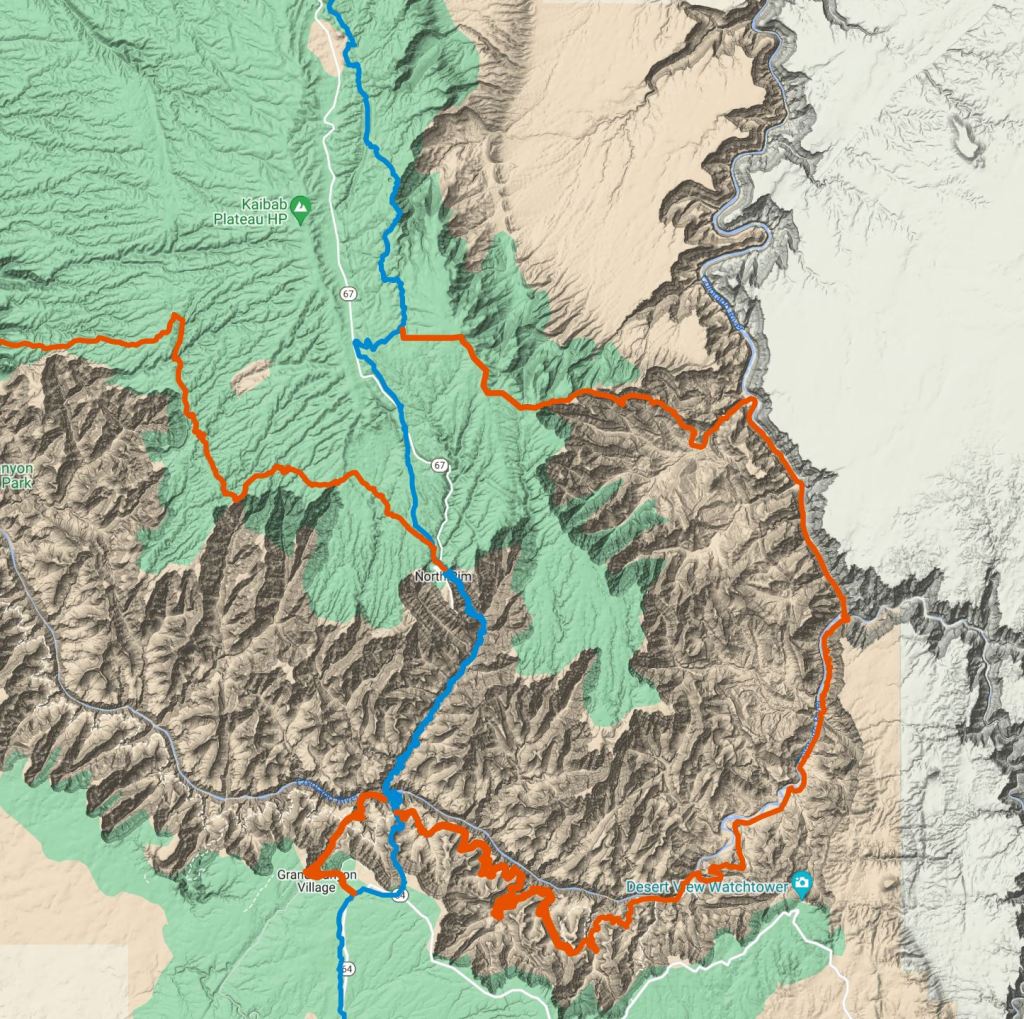
Section 3 Flagstaff to Pine 20th October Another long fairly flat walk of 115 miles on the next stretch to the tiny town of Pine was again going to be tough on my feet!

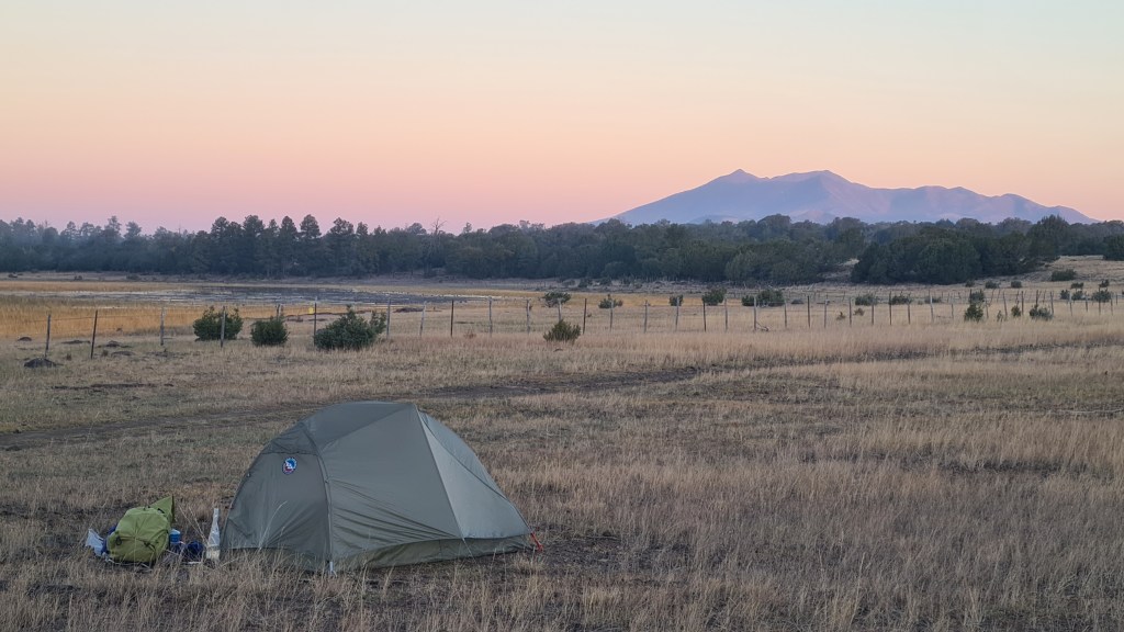
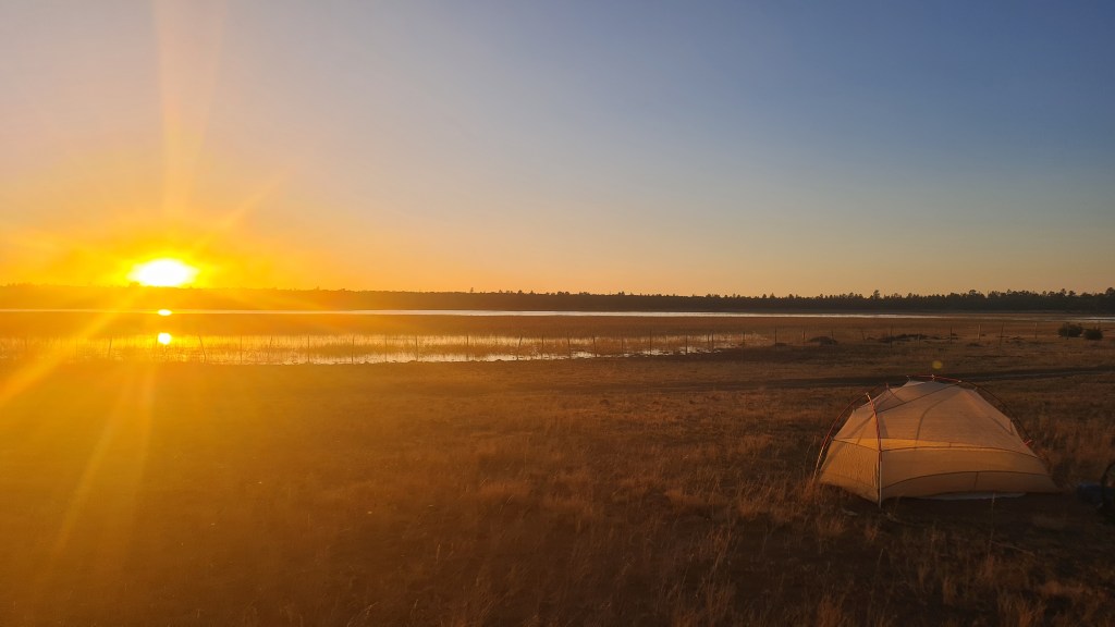
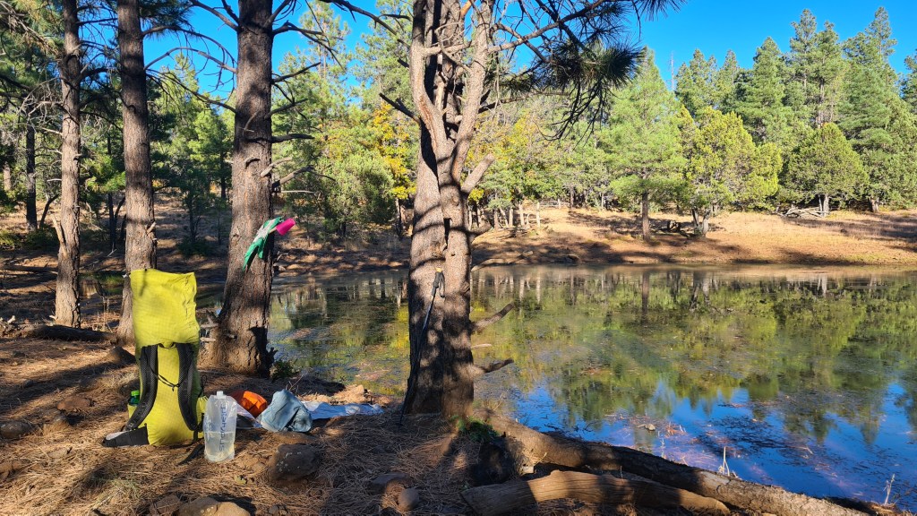
Leaving Flagstaff after crossing Route 66 on the ‘Urban Route’ variation of the AZT, I was back into the countryside surprisingly quickly. Ponderosa pines again dominated but then gave way to more sparse pinyon juniper. I chatted with ‘Fliss(?)’, ‘Mo’ and ‘Firecracker’ heading out of town but ended up camping solo at Horse Lake that night. Sunset here was stunning across the flat grasslands and lake, with noisy geese, elk and coyote adding to the ambience.

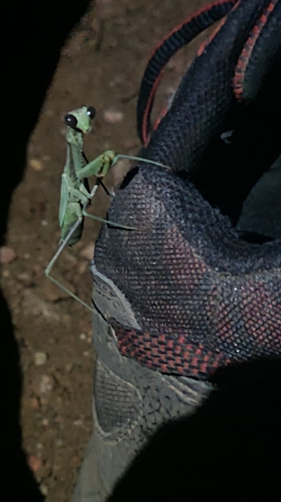
On the 2nd day out from Flagstaff I hiked round a prescribed fire set off by the Forestry Service which filled the air with thick smoke for an hour or two, before cutting off trail to the small settlement of Mormon Lake for lunch at the bar and a food top up. I came across a few of these 8 legged wonders along the way….

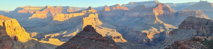
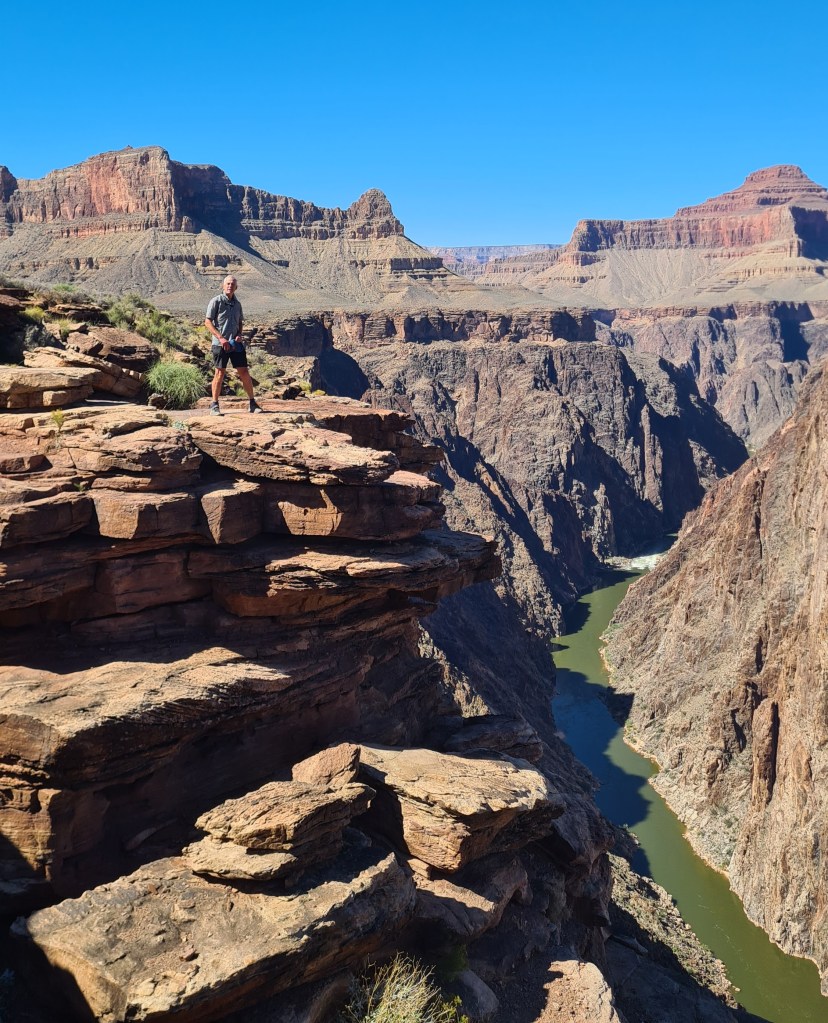
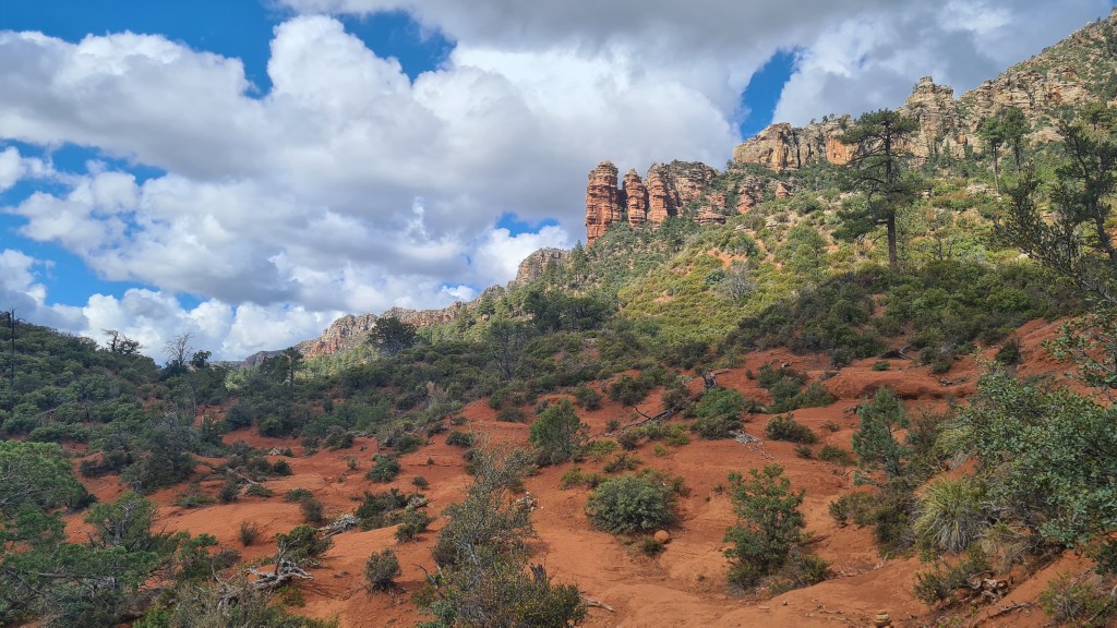
After another 3 days I eventually hit the pleasant Highline Trail and dropped off the ‘Mogollon Rim’, an escarpment descending from the Colorado Plateau with some welcome streams, red rock and (a rarity so far) clouds! The trail took me into the tiny town of Pine- arriving at 8.30am and diving into the Early Bird Cafe to meet a few other hikers for second breakfast. 330 miles or so hiked- hoorah

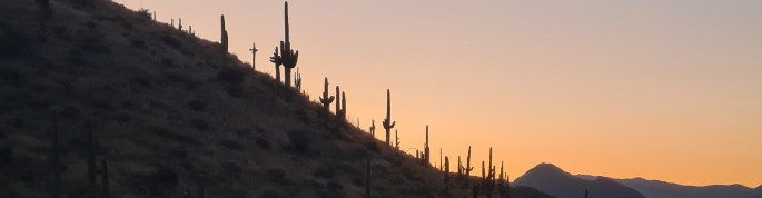
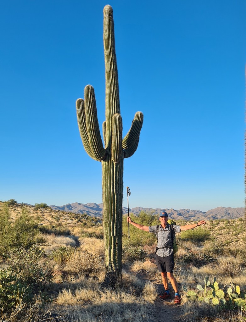
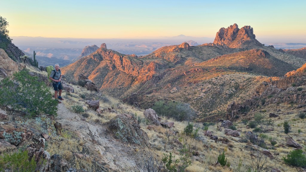
Section 4 Pine to Roosevelt Lake Marina 26th October 115 miles again to my next food resupply at Roosevelt Lake Marina. This one involved some more rugged up and down over the Mazatzal and Four Peaks Wilderness’s. A bit of rocky trail and scratchy shuffling through spikey bushes kept me on my toes. I think this was my favourite stage so far however as the variety was interesting and I saw my first javelinas (small boar that live in groups called squadrons!) ……and stunning saguaro cactus…yipee.

Saguaro cactus at dawn

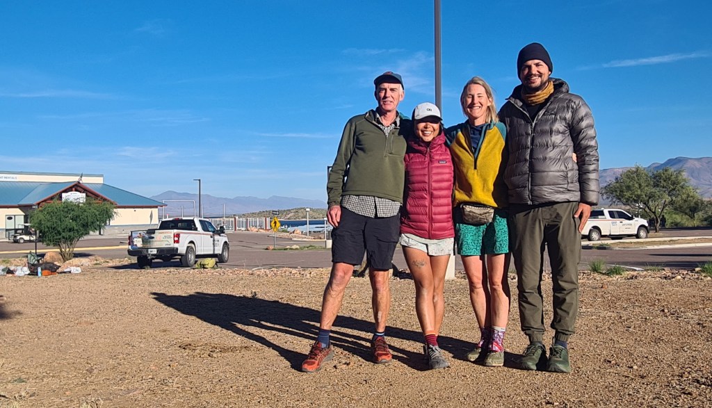
Section 5 Roosevelt Lake Marina to Kearny 1st November 80 miles Hikers seemed to coalesce at the lake marina with about 10 of us at one point- resting weary legs, eating, sifting gear and sharing tales from the trail.

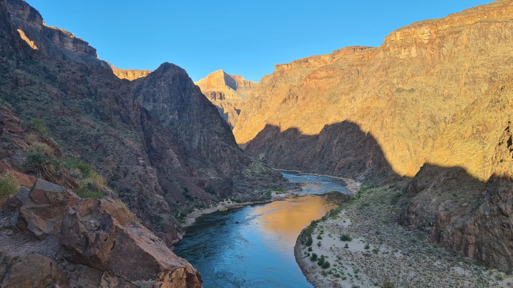
South from the marina I entered the Superstitions Wilderness, crisscrossing and chatting with fellow hikers Grandpa, Firecracker and Survivorman. It was another fine rocky area but one that dropped in elevation meaning that, despite now in November, the temperature really ramped up in the middle of the day. I took the opportunity for a cooling dip as we traversed alongside the Gila River, the trail’s lowest point at about 1,600 feet, before reaching the mining town of Kearny the next day.

Section 6 Kearny to Molino Basin Trailhead and Tucson 6th November 100 miles Kearny was a super friendly small town; from the offer of a place to stay by ‘Q’, easy hitching in and out, diner, pizza place, supermarket with free coffee for hikers, helpful post office staff etc…. it was just great.

With fellow hikers and ‘Q’, middle right, at her house in Kearny

Setting out from Kearny, the terrain continued as low desert scrub and the temperatures were hot- maybe 30C in the afternoon. I got into a pattern of waking about 5am and hiking by 6 in the dark for a bit to enjoy sunrise and the cool early temperatures. These were my favourite times of the day with hiking into dusk at about 17.30 to 18.00 being a close second. The disadvantage was that I spent most, if not all, of my camping time in the dark!

I met up with Carrie/Firecracker along the way and we hiked together after applying some plasters to patch Carrie up as a result of an argument with a barbed wire fence!

I was glad when the trail climbed up high to about 7.800 feet at Summerhaven (amazingly this far south, a winter ski resort) and Mount Lemmon. A veggie burger with Survivorman was a rare treat here and the granite hills and pine clad slopes were really nice. Leaving early morning was a bit harder with the sub-zero overnight temperatures but the trail remained interesting all the way down to Molino Basin trailhead road crossing. I decided to hitch from here into the city of Tucson for a full day off of luxury; real food, showers, a swim in the motel outside pool(!) and some gear fixing.

Next Arizona Trail III Tucson to the Mexican Border

Previous Arizona Trail 2023 – Part I Utah state line to Grand Canyon and Flagstaff

Photo gallery here….

Arizona Trail 2023 – I Utah state line to Grand Canyon and Flagstaff

In October-November 2023 Brian walked the 800 mile Arizona Trail southwards from the Utah stateline down to the Mexican border. I wild camped most of the way, but also stayed at designated campsites, with ‘trail angels’ and some motels in town. Overall it was an excellent experience! Here is a short (ish) description of my hike, some pictures, my impressions and links to more info.

Background The Arizona Trail (AZT) is a well defined and maintained trail heading north-south across the state of Arizona. It traverses a mix of desert, high plateau and mountain ranges up to about 9,000 feet (called Sky Islands), crossing two National Parks; the iconic Grand Canyon and less well known Saguaro outside the city of Tucson.

With blazingly hot summer temperatures at low levels and deep snow in winter on the higher sections, the best seasons to walk the whole way (‘thruhike’) are spring and autumn.

Reasons for hiking Martina and I have hiked many times in southern Utah which borders onto the north of Arizona. We have also been in the Grand Canyon in northern Arizona a few times before as part of our two Hayduke Trail adventures in 2014 and 2022, and as another wonderful 2018 loop hike in Kanab Creek area. From these we were aware of the Arizona Trail and have even hiked the northern 100 miles or so as it overlaps the Hayduke.

With Martina starting a new job, Brian chose the AZT as a less risky solo adventure than the cross country, scrambling Hayduke routes whilst providing the opportunity to hike in new areas to the south of our previous travels.

Hayduke in orange and Arizona Trail in blue below…

Section 1 to South Rim Grand Canyon 3rd October 2023 I set off from the Utah -Arizona stateline with a heavy feeling backpack and slight trepidation in pleasant cool sunshine and an initial stretch of about 90 miles hiking to reach the north rim of the grand canyon. The trail was well made and I soon climbed up from scrub desert through pinyon-juniper trees to the higher Kiabab plateau dotted with tall ponderosa pines. Trying to take it easy for the first few days to look after my feet and avoid injury, I kept to a moderate pace and under 20 miles per day. Camping was pretty straightforward making use of plenty of clear flat ground under the shelter of trees.

I chatted with 3 other hikers starting that same day; ‘Lentil’, ‘Good News’ and ‘Kidnapper’ – their ‘trail names’ – I decided just to be ‘Brian from Scotland’! That number of hikers was quite typical throughout the trail where I would be aware of other hikers each day, sometimes meeting them but often hiking on my own occasionally seeing signs of others such as their footprints.

The highest plateau elevations (up to 9,000 feet) were really fun with grassy meadows and gorgeous golden aspen trees amidst fir and pines. Temperatures were cool during the day and a chilly sub-zero (Celsius) at night, coating the tent with a layer of ice in the morning. Wildlife was surprisingly good; horned toad, lynx, woodpeckers, elk, deer and the ubiquitous ravens with their croaking and gurgling vocals.

Reaching the north rim of the Grand Canyon felt like a minor but significant success as the first completed section of the trail and the chance to stock up on food at the small store, pick up a camping permit for the crossing of the canyon and meet a few other hikers congregating there.

The map below shows the AZT in blue taking a scenic 26 mile direct crossing of the grand canyon via the ‘corridor trail’ ….. as opposed to the orange line of the Hayduke, a 5-6 day rollercoaster of excitement from North to South Rim. The Hayduke then also has another 7-8 day adventurous and stunning section in the canyon heading west to Kanab creek and beyond.

‘Bonus’ Grand Canyon loop 11th October I made an ‘on the spot’ decision to do an extra loop before leaving the Grand Canyon southwards on the AZT. My reasons were that it seemed a pity to depart the canyon after such a brief visit, I heard of a cool area around the Hermit Trail that I hadn’t been to before, and it gave me the chance to do some bigger climbs but shorter miles than the next couple of weeks of long, flat plateau hiking on the AZT. Fortunately I was able to pick up up a last minute permit easily at the backcountry park office and I set off…..

I had 3 1/2 days down the canyon (Bright Angel, Tonto West, Granite Falls and a bit of Boucher Trail) and in summary it was lovely, beautiful views, cool temperatures and away from the crowds.

Section 2 Grand Canyon South Rim to Flagstaff 14th October This section was always going to be tough for me as it was a long 115 miles of flattish high plateau to the next resupply in the town of Flagstaff – it wasn’t playing to my strengths as I like hills! That said the initial hiking through ponderosa pines was mellow, the water sources were sufficient and I was able to hike longer, up to 23.5 miles each day. The undulating terrain gave huge wide vistas, especially to Humphreys peak (the highest in Arizona that we walked up in 2017) and great sunsets and sunrises at camp. I was however relieved to arrive in Flagstaff to take a day off from hiking, sort out gear and food logistics, clean up and rest my battered feet.

Next Arizona Trail II Flagstaff to Tucson

Previous US South West & Hayduke

Photo gallery (or click image)