
Introduction For all Martina and I’s backpacking over the years, we have actually done very little long distance walks in our home country of Scotland. I guess one of the reasons is that we have explored Scotland extensively as part of hillwalking, climbing, kayaking and other trips such that there is less of a sense of discovery for us here. Not to say that Scotland isn’t fantastic with its beautiful mix of hills, sea and islands, ever changing light and accessibility throughout the year. And there is still plenty new for us to see, particularly around the coasts. But Scotland also does have challenges for backpacking over many days, with principle adversaries being wet weather with boggy underfoot conditions and, in summer- the midge!
The Isle of Skye though has a potentially wonderful backpack of about 7 days duration and 80 miles (130km) called the Skye Trail. Brian thought he would give it a go in the autumn of 2022. You can see maps of the route at Walkhighlands along with an excellent web guide and app.
See also Skye Trail 2025 blog
My hike Northbound
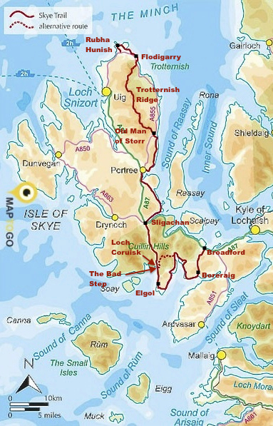
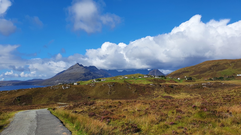
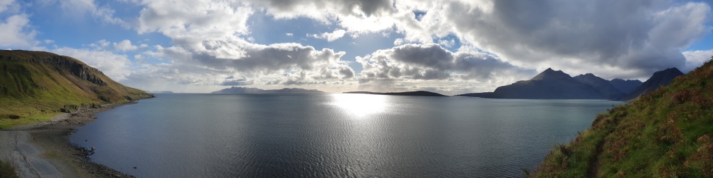
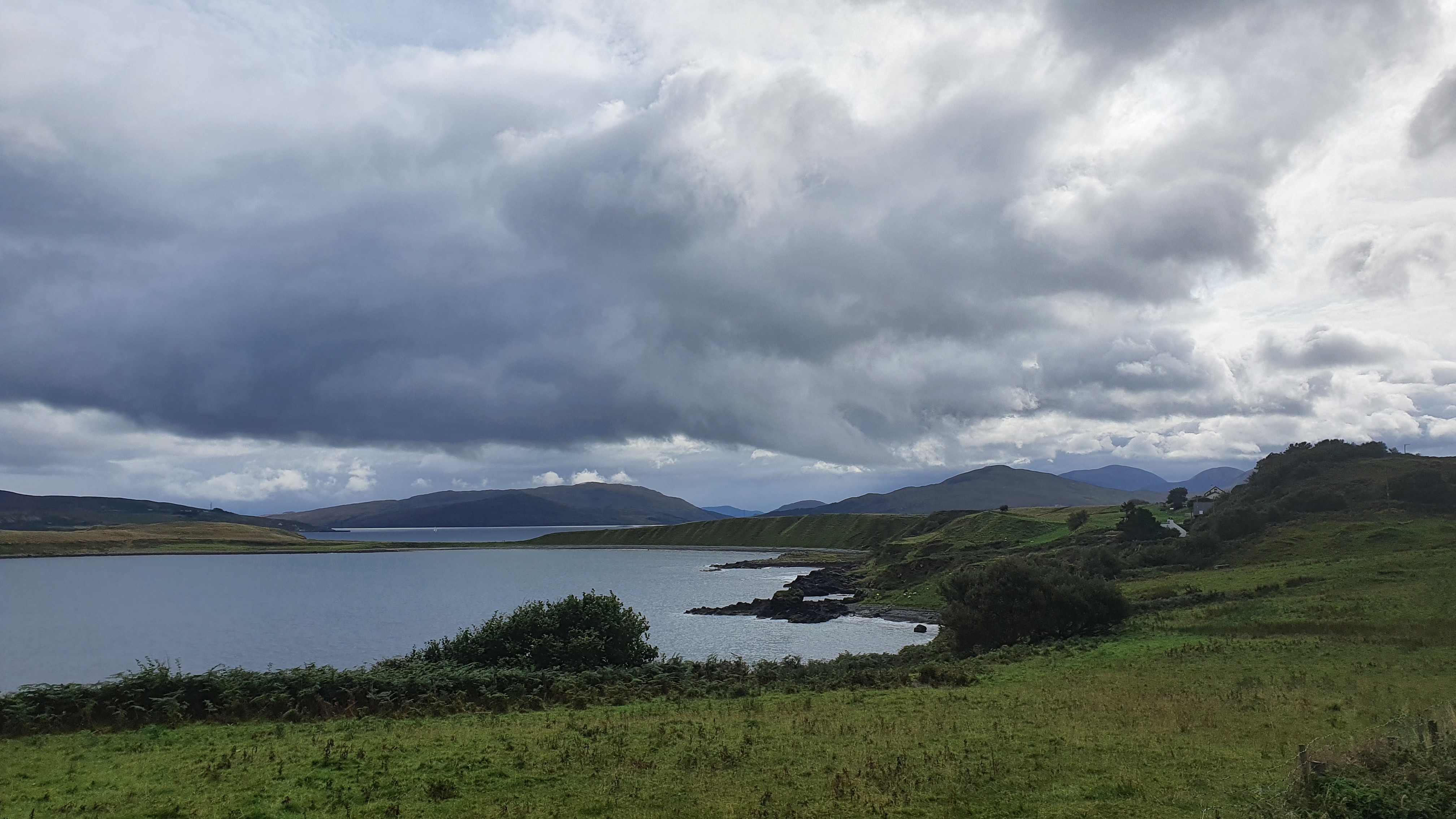
Day 1 Broadford to Torrin This was a short easy day. I started late from Broadford around 4pm but still made it just short of Torrin to camp at the bay of Camus Malag before joining road. The trails are dry making for relaxed walking over to the coast at Boreraig, with its town ruins evidence of Highland Clearances described in Walkhighlands. There is a lovely coastal path round to Loch Slapin and the views of the mountain Blabheinn (pronounced Blaven) in particular are spectacular. A really enjoyable mellow start.

Day 2 Torrin to Elgol to Camasunary This is another short guidebook day and I hiked on from Elgol for an extra few hours to camp to the north at Camasunary Bay. I started with a road walk through the small settlement of Torrin (the cafe was closed unfortunately!) and round the head of Loch Slapin. Good views to the mountains here and there is roadside camping opportunities next to the sea but you may need to share with campervans. The route leaves the road at the Blaven trailhead following a trail south for about 4km to return to the tarmac.
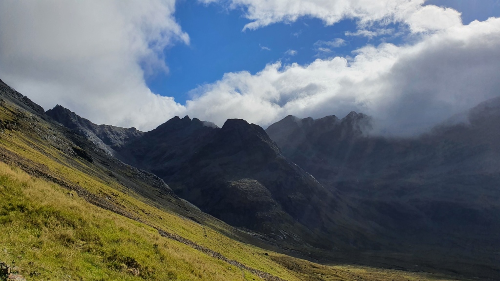
[Note that you could do a wild alternate here by hiking to the summit of Blaven, then down its south ridge to Camasunary. The panoramic views are great, but its a 3000 feet climb with rough ground on the descent and some scrambling. One for good weather. Maybe on balance I would recommend the Coruisk – Sgurr na Stri alternative below instead.]
I had showers and rainbows as I hiked through Kirkibost [a shortcut alternate takes you direct to Camasunary from south of here on a landrover track but its not as good as the normal route]. then a series of again viewful tracks south above the coast to near Spar Cave. I didn’t visit the cave but I think it would be a superb diversion-note you need a low tide to access it.
Another quiet road headed east over to Elgol. More great views out to sea and across to the Isle of Rum.
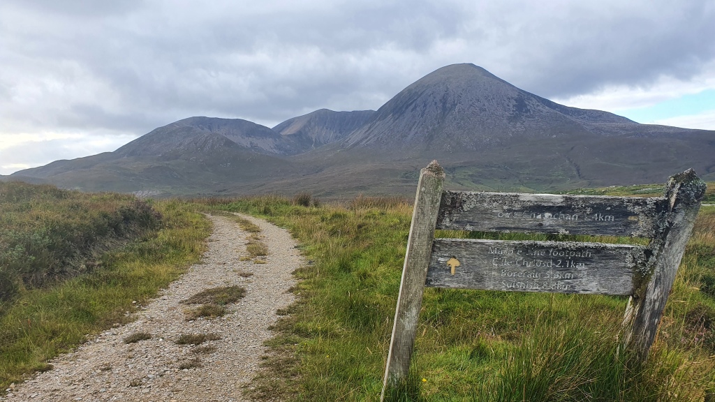
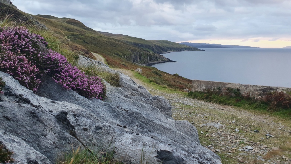
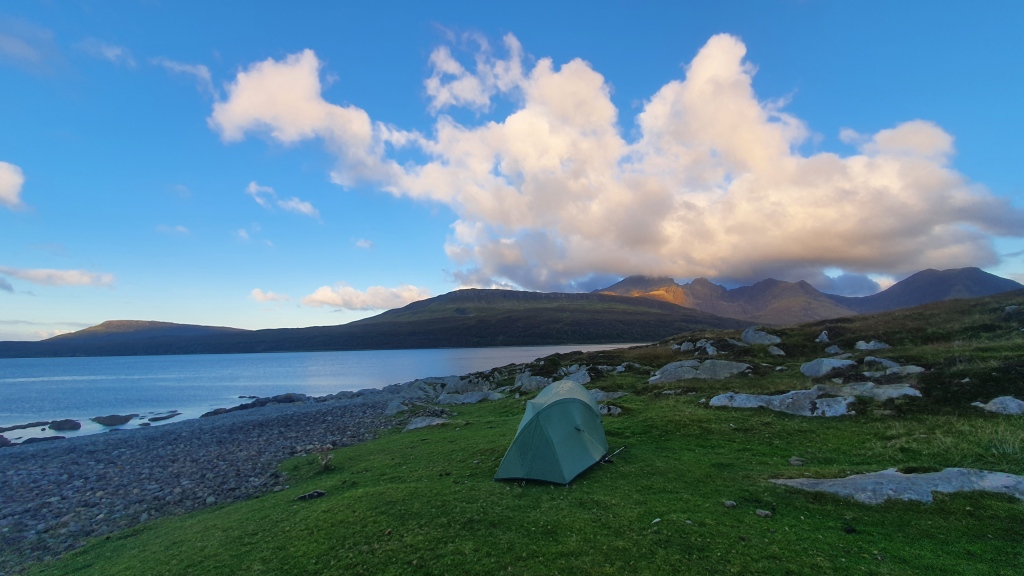
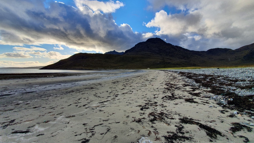
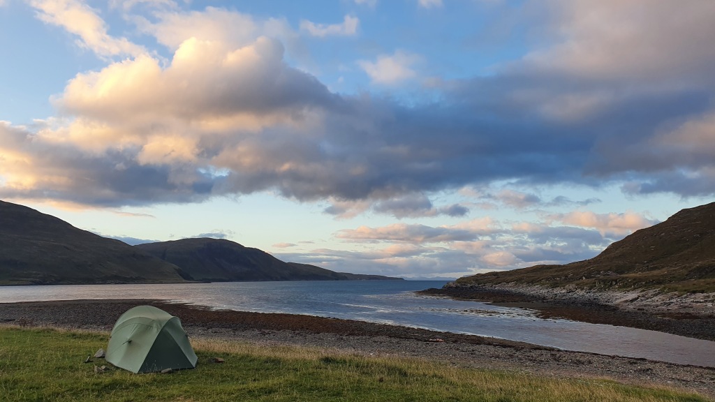
I stopped at Elgol for a late lunch before turning north on a excellent trail on a coastal escarpment to Camasunary. This was the best section so far as I headed along the, at times exposed, trail looking to the Cuillin mountains. You could camp at Glen Scaladal, there is some beach plastic ‘flotsom and jetsom’ but its still a good spot. I stopped beyond at Camasunary Bay to camp (there is also a popular bothy here you could stay at). Superb day.


Day 3 Camasunary to Sligachan The normal route here is straightforward following Glen Sligachan north on a good trail. This provides everchanging views to the Cuillin peaks above but stays low in a valley and misses the Cuillin mountains themselves which is a pity.
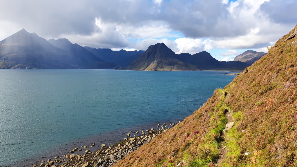
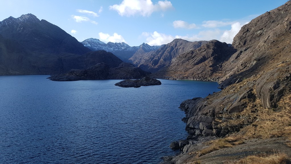
I took a somewhat more interesting route round the coast to Loch Coruisk via the ‘Bad Step’, then along the south of Loch Coruisk, up over the Cuillin ridge at the pass Bealach na Glaic Moire then after some scrabbling scree descents I connected with trails on the west of the mountains to Sligachan.
My post on Skye Trail Alternatives has more
My day started with a crossing of the river west of Camasunary over some stepping stones about 300m inland from the sea. I managed to stay dry which was a bonus – I have been soaked here before as it’s tidal and the river rises a lot during wet spells. Next up was a grand rough trail round the coast to the outlet of Loch Coruisk. This is atmospheric territory and reaches a crescendo at the ‘Bad Step’ – a sloping slab of rock perched above the sea. It is short and requires a Grade 2 (US Class 4 maybe) scramble using a crack line as a hand rail. Once past that I followed a faint trail through a short section of boulders and deep vegetation before exiting out over a shallow pass to Loch Coruisk. This was a fantastic spot with the loch walled in by imposing mountains.
There was a strong wind funneling down the loch and it was tough going along the lochside with lots of bog then a steep haul up to the high pass, Bealach na Glaic Moire, on the Cuillin ridge itself. I stopped for lunch hunched down behind a boulder from the gale force winds but the views were superb. The descent involved some (to be honest unpleasant) steep scree before I picked up a good trail above the crowded ‘Instagram spot’ of the Fairy Pools. I sped on over the pass, Bealach a’ Mhaim, with heavy rain showers preventing me stopping for a brew of tea to relax. There are beautiful waterfalls on the way to Sligachan which are quiet- unlike the Fairy Pools -and would be great for a dip if it was a bit warmer! Another superb day.


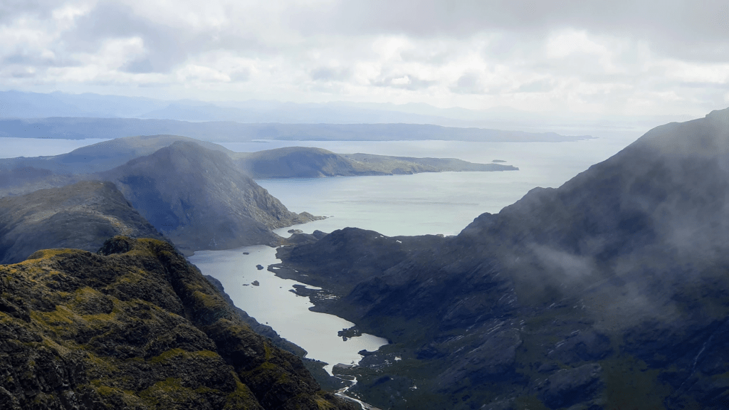
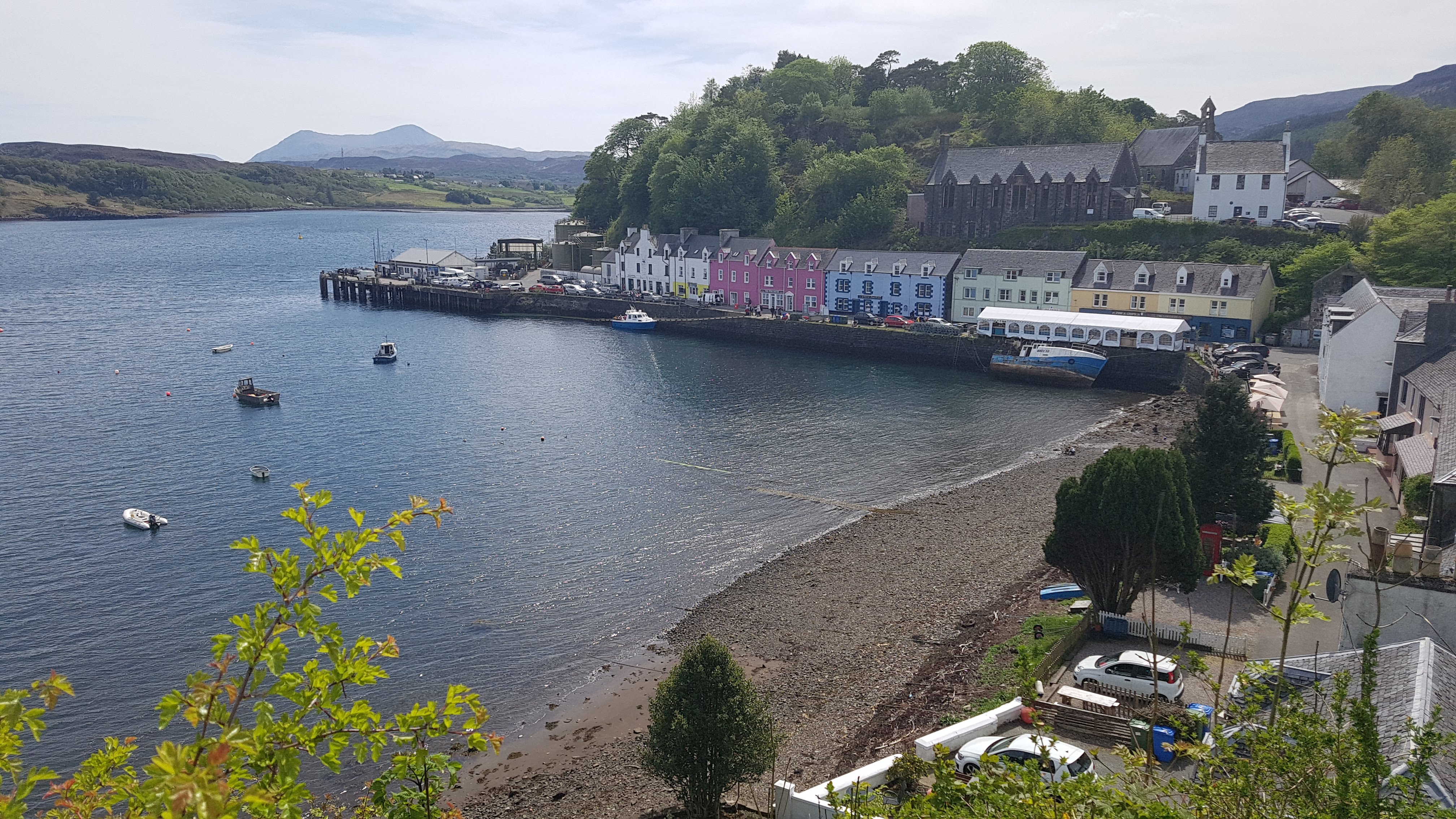
Day 4 Sligachan to Portree This is the least interesting day of the hike, more of a connector between the Cuillin mountains and the Trotternish ridge north of Portree. On the plus side the views can be good reducing the slightly dull 10.5km of road walking. I set off from Sligachan campsite in dark cloudy weather and followed the pleasant path along the north shore of Loch Sligachan. Views are good (again) and you see the Raasay ferry setting off on its short voyage. Unfortunately the sky’s opened once I hit the minor road so it was ‘heads down’ fast walk from there into Portree for me.
Day 5 Portree to The Storr trailhead It was raining hard in Portree and checking the forecast showed more rain for the next three days so I reluctantly stopped at this point and intend to return to backpack the remaining 3 days in better weather.
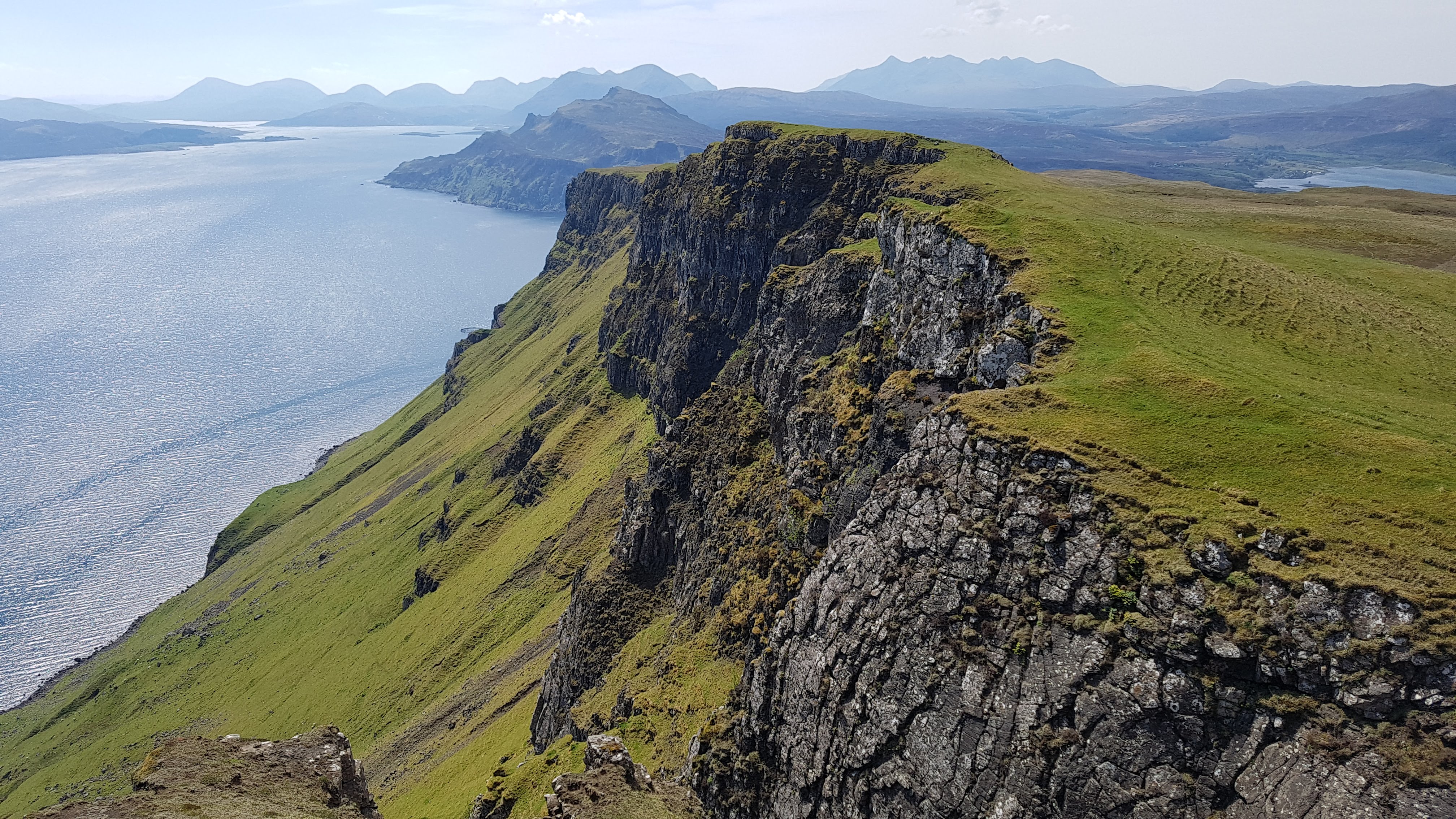
I did do this section in May 2021 though. A good trail leads round Portree harbour and bay- I saw both sea eagles and golden eagles on the climb out onto the ridge to the north. Views back to the Cuillin mountains and over to Raasay are splendid. It gets a bit boggier descending north but there is a short road you meet above Bearreraig Bay. I took the steep path down to the bay past the hydro station to its cool beach and fossils. A short but excellent day with Portree bay and a ridge walk.
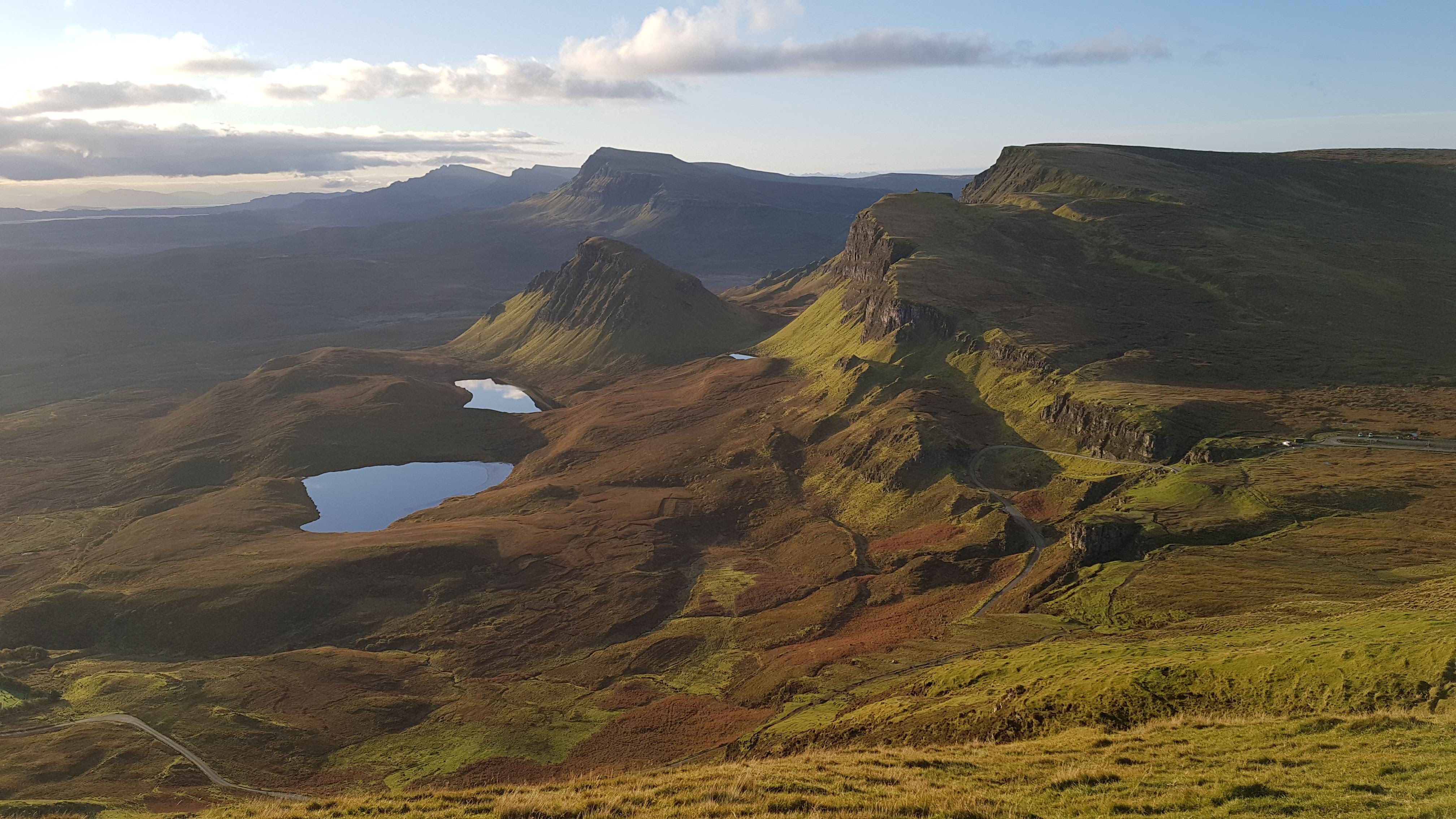
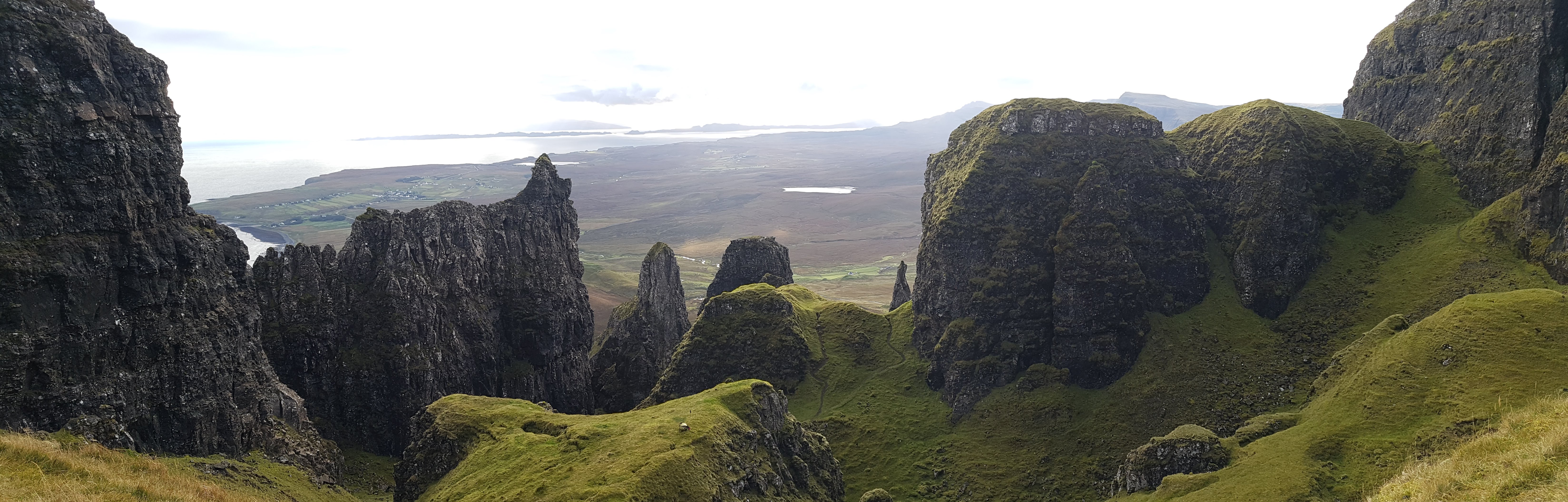
Day 6 The Storr to Flodigarry – Trotternish ridge Again I have hiked this ridge in the past and it is a brilliant undulating grassy ridge walk with expansive views. To the east are the hills of the mainland and the isles of Raasay and Rona. To the west are the island chain of the Outer Hebrides. At both ends are the weird rock formations of The Storr in the south and The Quirang in the north. Try and savor all of this on a good weather day.
Day 7 Flodigarry to Rubha Hunish and Duntulm A mostly cross country coastal walk to Sky’s most northerly point Rubha Hunish which has a wild spacious feel looking out across the sea to Harris.


Such an amazing area to see.
LikeLike
oh thanks, yes it’s dramatic scenery
Brian
LikeLike