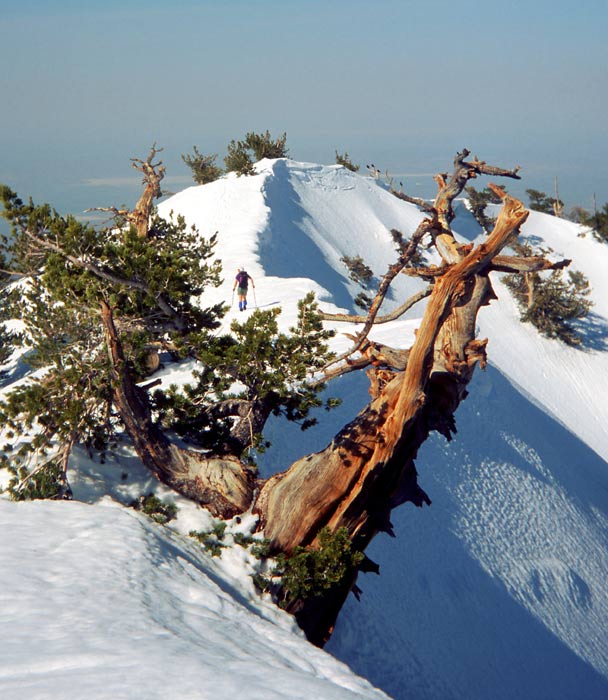
Wrightwood Next day (20th May) we walked on in clear air along the snow crusted ridge with the path visible now and then. We lost trace of the path completely as we descended in deep snow down the steep north slopes to Wrightwood.
Along ridges above Wrightwood
Arriving at midday, we enjoyed a blow out of pizza and coke at the Yodeller Inn before collecting our forwarding package at the Post Office. There was a PCT log at the Post Office and we located Brian Sweet from his entry in the book- he had just left and was now striding on ahead of us. I felt I needed an extra days rest to help my calf recover so we relaxed and got a room in the local Pine Lodge. Wrightwood was a very pleasant mountain town and ski area surrounded by forest and it was no hardship to rest and put our feet up.
We headed out on Friday 22nd May and walked along the closed mountain road rather than rejoining the PCT on its ascent of Mt Baden Powell straight away (to allow my calf a bit more recovery time). Before starting the hike in April we had driven up to here and climbed Mt Baden Powell to check out the snow and so didn’t feel the need to climb up again.
Baden Powell
Large patches of snow still engulfed the road as it weaved upwards through pine forest and, with no cars around, it still felt like remote hiking. It reminded me of the movie ‘The Shining’ where the hotel is set amongst forest and is closed for the season. We rejoined the PCT at the end of a long day and camped on a bed of pine needles just off the road. Further on, the PCT joined the ‘Rattlesnake Trail’ and right on cue we saw two snoozing on the trail!
As this was now Memorial Day weekend we actually saw some other hikers- only our second set of non PCT hikers so far. This group each had a deckchair attached to their rucksack plus a twelve pack of beer! A far cry to our attempted minimalist lightweight style. We had a good day that day covering 19.8 miles and we crossed the 400 mile mark for the trail in total. Our route still headed westwards and to the north we could now see the shimmering heat rising from the Mojave desert. We were in hotter conditions too and we made use of any shade we could see such as trees, bushes or cliffs.
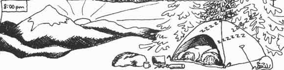
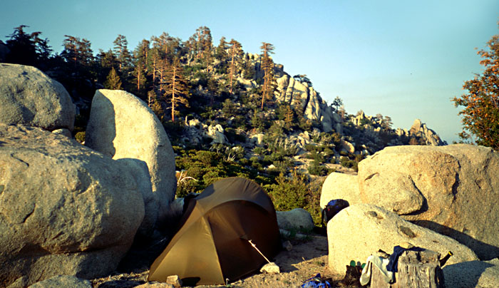
We had been hiking for almost a month now and had established a fairly steady camping routine to make our night comfortable. On some days we would have a specific objective and hike until we reached it, however most of the time we just hiked until early evening or to near a water supply and found a good spot for our tent. We have a free standing mountain tent which we came to love on the trail. Made by Terra Nova an English company, the ‘Voyager’ was a solid dependable shelter which could withstand almost any weather.
Usually we would stop hiking and pitch the tent on a flat spot then throw our gear inside and inflate our sleeping mats. One person would collect water and filter it using our Pur Hiker filter that operated a bit like a small bicycle pump. The other would set up our stove- a petrol/Coleman Gas fuelled MSR Whisperlite- prime the stove by heating some fuel in it, then set it alight. Mostly we cooked and eat whilst lying down in the tent- our legs were pretty fatigued at the end of each day and it helped to take the weight of our feet as soon as we could. Our liquid intake was important and we often would have soup and tea to add to the water we drunk throughout the day. After food our bodies were ready to give in but with a little effort we each wrote up a diary and even read novels until we couldn’t stay awake any longer! Sleep wasn’t usually a problem and we slept soon after dark in the evening and woke up early to make the most of the cool mornings. In the morning we started hiking about an hour after waking after having a tea and muesli breakfast and packing up the gear. There was something satisfying about leaving no trace that we had ever camped at the spot and heading off carrying all our needs on our back!
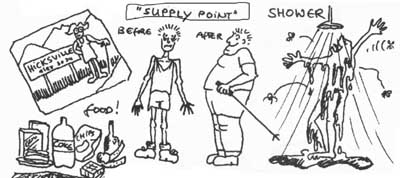
As we headed north again we approached the small town of Aqua Dulce situated in semi desert terrain. This was our next supply stop and it was two dusty, dirty hikers that arrived into the friendly town on Tuesday 26th May.
Big Bear City13th May We hit Highway 18 in worsening weather and decided to hitch down to Big Bear City. Not surprisingly it took awhile to get a lift as we must have looked a very dreary sight at the side of the road in blizzard conditions. We were successful after Martina virtually jumped in front of a pick-up in an attempt to get a lift. Desperation knows no bounds! We collected mail from the post office then collapsed into a local motel to dry out and await the end of the storm. We reckoned that we would wait it out here for a day after the snow stopped to give the snow a chance to melt from the trail.
Trail stopover’s were already beginning to attain a ritualistic status – our appetite for food (particularly junk food) was enormous and seemed only to be bounded by the shrinking size of our stomachs. At Big Bear we had a huge Mexican meal, then were both gorging on huge quantities of tortilla chips followed by ice cream as soon as our stomachs had settled. We also made the most of our time by repairing any items and buying food for the next section of trail. My camera had broken and, as I had sent it off for repair, I found a cheap temporary replacement at a local Wal-Mart. Showers and washing our clothes were also important (we only carried one set of clothes each with us to reduce weight). After attending to these items and making some phone calls and sending letters, the time fairly whizzed by. In this way we spent a day and a half at Big Bear before we prepared ourselves for returning to the trail in brightening sunshine the next morning.
It was now May 15th and the sun’s strength was strong on the remaining snow such that it cleared at a rapid rate. Even so, it would take maybe a couple of days of snow free weather to clear the snow completely, but we decided to move on anyway. Fortified with a ‘full-blown’ breakfast of pancakes, chips, eggs at the Mexican café La Paws we posted our forwarding box to the town of Aqua Dulce and managed to get a ride back to the trail out to Highway 18.
It was very different conditions now from the blizzards of two days ago. It was bright, sunny, if slightly chilly, and patchy snow remained here at a height of 6,800 feet. Our rucksacks contained food for 6 days to get us to Wrightwood, 100 miles walking away and nestled in the San Gabriel hills north of Los Angeles. We walked on to 6pm that evening and camped on snow in the forest, melting snow for our meal.Next day, after defrosting our boots, we hike on through patchy snow and out into more open country.
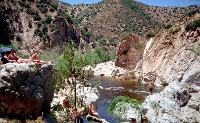
Crossing Deep Creek, we stopped off at hot springs which flow into the steep sided river. There were about 20 people bathing in the pools here and – much to our amazement- most were nude! We were desperate for a dip and a rest so ‘when in Rome’ we stripped off into the pools. It was delicious! The main creek acted as a perfect cold dip contrast to the hotter pools. A highlight came when Martina was offered drinking water from a guy dressed just in sandals and a rucksack! We reluctantly dragged ourselves away after 2 hours relaxation.
Deep Creek
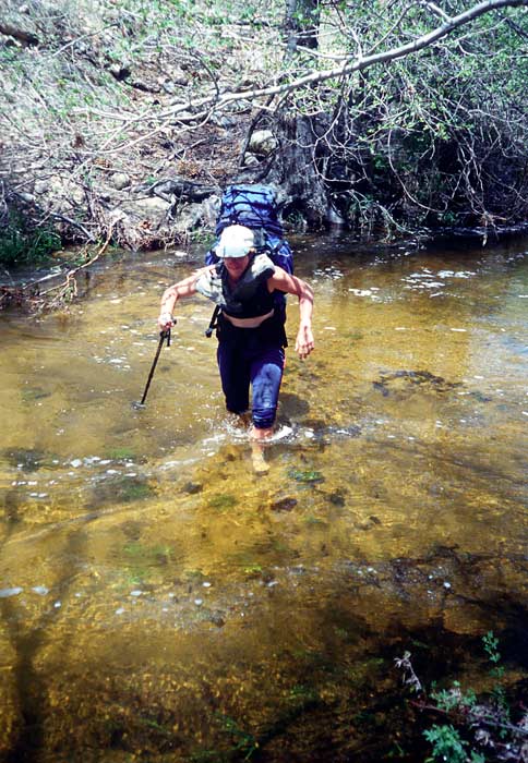
The terrain now was a bit more arid as we followed Deep Creek then past the huge Mojave dam via a wet creek ford. Passing Silverwood dam the next day we stopped off at the Summit Valley Country Store for breakfast. We sat outside munching whilst the owner delivered us his rather right wing views on gun ownership, why everyone should own a gun and how he had to be ready to defend himself from the state. We took it in mostly in silence, reflecting on the road signs full of gun shot holes and on the thankful lack of guns back in Scotland.
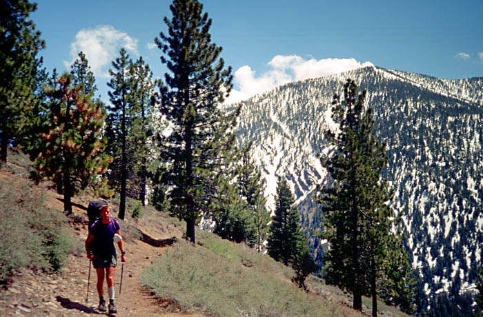
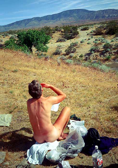
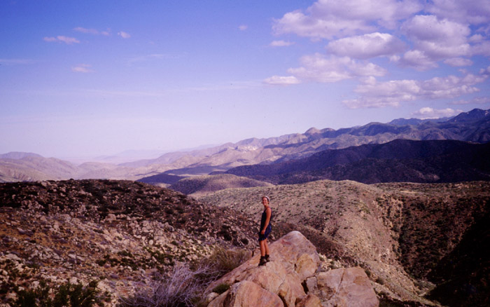
We were now heading west, between the southern edge of the Mojave desert and the northern outskirts of LA keeping to the high ground. On the 18th May we made it to Interstate 15 and camped half a mile short of the road out of sight in our own little sandy canyon. The San Gabriels, our next destination, could be seen ahead cloaked in snow and we ascended upwards on ridges to 7,300 feet where we found a high campsite with snow patches handy for our water supplies. I had a sore calf and was happy that we could drop down to the town of Wrightwood the next day for supplies and a rest. One of our aims of this trip was to camp high up on mountains above the tree line as often as possible, even if that meant carrying water up with us. The high camps can provide fantastic sunset and sunrise views and cool mountain air- a godsend in this dry dusty area. Here we could see back to the San Jacinto and Bernardino mountains as well as to the nearby snowy peaks such as Mt Bauldie. Martina was excellent working around the campsite as I rested feeling sorry for myself and my sore calf.
River crossings and drying out!
Next day we walk on in clear air along the snow crusted ridge with the path visible now and then. We lose any path completely as we descended in deep snow down the steep north slopes to Wrightwood……….
Idyllwild 8th May. After two days of low cloud in the village of Idyllwild and a life of excess and gross quantities of food, we were keen to get back on the trail. A stiff 2,500ft climb with bulging rucksacks took us into snow and then cloud to Saddle Junction at 8,000ft on the PCT itself. Deep snow covered the ridge ahead and cloud would descend then break up to give fleeting glimpses of the mountains ahead. The path was completely obscured by snow and we followed footsteps backed up by compass bearings. The footsteps were Brian Sweet’s who left the village a few hours before us and whom we hoped to catch up with. We had been waylaid by hitchhiking a lift from the village to the road end. The driver, John Holt, upon hearing we were Scottish, took us to see his neighbours who were in the middle of organising a Scottish wedding. They were a bit surprised as we were to suddenly be introduced by Mr Holt – who then proceeded to drive off in his car (with our packs still in his boot!!) After about an hour of embarrassment Mr Holt was tracked down and we managed to return to the trail.
San Jacinto
We followed the ridge for a mile or so before the path then contoured round the steep west flank of the mountain. In summer this must be a straightforward section, but with no visibility and deep snowdrifts we wandered around for a couple of hours before being able to follow traces of the path. An hour later the cloud lifted to give us views around the mountain and we heaved sighs of relief to see traces of the path ahead. Continuing around in deep snow we were soon joined by Brian whom we had passed as he was sitting out the cloudy weather. More deep snow with traces of path kept up till Strawberry Camp (a summer campsite which we found by stumbling upon a signpost half buried in snowdrift). From then the three of us plodded along in even deeper snow following map and compass only, frequently sinking deep (“post-holing” as the Americans call it) into the snow around covered boulders, trees, bushes and streams. We were around 8,000ft and in the sun whilst below we could see a carpet of cloud engulfing the Los Angeles valley. We later stopped, forced to camp on snow near a spot called Deer Springs.
It was a bitter night; cold enough to freeze the water in our bottles and to solidify our boots such that we had to slowly thaw our gear and ourselves the next morning before moving on. Unfortunately the snow had also frozen to a hard concrete consistency and we slithered around on the surface with our lightweight trail shoes. Traversing steep slopes each of us had occasion to use their ice axes in anger to break falls, so we soon decided to move in line with the leader chopping out steps in the snow with their axe. This was a tiring and slow method so we all took turns to lead the way. As the day progressed the strong sun gradually melted the snow and we were able to kick steps into the surface with our boots, and it was with relief we made it to a spur of San Jacinto called Fuller Ridge. Although this was snow-covered, too, we were able to follow the obvious feature of the ridge and within 3 hours we hit upon a logging-road clear of snow which we followed to regain the PCT. We had made 9 PCT miles only that day but were none the less exhausted. As we collapsed in a lovely viewful camp that night, cloud filled the valley, sitting at an altitude such that we could see above the cloud to the snow-capped San Bernardino hills and below to the lights of the freeway.
Fuller ridge camp
From the top of Fuller ridge, our next day involved a convoluted 20 mile descent of 9,000 feet to the San Gorgonio Pass and Interstate 10 which connects LA to the east and Palm Springs. At many times in the course of our walk we had reason to curse the designers of the PCT trail sections. But none more so than here. Our target Interstate could be seen all day below us but our path did anything but go down directly as it swept out the biggest set of zigzag’s conceivable – each traverse being sometimes as large as 2 miles and occasionally descending at such a mediocre angle as to seem to be going uphill. The obvious solution would be to take ourselves off the PCT and descend directly but the terrain conspired against this – scrub bush, manzanita, cactus – all meant that progress would be painful as well as slow. But the trail was a good one and it eventually took us down the slopes safely.
By lunchtime we had made it down to the valley floor and a small water tap built by the PCTA, we were extremely grateful for this godsend in the dry dusty valley. A good spot for lunch and to congratulate ourselves on completing the longest descent of the trip. Also for a rest- Martina had hurt a shin muscle in the walk and was applying anti-inflammatory gel as well as bandaging.
Eventually we moved on to tackle a crossing of the San Gorgonio valley. A strong wind channelled through the valley from the west. This was the stuff of the spaghetti western, tumbleweed hurtled past us bounding over the dusty valley floor. Our throats dried out with dust adhering to the walls of our mouths. We struggled westward into the teeth of the wind, each lost in our own world. Above the noise of the wind we could hear the racket of the Interstate as we approached it. Juggernauts rumbling past on a mission to supply LA and Palm Springs. Our route used a tunnel under the road and reached a low point of graffiti, junk, twisted metal and sun faded ‘Budweiser’ cans.
Beyond, a few shanty houses were spread out away from the road and we made our way through them on rutted tracks. On planning the day we had hoped to find a store here to stock up on ‘luxury’ food, but our hopes were soon dashed after Martina stepped up to house for information and was sternly rebuked by an unfriendly local. People liked their privacy here as, each house was surrounded by a large fence and usually some kind of sign indicating a large dog with a dislike of strangers was resident. Garden displays were of the trashed car and TV-screen variety. We pondered on why people would want to stay out here and barricade themselves up like this- perhaps they had no choice as it would be cheap land near to the work opportunities of Palm Springs. It evoked thoughts of ‘gun-totin’, checked-shirt, bristly residents driving us off their land.
With no chance of buying food we headed on towards the slopes of the hills to the north. Here we entered the San Bernardino mountains, a more rounded set of high hills up to 10,000ft and surrounding the town of Big Bear City where we had visited prior to starting the trail. Our first taste of these hills though was the swooshing of wind turbines. They filled the hillsides here in huge clusters of varied designs. We camped next to a wind-farm – not out of choice but because we were tired and could not go any further that day. In fact the sound of the turbines became a background aural wallpaper, especially to our tired bodies and we slept soundly that night.
It was a dry camp though, and we sped on quickly the next morning towards our next water source at Whitewater River, a long 13 miles from our last water. We found a watch on the path and carried it with us as we had a good chance of meeting its owner. He soon appeared ahead of us down at the river valley, it was none other than Brian Sweet again, he had camped only one mile ahead of us last night. We all stopped for some shade under trees at the river and Martina and I managed to bathe in its cool waters. The feeling of refreshment was incredible and such a tonic from the hot dusty walking of the morning.
Brian resting in the shade
The river formed our route for the next few miles, climbing up beside its snaking path with many crossings from side to side to find the best walking terrain. Our destination that night was Randy’s Hostel, a house constructed by Randy and friends well away from any roads in the San Bernardino mountain forests. Randy had posted adverts along the trail so we had been well informed that, for a cost, he would supply camping space, meals and showers – a great incentive for us as we climbed higher in the evening. The hostel didn’t let us down, both Randy and his friend Brad were both very welcoming and the hostel had a lovely cool setting in amongst cedar trees. They explained that they had been battling with the landowners for their right to remain in the hostel and were keen to argue their case to us. It sounded like they had been given a verbal agreement to build on the land but did not own any of it themselves.
There was a fair collection of hikers staying there that night; Brian Sweet, Mike, Lynne, Tony and ourselves. Randy was able to get a weather forecast which predicted snow and storms for the next few days and we each had to decide what to do next. We agreed with Brian Sweet that we would push on hard to make big Bear City, a long 33 miles away, rather than have to rest here for a few days so early in the journey. The others decided to stay put for the worst of the storm.
We left Randy’s early the next morning amidst darkening skies but helped by the fact that we were in deep forest that provide us with much shelter. We made good speed throughout the day and had covered 20 miles before the first snow fell on us in the evening. It then came down steadily and heavily – Brian stopped to camp but we continued for another three miles to stop at Arrastre, a snow covered summer campsite with a water supply. Throughout the night the snow piled up and wind would gush up the valley, swooping against the trees causing the snow to fall against the tent with a dull thud. It was a winterscape scene we awoke to in the morning. Although our fingers were numb with cold, fumbling with the stove and packing the tent, the scenery was beautiful with snow covering the ground and all the trees around. Brian wandered by as we were having breakfast and we walked off with him for Big Bear City, about 9 miles away. As we cleared the forest, we had the extraordinary sight (for us) of snow covered cactus.
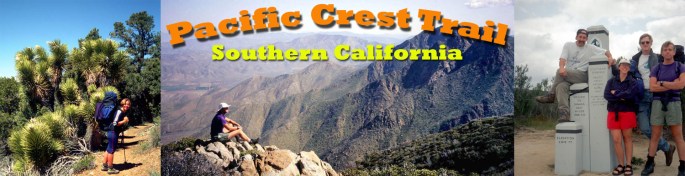
South California Mexican border to Walker Pass (650 miles)
The PCT’s southern terminus at the tiny outpost of Campo is in arid, semi desert, chaparral terrain and that is one of the main features we would encounter in Southern California. The route of the trail keeps for the most part to high ground, thus avoiding the worst of the dry hot areas. However there are many small mountain ranges crossed from Mt Laguna, San Jacinto to the San Gabriels north of LA and snow lingers on these ranges into early summer.
On the higher altitudes we could expect pine and cedar forests which would give us much needed shelter. We could cross arid desert and the next day find ourselves on snow covered hills and thus we had to consider carrying gear for both hot and cold conditions in these first few weeks (as a result we received a few strange looks walking in the desert with ice axes attached to our rucksacks!). So the country we would be crossing would not be mountainous particularly but would give us a fresh new experience of semi desert hiking and perhaps some easier hiking than we could expect later on.
Our main adversaries we thought when starting out were ; to avoid injury and build up our stamina slowly, ensure we get enough water, rattlesnakes, sunstroke and avoiding any ‘gun-tottin’ locals!
The Southern California section finishes at Walker Pass- a major east-west road crossing -Hw 178- and near the foot of the higher Sierra Nevada mountains of Central California to the north.
We had a week to spare based in LA before our intended start date around 25th April and we managed to drive out for two days skiing near Big Bear City and to climb Mt Baden Powell which, at nearly 10,000 ft, is the PCT’s highest point in southern California. The mountain was packed with snow on its tree lined slopes and provided an energetic 3000ft climb to its summit. The weather systems accompanying El Nino have been blamed for an unusually large amount of snow on the high ground and it was handy to see what this meant for our intended walk as it could have a major impact on our progress across hilly terrain.