Canyonlands National Park- Salt Creek backpack

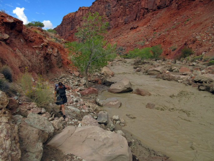
Wednesday 12th October 2016 Salt Creek  canyon lies in the south east of Canyonlands National Park and is unusual in that it holds a good flow of water in this dry part of southern Utah. Anasazi and Fremont Indians lived and farmed in this canyon centuries ago and have left behind well preserved rock art and dwellings making for a fascinating mix of canyon scenery and culture.

We had heard of Salt Creek previously as it is part of an excellent alternative route to the Hayduke Trail. When we passed by in 2014 however, we chose another variation on the north side of the Colorado river which fitted in better with our kayak journey down the Colorado.

This was now our chance to visit Salt Creek, and without the need to hike longer daily mileages that were required for the Hayduke, we would be able to spend time exploring the cliff dwellings and pictographs!

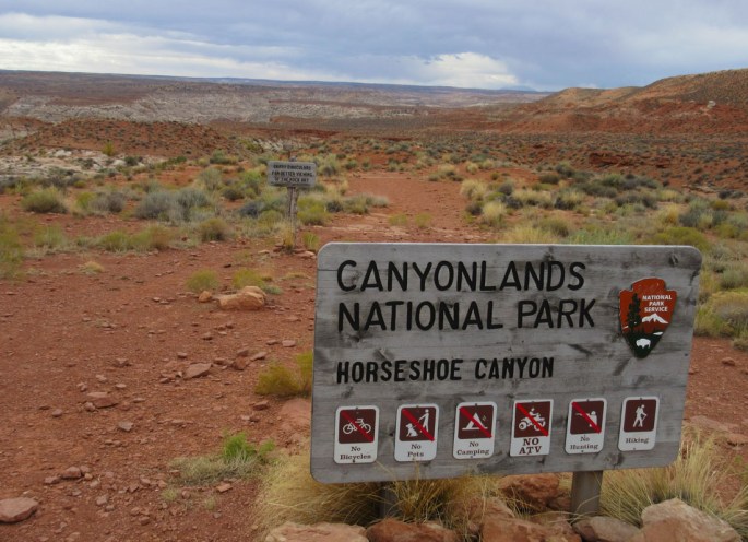
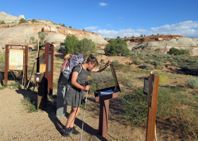
We popped into the National Park office at Needles District Visitor Center to pick up our permits (camping numbers are restricted here) and our mandatory bear canisters.  Black bears roam 1013-img_1517-salt-creek-croparound the higher ground in this area and drop into the canyons in autumn in search of food in the form of cactus fruit.

The canisters felt heavy and were awkward initially to fit into a backpack but, if they keep the bears out of our food and most importantly, protect the bears from getting accustomed to human food, then we were happy to take them!

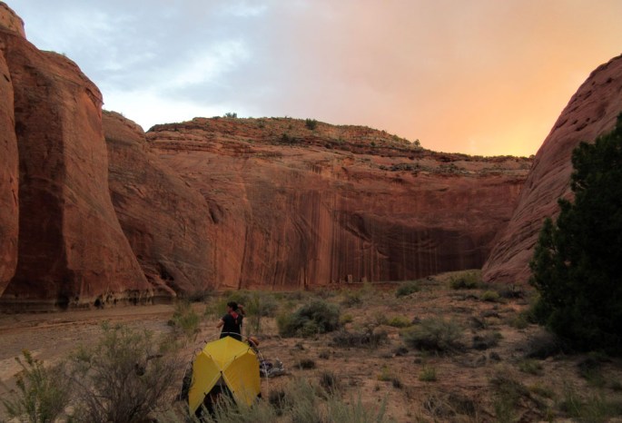
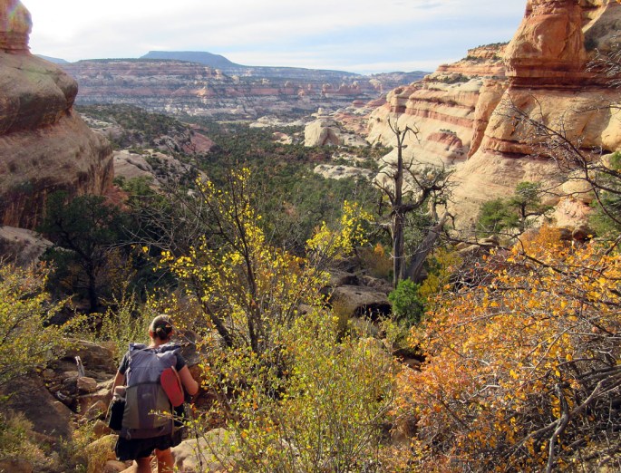
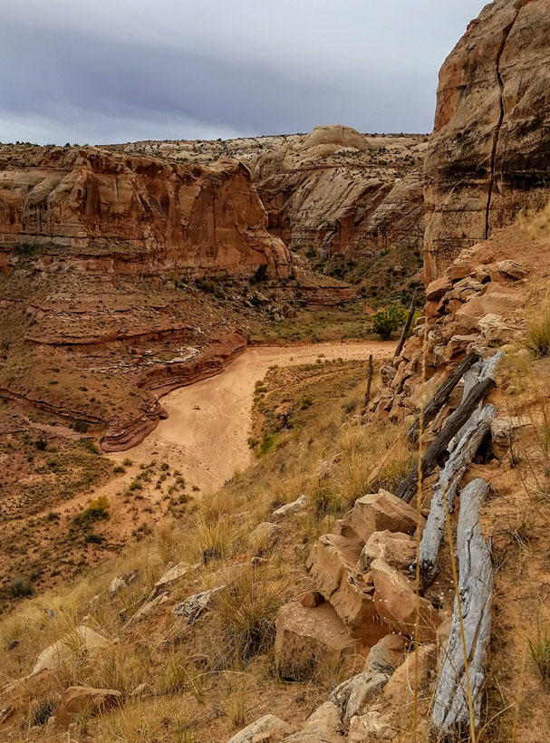
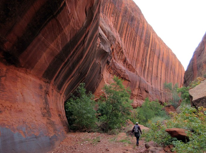
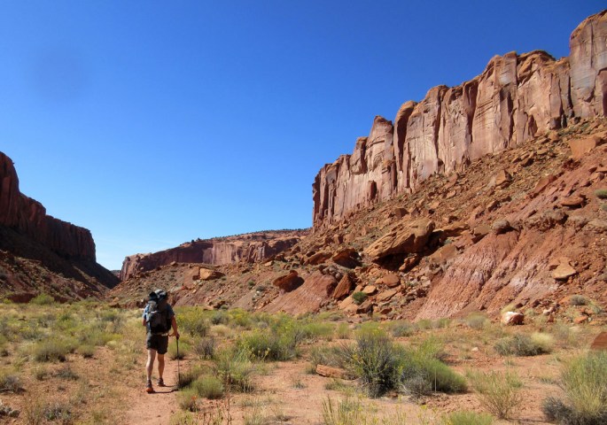
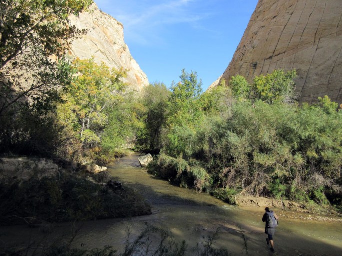
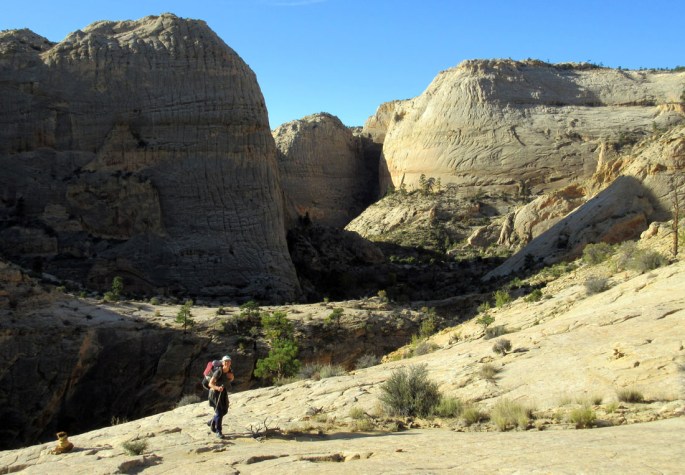
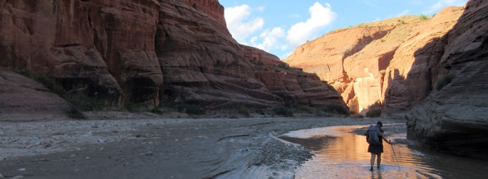
First we had a 20 mile drive south down a bumpy dirt track to our trailhead at Cathedral Butte amidst open pinyon juniper on a high plateau at 2,400 meters. At 5pm we set off on foot down a good trail into the canyon amidst the colourful striped red and white Cedar Mesa sandstone rock layers.

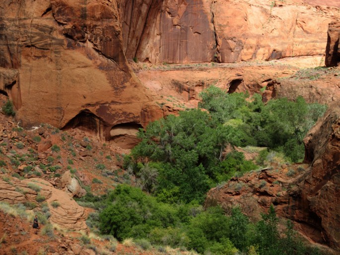
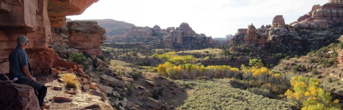
Looking down from the plateau into the expansive sage meadows of ‘Big Pocket’ (center right) and Salt Creek canyon to it’s left……

1014-img_1643-cathedral-butte-point-down-to-big-pocket-and-salt-creek

1012-img_1478-descent-into-salt-creek-evening

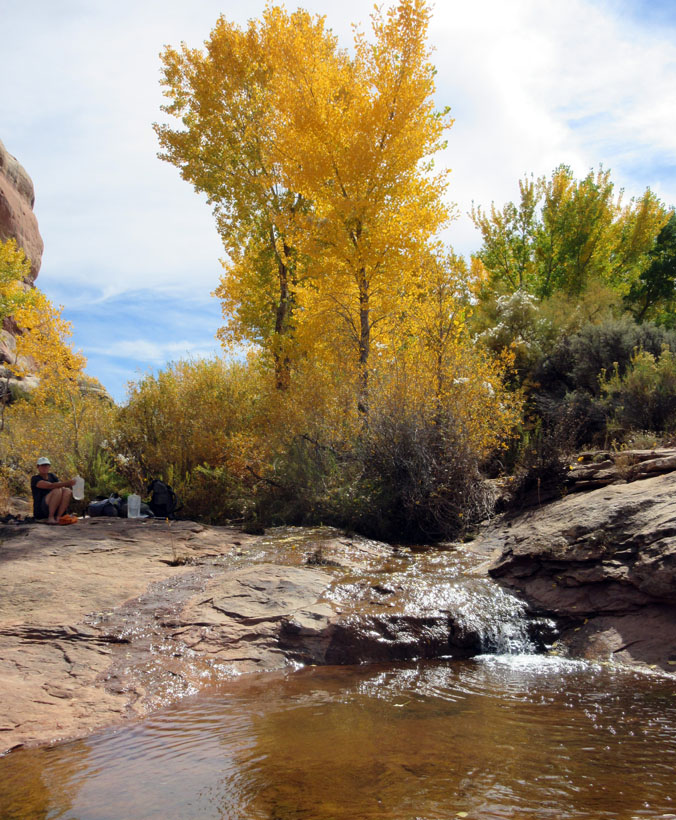
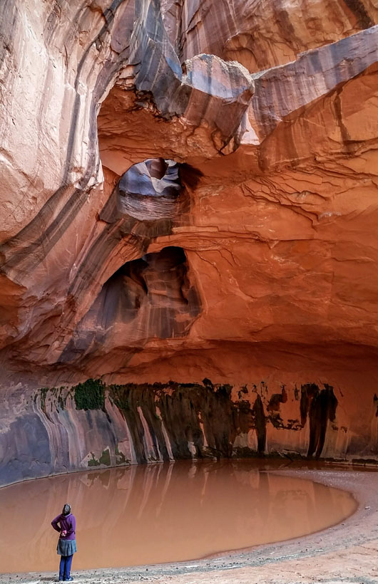
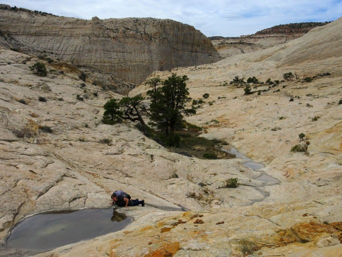
We picked up water on the way at a lovely water slide slab just before our pre-allocated campsite (SC1)……

1014-img_1642-salt-creek-pool-near-lees-cabin

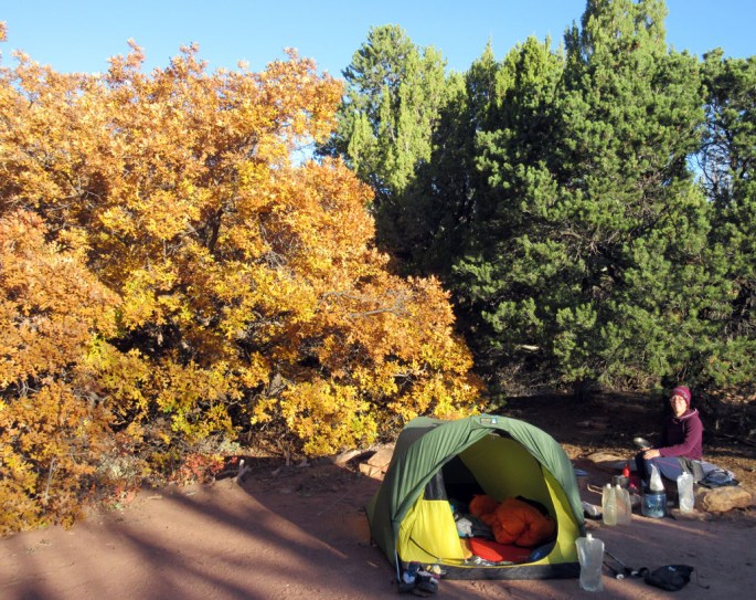
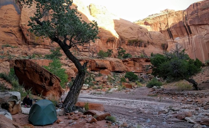
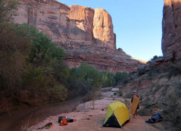
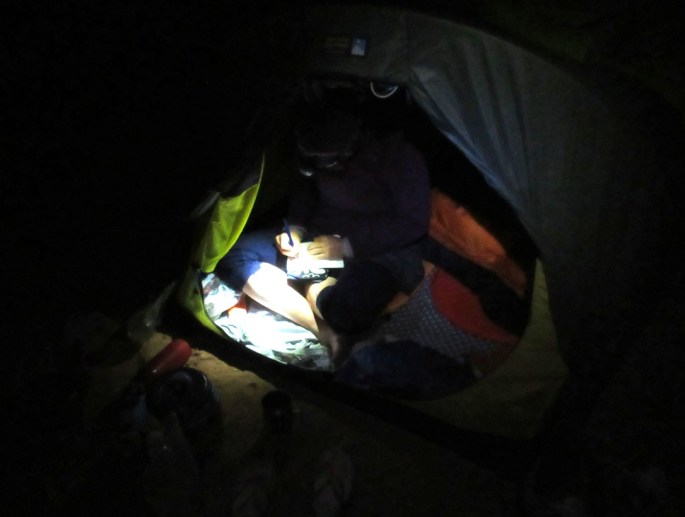
Thursday 13th October 2016 An excellent moonlit night with our first howling coyotes of the holiday – superb! It was cold overnight but the sun eventually hit the tent and warmed us up pretty quickly…

1013-img_1496-salt-creek-1st-camp-at-sc1

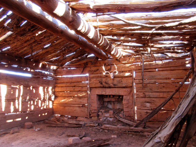
We hiked back to some meadows and explored  ‘Kirk’s Cabin’ nearby, a cool wooden structure dating from around 1890….

1013-img_1500-salt-creek-lees-cabin

Next we hiked north up the canyon on pretty good trails – first hitting a granary structure with about 4 buildings at the foot of a cliff. Onto the ‘Big Ruin’ from there which was maybe 15 minutes west of the trail and a long line of granaries 20 meters up from the ground on a horizontal cliff ledge. Pottery shards and corn could be seen at the foot of the east facing cliffs and we were happy to explore around here for a while in the now hot sun.

1013-img_1522-salt-creek-pano-big-ruin1013-img_1529-salt-creek-big-ruin

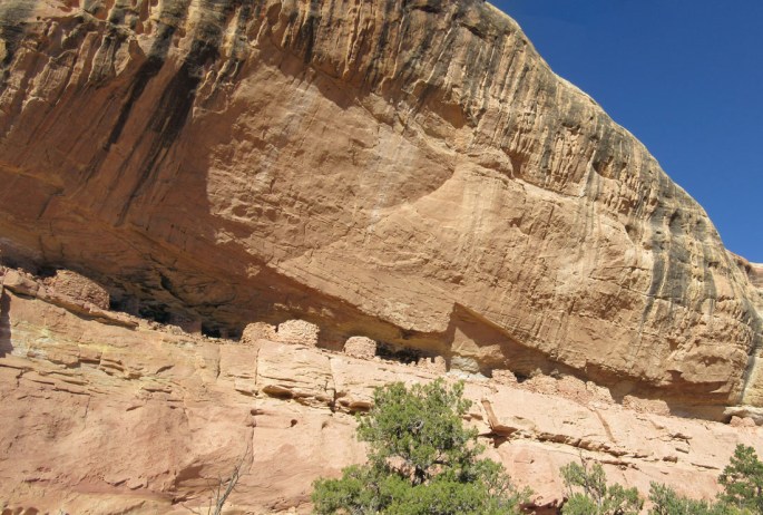
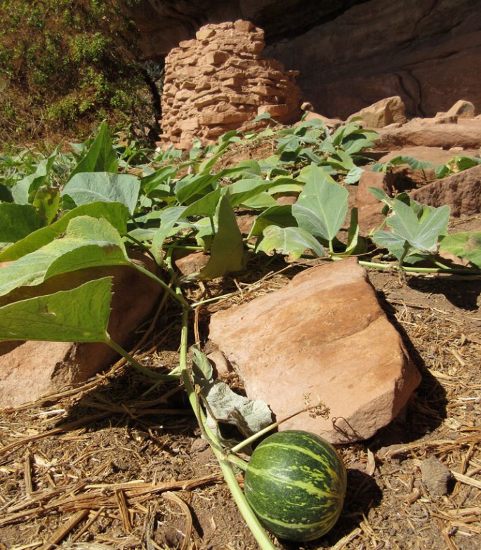
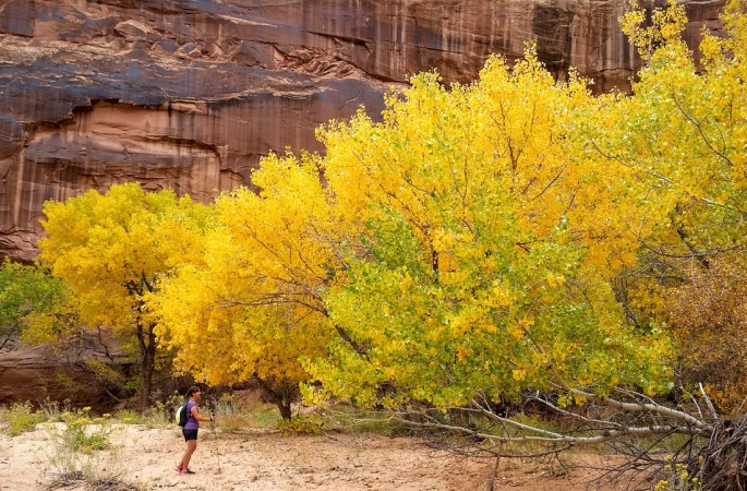
We hiked on, mostly through huge sagebrush and rabbit brush but occasionally with thick willow and tamarisk thickets. One of the most interesting sights of the day was ‘squash granary’ where some granaries sat under a huge overhang. Squash plants were growing there, presumably having lasted 700 years since the area was originally farmed- nice! Like almost all of these Anasazi locations it was a beautiful spot too.

1013-img_1535-salt-creek-squash-ruin

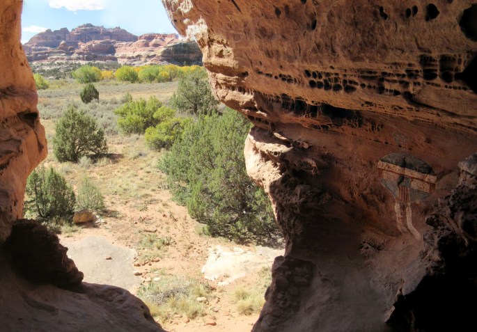
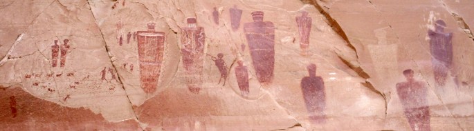
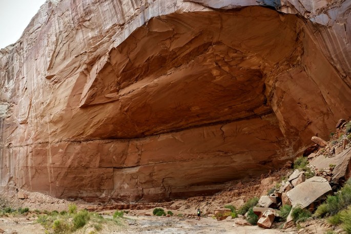
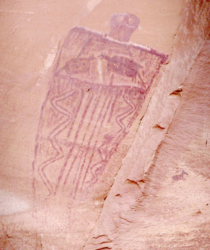
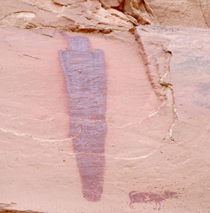
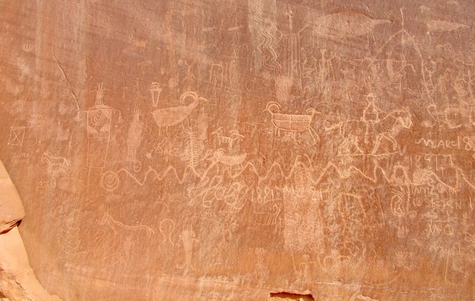
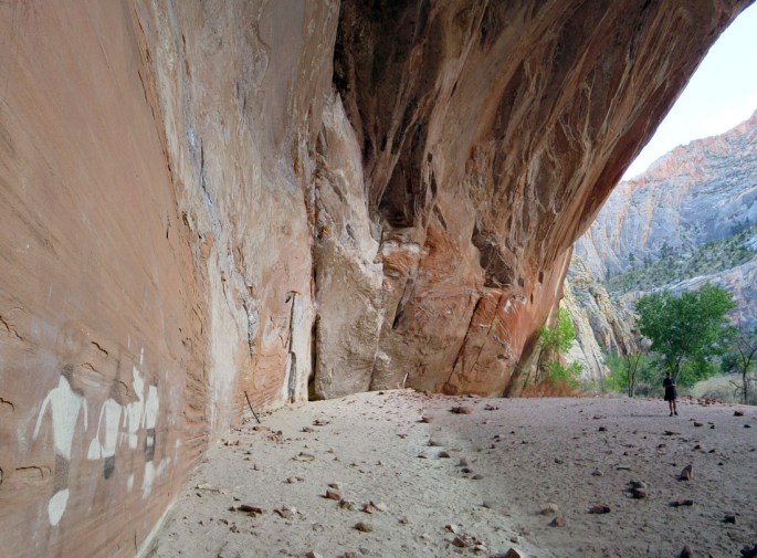
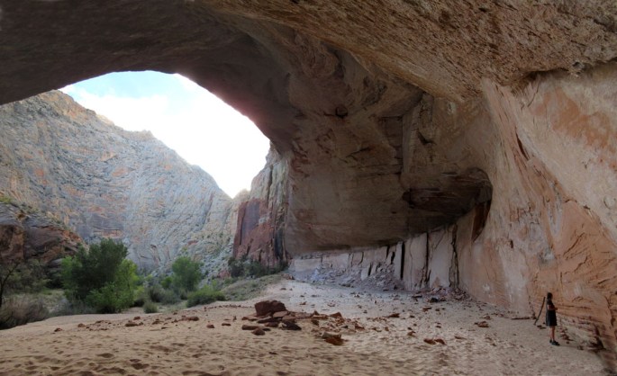
Further on we stopped at ‘All American Man’, a red white and blue coloured pictograph in another amazing location in a cave about 10 meters above the valley floor. This iconic site was better in real life than the pictures we had seen beforehand given its situation. The artwork looked a bit weird though – is it really 700 years old? [Update Yes it seems to have been radiocarbon dated to the 14th Century}

Looking out from inside the ‘All American Man’ cave. ‘AAM’ itself on the right.

1013-img_1557-all-american-man-pano

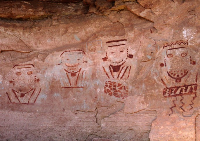
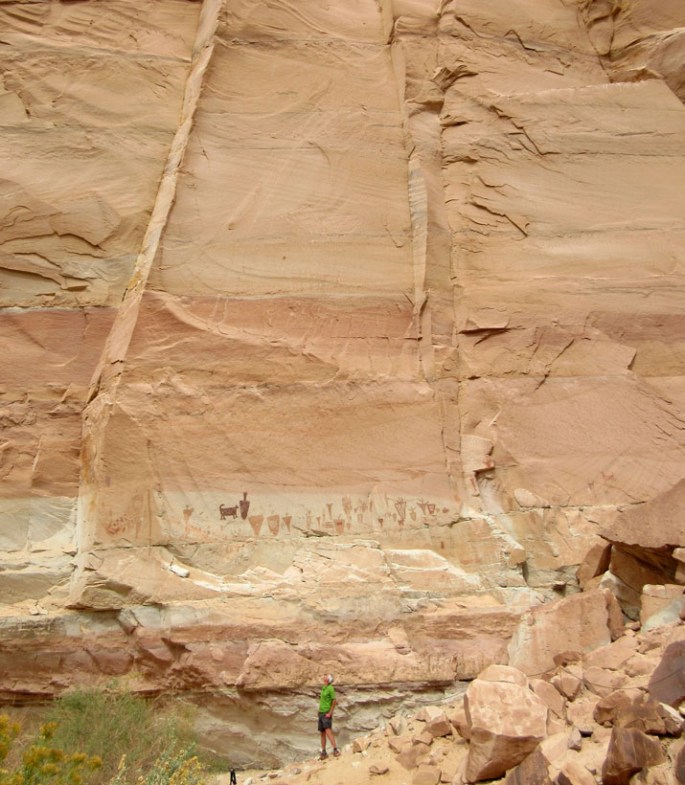
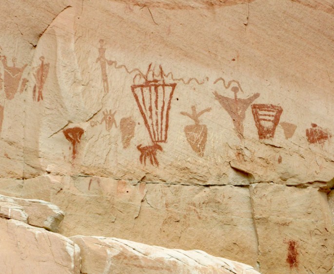
Onwards we passed an empty tent at campsite SC3 – our first sign of others down in Salt Creek Canyon. More great iconic rock art with the ‘4 faces’ and some weird figures that appear to be smiling – or maybe not?

1013-img_1570-salt-creek-four-faces 
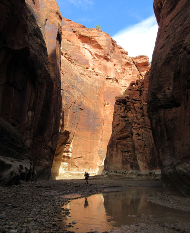
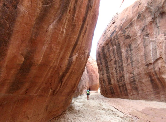
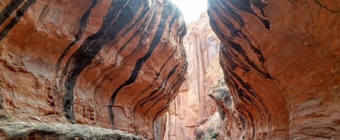
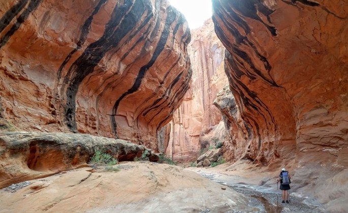
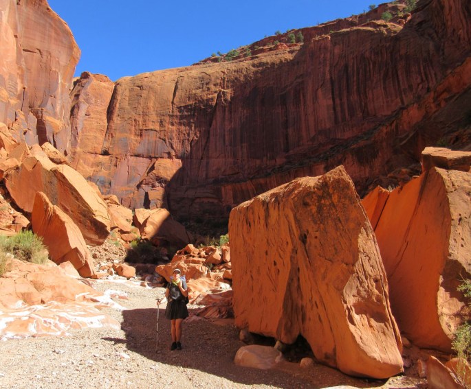
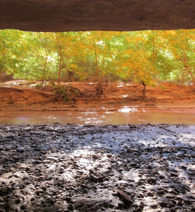
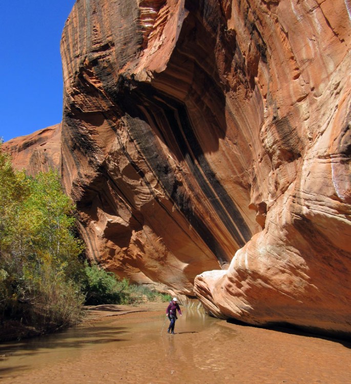
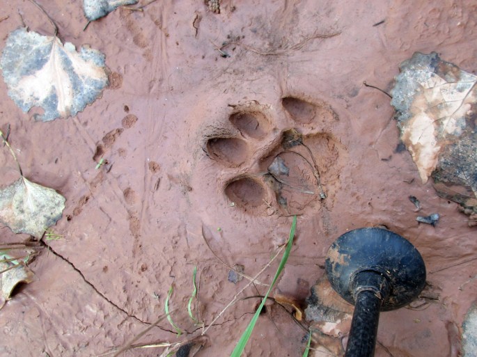
We hit some really thick bush and managed to lose the trail bushwhacking down near the riverbed. With some steep scrabbling up steep mud cliffs pulling up on bushes,we picked up a trail again. Lots of coyote and bear scat on the trail as well as some tracks as we eventually arrived at our campsite (SC4) above a tight river meander with steep coloured walls on either side. What a great relaxed day, mixing hiking and exploring ruins.1013-img_1588-salt-creek-cs4

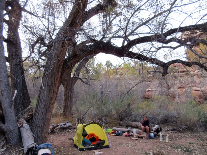
Friday 14th October 2016 Coyotes heard again through the night under a bright moon. Today we simply turned around and headed back up the canyon, which was not going to be a hardship given how wonderful it all was yesterday.

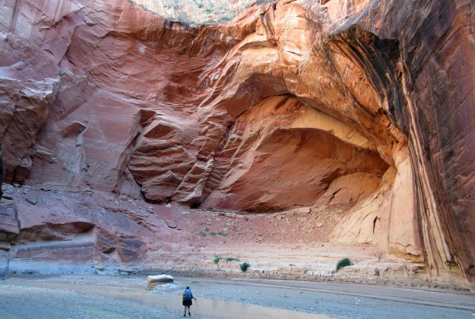
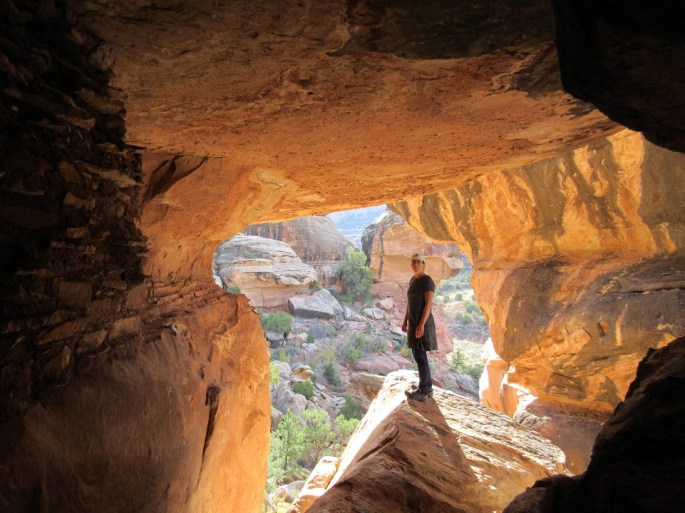
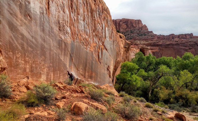
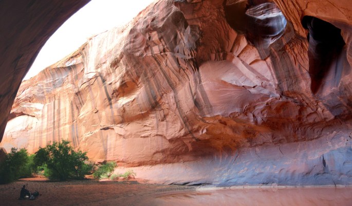
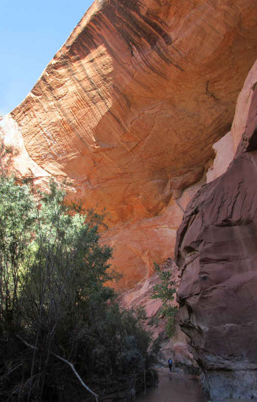
We found a cliff dwelling site just to the south of our campsite around the first river meander which we nicknamed ‘cave ruins’. Here there were stone buildings spread along a ledge system nestled under huge overhangs in another superb position. One pictograph had a line of people holding hands in a stylistic way. Our main find was a granary sheltered in a cave with a glorious outlook and beautifully reflected red colours.

1014-img_1625-salt-creek-cave-granary

You could see finger prints in the mud/clay used as mortar in the stone……

1014-img_1621b-salt-creek-cave-granary

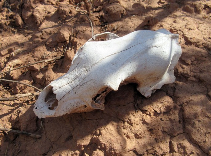
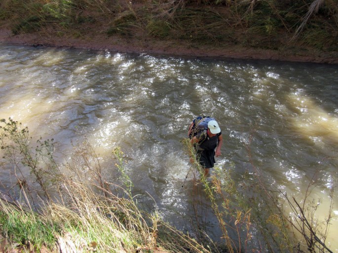
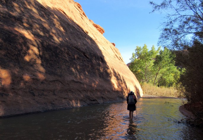
After spending a while exploring around the ledges we moved on southward up Salt Creek – this time managing to stick to the trail.  The temperatures today were pleasantly cool with a high cloud to block the sun. We came across a bear skull along the way, a fantastic rare find…..

1014-img_1640-salt-creek-bear-skull

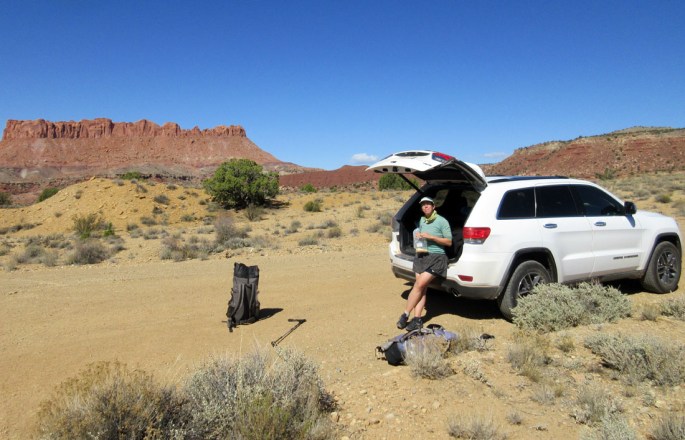
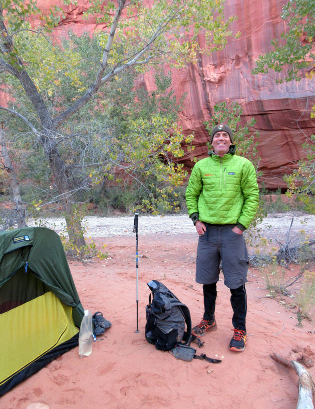
Making it back to the trailhead by about 4.30pm we decided to spend the night camped near to the car with the tent perched on the cliff edge looking down into the canyons below.

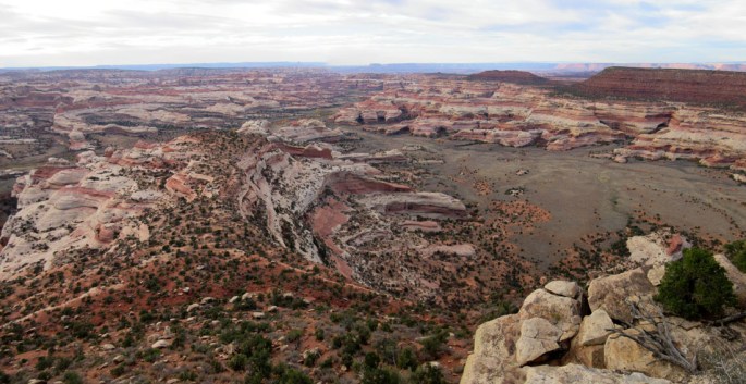
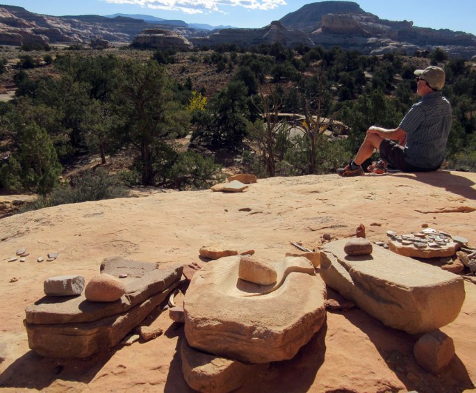
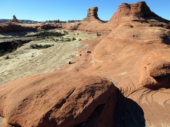
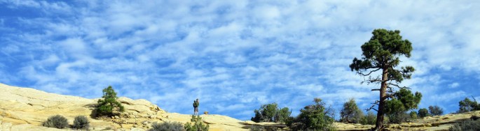
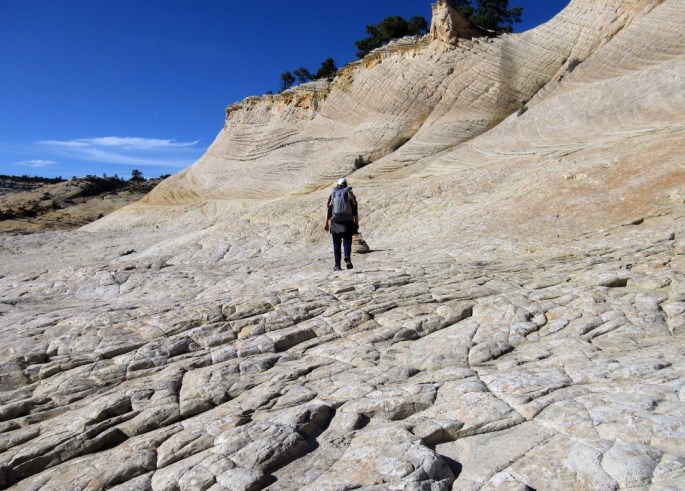
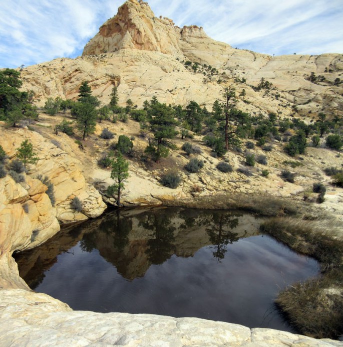
With some energy to spare, we spent the evening hiking out about 2 miles to Cathedral Point for even better views across the crazy canyons and coloured slabs in this area. There are lots of potential hiking trips to be done here with Lavender and Horse Canyons and the mesa’s between looking particularly good.

Back at the car we had a lovely camp meal of Mexican rice, beans, salsa, tortilla and topped off with some Uinta Heiferweizen beer!

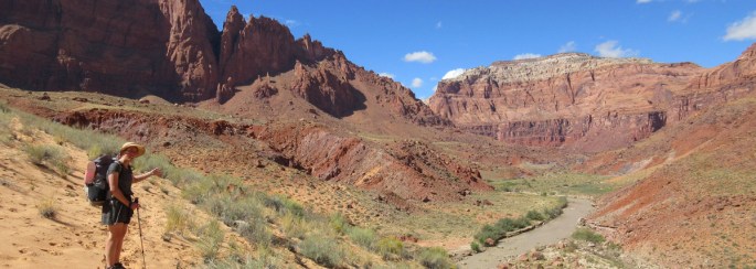
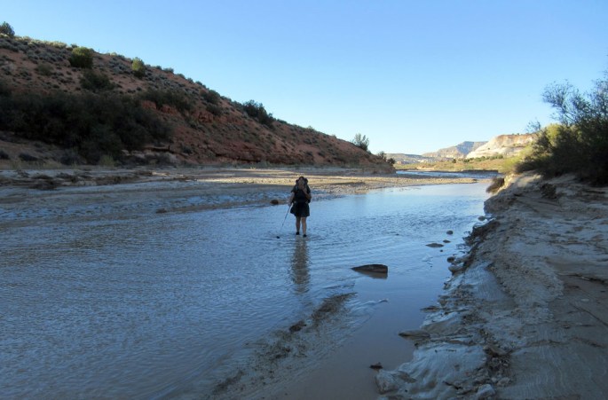
Saturday 15th October 2016 After driving back to the Needles visitor centre we went out on a day hike to the north end of Salt Creek on the ‘Peekaboo trail’.  It would have been nice to have thru hiked the length of Salt Creek but it would have involved some difficult logistics getting from one end back to our car so hence our separate hikes from either end of the canyon.

Peekaboo is a tremendous trail with much of the hiking on ‘slick rock’ slabs and panoramic views out to the rest of Canyonlands. There are some easy scrambling sections including a couple of ladders to cross short steep sections. We made it out to Salt Creek to visit another interesting pictograph panel of two ‘turtle shaped’ figures. We returned the same way but all in all it was a fantastic day out!

1015-img_1663-needles-peekaboo1015-img_1697-peekaboo-trail

More photos here….

Canyonlands National Park- Horseshoe canyon

Tuesday 11th October 2016 We drove north from Escalante area over Boulder Mountain and out into the beautiful wild badlands past Hanksville on Highway 12 and 24 before heading off down the Hans Flat dirt road for something like 30 miles to the Horseshoe canyon trailhead. The drive was enjoyable with vast open vistas across the high desert plateau and a big bruised cloudy sky.

We had read that Horseshoe canyon has some of the best pictograph rock art in the desert south west so were keen to see it in real life. The trailhead that we used sat on the west side of the deep canyon and we descended easily on a well worn old mining trail to the canyon floor. It looked like a hot sort of place but we were lucky with cool weather under a threatening cloudy sky.

1011-img_1446cc-hanksville-20161011_1001451011-img_1471-horseshoe

Walking along the easy dry canyon floor, we saw four different pictograph panels, with best at the end, the iconic ‘Great Gallery’. The art includes many figures around 7 feet tall in what is known as the ‘Barrier style’ – named after this canyon which used to be known as Barrier. You can read more from the national park webpages here.

With little known about the people that drew the figures, or even when they were drawn, we were left to imagine what the artworks were meant to depict. But they were definitely impressive to see!  Brian below one of the smaller panels for scale…

1011-img_1457-horshoe

Close up…….

1011-img_1454-horshoe

There were some cool huge alcoves along the canyon….

1011-img_1458c-horseshoe

The Great Gallery….

1011-img_1459-horshoe

There were a few drawings of what looked like domestic dogs with the figures…we particularly liked this one….

1011-img_1465-horshoe

Probably the most famous figure is this one often referred to as the ‘Holy Ghost’……

1011-img_1466-horseshoe

Some beautiful autumnal cottonwood trees on the way out…..

1011-img_1470b-horseshoe

And even the toilet block at the trailhead had it’s own ‘rock art’….!

1011-img_1472-horshoe

Peekaboo, Spooky and Brimstone slot canyons -day trip

10th October 2016 Today we had a day trip south of the town of Escalante to some superb narrow slot canyons. It was a 26 mile drive down the rattly dirt road of ‘Hole in the rock’ road before we turned off for the trailhead. We stopped about a mile short when the road got rougher and decided to hike in from there.

We had visited here in 2004 and had a great fun day out squeezing through the very narrow slots so we knew what to expect. They didn’t disappoint the second time around!

This time we took a video of our loop through Spooky canyon first then back through nearby Peekaboo……and you can see it here or click the image below.

1010-img_1416b-20161010_125415-spooky

Fantastic fun! Next we hiked east a bit through lovely sand dune territory to another narrowing canyon called Brimstone Gulch. We only got a a short distance down this one before we stopped at some deep, deep, cold pools between the canyon walls. We gave the canyon best and retreated back to the car after that!

1010-img_14351010-img_1443-exit-from-brimstone1010-img_14451010-img_1446

You can also see our Escalante photo gallery here of this and other nearby backpacks.

Silver Falls, Harris, Escalante, Neon and Choprock canyons II

Saturday 8th October 2016 Choprock canyon provided us with a pleasant, quiet and still night. In the morning we left our camping gear and decided to explore down the Escalante river to Neon canyon – intending to return to the tent and hike up Choprock canyon in the afternoon to camp.

First we had some cold river crossings and tough bushwhacking down the Escalante. We are learning that the rivers are a lot colder in the morning before they heat up from the sun later in the day!

After about an hour we came across more signs of trail and easier hiking- probably because we had passed Fence canyon which is another access point for hikers from the Egypt trailhead. Soon after that we stopped at a large petroglyph panel with a mix of older Anasazi art and more recent ‘Cowboy’ drawings.

1008-img_1292-heading-down-escalante-to-neon-20161008_095130

1008-img_1294-heading-down-escalante-to-neon1008-img_1296-heading-down-escalante-to-neon

We turned into Neon, a side canyon on the left/east side- it was leafy, about 30 meters wide with muddy pools of water and the most striking red walls imaginable. There was poison ivy around but it’s easy to recognise as it is shrubby and had turned to autumnal colours whilst the rest of the shrubby plants were still green. At least it was very visible and easy to avoid.

We hiked and waded for about 20 minutes up the beautiful twisting canyon before reaching a dead end- the ‘Golden Cathedral’. Here there was a pool of muddy water underneath a huge cave system pierced by two large holes where water must pour in times of rain. Reflected light against the walls created a stunning scene.

1008-img_1315-neon-20161008_1127211008-img_1325-pano-neon1008-img_1331-neon-toad

We sat around for a while before heading back to the tent, agreeing that this canyon was so good that we would return again as part of a future hike someday.

1008-img_1340-neon1008-img_1343-neon

Returning to the tent without incident, we packed up and headed up Choprock canyon. We dropped the backpacks again to explore the south fork, which was again scenic, but we found it had a bit too many deep pools to encourage us to go too far!

Choprock canyon itself though narrowed to give about an hour of tremendous hiking with the walls only a few meters apart.

1008-img_1347-choprock1008-img_1361-choprock1008-img_1374-20161008_161452-choprock-subway

The canyon opened up a bit after that and with some seeps of spring water appearing we pitched the tent at the junction with the north fork (or poison ivy fork). What a magnificent day for scenery!!

1008-img_1375-20161008_180856-choprock-camp

Brian explored the north fork in the evening and then we were treated to a slow motion spectacle of the moon gradually lighting up the canyon.

Sunday 9th October 2016 We awoke at 6.30am to get an early start today as we knew we would be heading out into open and potentially hot territory on our return back to the car. The canyon widened further as we headed upwards but still with steep rock walls of wingate sandstone about 400 meters apart. The going was easy up the gravelly meandering wash and we made good time. We heard canyon wren and saw some jackrabbits, ravens and coyote tracks but mostly the canyon was silent.

We climbed steadily up into the grey and purple chinle rock layer to the watershed amongst pinyon-juniper, before finding a scrambly route down through a short rock layer to the Moody dirt track. There was a massive petrified log protruding from the rock here studded with glistening crystals.

The Moody track provided an easy hike for a few miles back to the car to complete another great and varied loop hike!

More pics from this and our other Escalante hikes are here…

1008-img_1302-neon1009-img_1385-choprock-upper


Silver Falls, Harris, Escalante, Neon and Choprock canyons I

Thursday 6th October 2016 We planned to do a canyon loop around the Escalante river again but in a new area to us which we hoped would visit some of the finest scenery in the south west. In 2014 we visited the southern end of the Escalante river via Halls creek, Steven’s Canyon,Coyote Gulch and Hurricane as part of our Hayduke hike. This time we aimed to link up canyons to the north including Neon with it’s photogenic Golden Cathedral.

After coffee in the Burr Trail Outpost in Boulder, we drove along the super scenic Burr Trail for about 30 miles before turning south 10 miles down the Wolverine Loop Road on the east side. The road was a bit bumpy in places but we made it to a junction about 3 miles short of the hiking trailhead for Silver Falls Creek amidst big wide open vistas dotted with sage and pinyon-juniper. Here we sorted our gear out for 4 days and set off on foot down Silver Falls creek. We firstly followed a dusty jeep track to the actual trailhead for about an hour and from then just continued down the mostly dry stream bed surrounded by the colourful Chinle and Wingate rock formations.

1006-img_1205-silver-falls-canyon-ready-to-start-off1006-img_1210-upper-silver-falls-canyon

The sun was penetrating but the air was cold making for great hiking conditions. As we descended the canyon walls gradually closed in and meandered with the steep clean red wingate cliffs surrounding us. Although cross country, the hiking was pretty mellow following the canyon- allowing us to gaze upwards at the alcoves and streaked rock.

1006-img_1220-silver-falls-canyon1006-img_1230-silver-falls-canyon

Some water appeared in the canyon floor from springs before we reached the greenery of the fast flowing Escalante river itself. We got lost a bit in the deep willow shrubbery before wading through the river to find Harris Wash on the other side. Lot’s of fresh looking flood debris around here made for tougher hiking but we eventually found a comfy flat sand bench above Harris Wash to pitch the tent….

1006-img_1234-camp-in-harris-wash

Friday 7th October 2016 A cold starry night and also a smelly one! We had a skunk pass by the tent during the night but by morning the smell had subsided (or maybe we had just got used to it!).

We left the tent pitched and explored up Harris Wash for the morning. Starting out, we waded up the calf deep wash which had frigidly cold water and it took a couple of hours before the sun crept over the canyon walls and warmed us up. The flood debris made for slow going but Harris had some superb deep alcoves and colourful walls. We didn’t see anyone here and only saw two other pairs of hikers in the four days we were out despite Harris in particular being described as a popular canyon.

Every canyon in this region has it’s own character- depending on the different rock layers, the steepness of the canyon, the amount of water, the size of the water catchment, the amount of sun exposure amongst many factors. It does make for incredibly interesting hiking as the view changes at every meander bend and there are constant surprises to be found!

1007-img_1242-pano-harris-wash1007-img_1247-harris-wash1007-img_1257-harris-wash-return

We saw some wild turkey on the river banks but our main feathered companions were ravens -soaring above us with their shadows flickering across the canyon walls.

We found a side spring with fresh water coming in from a side canyon on the south side of Harris. Here we tried to climb out of the canyon here on grainy slickrock but we gave up due to the slippy rock and the lack of holds! A raven monitored our progress…..

1007 IMG_1253 harris wash raven watching us scramble.jpg

Soon after, we turned around and returned back to our tent for a mid afternoon lunch. The water and air temperature had warmed up making the return more relaxing. Our plan next was to pack up the tent and hike / wade down the Escalante river towards a side canyon called Choprock to camp there.

The Escalante river had a much larger volume than Harris and we had to criss- cross many times in thigh deep water. But it didn’t cause many difficulties despite the steep muddy river banks. Between crossings we hiked most easily on sage brush flats with faint trails and with more difficulty through willow and tamarisk scrub. The canyon here was roughly 500 meters wide and with deep red walls and autumnal cottonwoods it looked great.

We followed some big cat trails for a while, and it looked to us that it might be mountain lion- and quite fresh at that.

1007-img_1260-many-escalante-river-crossings1007-img_1267-escalante-nearing-choprock1008-img_1281-heading-down-escalante-to-neon-mountain-lion

Eventually we made it down to Choprock canyon at around 6pm and set up camp in a pleasant open spot next to our ever present cottonwood friends!

1007-img_1274-choprock-camp-escalante1007-img_1277-choprock-camp-fashion-escalante

Part II of our backpack to Neon and up Choprock canyon is here..

Escalante river, Bowington and Boulder Mail trails

Sunday 2nd October 2016 After returning from our hike down the Paria river we thought we would sample the canyons and slickrock plateau in the Escalante area of southern Utah with a short 2.5 day backpack straight out of Escalante town itself.

We descended down to the Escalante river from the trailhead at around 4pm in hot sun but soon found cool shade at the river amidst beautiful autumnal cottonwood trees.

1002-img_1097-escalante-river-start

The Escalante was lusher, greener and a little less severe than the Paria river and the contrast felt good. We hiked downriver easily with some good trail mixed with crossings of the calf deep water. We came across a huge alcove with a striking set of white pictographs with real size figures. A park service ammo box beside the rock art contained information leaflets and warned against touching the art to prevent it being damaged.  It dated the rock art at 2000 years old and the location inside the massive cave was wonderful.

1002-img_1113-pano-x-3-escalante-river-alcove

1002-img_1108-pano-x-4-escalante-river-alcove

Hiking on a bit, we splashed down the river before finding a pleasant riverside campsite. Another clear starry night above between the canyon walls was broken by constant flashes of distant lightning somewhere and some gusty winds. We had a night of broken sleep imagining another flash flood like last week’s in the Paria…

Monday 3rd October 2016 No floods thankfully, and we continued down the Escalante with a mix of trails, river and bushwhacking. The temp. dropped and we kept our fleeces and trousers on for a couple of hours as we arrived at the confluence with Death Hollow Canyon. A strong clear flow came out of Death Hollow and it was obvious that the river levels were high which was going to make our long hike up the canyon a little tougher than we had thought. 

1003-img_1121-escalante-death-hollow-confluence
Wading across the Escalante river into Death Hollow with its green riparian corridor

We set off up the river of Death Hollow which was frigid cold and knee deep. The vegetated banks were stuffed with poison ivy, so the river seemed the best way to make progress. Two dippers dashed around on the river. But boy was it cold.

We lasted about half an hour (reckoning that we had about 7-8 hours to our planned exit point at the Boulder Mail trail) and decided to turn back to regroup at the Escalante river again where we were able to sit in the sun to warm up and eat some bars for energy.

After scanning our map and the pages of Steve Allen’s wonderful guidebook ‘Canyoneering 3 – Loop hikes in Utah’s Escalante‘, we came up with another high level route northwards up onto the slickrock plateau above Death Hollow canyon on the ‘Bowington trail’ before meeting up again with our intended route.

After about 40 minutes further down the Escalante, we climbed up on rock slabs above the canyon amidst some beautiful ‘zen’ water slides and golden layered rock.

1003-img_1132-bowington-trail-start1003-img_1135-bowington-trail-start

We soon hit the ‘Bowington trail’ which we found to be a series of -just enough- cairns across undulating rock slabs and pinyon-juniper. The hiking on this route was relaxed, keeping our feet dry and with panoramic views- to Boulder Mountain to the north, the Henry’s mountains eastward and Navajo mountain south in Arizona. Tall ponderosa pine grew out of the cracks in the sandstone slabs.

Late in the afternoon we started dropping down on amazing rock formations into the canyon of Death Hollow again. Now following the more popular ‘Boulder Mail trail’ the cairns were more prominent but the scenery remained spectacular.

1003-img_1148-bowington-trail

We returned to Death Hollow and it’s river was still heavily vegetated but the going was easier at this point upstream of where we started out this morning. We found a lovely white sand bank under towering canyon walls in Death Hollow to camp. A great day.

Tuesday 4th October 2016 A cold morning as we climbed westward steeply and directly from camp out of the canyon using rock slabs (slickrock) on the ‘Boulder Mail Trail‘. Grand views all around in the early morning light…

1004-img_1170-death-hollow-exiting-on-the-boulder-mail-trail1004-img_1173-boulder-mail-trail

The hiking on this cairn marked trail continued through splendid scenery of pillow and brain shaped rock formations dotted with trees and some great little waterpockets in the rock hollows. We dropped down to cross Mamie Creek with a huge pool maybe 30m diameter at the bottom. The water here was rusty red colour  – from the iron rich rock we thought.

1003-img_1138-bowington-trail
Cricket watches us snack under a ponderosa

1004-img_1177-pano-boulder-mail-trail-mamie-creek

The rest of the day we meandered over rock slabs and across some sagebrush flats westward to eventually arrive at a rock rim overlooking a distant Escalante town. The cairns headed steeply down improbably over more rock slabs before we hit the lush corridor of Pine Creek at the bottom. All that remained was some now familiar splashing along the river and bushwhacking to pop out at the Escalante river again and back to the car.

What a magnificent short backpack with a huge variety of hiking in a quiet area -we didn’t see any other people. Steve Allen describes the Boulder Mail trail as ‘one of canyon country’s premier routes’and we agreed with that!

More photos of this trip and our other Escalante hikes here…..

Paria River Backpack II

Friday 30th September 2016 The next morning we were up before 7am but as we were moving around we noticed that the river had started roaring! The river had increased in height by more than a meter and had turned chocolate brown with silt. Branches were coming down with the river and the flow rate had massively increased with standing waves where we had crossed yesterday evening from the spring. It looked like a flash flood had come through and we thought ourselves lucky with our tent perched on a sand flat a few meters above the river level. The river looked impossible to cross and, as our intended route was to continue down the river itself we were a little trapped!

[Click image to see the video]
0928-img_1040-pano-paria-day-4-after-flash-flood
We sat watching the roaring river and set sticks up at the waters edge to monitor the height of the flow. After an hour or so the river level went down a little which gave us hope.

The river valley looked to widen out with a trail marked on our map starting about a mile downstream . If we could bushwhack down the south bank of the river for a way to stay out of the water, we could perhaps make it to the trail and continue downstream for a while before having to cross the river. So we decided to give it a go….

After some scrambling through willow, tamarisk and under some boulders we did hit an intermittent trail of sorts and we kept hiking.

0928-img_1054-paria-day-4

We soon hiked onto the ‘Chinle’ rock layer which here was colourful and soft providing a welcome shelf above the river for us to walk on. We stopped at a side canyon – ‘Bush Head’- and scrambled up to find a spring with fresher water to supply us for the day.

0928-img_1049-paria-day-4-after-flash-flood

The heat began to build after that as we headed downstream on sandy banks high above the river which was now lined by cliffs. We halted at a boulder, the only shade around, and were interested to see it had a petroglyph- we weren’t the first to find shade here!

0928-img_1064-paria-day-4-one-sheep-rock0928-img_1065-paria-day-4-one-sheep-rock

Eventually we dropped down a steep sand dune back to the river at the now abandoned Wilson’s Ranch. Our guidebook suggested it might have a spring, but after lot’s of searching, we gave up trying to find water and slumped down in the shade of some cottonwoods. We needed to get to the other side of the river but it was still running too strong to cross so we pitched the tent to try again in the morning. Both of us were rather thirsty by now so Martina took the brown silt laden liquid from the river and filled our ‘platypus’ water bags with the hope that the silt would settle to the bottom overnight.

Lo and behold, the dirt and silt did settle to give us about 2/3 rds of a liter from each of the 3 water bags. After treating it with our ‘Aqua Mira’ water purifier tablets it almost tasted fine!

0928-img_1073-paria-day-5

The water levels had definitely dropped overnight but the first crossing was still a challenge in thigh deep forceful water- but we made it. From there we strolled on with three other crossings to good trail on the final few miles to the tarmac road near the campsite at Lee’s Ferry, Arizona. Now for the challenge of getting back to our vehicle, 74 miles away in Utah!

0928-img_1089-paria-day-5

We needn’t have worried, after hiking down the minor tarmac road a few miles towards the main highway 89A, we got a lift for the final 3-4 miles to Marble Lodge – a gas station, diner, PO and motel. Fortified by some lunch, we started hitching and got two great lifts; firstly from a Navajo family then from a Mormon family returning to Salt Lake City area. Back at the car we drove to Kanab for a welcome shower and fresh food. What a great trip down the fantastic Paria River!

More photos here…..

0928-img_1093-paria-day-5-thumb-out

Paria River backpack I

Tuesday 27th September 2016 Our first backpack of this trip was to follow the Paria River down its lower section for about 40 miles or so to it’s confluence with the Colorado River. This was supposed to be one of the most spectacular canyon hikes around and we were so looking forward to it!

After an enjoyable morning hike in Snow Canyon state park near St George Utah, we drove east over to Kanab Utah to shop for food and then carried on about 40 miles east to the small Paria Visitor Center to pick up our permits for the hike.

We were told that a recent flash flood down the canyon had made hiking difficult with more water in the river, mud, quicksand and flood debris. Also that our intended start along a super narrow canyon called Buckskin Gulch for 14 miles before joining the Paria might not be possible due to deep pools and mud. We decided to still go for it but amended our plan to avoid the Buckskin start.  However we still hoped to be able to explore a part of Buckskin from the main Paria river.

The dirt road  was also closed a  mile short of the start trailhead, as it had been washed out by the flood, so we parked our car by the closed signs and sorted our gear for the hike out on the dirt road. We then set off in lovely low light at about 5.30pm for a short evening hike and soon reached the trailhead with a register…..

0927-img_0848-paria
At the Paria River trailhead

We dropped down to the river in a wide basin and followed it down making many pleasant splashy ankle deep crossings. The bed was sandy and mostly easy although there were some soft patches of mud where we sunk down into its squelchy depths!

0927-img_0852-paria
First of many Paria River crossings in the evening

The river basin soon steepened to rocky canyon walls…..

0927-img_0857-pariaAfter an hour or so we found a petroglyph site and soon after a sandy bench to set up camp. A grand start and it was great to back in canyon country!

0927-img_0871-paria-night-1

Wednesday 28th September 2016 We had some rain overnight so we both dashed out to put the outer tent on for shelter- other than that there was a clear sparkly sky to enjoy. We awoke at 6.30 and after a fine muesli breakfast we both were up and keen to hike down the canyon. After a few miles the canyon walls constricted and we were in the famous ‘narrows’.

0928-img_0909-paria-day-2

0928-img_0914-paria-day-2
The ‘Slide’ in the Paria above Buckskin Gulch

0928-img_0918-paria-day-2-nearing-confluence

The scenery was splendid with huge twisting rock walls of ‘Navajo’ sandstone with lovely alcoves, holes and towers. The river occasionally reached both sides of the canyon but was never more than knee deep. Soon we reached the confluence with Buckskin Gulch and we decided to drop our backpacks and hike up Buckskin for a while to explore.

Buckskin was beautiful with it’s own character- narrower and darker than the Paria with only a tiny flow of water but mostly an easy flat sandy bottom. In 2014 we had hiked down from the other side of Buckskin 14 miles upstream for about an hour. We need to come back and complete the full traverse – it is unique and amazing!

0928-img_0925-paria-day-2-buckskin-gulch

0928-img_0935-paria-day-2-buckskin-gulch
A snake in Buckskin Gulch…it didn’t look bothered by us thankfully

Back at the Paria we hiked down more great canyon to ‘Big Spring’ – some lovely clear water gushing out of the canyon walls. We picked up water here and hiked on a bit to find another scenic camp on a raised sandy bench above the stream and under some cottonwoods. Today had been both successful and scenic. We both had injury fears before starting but the tremendous scenery, the warm weather in the 20’s C (but not too hot) and the variety of intermittent crossings of the river, sandy benches and occasional trail seemed to work wonders for us!

0928-img_0941-paria-day-20928-img_0944-paria-day-2

Thursday 29th September 2016 More rain with distant thunderstorms overnight so again we scrambled out to put the outer tent on. The river level was up and flowing faster in the morning as we headed down river to an area called the ‘Goose-necks’ – a particularly winding steep walled canyon section. This was one of the most dramatic hiking locations we have ever been in. We stopped at an old 1930’s cast iron pump ‘Adams Pump’ for a break- it was intended to be used to transport water from the river up a pipe onto the plateau to provide water for cattle. It never went into operation, and looked remarkably well preserved.

[Click here or the image below for a short video clip]

0928-img_0966-pano-paria-day-3

0928-img_0986-pano-paria-day-3-water-pump
Adam’s Pump

After lunch we left our backpacks again and explored another side canyon – ‘Wrather’ which had lush vegetation, deep red walls and a stunning arch higher up- it was definitely worth the trip.

After more, deeper splashing down river, we came across another petroglyph rock art before a good dripping spring. We filled up our water bottles then waded across the river to camp across from the spring. Spanish rice, tea and biscuits for dinner with canyon wren song, bats overhead and glistening stars – another great day.

0928-img_0993-paria-day-3-wrather-canyon-datura
Datura in Wrather Canyon
0928-img_1000-pano-paria-day-3-wrather-canyon-arch
Wrather Arch
0928-img_1006-paria-day-3-wrather-canyon
Climbing up above the cottonwood trees in Wrather Canyon

0928-img_1025-paria-day-3

Go to part II of our Paria river hike here…..

Autumn 2016 in the US south west

We returned to the desert and canyons of southern Utah and northern Arizona in September/ October 2016. Two years ago we hiked and kayaked our own version of the Hayduke Trail. Having enjoyed it so much we returned this year with a rental car to hike to some other canyons and interesting places. Whilst we wouldn’t get the full immersion of a multi month hike such as the Hayduke, we were aiming to target some of the most spectacular places in the region with some trips ranging from  1 to 5 days.

You can see an overview in the interactive map below and read our blogs listed below too…

  1. Paria river backpack I
  2. Paria river backpack II
  3. Escalante river, Death Hollow, Bowington and Boulder Mail trails
  4. Silver Falls, Harris, Escalante, Neon and Choprock canyons I
  5. Silver Falls, Harris, Escalante, Neon and Choprock canyons II
  6. Peekaboo, Spooky and Brimstone slot canyons day trip
  7. Canyonlands National Park- Horseshoe canyon
  8. Canyonlands National Park- Salt Creek backpack
  9. Farewell to the Escalante area- Wolverine and Little Death Hollow canyons
  10. Video summary from our hikes (6 minutes)

1019-img_1785-escalante-outfitters

Coast to Coast Trail across England

A walking route that crosses northern England passing through the Lake District, Yorkshire Dales and North York Moors national parks
The Coast to Coast is about 200 miles long following trails, rough vehicle tracks and minor roads. Devised by Alfred Wainwright in 1972, it has since become the most popular long distance trail in Great Britain. It traverses a great variety of countryside in it’s releatively short length from the uplands of the Lake District to the limestone greenery of the Yorkshire Dales to the wooded valleys of the Eskdale and Littlebeck. The towns are interesting and rich in history too; good examples being Richmond with its Norman castle, Shap Abbey and Grasmere the cute tourist magnet in the Lakes.

We had a fun time on our hike which we split into two week long sections;
-Part I October 2015 we hiked west from Kirkby Stephen to St Bees
-Part II June 2016 we hiked east from Kirkby Stephen to Robin Hood’s Bay

Our walk

2015 westbound

Day 1 12th Oct 2015 Kirkby Stephen -Orton- Shap 22 miles
A gentle start through limestone countryside with dikes and a network of fields. Early drizzle cleared mid morning to give a bright day but with a biting cold westerly wind in our faces! We diverted to the picturesque village of Orton for lunch – which was definately worthwhile. The afternoon’s high moorland made for great hiking but we began to tire for the final few miles over the M6 motorway into Orton. Great day though!
Day 2 13th Oct 2015 Shap – Patterdale 17 miles
An early start on frosty ground with low lying mist at first. Orton Abbey was an atmospheric and splendid stop. From there we headed out over more undulating fields and woodland to reach Haweswater reaching into the eastern Lake District. Soon we climbed steeply up to the high tops of High Street with clear views back east to where we had come and out west into the central Lake District. A long drop past lovely Angle Tarn and then over some rubbly paths and we made it to camp in Patterdale just as the frost set in.
Day 3 14th Oct 2015 Patterdale – Grasmere – Greenup Edge 16 miles
We set out on a bitingly cold but clear morning gently up Grisedale to reach its tarn set in a great spot south of Helvellyn. An easy drop down and we were soon lunching in the tourist town of Grasmere with shops and a great bakery. Up Easdale in the late afternoon and we hit the high ridge of Greenup Edge with more great views. We found a camp spot on the descent to Stonethwaite above Eagle Crag. Another excellent day..
Day 4 15th Oct 2015 Greenup Edge – Ennerdale Bridge 16 miles
More deep frost this morning as we dropped down to Rosthwaite, picking up some food. A wonder through trees and steep climb by the road gave some more good views before we arrived at Honister Pass. this was a good chance to dry the tent from that covering of overnight frost whilst having coffee and cake from the cafe. Next we climbed over our final high Lake District ridge past Grey Knotts to steeply drop into quiet Ennerdale. This is a big valley stretching westwards and made for easy hiking all the way out to Ennerdale Bridge. We caved in and stayed in a hotel here which was well with the money for its good food and warmth.
Day 5 16th Oct 2015 Ennerdale Bridge – St Bees 15 miles
Our final day saw us start out on minor roads before following fine trail along a stream and then up Dent hill with its marvellous views out to the coast. The trail continued along minor roads and trail through some old mining villages before hitting the west coast and a grand finale south above the cliffs to St Bees. An excellent 5 day hike!

2016 eastbound

Day 1 28th May 2016 Kirkby Stephen – Nine Standards Rigg camp 6 miles
We dropped our car off at Kirkby Stephen around 5pm and decided to set out in the evening on the trail up the hill of Nine Standards Rigg. After a day of travel this was a good way to stretch our legs and we managed a high camp on the south ridge of the hill with nearby water.
Day 2 29th May 2016 Nine Standards Rigg – Ellers Beck Swaledale 21 miles
A grand long day through the Yorkshire Dales National Park. Dropping down was easy into Swaledale. The countryside here is beautiful with it’s stone built farm buildings and dykes. Ravenseat Farm was our first introduction to the scene, but Keld was also lovely and we had tea and cakes here next to the campsite as a line of vintage tractors started out on a tour of the dales. We met a couple of other C2C hikers hiking down beside the river Swale itself and had a pleasant chat before stopping for lunch at a cafe in Gunnerside. The meadows were green and full of flowers and this was now easy hiking! We pushed on hard though into the evening and both of us were sore by the time we set up camp in the woods.
Day 3 30th May 2016 Ellers Beck – Danby Wiske 23 miles
Lots of variety to start with walking through forest and fields into the large town of Richmond with its old castle. There was a fair and procession underway as we strode down the streets into the crowded centre of town. After a shopping and cafe stop we hiked out past the castle and over the river eastwards onto flatter countryside. This flat hiking began to hurt a bit for both of us but fortunately the weather brightened a little from the damp start to the day. The final few road miles into anby were sore on the feet so we were relieved to get a room and a shandy at the White Swann Inn in town!
Day 4 30th May 2016 Danby Wiske – Osmotherley 10 miles
Drab and a gale force westerly wind today. The walking was still flat and we had a fair bit of shelter from hedgerows and some trees. We made it to the A19 just before Inglebury Cross and dashed into the truckers cafe for shelter and mugs of tea. Looking at the forecast of gales continuing for the next few days in the east where we were heading but sunshine in the Lake District to the west, we decided to spend a couple of days out in the Lakes and return.
Day 5 4th June 2016 Osmotherley – North York Moors camp 18 miles
Refreshed after a wonderful high camp on Pike O Blisco in the Lakes and hill walking round the Langdale peaks, we returned to Osmotherley again in low cloud. But at least the wind had calmed down! We strode onto the high plateau of the North York Moors and into the clouds. The walking was on undulating heather terrain and we could gain distance quite easily on the good trails even though we were wet from the mist. Eventually camped in heather moors somewhere east of Bloworth Crossing near an abandoned railway.
Day 6 5th June 2016 North York Moors camp – Grosmont 20 miles
The sun eventually poked through in the morning- hoorah!- so we were able to get distant views over the moors. Stopped at the Lion Inn for morning tea, a venerable old travellers inn up on the moorland. From here we skirted the northern edges of the North York Moors over Glaisdale Moor before dropping down into leafy Eskdale. We were now walking down the lush and green river valley in the sun and it made a pleasant contrast to the moors. Stayed at a lovely B&B at Grosmont- the Geall Gallery- really recommended.
Day 7 6th June 2016 Grosmont – Robin Hood’s Bay 15.5 miles
Final day to the coast! A steep early climb was followed by a drop into another beautiful forested valley – Littlebeck. Then onto lower moors which to be honest were a bit soggy and tedious! We pushed through and made it to the coast by about lunchtime for a splendid finishing walk south to the village of Robin Hood’s Bay nestled by the sea. Overall an great 2 week hike with lots of variety but some tough flat walking on tarmac in the middle!

Photo gallery here

Some thoughts on the trail

What’s it like It’s mostly great fun with lots of variety hiking over the hills of the Lake District, Yorkshire Dales and North York Moors. Passing through many quaint villages, historical churches provides lots of interesting things to see. There are many places to resupply so, even if wild camping, you don’t really need to ever carry more than two days of supplies. The start and finish on both coasts are great highlights too. This isn’t that wild a trail so expect to see others and lots of cow and sheep fields. There is also a ‘low point’ of maybe 30 miles of flattish walking on field margins and minor roads between Richmond and Ingleby Cross which we found quite sore on the feet and less scenically interesting!
It is mostly good trail underfoot and we had only a few boggy sections (worst was near Robin Hood’s Bay in the moors west of Hawsker) but mostly the trail is excellent. We wore lightweight trail shoes and running shoes.

When to go The trail can be hiked pretty much at any time of the year. We hiked in October and June. Summers (July, August, September) can be busy though which can make accomodation tricky unless you have booked. In October we saw almost no other C2C hikers (but lots of day hikers in the Lake District). In June there were a few groups hiking each day but it didn’t feel busy. September/early October and April/May/June would on balance be our chosen times to visit balancing quiter periods but still potentially decent weather. Winter with the short days and wetter conditions would be for the hardy only.

Where to stay We carried a lightweight tent, mainly because we enjoy (particulary wild) camping but most people stay in B&B’s or hotels each night. The cost can stack up if doing this though. Estimate at about £80-£100 a night for bed and breakfast for two people. We ended up with 4 wild camps, 1 campsite, 5 B&B’s. If wild camping bring along some sort of water purifier such as chlorine dioxide droplets. You will also need to plan ahead as you can’t really camp in the low lying agricultural areas but the Lake District and North York Moors provide plenty of opportunities.

Planning Best to look at the sites below and get a guidebook and off you go. There are companies that can arrange your whole trip for you including accommodation and transport your bags between B&Bs if you like. We carried all our camping gear etc though and didn’t have a problem with that. Our approach also meant we had lots of flexibility in terms of where we stayed each night which suits our approach.

Links to information on the Coast to Coast
Brian and Martina’s photos Our photo gallery from the hike….
Ramblin Man Great info source on the trail
Wainwright’s book From the man himself and an entertaining and informative read!
Trailblazer guide The guidebook we used
Packhorse Provide full support services including transport from each end of the trail
Sherpavan Another support provider
Camino adventures Helpful planning tips here

Other trails near to the Coast to Coast
Penine Way 270 mile long official trail that crosses the C2C at Keld
Cleveland Way North York Moors trail that shares some tread with the eastern part of the C2C
Lyke Wake Walk A 40 mile crossing of the North York Moors based on an old coffin route
Cumbrian Way A 70 mile footpath through the Lake District
Land’s End to John O’Groats The big one..walking the length of Britain