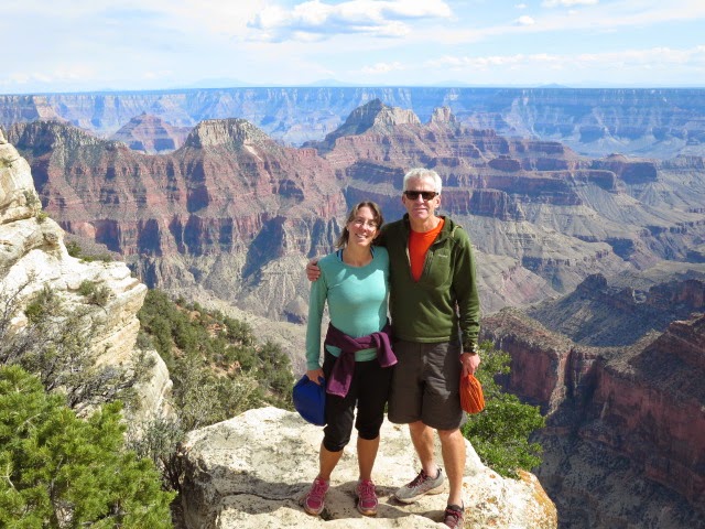
We drove down to the Flagstaff area in northern Arizona and climbed the Arizona’s highest point, Humphreys Peak (12,633ft or 3,851m) using the standard route up from the Arizona Snow Bowl ski area. It was cool to be in forest with pondarosa pine, douglas fir, then aspen up to limber pine and bristlecone pine on the highest ridges. Above we had views around northern Arizona and to the pitted landscape of volcanic cones. Being the highest peak, there were a fair number of hikers around with an excellent trail to follow. I guess though, the peak didn’t have particularly dramatic views compared with what we have in our own sunny Scotland so we decided one day was enough for us and we would spend the last few days before we flew out back in the canyon country of southern Utah.
On Humphreys
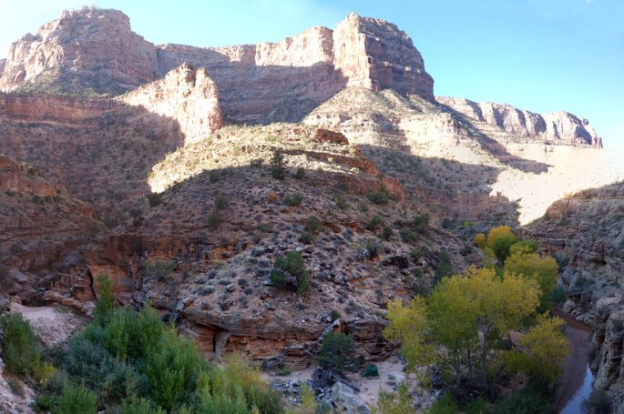
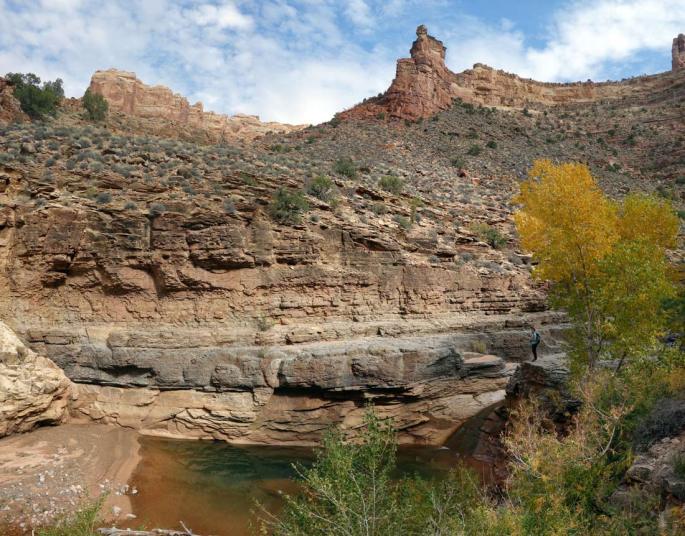
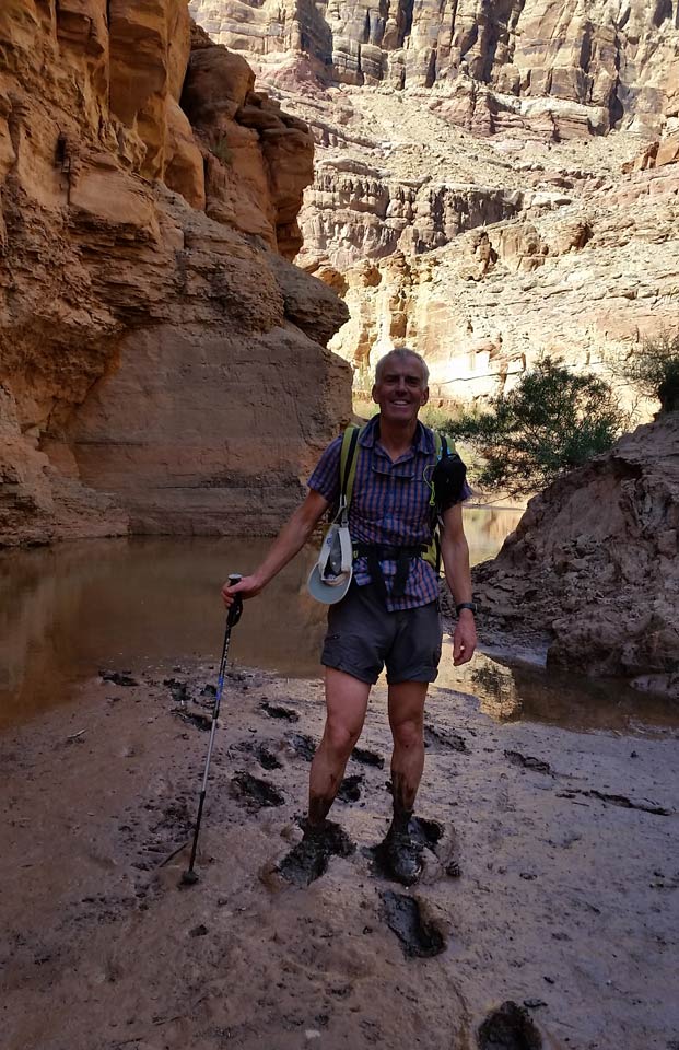
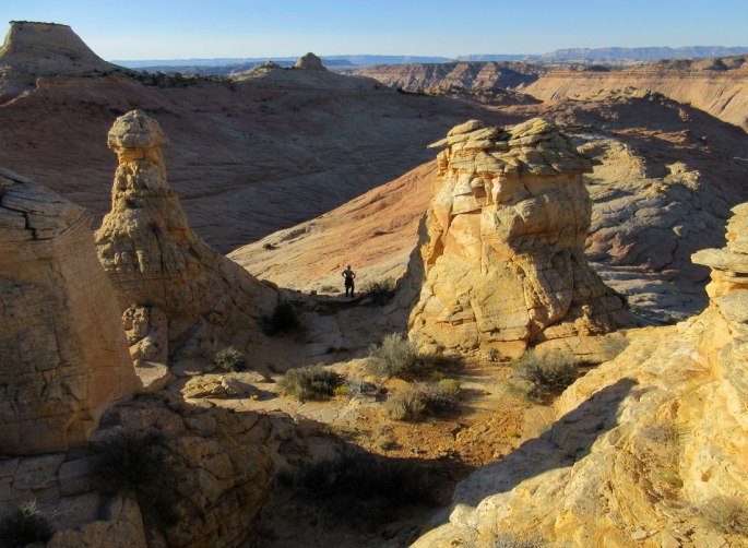
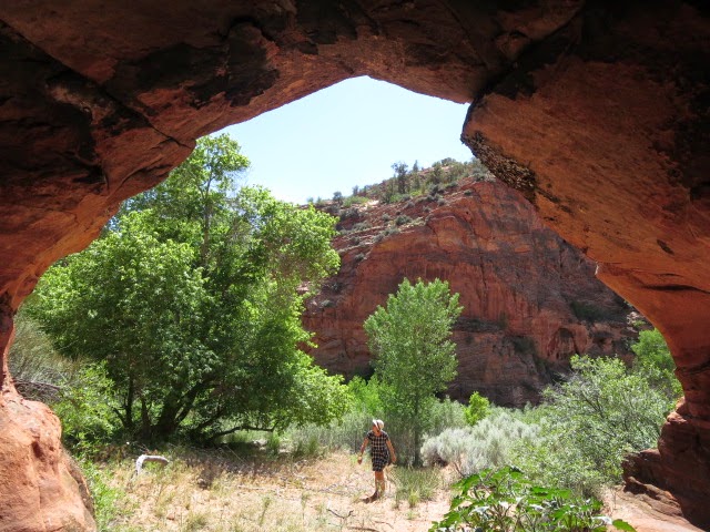
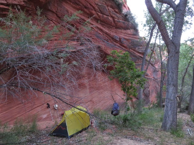
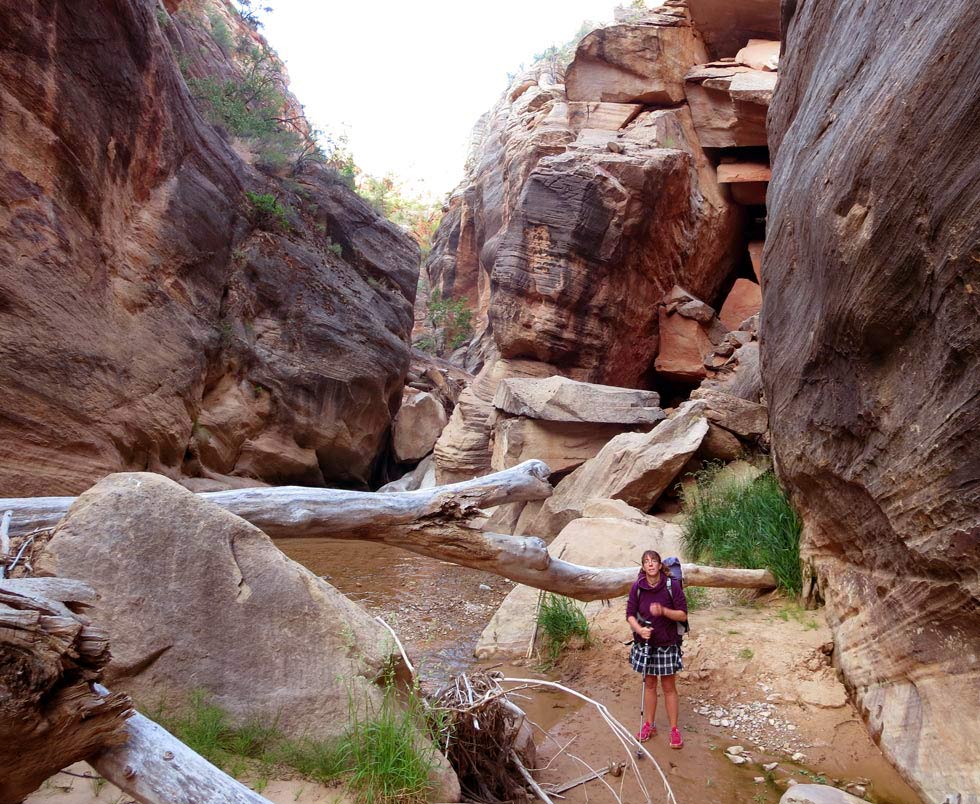
Tuesday 24th October 2017 Hackberry Canyon
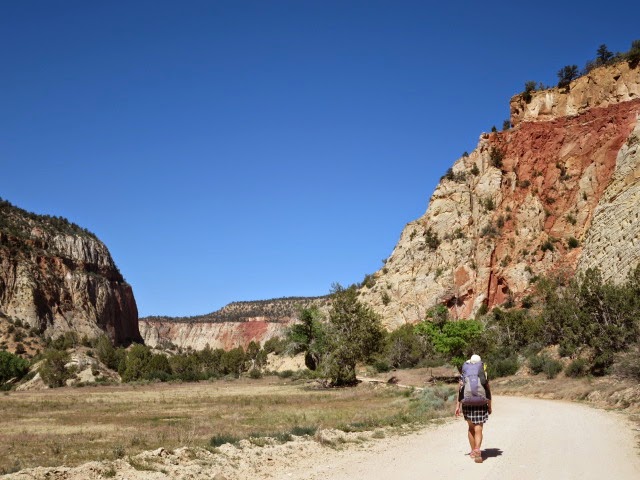
The aim for our last couple of days in Utah was to visit the Hackberry Canyon, Paria River confluence and find somewhere nice to camp overnight. From Page Arizona we drove over the Colorado River, past Big Water then left the tarmac to head north up Cottonwood dirt road for about 12 miles to near the foot of Hackberry Canyon. The light was sharp and clear and the cottonwoods looked particularly golden and autumnal.
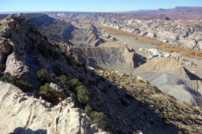
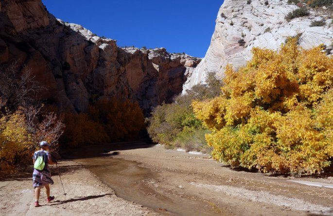
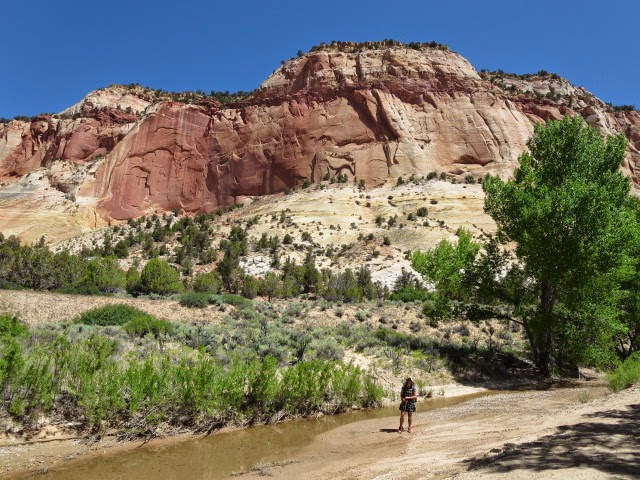
With Michael Kelsey’s guidebook in hand we hiked east uphill to the top of Cockscomb ridge on steep dirt road then cross country to the top of the ridge itself. The panorama was cool with great views over rippling sandstone layers and slickrock to Yellow Rock, Castle Rock and Powell Point way in the distance to the north. We then hiked north up Hackberry Canyon which we rather rushed through previously on our 2014 Hayduke hike. The twisting canyon was beautiful and a healthy stream rushed over the sand and between the curving red walls. As the canyon opened out further upstream continued up through cottonwoods to rustic Watson Cabin in a technicolour scene of gold, reds, greens under a deep blue sky.
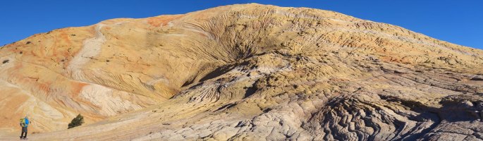
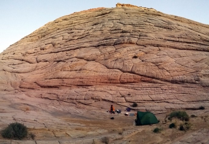
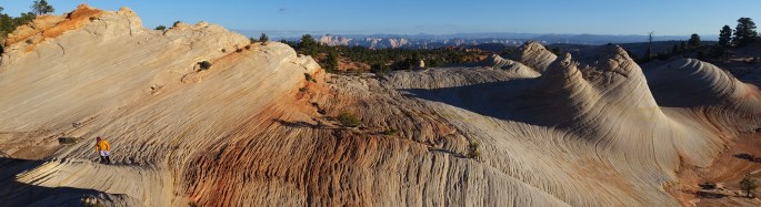
Back at the car, we packed the camping gear and headed uphill again this time to the west to the top of the amazingly colourful slabs of ‘Yellow Rock’. We found a superb camp near to the summit on slickrock and pitched the tent just before the sun set.
From the Cockscomb south down Cottonwood CreekLower HackberryWatson Cabin, HackberryCamp, Yellow Rock
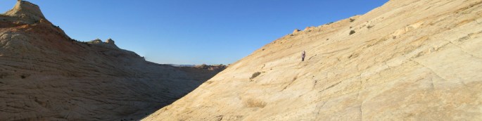
Wednesday 25th October 2017 Yellow Rock, Paria River
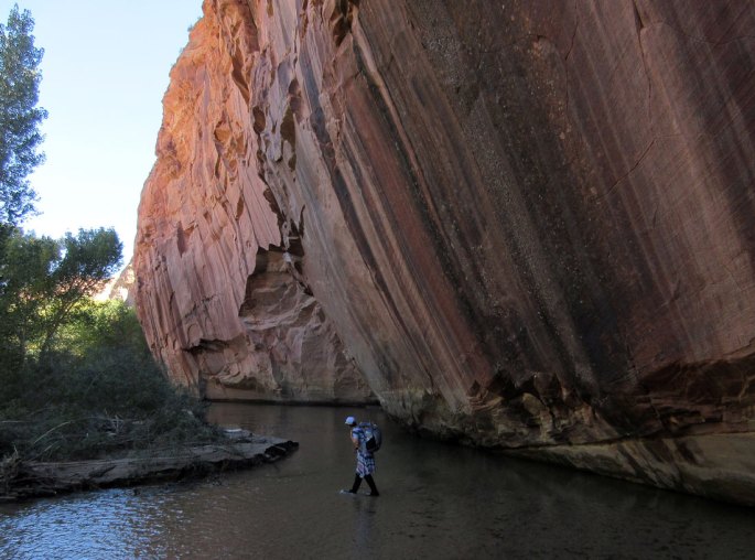
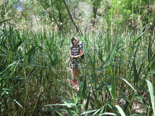
We awake early in the morning to see the sun rise and it quickly warms to tent up for breakfast. Stroll over Yellow Rock down to the natural feature ‘the red cairn’ where the rock patterns are particularly vibrant. The peak to the south provided some slabby scrambling – this whole area is cool! We then followed a faint trail west then south back down into the ‘box’ canyon of the Paria River past some lovely cactus rock gardens amidst pinyon juniper forest – very mellow!
Once down in the Paria we hike up to the old movie set (last movie filmed here was ‘The Outlaw Josie Wales’) nearby situated under some particularly colourful Chinle rock formations. The heat began to build in the afternoon and we were happy to splash back down the Paria through the box and up Cottonwood Wash back to the car to complete a great little mini trip!
After a good breakfast at Twin Rocks diner in Bluff we drove to South Mule Canyon for a day walk to look at some Anasazi ruins. Flaming Roof ruin was the best, living up to its name with its impressive streaky sandstone overhanging roof. Whilst here though we both agreed that backpacking for a few days suited us better than day hiking and allowed more of an immersion into the backcountry! So we decided to visit Dark Canyon further west and drove off mid-afternoon back to the basic Hite marina campsite at the edge of Lake Powell.
Some eerie coyote choruses overnight including some right next to the tent. A guy drove into the campsite last night and asked if there were any shops or diners nearby (Hite is a looong way from shops with Hanksville or Blanding being maybe 90 minute’s drive away). Martina gave him 2 snickers for the road and he set off for Hanksville!
Drove down in the morning to the Sundance TH- 11 miles of dirt road with beautiful vistas including the Henry Mountains prominent to the west and Sigor Ros on the stereo – superb! This road is also used as part of the Hayduke trail to hike between Dark Canyon and Hite and then onto the Dirty Devil river.
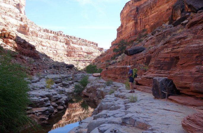
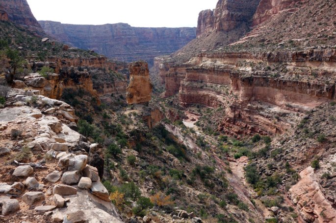
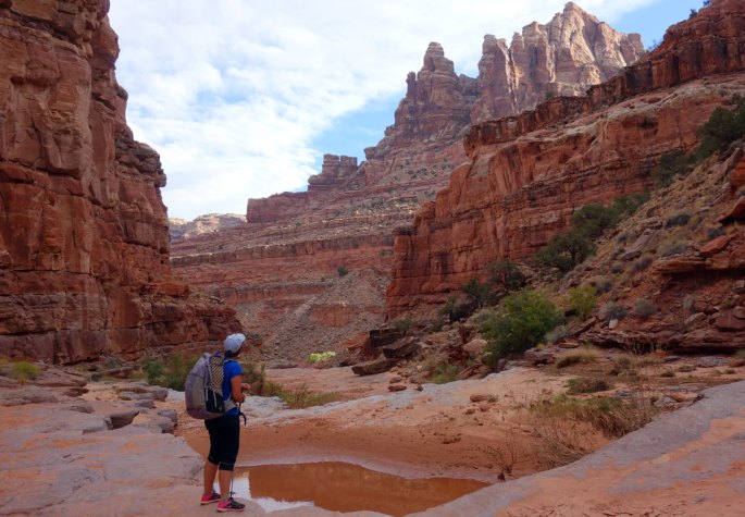
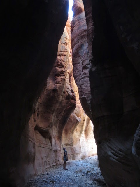
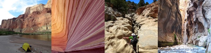
On leaving the car, we hiked for about an hour using the Hayduke route variation from the trail on a nice faint line through pinyon juniper and some cool slickrock before reaching the beautiful rim of Dark Canyon with horizontal layers and towers below. Three ravens and a raptor swooped above to complete the scene. The descent was steep, down bouldery and sandy ground, but at least is well cairned. We took it slowly and were down to a sub valley that feeds into Dark in an hour. After relaxing behind some massive boulders we moved on down the sub valley on good trail to cottonwoods and Dark Canyon itself with a healthy flowing river (rangers had warned us there might not be water here but that seemed unlikely with this major river system!).
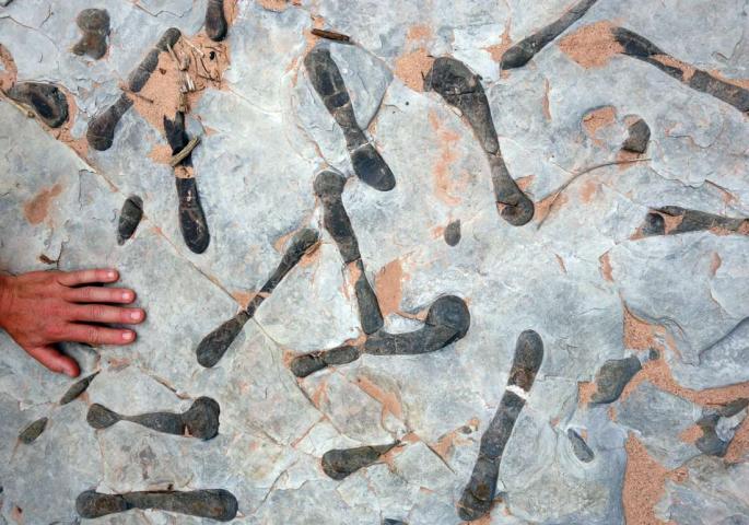
Our aim was to hike Dark Canyon upstream to the junction with Youngs canyon and set up camp to explore- this again being part of the Hayduke trail that we hadn’t yet seen. This was a fantastic walk, often on limestone pavements above the river shore providing a mix of easy walking mixed with scrambling. The pavement terraces were often undercut and embedded with red, white and black cherts (we think) in a beautiful abstract array. Fossils appeared now and then too. With the water often pouring down slabs forming pools and waterfalls, we managed one cold dip but it was fun. The canyon was deep with high open walls blocking the sun out much of the time- perhaps where the ’Dark’ name comes from?
At one point we hit a dead end in the canyon and were forced to back track until we could scramble out the west side before picking up a cool trail following the rim upstream. Nearing Young’s canyon we hit some slower travel, more lush vegetation and bushwhacking before we arrived at the atmospheric confluence with Youngs canyon and set up camp with Youngs waterfall cascading nearby. Great day!
Resting before hiking down the sub valley into Dark CanyonSmooth hiking along terraces in Dark CanyonOur tent (bottom right of centre) at the Dark- Youngs Canyon confluenceWeird limestone terraces – intrusions?Dark Canyon autumnal colours
Wednesday 18th October 2017 Dark Canyon
We decided to leave the tent in place and explore Youngs Canyon today. To get into the canyon we bypassed the waterfall by going 100m up Dark Canyon then taking a steep cairned trail before traversing back into Youngs above its pool. Soon after we hit a deeply vegetated patch thick with poison ivy and bamboo- bashing our way through we were glad it only lasted a few hundred meters before we emerged out into a dry canyon.
From here we scrambled up the canyon floor on slabs and over boulders. Staying in the canyon we arrived at a beautiful slabby rockwall which we climbed before being halted in our tracks by another steeper 20m wall. We backtracked 400-500m down canyon to reach a cairn at a side gully and scrambled our way up past a tower on the east to pick up a rough trail contouring up the canyon rim. Following this for maybe a mile it dropped us back into canyon floor where we continued upwards.
Lunch was under some cottonwoods in an open section of the canyon at the foot of the cairned route taken by the Hayduke onto the rim again far above. The Hayduke does a big detour from the canyon floor here to avoid a dryfall above. At 2pm we turned back and this time stayed on the eastern rim trail as it went past the tower, round the rim of the side gulley and on another 500m or so to a cairned descent steeply down a rubbly scooped gully. This went better than expected and we were soon back in the canyon to scrabble through the vegetation before returning to the tent at 4pm. The rim route on our return was much quicker. Overall the section of Youngs we looked at was wild and scenic.
After dinner Brian explored up Dark Canyon from the Youngs confluence and again it was interesting with a more chilled, tranquil vibe.
YoungsYoungs – Eastern rim traverse route with the tower centre picture
Thursday 19th October 2017 Dark Canyon
After a warm night we had a brief rain shower at breakfast and once it stopped we decided to both head further back up Dark Canyon and leave the tent. The meanders are tight upstream and we both loved the mellow feel with a gentle stream flowing. There is an attractive large pool which we bypassed on the right going upstream. After about 1.5 miles from the Young’s junction the water stopped flowing and we went another couple of miles before turning back. It would be great to include upper Dark Canyon in a future longer hike- perhaps on the Hayduke alt from Salt Creek or joining into Woodenshoe canyon going south.
Returning to the tent, we packed up and headed back downstream in Dark Canyon. Repeating this stretch was no hardship as it’s so great! We found an excellent place to pitch the tent on a rocky limestone terrace right above the river. Heard a dipper and canyon wren on the way.
Pool in Dark Canyon upstream of Youngs
Friday 20th October 2017 Lower Dark Canyon and up Sundance Trail
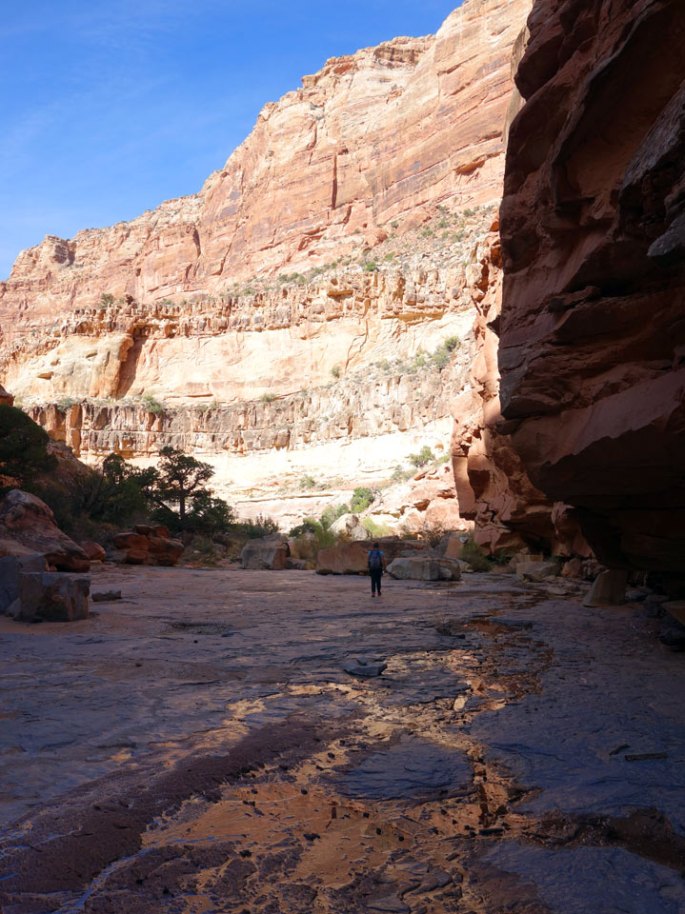
In the morning we hiked back down to the junction with the Sundance Trail after taking a short diversion up Lost Canyon which was also rather scenic. Met a couple of hikers from Flagstaff camping on the way. From there we decided to explore down the lower part of Dark Canyon to where it flows into the Colorado river. The canyon walls close in a little after the junction with Lean To Canyon and after a false attempt on the left, we retreated and climbed up to a trail on right/east of the canyon (LDC). This was a fantastic high ‘balcony’ trail with short exposed sections and tremendous views downstream.
After about an hour the trail drops down steeply to the valley floor at the junction with a side canyon from the east- a lovely spot with water sliding down bare slabs. From here we downclimbed past a deep, beautiful pool on its left and then scrambled up right past some loose blocks. Then things got muddy! Lake Powell must have reached up to here in the past but the lake has since retreated back leaving the valley floor filled with mud and silt making for stodgy going! The temperature built up too and we plodded on but eventually turned round about 300m short of the Colorado river itself.
Going back upstream was easier and again a great hike- we thoroughly recommend this lower part of Dark Canyon. Made it back to the juntion with the Sundance Trail at 3pm in hot, sultry conditions. After a drink in the shade of cottonwoods we shouldered our packs for the steep, hot climb ahead to the rim. Made it back to the car at 5.30pm after another great scenic trip. Drove to the metropolis of Blanding for a motel and pizza!
Lost CanyonLower Dark CanyonLower Dark CanyonMud near the Colorado!
Thursday 5th October 2017 We left Kanab campsite and drove on one of our favourite drives up through Orderville lined by beautiful autumnal cottonwoods and sparkling cold sun, then over the high plateau past Bryce canyon and onto Escalante town through stark but beautiful scenery. We asked at the ranger station about the state of Death Hollow river level as the river had defeated us last year with its deep, cold, fast flowing water. The ranger had one report of a team that had turned back recently at the crux narrows but we decided to head in anyway as the autumn has been dry and we expected the water levels to be reasonably low.
We left the car at a windswept and dusty turn off about 2 miles west of the town of Boulder in mid afternoon at the eastern trailhead of the Boulder Mail Trail. Having hiked the west portion of this trail last year and finding it to be superb we were so glad to be back now on the eastern side.
An easy hike to start on good trail winding its way through pinyon – juniper scrub before we dropped height onto slickrock and to cross Sand Creek with running water and lush cottonwoods, greenery and even some aspen. From there we continued west on slickrock before a bigger drop down rock into stunning Death Hollow. It was evening now and our thoughts were to finding a campsite before dark and we waded downstream in and out of the river of Death Hollow before finding the same site as last year on sparkling white sand on the canyon floor underneath ponderosas. Wonderful!
Into Sand CreekDropping down into Death Hollow itselfCamp in Death Hollow
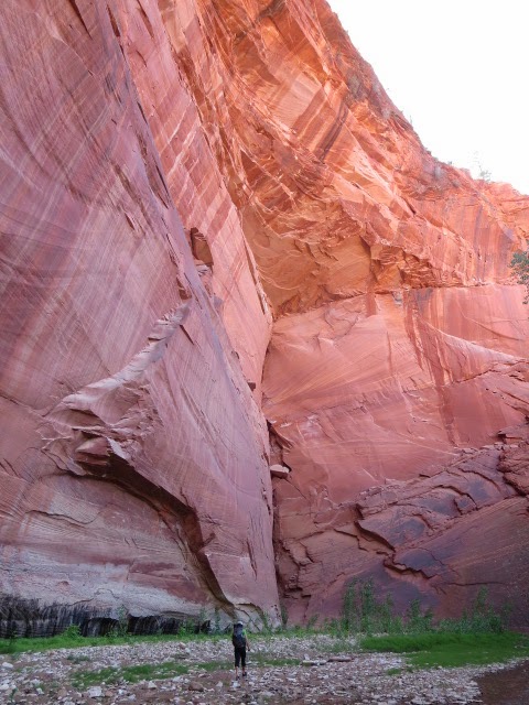
Friday 6th October 2017 Now for the descent down Death Hollow to the Escalante which had defeated us last year. The river bed here is filled with hard wearing volcanic boulders in many places making for tougher going than many of the canyon rivers here abouts. That plus the ubiquitous outcrops of poison ivy along the river banks slowed us down initially. The scenery was superb though with towering walls and the green canyon floor filled with tall ponderosas.
As we continued the going got easier and steady as we often followed faint trails on the banks between river crossings. The water warmed up into the day making the river crossings easier too. Often the bed of the stream was slickrock sandstone layer. It occasionally dropped off into potholes or deep clefts though such that we had to keep concentrating. We passed the junction of Mamie Creek which was a useful marker point and stopped for a bagel lunch on a beach with sparkling blue pools.
Lunch before the Death Hollow narrows
Next up was a section of narrows which were exciting! The water roared through a subway shaped slot with rock overhead forcing us down to a crawl and a sloping slippery ledge under the water for feet. A mistake would have made for a cold swim but we both made it and from then on Death Hollow was more mellow but continually beautiful. Saw some canyon wrens, dippers, blue jays, woodpeckers, 2 snakes and a buzzard!
We made it to the junction with the Escalante River at 3pm and noted that the Escalante had much less flow than Death Hollow. We continued down the Escalante with some trails, river crossings and bushwacking to camp near the Natural Bridge. What a great day!
Death HollowDeath Hollow
Escalante Natural Bridge
Saturday 7th October 2017 A cold night. Our shoes and socks froze overnight and we had a slow start waiting for the sun to hit us and thaw us out. We walked downstream along and across the Escalante river which was broader and more open here with sagebrush flats but still fringed by red rocky cliffs.
We crossed Highway 12 and saw a few people here around the trailhead, soon leaving the road and people though on a good mellow trail. Stopped to watch a canyon wren dart about on the rock only a couple of meters away. It had a white breast and long curving beak- good for extracting insects from cracks in the rock? There are a few well marked river crossings but mostly this section of the Escalante down to Boulder Creek is easy and relaxing hiking. Golden cottonwoods lined the river.
At Boulder Creek we hit a huge pile up of wood and flood debris which had formed a large island with rapids through the wood. Just beyond was a fresh downed cottonwood tree, with distinctive beaver teeth marks. Impressive!
Half an hour later we found our exit point from the river on the ‘Brigham Tea Bench’ as described by the Steve Allen Canyoneering 3 guidebook and stopped for lunch in the shade from the now hot sun at about 2.15pm.
A faint trail climbed up rock slabs to a dessicated wooden ‘line shack’- an old cabin complete with an old bed and table. From there we headed north on a mix of sandy flatlands and swirly slickrock following a wide bench between the high escarpment on our left and the canyon of the Gulch on our right/east. It was hot and sometimes tiring on the sand but the wild atmospheric open views were a great contrast to the canyon walking.
We decided to keep going into the evening to reach a series of rocky pools on the other side of a saddle on our western escarpment. Made it there to a wonderful campsite on a small patch of sand amongst rippled rock with a string of pools below us descending down the rock slabs. Crystal clear starry night and totally quiet- another great day!
Sunday 8th October 2017 Warm still air in the morning (8C) and we left the tent to scramble up the creased slabs to the north. The slabs were too steep to be taken direct but zig zagging and following lines of weakness allowed us to reach the summit with multiple pinnacles. What a spot!- which didn’t look like it sees many visitors at all but with extensive views across this remote sandstone area with the higher slopes of Boulder Mountain to the north.
Back at the tent we decided to also have a look at the water line dropping westwards before packing up and leaving the campsite. Numerous potholes and vegetated pond oasis’s made it another lovely area to explore.
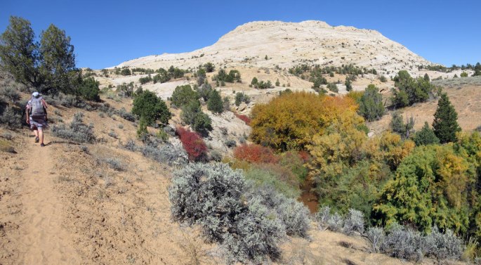
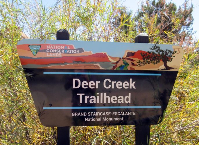
After a superb start to the morning we continued hiking north along the slabby eastern side of the dome escarpment until it faded away and we turned west to follow shallow washes into Deer Creek. Just before Deer Creek we hit an obstacle of a 30 foot cliff but after a bit of hunting around we found a slender tree trunk lying against the cliff and were able to shimmy down to the bottom. A bit more scrambling through bush, across Deer Creek then up walls on the west side aided by some juniper trees and we emerged onto a trail heading northwards upstream. Relaxed hiking past autumnal cottonwoods followed before we hit the Burr Trail tarmac road at a campsite and picnic tables.
From here we hiked north west on the Burr Trail towards Boulder town on tarmac. Paved road is not our favourite hiking but at least the scenery out here made it very pleasant and there was very little traffic although a supported cycle group came past at one stage. Eventually we caved in and hitched back to the car beyond Boulder. But what an excellent 4 day loop, with lots of scenic interest, variety, scrambling and a few side trips. Recommended!
Tuesday 3rd October 2017 We drove east from Las Vegas stopping off overnight at Snow Canyon State Parkand then onto the towns of Hildale/Colorado City on the Utah-Arizona border. Our aim was to do a two day loop hike up Water canyon onto the slickrock plateau of Canaan Mountain,camp and explore a bit before returning down Squirrel creek back to the car.
We hiked up the steep trail in Water Canyon with good flowing water (as you might expect) before the trail zig-zagged upwards steeply west of the canyon floor to ‘top rock’ – a small platform overlooking the canyons. This is a superb section of hiking taking an improbable line out of the canyon and onto the rim. From there we followed slick rock drainages holding good pothole water to the summit ridge of Canaan Mountain in a beautiful area called the White Domes.
We camped near here under a full moon and the next day meandered amongst the domes enjoying the slow creep of the morning sun glancing over the slick rock. Leaving our gear at the camp, we hiked west on an old stock trail with a mix of slickrock and deep sand amidst ponderosas with views north to Zion National Park.
On return to White Domes we collected up the camping gear and followed the stock trail east through some deep sand patches. A drop down into a scooped basin on the purest of slick rock was amazing though and we crossed the head of Water canyon, over a col, then gradually on more slick rock towards Squirrel creek. This was a wonderful, traverse. At the head of Squirrel creek we crossed a heavier used trail and turned down into the canyon with its lush greenery created from a flowing spring source. A jeep trail at the bottom made for easy walking via Short creek back down to the trailhead where our vehicle was now frying in the afternoon sun!
Squirrel and Short creek are part of an alternate of the Hayduke trail and Water canyon could be used as a further alternate to the Hayduke providing some extra stunning scenery at the cost of maybe 2-3 additional hours if you had spare energy!
You could also hike from the Water canyon trailhead north all the way over Canaan mountain to near Rockville on Highway 9 (which goes into Zion national park) as described in the guidebook ‘Favorite hikes in & around Zion National Park’.
Postscript: We have since hiked this traverse in 2018 and 2022, its superb!
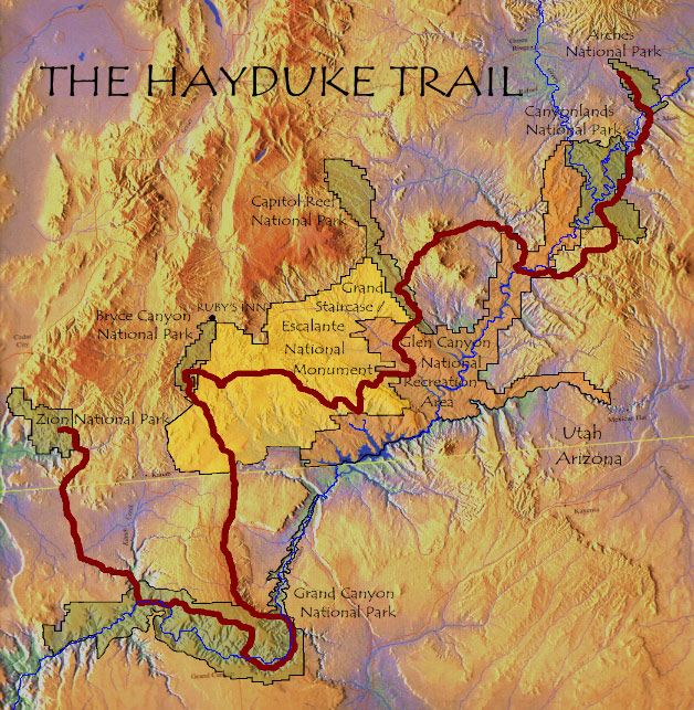
The Hayduke Trail is a 800 mile hike and scramble through the canyons of the Colorado Plateau in southern Utah and northern Arizona USA. The route links six stunning National Parks…. Arches, Canyonlands, Capitol Reef, Bryce Canyon, Grand Canyon and Zion.
The route connecting the parks stays pretty much in public lands including the wonderful Grand Staircase-Escalante National Monument, Glen Canyon National Recreation Area and numerous National Forests, BLM Districts, Primitive Areas, Wilderness Areas and Wilderness Study Areas. According to the Hayduke Trail website
‘the route is not intended to be the easiest or most direct route through this incredibly varied terrain, but is rather meant to showcase the stunning redrock wilderness of the American Southwest‘.
Created by Mike Coronella and Joe Mitchell, who spent years exploring the area and who published a guidebook in 2005, only a handfull of hikers have set out on the Hayduke each year. Roughly following the line of the mighty Colorado river south west, the Hayduke heads down into the Grand Canyon before heading north west to finish in Zion National Park. It goes down to about 1,800 feet at river level up to 11,419 at Mount Ellen in the Henry Mountains.
Mostly the terrain is arid and high desert but the plateau is cut into by a labyrinth of canyons, some with seasonal running water and springs. The prefered time of year to hike is the spring or autumn, between the blisteringly hot summer and the cold, snowy winter. Underfoot, much of the hiking is cross country, sometimes following canyon bottoms, wading rivers, hiking on sand or bushwacking through willow and tamarisk. There are a few good trails though, particulary in the national parks and jeep and dirt roads of various levels of use also provide easier travel across the plateau.
The Hayduke is not signposted or recognised as a national trail so hikers have to be self sufficient if they are to make it through the sometimes harsh, dry conditions. Above all though, the countryside is one of the most beautiful anywhere with the red walled canyons, clear skies, remoteness, lush green riparian corridors and stunning colourful rock strata.
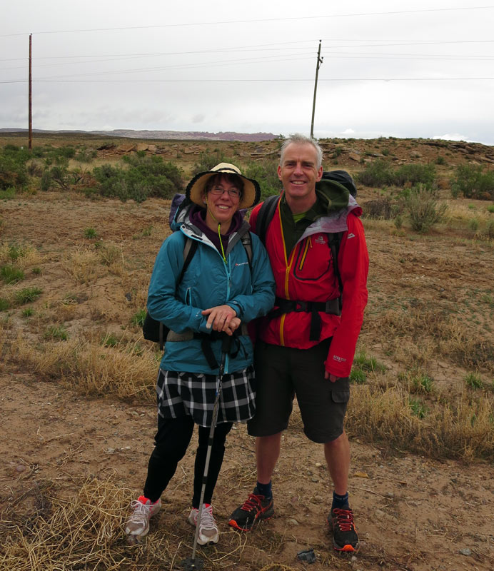
Although there is a guidebook, the nature of the terrain leads itself to a plethora of alternate routes and this appealed to us to research and explore our own variants. We, Brian and Martina, planned to set off hiking on the Hayduke in mid April 2014 and head westwards with lots of variations in mind.
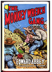
Edward Abbey The name ‘Hayduke’ is from the main character in the novel ‘The Monkey Wrench Gang’ by writer and environmental campaigner Edward Abbey. This has become a classic fictional story of ‘eco-warriers’ fighting back against the spread of industry and urbanisation of the wild areas of the US south west. ‘Hayduke’ set out to blow up railways and dams in the desert and in his run from the law, scrabbled his way through the harsh but beautiful landscape.
“In the first place you can’t see anything from a car; you’ve got to get out of the goddamned contraption and walk, better yet crawl, on hands and knees, over the sandstone and through the thornbush and cactus. When traces of blood begin to mark your trail you’ll see something, maybe.” Edward Abbey
Preparation We stay on the ‘Black Isle’ (but neither black or an island!) in the north of Scotland, a country with a rather wetter climate then the Colorado plateau. Not to be daunted though, during the winter of 2013-14 we did lots of hikes trying to replicate the Hayduke conditions as much as we could, covering around 20 miles a day seeking out rough sandy trails.
A local loop walk between the towns of Fortrose and Cromarty, along a rocky and sandy coastline with some climbing and rough dirt tracks proved to be about perfect- apart of course from the weather! It also happens to include superb geology and a range of coastal wildlife from dolphins, seals and the occasional otter to oystercatchers, fulmars, cormorants, shags and ravens. You can see the Site of Special Scientific Interest document for the coastline here.
In early April 2014 we headed out to Denver Colorado ready to start the Hayduke. Here we are on our first day in the rain at the edge of Arches National Park about to start hiking!
1st June Mt Carmel Junction to East Fork Virgin River 15.5 miles
We hitched out of Kanab and chose to rejoin the Hayduke by hiking down another route down the Virgin River from Mt Carmel junction. We started out down a jeep track following the river valley, half a mile south of the junction into an area called White Cliffs. The views out to these cliffs on either side of the wide valley were beautiful, the walking was easy for a while and the temperature today was refreshingly just warm. This was a lovely colourful hike with pink, red, yellow and white rock set against a clear blue sky.
White Cliffs
Heading west, we left the jeep track, sometimes to hike through the brush on either side of the river and sometimes finding it easier to hiking down the river itself.
Dropping the rucksacks at the junction with Mineral Gulch, we explored this canyon to the north which was a worthwhile trip up a narrow steep walled canyon of Navajo Sandstone with some deep caves.
Mineral Gulch
Mineral Gulch
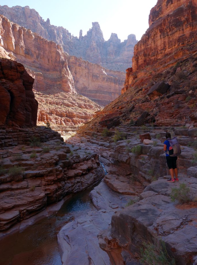
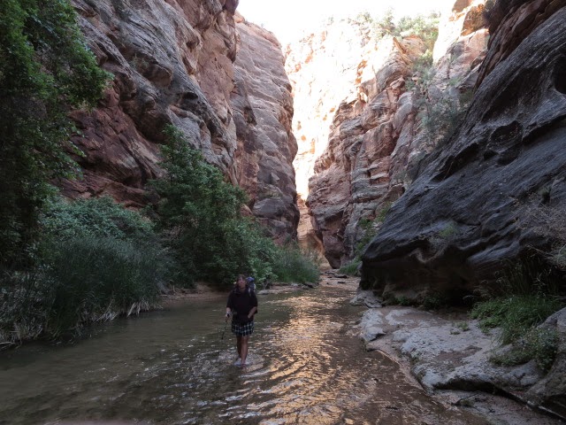
Back in the main river as the heat kicked in again, we collected the backpacks and hiked westwards as the canyon narrowed nicely with some big alcoves and deep red walls. We passed Rock Canyon where the Hayduke joined our river from the south and hiked another 4.5 miles of grand deep canyon called the Barracks- but Parunuweap is the Payute Indian name. Much of the hiking was in the roaring waters of the river itself now with the steep walls restricting hiking on the side banks -but this was fantastic hiking.
At about 18.30 we found a sandy bench to camp next to the river flanked by steep walls. We hoped for no flash floods in the night but the weather looked dry and stable overhead.
The Barracks
The Barracks
The Barracks
Camp in the Barracks
2nd June East Fork Virgin River to Zion Weeping Wall 18.5 miles
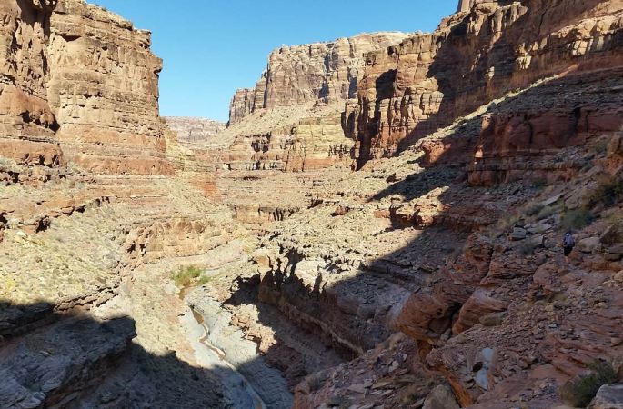
We were away from camp at 6.15 am splashing down the river between brilliant red steep canyon walls. As we progressed, the river got deeper and deeper, fed from many side springs such that we were thigh deep in water on occasions. After a couple of miles we reached a boulder jam where the river plunged noisily over into a deep pool. We avoided this obstacle by a climb up leftwards and then a subterranean descent down a chock stone chimney to exit below the blockage.
Back in the river we continued more easily to the ‘Fat Man’s Misery’ junction and our exit of the canyon on the Hayduke route just beyond. The Barracks had been a wonderful experience and we were so glad we were wrapping up our Hayduke hike in such magnificent, world class scenery.
We still had 15 miles to go though, so we stopped to collect and treat some water, had some food and emptied our shoes of the gravel from so much river wading.
The exit climb was bushy and Martina spotted some poison ivy which we hoped that we avoided. But there were signs of use from other hikers as we scrabbled up through some scrub to exit onto more open slickrock slabs. With the odd cairn to help us we then continued onto easier faint trails on flatter ground as we heading north.
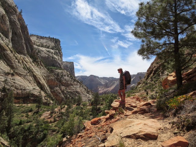
This was completely different to the deep canyon with red, gold and orange slick rock slabs on an undulating plateau and quite stunning in its own way. After skirting some mesas, we turned north to climb up a steep sided tree filled slot to a col. The views around here reminded us of Tuolumne Meadows in California and it had a great mountainous feel. Dropping down north through the slot like valley we passed by a couple of other parties of hikers before hitting the Zion National Park road.
It was 11.30 am now and we had been hiking for 5 hours and the heat had crept up into the 30’s C so we had a stop in the shade in view of Checkerboard Mesa – a wonderfully creased slabby mini-mountain
We headed on on good trail but the heat makes for hard going. Reaching Stave Spring we find that it is all but dry with just an intermittent drip every few seconds. We had only 5 miles to hike though and soon drop into the scenic steep walled valleys that Zion is famous for. A 2,500 foot descent and we make it to our trail end and the road.
Sadly the horrid heat somewhat detracted from the splendor of Zion valley and we headed out by bus quickly to escape the furnace! We vowed to return some day to give the park the attention it deserves.
Despite the heat of our last couple of weeks in the Grand Canyon and Zion, what a fantastic hike we have had on our own version of the Hayduke. The mix of beautiful red rock canyons, riparian green waterways, dry desert plateau and high forests has won us over. The variety and challenge of the terrain from scrambling through canyons and their sidewalls, wading rivers, hacking our way through scrub and enjoying some relaxing contrast of trails and jeep tracks was brilliant. Rather than being tired of this part of the world we are desperate to return!
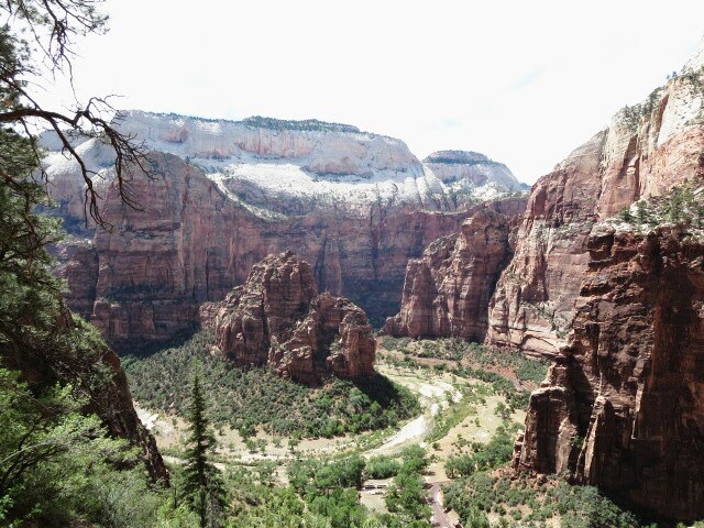
Slick rock hiking as we headed into Zion National Park
Checkerboard Mesa, Zion National Park
Zion
Looking down to the finish of the Hayduke Trail in Zion National Park
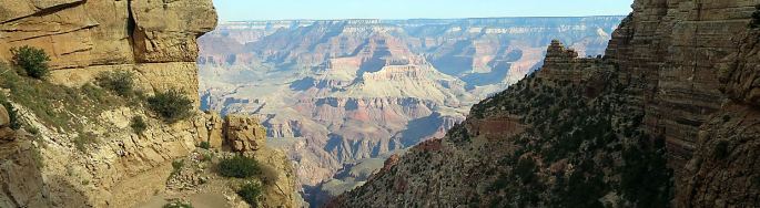
26th May Grand Canyon South Rim
We met up with Li Brannfors and friends Jen and Jasper who kindly let us stay with them in their South Rim national park lodgings. Today was a lovely relaxing day, catching up with things on the internet, eating lots and generally chilling out.
We reserved a campsite at Cottonwood Campground for our intended crossing of the Grand Canyon tomorrow to the North Rim. Well, it was almost booked out, but we got a place in the overflow mule area!
27th May Grand Canyon South Rim to Cottonwood Creek 18 miles
Alarm at 4.30 am Utah time (3.30 Arizona time!). Thanks to Li for a great stay!
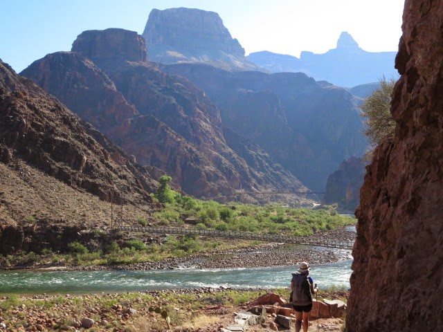
Off hiking around 4.20 in the dark to reach the rim of the canyon again to start descending the Bright Angel trail into the canyon. We dropped height easily on a zigzagging path in a valley, soon heading into the shade of beautiful green cottonwoods and flowing water at Indian Creek campground.
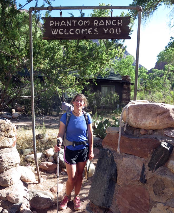
Following good trail down easily into the inner gorge of the canyon led us into different rock types of schists and granites to the Colorado river itself. We were able to cross the river on a suspension bridge here and hiked a short distance to Phantom Ranch (this is a park lodge and campsite set in a deep side canyon near the bottom of the Grand). We made it by 8.20 am after a 10 mile easy, scenic and enjoyable descent. Both glad to have started so early though as it was already roasting (maybe 30 C) at Phantom Ranch even this early.
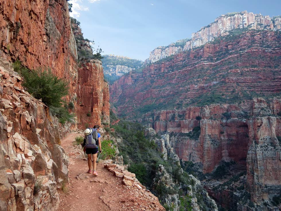
Picking up water, we had a look at the canteen and 1920’s style chalet buildings which all look pretty nice. But we headed on and now had the uphill part of the day ahead of us climbing towards the North Rim of the canyon on the popular North Kiabab trail. The hiking was on good trails, firstly following a stream flowing through a deep canyon made of ruptured schists and pegmatites- this rock scenery was very much like that in Scotland and was familiar to us!
The heat really cranked up though after about 1 and half hours hiking when the valley opened out and we had less shelter from the sizzling sun. A stop in the shade by the river revived us after we soaked our T-shirts in the river and wore them wet to cool us a little. It worked!
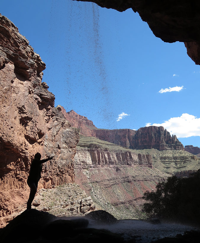
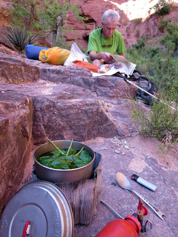
It was a relief to stop at a waterfall – ‘Ribbon Falls’ at 11 am for another cool down. We hid there from the sun for almost 6 hours under a deep mossy overhang with stalagtites; reading, dozing and chilling out under the waterfall. Some wild mint made for delicious tea and we had some frogs for company – perfect! Our thermometer recorded 36 C in the shade.
Eventually in the evening we hiked onwards, climbing up to Cottonwood campground which remained uncomfortably hot into the late evening.
The bridge over the Colorado River
28th May Grand Canyon Cottonwood Creek to North Rim 8 miles
It was uncomfortably hot overnight and at 3.30 am it was still 24 C and we decided to get up and hike on. Leaving at 4.20 am in the dark felt good and the trail was clear with head torches- climbing upwards towards the rim at 9,000 feet where we hoped it would be cooler!
Above Roaring Springs the light crept in and the scenery was beautiful with red rock walls and a ‘Dolomitic’ style trail traversing cliff edges. We made it to the top at the North Rim after about 3 hours and it was refreshingly chilly – it felt good to wear a fleece again. Also there was Ponderosa, White fir, Douglas fir and Aspen trees around, a great contrast to the dry inner Grand Canyon.
North Rim has a national park visitor centre, lodge, campsite and lots of tourists but is quiet compared with South Rim and we liked it. We find the laid back campers store and have a relaxed coffee and cake on the veranda- excellent!
Our dinner was a luxury mix of Idaho mash potato, black beans and salad, washed down with a bottle of Chardonnay- way hey! A campsite talk by park rangers on bats ends a wonderful relaxing day after the early start.
29th May North Rim rest day 4 miles
We were both happy to chill out today and take a stroll around the North Rim of the Grand Canyon for the views.
The evening park ranger talk is ‘Ravens’ – a specialty and love of Martina’s!
The heat of the inner Grand Canyon had been getting to us and we agree not to do the next section of the Hayduke which descends back into the canyon for a particularly tough hike where we felt that the heat would prevent us enjoying the marvelous scenery. We will need to come back earlier in spring or in autumn some day to do that!!!
Instead we decide to hike out north on the Arizona Trail tomorrow to the National Park entrance to complete a loop hike in the Grand Canyon National Park. Then to hitch back to near Zion National Park to do the final two days of the Hayduke Trail. It’s disappointing not to continue on the Hayduke but we would have been miserable hiking in these hot temperatures.
On the North Rim of Grand Canyon
30th May North Rim visitor centre to North park entrance on AZT 14 miles
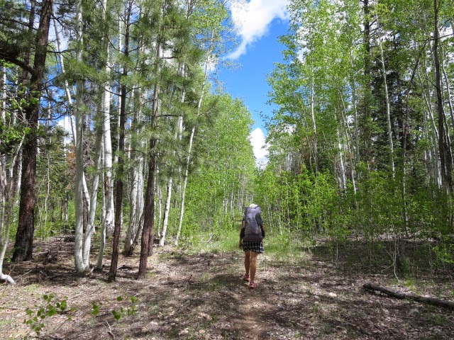
After posting our ‘float box’ of spare supplies at the PO to Zion National Park, we hike north at around 9.40 am on the Arizona Trail. It was easy going through green forest of aspen and ponderosa in cool conditions at 9,000 feet – hoorah!
We caught up with another hiker- Shawney(?)- running the AZT, covering 30-45 miles per day. We caught him at our walking pace because he had run up from the bottom of the Grand Canyon in the morning and had now slowed down after that huge climb. After a fun chat we leave him and hike on and reach the north entrance of the park where we quickly hitched a lift north to Jacob Lake resort.
Hiking on the Arizona Trail through aspen
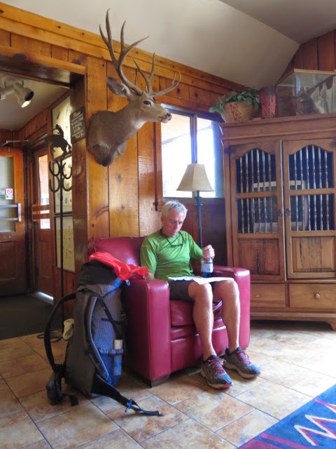
Brian at Jacobs Lake
31st May Jacob Lake to Kanab 0 miles
We took a day off today as Martina was feeling ill and we lucked out with a direct hitch to Kanab health centre (thanks!) and got taken straight away, diagnosed and antibiotics administered- our travel insurance was worth the money!
Across Utah!Jamal David Green’s excellent and extensive website describing his crossings of Utah with lots of Hayduke overlap. Also includes a superb Hayduke section. A treasure trove of information- nice videos too!
Grand Enchantment Trail Brett Tucker has created many other backpacking adventures in the south west including the G.E.T, the Northern New Mexico Loop and the Sky Islands Traverse. Each has a mapset and planning pack-superb!
Andrew Skurka Hayduke map bundle and resources pack.
Nicolas C Barth Sublime Hayduke photos and well described alternates with maps.
Michael Kelsey’s guidebooks These are wonderful guidebooks covering a lifetime of adventure on the Colorado plateau. ‘Canyon Hiking Guide to the Colorado Plateau’ is a must for inspiration and researching alternates but the others are great too!
Edward Abbey Writer, environmental campaigner and inspiration behind the Hayduke Trail.
Grand Canyon permits You will need a permit for your Hayduke hike through Grand Canyon National Park…..
Arizona TrailThe Hayduke makes use of this trail for around 60 miles in Northern Arizona. The AZT continues all the way south through the state of Arizona for 800 miles.
Arlette LaanSpring 2017 Westbound Lovely photos and descriptions. Hiking with Prana and Haiku. Makes you want to get out there and hike!
Treehugger and BlisterfreeSpring 2016 Westbound Two experienced desert hikers set out westbound March 31st from Arches NP and another excellent journal. Interesting comparison of Grand Enchantment Trail with Hayduke from the GET’s creator.
Carrot QuinnSpring 2016 Westbound From the author of ‘Thru Hiking will break your heart’ – Carrot and Dan’s 2016 hike.
Drop-n-rollSpring 2016 Westbound The two Kate’s hike in 2016 – including packrafts and a return to Moab by bike!
Katherine CookSpring 2015 Westbound Superb account of a daring hike taking in many variations into wild terrain.
Erin Saver ‘Wired’ Spring 2015 Westbound Wired’s blog partly with Katherine and partly with Gavin. Another great trip account. Wired’s web site has lots of hiker info plus a link to a Hayduke introductory article written for Trail Magazine.
Niki and TennyAutumn 2014 Westbound Nice blog and photos.
Lisa Curry and ‘KCop’ Autumn 2014Westbound An enjoyable read of a recent hike on the trail in autumn 2014 with dog Shilo!
Spiderwoman and The BrawnAutumn 2014 Westbound Lots of detailed Hayduke tips in word document format.
Brian and MartinaSpring 2014 Westbound This site! Our blog, photos and hiker tips including alternatives such as yellow rock and kayaking the Colorado from Moab to the Green River confluence.
Brian Tanzman ‘Buck30’Spring 2013 Westbound Excellent account of his successful Hayduke hike with Skittles including detailed hiker advice.
Rich Larson ‘Skittles’Spring 2013 Westbound Another excellent trail journal with Brian Tanzman.
DirtmongerSpring 2013Eastbound Part of a massive ‘Vagabond Trail’ hike including the Arizona, Hayduke and Grand Enchantment Trails.
Nicolas C BarthAutumn 2013 Westbound Sublime photos and alternates. Unlucky to be halted by a Grand Canyon park closure.
Pace and WhitefishSpring 2012 Westbound Nice trail journal from experienced hikers.
Cam HonanSpring 2012 Westbound Cam hiked westward on the Hayduke to the Grand Canyon south rim before continuing on the Arizona Trail and then the Grand Enchantment Trail to complete a ‘Southwestern Horseshoe’ route- sounds fun!
Ben MayberrySpring 2011Eastbound Part of a mega hike on the Arizona Trail, Hayduke, connection to the Continental Divide up to Canada to finish on the Great Divide Trail.
Sandra and Larry Taylor Spring 2011Eastbound Great blog of a Arizona and Hayduke Trail journey plus more!
Pony ExpressAutumn 2009Eastbound Enjoyable trail journal of Pony Express, Lindy and Sharon’s charity eastbound hike.
Andrew SkurkaSpring 2009 Westbound Early February start. Andrew created a Hayduke map bundle and resource as a result.
Whiptail and CaronSpring 2009 Westbound Nice blog and paddled the Colorado for a few days from Moab.
Dave and MichelleSpring 2009 Westbound Their first long backpack and another great journal.
Ryan Choi Spring 2008 Westbound A classic! Ryan’s descriptive account with Ben Deumling and heap’s of detours.
Justin LichterSpring 2008 Westbound ‘Trauma’ completed the first ever Pacific Crest Trail hike in winter 2014-15 with ‘Pepper’.
Mike CoronellaSpring 2005 Westbound Co-originator of the trail and co-author of the guidebook with fantastic exploration. Lots of trail updates on the website.
Brian Frankle Autumn 2005Eastbound The first continuous Hayduke hike- and a great account too!
We started by crossing of the Grand Canyon from the South Rim to the North Rim via the Bright Angel and North Kaibab trails. Then we succumbed to the heat of the canyon bottom at the end of May and missed out the western part of the Hayduke’s Grand Canyon traverse and instead skipped forward to finish with a sweltering hot hike through Zion National Park.
Section 12|Bright Angel Trail We enjoyed the mix of hiking up to South Rim on the South Kaibab Trail and then descending back to the Colorado River via the Bright Angel Trail. We dropped from the rim at about 4.45am to get some early hiking in before the heat of the day hit us and that worked out well. I think we made it to Phantom Ranch in the canyon bottom by 8am or so. It was already blisteringly hot in the sun by then though (26th May).
Section 12|28.1 Ribbon Falls are an oasis in the heat of the North Kaibab Trail. Our afternoon was spent in the shade and dipping in the falls before we felt it was safe to head on to Cottonwood Campground.
Zion
Below the East Fork drop off (chimney on the right of the picture)
Section 14|54.2 East Fork Virgin River. There is a drop off here and we followed the climb up a gulley on the left bank about 50 feet before the drop off. Then turn right (downstream) before dropping down a chimney between huge boulders back down to river level. We had to hand packs down this stretch to get through but it was ok (see pic on right). More details from’Across Utah’ website
Section 14|54.9 Once you negotiate the drop off, you have about 0.7 miles to go before the exit out of the East Fork. There is a canyon coming in from the right as a marker at this point and the exit route is straight ahead- a vegetated steep corner. It is a bit of a scrabble up the corner with the easier line heading out right away from the corner- but if you have got this far it will be fine! There are some rock slabs at the top of the vegetation and then the odd cairn and trail heading north. ‘Across Utah’ website describes a better sounding alternate
Section 14|57.4 There was a good trail heading up the draw to the narrow saddle. This has now more use than described in the Hayduke guidebook from hikers returning back north to the road from canyon trips.
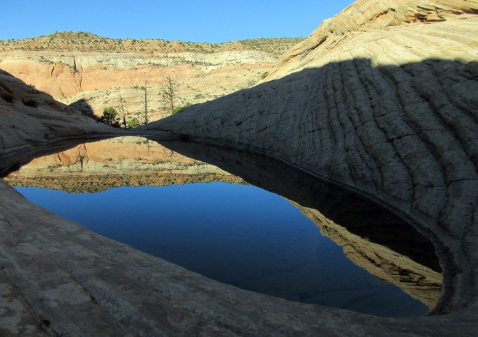
Section 14|58.7 Confirming Li’s map statement that there are many deep stagnant pools in the slickrock as you approach the road.
Section 14|65.6 Stave Spring. This was as good as dry when we passed by (2nd June) and it looked like it dries up in the heat of summer – but you only have another 4 miles to Weeping Wall and Zion Canyon!