Here are some of my notes on the Arizona Trail for other hikers…
Hiker references Being quite a popular walk, there is a lot of planning information already out there….
Arizona Trail Association A great first stop and worthwhile joining the Association to support the trail.
Average Hiker, Ellie Thomas has a good website setting out the logistics.
The Trek has a guide to trail towns for resupply and resting. A web search will find many more…
Facebook There is lots of info and a place for hikers each year to ask questions on Facebook- really helpful- just search with this text for your planned year ie Arizona Trail Class of 2023
Maps and guides I love maps, I love imagining what it represents on the ground and then actually travelling through the territory displayed. For hiking, call me ‘old skool’, but paper topographic maps are my first choice. Easy to use, great for navigation, but also showing the surrounding countryside and a reasonably large area of land to provide context on distant features. I fold the current pages in the pocket of my shorts so I can easily refer to them whilst walking.
I do also download maps to my phone as a backup and to utilise the GPS.
It adds a lot to my enjoyment to have something on say the local geology, flora, fauna and history. I often take extracts from paper books or electronic documents on my phone for this- really nice to read overnight in the tent.
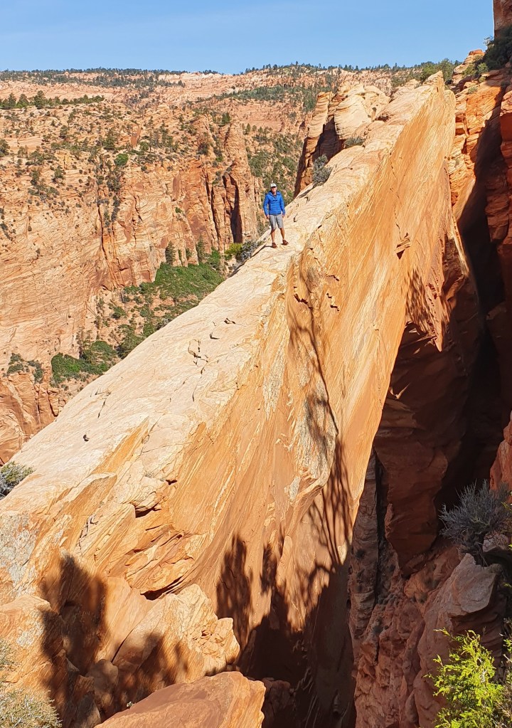
On this trail I cut out map pages from the Arizona Trail guidebook, which to be honest in this case didn’t offer much useful information except a rough overview and were limited value for either navigation or wider context.
In addition I had the FarOut app on my phone which has the trail marked against a low definition background map. The best use for me though was the ability to view comments from others against features (and add my own). This was superb for getting up to date info on water sources in particular and was worth paying for the app just for that alone. On the downside, I found FarOut rather reduced the trail to a line ahead with a series of waypoints of gates, fences and water tanks! Its a pity it doesn’t offer any other interesting information such as on the flora/fauna.
If hiking the trail again I would prepare my own topo maps using online mapping software such as Caltopo, add a GPS track and my comments, then print out colour map sheets in advance. I would also still take FarOut app on my phone, mostly for water and trail updates and find some more flora/fauna background reading for along the way.
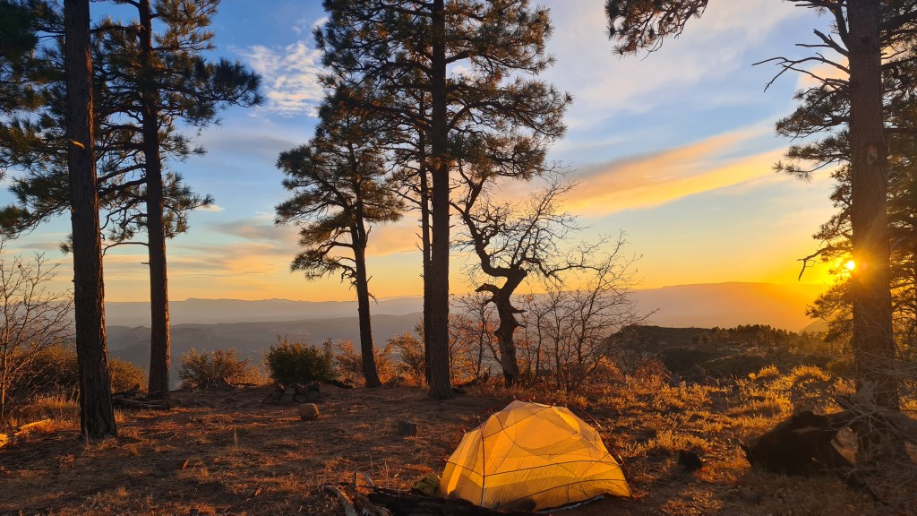
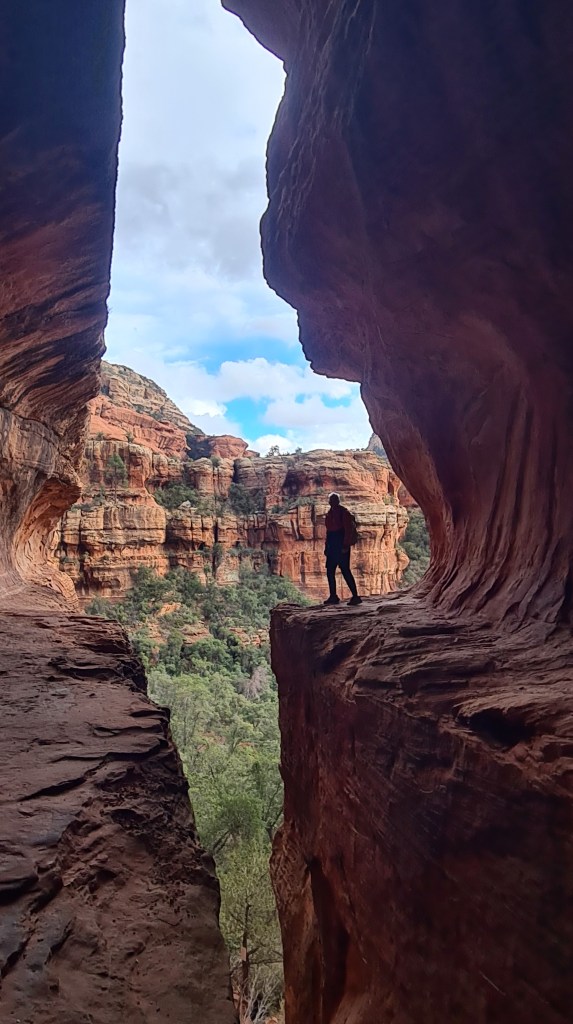
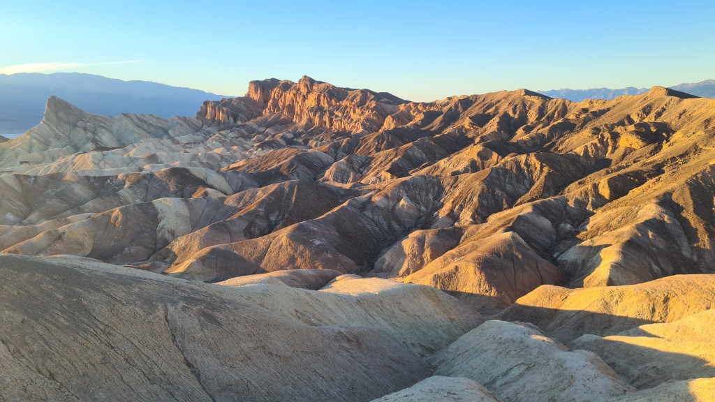
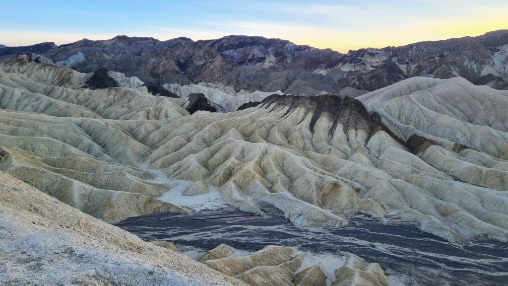
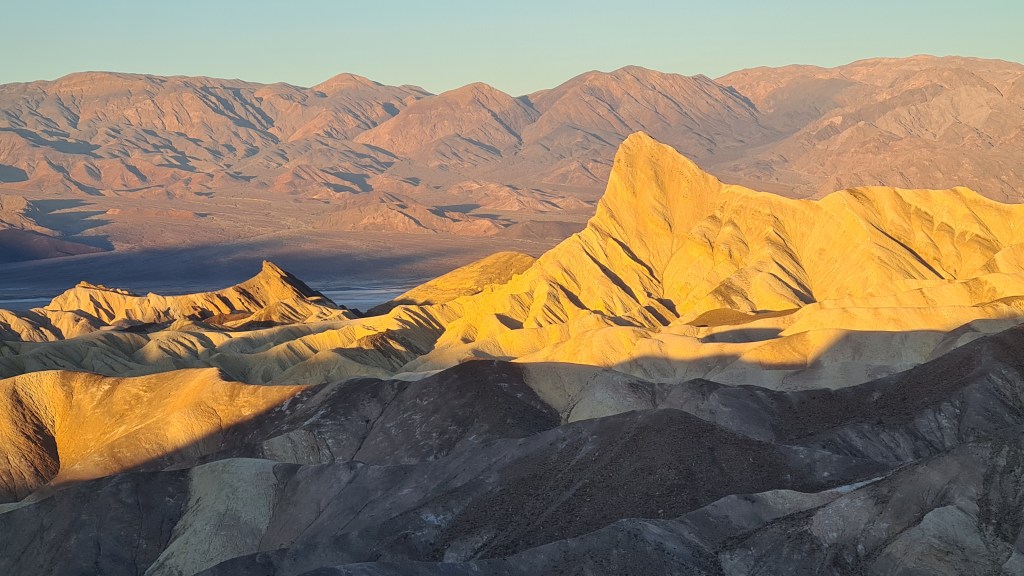
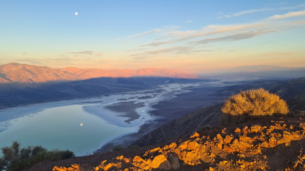
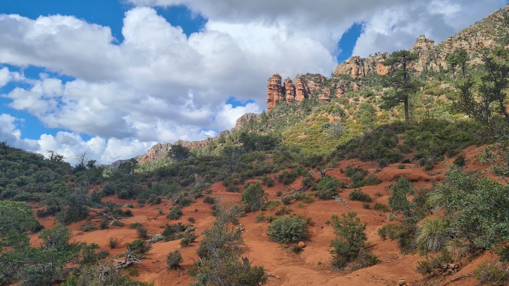
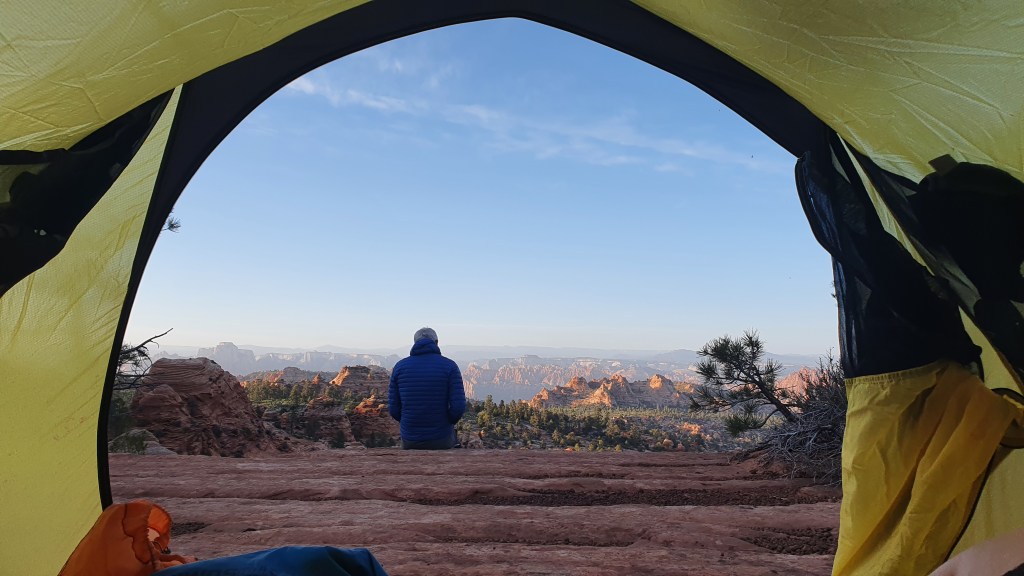
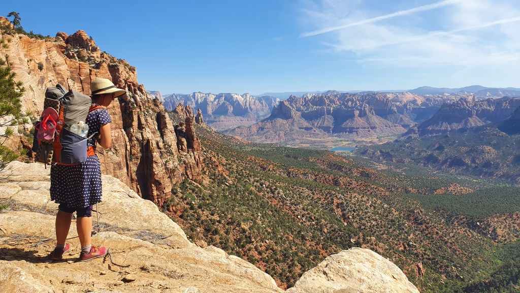
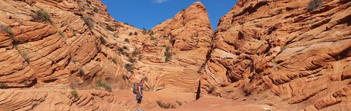
After the Arizona Trail… I had a few days spare before flying out of Las Vegas back to Scotland and made good use of these for some shorter hikes near Sedona then Red Rocks Canyon, Nevada and Death Valley National Park, California.
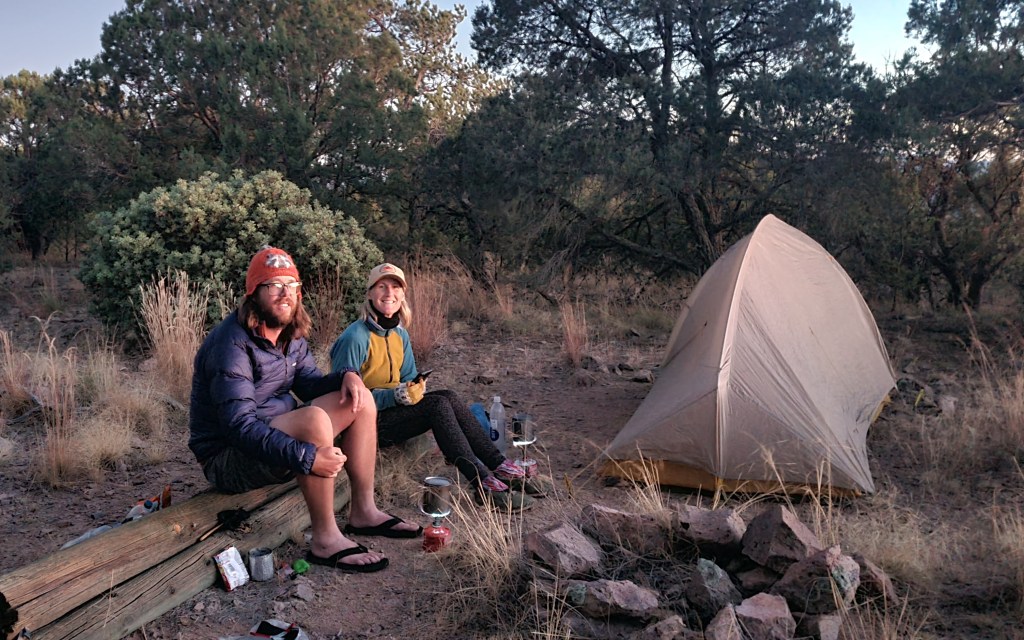
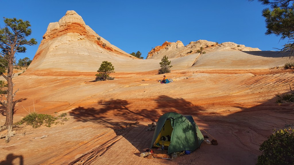
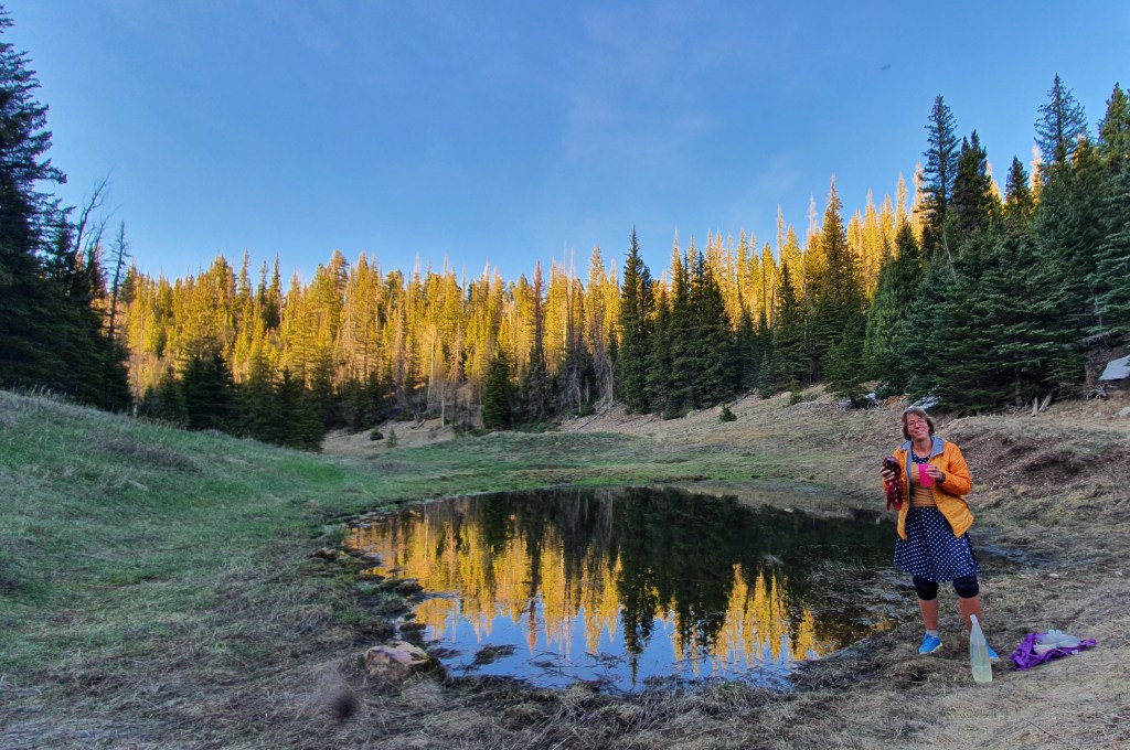
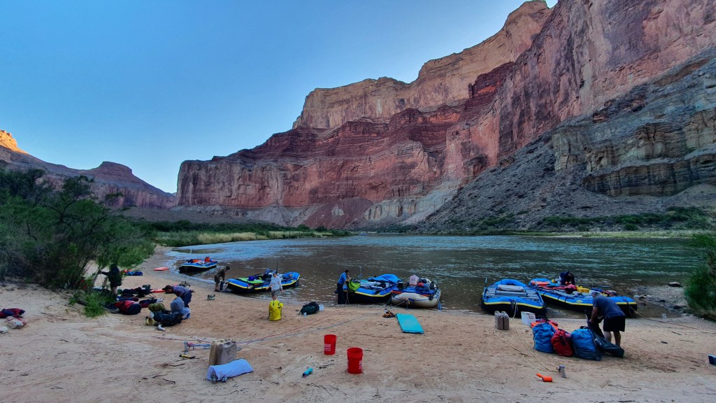
Section 7 Molino Basin Trailhead to Gabe Zimmerman Trailhead 12th November 48 miles Oh that was a great stop in Tucson, and feeling refreshed I got an Uber back out to Molino Basin via Safeway for a food restock, bagels and coffee. I sat outside the supermarket at the trolley bay charging my phone at a mains socket, sifting food and munching bagels. It was wonderful and I had 3 people come up to me and chat asking about the Arizona Trail, maybe they felt sorry for me looking a bit trashy!
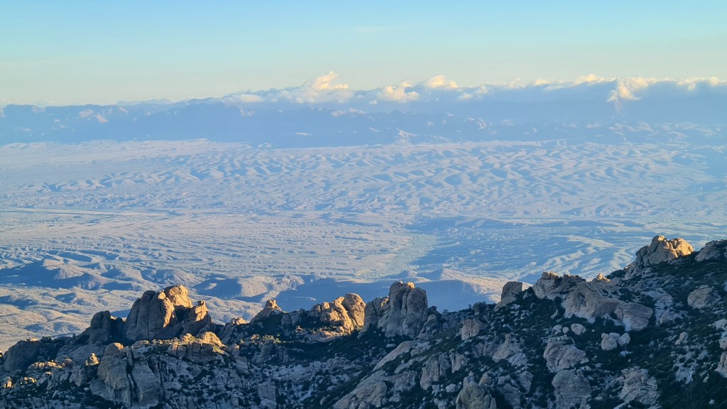
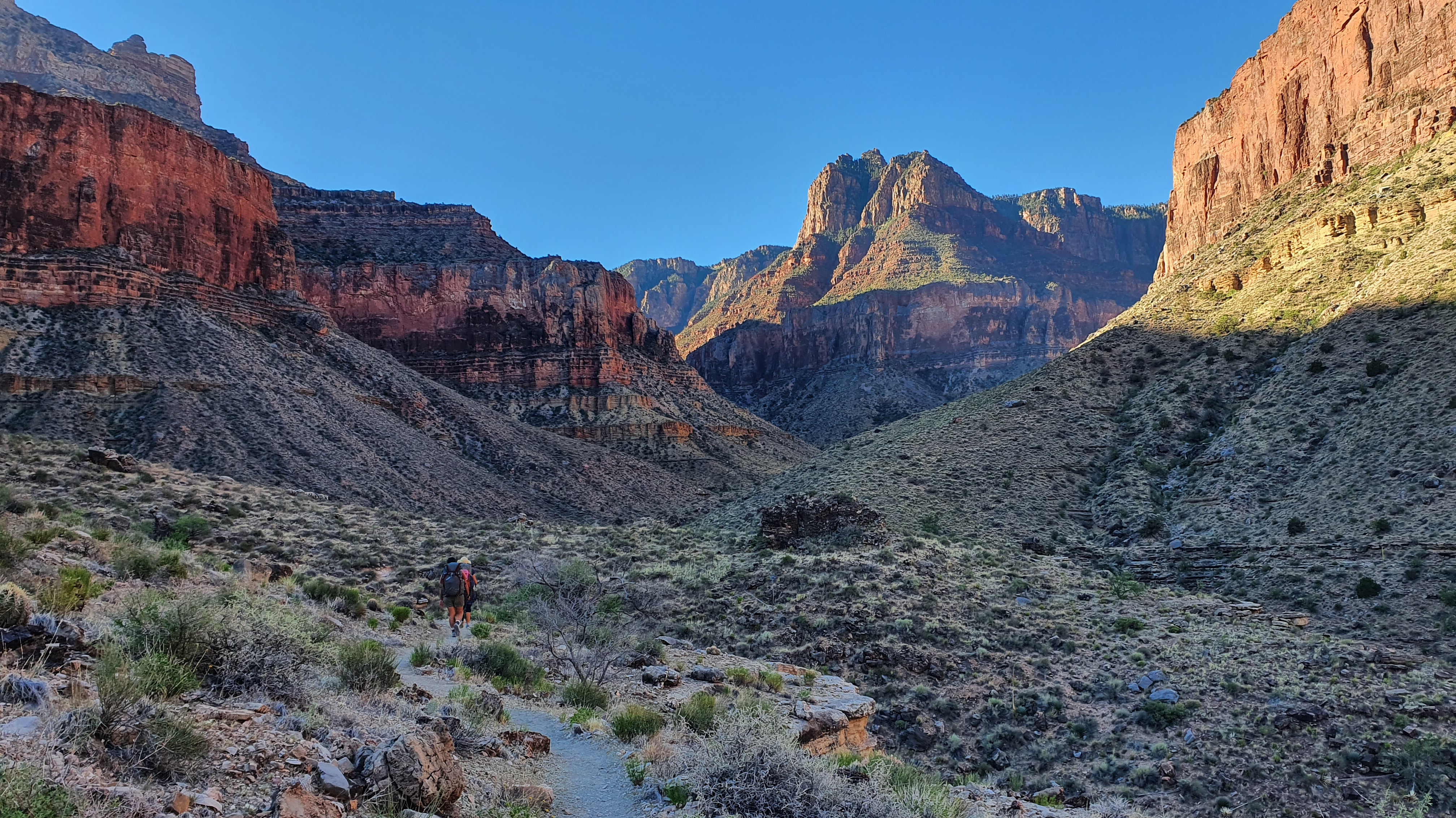
At the trailhead I was restarting where I left off following a well made undulating path southward with ever closer views of the next ‘sky island’, Mica Mountain. It was pleasant coolish hiking at between 18-22C and I made quick time to camp in the dark at the edge of Rincon Wilderness Boundary a little of the way up the climb. Away by 6am next morning in the dark I enjoyed the steady climb into Saguaro National Park and up to the top at about 8,600 feet. I had seen a torch light a few miles below me to the north and it was nice to know another hiker was out there too.
Boy but it was cold up there, it felt well below freezing and I happily headed downhill through the trees and out below into open saguaro cactus country.
Section 8 Gabe Zimmerman Trailhead to Patagonia 15th November 67 miles After a stopover with Josh and Suzanne, two kind people who let me stay with them near Colossal Cave, I kept going across I10, the last of the east-west highways, and onto lower flatter terrain again. I made good miles from here to Patagonia, assisted by some weather including clouds overhead and even the odd thunderstorm to cool things down.
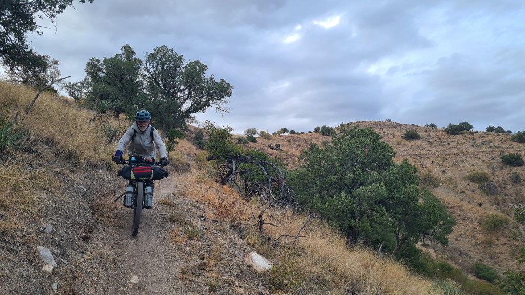
Highlights included spotting a bobcat, 2 bikepackers and some pretty good water sources along the way. Hitching into Patagonia turned out to be easy and rather inevitably I headed straight to a diner for an extended brunch!
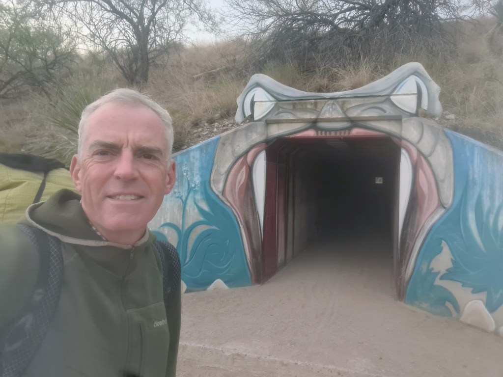
PatagoniaHiking pre-dawnI10 tunnel
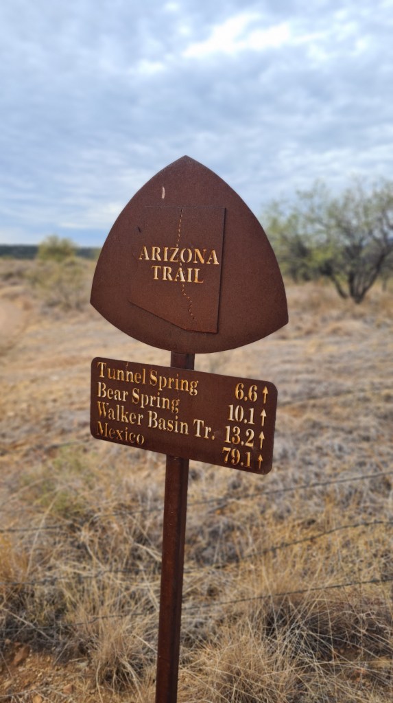
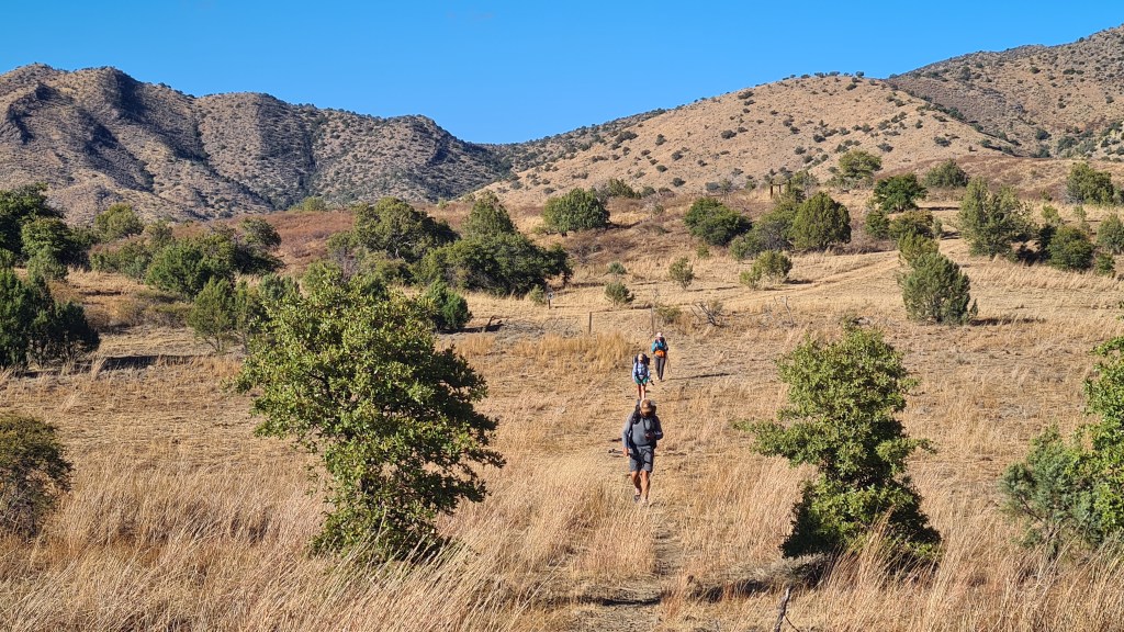
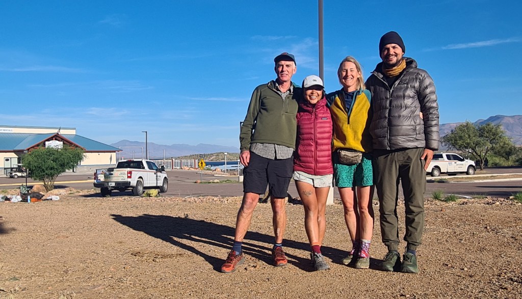
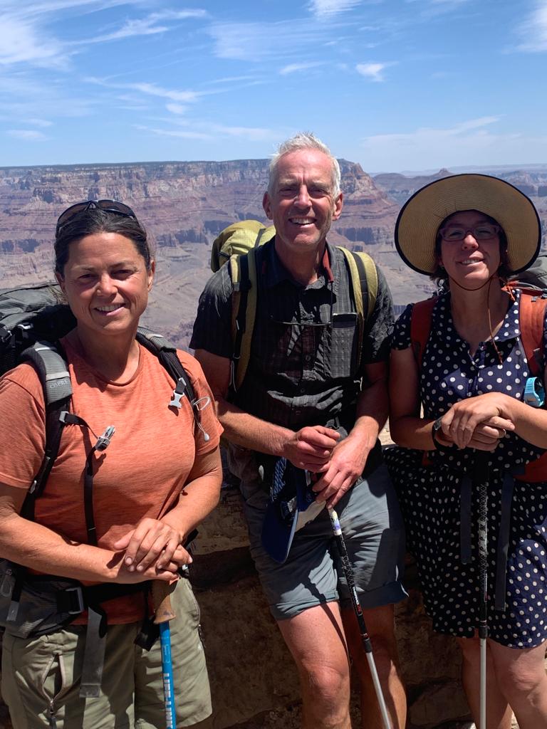
Section 9 Patagonia to Mexican Border 19th November 53 miles Well refreshed again after another welcoming town of Patagonia, I left for the final push to Mexico with Swig and Firecracker, hitching a lift back to the road crossing.
Swig, Brian, Firecracker
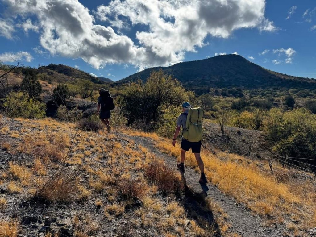
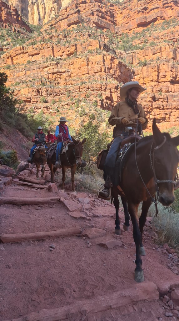
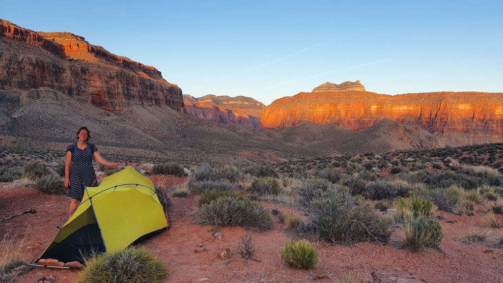
Conditions got cold and windy once we climbed up to about 8,000 feet on the flanks of Miller Peak for one bitterly cold last camp. On the last day 20th November, I nipped up to the top of Miller Peak which was covered in frost before the steady descent to the border. Finishing there with other hikers Swig, Firecracker and Cheese Curd was fun, but it felt a little anti climatic with the weird section of high metal fencing and the super high winds…… But 800 miles of Arizona was a really great experience overall and it was superb to share it off and on with so many cool people!
Survivorman’s last night cowboy camping to the endSwig and Firecracker at camp
Section 3 Flagstaff to Pine 20th October Another long fairly flat walk of 115 miles on the next stretch to the tiny town of Pine was again going to be tough on my feet!
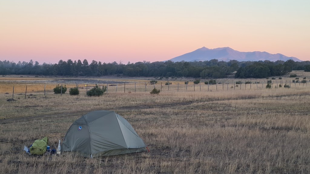
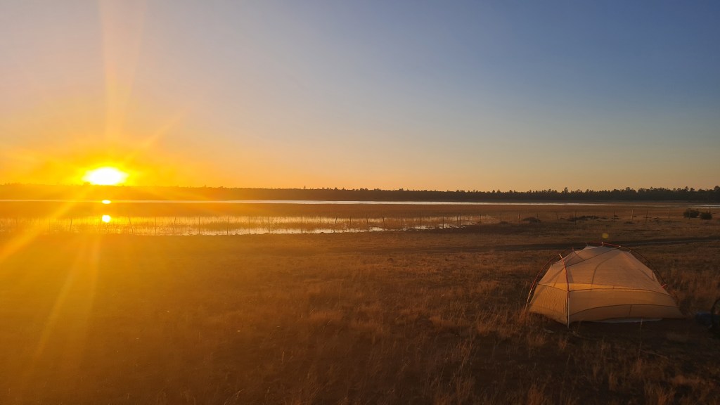
Leaving Flagstaff after crossing Route 66 on the ‘Urban Route’ variation of the AZT, I was back into the countryside surprisingly quickly. Ponderosa pines again dominated but then gave way to more sparse pinyon juniper. I chatted with ‘Fliss(?)’, ‘Mo’ and ‘Firecracker’ heading out of town but ended up camping solo at Horse Lake that night. Sunset here was stunning across the flat grasslands and lake, with noisy geese, elk and coyote adding to the ambience.
Arriving at Mormon Lake!Golden cottonwoodSmoldering firesSmoke hazeBack north to Humphreys PeakHorse Lake sunset
On the 2nd day out from Flagstaff I hiked round a prescribed fire set off by the Forestry Service which filled the air with thick smoke for an hour or two, before cutting off trail to the small settlement of Mormon Lake for lunch at the bar and a food top up. I came across a few of these 8 legged wonders along the way….
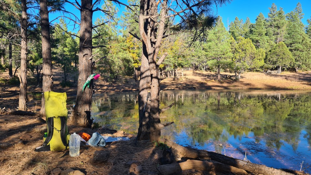
After another 3 days I eventually hit the pleasant Highline Trail and dropped off the ‘Mogollon Rim’, an escarpment descending from the Colorado Plateau with some welcome streams, red rock and (a rarity so far) clouds! The trail took me into the tiny town of Pine- arriving at 8.30am and diving into the Early Bird Cafe to meet a few other hikers for second breakfast. 330 miles or so hiked- hoorah
Camp above PineWater filtering break at ‘Foot in Tree’ TankBelow the Mogollon Rim
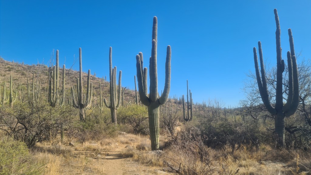
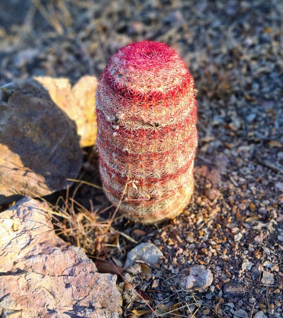
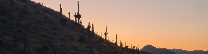
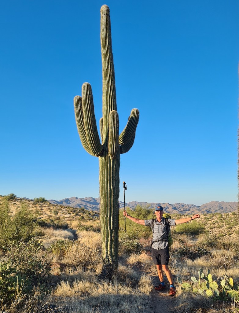
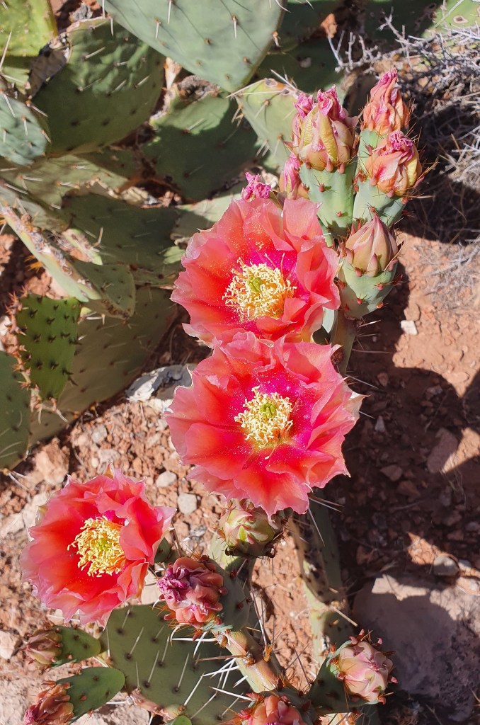
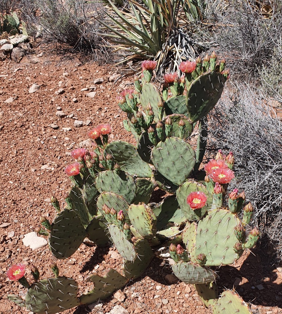
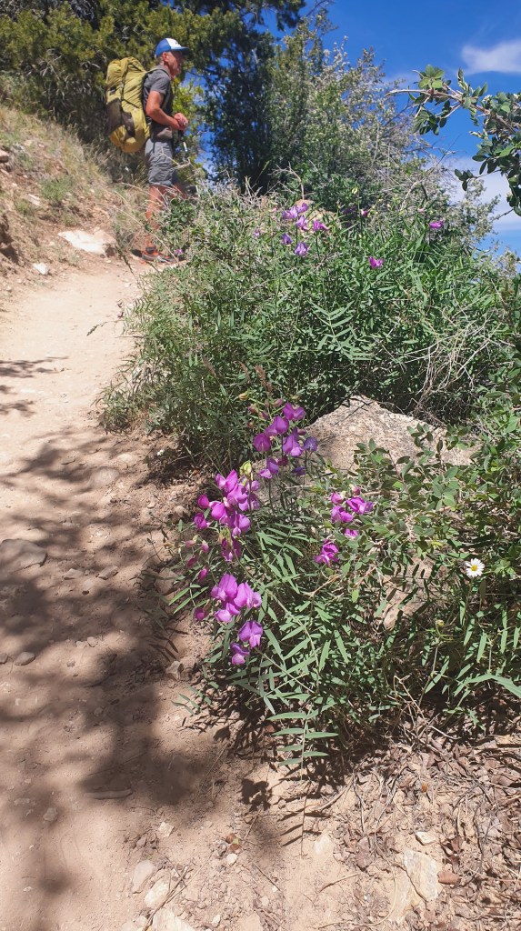
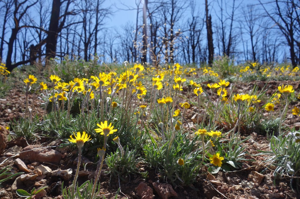
Section 4 Pine to Roosevelt Lake Marina 26th October 115 miles again to my next food resupply at Roosevelt Lake Marina. This one involved some more rugged up and down over the Mazatzal and Four Peaks Wilderness’s. A bit of rocky trail and scratchy shuffling through spikey bushes kept me on my toes. I think this was my favourite stage so far however as the variety was interesting and I saw my first javelinas (small boar that live in groups called squadrons!) ……and stunning saguaro cactus…yipee.
Saguaro cactus at dawn
Section 5 Roosevelt Lake Marina to Kearny 1st November80 miles Hikers seemed to coalesce at the lake marina with about 10 of us at one point- resting weary legs, eating, sifting gear and sharing tales from the trail.
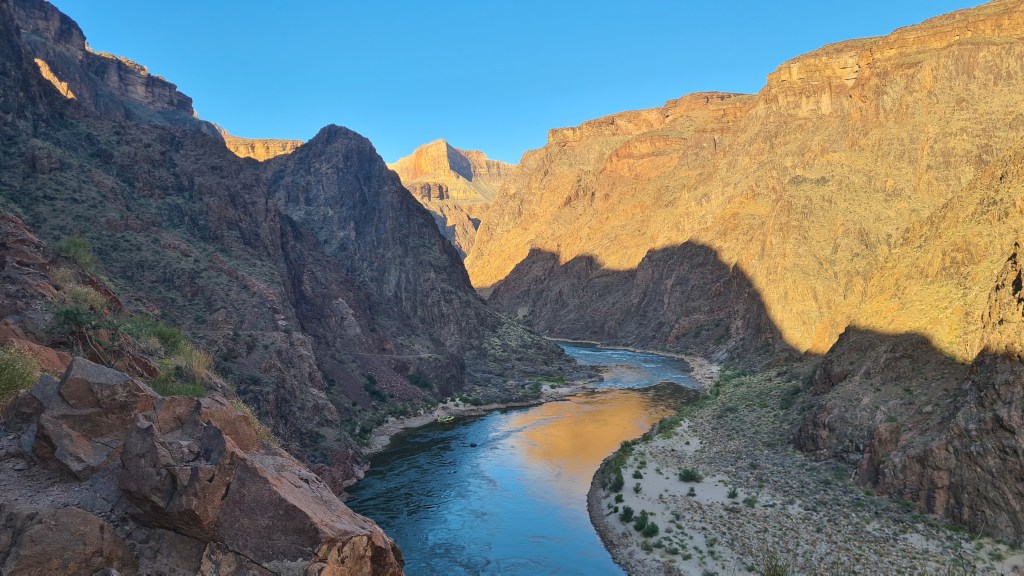
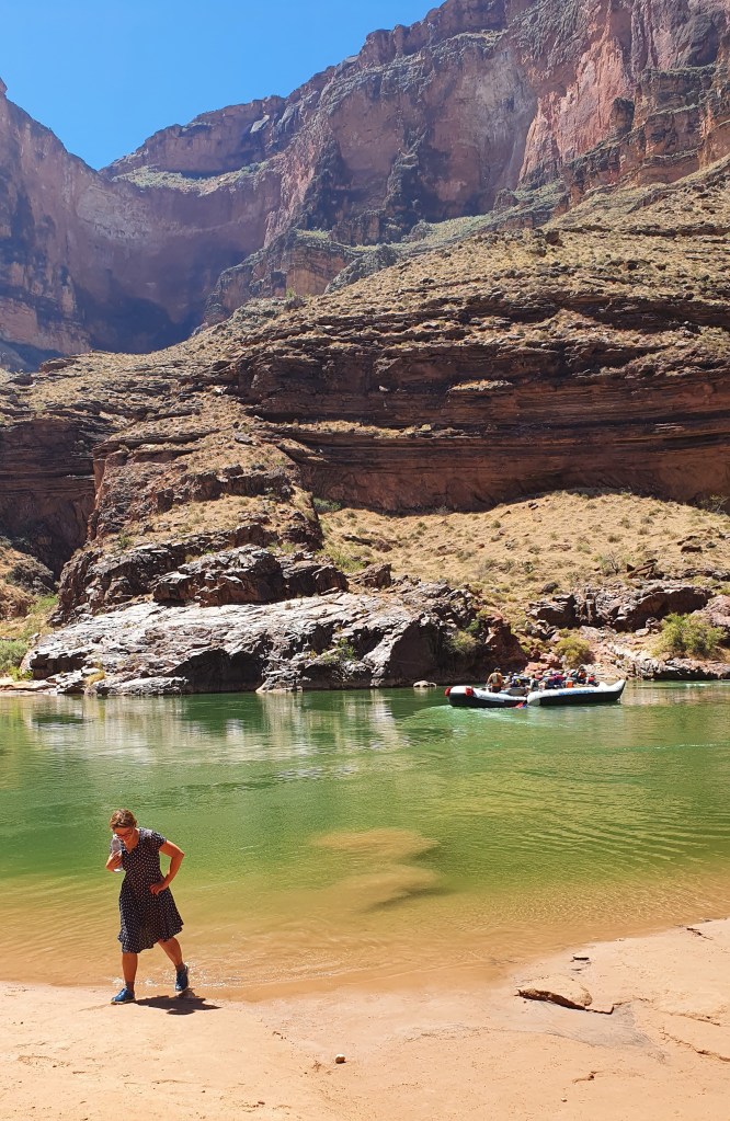
South from the marina I entered the Superstitions Wilderness, crisscrossing and chatting with fellow hikers Grandpa, Firecracker and Survivorman. It was another fine rocky area but one that dropped in elevation meaning that, despite now in November, the temperature really ramped up in the middle of the day. I took the opportunity for a cooling dip as we traversed alongside the Gila River, the trail’s lowest point at about 1,600 feet, before reaching the mining town of Kearny the next day.
L-R Brian, Grandpa, Firecracker, Survivorman
Section 6 Kearny to Molino Basin Trailhead and Tucson 6th November 100 miles Kearny was a super friendly small town; from the offer of a place to stay by ‘Q’, easy hitching in and out, diner, pizza place, supermarket with free coffee for hikers, helpful post office staff etc…. it was just great.
With fellow hikers and ‘Q’, middle right, at her house in Kearny
Setting out from Kearny, the terrain continued as low desert scrub and the temperatures were hot- maybe 30C in the afternoon. I got into a pattern of waking about 5am and hiking by 6 in the dark for a bit to enjoy sunrise and the cool early temperatures. These were my favourite times of the day with hiking into dusk at about 17.30 to 18.00 being a close second. The disadvantage was that I spent most, if not all, of my camping time in the dark!
I met up with Carrie/Firecracker along the way and we hiked together after applying some plasters to patch Carrie up as a result of an argument with a barbed wire fence!
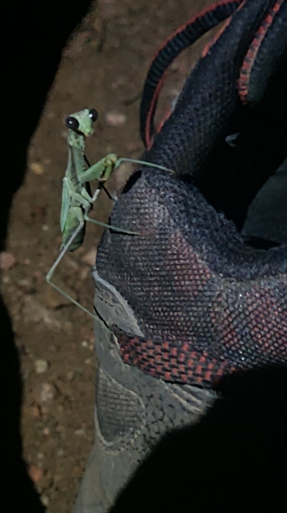
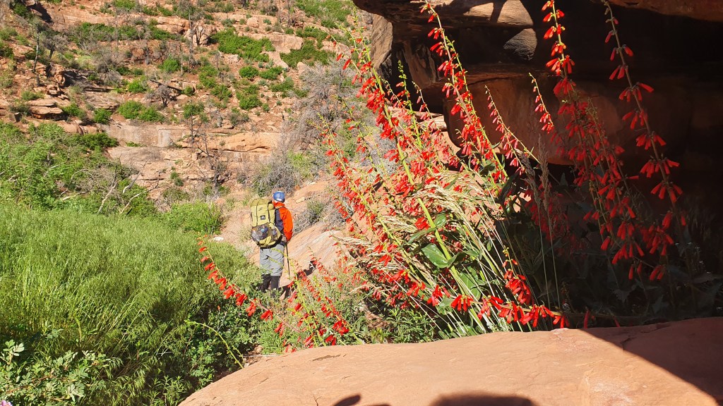
Preying mantis Rare shade at a water tankMount Lemmon, granite country
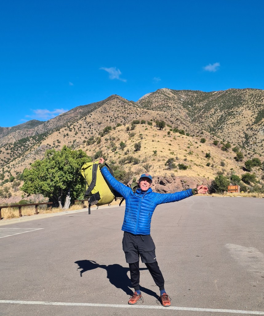
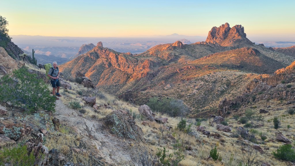
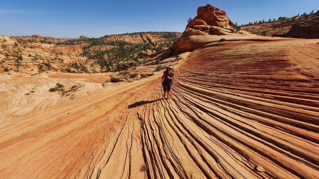
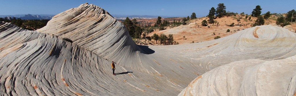
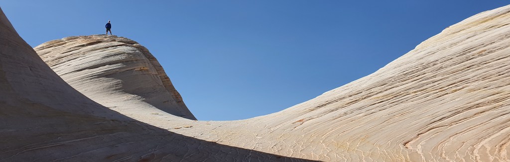
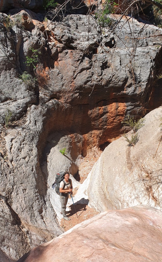
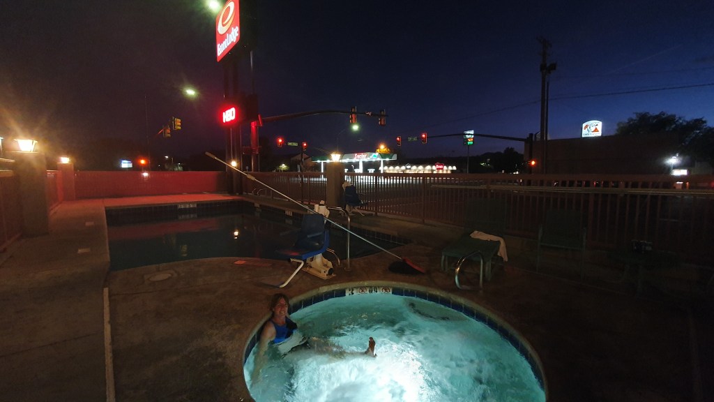
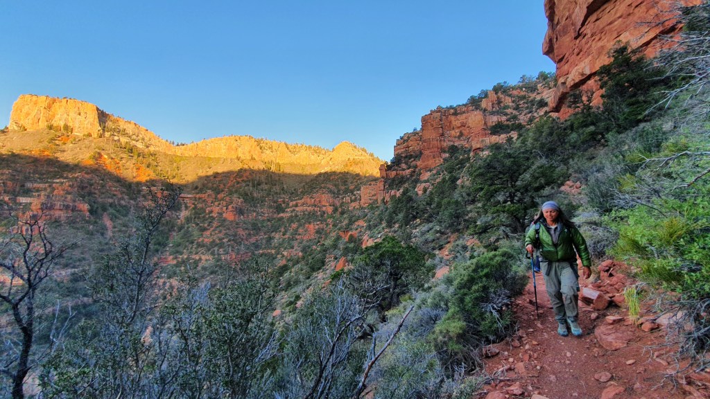
I was glad when the trail climbed up high to about 7.800 feet at Summerhaven (amazingly this far south, a winter ski resort) and Mount Lemmon. A veggie burger with Survivorman was a rare treat here and the granite hills and pine clad slopes were really nice. Leaving early morning was a bit harder with the sub-zero overnight temperatures but the trail remained interesting all the way down to Molino Basin trailhead road crossing. I decided to hitch from here into the city of Tucson for a full day off of luxury; real food, showers, a swim in the motel outside pool(!) and some gear fixing.
In October-November 2023 Brian walked the 800 mile Arizona Trail southwards from the Utah stateline down to the Mexican border. I wild camped most of the way, but also stayed at designated campsites, with ‘trail angels’ and some motels in town. Overall it was an excellent experience! Here is a short (ish) description of my hike, some pictures, my impressions and links to more info.
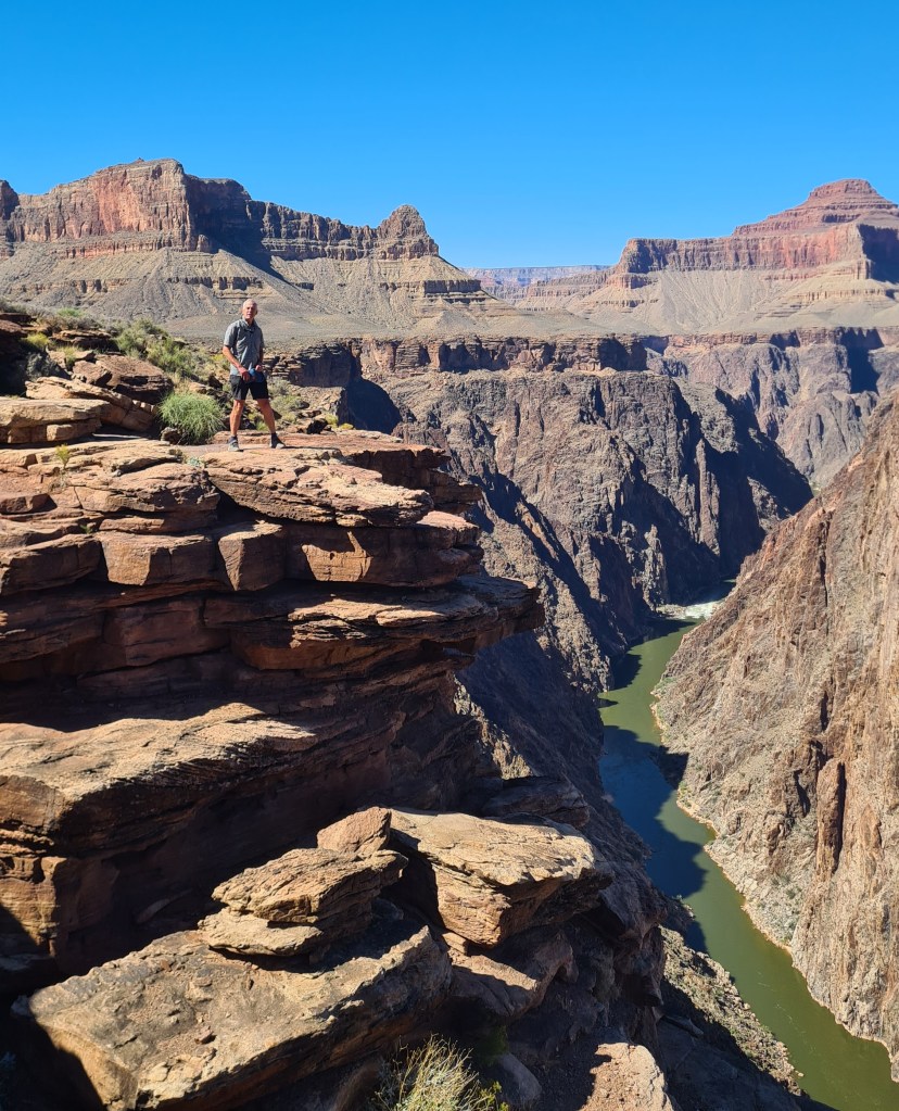
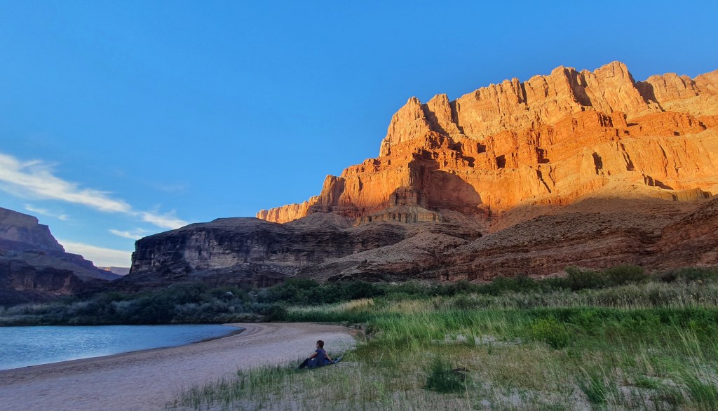
‘Lentil’ atRibbon Falls, Grand Canyon
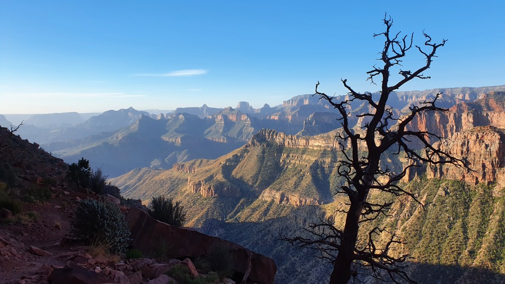
Background The Arizona Trail (AZT) is a well defined and maintained trail heading north-south across the state of Arizona. It traverses a mix of desert, high plateau and mountain ranges up to about 9,000 feet (called Sky Islands), crossing two National Parks; the iconic Grand Canyon and less well known Saguaro outside the city of Tucson.
With blazingly hot summer temperatures at low levels and deep snow in winter on the higher sections, the best seasons to walk the whole way (‘thruhike’) are spring and autumn.
Reasons for hiking Martina and I have hiked many times in southern Utah which borders onto the north of Arizona. We have also been in the Grand Canyon in northern Arizona a few times before as part of our two Hayduke Trail adventures in 2014 and 2022, and as another wonderful 2018 loop hike in Kanab Creek area. From these we were aware of the Arizona Trail and have even hiked the northern 100 miles or so as it overlaps the Hayduke.
With Martina starting a new job, Brian chose the AZT as a less risky solo adventure than the cross country, scrambling Hayduke routes whilst providing the opportunity to hike in new areas to the south of our previous travels.
Hayduke in orange and Arizona Trail in blue below…
Section by section
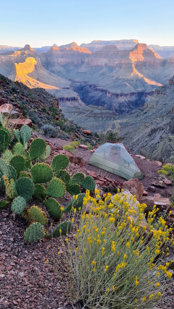
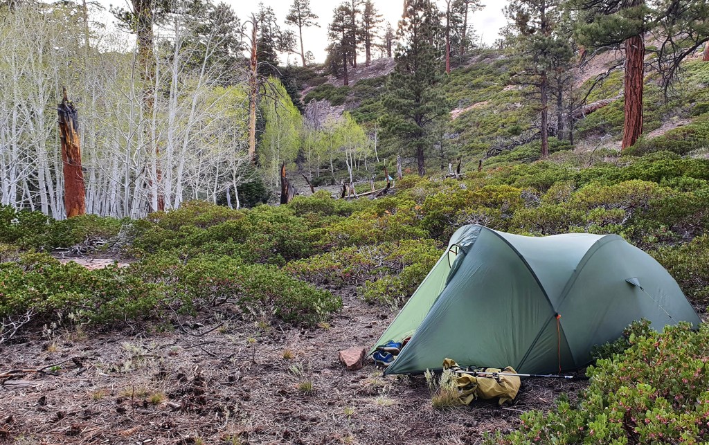
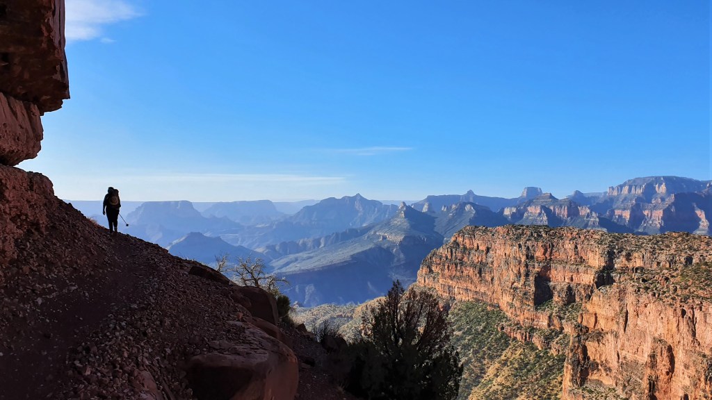
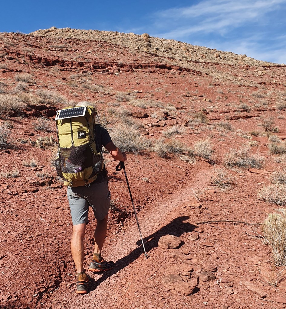
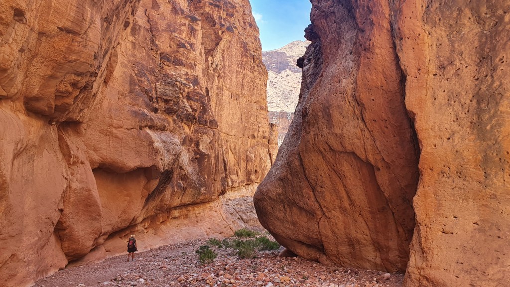
Section 1 to South Rim Grand Canyon 3rd October 2023 I set off from the Utah -Arizona stateline with a heavy feeling backpack and slight trepidation in pleasant cool sunshine and an initial stretch of about 90 miles hiking to reach the north rim of the grand canyon. The trail was well made and I soon climbed up from scrub desert through pinyon-juniper trees to the higher Kiabab plateau dotted with tall ponderosa pines. Trying to take it easy for the first few days to look after my feet and avoid injury, I kept to a moderate pace and under 20 miles per day. Camping was pretty straightforward making use of plenty of clear flat ground under the shelter of trees.
I chatted with 3 other hikers starting that same day; ‘Lentil’, ‘Good News’ and ‘Kidnapper’ – their ‘trail names’ – I decided just to be ‘Brian from Scotland’! That number of hikers was quite typical throughout the trail where I would be aware of other hikers each day, sometimes meeting them but often hiking on my own occasionally seeing signs of others such as their footprints.
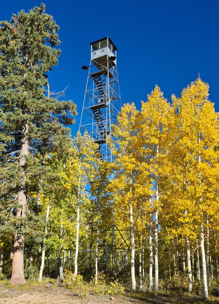
The highest plateau elevations (up to 9,000 feet) were really fun with grassy meadows and gorgeous golden aspen trees amidst fir and pines. Temperatures were cool during the day and a chilly sub-zero (Celsius) at night, coating the tent with a layer of ice in the morning. Wildlife was surprisingly good; horned toad, lynx, woodpeckers, elk, deer and the ubiquitous ravens with their croaking and gurgling vocals.
Starting offwith LentilLynx!
Reaching the north rim of the Grand Canyon felt like a minor but significant success as the first completed section of the trail and the chance to stock up on food at the small store, pick up a camping permit for the crossing of the canyon and meet a few other hikers congregating there.
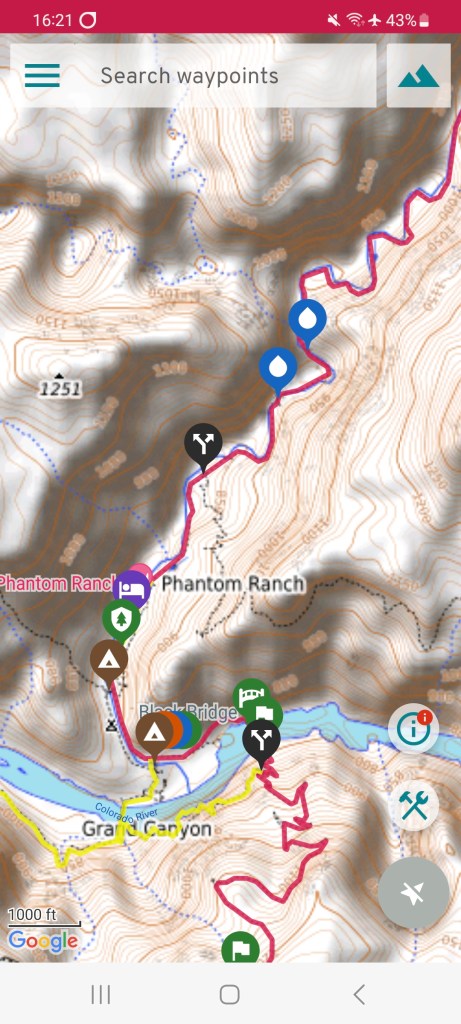
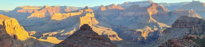
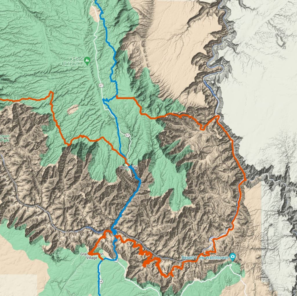
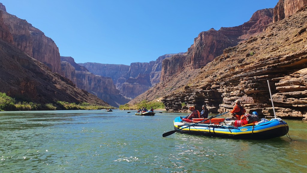
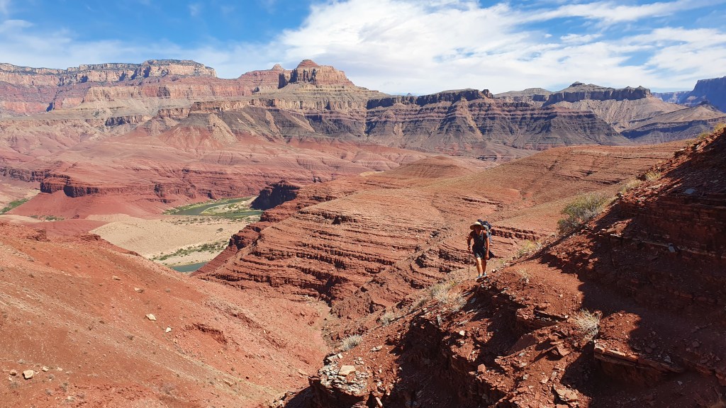
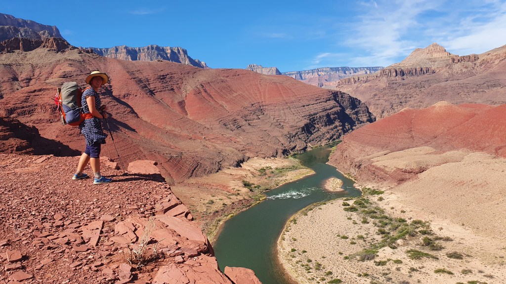
The map below shows the AZT in blue taking a scenic 26 mile direct crossing of the grand canyon via the ‘corridor trail’ ….. as opposed to the orange line of the Hayduke, a 5-6 day rollercoaster of excitement from North to South Rim. The Hayduke then also has another 7-8 day adventurous and stunning section in the canyon heading west to Kanab creek and beyond.
Crossing the Grand Canyon
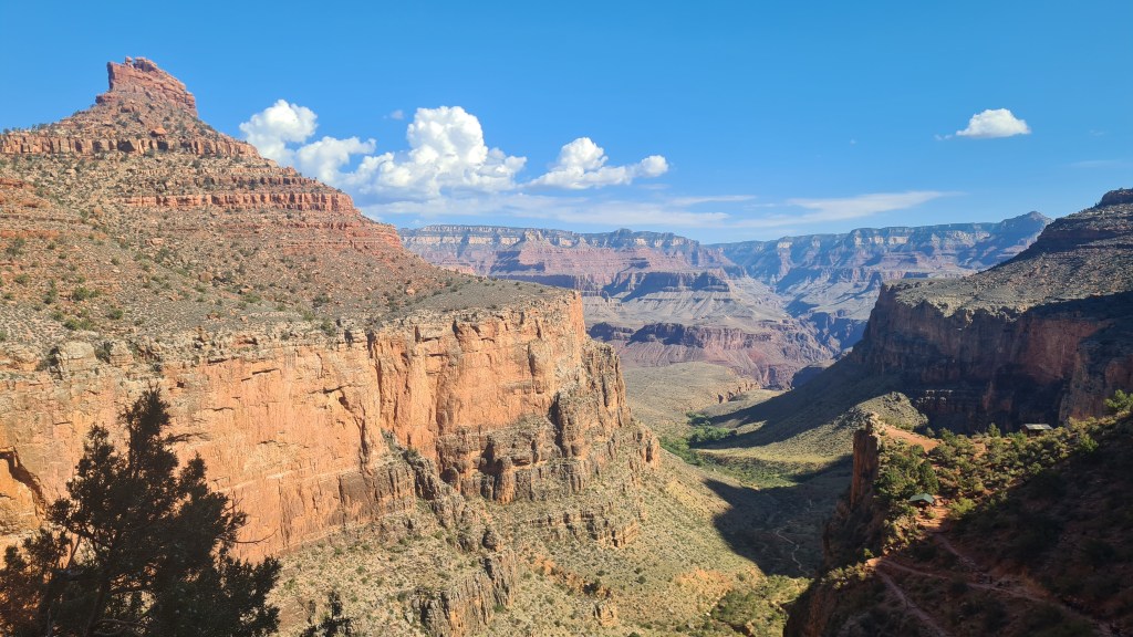
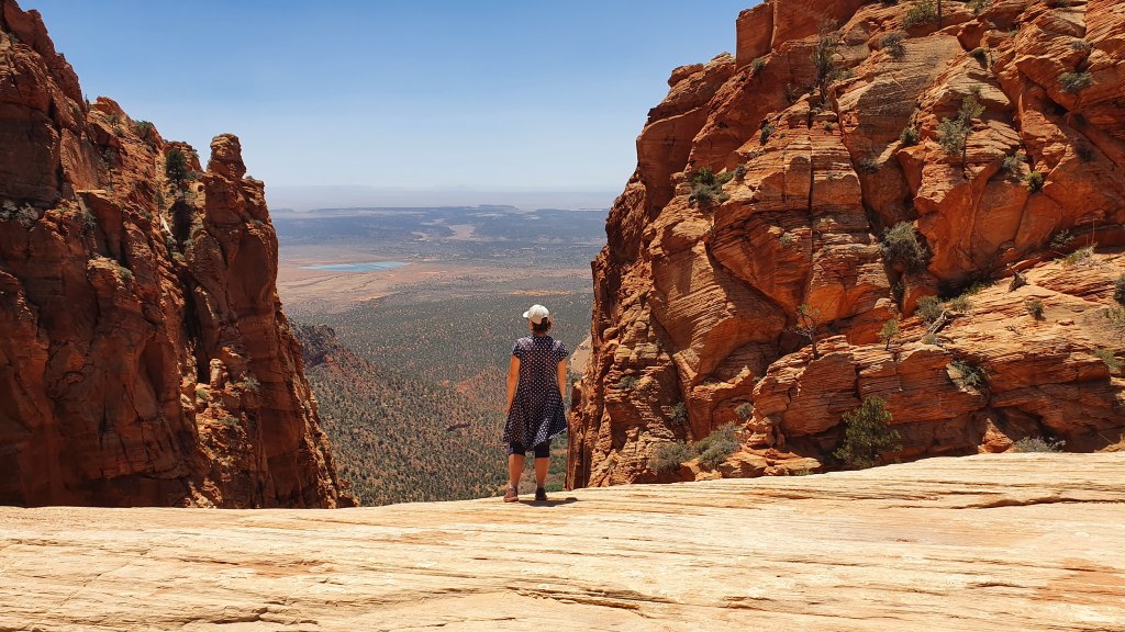
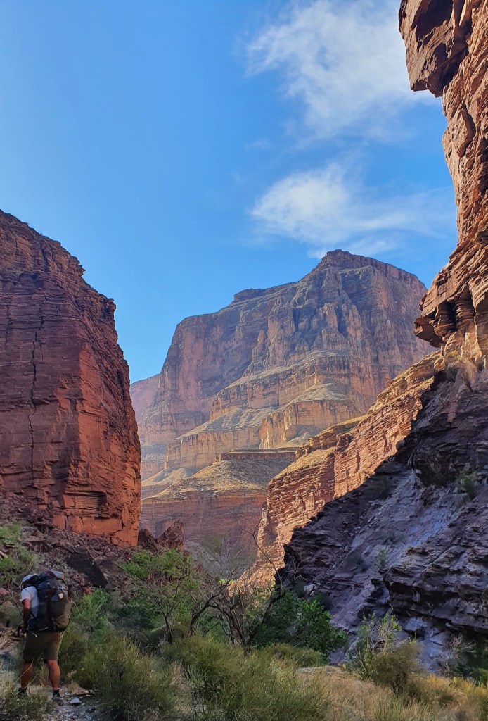
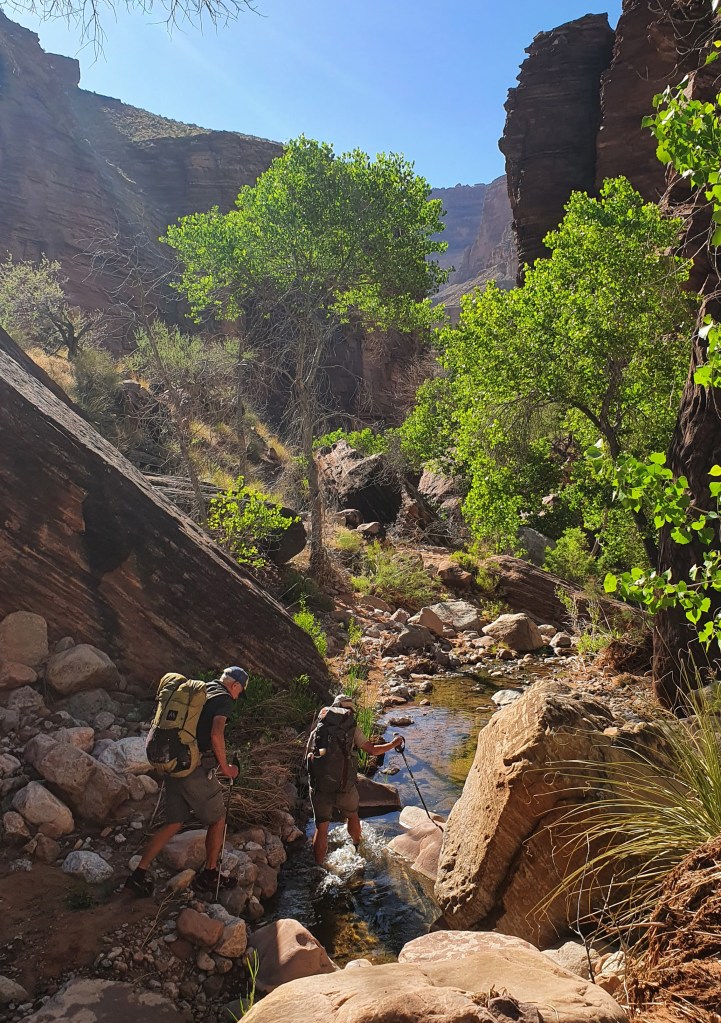
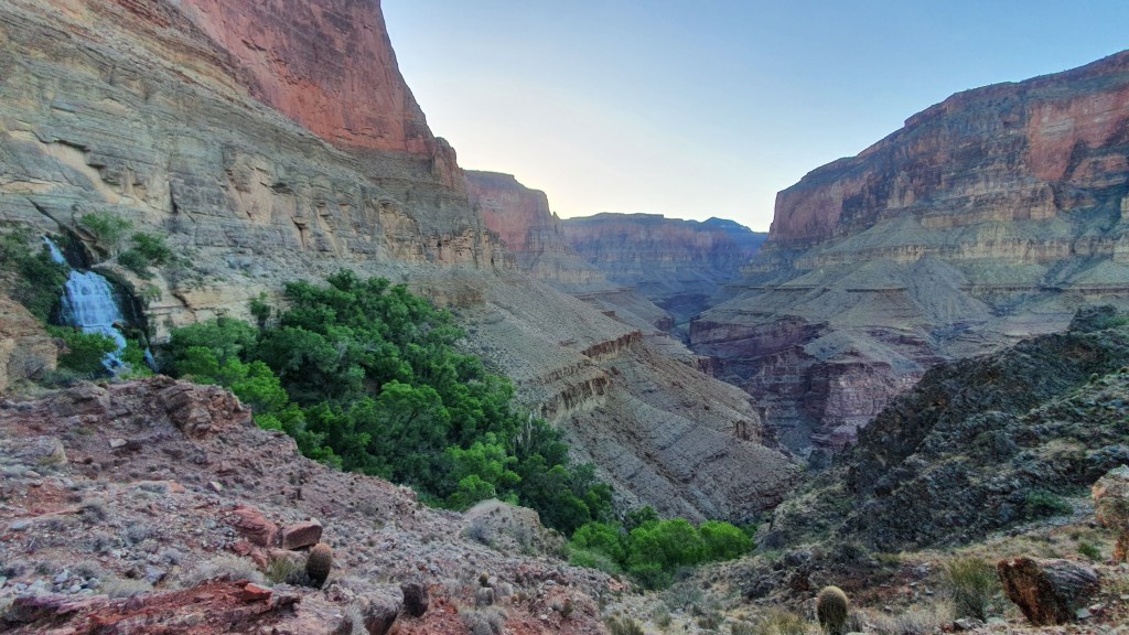
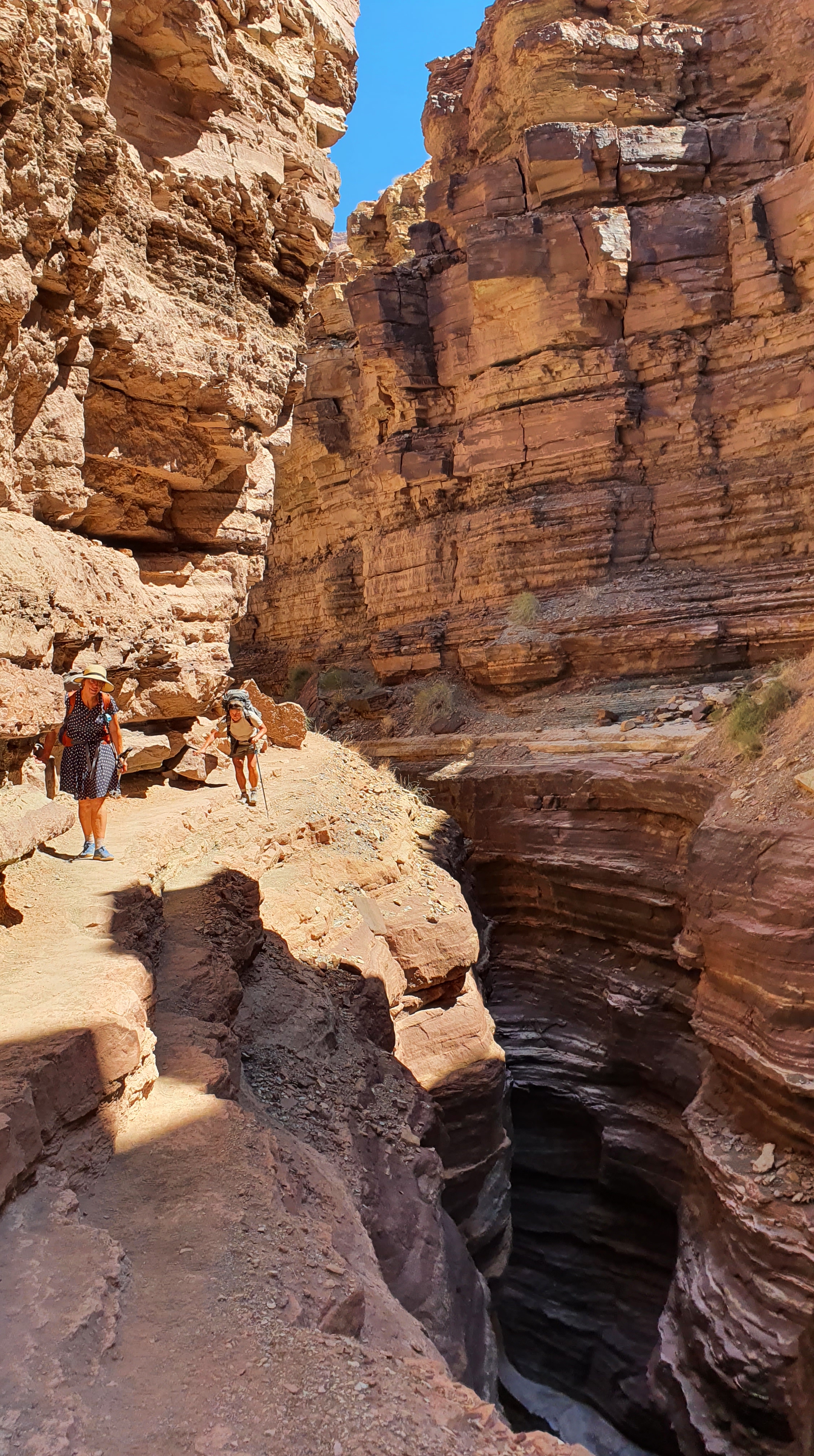
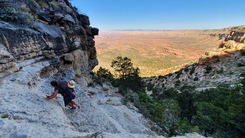
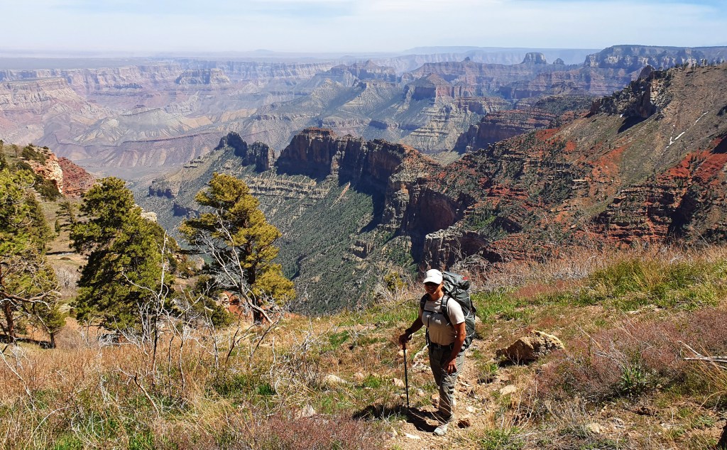
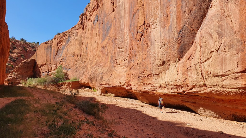
‘Bonus’ Grand Canyon loop 11th October I made an ‘on the spot’ decision to do an extra loop before leaving the Grand Canyon southwards on the AZT. My reasons were that it seemed a pity to depart the canyon after such a brief visit, I heard of a cool area around the Hermit Trail that I hadn’t been to before, and it gave me the chance to do some bigger climbs but shorter miles than the next couple of weeks of long, flat plateau hiking on the AZT. Fortunately I was able to pick up up a last minute permit easily at the backcountry park office and I set off…..
I had 3 1/2 days down the canyon (Bright Angel, Tonto West, Granite Falls and a bit of Boucher Trail) and in summary it was lovely, beautiful views, cool temperatures and away from the crowds.
Section 2 Grand Canyon South Rim to Flagstaff 14th October This section was always going to be tough for me as it was a long 115 miles of flattish high plateau to the next resupply in the town of Flagstaff – it wasn’t playing to my strengths as I like hills! That said the initial hiking through ponderosa pines was mellow, the water sources were sufficient and I was able to hike longer, up to 23.5 miles each day. The undulating terrain gave huge wide vistas, especially to Humphreys peak (the highest in Arizona that we walked up in 2017) and great sunsets and sunrises at camp. I was however relieved to arrive in Flagstaff to take a day off from hiking, sort out gear and food logistics, clean up and rest my battered feet.
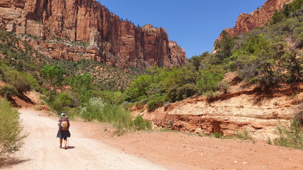
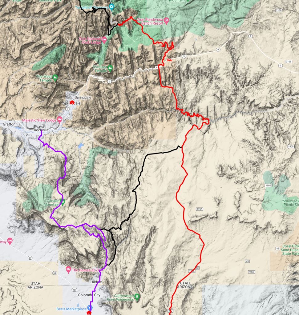
For the last section of our Hayduke hike we headed north from the Utah Arizona border to Zion National Park. Typically for us, we deviated from the actual Hayduke route to instead cross an area to the west called Caanan Mountain. Although to be fair to us, the final route used by the Hayduke in Zion NP (Weeping Wall) is currently closed due to rockfall so variants are pretty valid.
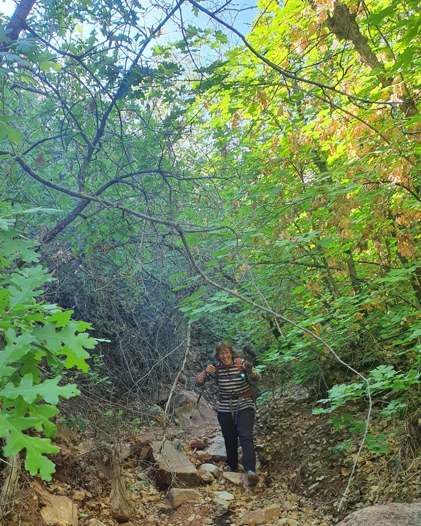
We hiked north through the streets of the town of Hildale from the Utah-Arizona state line into Water Canyon and the Caanan Mountain area.
We soon left the town for a steep ascent up Water Canyon
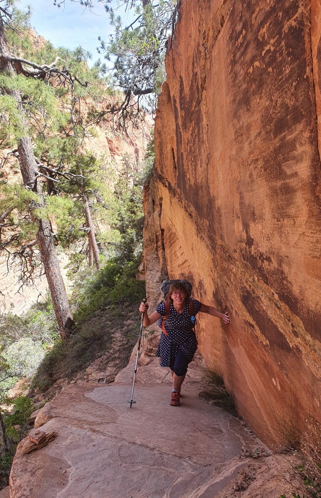
Into higher ground over beautiful cross-bedded sandstoneThe scenery just got better and better – Zion National Park in the backgroundColourful campsite on flat ‘slickrock’
In the morning we did a side hike up to the high rim of Water Canyon to see its arch…
Looking back down Water CanyonSome great hiking on the rock slabsWe can’t afford to be choosy when it comes to water! We carried this with us but thankfully later found a better supplyAmidst surreal black iron accretions on top of cream coloured sandstoneLooking south across the ‘Arizona Strip’ to the edge of Grand CanyonAn old winch or ‘Windlass’ used to lower timber down the 1000ft cliff to the plains below2nd night camp with grand views to Zion National ParkMorning hiking with Indian paintbrushLooking towards Zion before descendingSlow going with hot energy sapping sand, cross country and rubbly descents…desert now in full bloom……bloom…Back into town to pick up a rental car!
Many thanks for all the help we have received with planning and logistics for this hike from Charlie Neumann, Joe Mitchell, Li Brannfors, Monica Stapleton and Jamal Green; and for support, inspiration and shared enthusiasm from fellow Hayduke hikers Heather K, Nathan K, Mike Tyler, Ryan, Peter, Race, Not Guilty, Sprinkler and ‘Butcha; also the numerous wonderfully generous Americans (and two Danes) who gave us lifts in their cars to town and those we met who gave us fruit, water and kind words of encouragement!
Hiker Notes
Our route as mentioned above deviated from the Hayduke to cross Canaan Mountain from Hildale to Rockville. You can click on the overview map below to enlarge it. (Our route in purple, Hayduke in red and some other alts in black).
This is a marvelous hike has a real Hayduke flavor to it with a mix of trails, cross country, route finding and superb scenery. Its downside is that it misses out the ‘Barracks’ on the Hayduke which is also top class.
Water is available in the well named Water Canyon, then there are some big potholes in the slickrock wash at the top of Water Canyon. Sawmill Spring had water about 10 minutes downstream from the spring itself and there was some seeps and pools in the slickrock below that.
The attractively named “Swamp Point” high on the edge of the North Rim (no swamp, just a few mosquitoes) was our departure point back into the Grand Canyon after resting, eating and watching out for the endemic Kiabab Squirrel in the campground near North Rim Lodge.
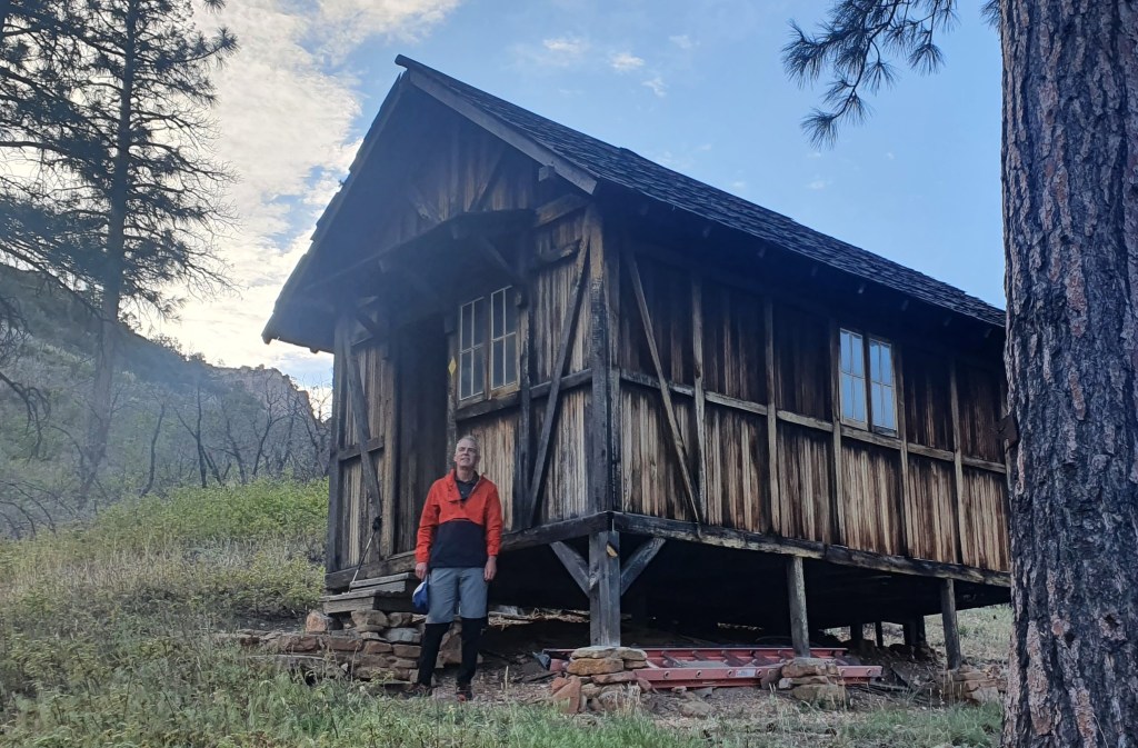
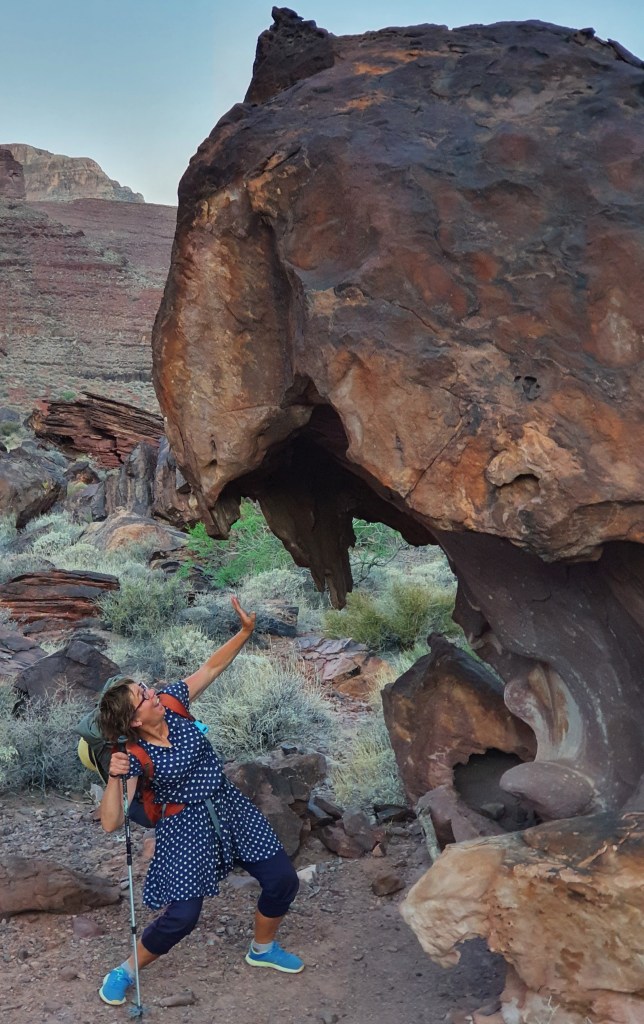
Just below the rim lies Teddy’s (Roosevelt) Cabin, a cool ‘bothy‘. Apparently the great man stayed here on a cougar hunt – the cabin was built (and named) afterwards. From this piece of civilization our route headed into the wilds, sans trail, bushwhacking and scrambling down Saddle Canyon and then Tapeats Creek.
Teddy’s Cabin
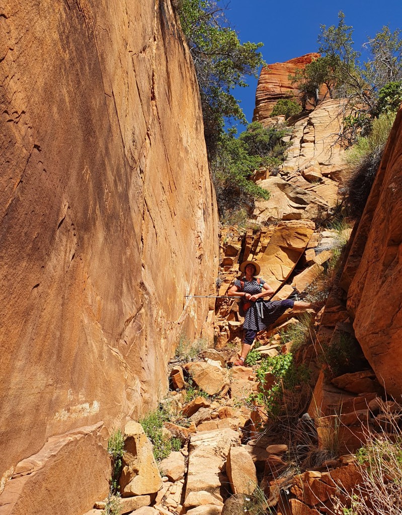
Firstly we bushwhacked our way down through the scrub in upper Saddle Canyon. This was slow going but not too difficult until we took a route out to avoid a big dryfall. We climbed out the canyon too early and got into some nasty scrubby, loose sand scrambling before we returned back to the canyon and finding a set of cairns for a better route.
Upper Saddle CanyonOld burn area with lots of wild flowers
After a few hours of that, the walls of the lower part of Saddle Canyon suddenly rise up and form smooth alcoves above and slick chutes and channels under foot and we found ourselves sliding and scrambling down polished half pipes and overhangs into dark pools of water. By that time we were joined by a fourth hiker (Peter) and were able to assist each other, passing packs down the steep drops. Superb and exciting stuff, unfortunately I then stored the camera away in a waterproof bag for safety!
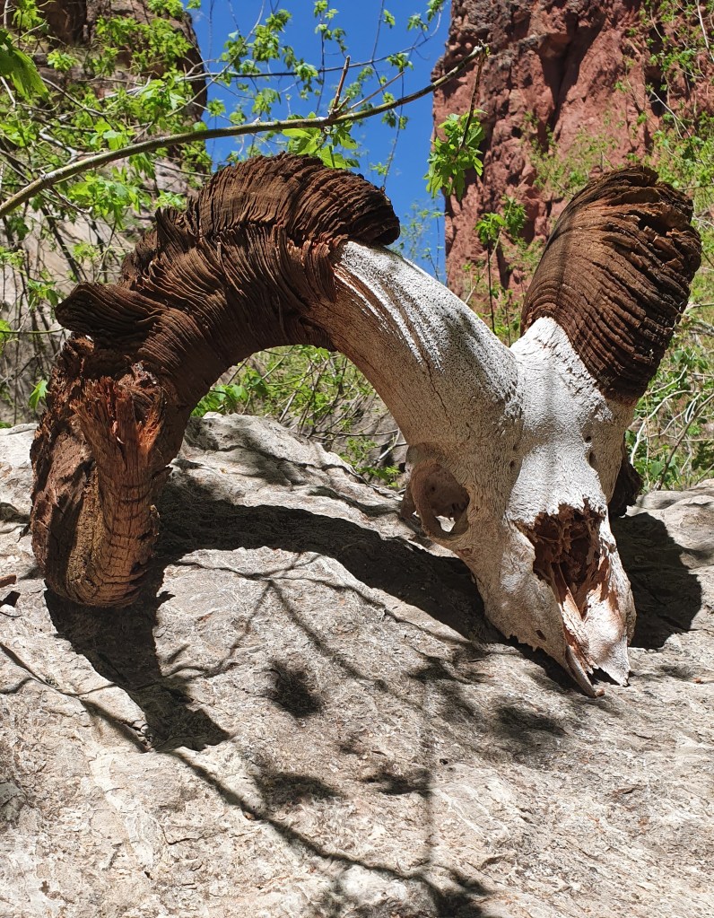
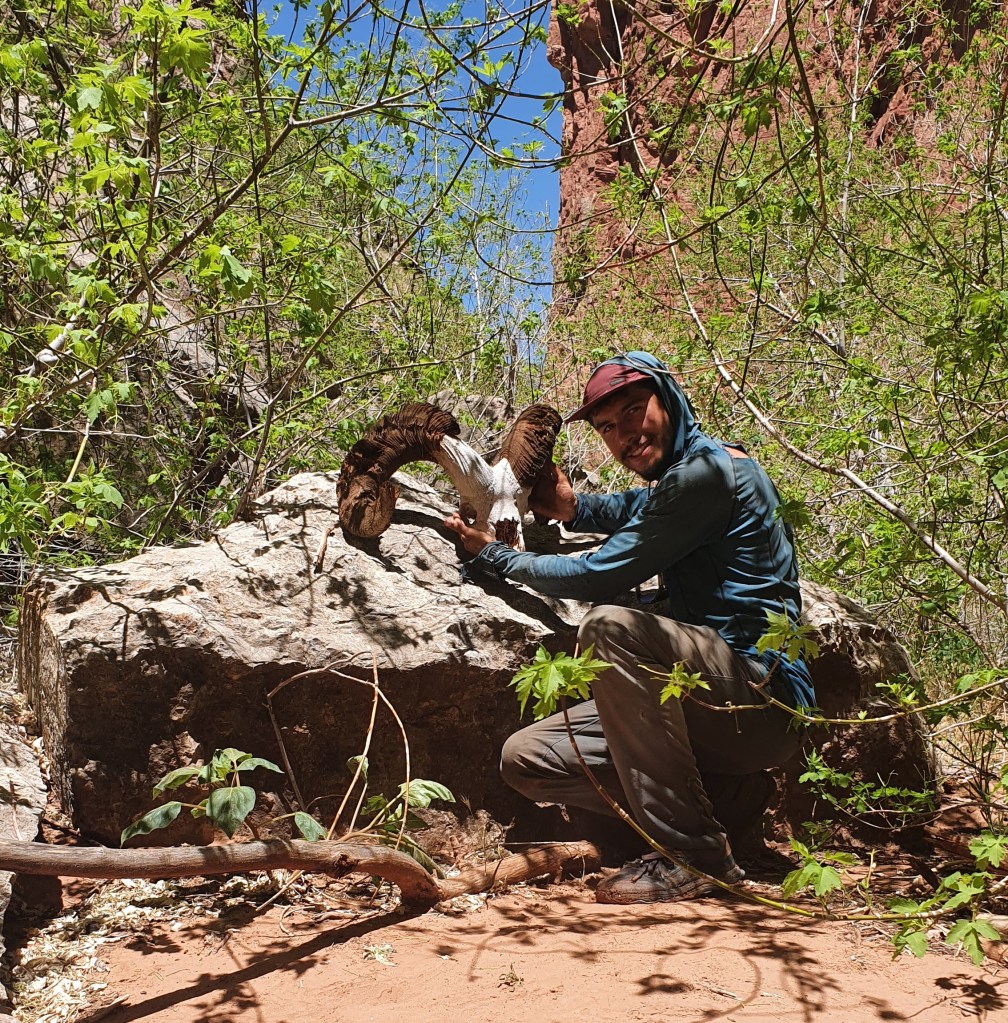
Hayduker Peter with huge Bighorn sheep skull we found in Upper Tapeats Creek
After the shady but steep narrows of Saddle Canyon, we joined Tapeats Creek which was dry and hot at mid day. But after a couple of hours of sizzlingly hot hiking with a few rests in the shade we thankfully reached pools of water, then flowing water and then to a roaring clear river which we had to cross numerous times.
Travelling through this terrain without trails is hot sweaty and challenging and we took 12 hours to cover 11 miles that day, arriving at our intended camping spot near the junction of Tapeats Creek and Thunder River at dusk. We were welcomed by a large pink rattlesnake who slithered away and happily was not seen again during the night!
Next morning at 5 am we climbed up 1,400ft to Thunder Spring, a roaring cascade of spring water gushing straight out of the limestone cliff. We knew the day would be hot, so the early start maximised the comparatively milder morning temperatures (and beautiful morning light).
Leaving Surprise ValleyThunder Spring
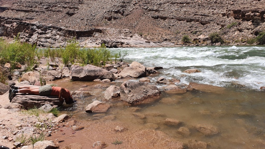
We rested for a couple of hours at the oasis-like Deer Creek in the welcome shade of cottonwood trees and descended the beautiful Deer Creek narrows before reaching the banks of the Colorado River itself around 11am. We were not alone: Deer Creek is a must-see side trip for river rafters.
Deer Creek narrows At the Colorado River
We found ourselves a shady cave under some big boulders and tried to sit out the heat. The forecast at river level had been for 107 F (41.6 °C) that day and the next.
We passed the day reading, venturing out only occasionally to dip in the pool below Deer Creek falls and to talk the boaters arriving at the beach. In the afternoon we (Brian and Martina) decided that it was way too hot to enjoyably continue hiking down the canyon (an off trail route requiring boulder hopping on the steep riverside most of the way for 8 miles or so, we had done this in 2017 but in cooler temperatures).
Camping on the way out of the Grand Canyon
So we hiked back uphill that evening and, with a 3.30am alarm the next morning and a helpful bright moon we continued upwards when it was cooler, all the way to the North Rim on the scenic Bill Hall trail. About a 4,700ft climb in all. There we got a lift with some friendly hikers from Idaho to the town of Hurricane, Utah.
Final ascent on Bill Hall trail up to the North Rim of the Grand Canyon
Heather and Peter have hiked on (hardier than us!). We are hopping forward and with the help of a cooler weather window hope to continue our route into Zion National Park…meantime we are enjoying a decadent town stop!
Hiker Notes
Section 13 miles 27.9-37.4 I think the section down Saddle Canyon to Upper Tapeats Campground is one of the toughest sections of the Hayduke, although with some great scrambling and scenery. We were here mid May and it took us about 10 hours but that included about 1-2 hours time wasted scrabbling about at a wrong exit from Saddle Canyon.
The initial descent down Saddle Canyon (28.6-30.2) was cross country with some scrub in the dry bed of the creek but wasn’t too hard at all. Maybe with more people on the Hayduke it is gradually getting easier.
We missed the correct exit from the dry canyon bed at 30.2 to traverse around the dryfall and headed uphill too early. There are a few smaller dryfalls you get to first which have cairns on the left side but you need to go down past these to more cairns before the bigger dryfall. The route from there back into Saddle Canyon involves traversing on the left west side onto a ridge then descending its west side to a small side wash and back into Saddle Canyon. It was pretty slow going, scratchy bushwhacking but had some cairns and signs of traffic.
Once you are back into Saddle Canyon at mile 31.0 the character changes straight away to scrambling and hiking inside the slickrock canyon. There were a few drop offs where we were happy to have a team to assist each other and lower packs- it would be trickier solo. The cord to lower packs was definitely useful. We didn’t really get too wet in the slickrock potholes, maybe knee deep. A superb canyon.
The scrambling ends at 32.6 with the Stina Canyon junction. From memory there were two small potholes at 33.1, the junction with Crazy Jug Canyon. The next few miles were very hot down a rubbly dry streambed and slow going. The going gets nicer about 1/2 mile before Tapeats Spring though with cottonwoods, shade, pools and running water.
Once we met Tapeats Spring the river changed character to a raging and loud cataract! There is a trail which helps a lot starting on the south side and crossing the river at reasonable places with some scrambling along the way. We maybe had knee deep water after a dry spell, any more might have made progress difficult. The area is really dramatic and scenic and a stand out of the Hayduke if you have low enough water levels!
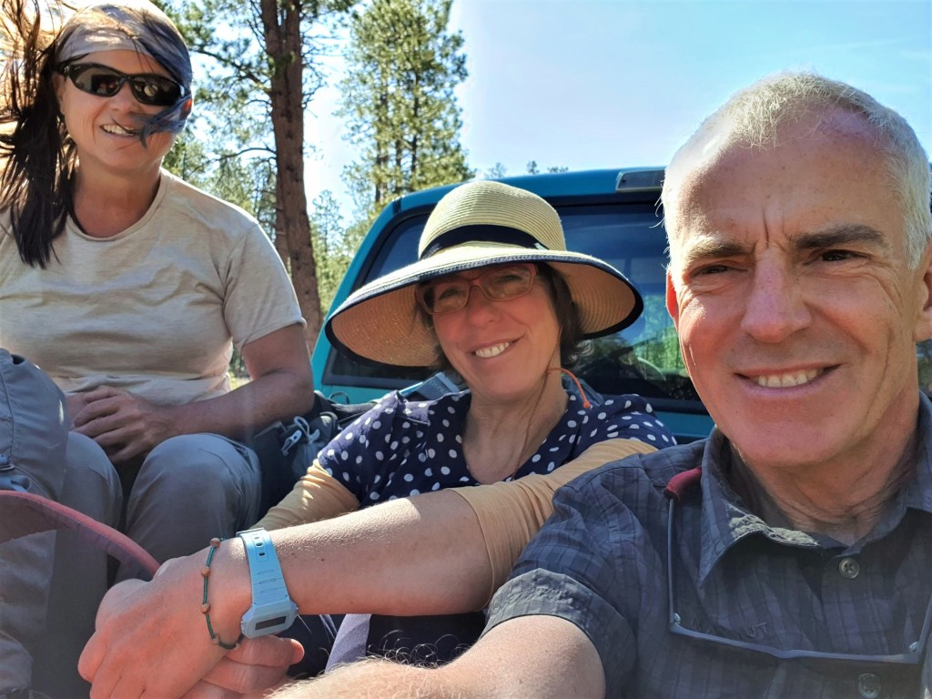
At the small lodge of Jacobs we joined forces with Heather whose three hiking partners have all left the trail for various reasons. Good to have more options when it comes to the point where we have to draw lots about which member of the expedition to eat when we run out of food, for we were now heading back out on a pickup truck to the tough part of the trail: the Grand Canyon!
Heading back to the trail in styleThe Arizona Trail (AZT) a “proper” trail to follow
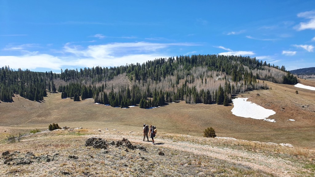
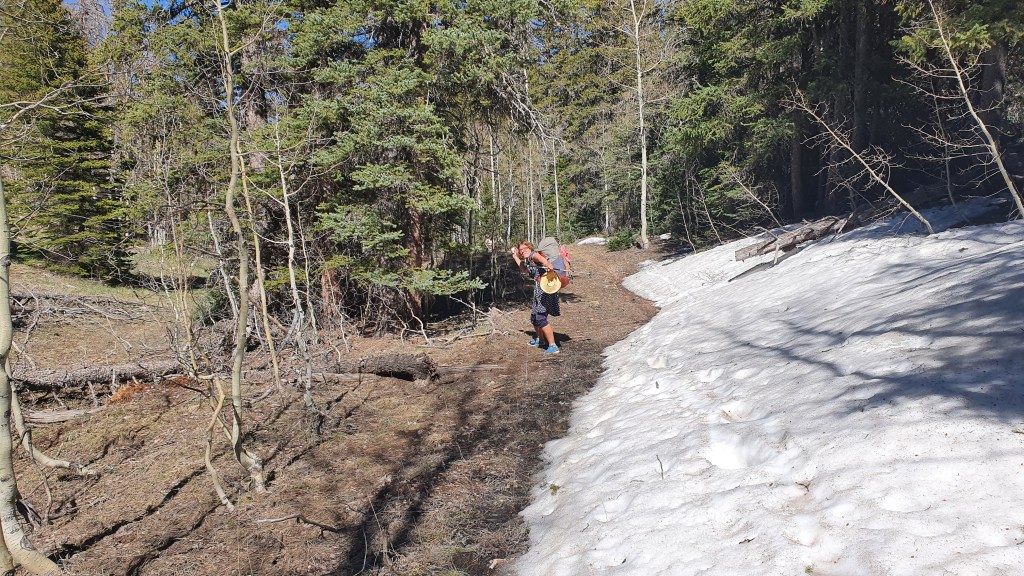
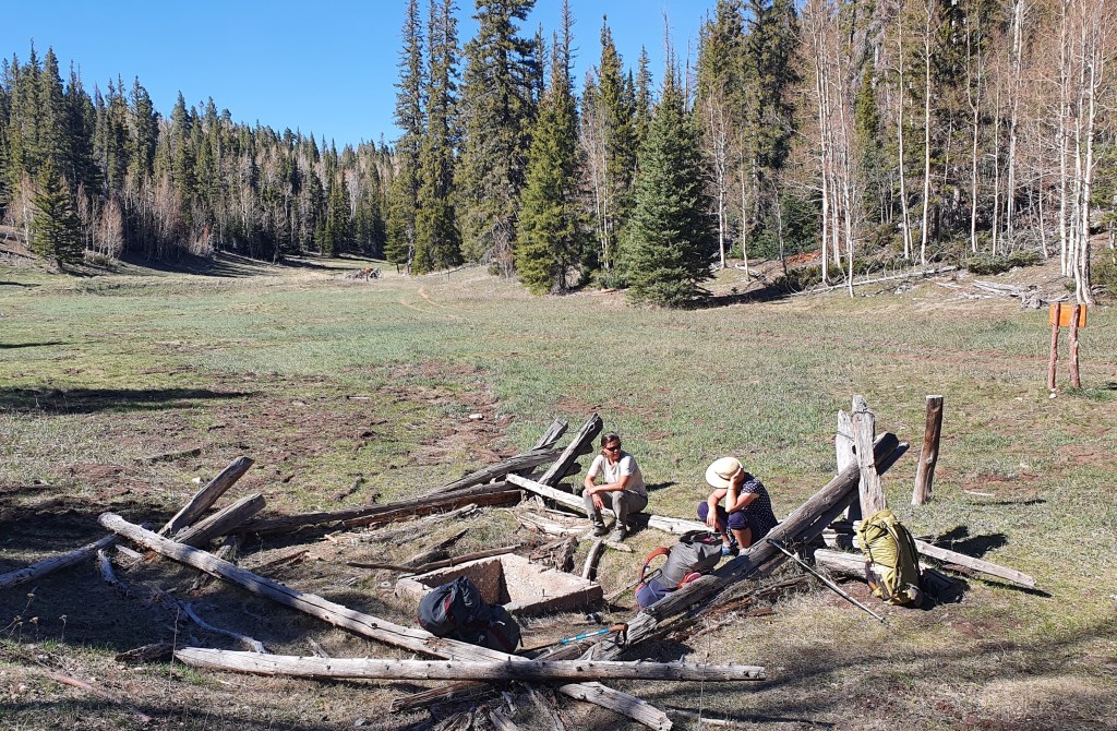
But first the trail keeps following the AZT on the plateau up to 9000 feet altitude through aspen (still mostly leafless), fir, spruce and pine forest with open alpine meadows in between. Winter is only just retreating here.
Snow melt and springs galore!Crystal SpringCamped near water at SourdoughKiabab Plateau
We reached the edge of the Grand Canyon at Nankoweap on our second night out, with gale force winds and we camped in relative shelter amongst aspens at the edge of the cliffs dropping down into the Grand Canyon. Next morning we started our 6,000 foot descent to the Colorado River at dawn.
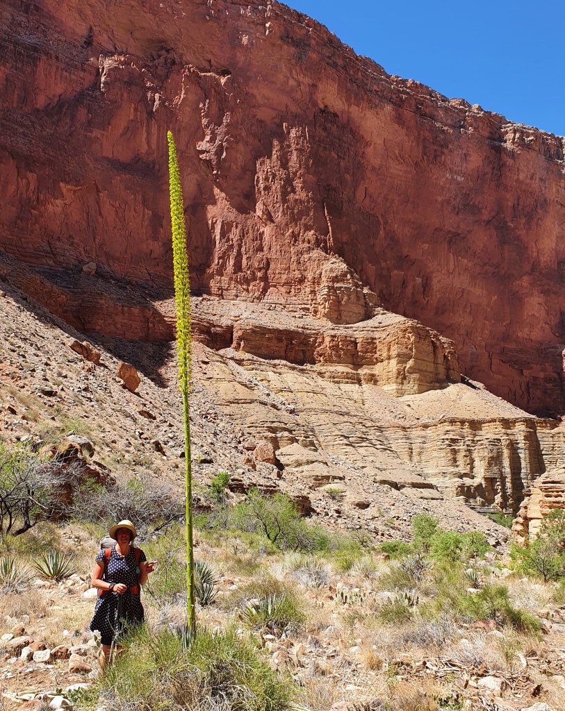
Dropping down towards Nankoweap canyonPrickly pear paradise low down in the Grand Canyon near Nankoweap riverAgave utahensis var kaibabensis
The heat ramped up as we descended down to the inner cauldron of the Colorado River. We camped that night at the bottom of Nankoweap canyon on the shore of the Colorado Rivet itself with stormy gusting winds whipping sand and river water at us.
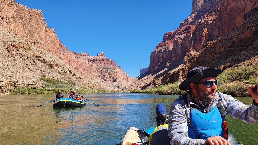
We were not alone however as there were two big motorised commercial river boats moored on our beach with about 25 clients. A private boat trip with 6 small rubber rafts was moored in the next bay downstream. In the evening we walked up to a viewpoint and afterwards chatted to the private rafters. They were a group of friends, relatives and acquaintances from all over the US. Their figurehead “Uncle Dave” was very welcoming and, once we had sourced a life jacket for each of us, generously invited us to travel 9 miles down river the next day with them..
Heather and Martina with boatman Brian (Big Dill)
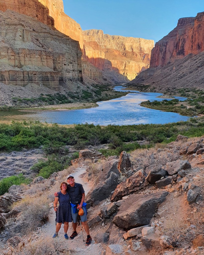
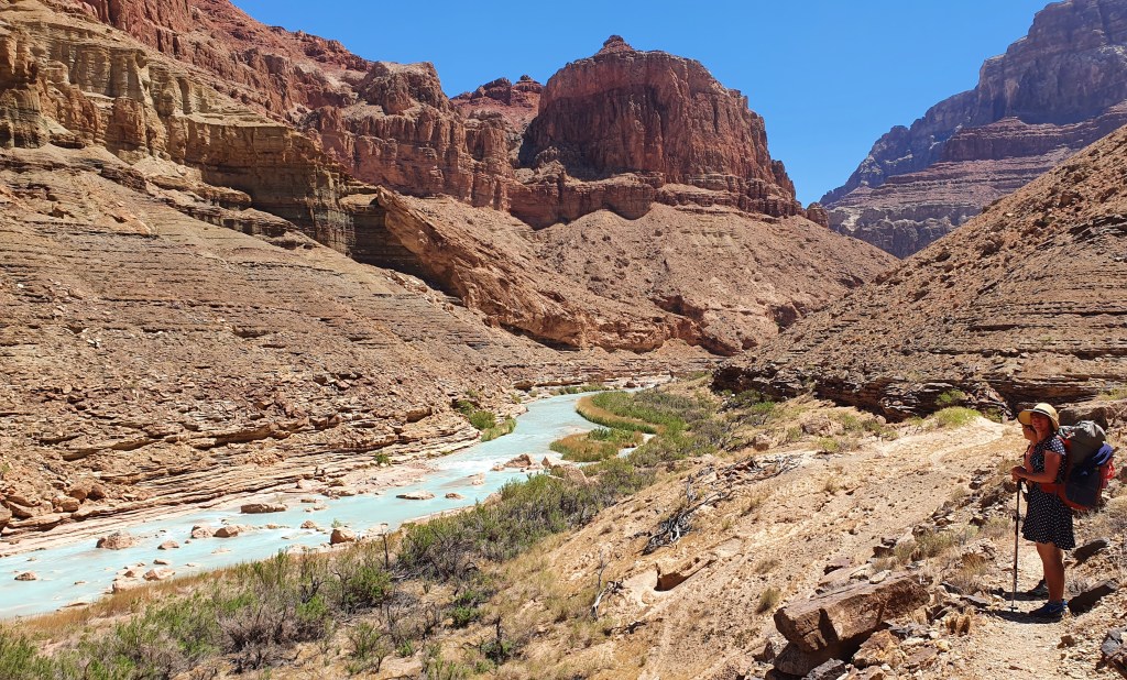
After a fun (and wet from rapids) morning on the river with our boater friends, we got off at the Little Colorado River confluence with the Colorado and said our farewells.
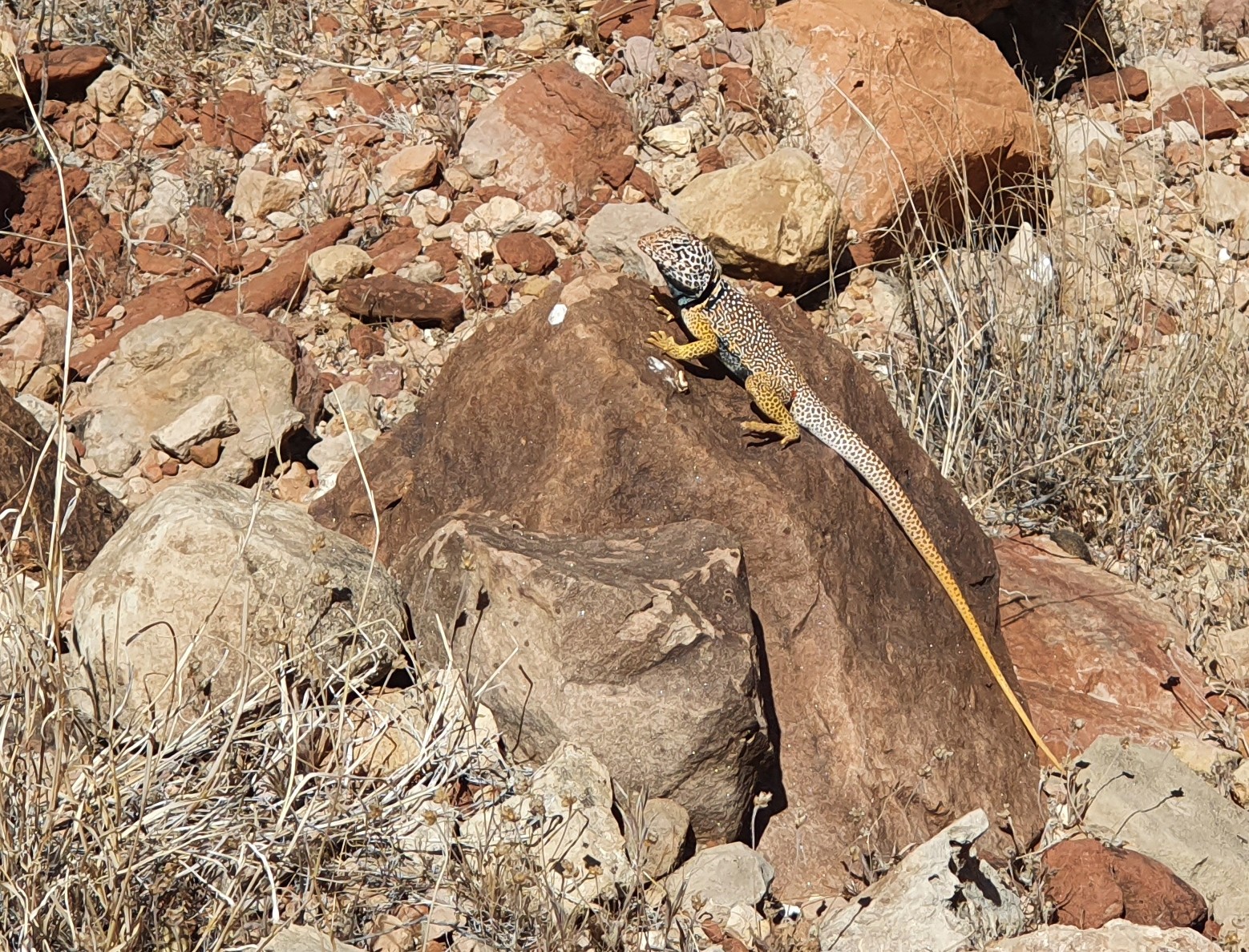
View of the turquoise blue Little Colorado RiverCollared lizard posing by the trail
Our target for camping was Lava Canyon rapids and the trail stayed high above the river on balcony ledges until we got there. The wind was back and buffeting but at least helped keep us coolish in the 30C heat. We chose to camp in a dense grove of trees that provided shelter from the wind. When it got dark and the wind abated we sat on the beach for a while with our rafting friends camped opposite us on the other side of the river.
Camping opposite Lava Canyon Rapids
Because the mid day temperatures are way above 30°C, we start hiking at dawn now (5am). The best time to hike for beautiful light as well!
Hiking at first lightThe green corridor of the Colorado River
Tributaries to the Colorado River form a labyrinth of deep canyons that we followed until we can cross them, making for a wriggly but beautiful route. Some scrambling added to the interest- this is a great hike in the depths of the Grand Canyon.
Heather cools down with a hair rinseLunchtime tea beside the ColoradoLooking towards Hance Rapids, our next campsite
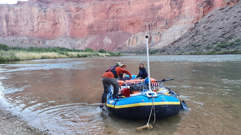
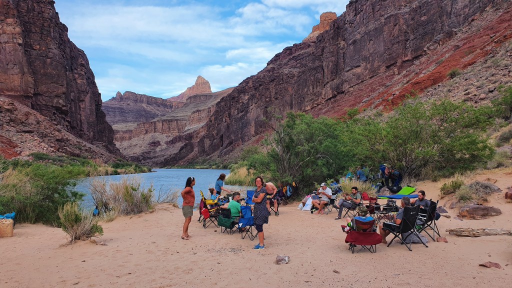
By chance, we met up with our boating friends again at Hance Rapids on the Colorado River where they had moored and we camped too with good access to water from the river. We were invited to their evening campfire circle and dinner.
Hance Rapids boaters camp
After 5 nights and 6 days hiking we arrived at the South Rim on May 11th. Fresh food, showers and rest beckon! Next we will hike back down into the canyon bottom and up to the North Rim to continue our hike…..
Dangers of the Hayduke!Long climb out to Grand Canyon rimHiking up to the South Rim via Hance Creek, Horseshoe Mesa andGrand View TrailTopping out of the Grand Canyon on the South rim after 6 days, dusty but happy!
Hiker Notes
Route We mostly followed the Hayduke in this section apart from at the end where we hiked out of the Grand Canyon to the south rim on the Grand View Trail. This shortened the route a bit and we had already hiked the remainder part along the Tonto Trail and up South Kiabab Trail in 2014. This part was also our least favourite hike due to the heat and paucity of water!
South from Jacob Lake the Hayduke follows the well maintained and relatively popular Arizona Trail (AZT) for about 30 miles. Good AZT water report website.
Its dry from leaving the AZT til hitting Nankoweap Canyon about 8 miles down from the North Rim on Nankoweap Trail. This trail is really scenic and makes for a superb hike. Nankoweap Canyon looks like a perennial stream with a gushing spring source just 10 or 20m downstream from where the trail hits the stream.
Once you hit the Colorado River there are a number of places to access the river for water. You can’t do this anywhere though so best keeping an eye on the map. the Nankoweap Granaries are definitely worth the side trip.
The route along the Colorado River between Nankoweap and the north of the Little Colorado can be pretty slow going over boulders with bushwhacking so allow plenty of time and best to start early if its going to be hot. We have managed to get lifts across the river to the Little Colorado outlet pretty easily within a few hours both times we have been there.
Hance Creek had a good, if small, flow of water.
Overall, from Jacob Lake to South Rim is a brilliant hiking expedition and if there in May, the main challenge is the heat down in the bottom of the canyon.
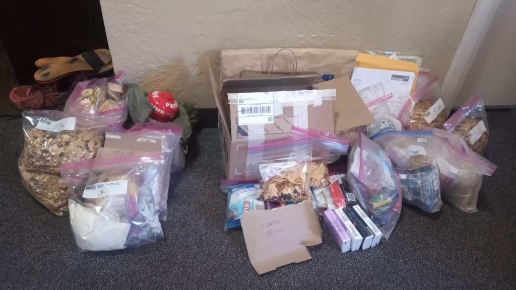
During our rest days in the town of Kanab we bought food for the trail ahead; 2 days to carry straight away for the hike down Buckskin Gulch and onto the Arizona Trail, then with the help of a friend, 6 days which we left at a remote diner/hotel called Jacob Lake (on the Northern plateau of the Grand Canyon) and a whopping 8 days of supplies which we mailed to the post office at North Rim of the Grand Canyon.
Supplies for the next few weeks
We started putting our thumbs up on Highway 89 out of Kanab at 7am on 4th May and got a lift back to the trail with an 82 year old gentleman who was driving a portable water tanker for supplying firefighting crew in New Mexico. He was driving it there from Montana!
Upper Buckskin GulchNarrows at Wire Pass
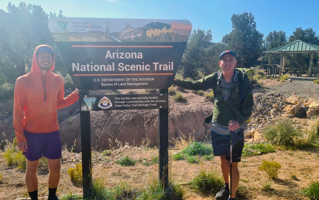
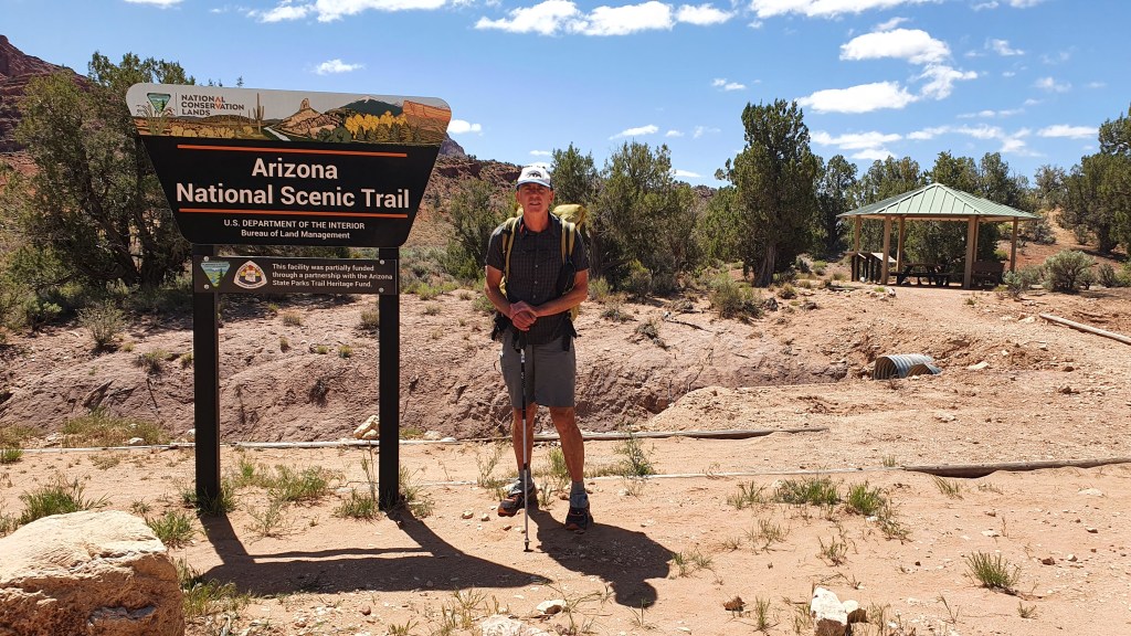
The Hayduke goes through some spectacular sandstone country in and around Buckskin Gulch and then picks up the Arizona Trail (AZT) for approx 65 miles. The AZT itself starts at the Mexican border in the south and finishes after around 800 miles at the Utah state border. We were hiking it southward ‘against Wainwright’, meeting lots of northbound hikers who were nearing their finish line. What this meant for us was that we had well maintained, clear trail to follow for the next few days!
Brian at the Northern terminus of the AZT
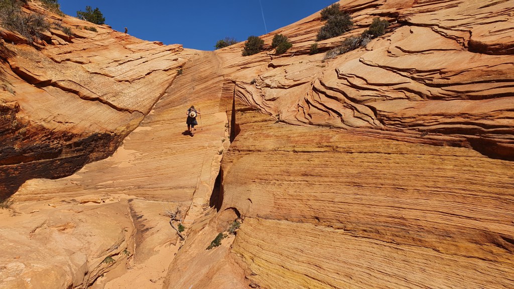
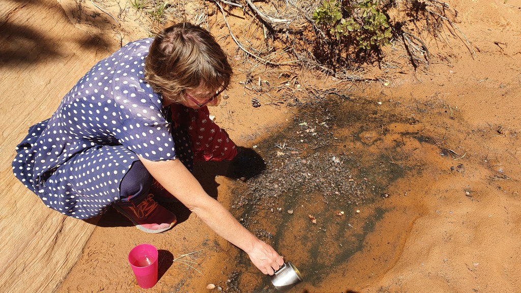
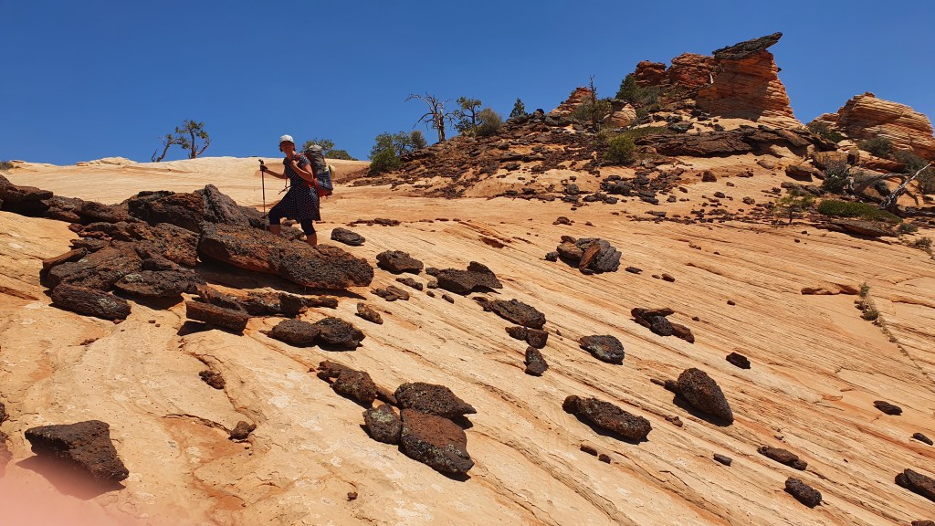
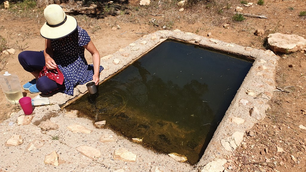
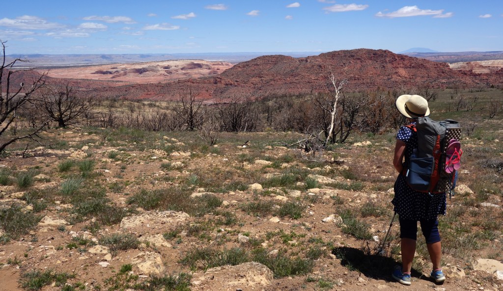
Once on the AZT we climbed very quickly up onto the Kiabab Plateau, a high limestone forested area that forms the North Rim of the Grand Canyon. We left behind the slick gold and red sandstone and spent two days in dry pinyon-juniper forest, then ponderosa pines higher up. Our one water source was from a “wildlife guzzler”. Below Martina is straining some “wildlife” out with a handkerchief before treating the water!
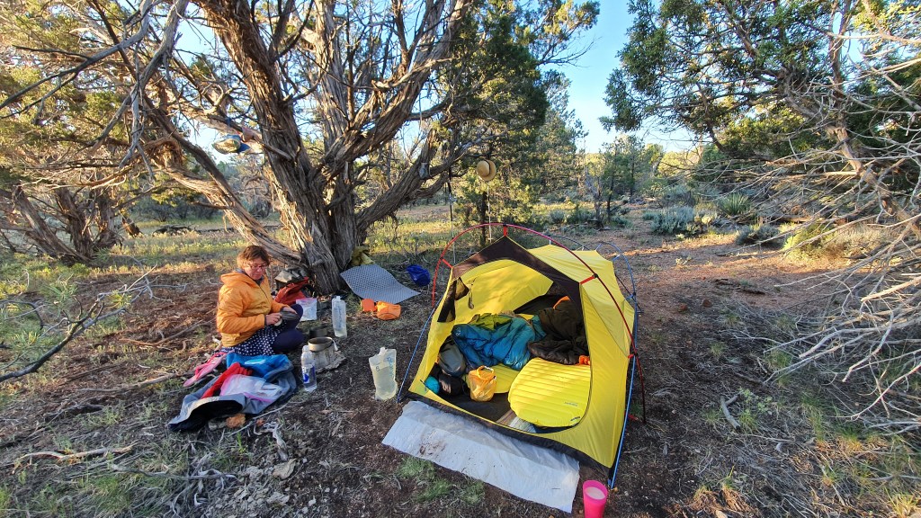
To avoid setting the dry forest floor on fire with our stove, we usually cook on a flat rock…but if none are available a cow pat does the trick!Camp amongst pinyon-juniperLooking back north to Utah and canyonsSome burn areasWe disturbed this rattlesnake lounging beside the trail
After two days we got to Jakob Lake, got a hotel room and picked up our food parcel ready for the next 6 to 7 exciting days headed for the depths of the Grand Canyon……
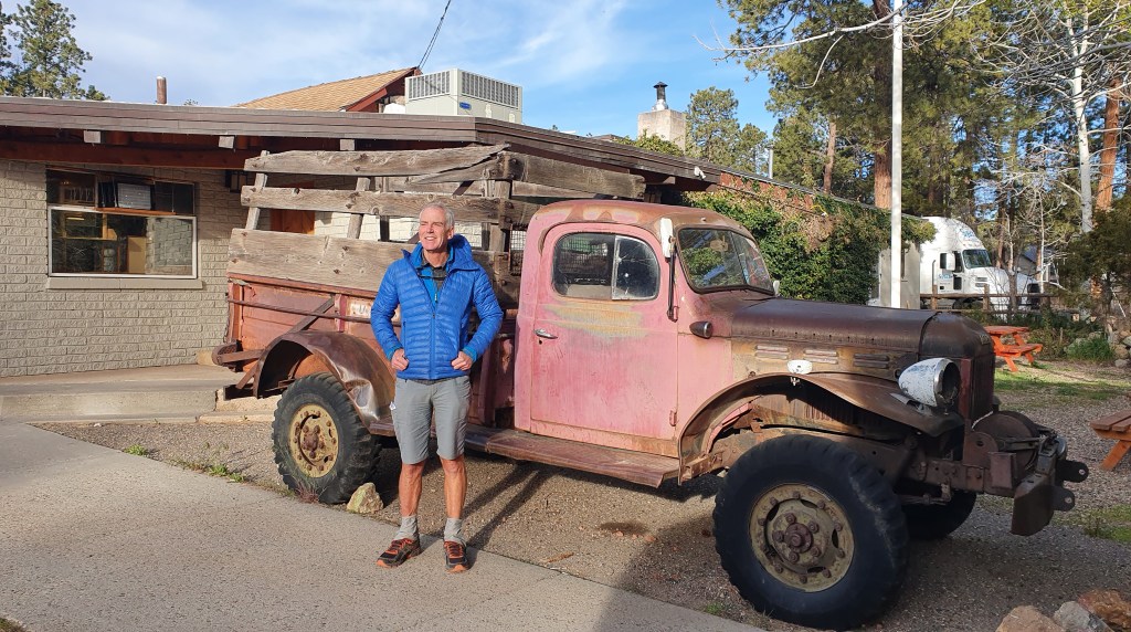
Vintage transport at Jacob Lake
Hiker Notes
Route For the first time we followed the Hayduke in this section(!) with the exception of the enforced fire reroute on the AZT below…
Water- we relied on a single source about 4 miles south of the Utah-Arizona state border, the wildlife guzzler as pictured above which seems reliable. That said there was a fair bit of activity at the state border with a few northbound AZT hikers finishing each day in May. There could be a fair chance of picking up water here from people there to meet AZT hikers.
AZT diversion- there was a rerouting of the AZT north of Jacob Lake due to burn areas impacting the trail. See sign below…