2025 Escalante north backpack

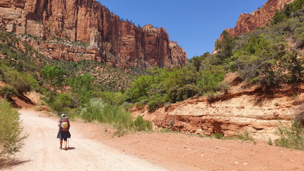
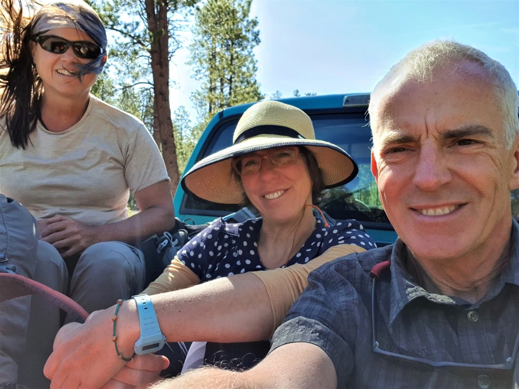
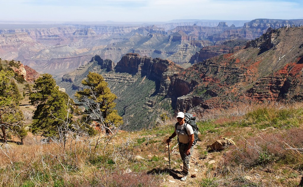
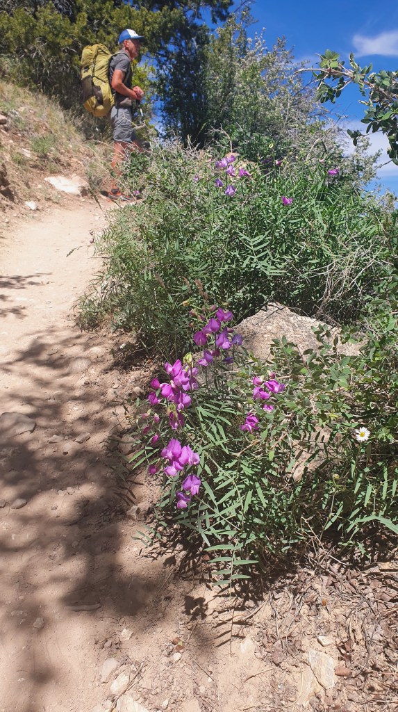
We flew over from Scotland to the US at the end of September 2025 with permits to hike for 5 days down the iconic Buckskin Gulch and Paria River on the Utah/Arizona border. We have hiked here before (such as the Paria in 2016) but never the entire length of the two canyons together despite two previous attempts.

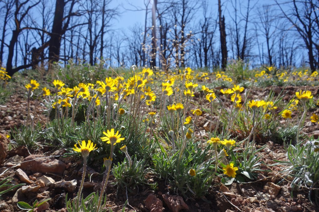
…..But it was not be this time either unfortunately due to thunderstorms and floods when we arrived at the trailhead. We visited nearby Waheap toadstools and ended up sheltering under a recess with a waterfall forming above. Buckskin in particular, being a very long slot canyon, is particularly dangerous during floods.

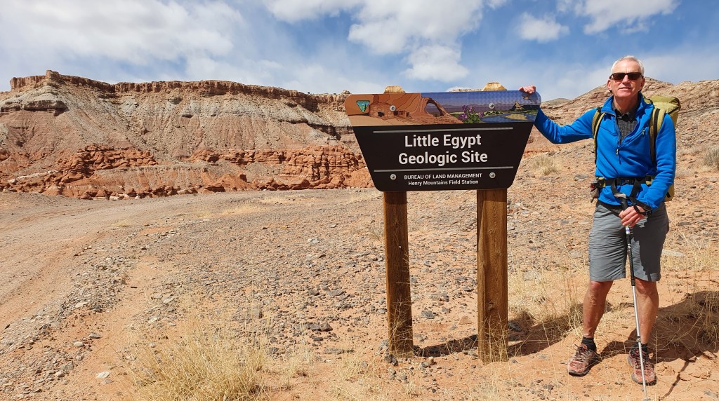
Och well, we had a long list of other potential hikes and quickly diverted to doing a route new to us in our much loved Escalante river catchment of southern Utah.

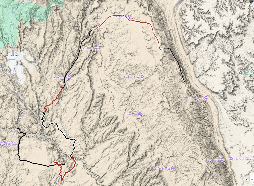
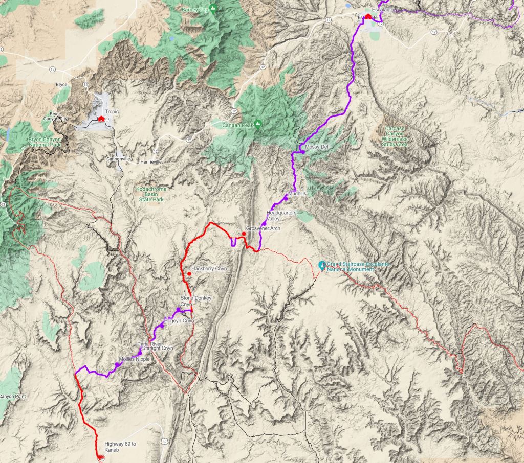
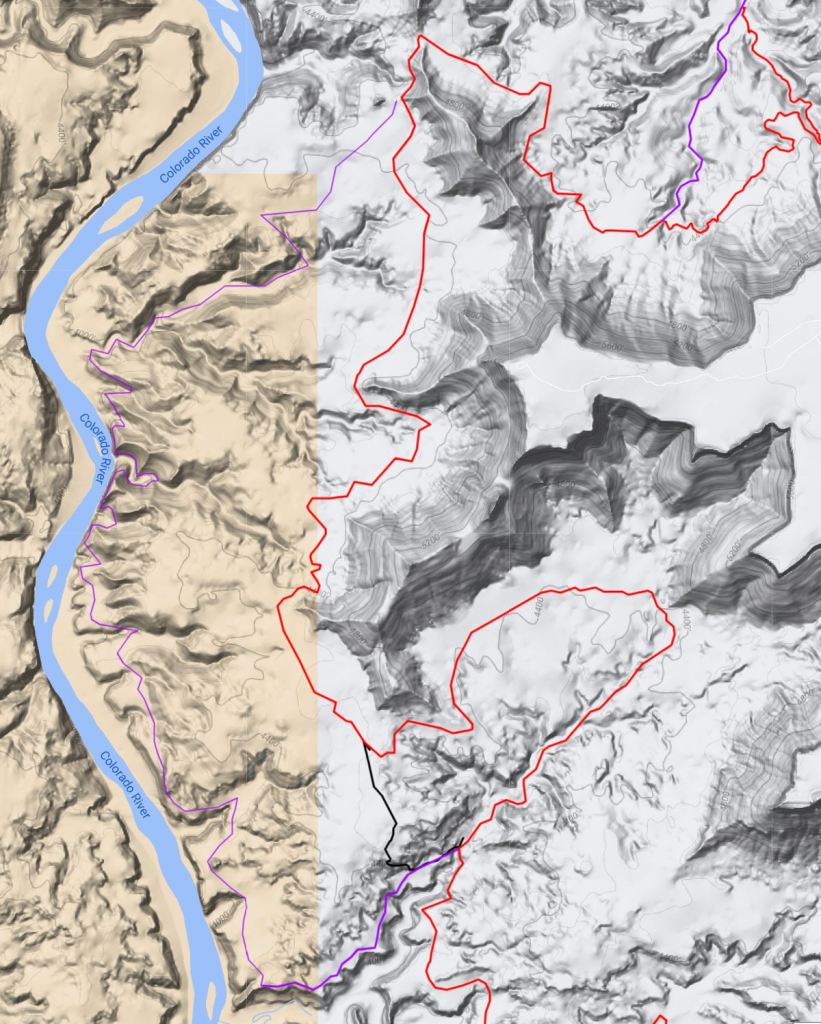
Our backpack was to take us over 7 days to Upper Muley Twist canyon, Lamp Stand , Egg Canyon, upper Gulch , unnamed slickrock area bordering Deer Creek, Brigham Tea Bench, lower Gulch , Escalante river ‘Ladder exit’, ‘Cosmic Navel’, Red Breaks-Spencer Flats and Phipps Wash to finish at the Highway 12 road bridge over the Escalante river.

To plan the hike, we relied on notes and maps from previous trips but also got inspiration and “beta” from the first part of Jamal Green’s ‘Via Escalante East’ Hayduke alternative from Muley Twist to the Gulch trailhead and (one of our favourite go-to sources for all things Escalante) Steve Allen’s books ‘Canyoneering 2 and 3‘. All are excellent resources and recommended.

29th September 2025 Day 1 Upper Muley Twist

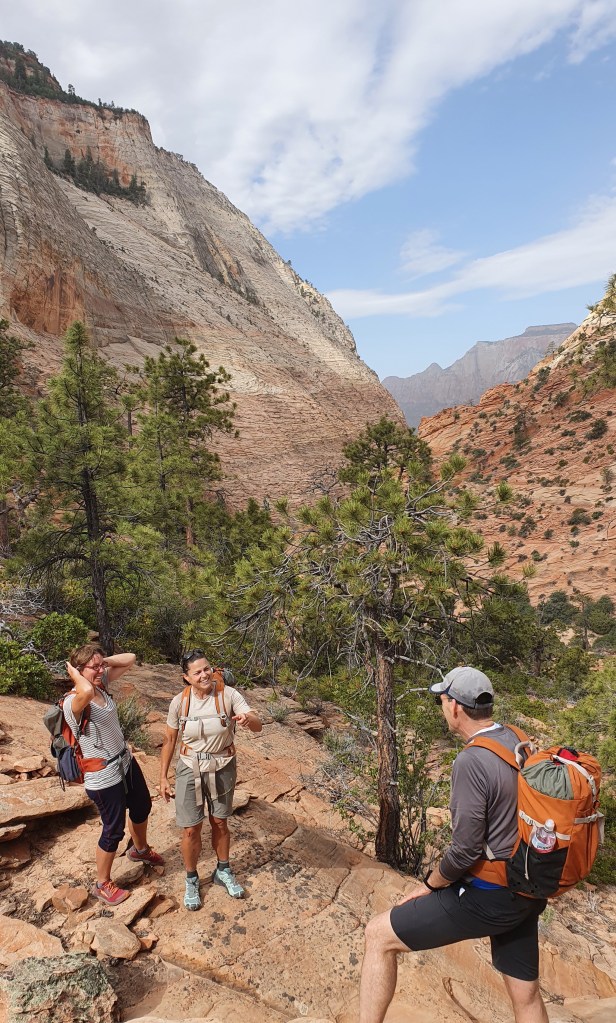
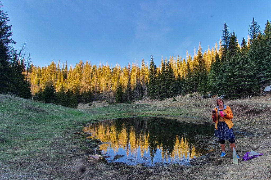
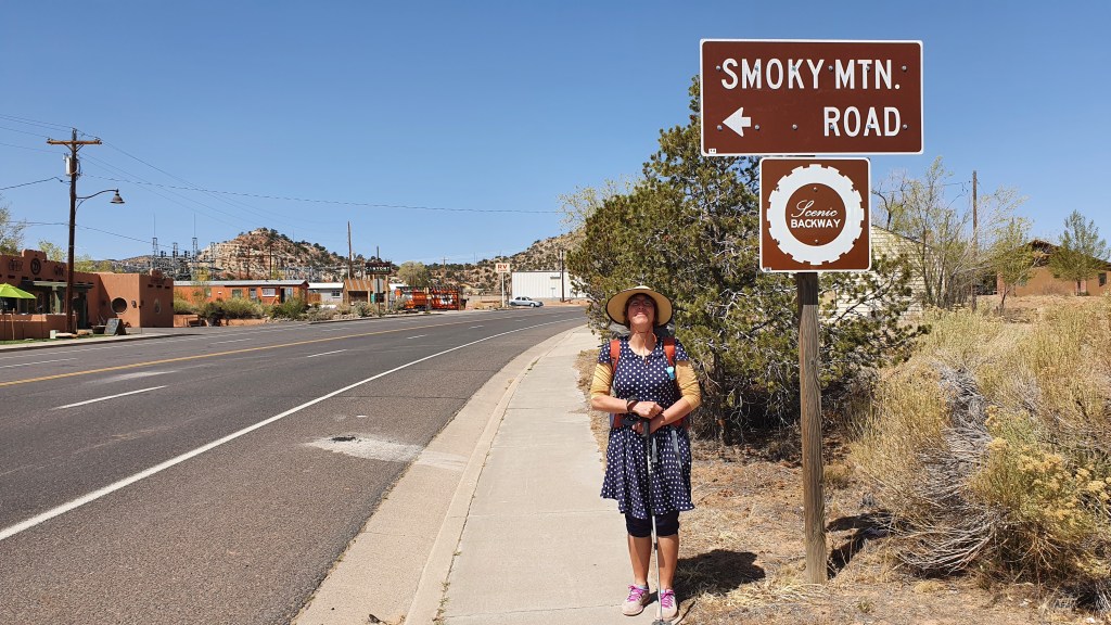
We started late at about 3pm after a long but beautiful drive from Kanab and a 28 mile hitchhike from the Gulch trailhead to Muley Twist on the Burr Trail road. It took a while to get a ride even though plenty of cars stopped for us. Some stopped to asked us if we knew where ‘Singing Canyon’ was and some stopped to tell us they were going to ‘Singing Canyon’. We hadn’t heard of it and were starting to wonder how, after all the time we spent here over the last 20 years, we didn’t know about this famous canyon. Turns out is is a very short 30 meters slot next to a layby in Long Canyon. Nice photo stop, very busy by all accounts. Eventually we got a lift to the trailhead with a Catalonian tourist (who also stopped at Singing Canyon so we got to see it!)

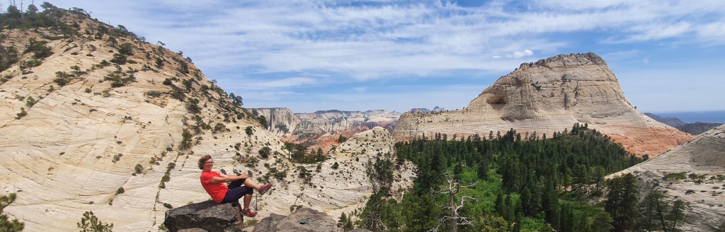
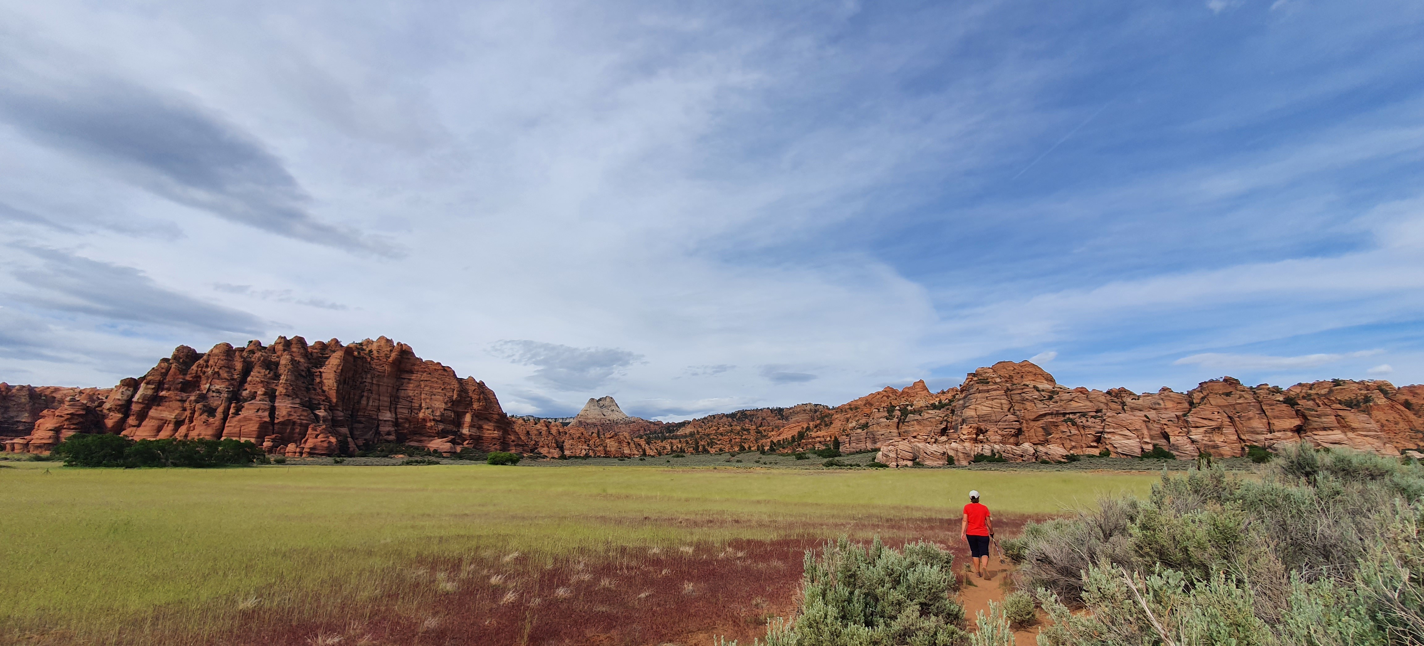
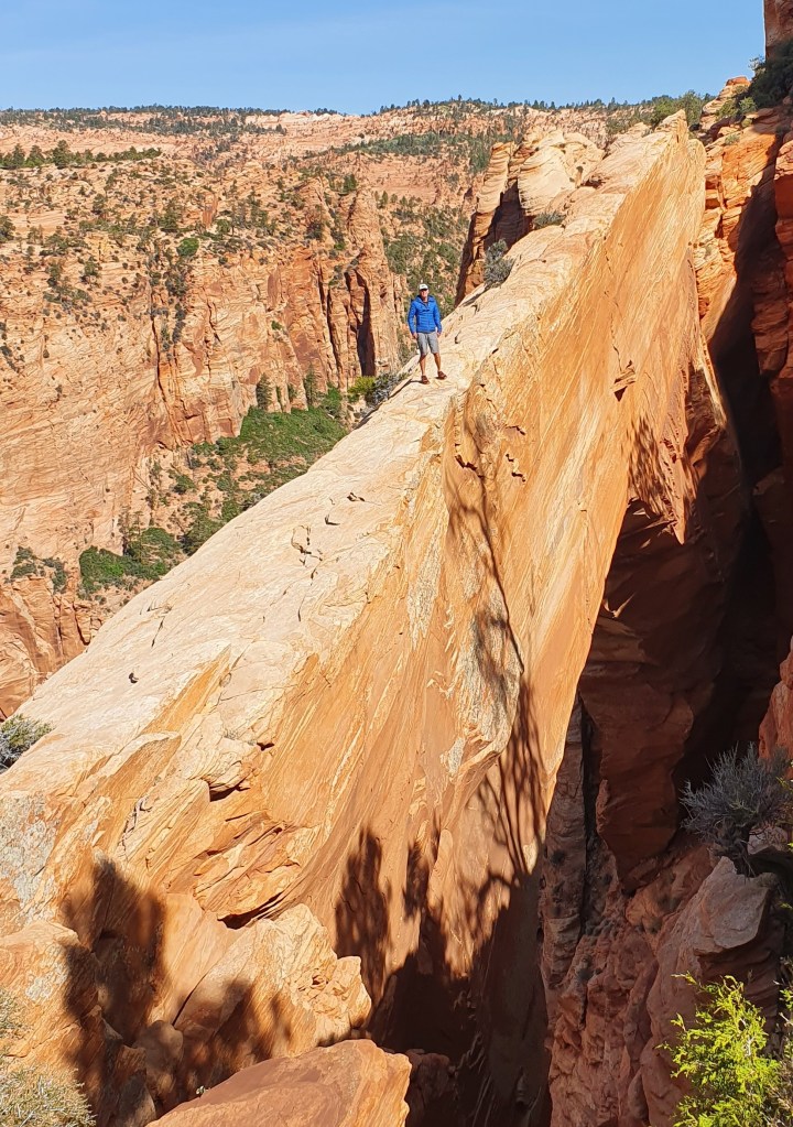
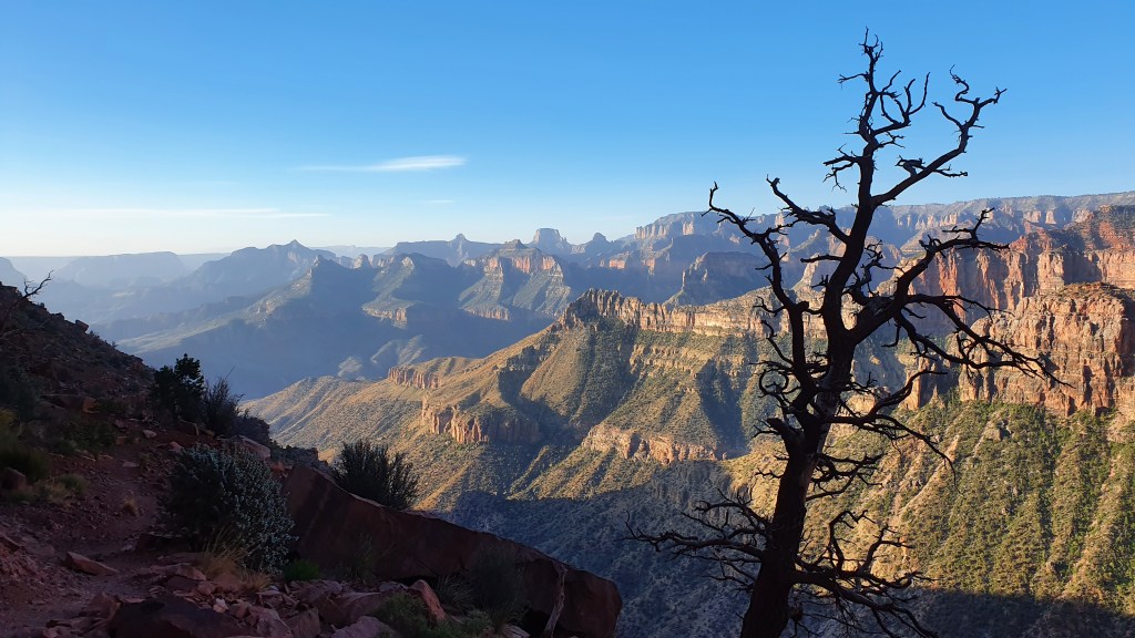
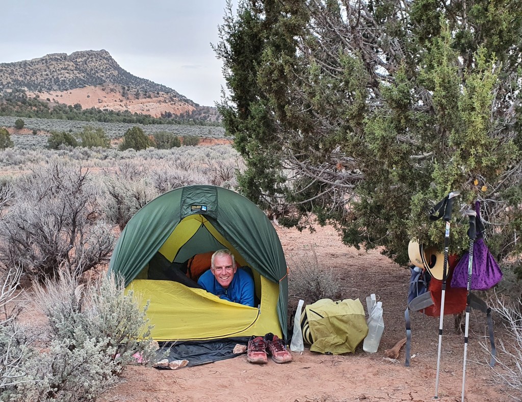
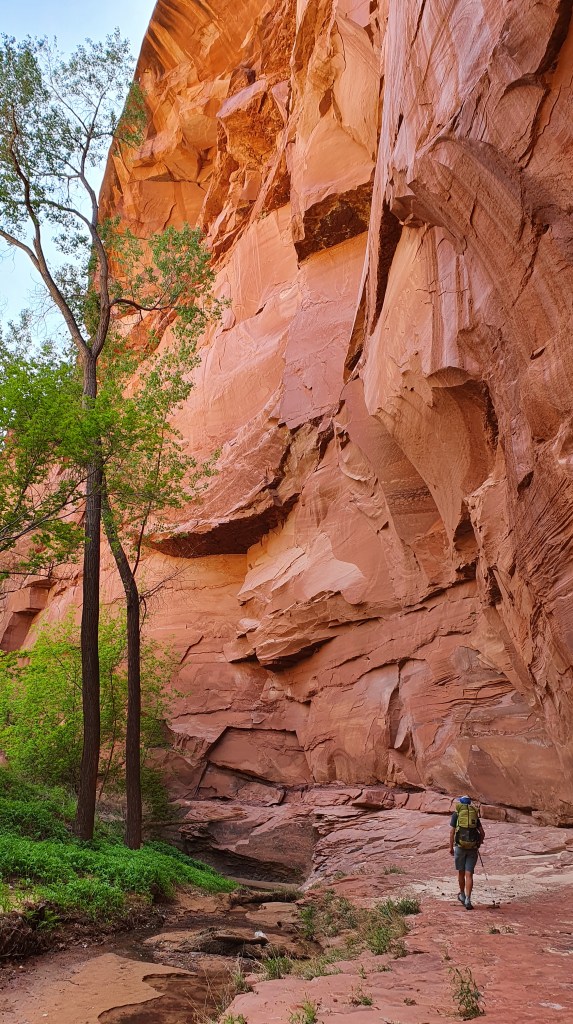
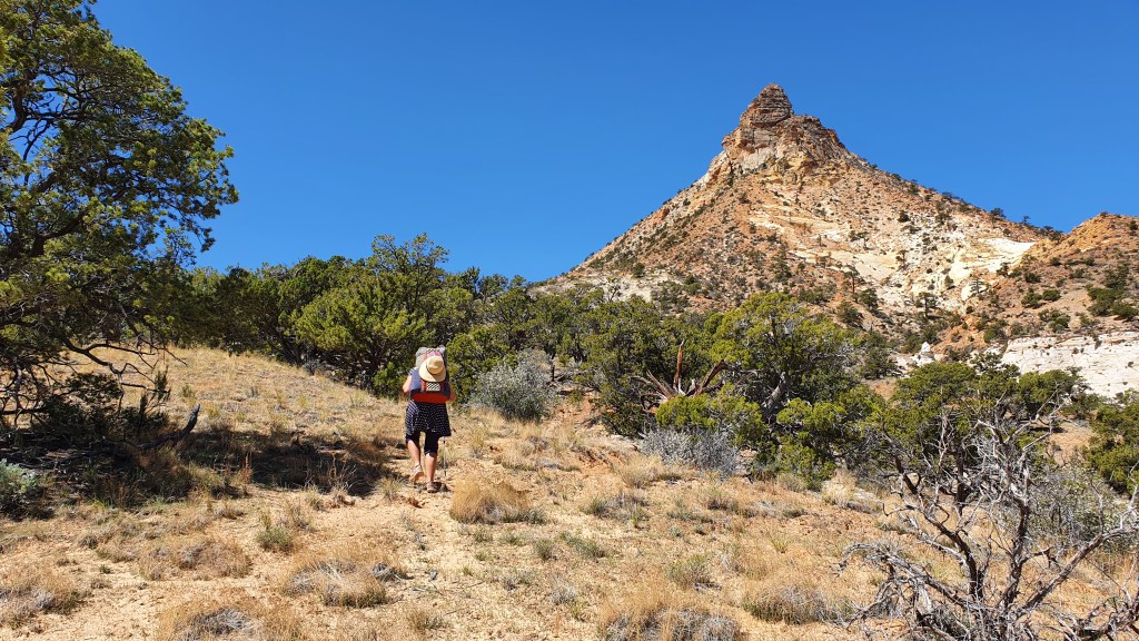
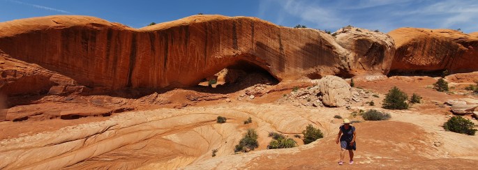
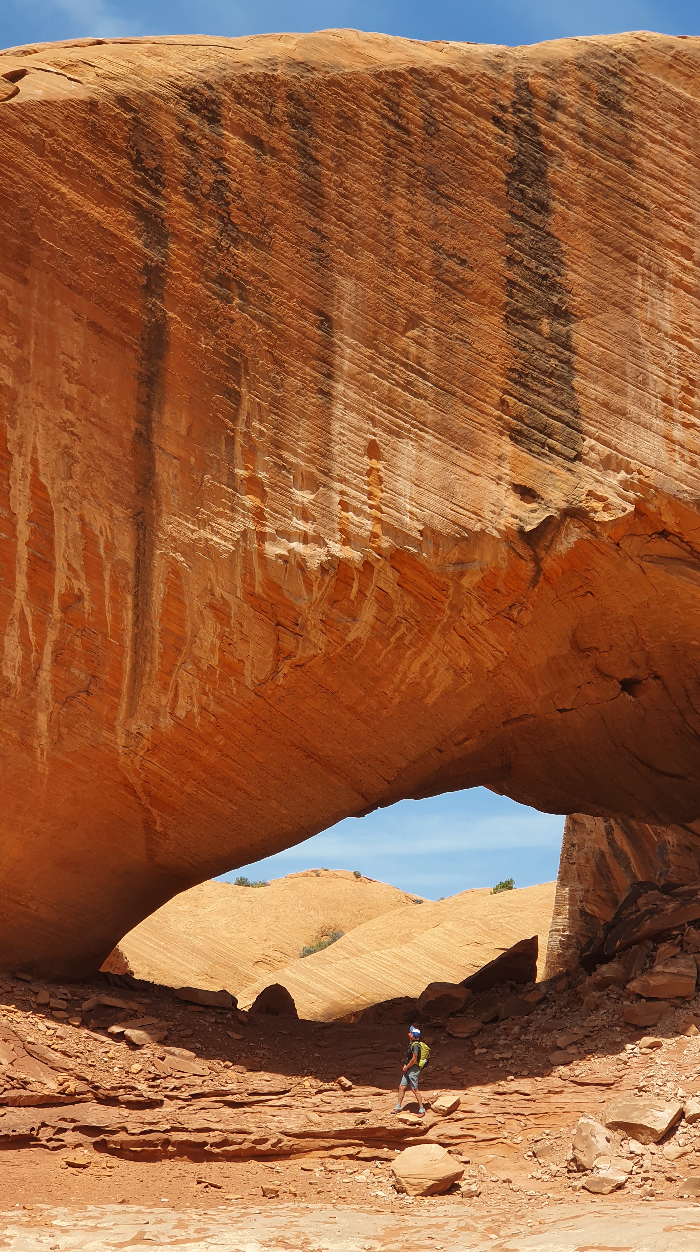
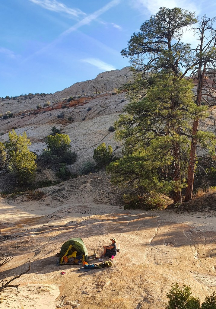
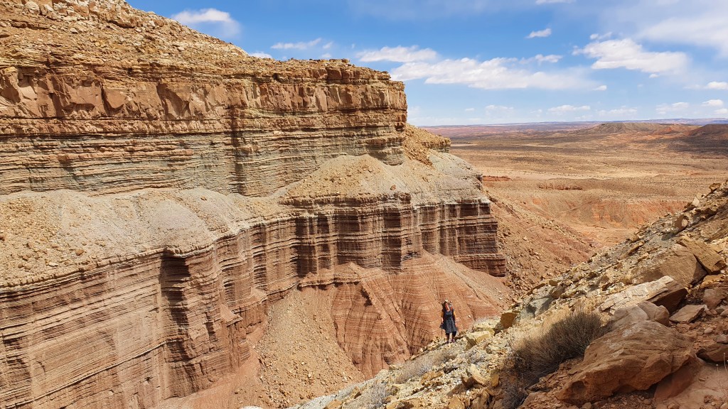
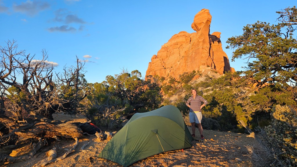
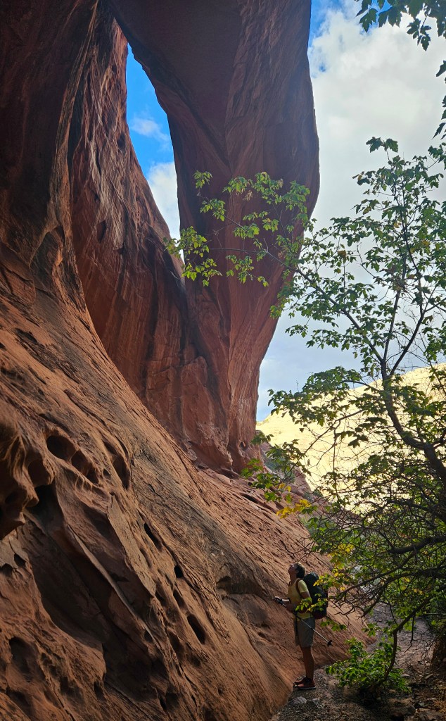
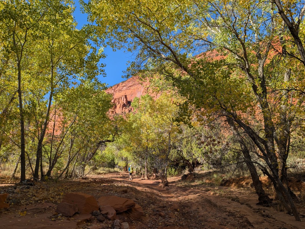
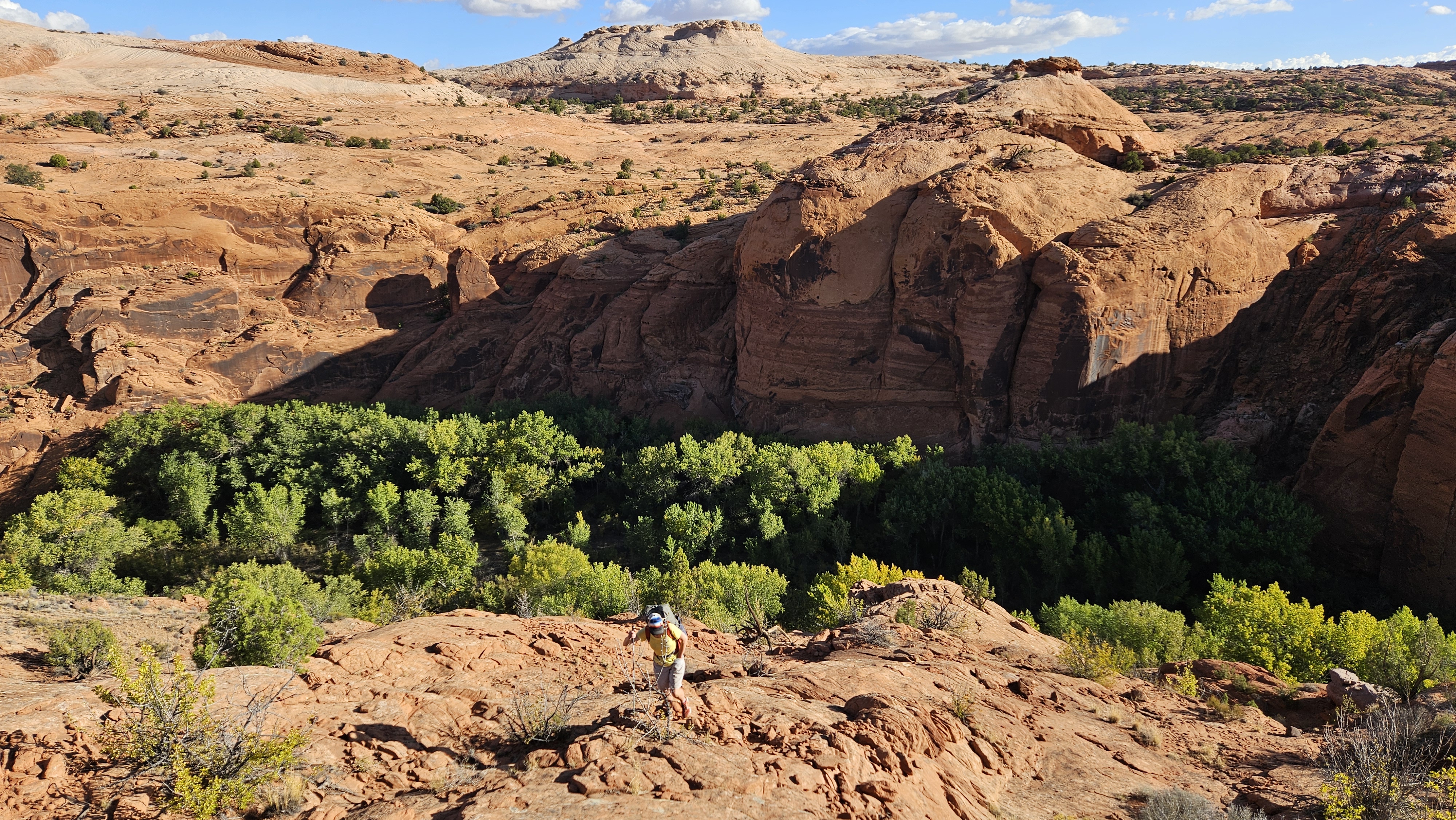
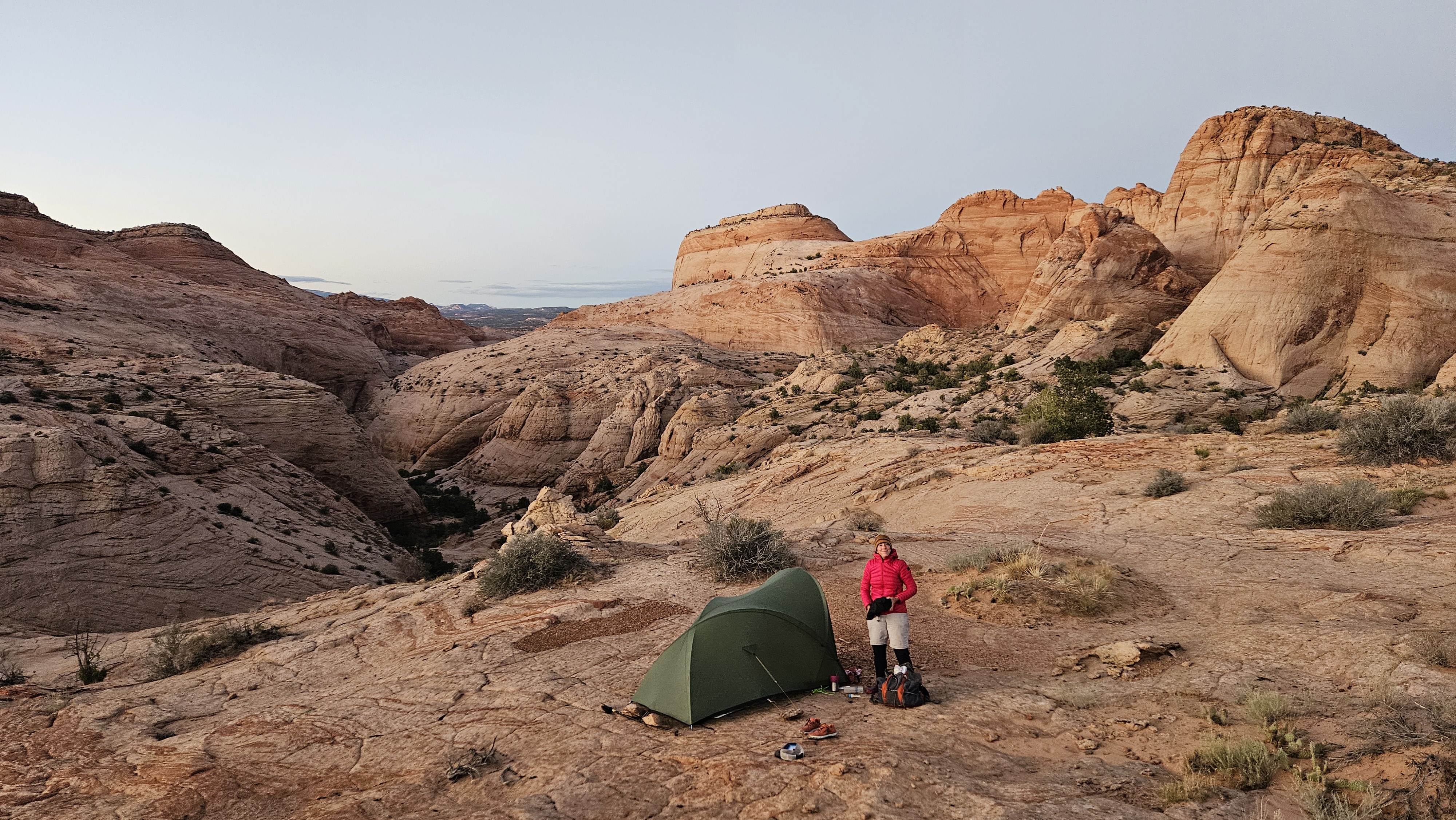
Upper Muley Twist is a valley formed in the geological wonder of the waterpocket fold within Capitol Reef National Park. Here the usually horizontal layers are tilted steeply up and it is crawling with sandstone arches. Easy walking took us to Cap Arch, where we split west to head up a side canyon with some fun short scrambly sections around boulders to find a camp at a viewful saddle. A great short first day to get rid of those jetlag blues.

Day 2 Circle Cliffs – the Lampstand (spoiler: it looks nothing like a lampstand)

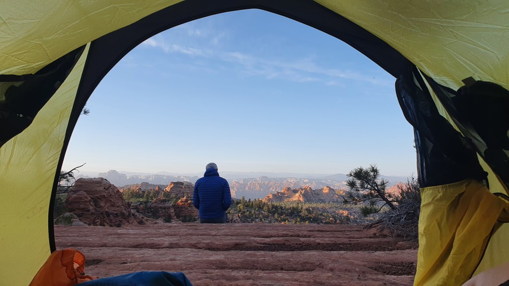
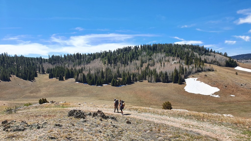
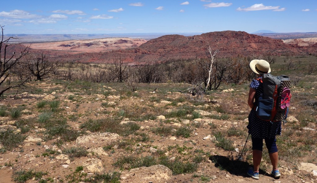
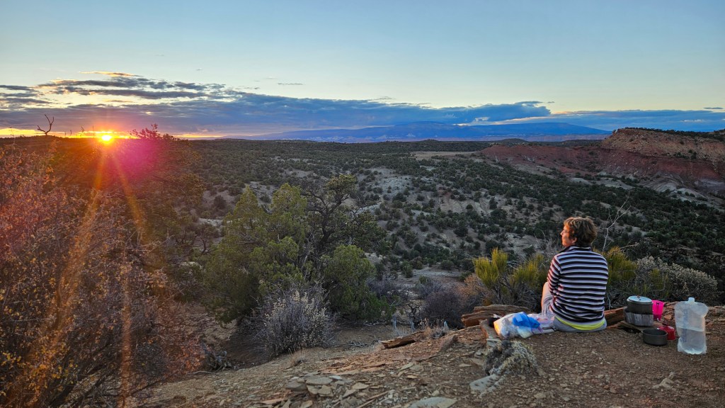
That first camp established a high standard for the rest of the hike with panoramas east to the Henry Mountains and west over the red Circle Cliffs to the golden aspen tinged plateau of Boulder Mountain.

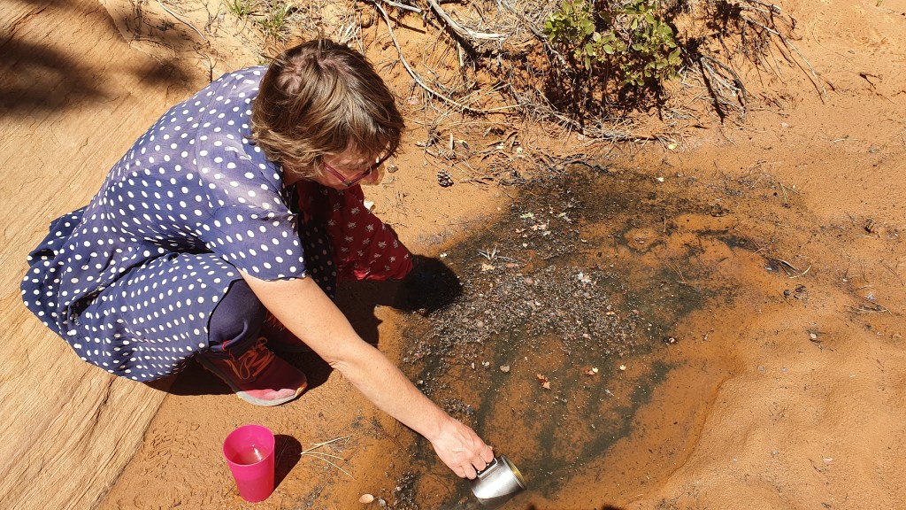
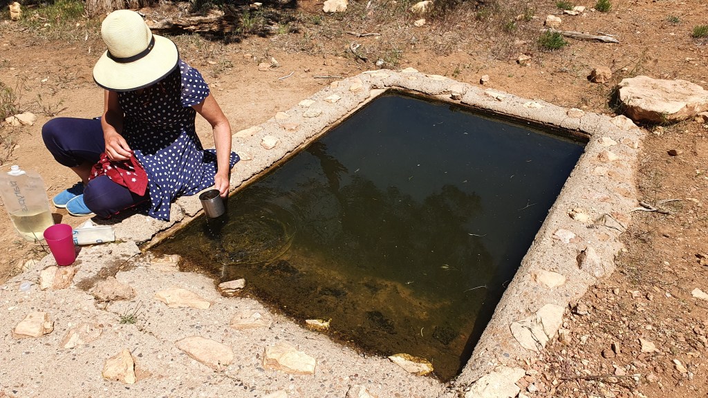
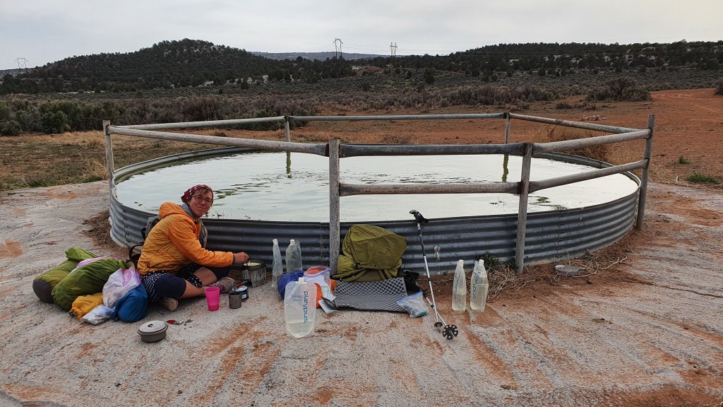
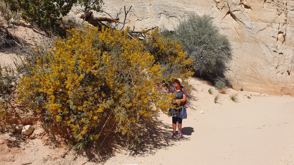
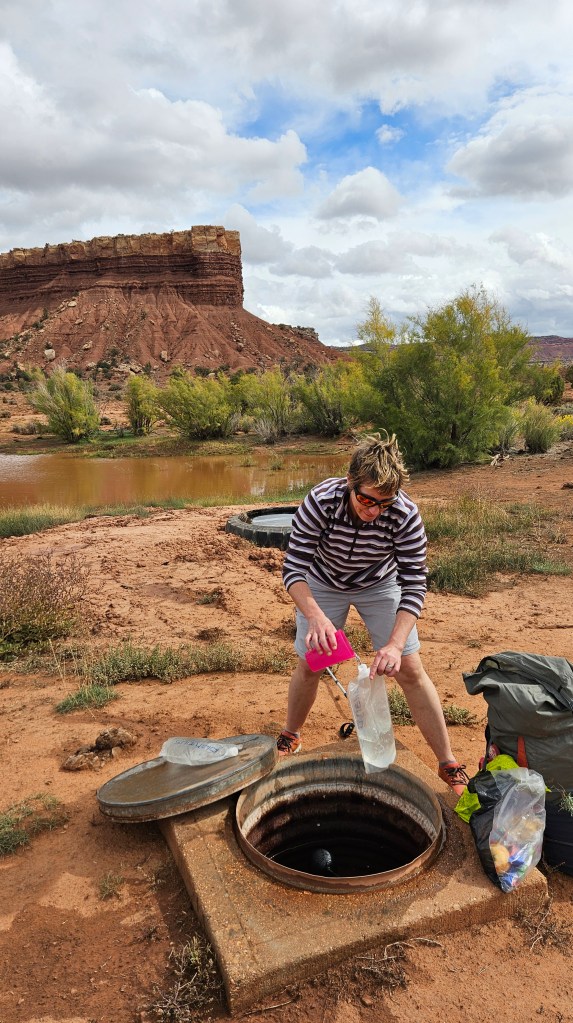
Setting out from there, we had a bit of cross country up and down hard shale slopes onto a plateau which bore all the hallmarks of being used for cattle farming for the past 100 years. Ranching means water and we were going to rely on water from ‘The Onion Beds’, a couple of pools (enhanced by ranchers) with variable water supply. This time of year, the cows had gone on to better things so we were hopeful about the water but the recent rain had muddied the ponds to a bright orange. We took 6 liters with us anyway (never reject water in the desert) and followed jeep tracks north through pinyon juniper, sandy washes and gravelly plain towards the “Lampstand”.

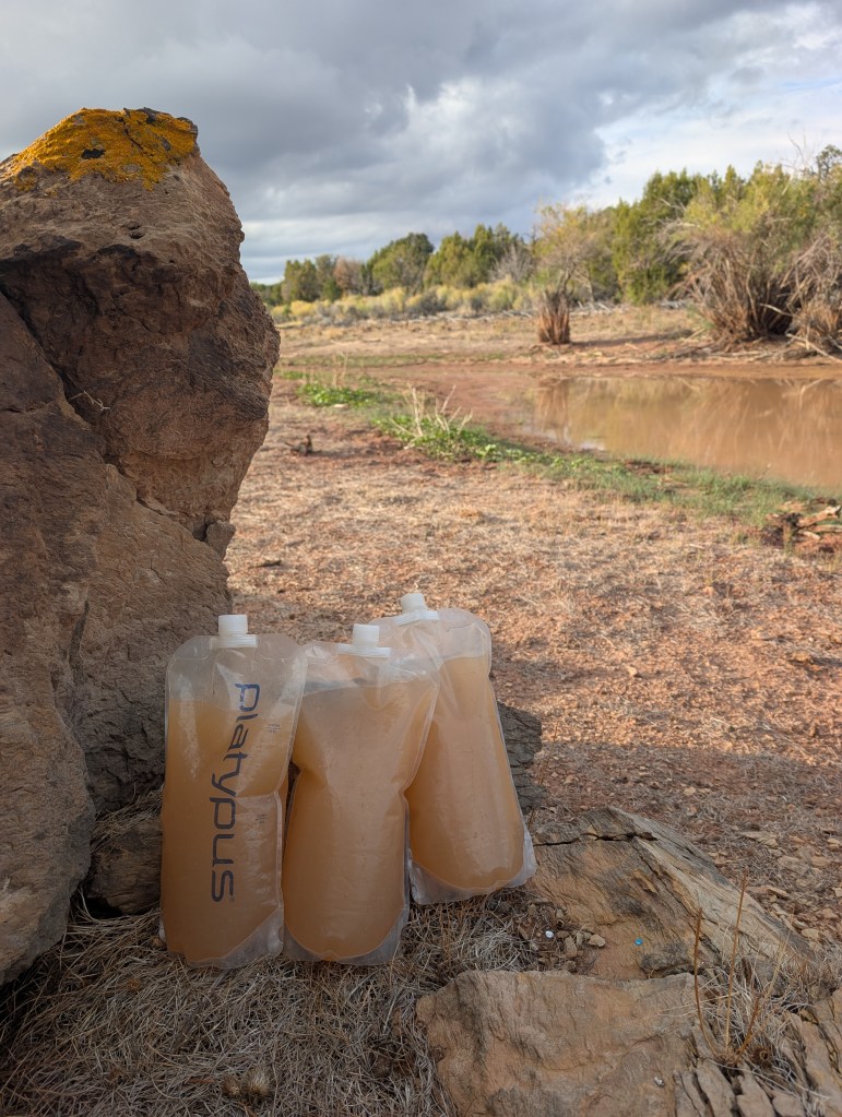
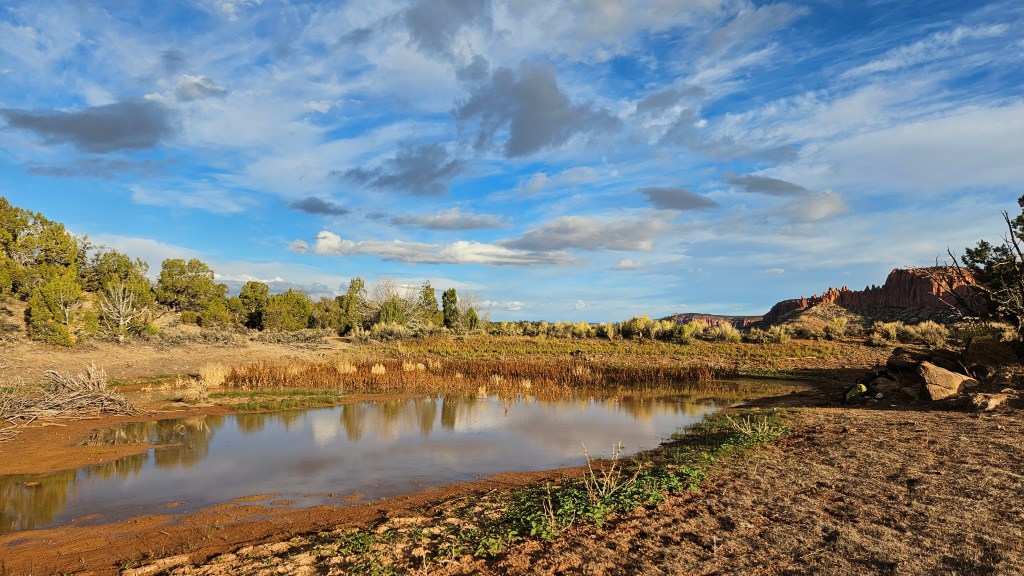
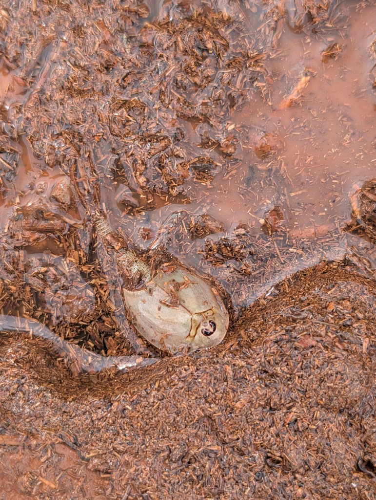
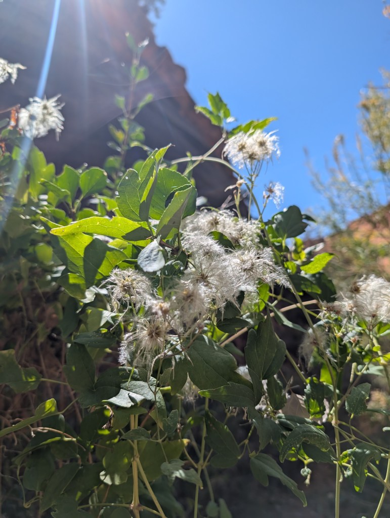
Lucky for us the ranchers had put in a new, spring fed water supply near the Lampstand and we didn’t have to drink the Onion Beds water after all. Next to the covered spring was another stock pond (cow spa). The recent rains had filled this up with plant debris as well as water and there was a writhing mass of sinister looking little animals on the edge of one of the ponds. Turns out they were tadpole shrimps, a species that has been around 220 million years or so, since the dinosaurs. They are famous for being able to survive long periods of desiccation, an evolutionary marvel …but still quite creepy.

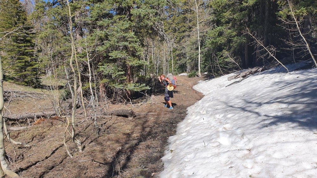
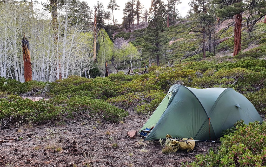
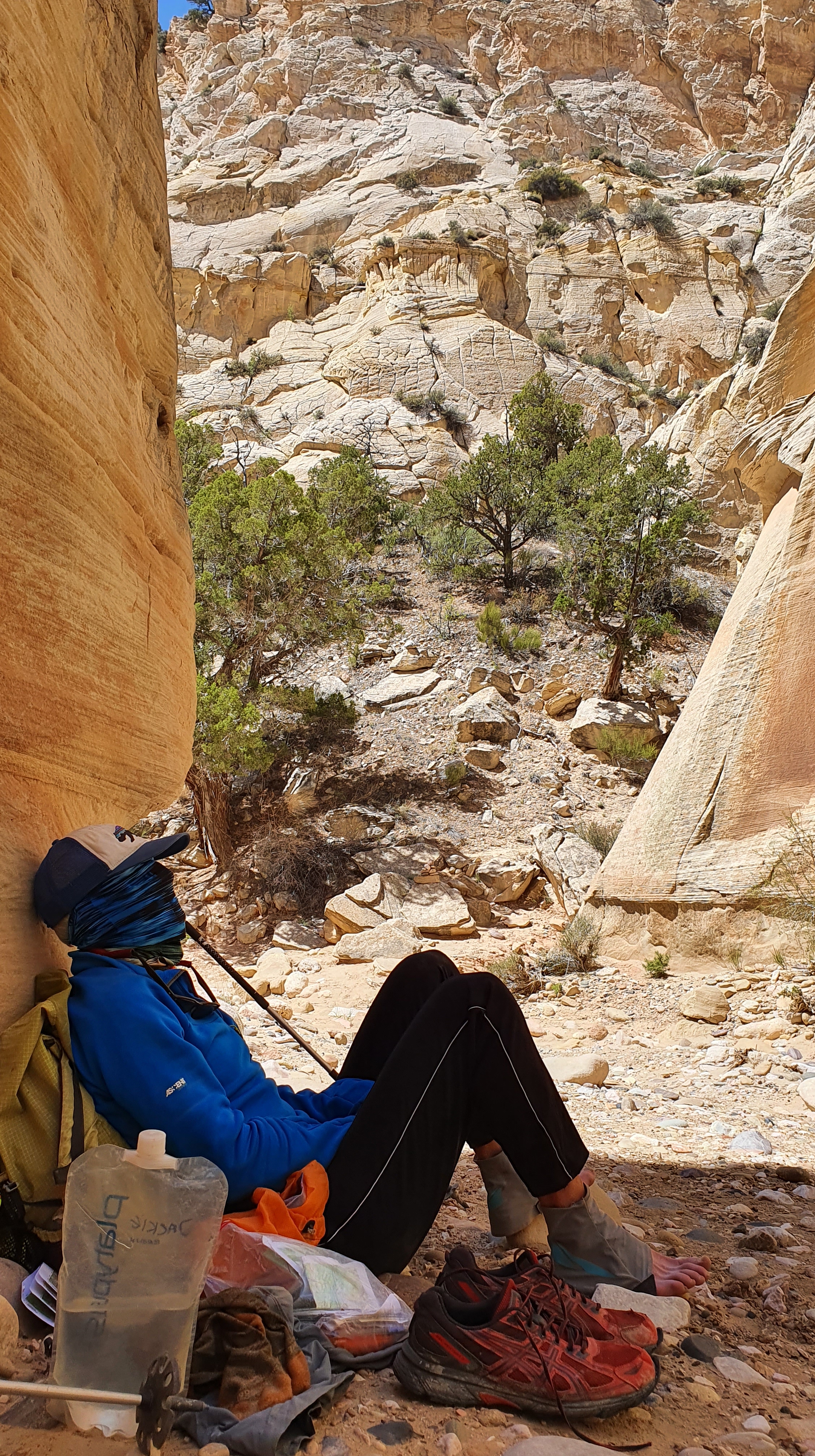
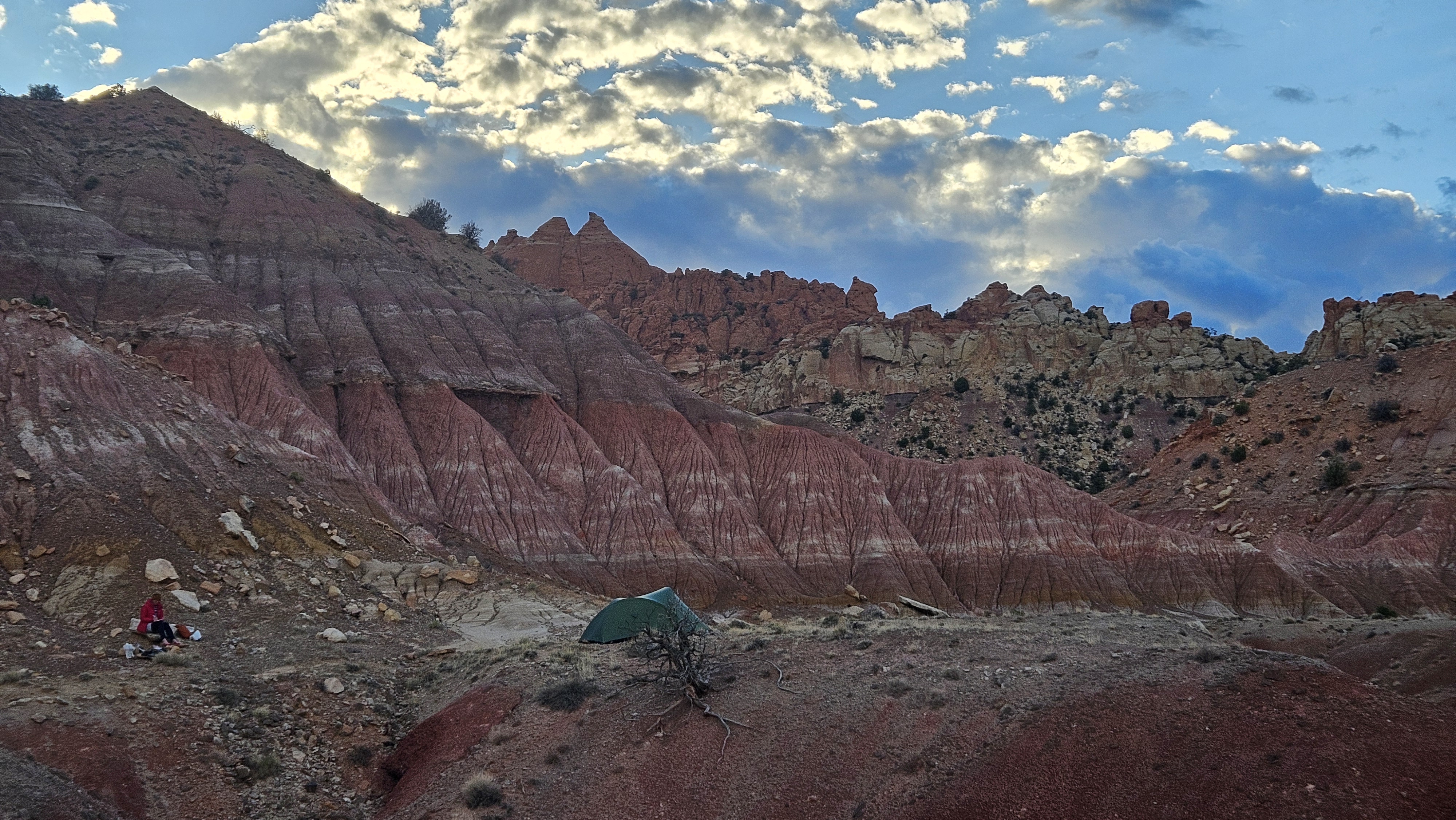
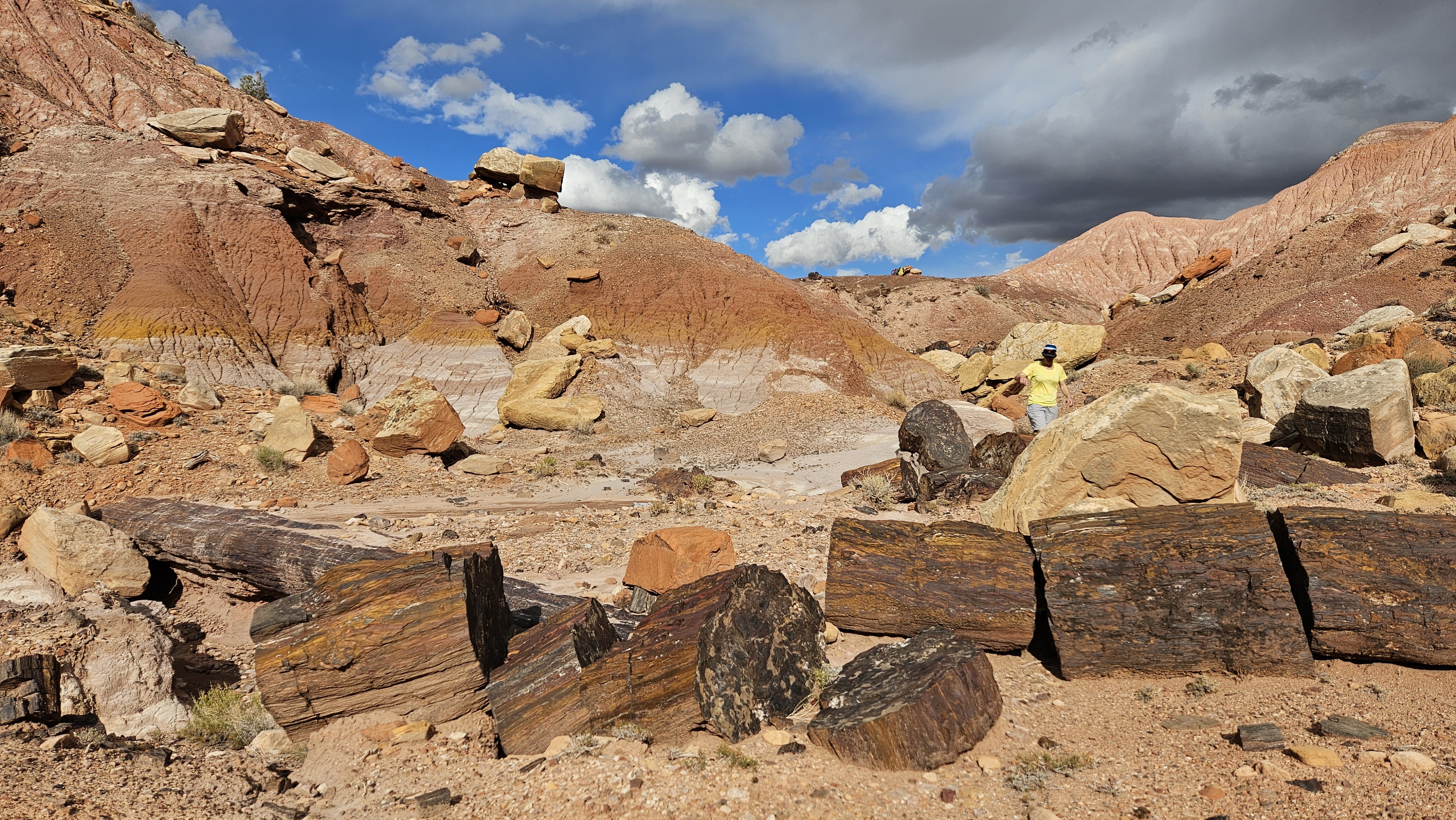
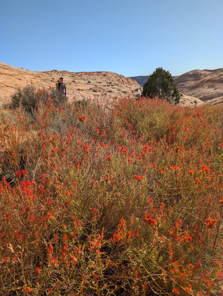
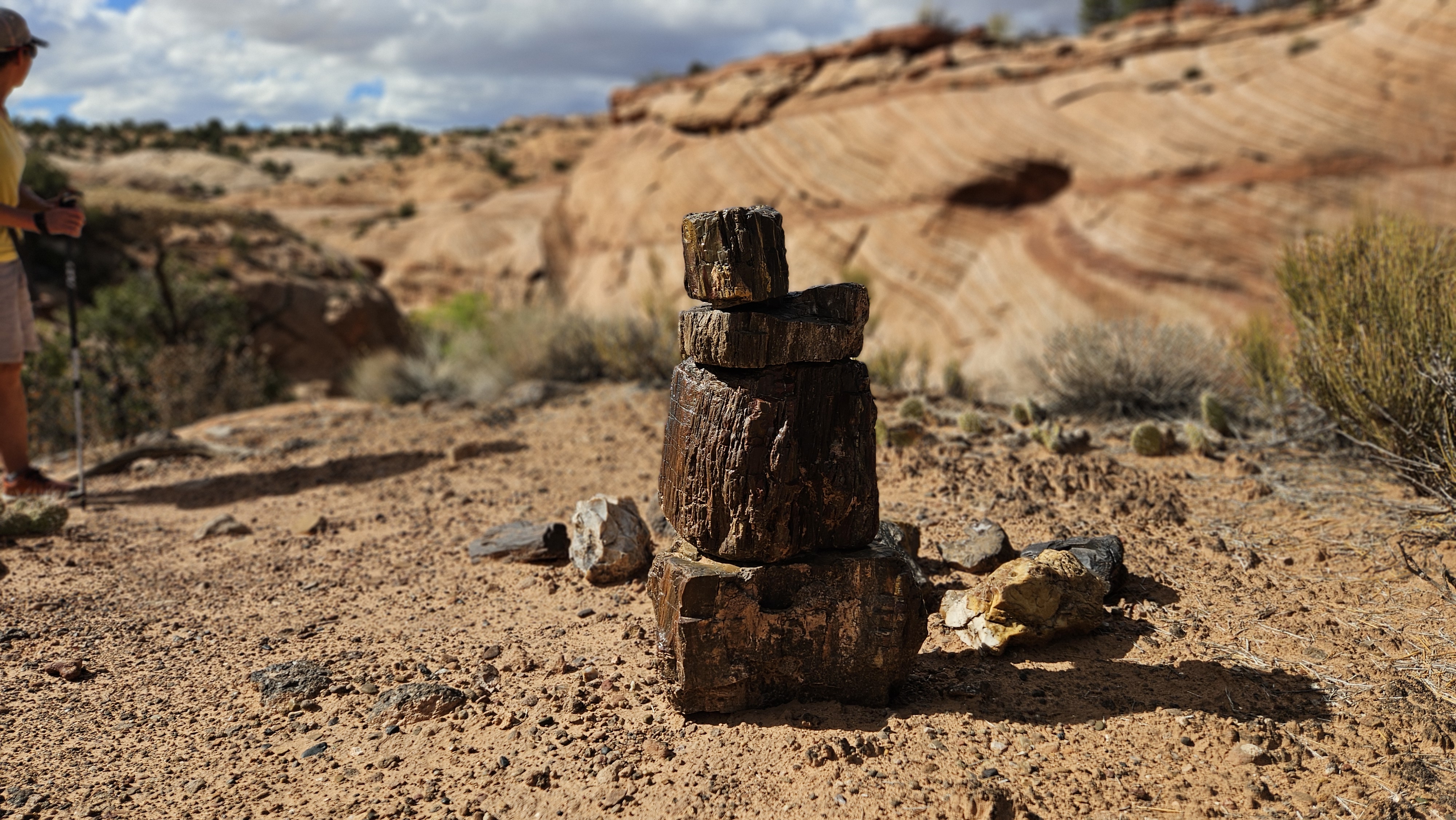
A few brief showers kept the air cool and clear as we climbed a little through colourful Chinle rock on old mine tracks to camp at ‘Pink Pass’ above Egg Canyon. There were incredible petrified (fossilised) trees nearby and the whole area was a vivid technicolour delight.

Day 3 Egg Canyon and The Upper Gulch

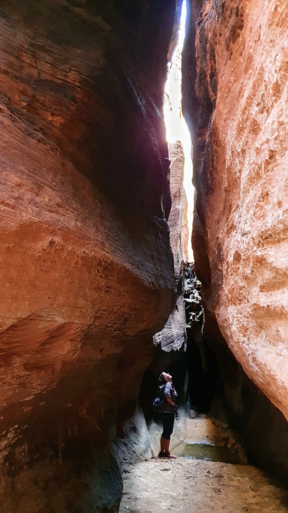
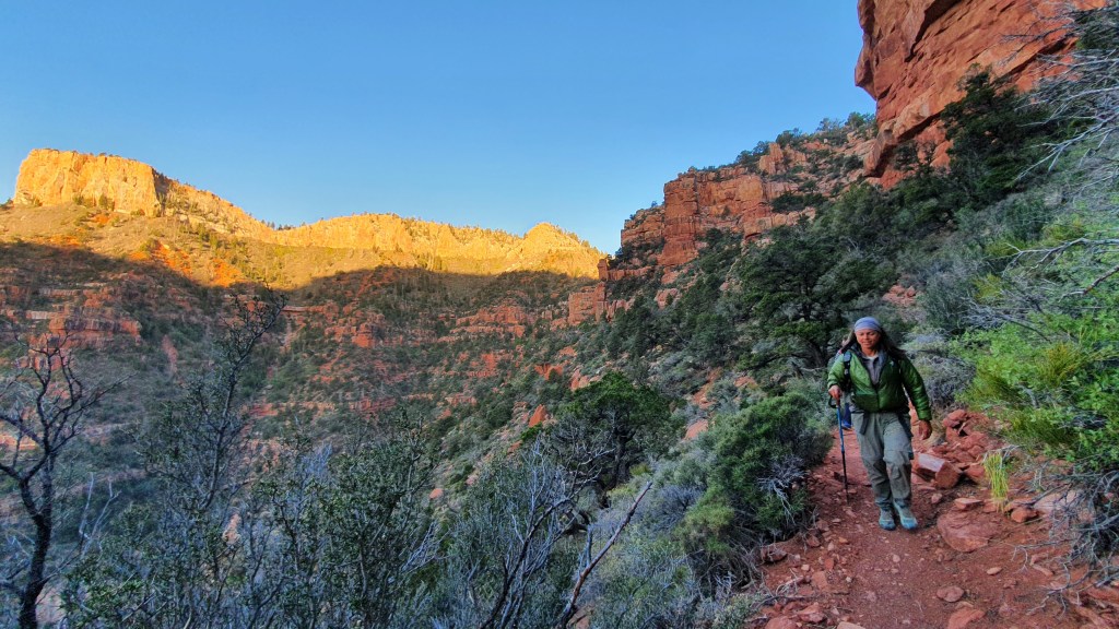
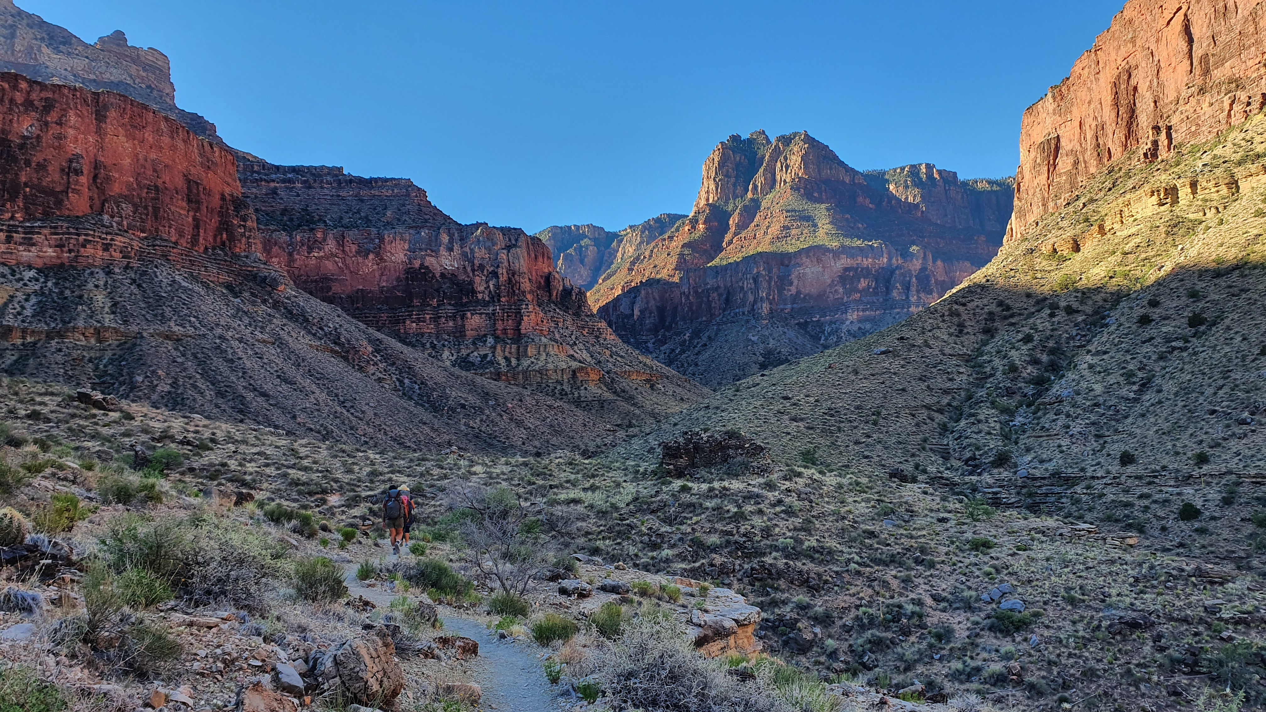
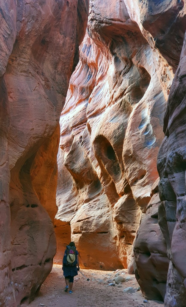
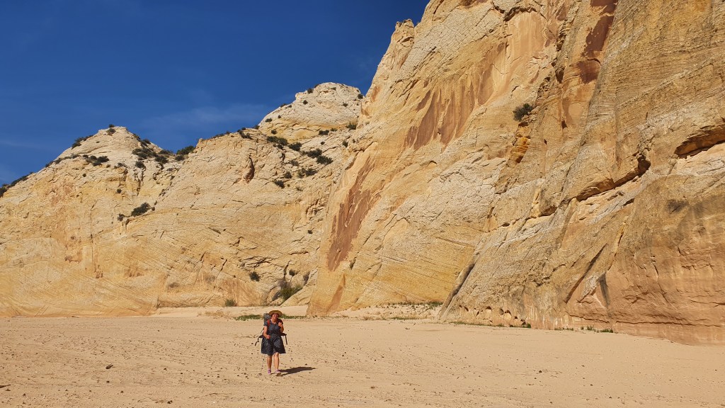
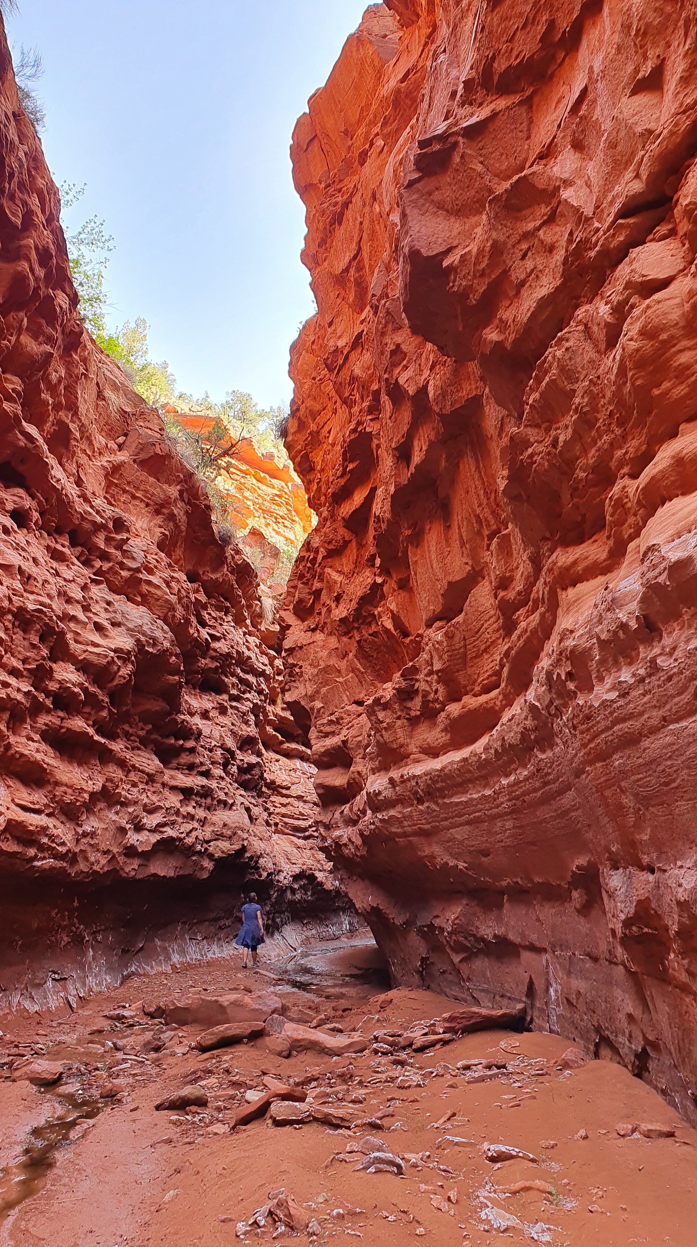
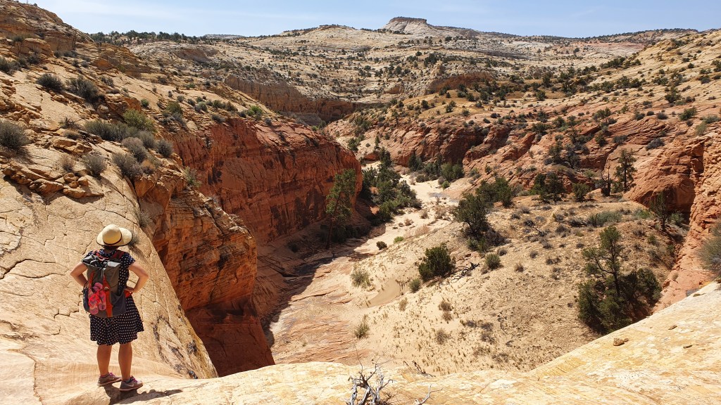
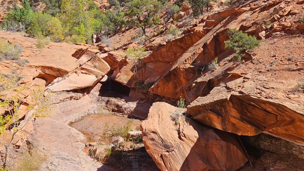
Egg Canyon in the morning provided a mellow, meandering walk down through purple and blue Chinle rock layers that looked like velvet in the glow of the light reflected into the canyon from the orange Wingate cliffs above. The canyon widens after a junction with the Gulch from the North, cottonwood trees come in and the well-named Water Canyon joining from the west was delivering a clear stream of water out of its grassy(!) mouth. From there the waters flowed down The Gulch all the way to the road bridge including a tranquil waterfall at a narrows with attendant dragon fly (there seems to be one at every pool this time of year).

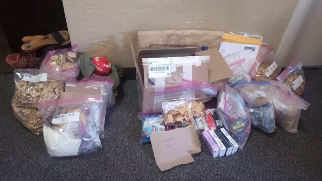
Arriving at The Gulch TH and our car, we saw the first hikers we had seen since just after our start at Upper Muley Twist. Being short on food and needing to plan our next few days, we chose to drive back to Escalante town, resupply and return the next day to continue our hike southwards. Altogether this was a really enjoyable hike mixing tracks with cross country and loads of scenic variety.

Day 4 The Gulch -Slickrock and Boulders

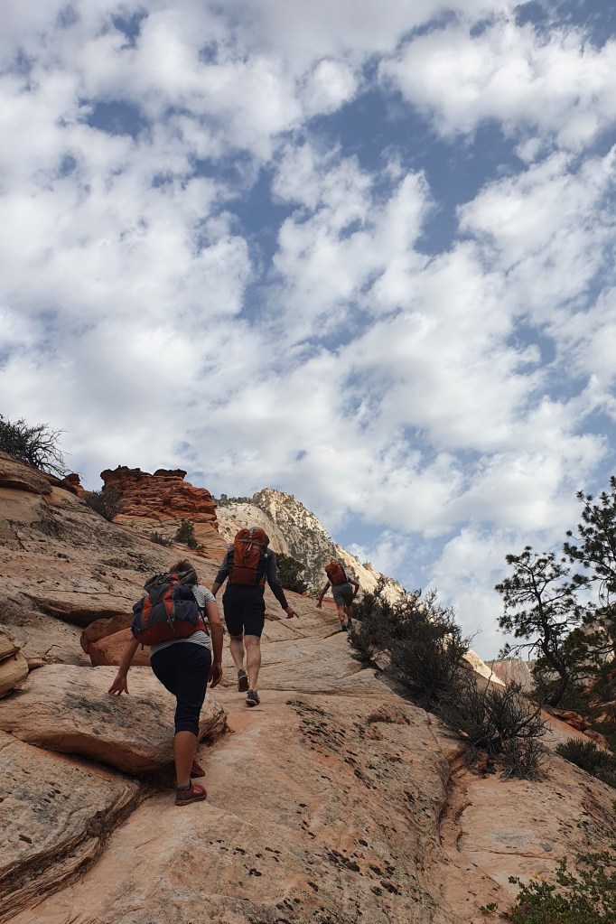
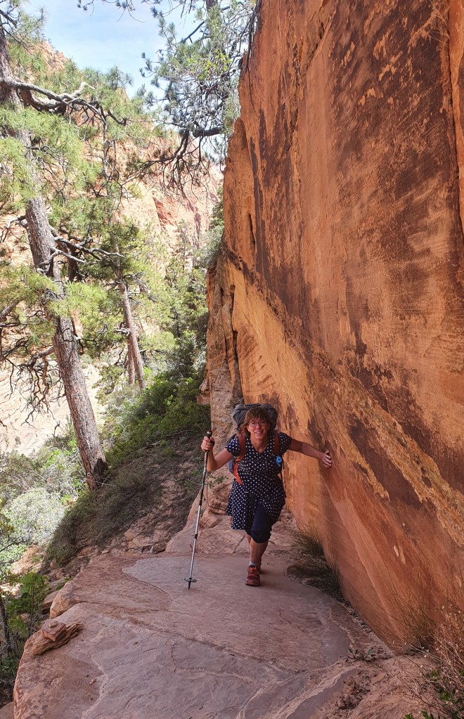
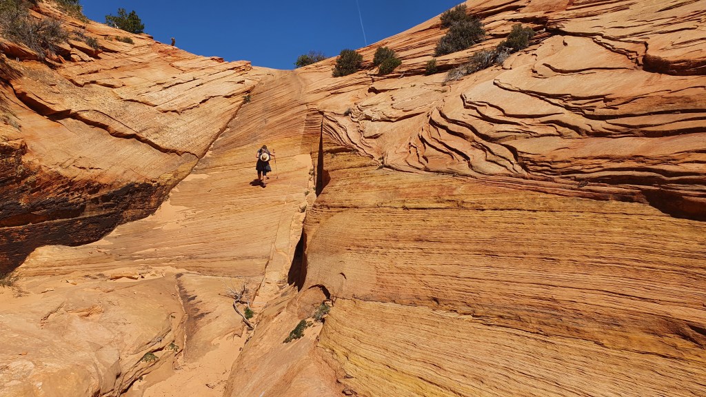
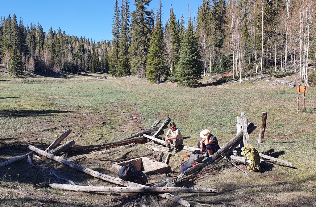
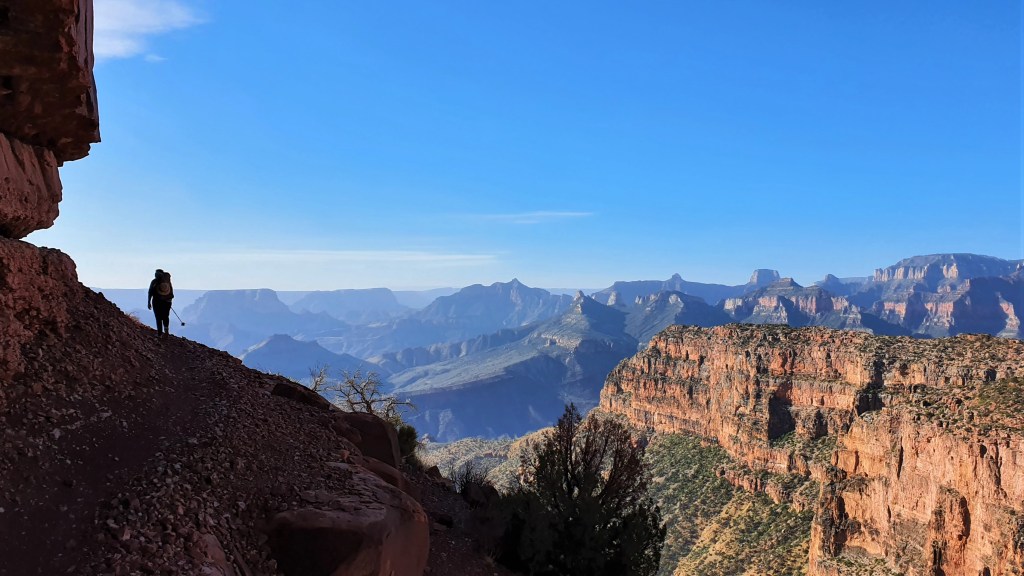
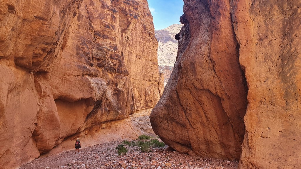
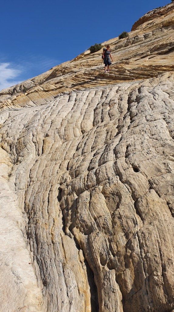
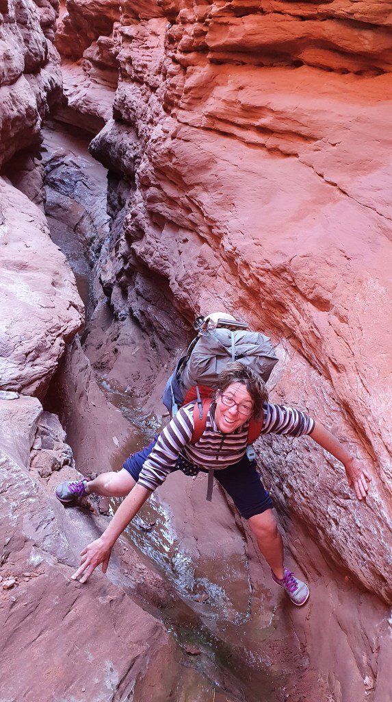
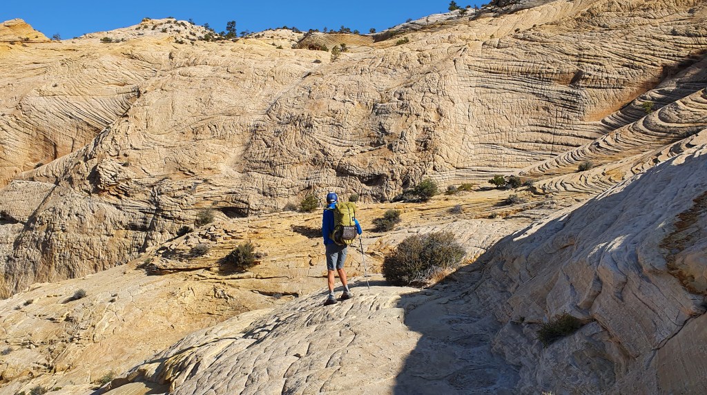
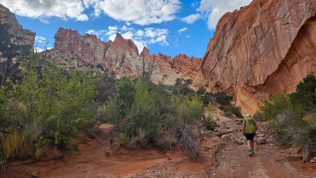
Back at the Gulch TH, we aimed to climb straight up some broken cliffs to allow us to traverse ridges and washes between the lower Gulch and Deer Creek to the west. We spent time zig-zagging around ledges to find a way up through the rock layers, splitting up to search in different directions. Eventually we found a scrambling way almost straight above the trailhead onto a small sandy dome with panoramic views over the surrounding canyons and hills (this would be trickier to do if descending down in the other direction).

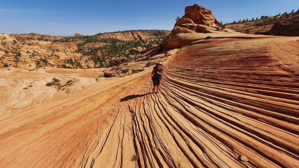
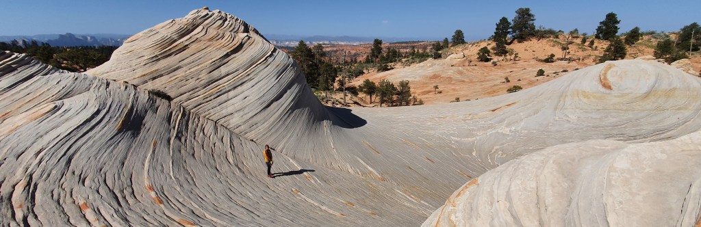
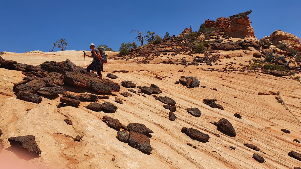
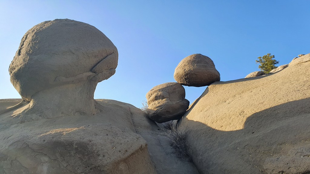
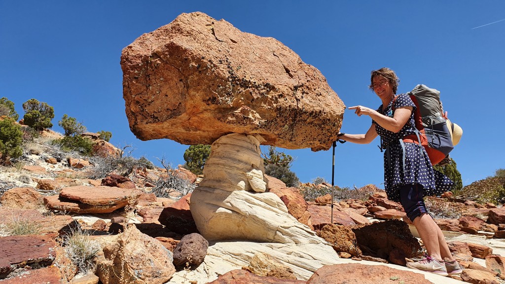
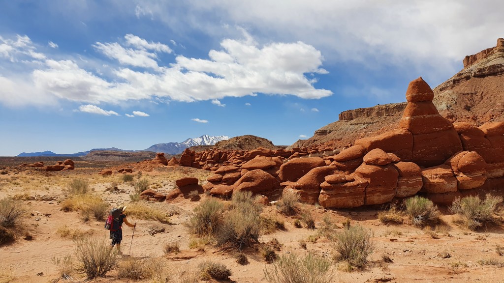
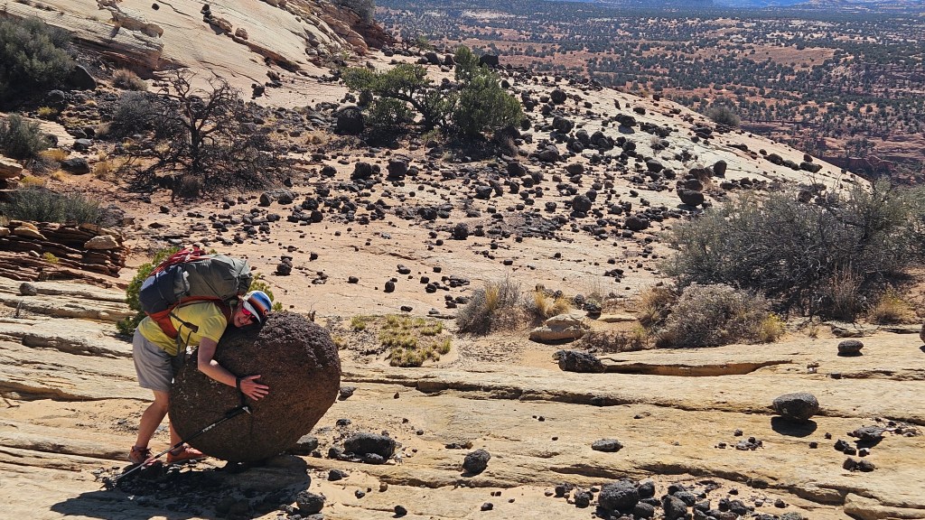
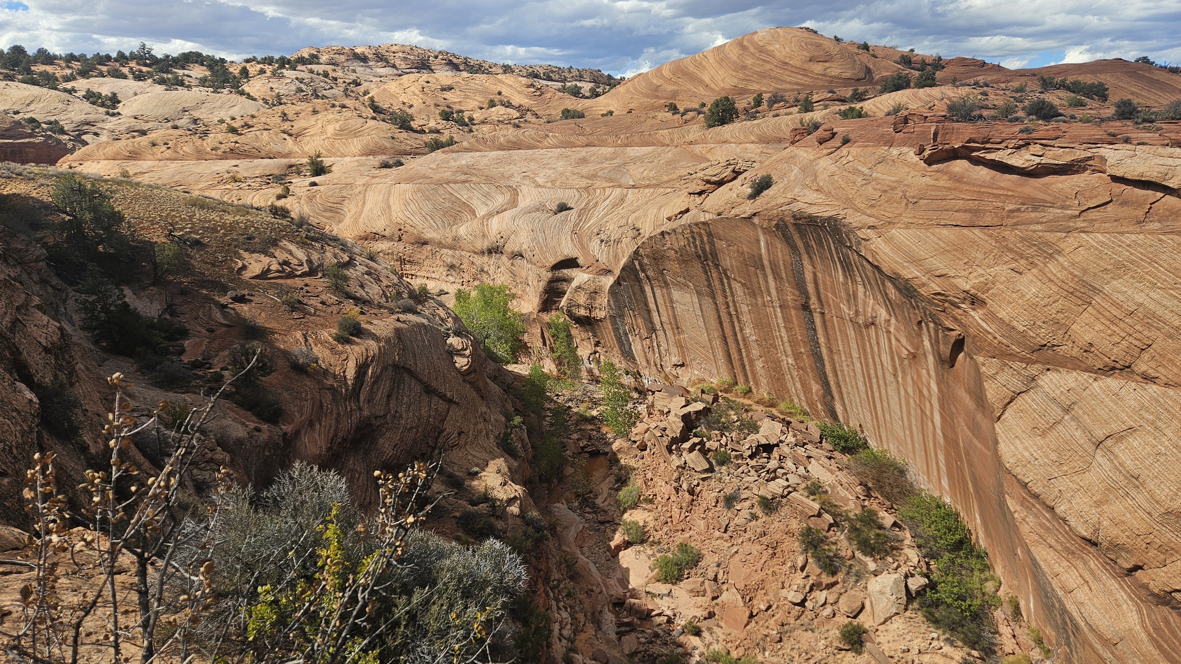
We were able to continue following the high ground on lovely rocky slabs (slickrock), dotted with rounded, black, volcanic boulders (guaranteed to put a smile on your face) before descending to cross a small canyon dip called ‘Sand Holler’.

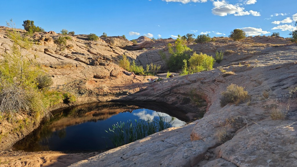
Heading south west we found a few large potholes of water along a drainage dotted with Ponderosa pine before reaching a scenic, slabby saddle (we had camped here and scrambled up the peak to the north in 2017). This time we wanted to climb a steeper set of slabs south following an alternative route described by Steve Allen in Canyoneering 2 ‘for the slickrock aficionado’.

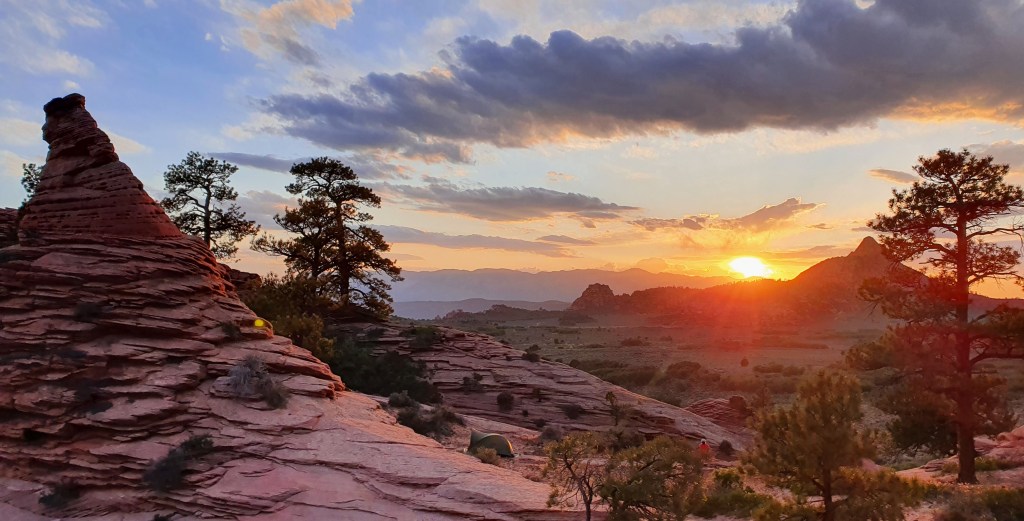
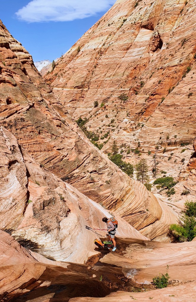
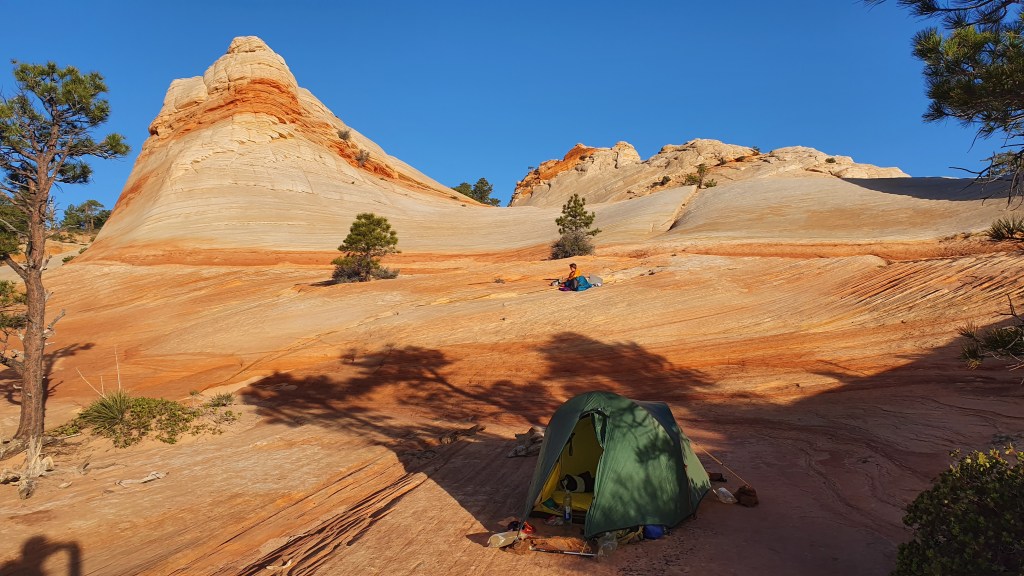
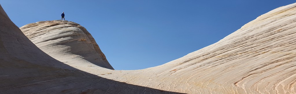
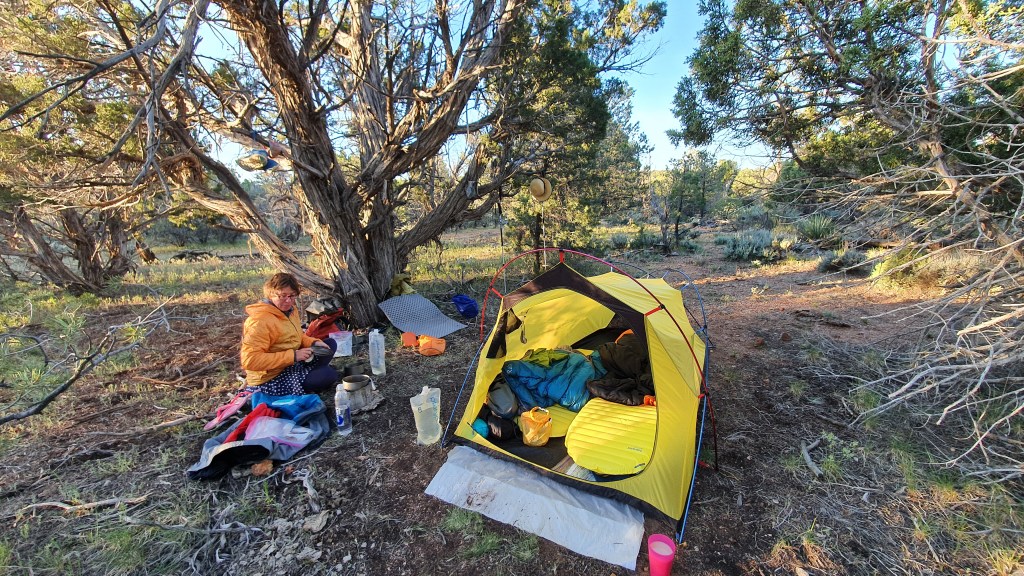
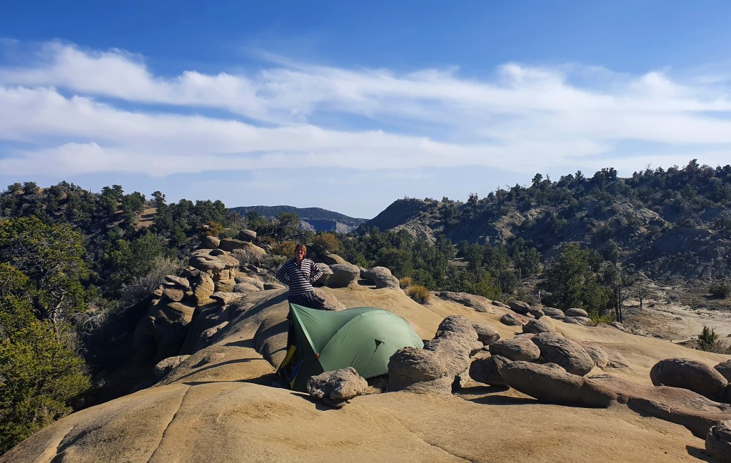
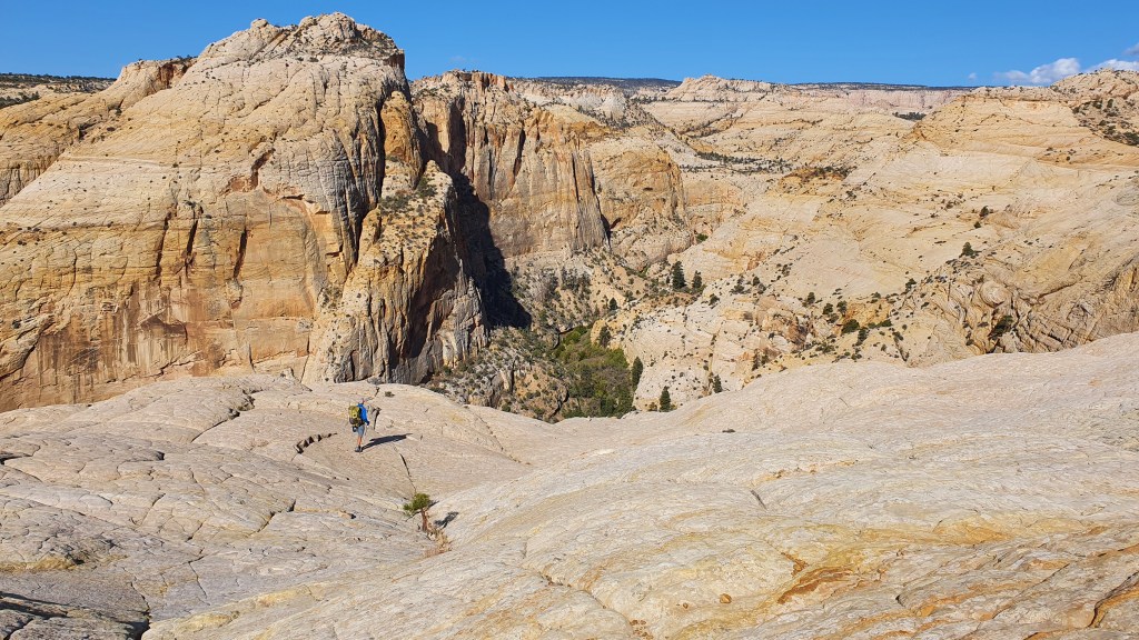
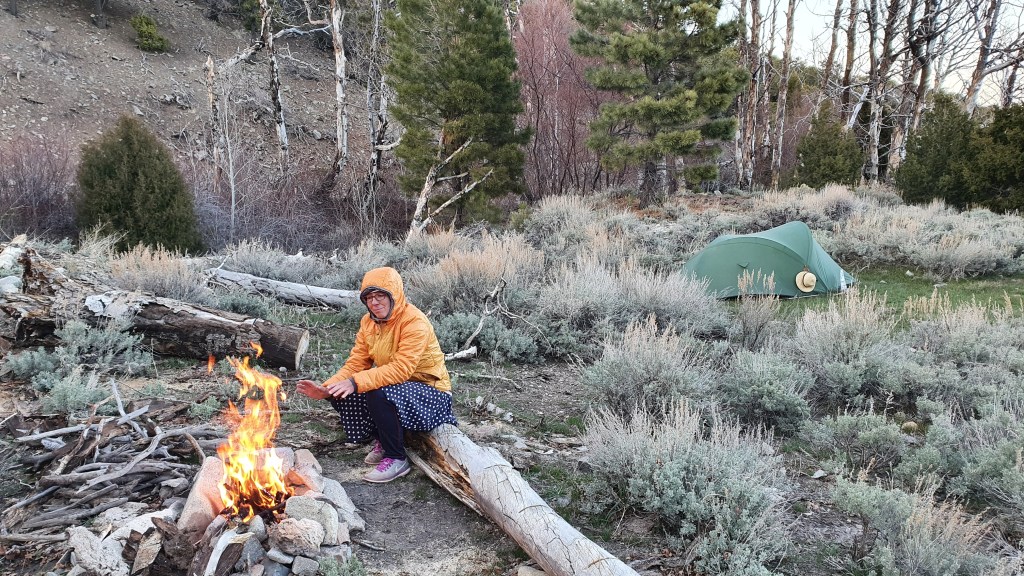
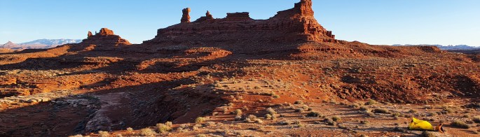
The initial climb felt a bit ‘out there’ though on a huge expanse of slabs and we had a bit of back and forth-ing to find a line of least resistance. Once up, we dropped at a lesser gradient into a unnamed valley system of rock slabs and water potholes to camp.

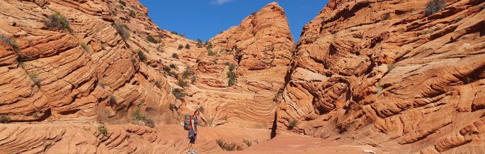
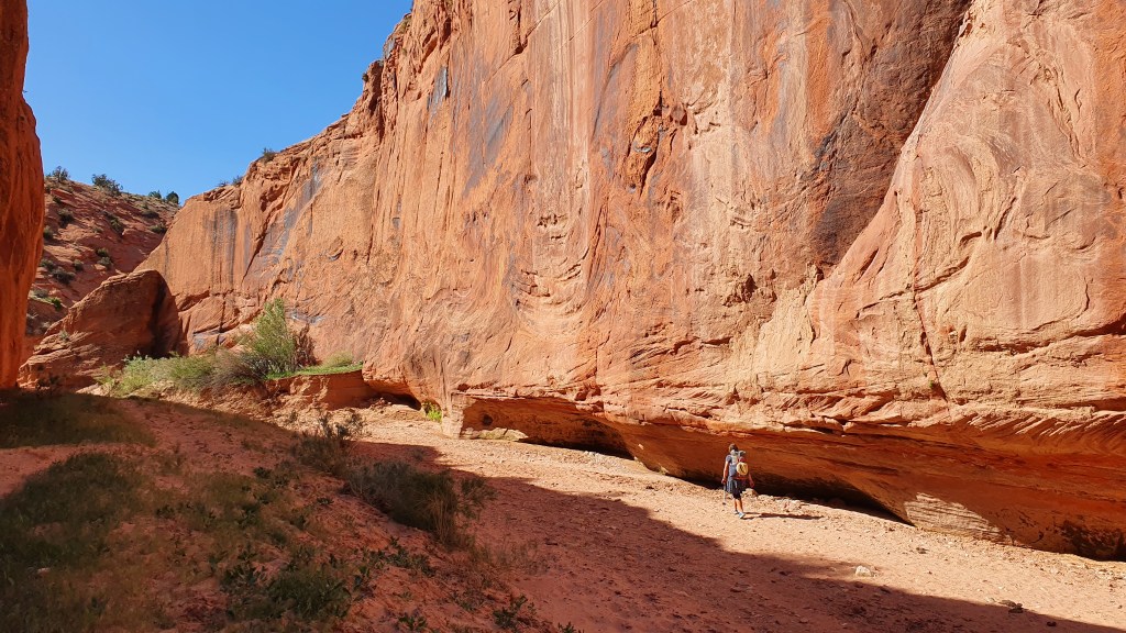
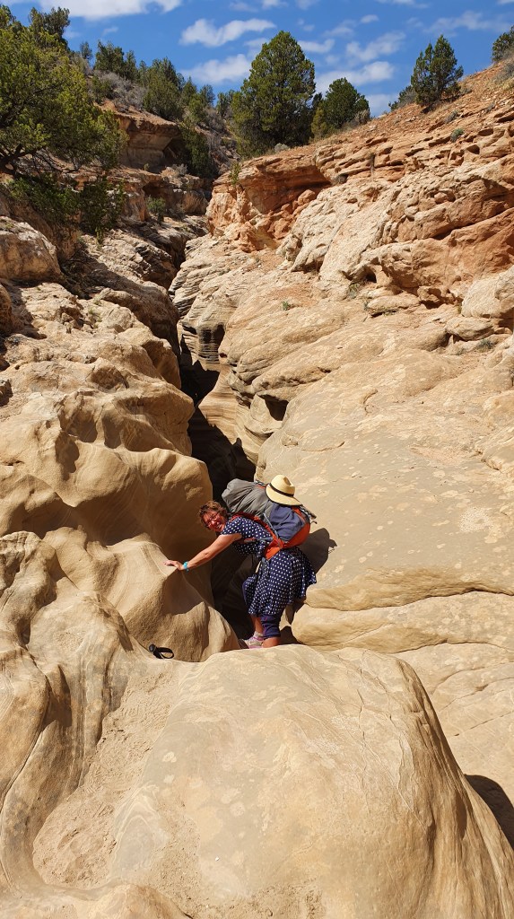
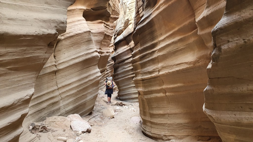
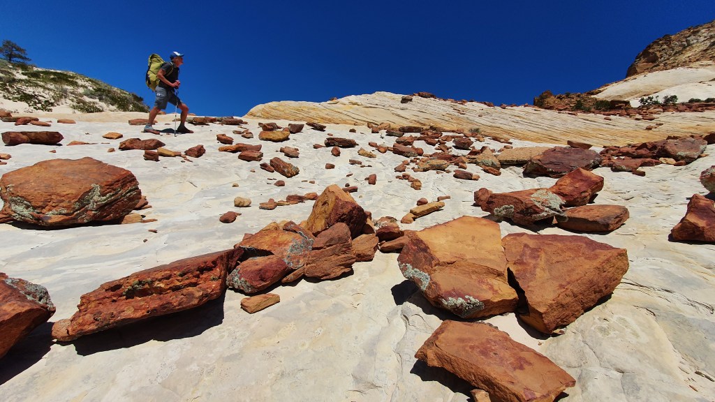
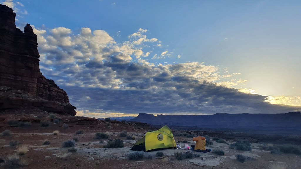
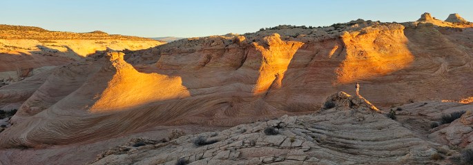
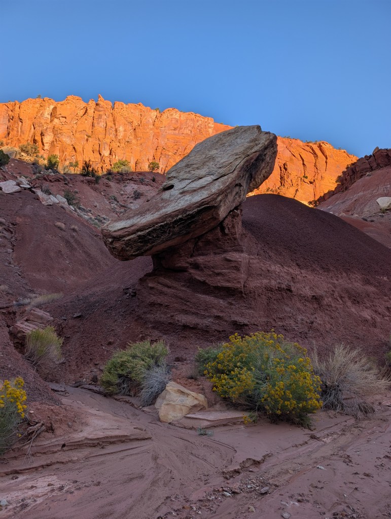
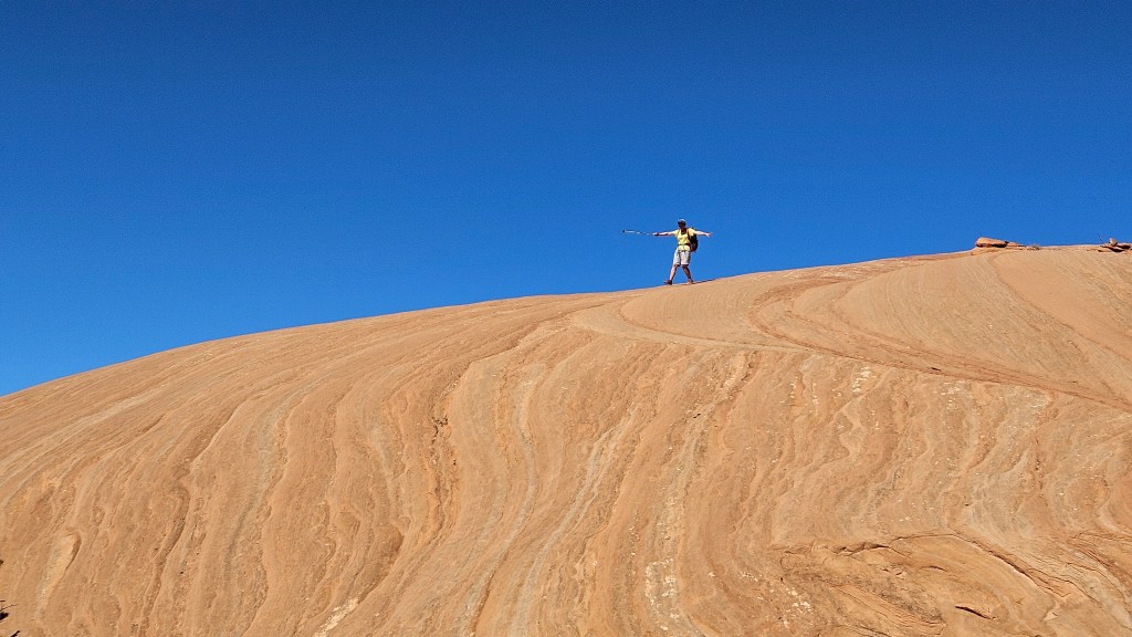
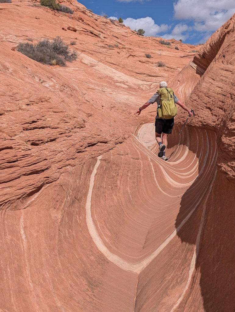
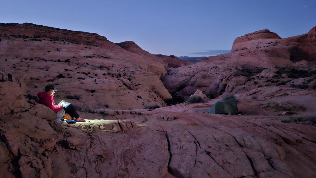
There are no adequate words in the English language to describe the beauty of the slickrock landscape that we moved through for the rest of this day and the next morning on this route: the sweep, the shapes, the colours, the ever so clearly visible imprint of deep time in the sandstone, the blue sky, the many many stars, the silence at night, the climbing of the moon, the blaze of the sunrise on the rock (you can almost feel the earth rotate under your feet!).

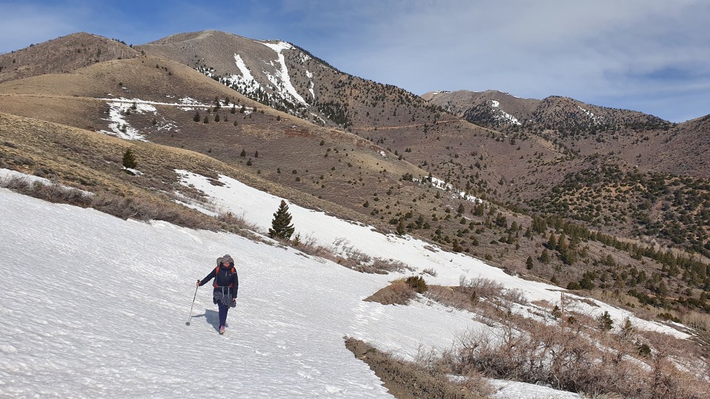
Day 5 More Slickrock to The Lower Gulch

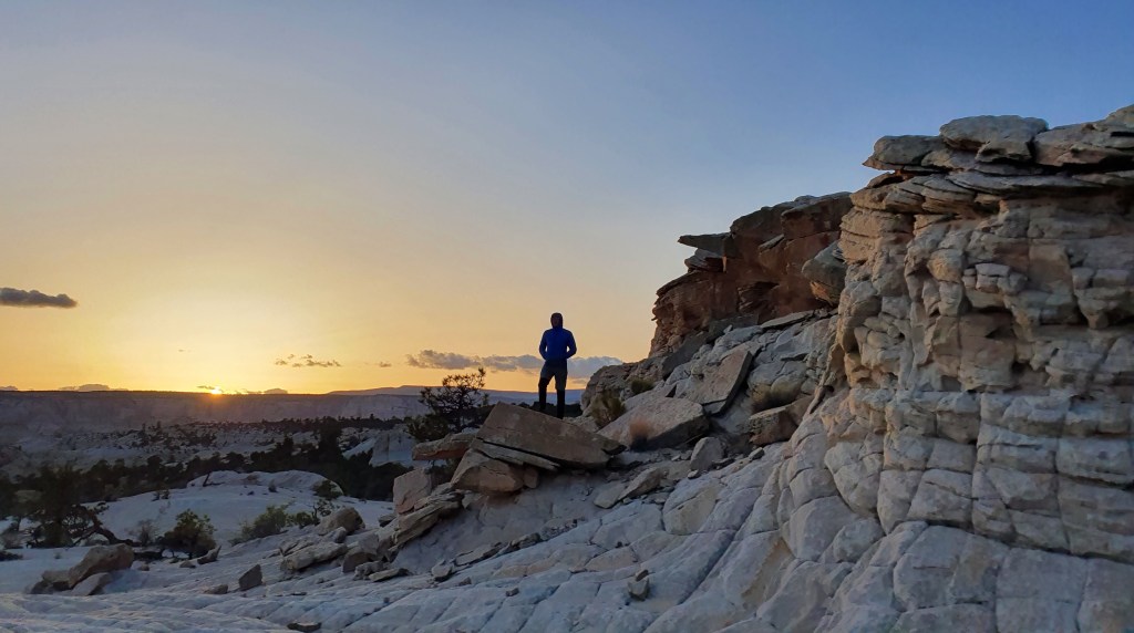
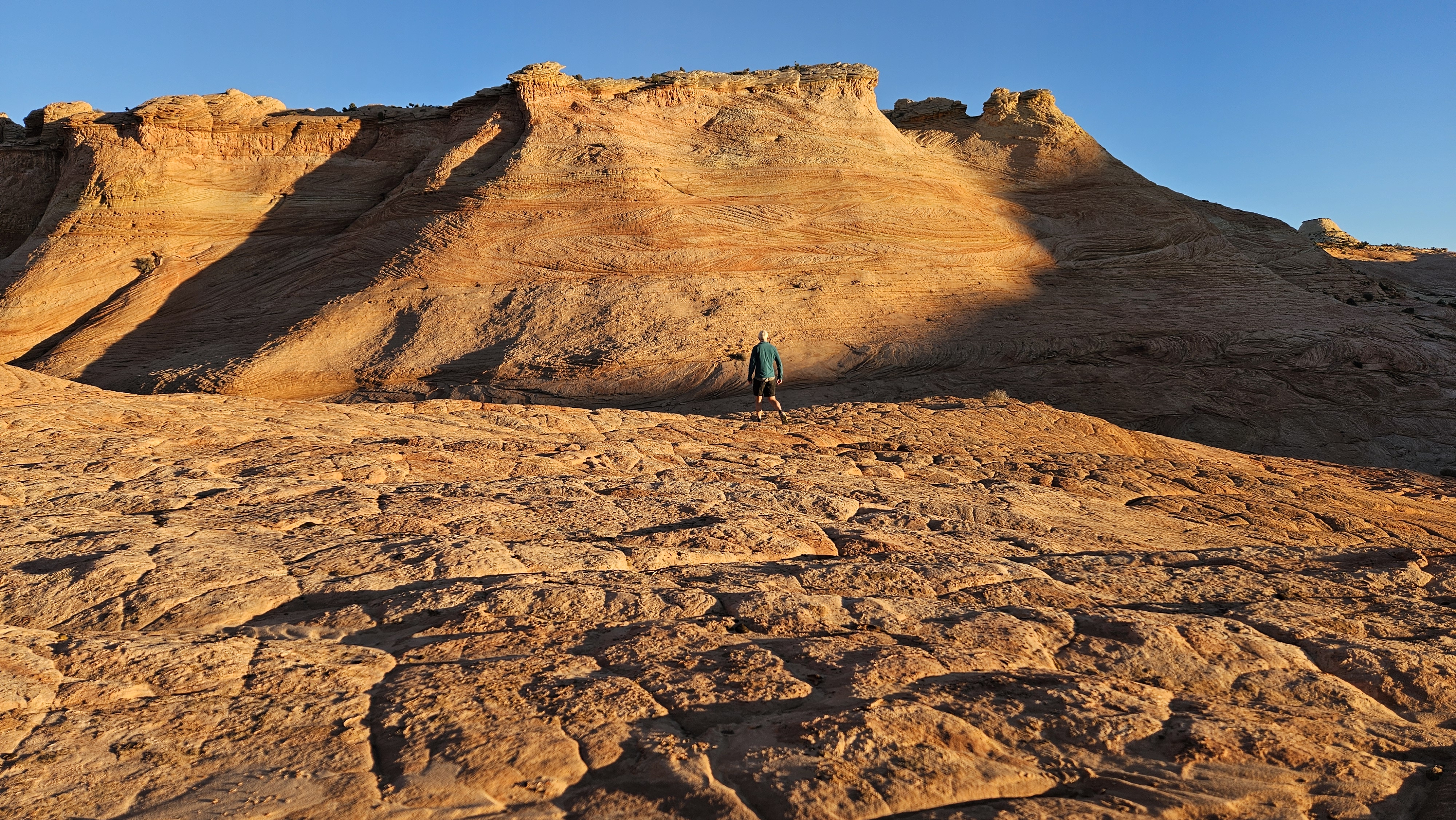
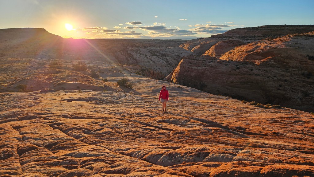
We walked up a nearby peak for a glorious sunrise before continuing down more stunning slick rock slabs towards Deer Creek, then undulated over small slabby ridges on its east side before stopping for a rest above Boulder Creek narrows (crossing another previous hike, this time in 2019).

From this spot there are a few route options and we chose to cross over to the rim of lower Gulch canyon next via slabby ‘Tanks’ drainage and sandier Brigham Tea Bench, pleased to find a cairn or two marking a scrambling descent down into the narrow canyon.

‘Varnished streaked wall’ in The Gulch

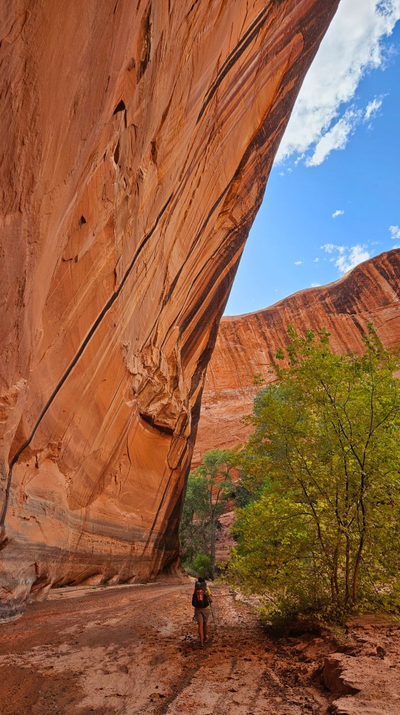
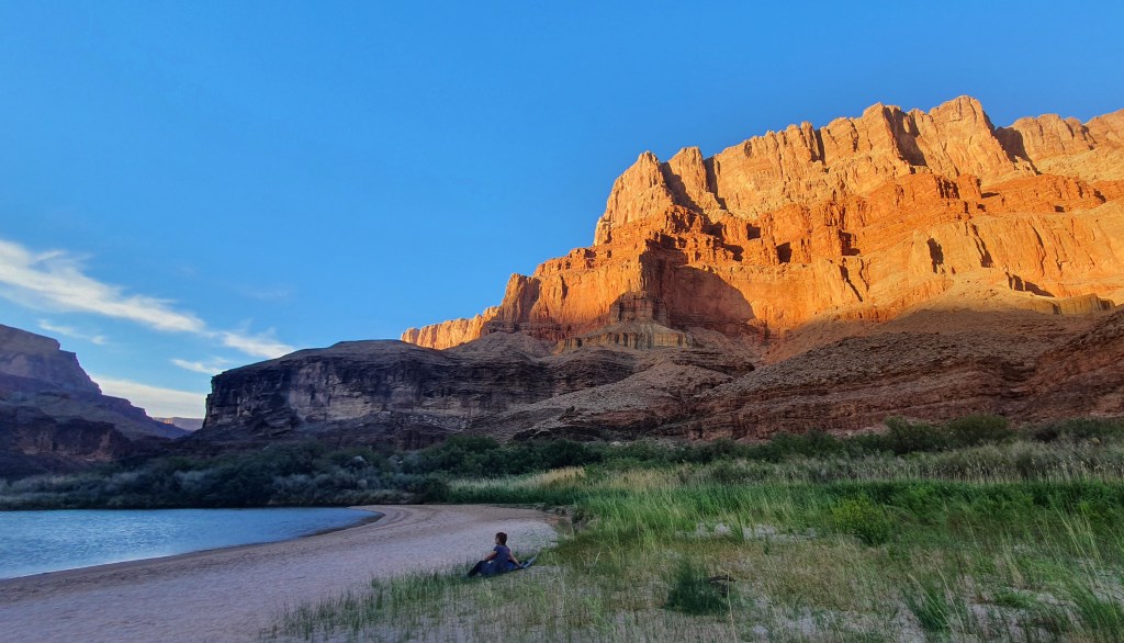
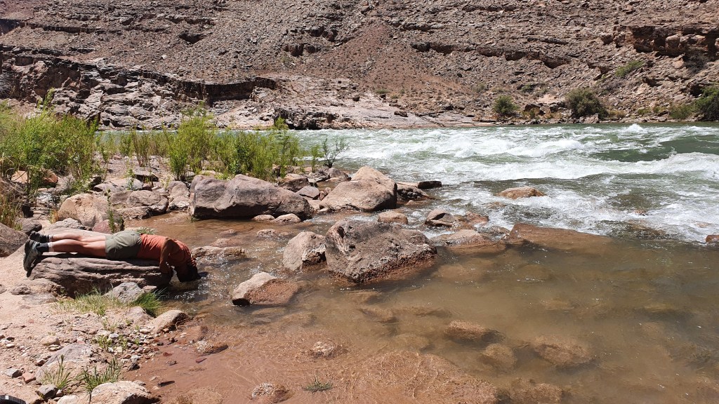
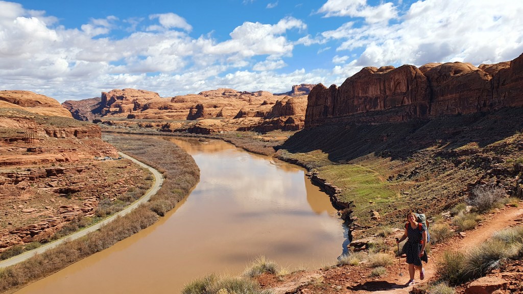
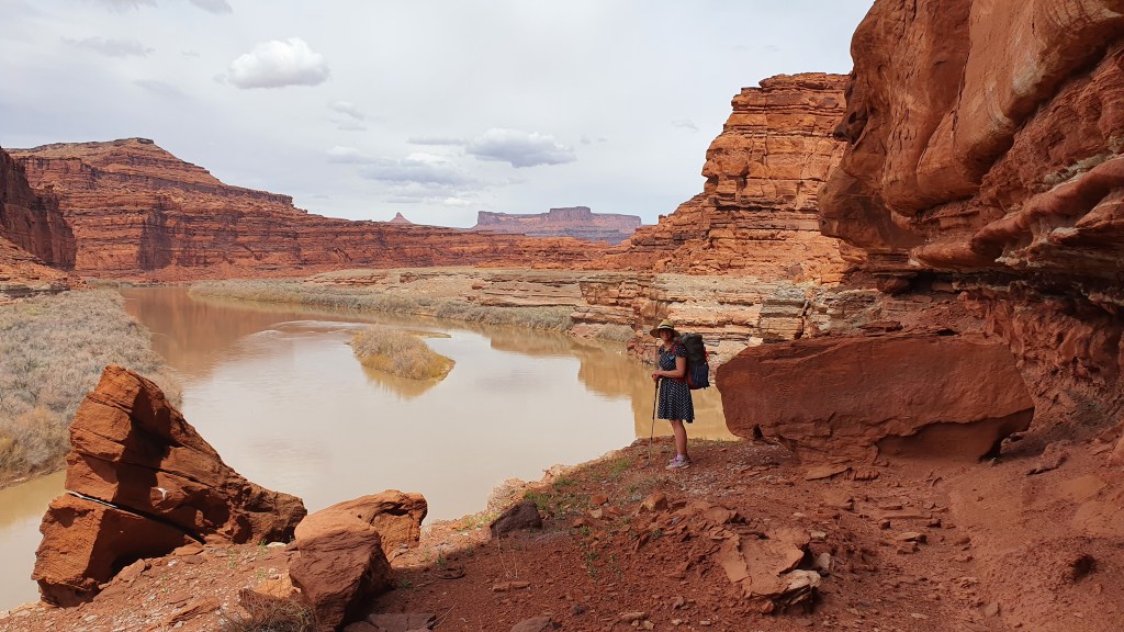
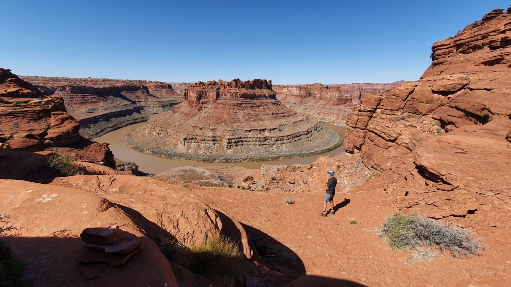
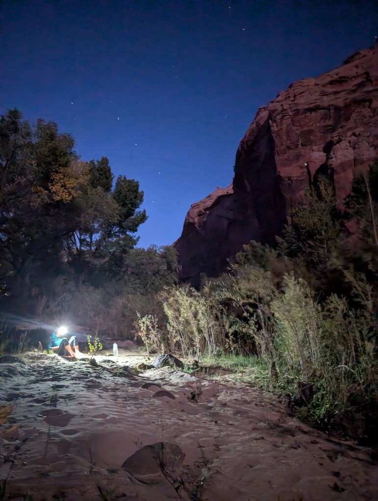
The Gulch is scenic with steep red walls but the going got a bit tougher partly because the recent rain had made the walking very muddy and slippy and because the section towards the Escalante is quite overgrown and becomes more so, the close one gets to the big river. There was also a disappointing amount of fresh cattle trails and dung in the Gulch. We were also getting tired and still acclimatising to the desert heat so we were very happy to see the Escalante (like an old friend) flowing strong and pretty clear and offering us a lovely camp with cottonwood trees above (and a wash in the moonlight).

Day 6 Cosmic Navel and Spencer Canyon

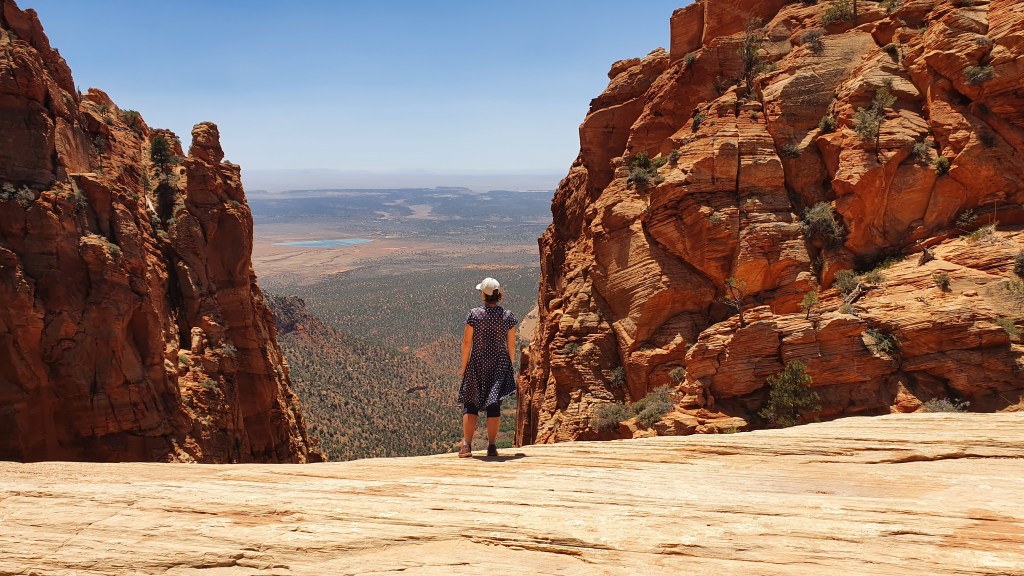
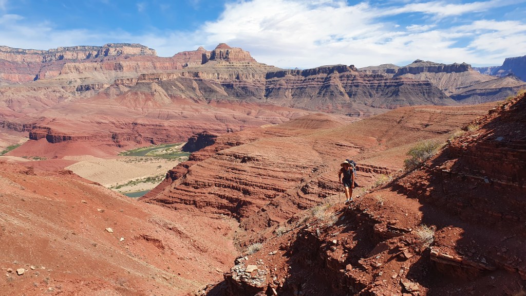
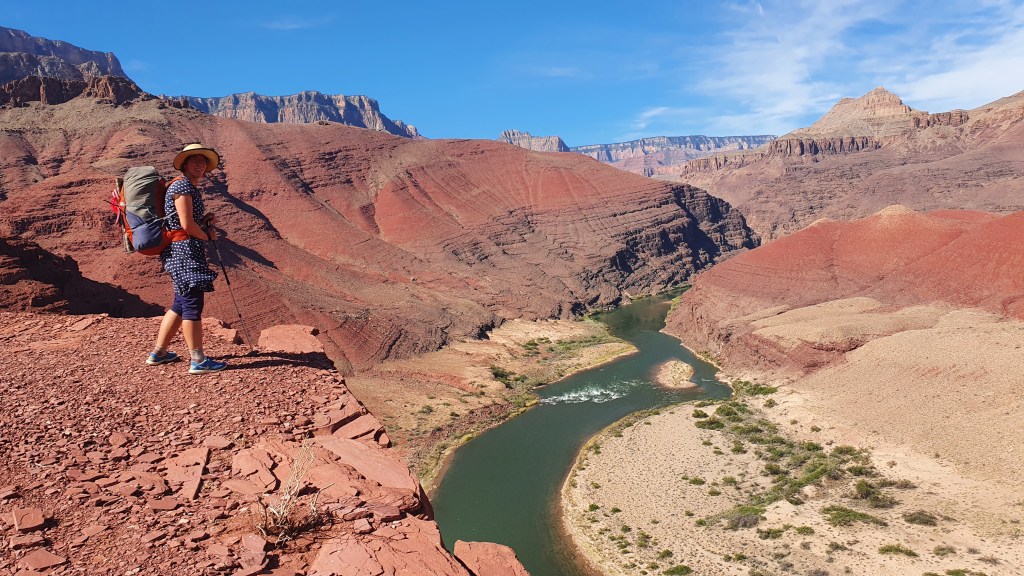
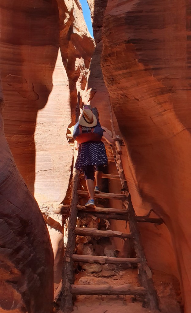
Our aim today was to explore the Red Breaks-Spencer Flats areas above the west side of the Escalante river, but first we had to find a way out of the Escalante’s canyon bed. Our route involved wading down the river for a short distance past ‘ladders canyon’ (it reputedly had at some point ladders installed to climb out – we did not check their state of repair), then a scramble through the cliff bands. First on a rough trail up a bouldery gully, then a traverse left to find the easiest line up slabby rocks to the top (we had read of this exit route in Steve Allan’s book and involved “Moki steps” and were glad to find it an easy exit for us).

Climbing out from the Escalante river

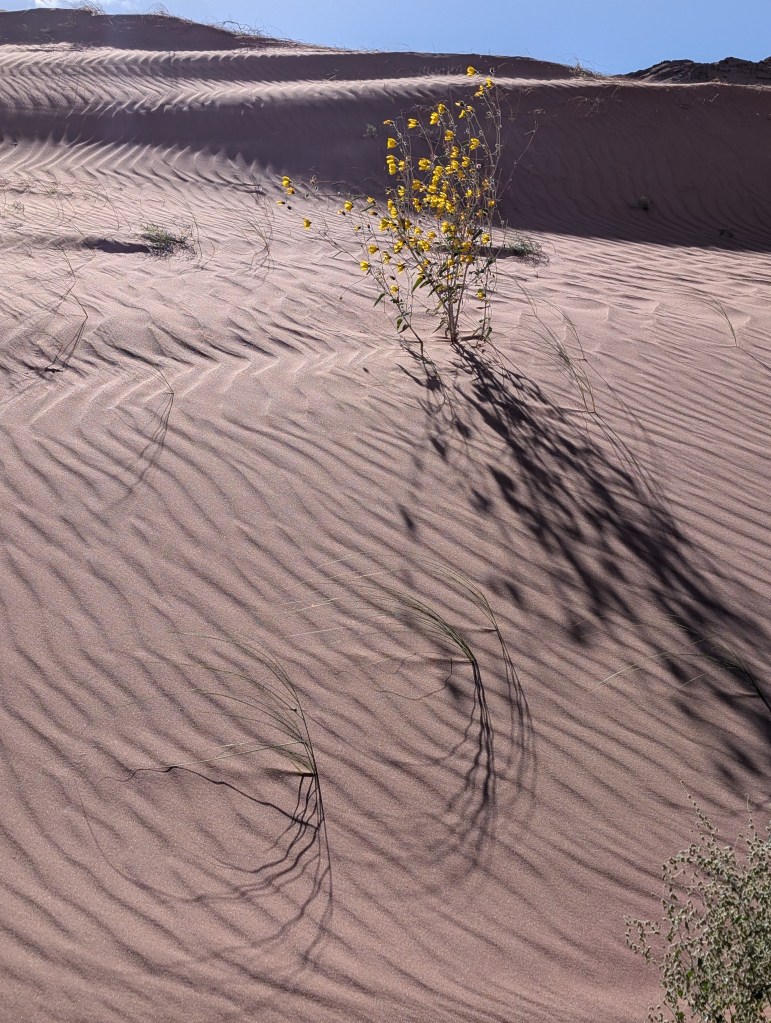
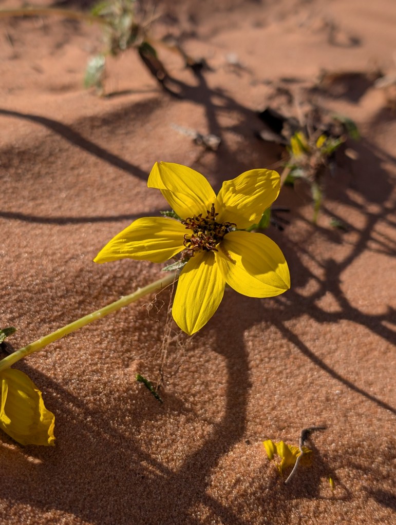
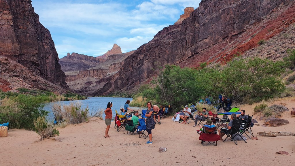
Making our way southward cross country we came across some pristine fluted sand dunes before ascending another slickrock valley dotted with big potholes full of water. Our destination for lunch was the weird rock feature known by various names including the ‘Cosmic Navel’. We saw other people here, our first since leaving the car at The Gulch TH. It’s an easy hike from a trailhead accessible by 4WD and we were here on the weekend so it was busy. It’s also very unusual and beautiful but equally impressive were the extensive red and white slick rock slabs to the north that we continued our days hike over after lunch.

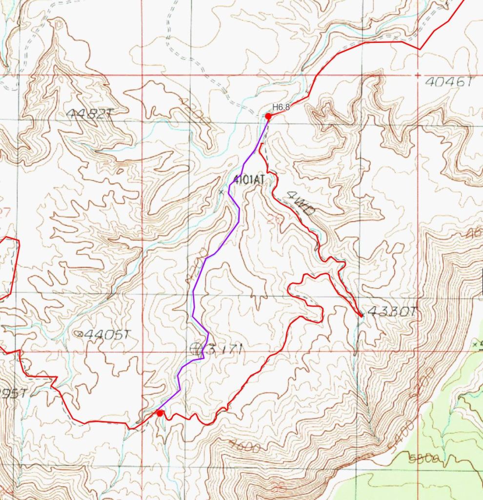
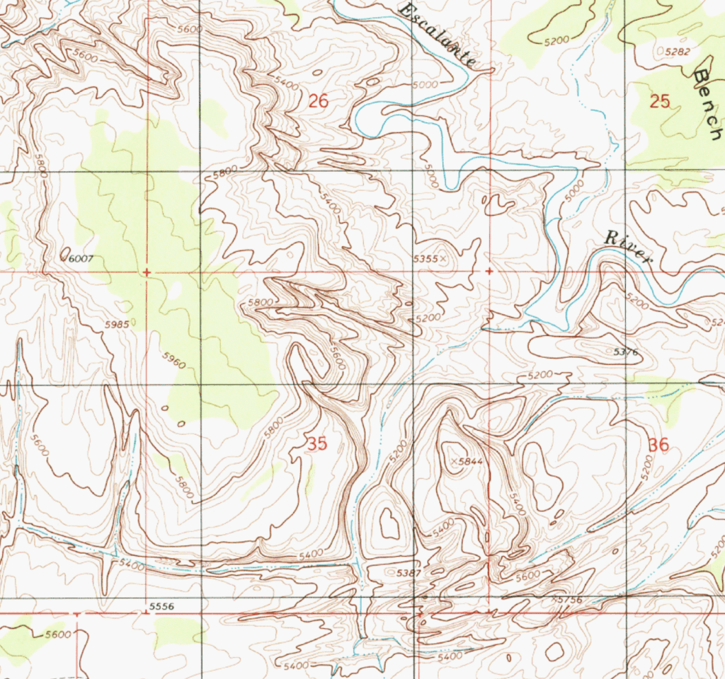
Following a sandy drainage down northwards we made it to the top of the intriguing complex Spencer Canyon system, which appears mountainous from afar and has unusual criss-cross defiles as seen on the map below.

Once we had located some more very healthy looking water holes we decided to camp nearby and explore the edges of the canyons into the evening. It would be good to return and scramble down into the canyon bottoms here – one to return to!

Day 7 Big Spencer Flats and Phipps Wash

Walking west we followed a grove of Ponderosa trees formed in a line. The unusual presence of the Pondies here is highlighted by Mr Kelsey in his guidebook (which we love and honour) where he gives the precised number of trees he saw when he traveled here as 18 – we can report that some have fallen and some have sprouted and grown up since he put pen to paper so if anyone was to update the book, a recount would need to be done!) along a small valley slot before slowing down on a trail consisting of deep sand. Then a better dirt road (Old Sheffield Road) which made for easy walking across a flat plain with wide panoramas.

A car drew up (we were not hitch-hiking at this point) and the agitated driver exited the car and asked us if we had a vehicle that could help tow their friends car out of sand and mud a few miles away. It took a few repetitions of the words “we have no car, we are walking” before he was convinced that we were no use to him.

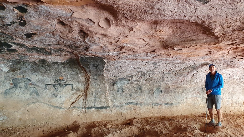
The canyon of Phipps Wash was our next target and we ended up skirting its small but steep headwall cliff to the west before dropping down into it’s upper bowl. This top section of Phipps contained yet more gorgeous colourful rock slabs as well as old horse shoes and cow bones. Once below the main pour overs, perhaps for the first time this week, the temperature got a little hot for us and we needed to rest in the shade under cottonwood trees. It got so hot that we didn’t even fancy going up to Phipps’ arch this time (we had been here in 2022 while having a break from Hayduke II).

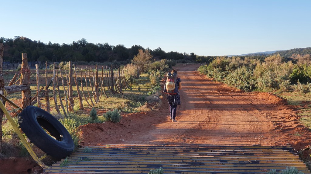
There was almost no water in Phipps Wash (apart from a few smelly stagnant pools) which was a surprise because of the recent rain and the comparative abundance of water everywhere else. Also we had found good running water here in 2018 and 2022. This helped us make up our minds to put our heads down and hike out to the road at Escalante bridge on Highway 12 in the late afternoon to give us some time to hitch back to our car.

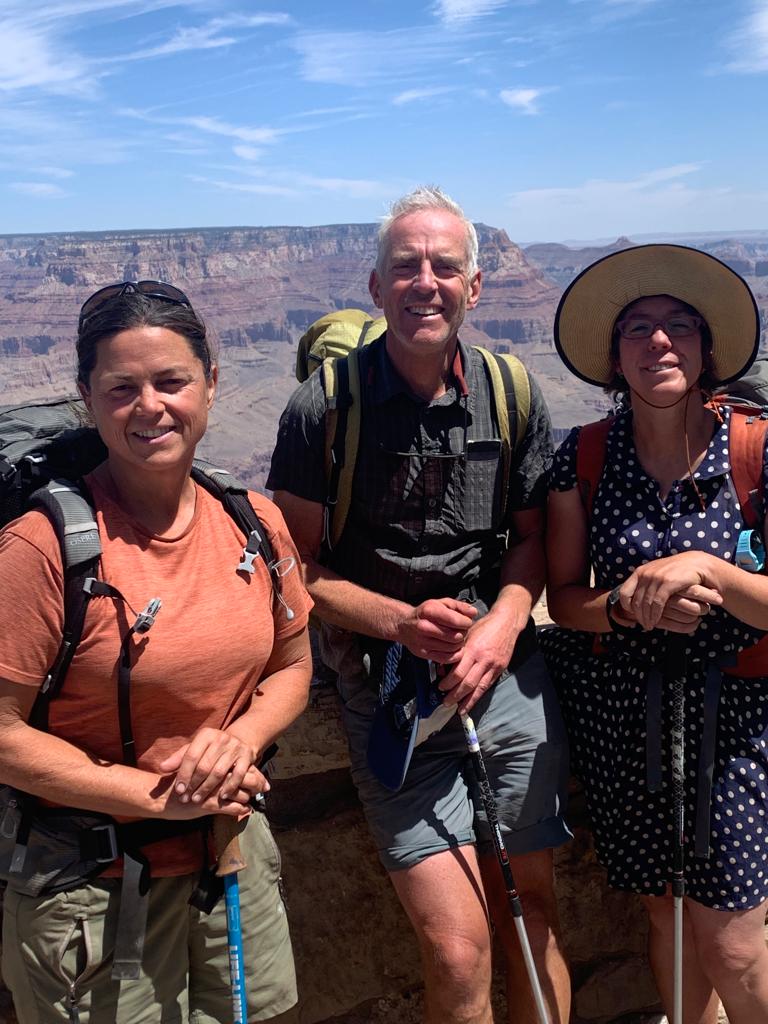
We totally lucked out again with a generous lift (sharing a back seat with an elderly Alsatian dog who took up half the seat while we shared the other half) and within the hour were back reunited with our hire car at The Gulch TH. These 7 days were absolutely packed with amazing sights and glorious cross-country off-trail walking over beautiful slickrock slabs. The Escalante area never lets let us down!

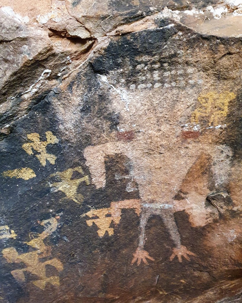
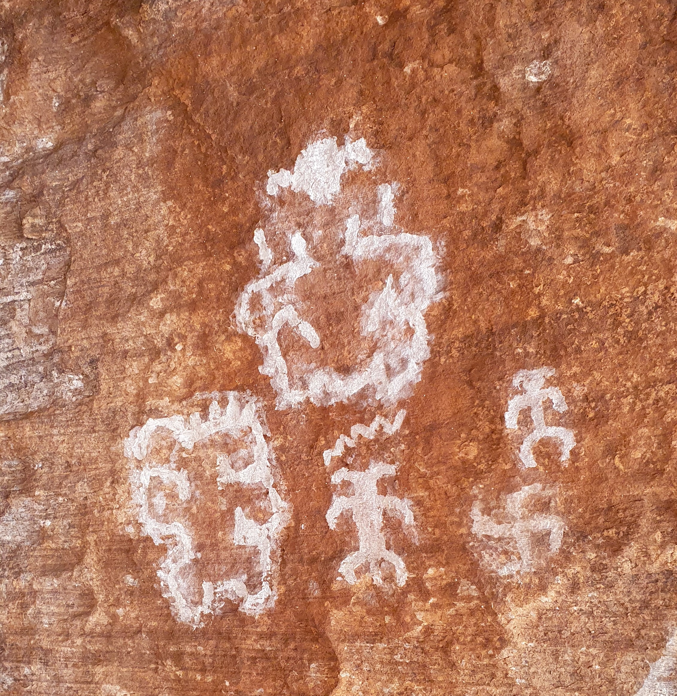
We also have a photo gallery here at pbase

Arizona Trail 2023 – I Utah state line to Grand Canyon and Flagstaff

In October-November 2023 Brian walked the 800 mile Arizona Trail southwards from the Utah stateline down to the Mexican border. I wild camped most of the way, but also stayed at designated campsites, with ‘trail angels’ and some motels in town. Overall it was an excellent experience! Here is a short (ish) description of my hike, some pictures, my impressions and links to more info.

Background The Arizona Trail (AZT) is a well defined and maintained trail heading north-south across the state of Arizona. It traverses a mix of desert, high plateau and mountain ranges up to about 9,000 feet (called Sky Islands), crossing two National Parks; the iconic Grand Canyon and less well known Saguaro outside the city of Tucson.

With blazingly hot summer temperatures at low levels and deep snow in winter on the higher sections, the best seasons to walk the whole way (‘thruhike’) are spring and autumn.

Reasons for hiking Martina and I have hiked many times in southern Utah which borders onto the north of Arizona. We have also been in the Grand Canyon in northern Arizona a few times before as part of our two Hayduke Trail adventures in 2014 and 2022, and as another wonderful 2018 loop hike in Kanab Creek area. From these we were aware of the Arizona Trail and have even hiked the northern 100 miles or so as it overlaps the Hayduke.

With Martina starting a new job, Brian chose the AZT as a less risky solo adventure than the cross country, scrambling Hayduke routes whilst providing the opportunity to hike in new areas to the south of our previous travels.

Hayduke in orange and Arizona Trail in blue below…

Section 1 to South Rim Grand Canyon 3rd October 2023 I set off from the Utah -Arizona stateline with a heavy feeling backpack and slight trepidation in pleasant cool sunshine and an initial stretch of about 90 miles hiking to reach the north rim of the grand canyon. The trail was well made and I soon climbed up from scrub desert through pinyon-juniper trees to the higher Kiabab plateau dotted with tall ponderosa pines. Trying to take it easy for the first few days to look after my feet and avoid injury, I kept to a moderate pace and under 20 miles per day. Camping was pretty straightforward making use of plenty of clear flat ground under the shelter of trees.

I chatted with 3 other hikers starting that same day; ‘Lentil’, ‘Good News’ and ‘Kidnapper’ – their ‘trail names’ – I decided just to be ‘Brian from Scotland’! That number of hikers was quite typical throughout the trail where I would be aware of other hikers each day, sometimes meeting them but often hiking on my own occasionally seeing signs of others such as their footprints.

The highest plateau elevations (up to 9,000 feet) were really fun with grassy meadows and gorgeous golden aspen trees amidst fir and pines. Temperatures were cool during the day and a chilly sub-zero (Celsius) at night, coating the tent with a layer of ice in the morning. Wildlife was surprisingly good; horned toad, lynx, woodpeckers, elk, deer and the ubiquitous ravens with their croaking and gurgling vocals.

Reaching the north rim of the Grand Canyon felt like a minor but significant success as the first completed section of the trail and the chance to stock up on food at the small store, pick up a camping permit for the crossing of the canyon and meet a few other hikers congregating there.

The map below shows the AZT in blue taking a scenic 26 mile direct crossing of the grand canyon via the ‘corridor trail’ ….. as opposed to the orange line of the Hayduke, a 5-6 day rollercoaster of excitement from North to South Rim. The Hayduke then also has another 7-8 day adventurous and stunning section in the canyon heading west to Kanab creek and beyond.

‘Bonus’ Grand Canyon loop 11th October I made an ‘on the spot’ decision to do an extra loop before leaving the Grand Canyon southwards on the AZT. My reasons were that it seemed a pity to depart the canyon after such a brief visit, I heard of a cool area around the Hermit Trail that I hadn’t been to before, and it gave me the chance to do some bigger climbs but shorter miles than the next couple of weeks of long, flat plateau hiking on the AZT. Fortunately I was able to pick up up a last minute permit easily at the backcountry park office and I set off…..

I had 3 1/2 days down the canyon (Bright Angel, Tonto West, Granite Falls and a bit of Boucher Trail) and in summary it was lovely, beautiful views, cool temperatures and away from the crowds.

Section 2 Grand Canyon South Rim to Flagstaff 14th October This section was always going to be tough for me as it was a long 115 miles of flattish high plateau to the next resupply in the town of Flagstaff – it wasn’t playing to my strengths as I like hills! That said the initial hiking through ponderosa pines was mellow, the water sources were sufficient and I was able to hike longer, up to 23.5 miles each day. The undulating terrain gave huge wide vistas, especially to Humphreys peak (the highest in Arizona that we walked up in 2017) and great sunsets and sunrises at camp. I was however relieved to arrive in Flagstaff to take a day off from hiking, sort out gear and food logistics, clean up and rest my battered feet.

Next Arizona Trail II Flagstaff to Tucson

Previous US South West & Hayduke

Photo gallery (or click image)

Post Hayduke explorations…

It is now late May and near the end of the season here for us in southern Utah as the temperature is getting a bit too hot. We picked up a rental car though and did some day trips in around the Zion and Bryce National Park area…. We have been to Bryce Canyon before, but it was hard to resist the mellow pleasant hiking in this popular park with cooler temperatures high up above the lower canyons

Parowan gap north of Cedar City. Southern Utah. An impressive array of pretty abstract looking petroglyphs etched into the rock.

Zion National Park, looking south to the peak of North Guardian Angel
Enjoyable scrambling up slabs on North Guardian Angel
Mellow green pastures in western Zion National Park approaching a cave with pictographs
Looking back out from a pictograph cave in Zion NP
These pictographs are etched out of fire blackened walls in the cave and it seems of unknown age
More pictographs in the cave, this time using white pigment and some crazy looking creatures
You can just see the tent, lower center, on rock slabs south of Hop Valley near Zion National Park
Martina, Heather and Dan. We were grateful to take part in a canyoneering trip arranged by Heather and Dan to Spry Canyon in Zion National Park. Thanks for inviting us!
Some superb scrambling on slabs to approach Spry Canyon
The descent of Spry Canyon involved about 12 rappels (abseils), lots of scrambling and a few dips into dank pools! Grand rock scenery here at the first rappel.
The canyon narrowed up
Brian abseiling (abseil 3 of 12 ?)
Brian trying vainly to avoid one of the deep pools
Dan descending into a pothole of cold water
Martina abseils off an overhang
M at the M&M super store in Las Vegas
Flying out of Las Vegas…

Grand finale to the edge of Zion National Park

For the last section of our Hayduke hike we headed north from the Utah Arizona border to Zion National Park. Typically for us, we deviated from the actual Hayduke route to instead cross an area to the west called Caanan Mountain. Although to be fair to us, the final route used by the Hayduke in Zion NP (Weeping Wall) is currently closed due to rockfall so variants are pretty valid.

We hiked north through the streets of the town of Hildale from the Utah-Arizona state line into Water Canyon and the Caanan Mountain area.

We soon left the town for a steep ascent up Water Canyon

In the morning we did a side hike up to the high rim of Water Canyon to see its arch…

We can’t afford to be choosy when it comes to water! We carried this with us but thankfully later found a better supply
…desert now in full bloom…
…bloom…
Back into town to pick up a rental car!

Many thanks for all the help we have received with planning and logistics for this hike from Charlie Neumann, Joe Mitchell, Li Brannfors, Monica Stapleton and Jamal Green; and for support, inspiration and shared enthusiasm from fellow Hayduke hikers Heather K, Nathan K, Mike Tyler, Ryan, Peter, Race, Not Guilty, Sprinkler and ‘Butcha; also the numerous wonderfully generous Americans (and two Danes) who gave us lifts in their cars to town and those we met who gave us fruit, water and kind words of encouragement!

Hiker Notes

Our route as mentioned above deviated from the Hayduke to cross Canaan Mountain from Hildale to Rockville. You can click on the overview map below to enlarge it. (Our route in purple, Hayduke in red and some other alts in black).

This is a marvelous hike has a real Hayduke flavor to it with a mix of trails, cross country, route finding and superb scenery. Its downside is that it misses out the ‘Barracks’ on the Hayduke which is also top class.

We did this hike in the opposite direction in Autumn 2018.

This site ‘Favorite Hikes in and around Zion National Park‘ gave us the original idea and the book is worthwhile purchasing too.

Water is available in the well named Water Canyon, then there are some big potholes in the slickrock wash at the top of Water Canyon. Sawmill Spring had water about 10 minutes downstream from the spring itself and there was some seeps and pools in the slickrock below that.

The Grand Canyon part I

At the small lodge of Jacobs we joined forces with Heather whose three hiking partners have all left the trail for various reasons. Good to have more options when it comes to the point where we have to draw lots about which member of the expedition to eat when we run out of food, for we were now heading back out on a pickup truck to the tough part of the trail: the Grand Canyon!

But first the trail keeps following the AZT on the plateau up to 9000 feet altitude through aspen (still mostly leafless), fir, spruce and pine forest with open alpine meadows in between. Winter is only just retreating here.

We reached the edge of the Grand Canyon at Nankoweap on our second night out, with gale force winds and we camped in relative shelter amongst aspens at the edge of the cliffs dropping down into the Grand Canyon. Next morning we started our 6,000 foot descent to the Colorado River at dawn.

The heat ramped up as we descended down to the inner cauldron of the Colorado River. We camped that night at the bottom of Nankoweap canyon on the shore of the Colorado Rivet itself with stormy gusting winds whipping sand and river water at us.

We were not alone however as there were two big motorised commercial river boats moored on our beach with about 25 clients. A private boat trip with 6 small rubber rafts was moored in the next bay downstream. In the evening we walked up to a viewpoint and afterwards chatted to the private rafters. They were a group of friends, relatives and acquaintances from all over the US. Their figurehead “Uncle Dave” was very welcoming and, once we had sourced a life jacket for each of us, generously invited us to travel 9 miles down river the next day with them..

After a fun (and wet from rapids) morning on the river with our boater friends, we got off at the Little Colorado River confluence with the Colorado and said our farewells.

Collared lizard posing by the trail

Our target for camping was Lava Canyon rapids and the trail stayed high above the river on balcony ledges until we got there. The wind was back and buffeting but at least helped keep us coolish in the 30C heat. We chose to camp in a dense grove of trees that provided shelter from the wind. When it got dark and the wind abated we sat on the beach for a while with our rafting friends camped opposite us on the other side of the river.

Because the mid day temperatures are way above 30°C, we start hiking at dawn now (5am). The best time to hike for beautiful light as well!

Tributaries to the Colorado River form a labyrinth of deep canyons that we followed until we can cross them, making for a wriggly but beautiful route. Some scrambling added to the interest- this is a great hike in the depths of the Grand Canyon.

By chance, we met up with our boating friends again at Hance Rapids on the Colorado River where they had moored and we camped too with good access to water from the river. We were invited to their evening campfire circle and dinner.

After 5 nights and 6 days hiking we arrived at the South Rim on May 11th. Fresh food, showers and rest beckon! Next we will hike back down into the canyon bottom and up to the North Rim to continue our hike…..

Hiking up to the South Rim via Hance Creek, Horseshoe Mesa and Grand View Trail
Topping out of the Grand Canyon on the South rim after 6 days, dusty but happy!

Hiker Notes

Route We mostly followed the Hayduke in this section apart from at the end where we hiked out of the Grand Canyon to the south rim on the Grand View Trail. This shortened the route a bit and we had already hiked the remainder part along the Tonto Trail and up South Kiabab Trail in 2014. This part was also our least favourite hike due to the heat and paucity of water!

South from Jacob Lake the Hayduke follows the well maintained and relatively popular Arizona Trail (AZT) for about 30 miles. Good AZT water report website.

Its dry from leaving the AZT til hitting Nankoweap Canyon about 8 miles down from the North Rim on Nankoweap Trail. This trail is really scenic and makes for a superb hike. Nankoweap Canyon looks like a perennial stream with a gushing spring source just 10 or 20m downstream from where the trail hits the stream.

Once you hit the Colorado River there are a number of places to access the river for water. You can’t do this anywhere though so best keeping an eye on the map. the Nankoweap Granaries are definitely worth the side trip.

The route along the Colorado River between Nankoweap and the north of the Little Colorado can be pretty slow going over boulders with bushwhacking so allow plenty of time and best to start early if its going to be hot. We have managed to get lifts across the river to the Little Colorado outlet pretty easily within a few hours both times we have been there.

Hance Creek had a good, if small, flow of water.

Overall, from Jacob Lake to South Rim is a brilliant hiking expedition and if there in May, the main challenge is the heat down in the bottom of the canyon.

Into Arizona…

During our rest days in the town of Kanab we bought food for the trail ahead; 2 days to carry straight away for the hike down Buckskin Gulch and onto the Arizona Trail, then with the help of a friend, 6 days which we left at a remote diner/hotel called Jacob Lake (on the Northern plateau of the Grand Canyon) and a whopping 8 days of supplies which we mailed to the post office at North Rim of the Grand Canyon.

Supplies for the next few weeks

We started putting our thumbs up on Highway 89 out of Kanab at 7am on 4th May and got a lift back to the trail with an 82 year old gentleman who was driving a portable water tanker for supplying firefighting crew in New Mexico. He was driving it there from Montana!

The Hayduke goes through some spectacular sandstone country in and around Buckskin Gulch and then picks up the Arizona Trail (AZT) for approx 65 miles. The AZT itself starts at the Mexican border in the south and finishes after around 800 miles at the Utah state border. We were hiking it southward ‘against Wainwright’, meeting lots of northbound hikers who were nearing their finish line. What this meant for us was that we had well maintained, clear trail to follow for the next few days!

Once on the AZT we climbed very quickly up onto the Kiabab Plateau, a high limestone forested area that forms the North Rim of the Grand Canyon. We left behind the slick gold and red sandstone and spent two days in dry pinyon-juniper forest, then ponderosa pines higher up. Our one water source was from a “wildlife guzzler”. Below Martina is straining some “wildlife” out with a handkerchief before treating the water!

To avoid setting the dry forest floor on fire with our stove, we usually cook on a flat rock…but if none are available a cow pat does the trick!

After two days we got to Jakob Lake, got a hotel room and picked up our food parcel ready for the next 6 to 7 exciting days headed for the depths of the Grand Canyon……

Vintage transport at Jacob Lake

Hiker Notes

Route For the first time we followed the Hayduke in this section(!) with the exception of the enforced fire reroute on the AZT below…

Water- we relied on a single source about 4 miles south of the Utah-Arizona state border, the wildlife guzzler as pictured above which seems reliable. That said there was a fair bit of activity at the state border with a few northbound AZT hikers finishing each day in May. There could be a fair chance of picking up water here from people there to meet AZT hikers.

AZT diversion- there was a rerouting of the AZT north of Jacob Lake due to burn areas impacting the trail. See sign below…

Back hiking South West to Hwy 89 and Kanab – mostly “Alt”duke

It had always been our plan to hike an alternate to the Hayduke from the town of Escalante to Highway 89 and the next town stop of Kanab. Heading in a South Westerly direction our route would join and cross the Hayduke for a while but taking an independent line for much of the way. Information about this route was gratefully gleaned from Jamal Green’s website and blog. You can click on the overview map below to enlarge it. (Our route in purple, and red where joining the Hayduke).

On Monday 25 April we finally walked out of Escalante, blisters dried and dressed, with all our belongings and 6 days food on our back to climb up the Smokey Mountain Road onto the Kaiparowits Plateau. We then followed the tad morbidly named ‘Death Ridge’ jeep road for a while. After that the reds and yellows of the rock and grand ponderosa pines give way to ‘The Mudhills’ with muted greys and some surreal landscapes.

We hiked through this grey landscape for a day and a half past Canaan Mountain into the very remote Wahweap wash drainage system where we found precious water at Headquarters Spring. From there we briefly picked up the Hayduke Trail to Grosvenor Arch and camped near a luxurious cattle tank from which we prepared dinner, breakfast and our daily water ration.

Grovesnor Arch

In the morning we met a torpid snake warming itself in the sun. It wasn’t going anywhere in a hurry, in contrast to which we were eagerly heading towards an exciting slot canyon in Round Valley Draw (leading to Hackberry Canyon- both part of the Hayduke Trail proper).

Wildlife dozing in the morning sun
Brian sits out a dust storm at the end of the slot canyon

We camped that night under red rock walls in Hackberry Canyon with running water (a rare delight).

On our fourth day we headed west out of Hackberry, leaving the Hayduke again and striking out above the canyons over golden sands with fantastic views in all directions. Our itinerary now followed some imaginatively named canyons: Stone Donkey, Hogeye, Paria, Kitchen and Starlight…

We crossed the Paria River at the mouth of Hogeye and met not only the Hayduke Trail again at this point but also, by pure chance, our fellow hikers Heather, Ryan and Mike – the first two reclining in a pool in the river! After stopping for a chat we headed out on our alternate route and walked up Kitchen Canyon (a very actively eroding bright red rubble-fest with muddy, silty water) and into Starlight Canyon- also bright red and collapsible looking but with clear cold water flowing down from multiple springs. This lovely canyon also had some narrows and a fun scramble up a waterworn shoot.

The narrows of Starlight Canyon
Scrambling up the shoot at the end of the narrows in Starlight Canyon

We camped below the narrows. The next day we reached a large cave with pictographs painted in soot at the back on a white wall. Very impressive.

We had seen the pointy landmark that is Mollies Nipple on our first day out of Escalante town, rising above the plateau. Now, on day 5 we were aiming to hike across its flanks. More steep sand (with ever more flowers coming out) but amazing technicolour views!

From the Nipple a sandy ATV track took us into the red valley below and reunited us with the Hayduke Trail for the last 10 miles. Final camp was made under a juniper near a spring 7 miles from Highway 89. On our last day we got up at dawn to hike in the cool of the morning. A lovely couple from Colorado gave us a lift into the town of Kanab.

Kanab is a fabulous little town: it has two independent supermarkets and many shops are shut on Sunday (including one of the supermarkets!). It’s back country used to be a favoured movie location in the 40’s and 50’s so it has a hint of Hollywood to it. Clint Eastwood shot ‘The Outlaw Josie Wales” near here!

Hiker Notes

Route The route we took between Escalante town and Highway 89 was really enjoyable with a particularly great sequence of canyons in the middle in the area of the Paria River. Overview map here We pretty much joined up 3 alternatives described by Jamal Green along with some information from Michael Kelsey’s guide;

firstly Via Escalante West

then Stone Donkey to Hogeye

then a short hike down the Paria River before going up Kitchen and Starlight Canyons. Jamal Kitchen/Starlight text here and Kelsey’s Paria River Guidebook had useful information on upper Starlight, the cave and Mollies Nipple.

Alvey Wash- 04/25/22 About 5.5 miles south of Escalante town on Smokey Mountain dirt road- there was water running here where the wash narrows.

Mossy Dell- 04/25/22 This is about 19 miles from Escalante town and mentioned as a water source by Jamal but we couldn’t find any water here unfortunately.

Collet Canyon forks- 04/25/22 The jeep road crosses a few forks of upper Collet Canyon but all were dry for us. It looks like they might flow for a bit following rain.

Headquarters Springs- 04/26/22 A number of small flows of water here. We couldn’t find the cabin marked on the map though…

Corral south of Grosvener Arch- 04/26/22 Two good full tanks of water here, see map below.

Round Valley Draw, HT Section 8 mile 2.9- Our second time down these narrows and this is an excellent scramble.

Hackberry Canyon, HT Section 8 mile 11.2- 04/27/22 Water started from about here. Bear in mind its a tough walk down canyon from the narrows of RVD to this point in deep soft sand. Also this area was fouled by cattle making the water a little less inviting!

Hogeye Creek- 04/28/22 Excellent water flow in two shady sections in the middle of Hogeye down to maybe half a mile before the Paria River.

Paria River- 04/28/22 This was flowing quite clear between Hogeye and Kitchen.

Kitchen Canyon- 04/28/22 Very, very muddy flow. The canyon is so rubbly and loose that it looks like it the water flow is full of mud and silt from the side walls sliding into the wash.

Starlight Canyon- 04/29/22 Lovely flow of good water up the length of this canyon to where we exited at the cave.

1/2 mile to north of Kitchen Corral Spring (HT 43.4) – 04/30/22 Good small flow 1/4 mile east of Hayduke Trail dirt road along side canyon on jeep road. Go over barbed wire to small spring that is piped off so the canyon looks dry before you get to the spring.

Testing the feet around Escalante

Between 17 April and 25 April we based ourselves in and around the small town of Escalante. We looked after the car of a fellow hiker Nathan who has joined Hayduke hikers Heather, Mike and Ryan for a 6 day section and by generously leaving the car with us, we were able to pick them all up from their destination trailhead when they had finished.

Meantime we were able to treat blisters and go for day hikes of increasing length to test progress. We started with a visit to Phipps Arch, a day in upper Pine Creek and then two days on the Boulder Mail Trail. Here are some shots of our “test hikes”.

Phipps Wash day hike (see also the banner of this page)
Although with car, we preferred to camp on the beautiful slickrock, a short walk from the road.

After a couple of day hikes we walked the Boulder Mail Trail as an overnight backpack between the towns of Boulder and Escalante. This follows the route once taken by the mailman and his horse from the town of Boulder to Escalante before there was a road. It goes through spectacular canyon and rock slab terrain!

Spring is slowly starting to add colour to the desert
After about 40 miles of test-hiking the feet had sufficiently recovered and allowed us to head onwards on our intended route through the desert on the Hayduke (and alternates).

Blistering into the Henry Mountains

On Wednesday 13 April we left Hanksville to hike for eight days to the town of Escalante. We got a lift to the trailhead from a young rancher who was taking horses in a trailer into the range to round up cattle. He told us his grandfather used to walk the herd 100 miles from their winter to summer pastures up the hill. He dropped us off at “Little Egypt”. Before us loomed the refreshing looking snows of the Henry Mountains. And uphill we went…

Little Egypt gets its name from the curious rock formations found there. We were hiking upwards through layers of sedimentary rock of ever changing colour and consistency, traversing forward in time from the oldest to the youngest layers.

We scrambled cross country on loose shale soil above Little Egypt onto a broad slope heading upwards towards the Henry Mountains.

Some of rock layers around the foot of the mountain contain metals. Uranium is still mined in this area. Our trail led through the site of a now vanished gold mining town. Only a couple of cabins remain.

The first water appeared after 10 miles at Crescent Creek and we made camp. The creek was already fringed with thick icicles. We knew from the forecast it was going to be a cold night at 7,800 feet. Our water froze in the bottles over night.

Next day it was sunny but still bitterly cold and very windy. We opted to go over a pass (9,000 ft Copper Ridge) rather than the top of the mountain and hiked 10 miles to the next water source (Airplane Spring). Here we made hot tea and took stock.

Brian’s blisters had multiplied again, were painful and some were bloody. So the sensible decision was made to retreat. That still meant climbing back up over the pass and back to the freezing camp and a 20 mile day. Luckily the weather got a bit milder on the second night there. On Friday 15 April we were back at the roadside and hitched a lift into Hanksville.

Return to Hanksville via the culvert under Highway 95 – too many blisters

Since then much has happened. We have met more Hayduke hikers (Marty, Not Guilty, Peter), took in some great live music and through mind-blowing generosity obtained the use of a car for a week without which we would really be stuck. Thank you Nathan!!!

Now we are in the town of Escalante, eating well, resting and hoping to be back on the trail by the start of next week.

Back.on the trail, soon

Hiker Notes

Route We hiked from H95 past Little Egypt then joined the Hayduke before Crescent Creek. We then took an alternate dirt road south over Copper Ridge to Airplane Spring. Due to Brian’s blisters(!) we then turned about and hiked back to H95 but this time following the Hayduke from Crescent Creek to H95.

Little Egypt – This is an alternative route south of the Hayduke Trail from H95 as described by Nic Barth. The hoodoos and mining cabins were interesting and worthwhile as an alt.

Crescent Creek– Good flowing water as the jeep track nears the creek bed. Nice camping on the west side of the river too.

Airplane Spring on a lower alternate on the south slopes of the Henry Mountains had reasonable water in two wells inside the fenced off area.

Moab to Needles Canyonlands NP

Two nights rest and a lot of rain in the town of Moab and we are off again. We are following the mighty Colorado river. In 2014 we paddled down it. This time we are walking in and out of canyons, over ridges and along ledges.

At first we still shared our trail with mountain bikes and ATVs. Although this is very remote country, there are some one or two homes out here and the people who live off grid are usually very hospitable. Like Tom and his tortoise Kobe. He shared his drinking water (which is hauled in by 4×4 over some fearsome rugged terrain) and some good stories about hikers that have come past on the Hayduke and ATV drivers he has had to rescue over the years. He also has installed a Frisby golf course on his property but we didn’t have time…

Although we are following the Colorado, we only stood on its banks with our toes in its water once. The rest of the time we were high above it on ledges and weaving inland to go around (and sometimes into) steep tributary canyons. There are still some areas used for seasonal cattle pasture (less so now after an ongoing long draught).

We passed by an old cowboy camp ‘Tangrens’, used by horsemen up to the 50’s I think. There was an old bedstead and tissue roll amazingly intact as well as some unidentified foodstuffs in jars… we were hungry but didn’t try!

Rustler Creek dryfall had a cool scramble under a chockstone

One of the best things in Canyon country is camping with a view of the landscape below at dusk and dawn. And in between the clear night sky and the complete silence…except when there is a cricket…or an owl…or a coyote. Then it’s even better!

After 4 days we arrived at Needles Outpost, a privately run campsite and store at the edge of Canyonlands National Park and we are having a rest day in one of they glamping tents. Comes with a hammock. Very relaxing! We picked up one of our resupply parcels here with food for the next section. So far we have come about 105 miles. Doing some kit repair and enjoying a hot shower before hiking on into The Maze.

Resting up in Needles Outpost before we head out again!

More pics on our pbase site here

Hiker notes

Route We followed the Hayduke but with a few alternates as described.


HT30.2 We did the Amasa Back alternative which was nice and recommended. We started at Kane Creek, where there was a trail from the Trailhead to a bridge over the creek a few hundred meters up from the Colorado River (the Colorado river backs up into Kane Creek making it awkward and muddy to cross). There is a steep scramble down from the high point into Jackson Hole on an old trail, but other than that it is trail or jeep roads with good views.
Stopped at Base Camp and chatted to Tom who kindly let us fill up with water as well as admiring the tortoise!
There were 2 river access points to the Colorado River for water south of Base Camp after HT4.5, see below.


HT6.8 This is Chicken Corner and hard to miss, see pic! We took a direct alt (purple line below) south up a mellow wash with a couple of 2-3m high scrambling steps to short cut the HT (red below) which is an indirect jeep road. Worthwhile- its shorter and more interesting than the jeep road I think.


HT11.3 We left the HT just south of the pass at HT11.3 for a grand alternative down Hermit Canyon based on the Kelsey Canyonlands guidebook. We then followed a lovely limestone bench above the Colorado River narrowing to a meter or so in places.

There likely was access to the Colorado River for water from the bench, both at the bottom of Hermit and at the first canyon south of Hermit, but we didn’t check either out so can’t confirm that.

There is also the cool Tangren old horse camp on the way (please leave everything in place). We couldn’t find the spring to the east of Tangren as described in Kelsey though, …. I have doubts that it still exists.

We continued on the bench along the rim to Lockhart Canyon. Here we thought we could cross Lockhart and continue south to connect with the Hayduke at Rustler Canyon. There was a small cairn at the rim of Lockhart looking like we could drop down into the canyon. However we didn’t fancy it, the top looked too loose and rubbly for us!

Instead we followed the rim of Lockhart east easily on the same bench. Continuing along the rim of the north fork back to the Hayduke at HT20.9 and the foot of the Nic Barth Lockhart Cliff descent and a big pour off (black line below). This Hermit alternate taking you above the Colorado River is scenic and varied. Email me if you want more info.

Overview map showing our Hermit Canyon route in purple along the Colorado river (Hayduke in red)


HT20.9 There was a small clear flow of water coming down a slabby gully within the first half mile south of HT20.9 but I suspect this would be short lived after the rain we had about 4 days before so I wouldn’t rely on it.


HT25.4 Lockhart had a good flow for about 1/3 mile

HT32.3 Rustler dryfall. there was a small pool just above the dryfall but but Rustler was dry below. The direct route under the chockstone was fun!

HT35.1 Indian Creek. Pools of water in this stretch but no flow.

HT39.3 ‘We hope so’ wash. About 1/4 mile south of HT39.3 there is a large pothole of water just under a small dryfall. We took a side route out to the Colorado River neck lookout (pic above). Nice view and a short diversion starting from 200-300m before the pothole in ‘We hope so’ wash. Would be a nice camp spot too…