Grand Canyon III- feeling hot, hot, hot

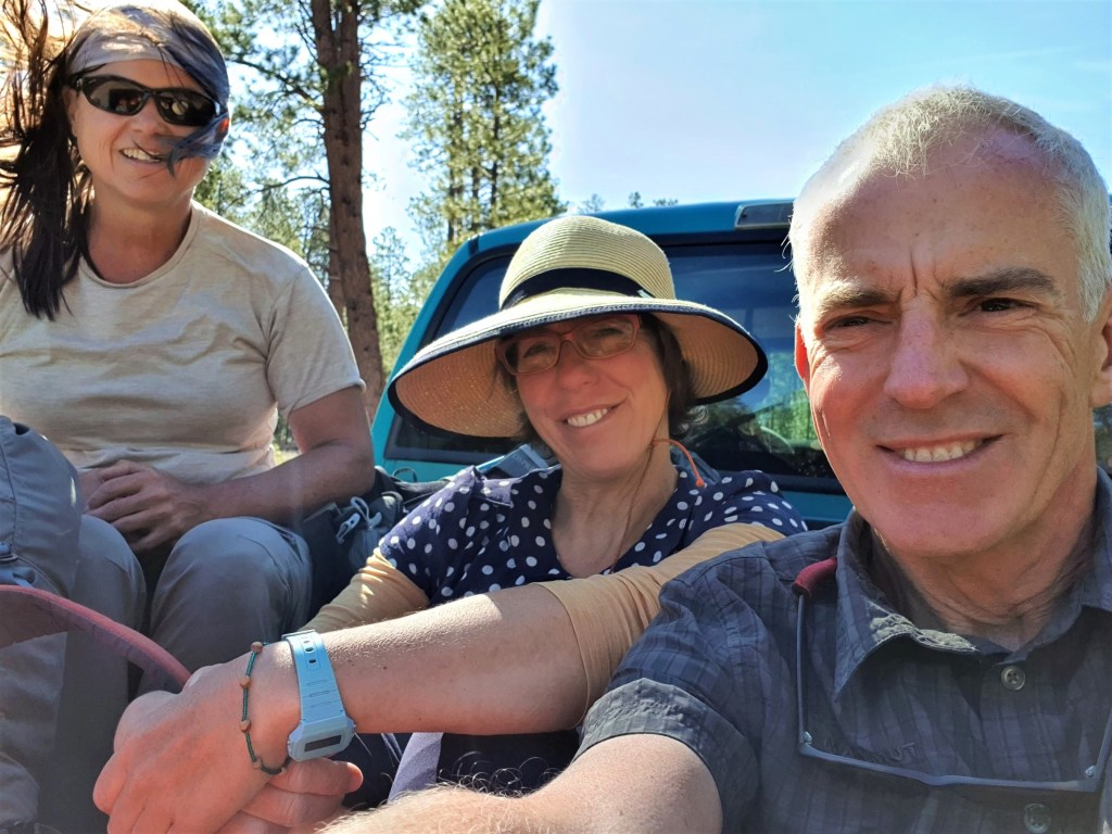
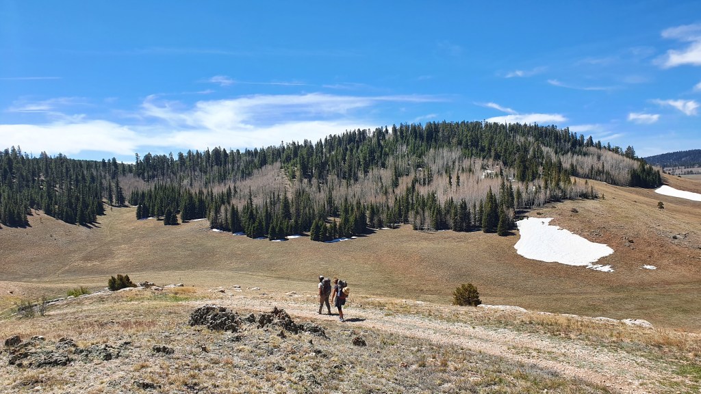
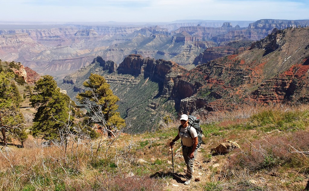
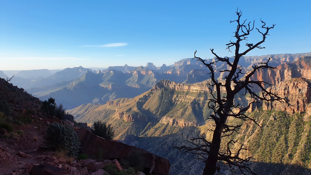
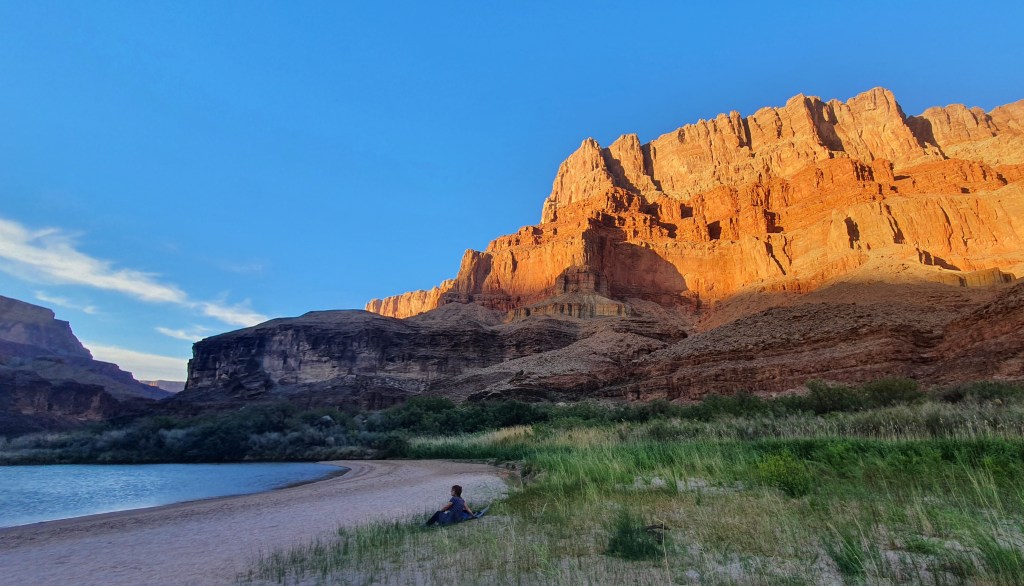
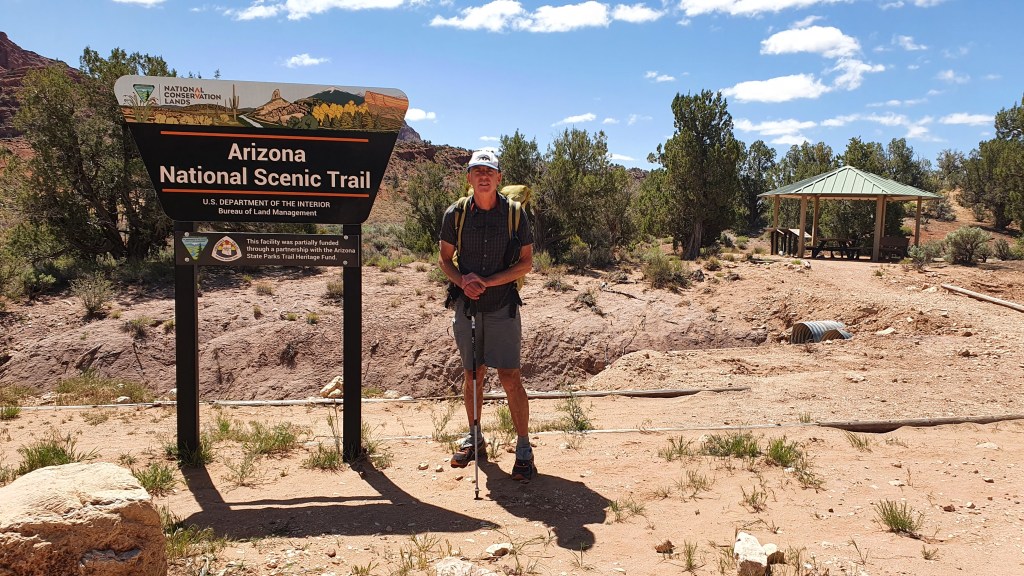
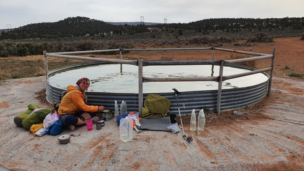
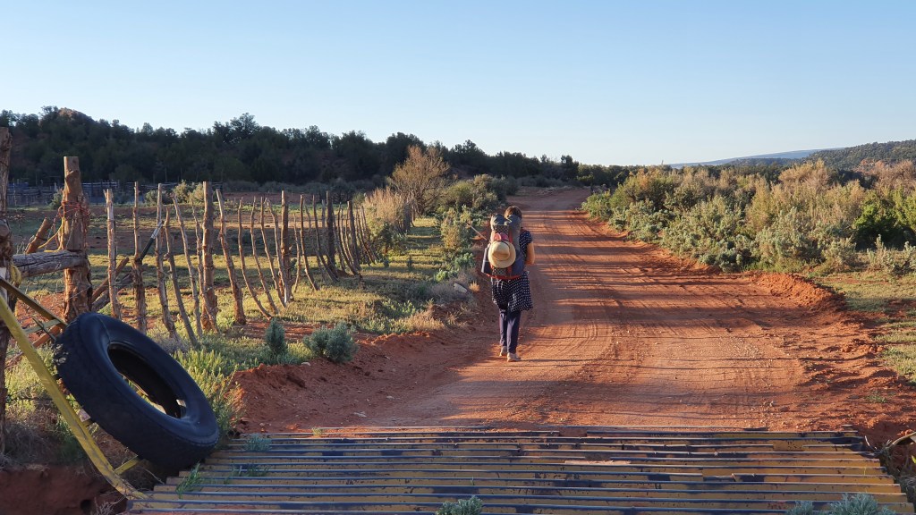
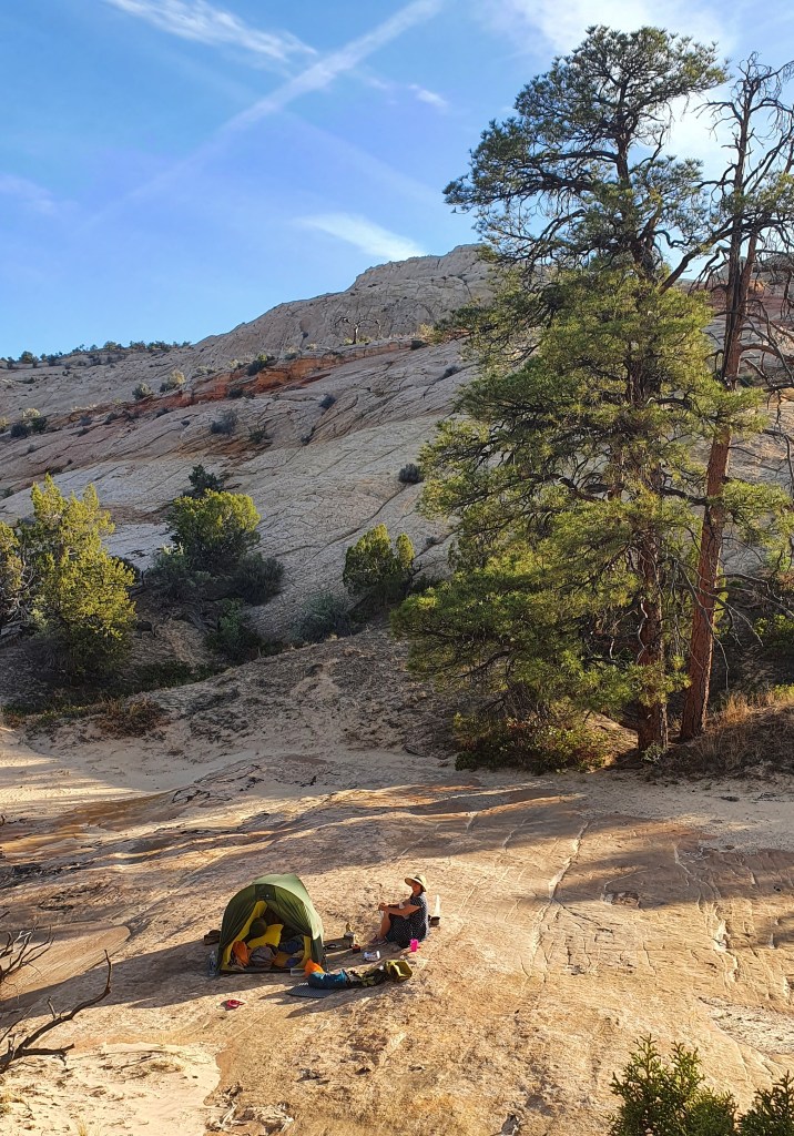
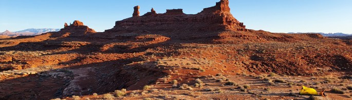
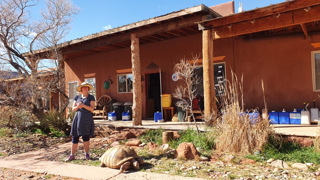
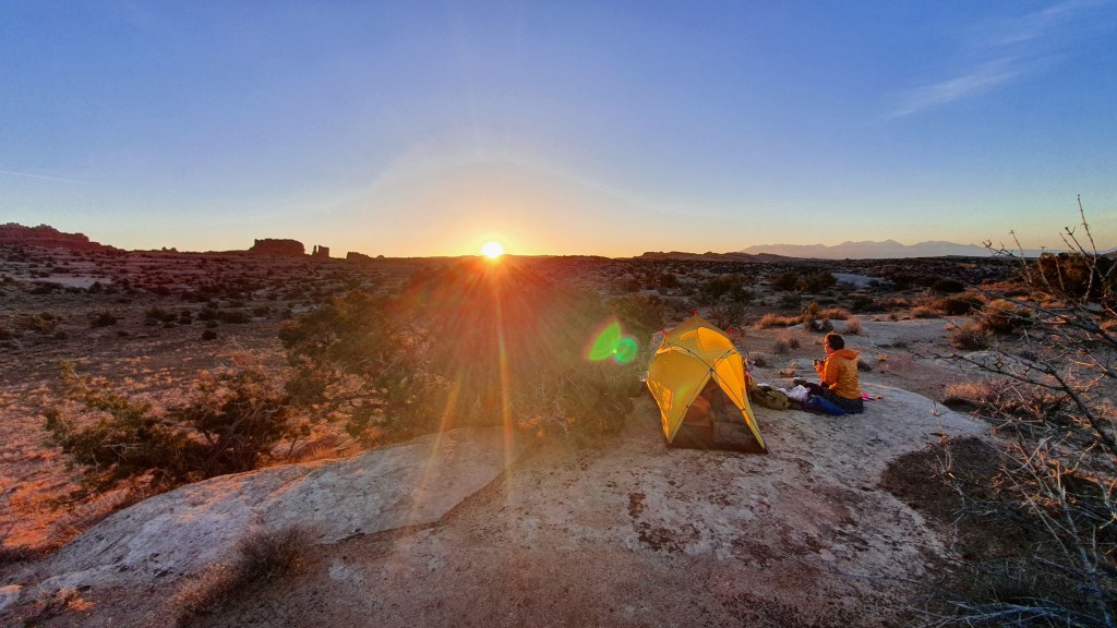
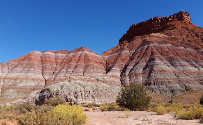
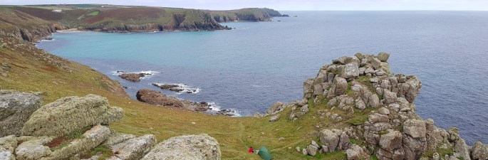
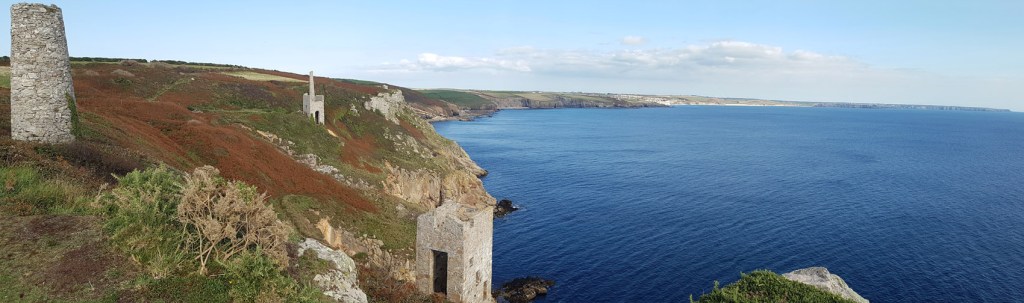
The attractively named “Swamp Point” high on the edge of the North Rim (no swamp, just a few mosquitoes) was our departure point back into the Grand Canyon after resting, eating and watching out for the endemic Kiabab Squirrel in the campground near North Rim Lodge.

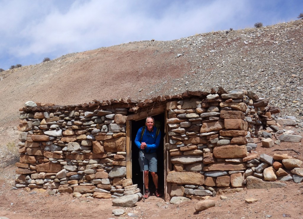
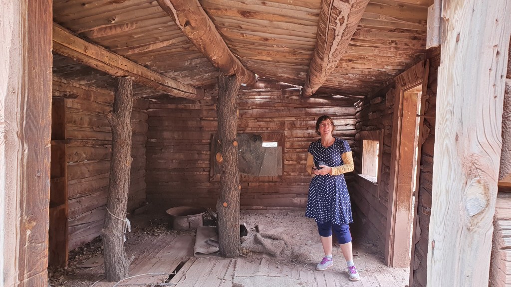
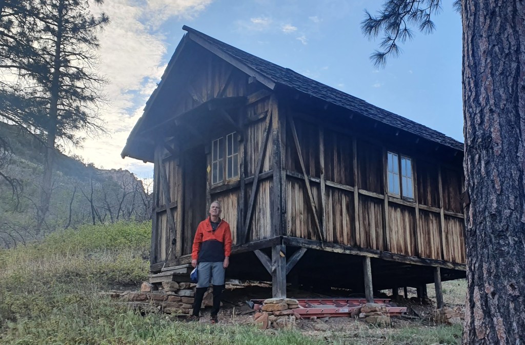
Just below the rim lies Teddy’s (Roosevelt) Cabin, a cool ‘bothy‘. Apparently the great man stayed here on a cougar hunt – the cabin was built (and named) afterwards. From this piece of civilization our route headed into the wilds, sans trail, bushwhacking and scrambling down Saddle Canyon and then Tapeats Creek.

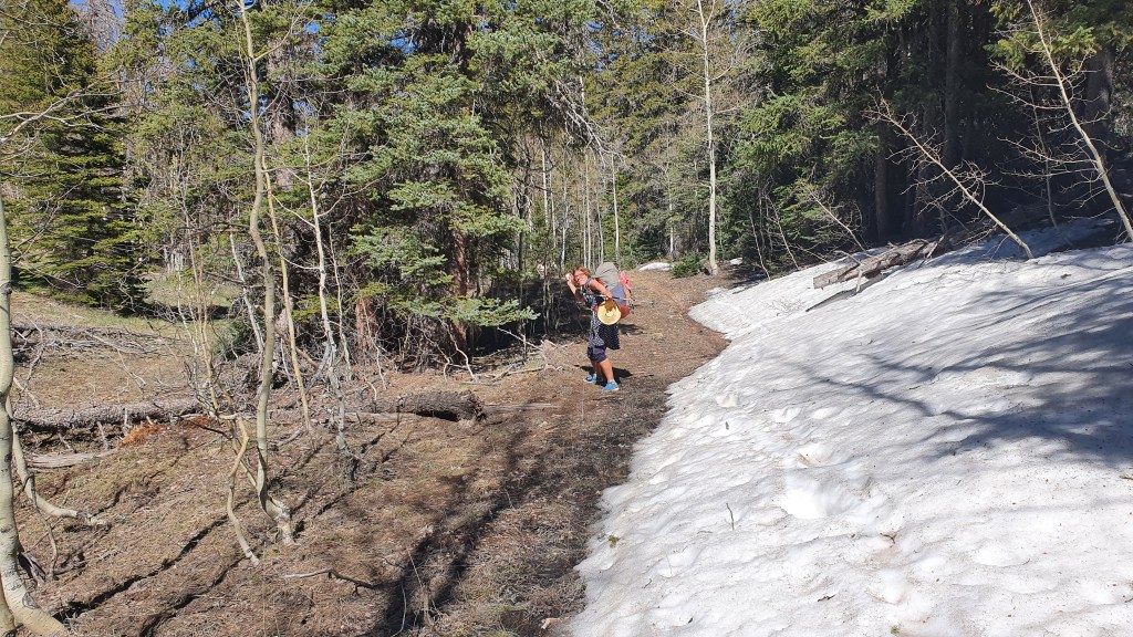
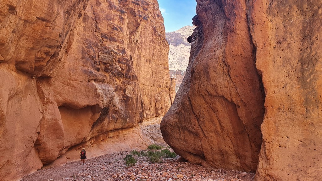
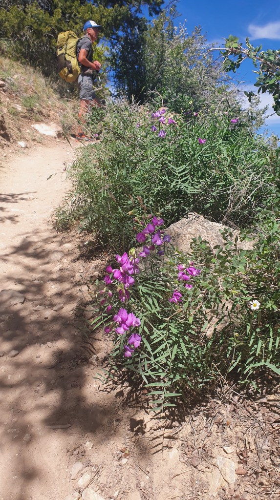
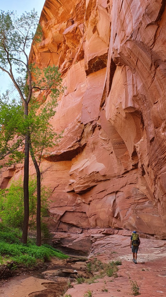
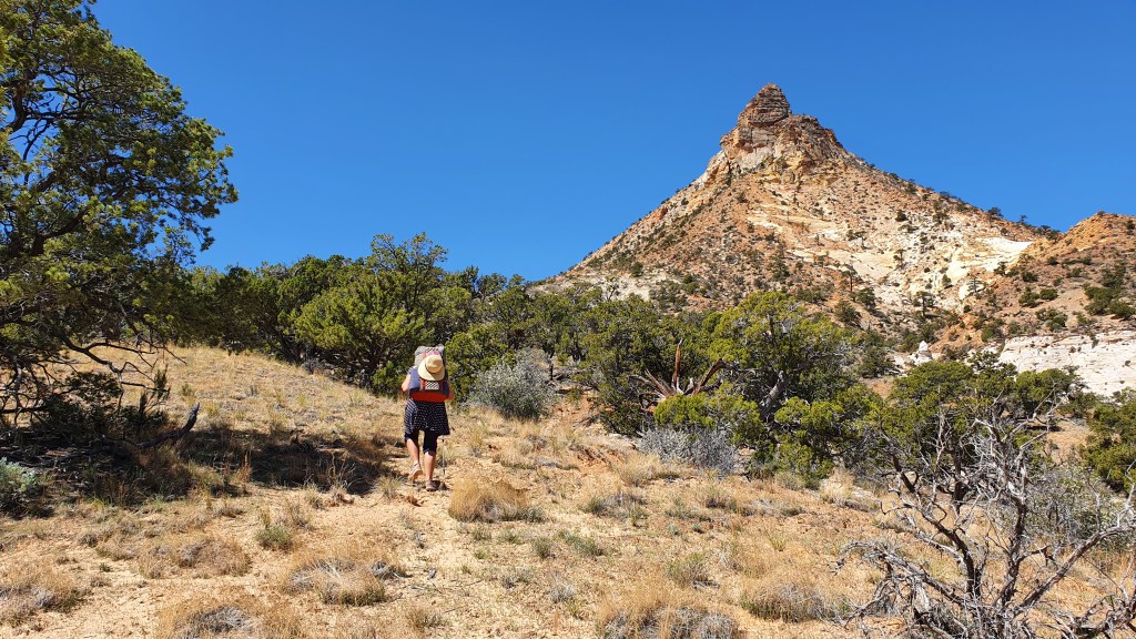
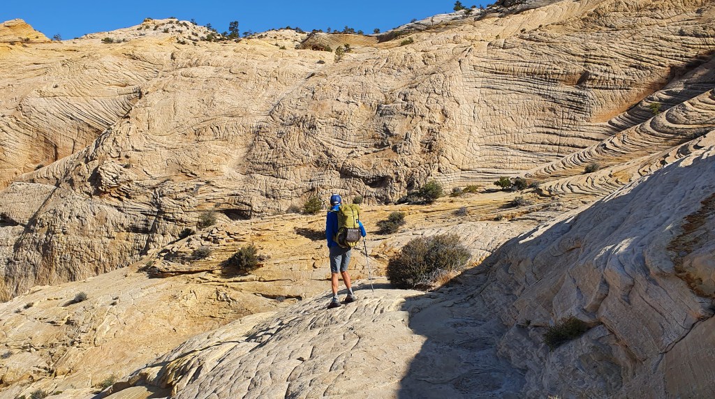
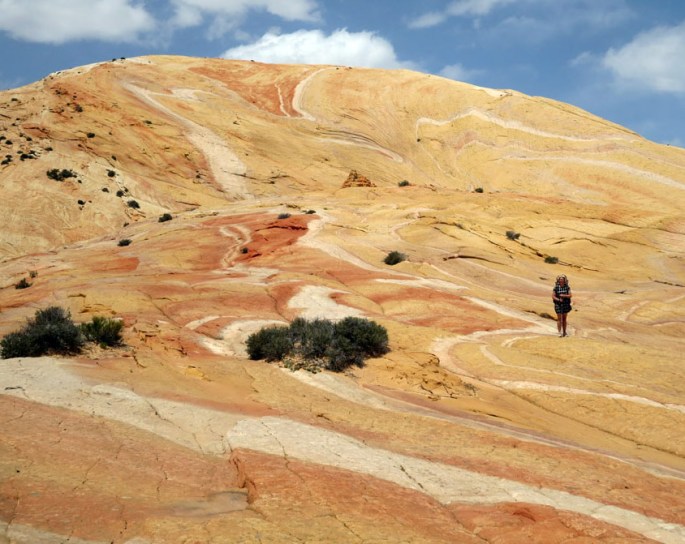
Firstly we bushwhacked our way down through the scrub in upper Saddle Canyon. This was slow going but not too difficult until we took a route out to avoid a big dryfall. We climbed out the canyon too early and got into some nasty scrubby, loose sand scrambling before we returned back to the canyon and finding a set of cairns for a better route.

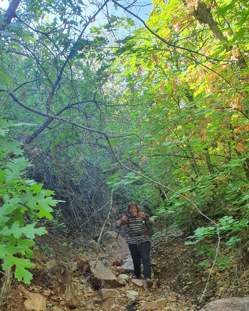
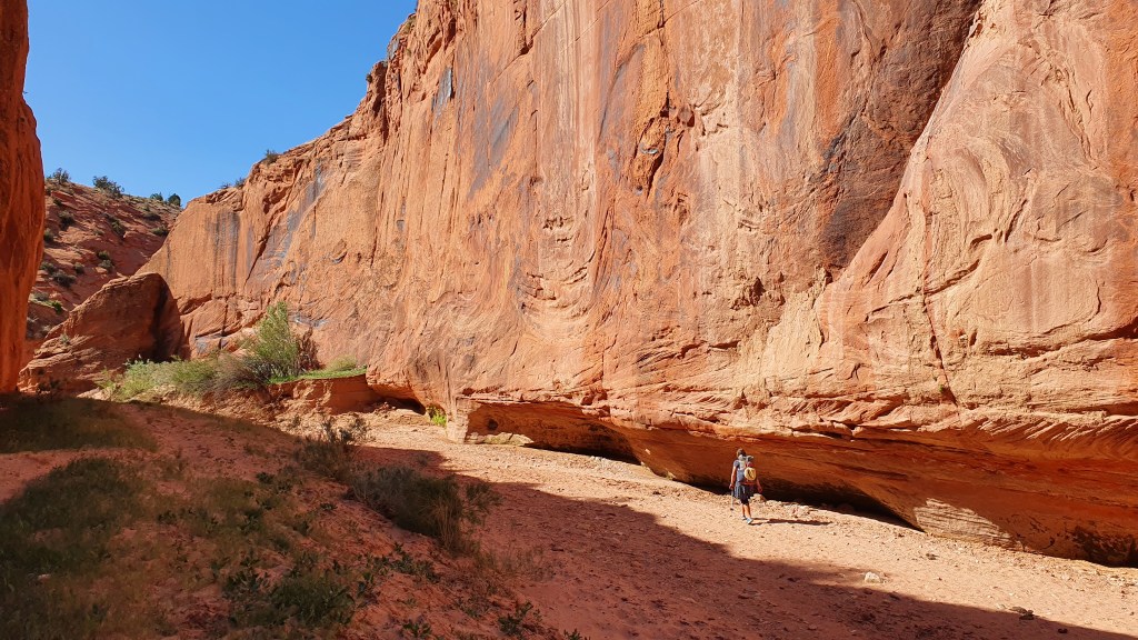
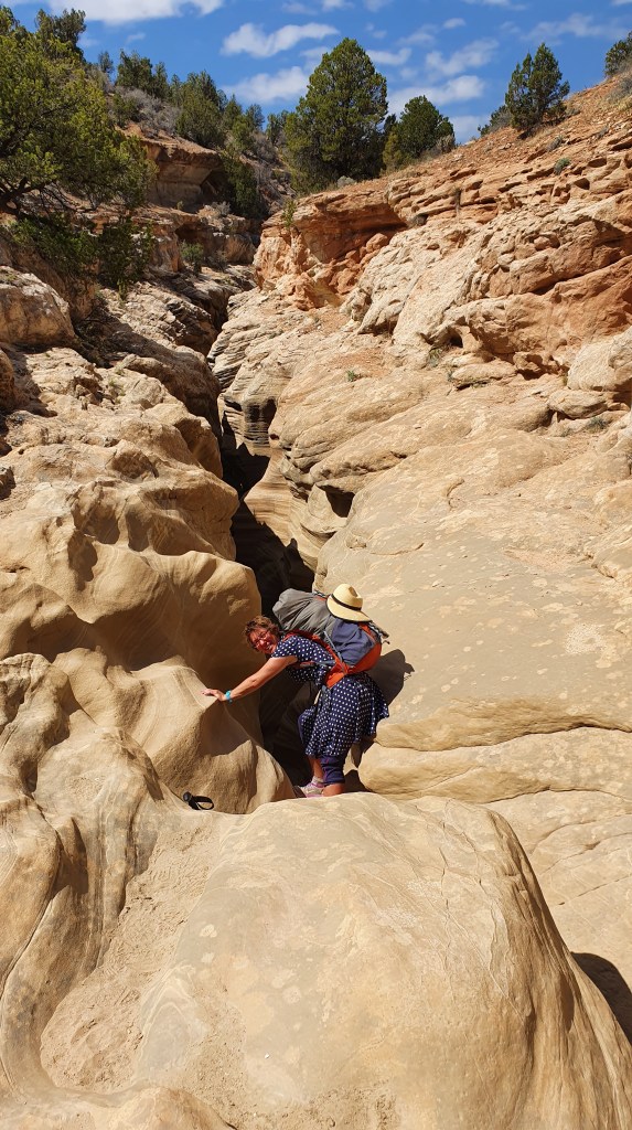
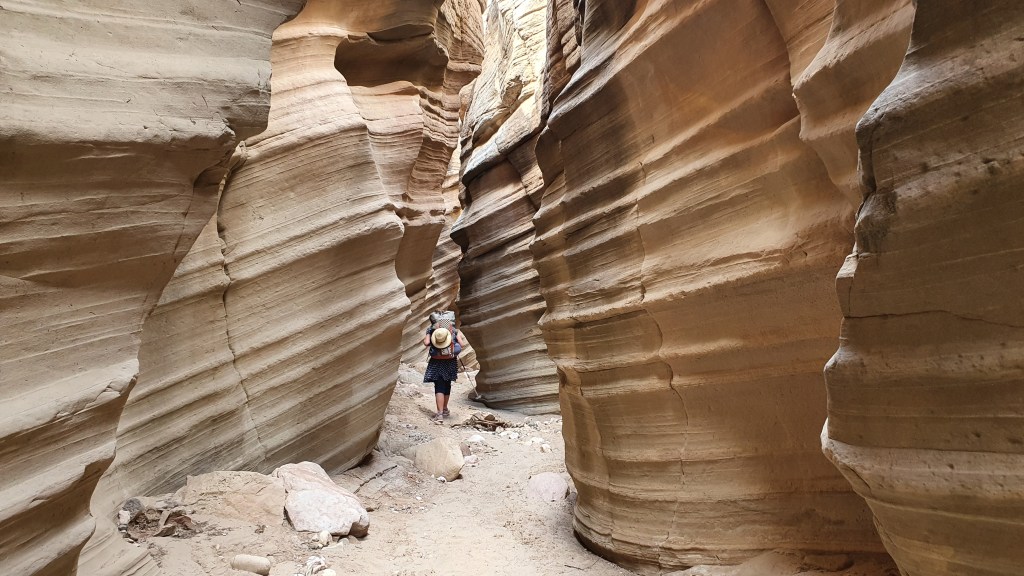
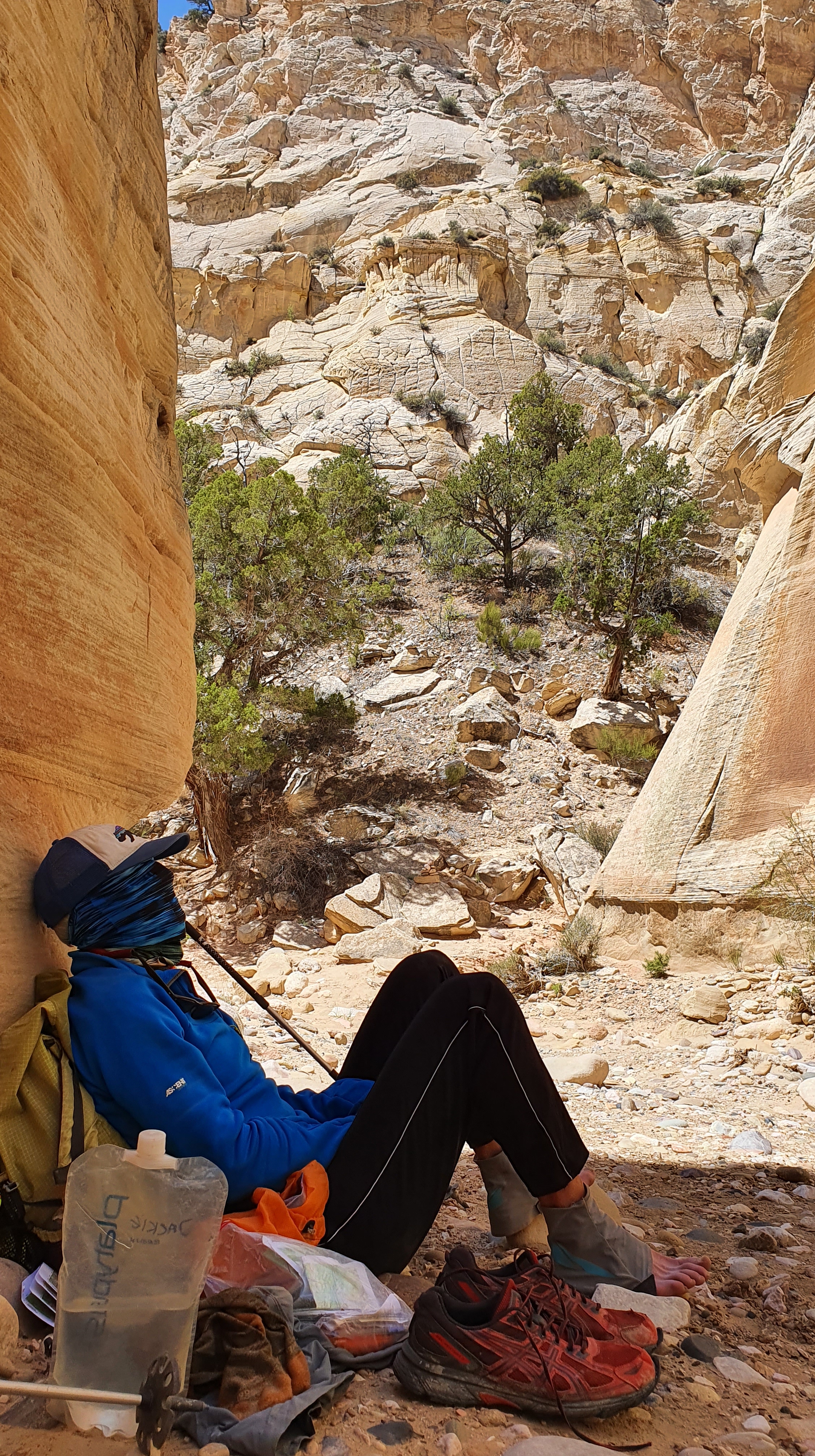
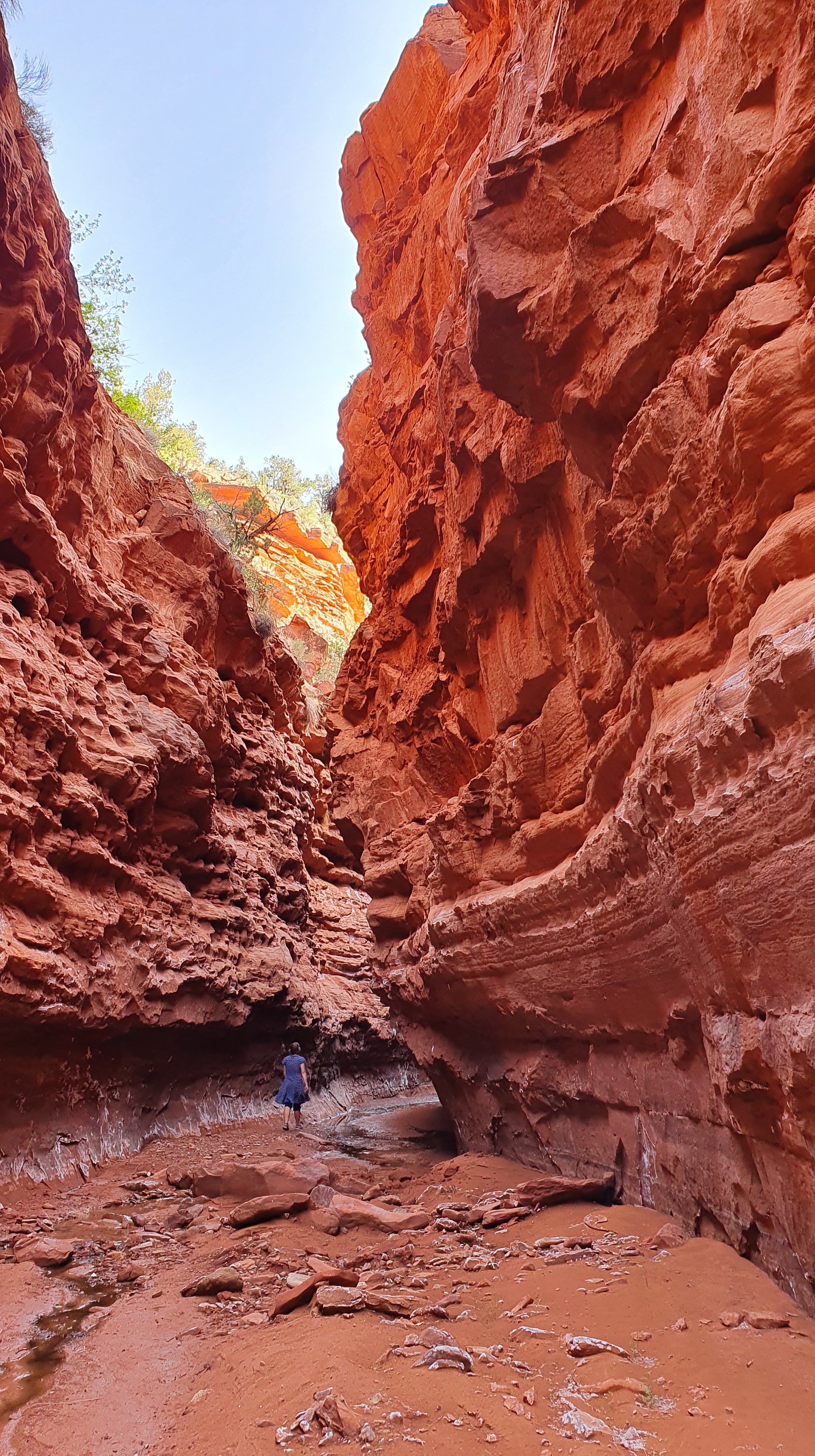
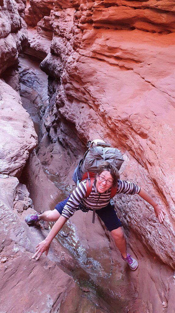
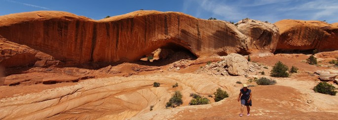
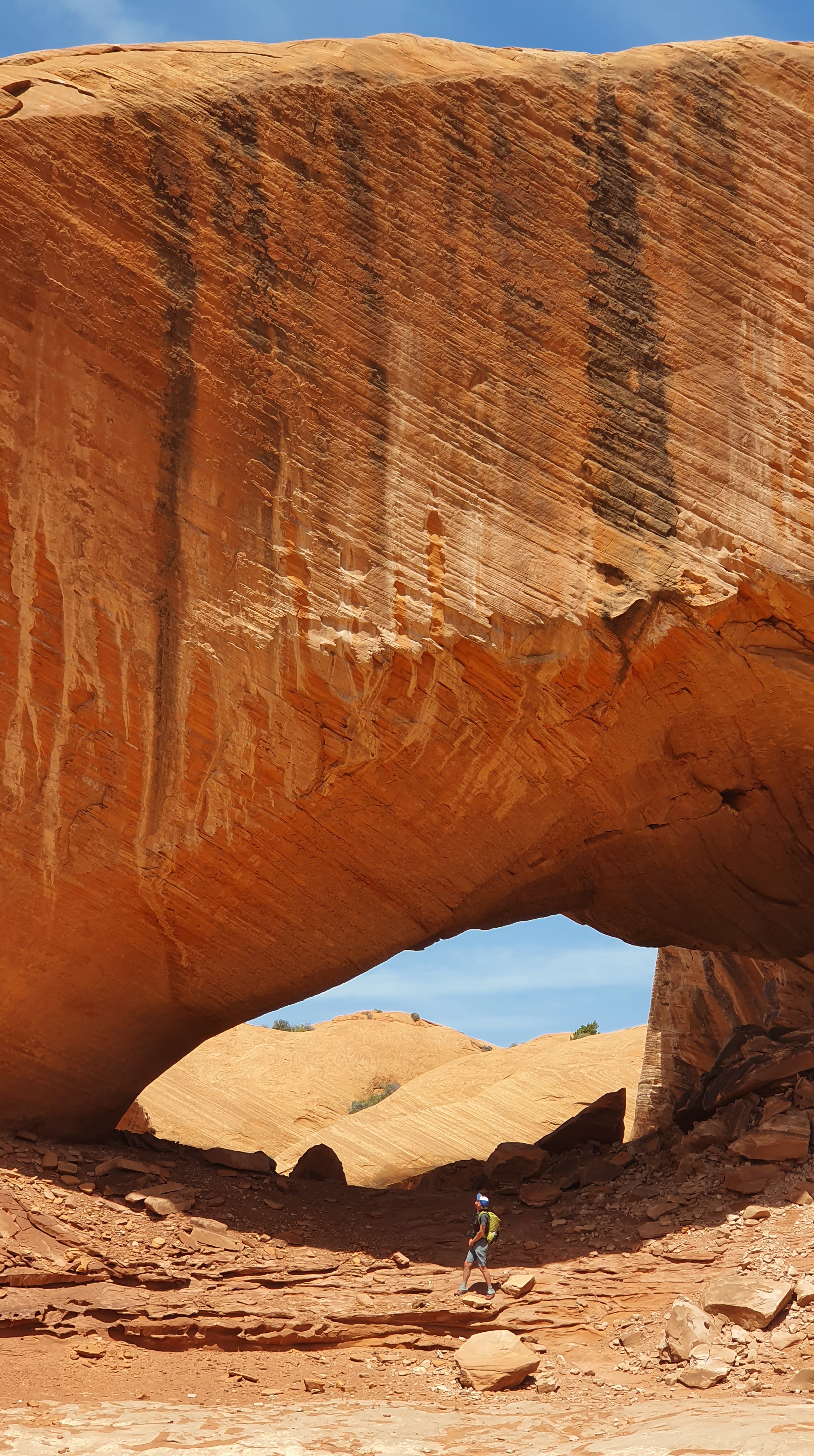
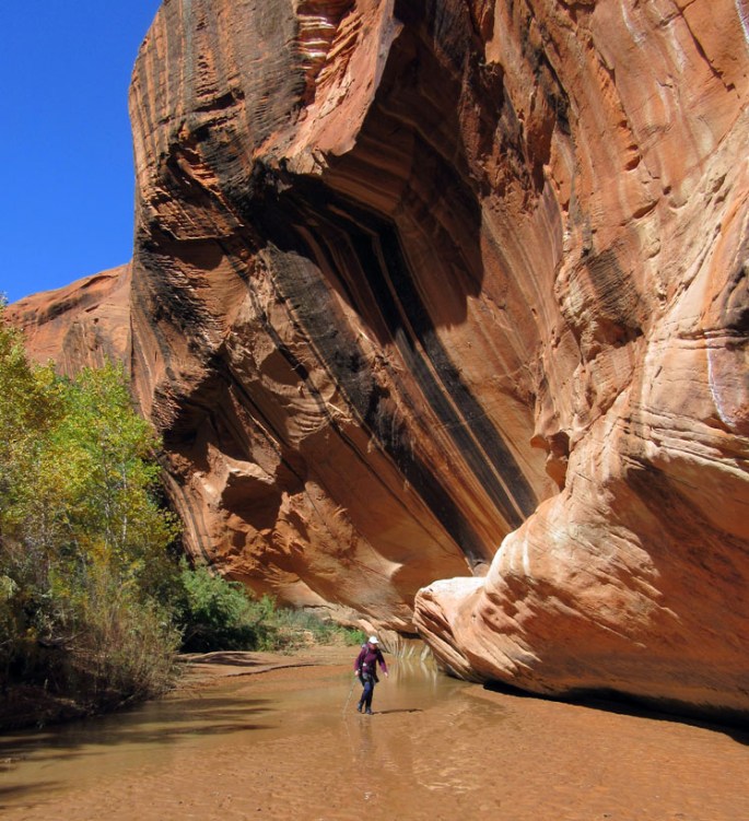
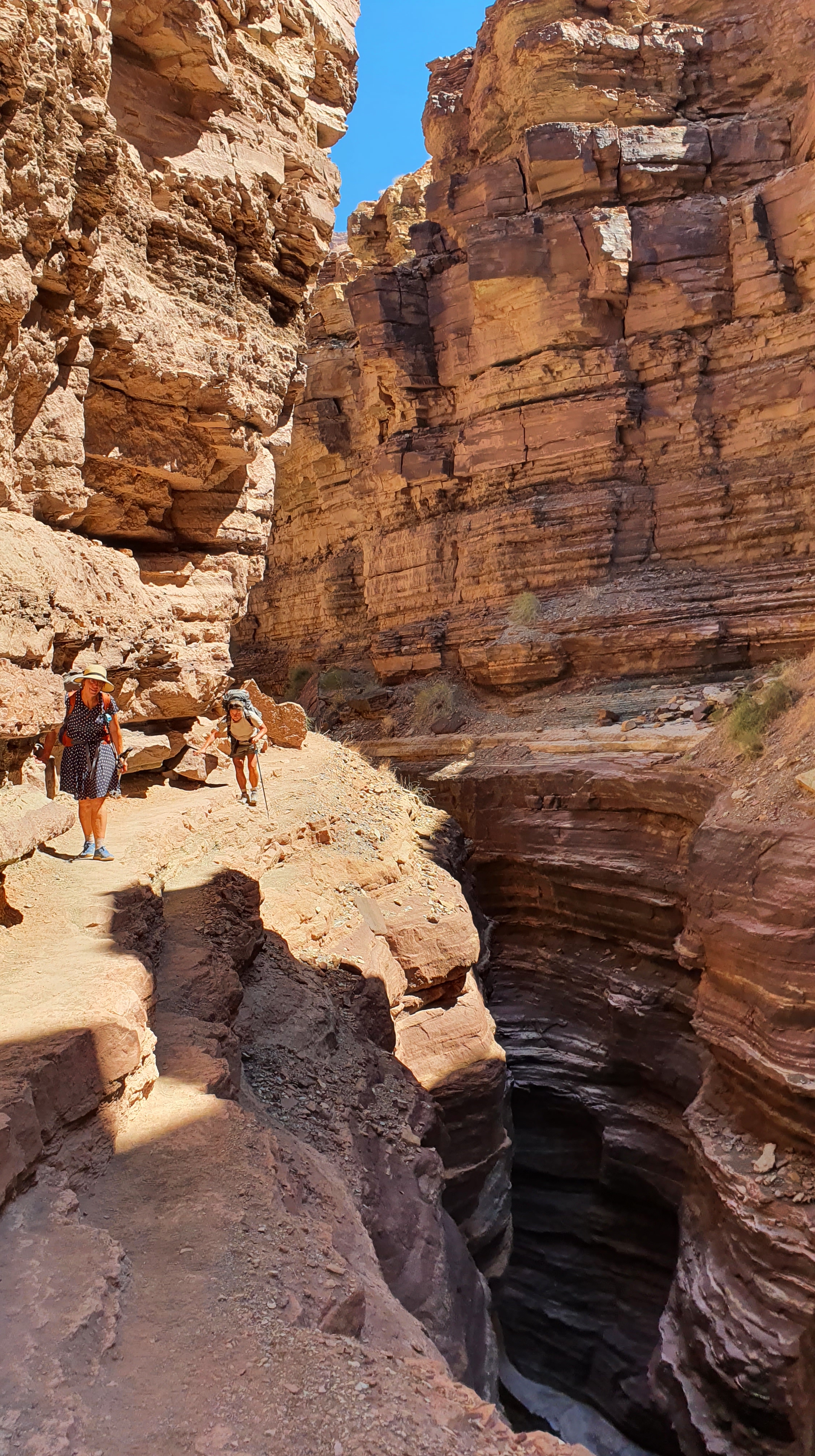
After a few hours of that, the walls of the lower part of Saddle Canyon suddenly rise up and form smooth alcoves above and slick chutes and channels under foot and we found ourselves sliding and scrambling down polished half pipes and overhangs into dark pools of water. By that time we were joined by a fourth hiker (Peter) and were able to assist each other, passing packs down the steep drops. Superb and exciting stuff, unfortunately I then stored the camera away in a waterproof bag for safety!

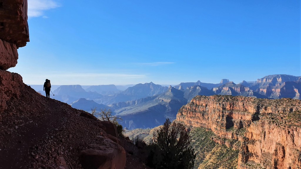
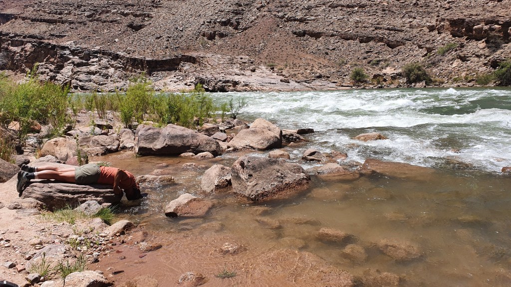
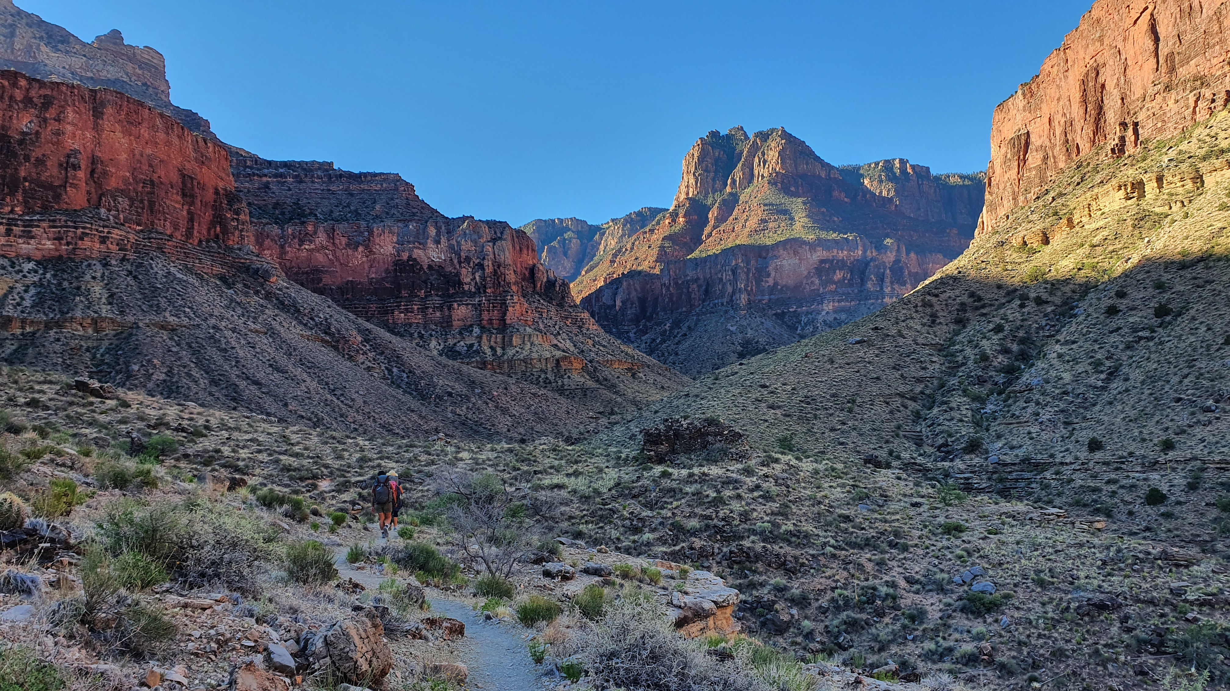
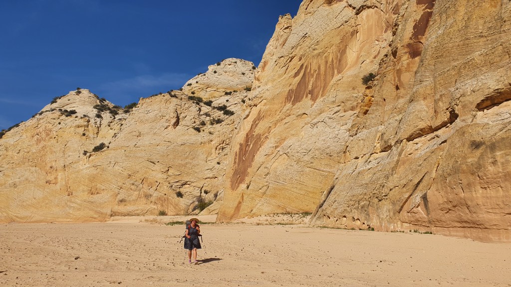
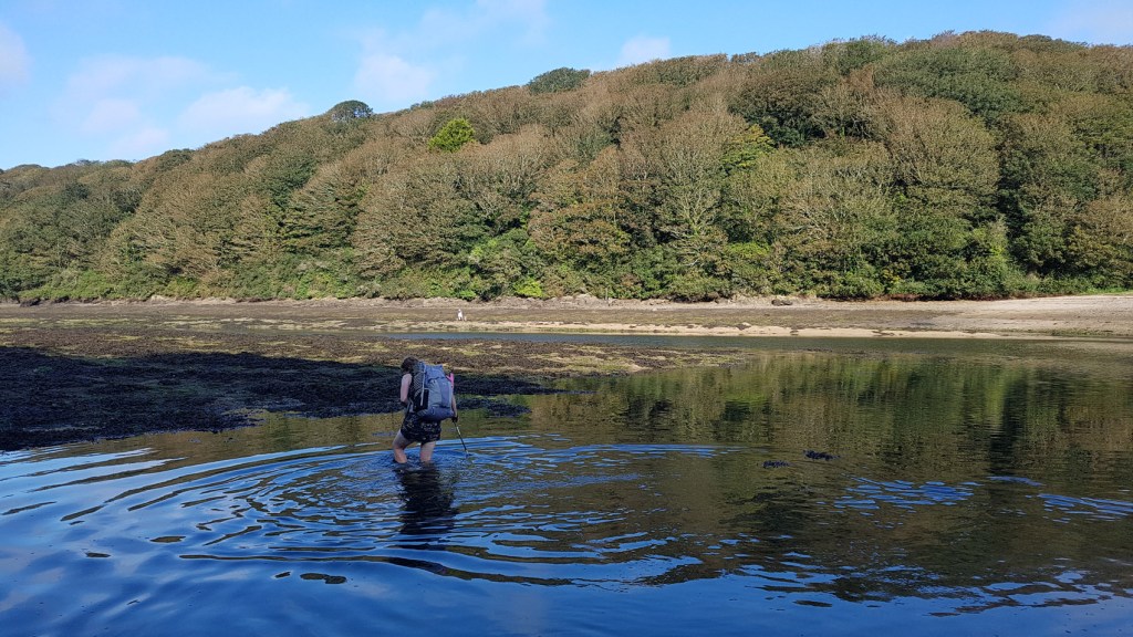
After the shady but steep narrows of Saddle Canyon,  we joined Tapeats Creek which was dry and hot at mid day. But after a couple of hours of sizzlingly hot hiking with a few rests in the shade we thankfully reached pools of water, then flowing water and then to a roaring clear river which we had to cross numerous times.

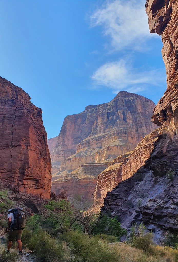
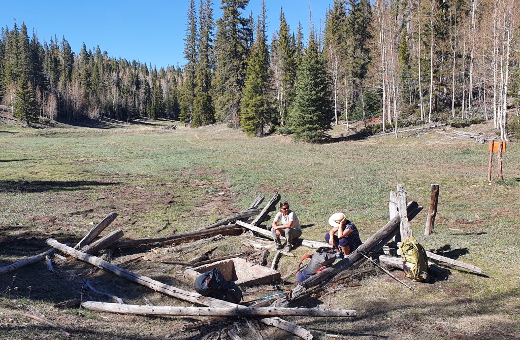
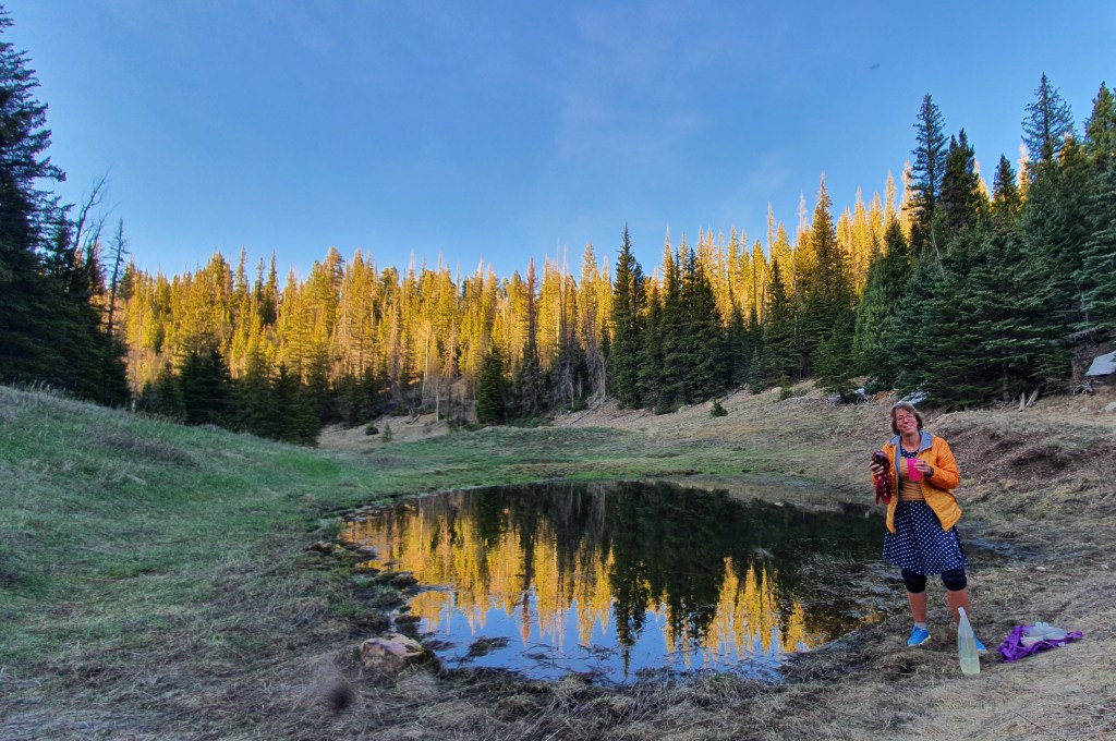
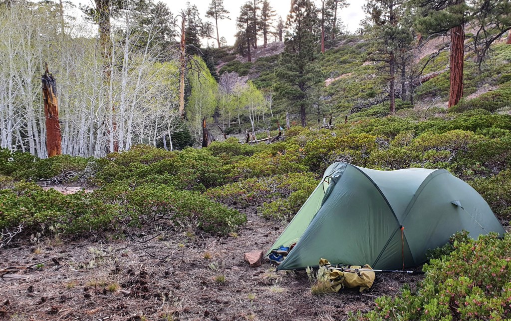
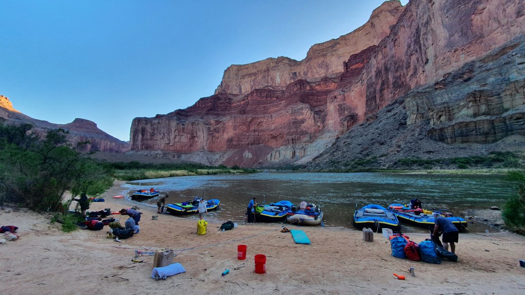
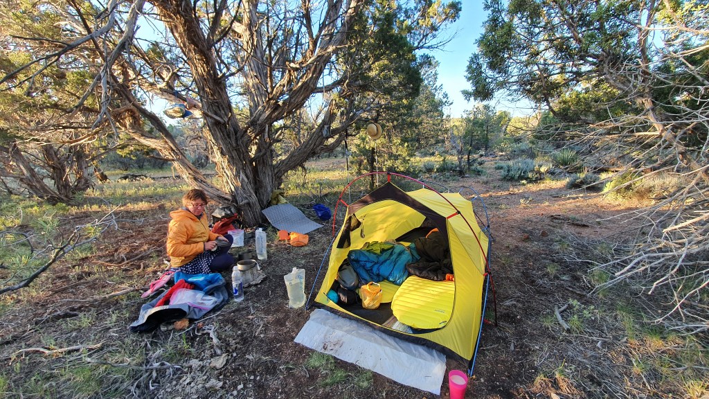
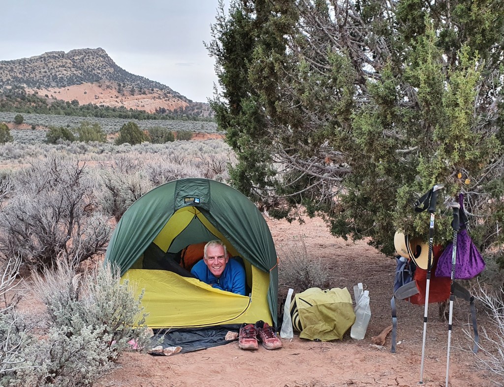
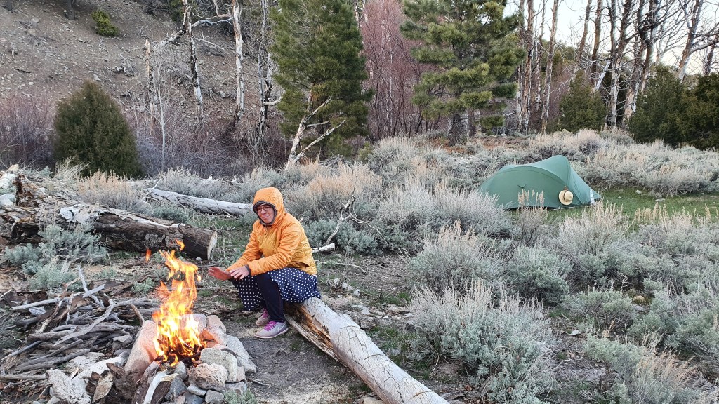
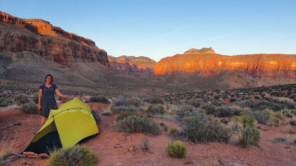
Travelling through this terrain without trails is hot sweaty and challenging and we took 12 hours to cover 11 miles that day, arriving at our intended camping spot near the junction of Tapeats Creek and Thunder River at dusk. We were welcomed by a large pink rattlesnake who slithered away and happily was not seen again during the night!

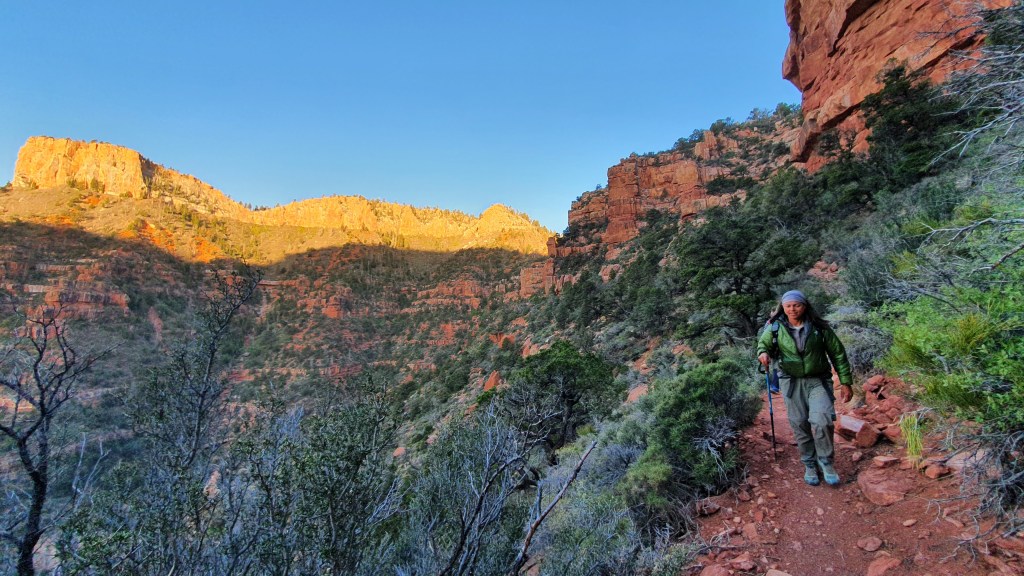
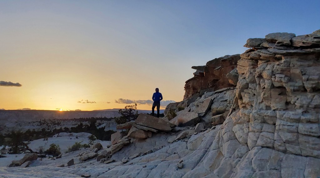
Next morning at 5 am we climbed up 1,400ft to Thunder Spring, a roaring cascade of spring water gushing straight out of the limestone cliff. We knew the day would be hot, so the early start maximised the comparatively milder morning temperatures (and beautiful morning light).

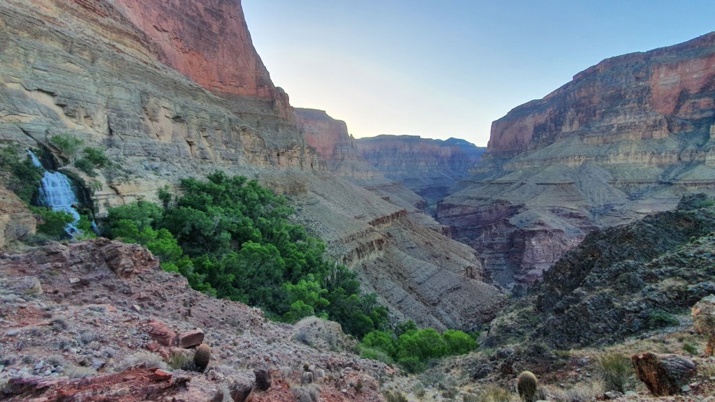
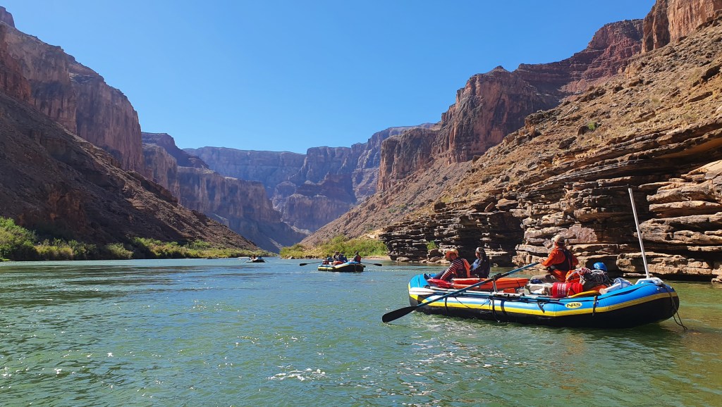
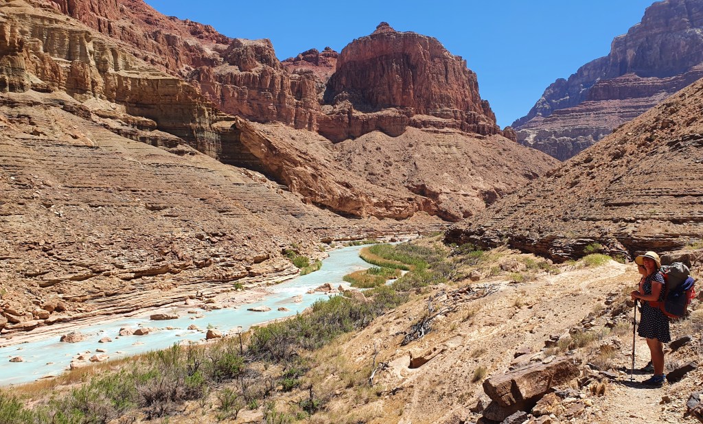
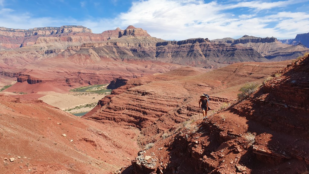
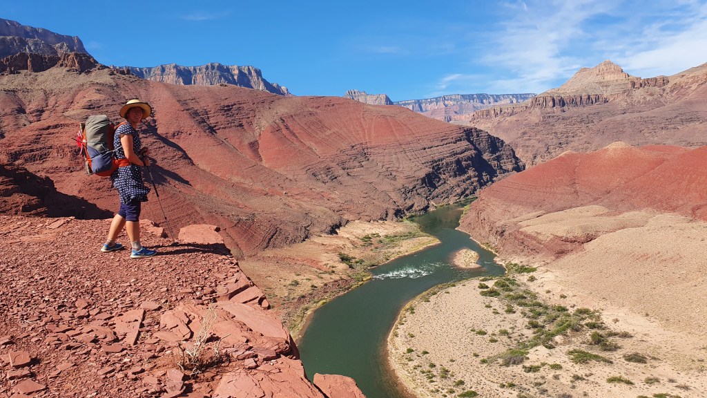
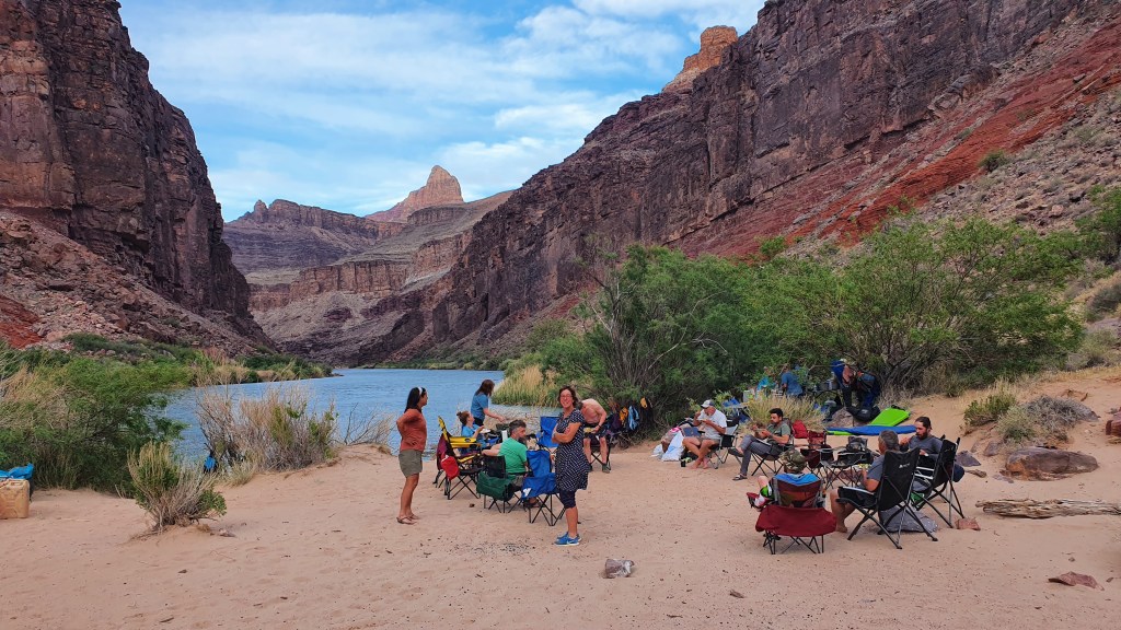
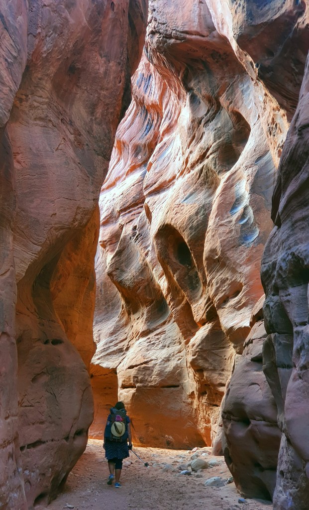
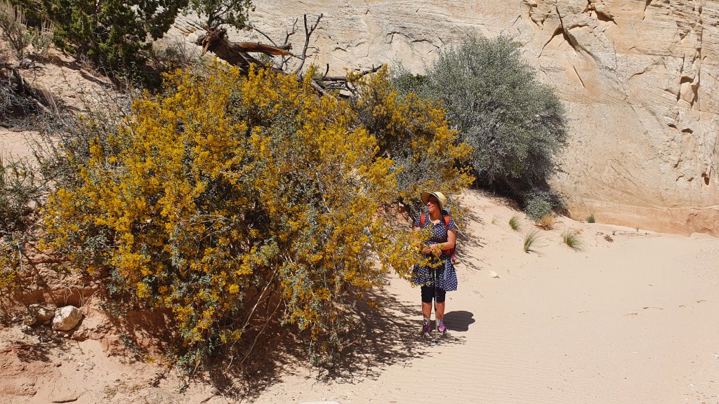
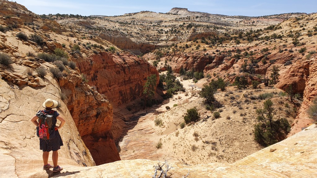
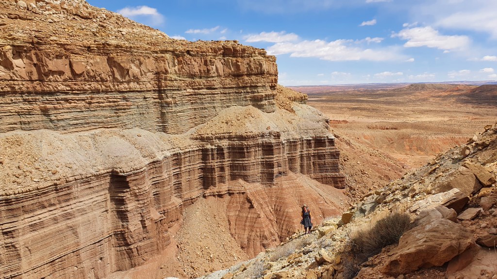
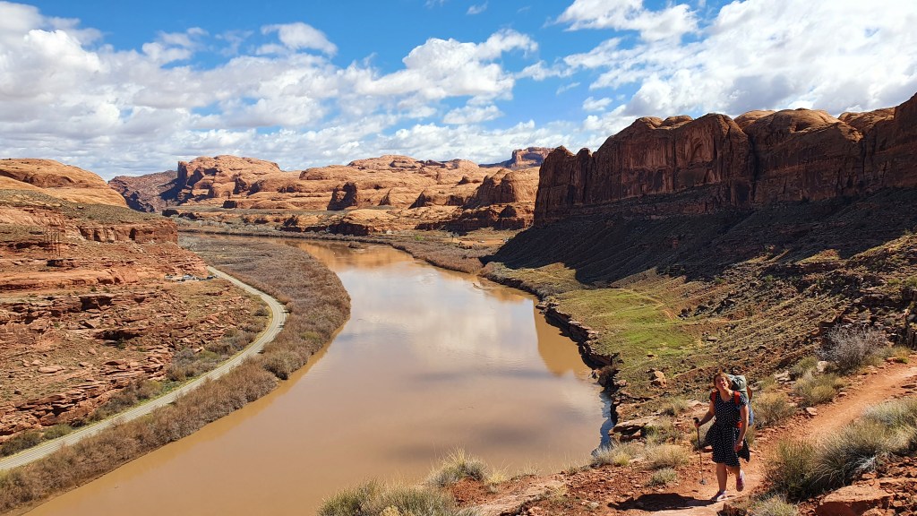
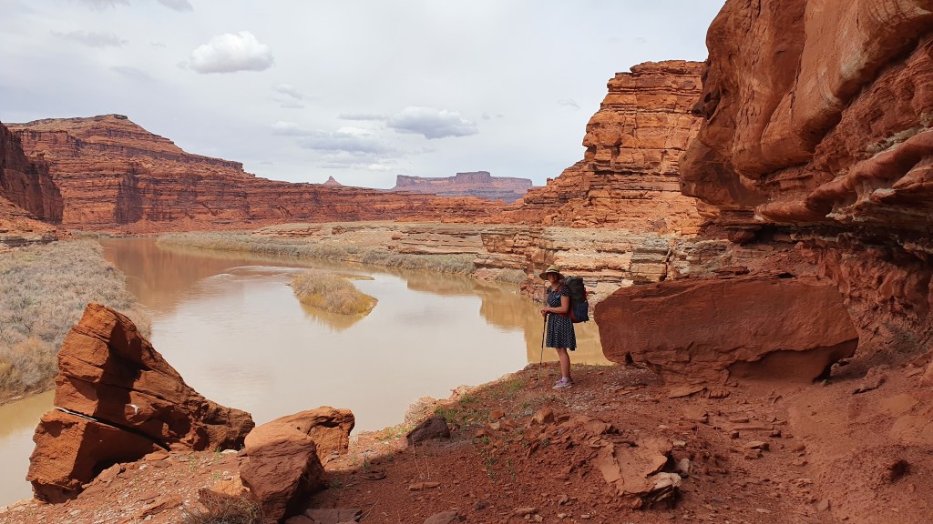
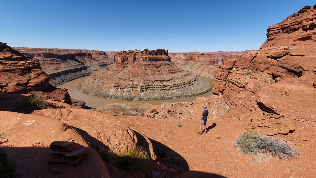
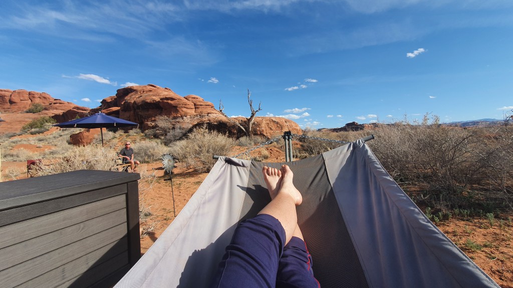
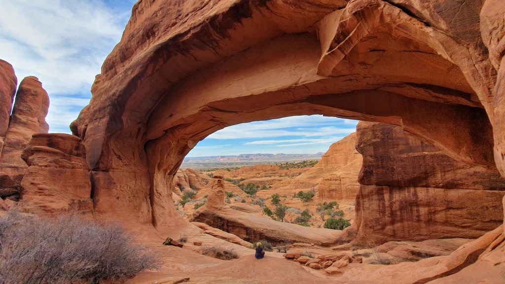
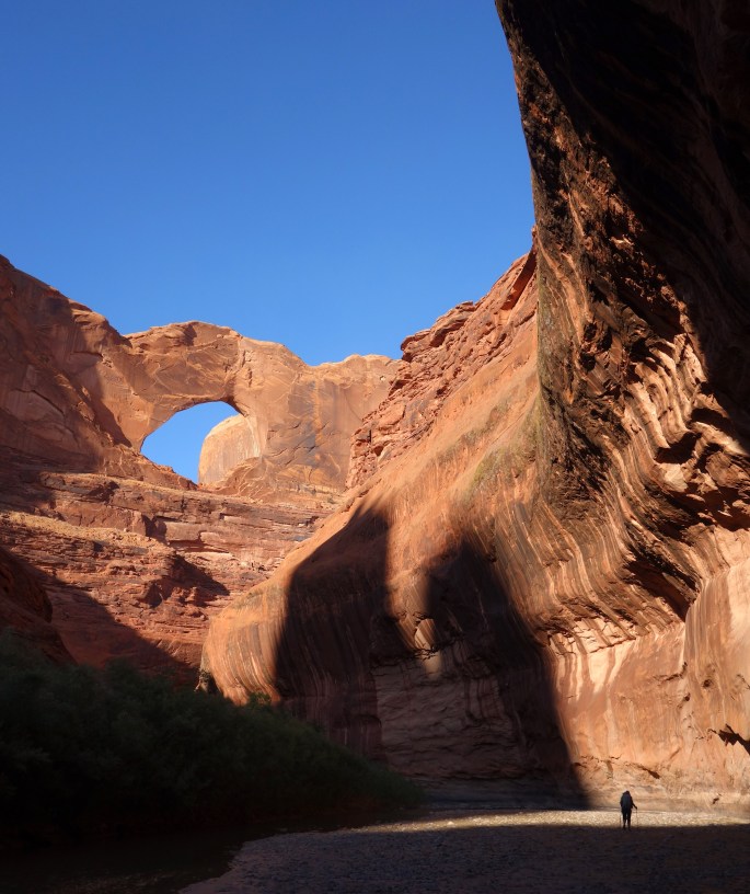
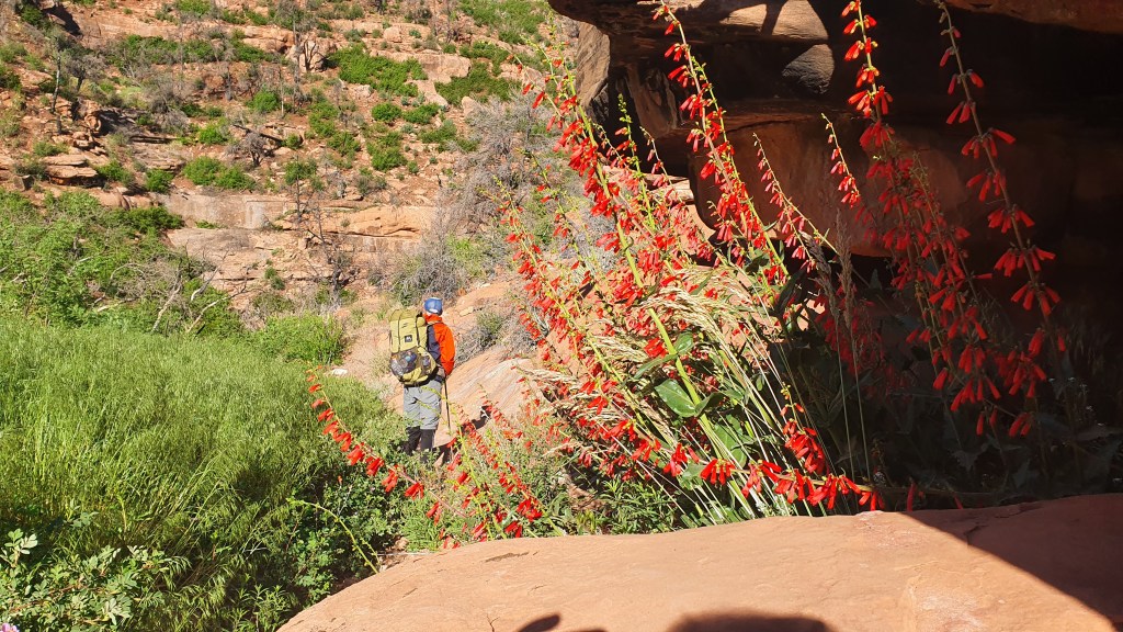
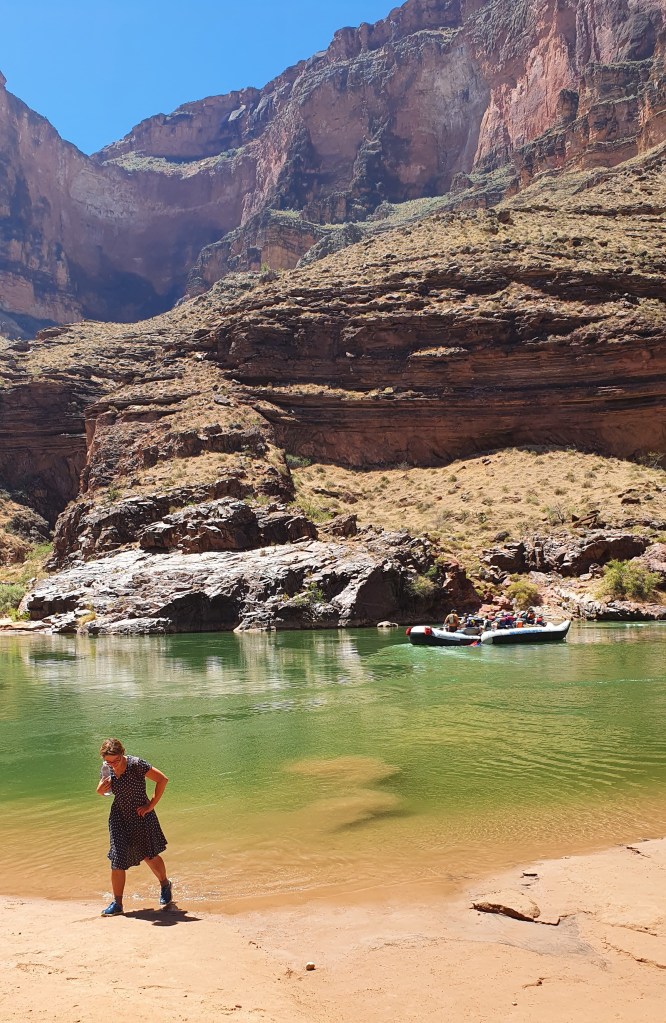
We rested for a couple of hours at the oasis-like Deer Creek in the welcome shade of cottonwood trees and descended the beautiful Deer Creek narrows before reaching the banks of the Colorado River itself around 11am. We were not alone: Deer Creek is a must-see side trip for river rafters.

Deer Creek narrows

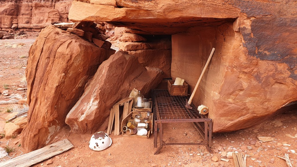
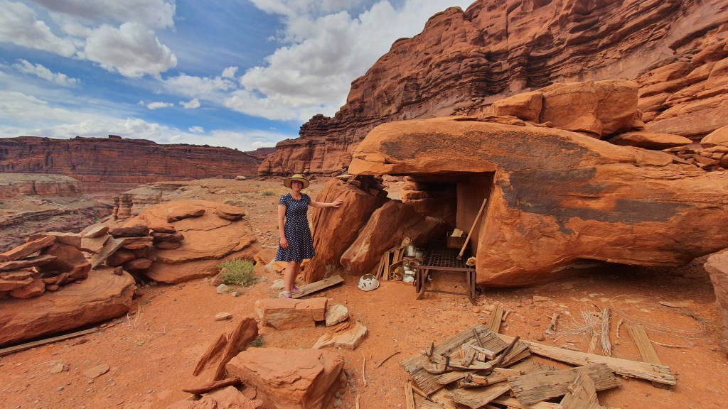
We found ourselves a shady cave under some big boulders and tried to sit out the heat. The forecast at river level had been for 107 F (41.6 °C) that day and the next.

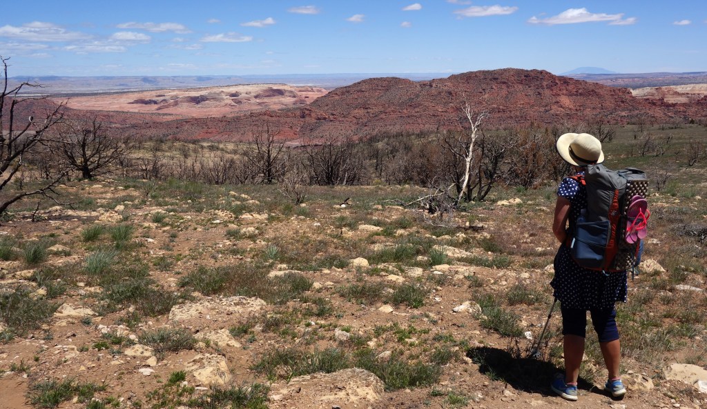
We passed the day reading, venturing out only occasionally to dip in the pool below Deer Creek falls and to talk the boaters arriving at the beach. In the afternoon we (Brian and Martina) decided that it was way too hot to enjoyably continue hiking down the canyon (an off trail route requiring boulder hopping on the steep riverside most of the way for 8 miles or so, we had done this in 2017 but in cooler temperatures).

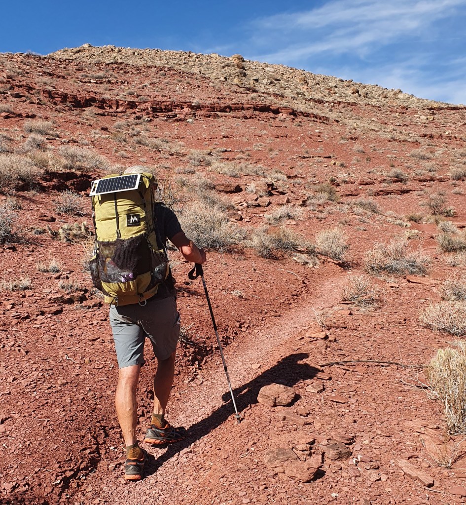
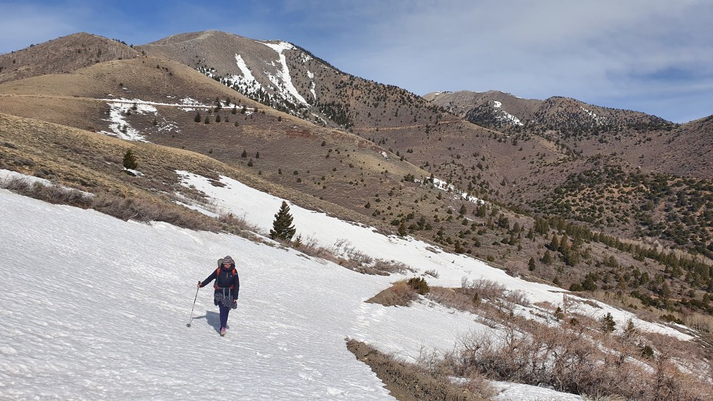
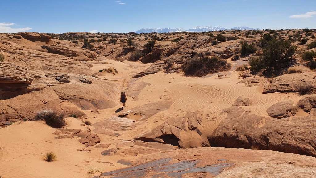
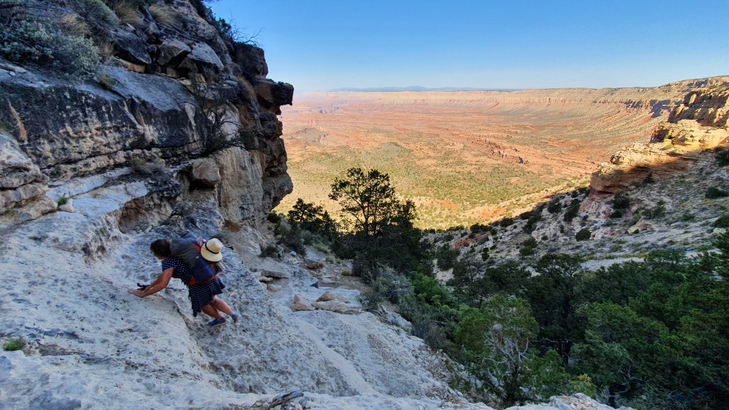
So we hiked back uphill that evening and, with a 3.30am alarm the next morning and a helpful bright moon we continued upwards when it was cooler, all the way to the North Rim on the scenic Bill Hall trail. About a 4,700ft climb in all. There we got a lift with some friendly hikers from Idaho to the town of Hurricane, Utah.

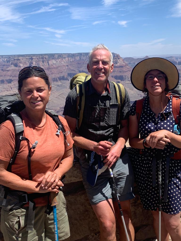
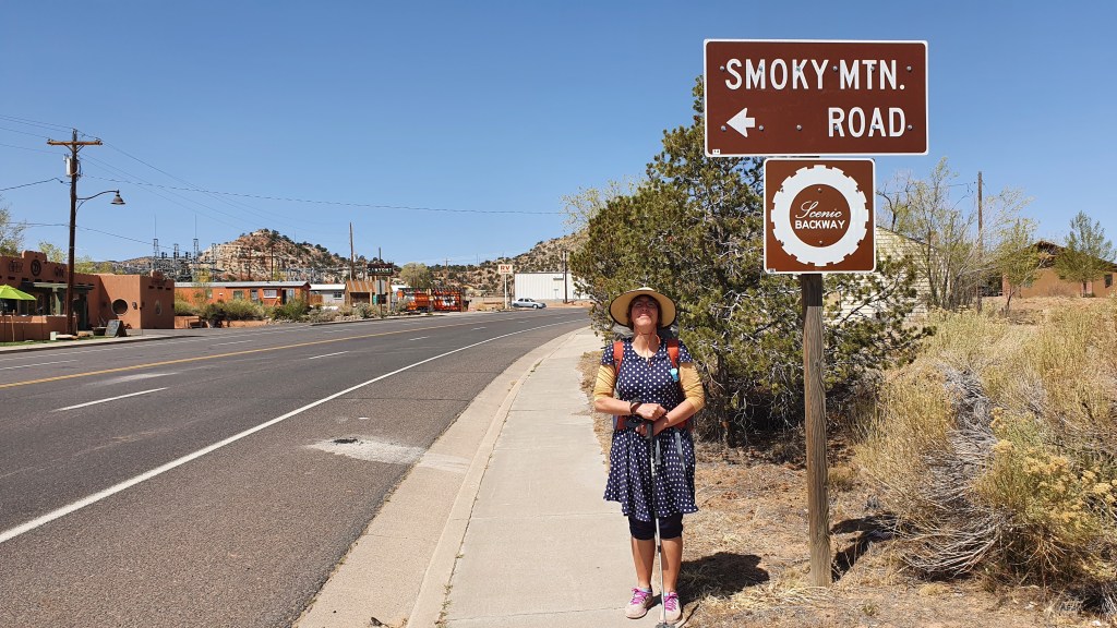
Heather and Peter have hiked on (hardier than us!). We are hopping forward and with the help of a cooler weather window hope to continue our route into Zion National Park…meantime we are enjoying a decadent town stop!

Hiker Notes

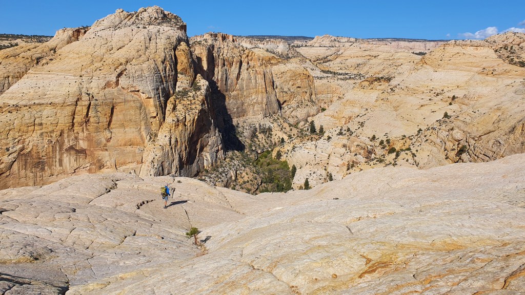
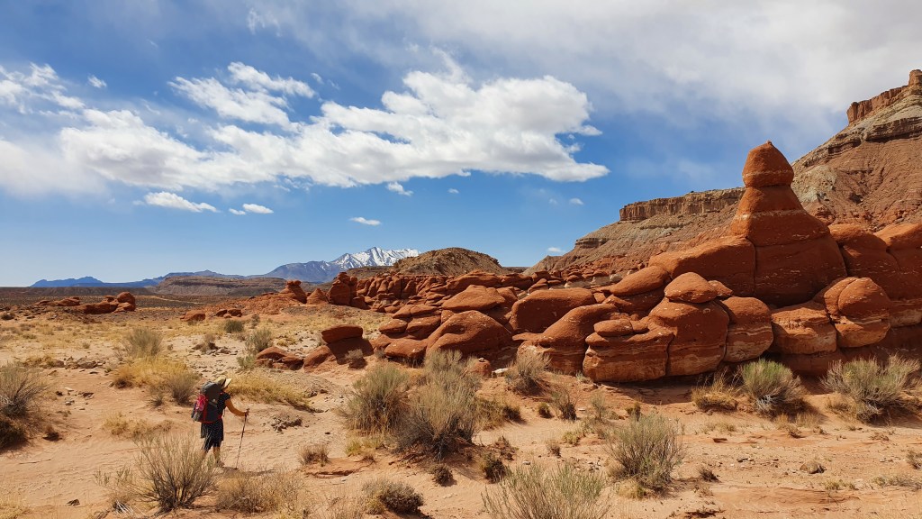
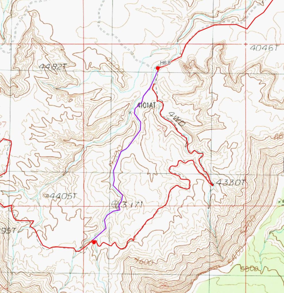
Section 13 miles 27.9-37.4 I think the section down Saddle Canyon to Upper Tapeats Campground is one of the toughest sections of the Hayduke, although with some great scrambling and scenery. We were here mid May and it took us about 10 hours but that included about 1-2 hours time wasted scrabbling about at a wrong exit from Saddle Canyon.

The initial descent down Saddle Canyon (28.6-30.2) was cross country with some scrub in the dry bed of the creek but wasn’t too hard at all. Maybe with more people on the Hayduke it is gradually getting easier.

We missed the correct exit from the dry canyon bed at 30.2 to traverse around the dryfall and headed uphill too early. There are a few smaller dryfalls you get to first which have cairns on the left side but you need to go down past these to more cairns before the bigger dryfall. The route from there back into Saddle Canyon involves traversing on the left west side onto a ridge then descending its west side to a small side wash and back into Saddle Canyon. It was pretty slow going, scratchy bushwhacking but had some cairns and signs of traffic.

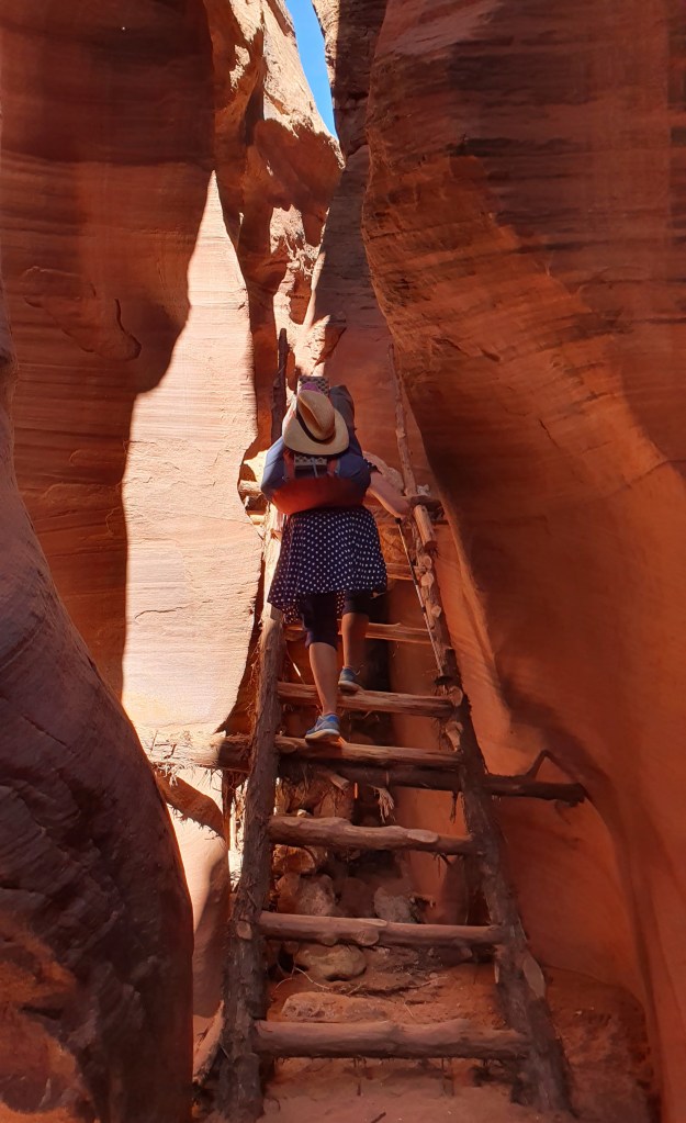
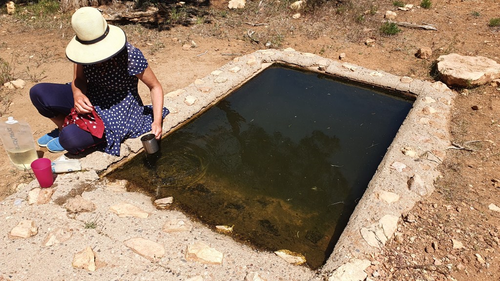
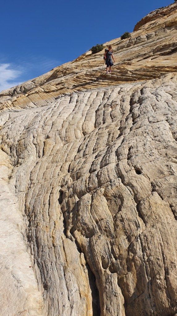
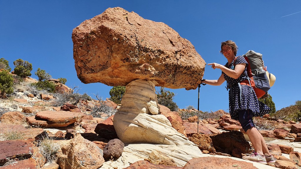
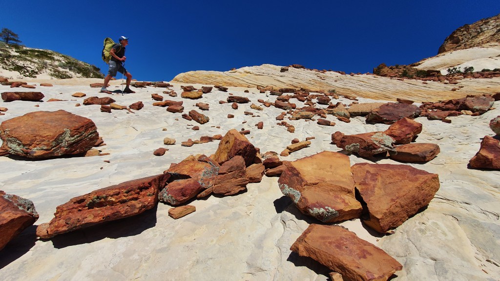
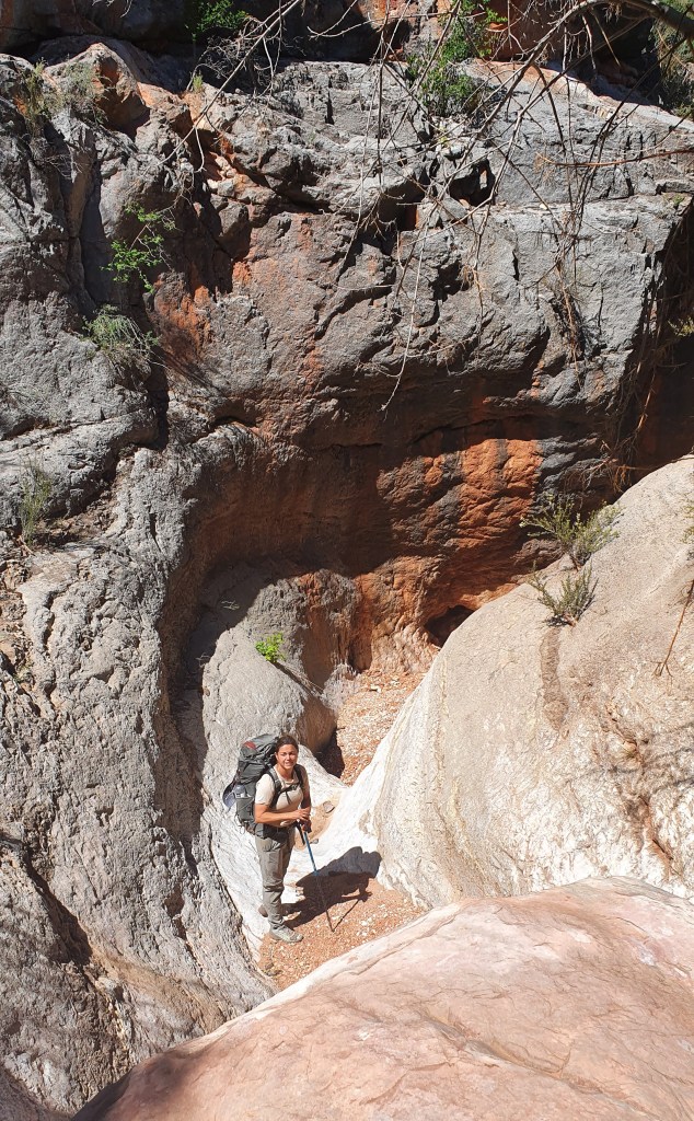
Once you are back into Saddle Canyon at mile 31.0 the character changes straight away to scrambling and hiking inside the slickrock canyon. There were a few drop offs where we were happy to have a team to assist each other and lower packs- it would be trickier solo. The cord to lower packs was definitely useful. We didn’t really get too wet in the slickrock potholes, maybe knee deep. A superb canyon.

The scrambling ends at 32.6 with the Stina Canyon junction. From memory there were two small potholes at 33.1, the junction with Crazy Jug Canyon. The next few miles were very hot down a rubbly dry streambed and slow going. The going gets nicer about 1/2 mile before Tapeats Spring though with cottonwoods, shade, pools and running water.

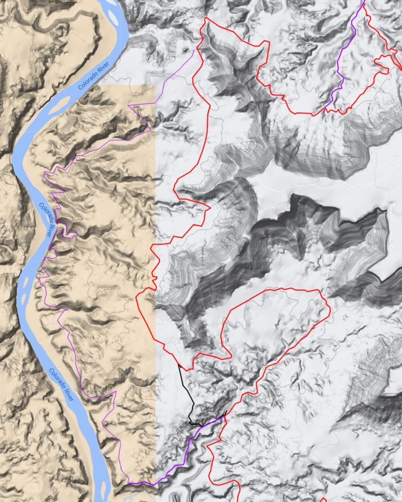
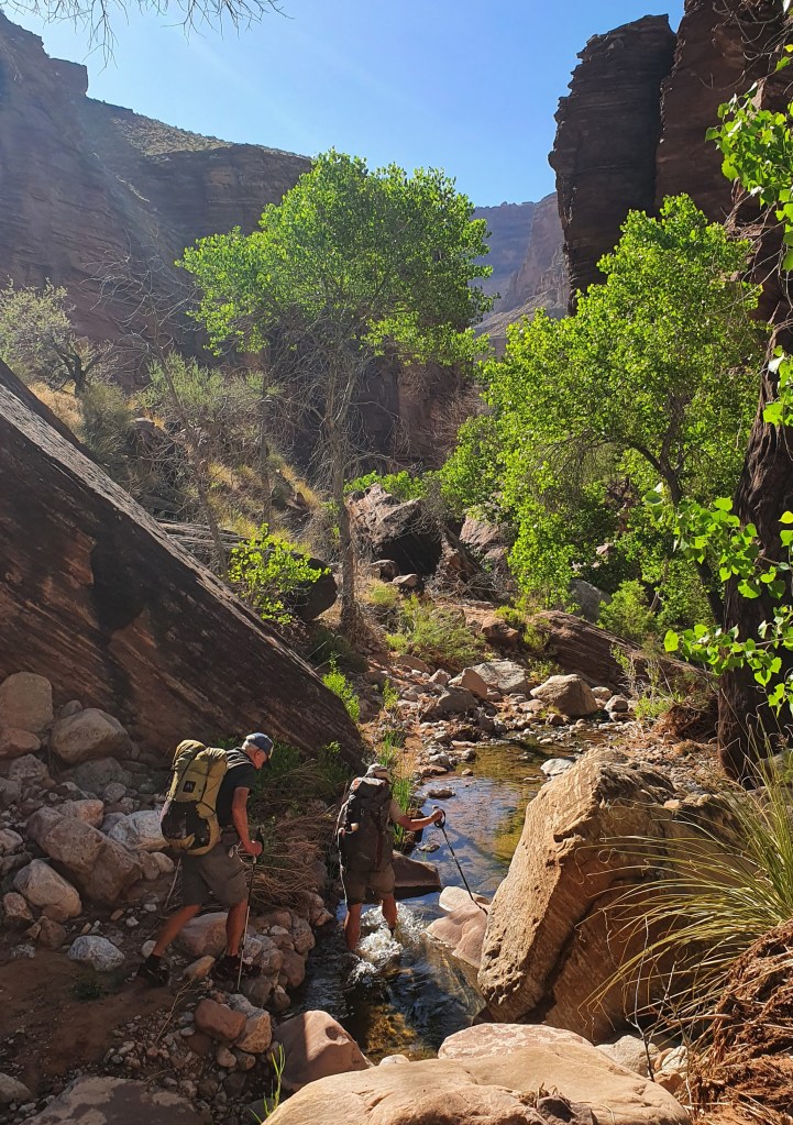
Once we met Tapeats Spring the river changed character to a raging and loud cataract! There is a trail which helps a lot starting on the south side and crossing the river at reasonable places with some scrambling along the way. We maybe had knee deep water after a dry spell, any more might have made progress difficult. The area is really dramatic and scenic and a stand out of the Hayduke if you have low enough water levels!

The Grand Canyon part I

At the small lodge of Jacobs we joined forces with Heather whose three hiking partners have all left the trail for various reasons. Good to have more options when it comes to the point where we have to draw lots about which member of the expedition to eat when we run out of food, for we were now heading back out on a pickup truck to the tough part of the trail: the Grand Canyon!

But first the trail keeps following the AZT on the plateau up to 9000 feet altitude through aspen (still mostly leafless), fir, spruce and pine forest with open alpine meadows in between. Winter is only just retreating here.

We reached the edge of the Grand Canyon at Nankoweap on our second night out, with gale force winds and we camped in relative shelter amongst aspens at the edge of the cliffs dropping down into the Grand Canyon. Next morning we started our 6,000 foot descent to the Colorado River at dawn.

The heat ramped up as we descended down to the inner cauldron of the Colorado River. We camped that night at the bottom of Nankoweap canyon on the shore of the Colorado Rivet itself with stormy gusting winds whipping sand and river water at us.

We were not alone however as there were two big motorised commercial river boats moored on our beach with about 25 clients. A private boat trip with 6 small rubber rafts was moored in the next bay downstream. In the evening we walked up to a viewpoint and afterwards chatted to the private rafters. They were a group of friends, relatives and acquaintances from all over the US. Their figurehead “Uncle Dave” was very welcoming and, once we had sourced a life jacket for each of us, generously invited us to travel 9 miles down river the next day with them..

After a fun (and wet from rapids) morning on the river with our boater friends, we got off at the Little Colorado River confluence with the Colorado and said our farewells.

Collared lizard posing by the trail

Our target for camping was Lava Canyon rapids and the trail stayed high above the river on balcony ledges until we got there. The wind was back and buffeting but at least helped keep us coolish in the 30C heat. We chose to camp in a dense grove of trees that provided shelter from the wind. When it got dark and the wind abated we sat on the beach for a while with our rafting friends camped opposite us on the other side of the river.

Because the mid day temperatures are way above 30°C, we start hiking at dawn now (5am). The best time to hike for beautiful light as well!

Tributaries to the Colorado River form a labyrinth of deep canyons that we followed until we can cross them, making for a wriggly but beautiful route. Some scrambling added to the interest- this is a great hike in the depths of the Grand Canyon.

By chance, we met up with our boating friends again at Hance Rapids on the Colorado River where they had moored and we camped too with good access to water from the river. We were invited to their evening campfire circle and dinner.

After 5 nights and 6 days hiking we arrived at the South Rim on May 11th. Fresh food, showers and rest beckon! Next we will hike back down into the canyon bottom and up to the North Rim to continue our hike…..

Hiking up to the South Rim via Hance Creek, Horseshoe Mesa and Grand View Trail
Topping out of the Grand Canyon on the South rim after 6 days, dusty but happy!

Hiker Notes

Route We mostly followed the Hayduke in this section apart from at the end where we hiked out of the Grand Canyon to the south rim on the Grand View Trail. This shortened the route a bit and we had already hiked the remainder part along the Tonto Trail and up South Kiabab Trail in 2014. This part was also our least favourite hike due to the heat and paucity of water!

South from Jacob Lake the Hayduke follows the well maintained and relatively popular Arizona Trail (AZT) for about 30 miles. Good AZT water report website.

Its dry from leaving the AZT til hitting Nankoweap Canyon about 8 miles down from the North Rim on Nankoweap Trail. This trail is really scenic and makes for a superb hike. Nankoweap Canyon looks like a perennial stream with a gushing spring source just 10 or 20m downstream from where the trail hits the stream.

Once you hit the Colorado River there are a number of places to access the river for water. You can’t do this anywhere though so best keeping an eye on the map. the Nankoweap Granaries are definitely worth the side trip.

The route along the Colorado River between Nankoweap and the north of the Little Colorado can be pretty slow going over boulders with bushwhacking so allow plenty of time and best to start early if its going to be hot. We have managed to get lifts across the river to the Little Colorado outlet pretty easily within a few hours both times we have been there.

Hance Creek had a good, if small, flow of water.

Overall, from Jacob Lake to South Rim is a brilliant hiking expedition and if there in May, the main challenge is the heat down in the bottom of the canyon.

Into Arizona…

During our rest days in the town of Kanab we bought food for the trail ahead; 2 days to carry straight away for the hike down Buckskin Gulch and onto the Arizona Trail, then with the help of a friend, 6 days which we left at a remote diner/hotel called Jacob Lake (on the Northern plateau of the Grand Canyon) and a whopping 8 days of supplies which we mailed to the post office at North Rim of the Grand Canyon.

Supplies for the next few weeks

We started putting our thumbs up on Highway 89 out of Kanab at 7am on 4th May and got a lift back to the trail with an 82 year old gentleman who was driving a portable water tanker for supplying firefighting crew in New Mexico. He was driving it there from Montana!

The Hayduke goes through some spectacular sandstone country in and around Buckskin Gulch and then picks up the Arizona Trail (AZT) for approx 65 miles. The AZT itself starts at the Mexican border in the south and finishes after around 800 miles at the Utah state border. We were hiking it southward ‘against Wainwright’, meeting lots of northbound hikers who were nearing their finish line. What this meant for us was that we had well maintained, clear trail to follow for the next few days!

Once on the AZT we climbed very quickly up onto the Kiabab Plateau, a high limestone forested area that forms the North Rim of the Grand Canyon. We left behind the slick gold and red sandstone and spent two days in dry pinyon-juniper forest, then ponderosa pines higher up. Our one water source was from a “wildlife guzzler”. Below Martina is straining some “wildlife” out with a handkerchief before treating the water!

To avoid setting the dry forest floor on fire with our stove, we usually cook on a flat rock…but if none are available a cow pat does the trick!

After two days we got to Jakob Lake, got a hotel room and picked up our food parcel ready for the next 6 to 7 exciting days headed for the depths of the Grand Canyon……

Vintage transport at Jacob Lake

Hiker Notes

Route For the first time we followed the Hayduke in this section(!) with the exception of the enforced fire reroute on the AZT below…

Water- we relied on a single source about 4 miles south of the Utah-Arizona state border, the wildlife guzzler as pictured above which seems reliable. That said there was a fair bit of activity at the state border with a few northbound AZT hikers finishing each day in May. There could be a fair chance of picking up water here from people there to meet AZT hikers.

AZT diversion- there was a rerouting of the AZT north of Jacob Lake due to burn areas impacting the trail. See sign below…

Back hiking South West to Hwy 89 and Kanab – mostly “Alt”duke

It had always been our plan to hike an alternate to the Hayduke from the town of Escalante to Highway 89 and the next town stop of Kanab. Heading in a South Westerly direction our route would join and cross the Hayduke for a while but taking an independent line for much of the way. Information about this route was gratefully gleaned from Jamal Green’s website and blog. You can click on the overview map below to enlarge it. (Our route in purple, and red where joining the Hayduke).

On Monday 25 April we finally walked out of Escalante, blisters dried and dressed, with all our belongings and 6 days food on our back to climb up the Smokey Mountain Road onto the Kaiparowits Plateau. We then followed the tad morbidly named ‘Death Ridge’ jeep road for a while. After that the reds and yellows of the rock and grand ponderosa pines give way to ‘The Mudhills’ with muted greys and some surreal landscapes.

We hiked through this grey landscape for a day and a half past Canaan Mountain into the very remote Wahweap wash drainage system where we found precious water at Headquarters Spring. From there we briefly picked up the Hayduke Trail to Grosvenor Arch and camped near a luxurious cattle tank from which we prepared dinner, breakfast and our daily water ration.

Grovesnor Arch

In the morning we met a torpid snake warming itself in the sun. It wasn’t going anywhere in a hurry, in contrast to which we were eagerly heading towards an exciting slot canyon in Round Valley Draw (leading to Hackberry Canyon- both part of the Hayduke Trail proper).

Wildlife dozing in the morning sun
Brian sits out a dust storm at the end of the slot canyon

We camped that night under red rock walls in Hackberry Canyon with running water (a rare delight).

On our fourth day we headed west out of Hackberry, leaving the Hayduke again and striking out above the canyons over golden sands with fantastic views in all directions. Our itinerary now followed some imaginatively named canyons: Stone Donkey, Hogeye, Paria, Kitchen and Starlight…

We crossed the Paria River at the mouth of Hogeye and met not only the Hayduke Trail again at this point but also, by pure chance, our fellow hikers Heather, Ryan and Mike – the first two reclining in a pool in the river! After stopping for a chat we headed out on our alternate route and walked up Kitchen Canyon (a very actively eroding bright red rubble-fest with muddy, silty water) and into Starlight Canyon- also bright red and collapsible looking but with clear cold water flowing down from multiple springs. This lovely canyon also had some narrows and a fun scramble up a waterworn shoot.

The narrows of Starlight Canyon
Scrambling up the shoot at the end of the narrows in Starlight Canyon

We camped below the narrows. The next day we reached a large cave with pictographs painted in soot at the back on a white wall. Very impressive.

We had seen the pointy landmark that is Mollies Nipple on our first day out of Escalante town, rising above the plateau. Now, on day 5 we were aiming to hike across its flanks. More steep sand (with ever more flowers coming out) but amazing technicolour views!

From the Nipple a sandy ATV track took us into the red valley below and reunited us with the Hayduke Trail for the last 10 miles. Final camp was made under a juniper near a spring 7 miles from Highway 89. On our last day we got up at dawn to hike in the cool of the morning. A lovely couple from Colorado gave us a lift into the town of Kanab.

Kanab is a fabulous little town: it has two independent supermarkets and many shops are shut on Sunday (including one of the supermarkets!). It’s back country used to be a favoured movie location in the 40’s and 50’s so it has a hint of Hollywood to it. Clint Eastwood shot ‘The Outlaw Josie Wales” near here!

Hiker Notes

Route The route we took between Escalante town and Highway 89 was really enjoyable with a particularly great sequence of canyons in the middle in the area of the Paria River. Overview map here We pretty much joined up 3 alternatives described by Jamal Green along with some information from Michael Kelsey’s guide;

firstly Via Escalante West

then Stone Donkey to Hogeye

then a short hike down the Paria River before going up Kitchen and Starlight Canyons. Jamal Kitchen/Starlight text here and Kelsey’s Paria River Guidebook had useful information on upper Starlight, the cave and Mollies Nipple.

Alvey Wash- 04/25/22 About 5.5 miles south of Escalante town on Smokey Mountain dirt road- there was water running here where the wash narrows.

Mossy Dell- 04/25/22 This is about 19 miles from Escalante town and mentioned as a water source by Jamal but we couldn’t find any water here unfortunately.

Collet Canyon forks- 04/25/22 The jeep road crosses a few forks of upper Collet Canyon but all were dry for us. It looks like they might flow for a bit following rain.

Headquarters Springs- 04/26/22 A number of small flows of water here. We couldn’t find the cabin marked on the map though…

Corral south of Grosvener Arch- 04/26/22 Two good full tanks of water here, see map below.

Round Valley Draw, HT Section 8 mile 2.9- Our second time down these narrows and this is an excellent scramble.

Hackberry Canyon, HT Section 8 mile 11.2- 04/27/22 Water started from about here. Bear in mind its a tough walk down canyon from the narrows of RVD to this point in deep soft sand. Also this area was fouled by cattle making the water a little less inviting!

Hogeye Creek- 04/28/22 Excellent water flow in two shady sections in the middle of Hogeye down to maybe half a mile before the Paria River.

Paria River- 04/28/22 This was flowing quite clear between Hogeye and Kitchen.

Kitchen Canyon- 04/28/22 Very, very muddy flow. The canyon is so rubbly and loose that it looks like it the water flow is full of mud and silt from the side walls sliding into the wash.

Starlight Canyon- 04/29/22 Lovely flow of good water up the length of this canyon to where we exited at the cave.

1/2 mile to north of Kitchen Corral Spring (HT 43.4) – 04/30/22 Good small flow 1/4 mile east of Hayduke Trail dirt road along side canyon on jeep road. Go over barbed wire to small spring that is piped off so the canyon looks dry before you get to the spring.

Testing the feet around Escalante

Between 17 April and 25 April we based ourselves in and around the small town of Escalante. We looked after the car of a fellow hiker Nathan who has joined Hayduke hikers Heather, Mike and Ryan for a 6 day section and by generously leaving the car with us, we were able to pick them all up from their destination trailhead when they had finished.

Meantime we were able to treat blisters and go for day hikes of increasing length to test progress. We started with a visit to Phipps Arch, a day in upper Pine Creek and then two days on the Boulder Mail Trail. Here are some shots of our “test hikes”.

Phipps Wash day hike (see also the banner of this page)
Although with car, we preferred to camp on the beautiful slickrock, a short walk from the road.

After a couple of day hikes we walked the Boulder Mail Trail as an overnight backpack between the towns of Boulder and Escalante. This follows the route once taken by the mailman and his horse from the town of Boulder to Escalante before there was a road. It goes through spectacular canyon and rock slab terrain!

Spring is slowly starting to add colour to the desert
After about 40 miles of test-hiking the feet had sufficiently recovered and allowed us to head onwards on our intended route through the desert on the Hayduke (and alternates).

Blistering into the Henry Mountains

On Wednesday 13 April we left Hanksville to hike for eight days to the town of Escalante. We got a lift to the trailhead from a young rancher who was taking horses in a trailer into the range to round up cattle. He told us his grandfather used to walk the herd 100 miles from their winter to summer pastures up the hill. He dropped us off at “Little Egypt”. Before us loomed the refreshing looking snows of the Henry Mountains. And uphill we went…

Little Egypt gets its name from the curious rock formations found there. We were hiking upwards through layers of sedimentary rock of ever changing colour and consistency, traversing forward in time from the oldest to the youngest layers.

We scrambled cross country on loose shale soil above Little Egypt onto a broad slope heading upwards towards the Henry Mountains.

Some of rock layers around the foot of the mountain contain metals. Uranium is still mined in this area. Our trail led through the site of a now vanished gold mining town. Only a couple of cabins remain.

The first water appeared after 10 miles at Crescent Creek and we made camp. The creek was already fringed with thick icicles. We knew from the forecast it was going to be a cold night at 7,800 feet. Our water froze in the bottles over night.

Next day it was sunny but still bitterly cold and very windy. We opted to go over a pass (9,000 ft Copper Ridge) rather than the top of the mountain and hiked 10 miles to the next water source (Airplane Spring). Here we made hot tea and took stock.

Brian’s blisters had multiplied again, were painful and some were bloody. So the sensible decision was made to retreat. That still meant climbing back up over the pass and back to the freezing camp and a 20 mile day. Luckily the weather got a bit milder on the second night there. On Friday 15 April we were back at the roadside and hitched a lift into Hanksville.

Return to Hanksville via the culvert under Highway 95 – too many blisters

Since then much has happened. We have met more Hayduke hikers (Marty, Not Guilty, Peter), took in some great live music and through mind-blowing generosity obtained the use of a car for a week without which we would really be stuck. Thank you Nathan!!!

Now we are in the town of Escalante, eating well, resting and hoping to be back on the trail by the start of next week.

Back.on the trail, soon

Hiker Notes

Route We hiked from H95 past Little Egypt then joined the Hayduke before Crescent Creek. We then took an alternate dirt road south over Copper Ridge to Airplane Spring. Due to Brian’s blisters(!) we then turned about and hiked back to H95 but this time following the Hayduke from Crescent Creek to H95.

Little Egypt – This is an alternative route south of the Hayduke Trail from H95 as described by Nic Barth. The hoodoos and mining cabins were interesting and worthwhile as an alt.

Crescent Creek– Good flowing water as the jeep track nears the creek bed. Nice camping on the west side of the river too.

Airplane Spring on a lower alternate on the south slopes of the Henry Mountains had reasonable water in two wells inside the fenced off area.

Moab to Needles Canyonlands NP

Two nights rest and a lot of rain in the town of Moab and we are off again. We are following the mighty Colorado river. In 2014 we paddled down it. This time we are walking in and out of canyons, over ridges and along ledges.

At first we still shared our trail with mountain bikes and ATVs. Although this is very remote country, there are some one or two homes out here and the people who live off grid are usually very hospitable. Like Tom and his tortoise Kobe. He shared his drinking water (which is hauled in by 4×4 over some fearsome rugged terrain) and some good stories about hikers that have come past on the Hayduke and ATV drivers he has had to rescue over the years. He also has installed a Frisby golf course on his property but we didn’t have time…

Although we are following the Colorado, we only stood on its banks with our toes in its water once. The rest of the time we were high above it on ledges and weaving inland to go around (and sometimes into) steep tributary canyons. There are still some areas used for seasonal cattle pasture (less so now after an ongoing long draught).

We passed by an old cowboy camp ‘Tangrens’, used by horsemen up to the 50’s I think. There was an old bedstead and tissue roll amazingly intact as well as some unidentified foodstuffs in jars… we were hungry but didn’t try!

Rustler Creek dryfall had a cool scramble under a chockstone

One of the best things in Canyon country is camping with a view of the landscape below at dusk and dawn. And in between the clear night sky and the complete silence…except when there is a cricket…or an owl…or a coyote. Then it’s even better!

After 4 days we arrived at Needles Outpost, a privately run campsite and store at the edge of Canyonlands National Park and we are having a rest day in one of they glamping tents. Comes with a hammock. Very relaxing! We picked up one of our resupply parcels here with food for the next section. So far we have come about 105 miles. Doing some kit repair and enjoying a hot shower before hiking on into The Maze.

Resting up in Needles Outpost before we head out again!

More pics on our pbase site here

Hiker notes

Route We followed the Hayduke but with a few alternates as described.


HT30.2 We did the Amasa Back alternative which was nice and recommended. We started at Kane Creek, where there was a trail from the Trailhead to a bridge over the creek a few hundred meters up from the Colorado River (the Colorado river backs up into Kane Creek making it awkward and muddy to cross). There is a steep scramble down from the high point into Jackson Hole on an old trail, but other than that it is trail or jeep roads with good views.
Stopped at Base Camp and chatted to Tom who kindly let us fill up with water as well as admiring the tortoise!
There were 2 river access points to the Colorado River for water south of Base Camp after HT4.5, see below.


HT6.8 This is Chicken Corner and hard to miss, see pic! We took a direct alt (purple line below) south up a mellow wash with a couple of 2-3m high scrambling steps to short cut the HT (red below) which is an indirect jeep road. Worthwhile- its shorter and more interesting than the jeep road I think.


HT11.3 We left the HT just south of the pass at HT11.3 for a grand alternative down Hermit Canyon based on the Kelsey Canyonlands guidebook. We then followed a lovely limestone bench above the Colorado River narrowing to a meter or so in places.

There likely was access to the Colorado River for water from the bench, both at the bottom of Hermit and at the first canyon south of Hermit, but we didn’t check either out so can’t confirm that.

There is also the cool Tangren old horse camp on the way (please leave everything in place). We couldn’t find the spring to the east of Tangren as described in Kelsey though, …. I have doubts that it still exists.

We continued on the bench along the rim to Lockhart Canyon. Here we thought we could cross Lockhart and continue south to connect with the Hayduke at Rustler Canyon. There was a small cairn at the rim of Lockhart looking like we could drop down into the canyon. However we didn’t fancy it, the top looked too loose and rubbly for us!

Instead we followed the rim of Lockhart east easily on the same bench. Continuing along the rim of the north fork back to the Hayduke at HT20.9 and the foot of the Nic Barth Lockhart Cliff descent and a big pour off (black line below). This Hermit alternate taking you above the Colorado River is scenic and varied. Email me if you want more info.

Overview map showing our Hermit Canyon route in purple along the Colorado river (Hayduke in red)


HT20.9 There was a small clear flow of water coming down a slabby gully within the first half mile south of HT20.9 but I suspect this would be short lived after the rain we had about 4 days before so I wouldn’t rely on it.


HT25.4 Lockhart had a good flow for about 1/3 mile

HT32.3 Rustler dryfall. there was a small pool just above the dryfall but but Rustler was dry below. The direct route under the chockstone was fun!

HT35.1 Indian Creek. Pools of water in this stretch but no flow.

HT39.3 ‘We hope so’ wash. About 1/4 mile south of HT39.3 there is a large pothole of water just under a small dryfall. We took a side route out to the Colorado River neck lookout (pic above). Nice view and a short diversion starting from 200-300m before the pothole in ‘We hope so’ wash. Would be a nice camp spot too…

Arches National Park March 2022

We are walking!

We hopped across the Atlantic from Glasgow to Denver and holed up in the University and all-round outdoorsy town of Boulder, Colorado, for two nights. Here we shopped for hiking food for 17 days and packed two boxes to send forward with supplies: one to Caleb at Needles Outpost just outside Canyonlands National Park and one to the post office in Hanksville Utah. We will hopefully meet those boxes again!

Winter was still lingering in the foothills of the Rocky Mountains near Boulder. Paths amongst trees held compacted old snow and the vegetation was parched. We went for a walk around the Flat Irons (rock formations above the town) in bright sunshine and cold clear air.

In the afternoon of the second day we returned the hire car at Denver airport: feet only from now on! A 45 minute flight in a bus size plane took us over the Rockies to Moab airport with one rucksack each, all our belongings within and 3 days food.

Moab Canyonlands airport. Baggage collection in the sun

We walked from the desert airport across Highway 191 and towards the Klondike bluffs, a wall of red rock formations at the edge of Arches National Park. A couple of hours on but still outside the park, we made our first camp, snowy hills to the East in the glow of the setting sun, the warm air juniper scented and the distant hum of unfeasibly large American trucks..we were back!!!

Now, three days later, we have seen many rock arches, tiptoed over prickly balls of Russian thistle (a sort of angry tumble weed with spikes that gets blown around where it is flat), been checked out by Ravens as a potential source of titbits more than once, exclaimed at the sight of lizards on the rock, pointed out interesting paw prints in the sand to each other (coyote, beaver), seen one live and one dead jack rabbit, drunk water from a stream, crossed the same stream over and over again, watched the sun rise, shared a canyon with a flock a turkeys for the night, found some marvellous petroglyphs and pictographs in insanely scenic places and exclaimed at every new flower that has opened around us as spring is slowly unfurling (not many leaves on the trees here yet either).

Now we are having our first town stop in Moab, another outdoorsy place. To our great delight it has been raining last night and today which will fill the rock holes, boost the streams and enliven the springs we depend on for water as we hike on along the mighty Colorado from here.

Hiker Notes

Route We had plenty of time to spend in Arches NP to align with our permits for the next section so took a longer indirect more scenic route in parts than the Hayduke. We walked from Moab Canyonlands Airport, across H191 to Tower Arch, then NE across Salt Valley to the Devils Garden, back SW across salt Valley following the pipeline to the Hayduke and Courthouse Wash.

Willow Springs 03/27/22- Good pools before and small flow around the junction with Willow Springs.

Upper Courthouse Wash 03/27/22- Good flow down to Sevenmile Canyon then dry to near the road. We had a fair bit of bushwhacking after Sevenmile but may not have found the best route.

This year we followed the Hayduke route down Upper Courthouse Wash as opposed to 2014 where we took an another route described by Nic Barth ‘Arches Slickrock Alternate’ (green on the map). This slickrock line was way more enjoyable and scenic in my opinion – but did involve some Class 4 downclimbing down into the canyon.

Lower Courthouse Wash 03/27/22- Pretty mellow hiking but with more beaver activity this time than we saw in 2014.

US Hayduke 2022

The Hayduke Trail is a 800 approx. mile hike and scramble through the canyons of the Colorado Plateau in southern Utah and northern Arizona USA. The route links six stunning National Parks…. ArchesCanyonlandsCapitol ReefBryce CanyonGrand Canyon and Zion and crosses great places in-between.

And hey, we went back in Spring 2022 to hike in this area again with some cool variations after a previous hike in 2014 and a few other visits to this amazing land of canyons and high desert. We started hiking direct from Moab airport into Arches National Park in the east on 22nd March through to Zion NP. Posts below and highlights YouTube video here

HIKE

1 Arches National Park

2 Moab to Needles in Canyonlands NP

3 Needles to Hanksville via The Maze

4 Blistering into the Henry Mountains

5 Testing the feet around Escalante

6 Back hiking South West to Hwy 89 and Kanab

7 Into Arizona….

8 Grand Canyon part I

9 Grand Canyon part II – South to North Rim

10 Grand Canyon part III – feeling hot, hot, hot…

11 Grand finale to Zion National Park

12 Post Hayduke explorations….

13 NOTES FOR HIKERS

PRE HIKE

Hayduke training hikes

Hayduke background (from 2014)

Hiker links

Other useful links

Our intended route in 2022

Some photos from previous hikes in the area to show what its like….

From 2014- ‘Happy Canyon’
Yellow Rock

Cornwall 2020 -South West Coast Path

In April 2019 we hiked for a week along part of the 630 mile long South West Coast Path in England. We walked a section from Bude to St Ives on the west coast of Cornwall.

We returned in September 2020 for another week long section continuing from St Ives round the southern tip of Land’s End and Lizard Point to to the town and port of Falmouth.

In summary this was another great and varied hike, mostly following trails above coastal cliffs but also along beaches and through many small harbour towns. We camped all the way with a mix of commercial campsites and wild camping.

Photo gallery here

Day 1 St Ives to Pendeen 7th September 2020 We returned to where we left off last year at the Hellesveor campsite just above St Ives after a long drive south from Scotland, stopping to visit the weird and wonderful town of Glastonbury and hike up historic Glastonbury Tor.

Starting late morning, we walked a trail about 3/4 mile down to join the coastal path to the sound of booming atlantic waves. Heading south the trail was clear and undulating over granite boulders, making for slow but scenic going. It was hot and muggy and we were sharing the path with quite a few people- seemingly the stretch from St Ives down to Zennor is a popular day trip – helped by a regular bus service.

At Zennor we saw a group of rare choughs along with ravens and birds of prey. Bosigran provided a rest stop allowing us to look at the fine cliffs, scene of many past fantastic rock climbing trips for us.

At about 6pm we reached Porthmeor Cove, a wild spot with a huge swell producing crashing waves onto the beach. This provided a good spot to stop to cook up dinner on a granite boulder with a seal popping up in the breaking waves studying the beach.

After dinner we shuffled on looking for a decent water supply and wild camp site- it proved a bit tricky but just past Pendeen lighthouse we came to a road end and a very basic commercial camp site so we called it a day- and it was a fine start!

Day 2 Pendeen to east of Land’s End  It was bright as we awoke and we set off early past a huge old mining area at Boscaswell with an atmospheric misty wisp to the air. Some of the derelict tin mines are perched down steep cliffs overlooking the sea and it’s a dramatic area.

After taking a valley inland for a bit at Kenidjack we soon reached Cape Cornwall, a small spit of land reaching out into the sea with breakers crashing on the rocks. Plenty of people around here including a painting class at the shore. We chatted to the NTS attendant who said that the sea was calm at the moment – but it looked pretty wild to us! On to the huge beaches of Whitesand Bay which led to the harbour of Sennan- again familiar to us from past trips for its climbing and surfing.

From Sennan it is a short hop to the touristy Land’s End but the views are great out to various small islands and lighthouse. We left the crowds to turn south east along the cliff tops for a way and found a superb wild campsite around Carn Boel. After scrambling down to the shore, Martina had a swim in an amazingly scenic tidal pool. We watched gannets soaring by the cliffs and diving into the water in the evening- another good day.

Day 3 Carn Boel to Penzance More cliff top hiking with good views in the morning and we descended down to the shore at Nanjizal beach to explore an arch and cave with seals lolling about in the waves just offshore.

At Gwennap Head we passed a lookout station above another familiar climbing area of Chair Ladder. Mist descended though so we moved on to Porthgwarra and its small cafe was an irresistible stop. A steep drop on stairs took us into Porthcurno – home to the cliffside theatre of Minack. The mist thickened a bit with us getting a soaking from brushing through the undergrowth at the sides of the trail. The air was super sticky and muggy and a fine drizzle added to the all over wetness.

Our direction turned to the north east now towards the town and harbour of Mousehole. A scenic and popular tourist destination it was too, but we headed on in the hope that we could find accommodation in Penzance for the night to ‘de-stick’ and dry out. The way to Penzance was built up but the hiking was pleasant. During this time of Covid-19 closures, there were fewer hotels and B&Bs open and nothing was available for the night, so we hiked through to the other side of Penzance to find an ok urban campsite- at least it was next to a Tesco grocery store for food supplies!

Day 4 Penzance to Porthleven After posting my defunkt camera back home we hiked north out of Penzance alongside the beach with the distinctive island landmark of St Michael’s Mount on the horizon. Today was a mellow sort of day with wall to wall sunshine and lots of people out enjoying themselves on the beaches- including some dudes on weird motorised surfboards zipping around.

An early stop for cakes at Marazion town opposite the Mount was hard to resist- this is not a route for losing weight with so many cafes along the way! Easier hiking along a rocky low shore followed and we managed a stop for a swim in beautiful green blue waters.

We arrived in the evening at Porthleven – another busy but picturesque harbour town. After pizza at the quayside we hiked uphill for a bit to locate the spacious Treva campsite for the night.

Day 5 Porthleven to Lizard More mellow cliff walking and pretty harbours in a south easterly direction took us to Lizard Point- the southernmost point in mainland Britain. The rock is more metamorphic here (after the granite of Land’s End) exposed in twisted and contorted cliffs. Just below the lighthouse and foghorns at the point we found a superb tiny spot for the tent looking out to open water. After bathing our feet in a gurgling rock pool we settled in with the sweeping beam from the lighthouse above us and the odd light on the horizon from shipping – a superb spot!

Day 6 Lizard to near Porthallow The cloud descended about 5am with rain and this triggered the foghorn from the lighthouse right above us- so that was us very awake!

After breakfast though the cloud cleared and we set off in the sun. The downside of the early shower was that we got a bit of a soaking on the trail from bracken and other vegetation overgrowing the path. But the going on undulating cliff tops was pleasant with a flat sea below as we had now turned generally northwards and were sheltered from the winds.

We stopped at Kennack Sands cafe for the obligatory tea,coffee and cake whilst the tent and sleeping bags were drying in the sun. More pleasant walking took us to Coverack for lunch overlooking the harbour. From there the going was flatter, past a fairly ugly quarry at Dean Point, although it was nice to see the crystalline igneous gabbro rock there (famously good climbing rock occuring in the Isle of Skye in Scotland).

An excursion inland for a wee while made for a bit of a change along hedgerows and through fields before we popped out at the ‘Fat Apple’ cafe. We couldn’t resist and ended up camping here with the availability of showers sealing the deal.

Day 7 Porthallow To Falmouth A clear night with plenty of owls and woodland bird songs in the morning with our campsite being away from the coast. There was some dew early on but the trail was drier than yesterday and it was easy hiking as we headed west into the huge Helford River estuary. This was quite mellow, through woods down to the water and a few pleasant small coves.

We waded the muddy inlet at Gillan Harbour and just managed to get across with the tide coming in. Strangely we met another backpacker just before who had hiked past quickly saying it wasn’t possible to cross, but we have heard that many times over the years and like to look and decide ourselves- it was fine!

Further inland on the estuary we reached Helford town and set a yellow sign up at the ferry crossing to signal for the boat. After a little doubt, it did come over and gave us a lift across to the northern shore, weaving through the many sailing boats moored in this sheltered water.

The sun was out, and being Sunday, the area was mobbed with sailing boats and people enjoying the beaches. It was hot going back along the northern shore of the bay and we made it to Maenporth for late lunch. This was the busiest beach we had seen so far but we did manage at least to buy a couple of paninis and crawl away to eat them in the shade.

From there it was just some straightforward but hot and sweaty hiking into the large port town of Falmouth- and this time we had managed to get a hotel room for a good clean at the end of our hike.

This was a grand 7 days of hiking around the south tip of England with a good mix of cliffs, beaches and towns. Falmouth turned out to be a fine place for eating out and we were able in the morning to get a bus and train back the short distance to our car and start point. What to do next to relax in St Ives area? Surfing was the only option!